
soil solute sorbed content
Type of resources
Available actions
Topics
Keywords
Contact for the resource
Provided by
Years
Formats
Representation types
-
Changwu station was found in 1984 as one of field experiment stations of Institute of Soil and Water Conservation, Chinese Academy of Sciences (ISWC, CAS). It joined the Chinese Ecosystem Research Network (CERN) organized by CAS in 1991 and the National Ecosystem Research Network of China (CNERN) in 2005 by the Ministry of Science and Technology of the People’s Republic of China. The station located in Wangdong Village, Hongjia town, Changwu County, Shaanxi Province, 200 km away from Xi’an city. Its location is E107°41′ and N35°12′, south of the Loess Plateau. It belongs to the warm temperate semi-humid continental monsoon climate. Mean annual precipitation is 580mm and temperature 9.1℃, frost-free day 171. The elevation is about 1200 m and the depth of ground water is 50-80m. Main crops are winter wheat, spring maize, potato, sorghum, millet, beans and so on. The zonal soil is called Heilu soil with a parent material of clay loam Malan loess paleosol soil with an average depth in excess of 100m that were deposited during the Quaternary period. It belongs to the high table land - gully region, and a typical rain-fed agricultural area on the Loess Plateau. Wangdong small watershed, which the station located in, is 6.3km2. Three landform types are high table land, slop land called “Liang” and valley, which occupy the total area of watershed with 35%, 35.6% and 29.4%, respectively. The soil is deep and has good physical properties, like reservoir, support the agro-ecological system.
-
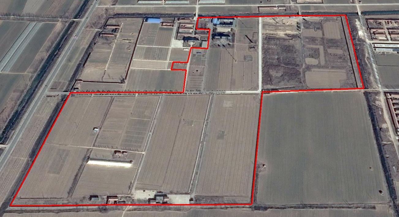
The Yucheng Comprehensive Experiment Station (YCES) of Chinese Academy of Sciences (CAS) is located at the irrigation district of the Yellow River Basin in the Huang-Huai-Hai Plain, also called North China Plain. Physiognomy is characterized as hinterland covered mainly by fluvo-aquic soil (Fluvisol or cambisal) and salinized fluvo-aquic soil in the Yellow River Alluvial Plain. This region is dominated by warm-temperate semi-humid monsoon climate with ample energy and water resources. Historically, natural disasters such as drought, waterlogging, salinization, and wind erosion frequently occurred, resulting in vulnerable ecological environment and low grain production. Integrated improvements and managements were deployed in last several decades, and this region has become suitable for planting winter wheat, corn, cotton, and soybean with high yields in the Huang-Huai-Hai Plain. Research objectives and contents Objectives: regional sustainable agriculture rational utilization of natural resources such as water, land, climate, biomass, etc. Contents: conducting long-term observations and experiments understanding the mechanism of energy transfer and mass cycle in farmlands developing models from point to regional scales improving and developing instruments and measurement methods improving agro-ecosystem managements demonstrating research results and technologies Research achievements: Outstanding research results and massive experiment data have been achieved at the YCES. The achievements cover research fields of farmland evapotranspiration, crop water use, water transfer mechanism, experimental remote sensing techniques, regional agriculture demonstration, and technology transfer. More than 1,000 papers, 15 monograph books, and 5 data sets have been published. A number of awards were granted by national, CAS, and international academic organizations, for example, Agriculture Prize granted by the Third World Academy of Sciences Science and Technology Progress Award by Chinese Academy of Sciences National Top Award of Science and Technology Progress
-
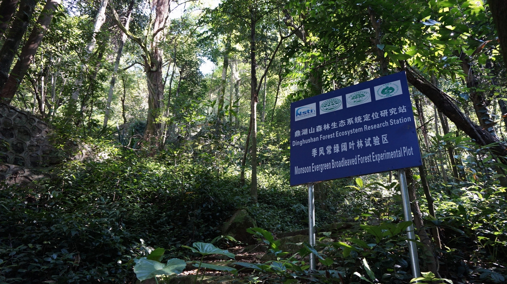
DHS has well protected monsoon evergreen broadleaf forest and its successional forests. Therefore, DHS is an ideal place to research successional processes and patterns of subtropical forest ecosystems, as well as to restore or rehabilitate the degraded forest ecosystems in subtropics of China.