
soil texture
Type of resources
Available actions
Topics
Keywords
Contact for the resource
Provided by
Years
Formats
Representation types
-
Solid texture data of the Gesäuse-Johnsbachtal site.
-
Soil survey conducted on Krcedinska ada, 2012 - 2013
-
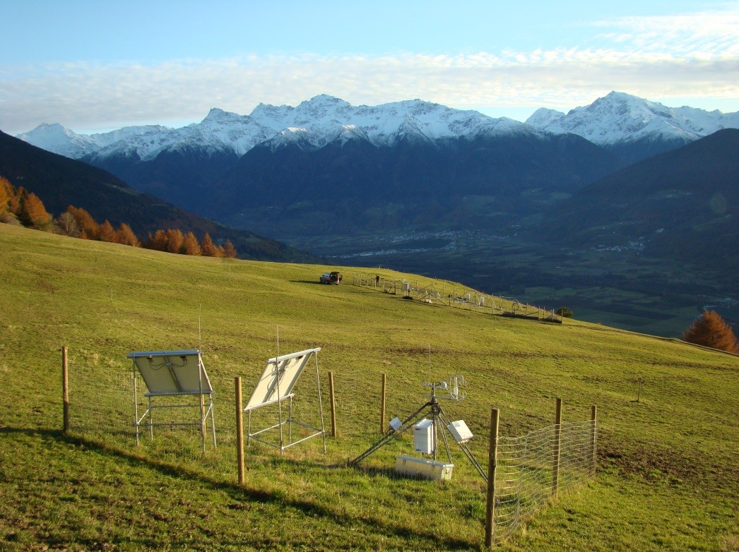
Muntatschinig (Monteschino) is a 25m x 15m grassland site (managed meadow) on 1480m. The site was first established in 2008 as a weather station and is still the most extensive of the four sites. In 2010 the University of Innsbruck installed an eddy covariance station. Nine automatic lysimeters were added to measure evapotranspiration and water use efficiency. Since 2012 a rain-out shelter system has been used for simulating spring and summer droughts. This site is one of the sites along the elevation transect used for grassland transplantation experiments.
-
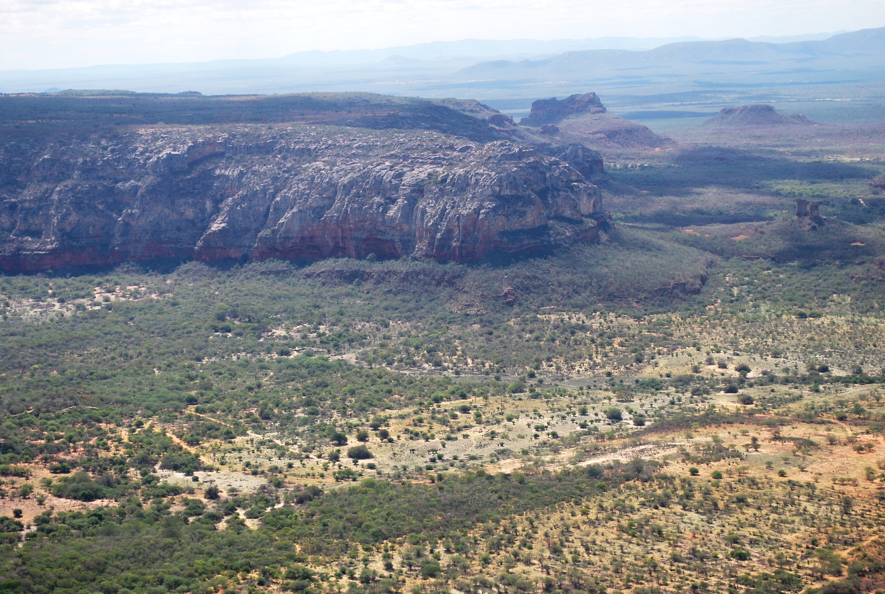
The present proposal aims to assess how human disturbance and changes in rainfall regime affect the Caatinga ecosystem’s biota at different levels of biological organization (i.e, from populations to ecosystem level), by correlating these aspects with the theoretical reference shown in macro trends already documented in the tropics. The project will be developed in Catimbau National Park, a polygon of approximately 63,000 ha, and one of the most important protected areas in the Caatinga. The Park presents vocation for ecological studies of long-term and thus to become an LTER site due to a series of reasons: (1) it has a biological, archaeological and landscape heritage of inestimable value, (2) it shelters areas with different historical land use and anthropic disturbance on the vegetation of Caatinga, (3) there are already in place several research initiatives and training of human resources, and (4) in term of unit management aspects, logistics and infrastructure are favorable for long-term initiatives. Furthermore, the implementation and achievement of this project’s objectives are centered on: (1) establishment of a set of 30 permanent plots, (2) periodic multi-taxa inventories, (3) continuous monitoring of environmental and anthropogenic variables (4) consolidation of biological, land usage and environmental data on the basis of GIS type and (5) dissemination / transfer of information through a wide range of instruments.This proposal will be implemented by a network composed of 23 researchers supported by a number of undergraduate / graduate students, all from six national institutions and three other overseas. The main core of the graduate programs are Plant Biology, Biology Animal and Fungal Biology, all at the Federal University of Pernambuco (UFPE). In summary, the "LTER Catimbau National Park" is an important proposal and has the ability to expand knowledge about how dry biota respond to land use changes and precipitation, with all the implications that these answers may have for the management of biodiversity and the achievement of sustainable development in semi-arid regions.
-
Field work - repeated measurements and multiple point measurements
-
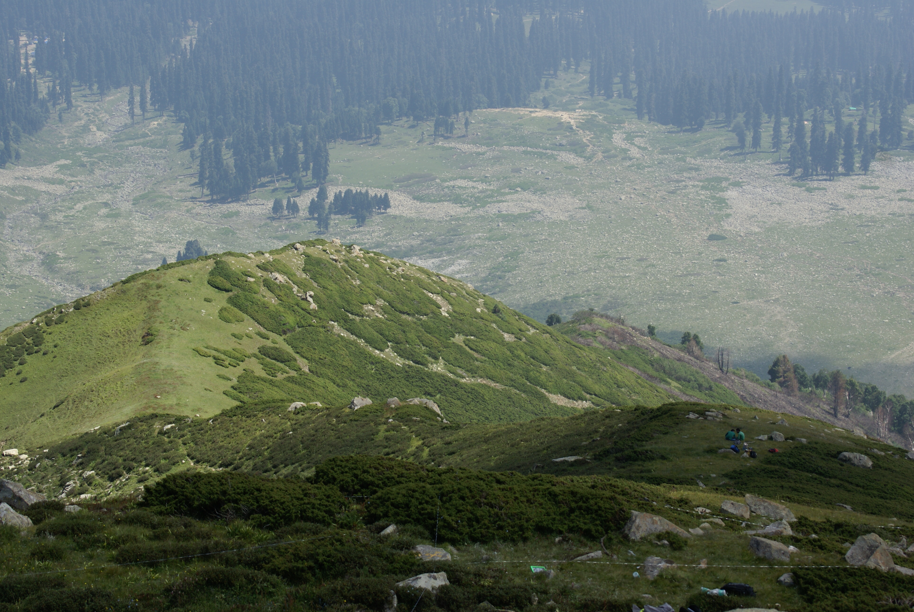
Dynamics of alpine tree line has been reported from several mountain ranges in Europe, in North America, New Zealand as well as in the Alps (Grabherr et al. 1994). This led to the formation of the GLORIA (Global Observation Research Initiative in Alpine Environments) project, dedicated to initiate a global indicator network towards research on the effects of climate change through an international co-operation. Indian part of Himalaya was not having any site towards this mission till 2013. Therefore, based on some Indian studies which also indicated this trend in more pronounced manner, the need of having Indian network was felt. It was in this context as a part of network project across the Indian Himalayan states under the banner of HIMADRI (Himalayan Alpine Dynamics Research Initiative) a long-term monitoring site was established in Kashmir Himalaya at Gulmarg, a famous hill resort. This particular work plan (TeaComposition initiative) is conducted at this selected HIMADRI site. Gulmarg lies on the north east side of the Pir Panjal Range and is about 60 kms west of Srinagar city. It encompasses the upper catchment area of Ferozpur Nullah and the forests that surround the Gulmarg meadow. The vegetation in Gulmarg mainly comprises of coniferous temperate mountain forests of Blue Pine (Pinus Wallichiana), sub-alpine forests of Silver Fir (Abies pindrow) and Himalayan Birch (Betula utilis), followed by alpine scrub and meadows.
-
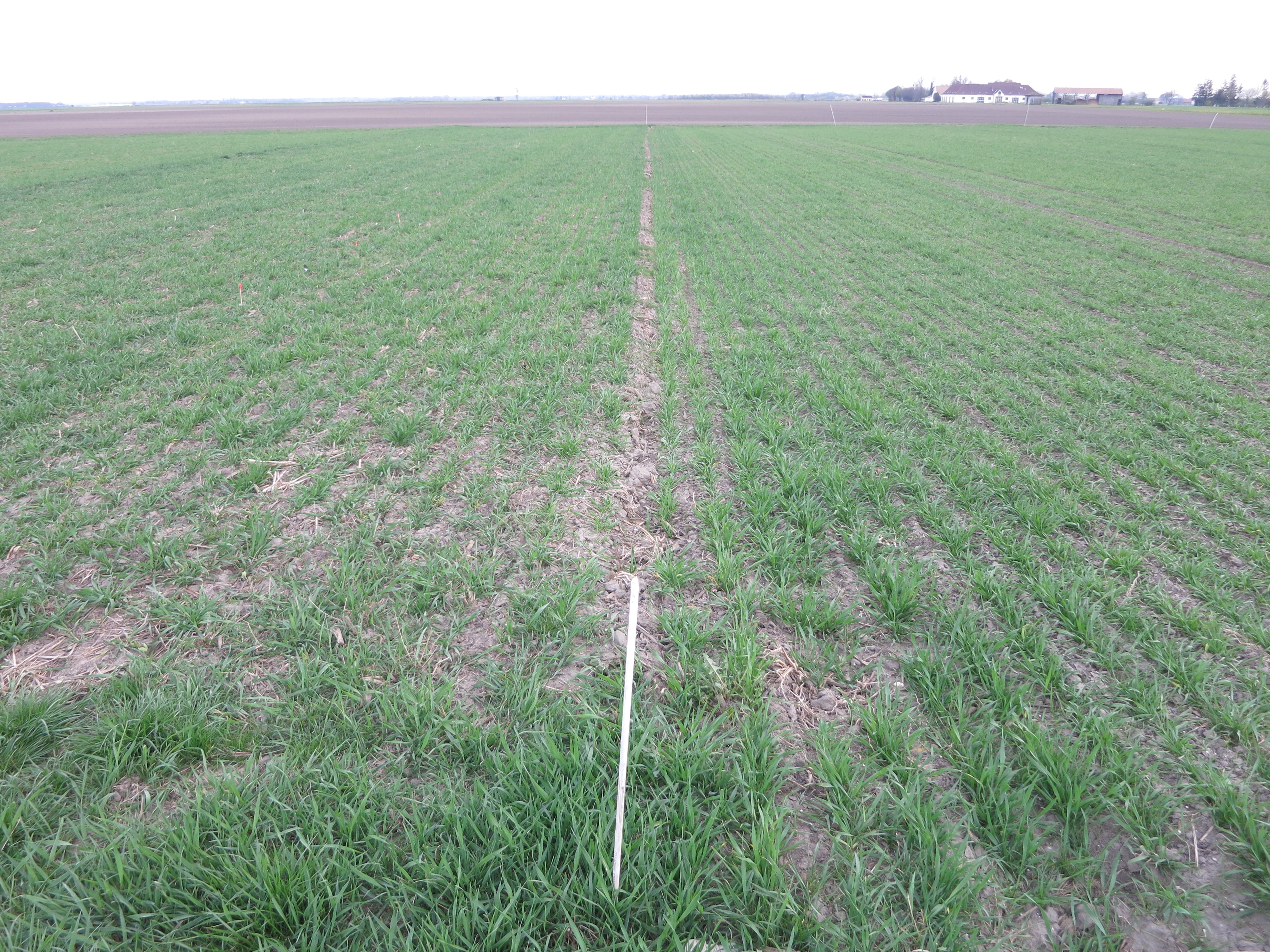
The Fuchsenbigl Field Station is an agricultural research site of the Austrian Agency for Health and Food Safety (AGES) and representative of productive soils managed as arable land. This site is located in the Marchfeld (Lower Austria), the soil is described as a fine sandy-loamy Calcaric Chernozem (WRB). Cultivated crops include cereals (e.g. winter wheat, barley, rye), sugar beet, maize and potatoes. Current research objectives include to study the effects of different conventional arable management practices on crop yields and quality and on chemical, physical and biological soil parameters.
-
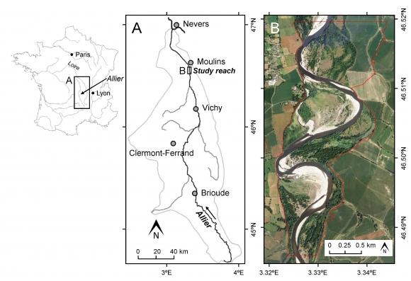
This study site is in the south of the city of Moulins, including the National Nature Reserve of the Val d'Allier which protects 1,450 hectares over approximately 28 km along the lower course of the Allier River. The Allier river is considered as the last wild river of Europe because of its strong fluvial dynamics and remaining free meandering river segments. The studied sector within the nature reserve is still very mobile, with a strong lateral dynamic, where the width of the divagation can be of the order of one kilometer. At this scale, it is unique in Europe.
-
Mars, Mont Mars, (Fontainemore, Aosta)
-
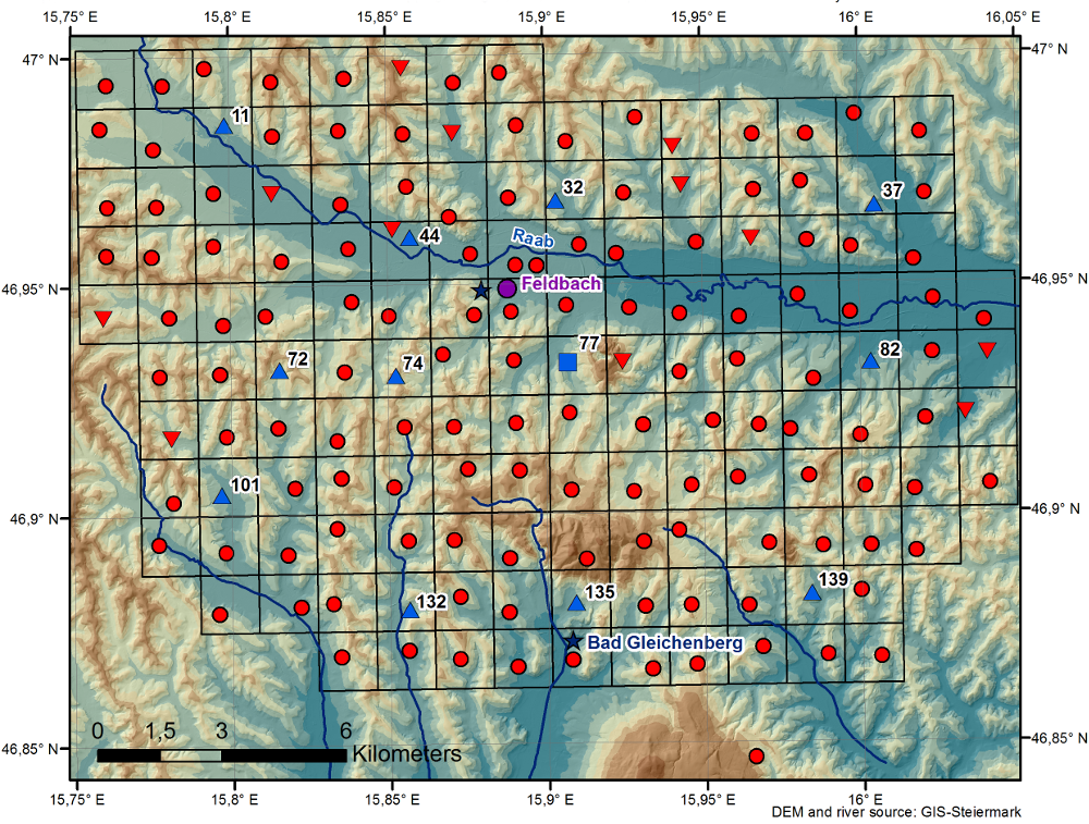
The WegenerNet climate station network Feldbach region is a pioneering weather and climate observation experiment at very high resolution located in Eastern Styria near the city of Feldbach in Southeast Austria, a region characteristic for experiencing a rich variety of weather and climate patterns. The network comprises 156 meteorological stations measuring temperature, precipitation, and other parameters, in a tightly spaced grid within an area of 23 km x 18 km centered near the city of Feldbach (46.93°N, 15.90°E). With its stations every about two square-km (area of about 300 square-km in total), and each station with 5-min time sampling, the network provides regular measurements since January 2007. As of 2010 a complementary meteorological-hydrological network of several stations was added in the mountainous upper Styrian region of National Park Gesaeuse as contribution to the LTER site Johnsbachtal (the "sister site" LTER_EU_AT_029_001 of this site LTER_EU_AT_029_002, both affiliated with the LTSER Platform Eisenwurzen). As part of the Johnsbachtal site, the WegenerNet Johnsbachtal consists of fourteen mountain-proof stations within a region-scale of about 10 km, ranging from valley altitudes below 700 m to mountain tops higher than 2100 m. The WegenerNet at both sites together provides strong value for both alpine foreland and mountain region studies.