
soil water content
Type of resources
Available actions
Topics
Keywords
Contact for the resource
Provided by
Years
Formats
Representation types
-
The hydrological research within the Harz/Central German Lowland Observatory is concentrated in the catchment area of the river Bode (catchment size approx. 3.300 km²). The detection of scale dependencies in flowpaths, run-off generation or residence times requires scale-related approaches of observation. Therefore, a nested approach including small process plots (< 2 km²), meso-scale subcatchments (approx. 100 km²) up to the scale of the complete Bode catchment will be established. A more detailed description of the hydrological observatory and the several intensive test sites can be found at www.tereno.net.
-
Modeled with Mohid
-
Six weighing lysimeters (1.5 m height; 1.0 m in diameter) with a soil surface area of 1.0 m² were installed on ground surface level at the Experimental Field Station Dedelow of the Leibniz Centre for Agricultural Landscape Research (ZALF). Water retention time series from 2012-2014 were obtained from tensiometer/MPS-1 sensors and TDR data measured in 10, 30, and 50 cm depths of six soil monoliths of lysimeters extracted from two differently managed field sites (lysimeters 1, 3, 5 from site Dedelow, lysimeters 2, 4, 6 from site Holzendorf).
-
This dataset contains daily micro-meteorological data from the experimental plots at the Climoor field site in Clocaenog forest, North East Wales. It runs from 15/7/1999 until 30/06/2015, and contains air temperature, (degrees celsius) soil temperature (degrees celsius) at 2 depths (5 and 20centimetre) as well as soil moisture. The dataset has been quality checked, and incorrect or missing values removed, data has not been infilled. Climoor is a climate change manipulation experiment that utilises automated roof technology to produce drought and warming experimental treatments that reflect climate change predictions for the next 20-30 years.
-
This dataset contains daily micro-meteorological data from the experimental plots at the Climoor field site in Clocaenog forest, North East Wales. The data contain air temperature, (degrees celsius) soil temperature (degrees celsius) at 2 depths (5 and 20 centimetres) and soil moisture as metre cubed per metre cubed. The data run from 01/07/2015 until 31/08/2016. Data were recorded in minute intervals. Up to January 2016 the data were then averaged hourly, after January 2016 data were averaged half hourly. Data are then to averaged to daily values, which are reported here. The dataset has been quality checked, and incorrect or missing values removed, data has not been infilled. Climoor is a climate change manipulation experiment that utilises automated roof technology to produce drought and warming experimental treatments that reflect climate change predictions for the next 20 to 30 years. The reported plot level temperature and soil moisture data are important to evaluate the effect of the imposed climatic treatments on ecosystem processes and functioning. Data were not collected between 9th October 2015 and 3rd November 2015 due to problems with the sensors. Data collection, processing and quality checking were carried out by CEH Bangor staff members.
-
TERENO Harz - central german lowland - Hohes Holz Time series station data includes time series data for the year 2019 for the following parameter: LAI, Eddy Flux, Precipitation, Atmospheric Pressure, Relative Humidity, Air Temperature, Wind Direction, Wind Speed, incoming Long Wave Radiation, outgoing Long Wave Radiation, incoming Short Wave Radiation, outgoing Short Wave Radiation, Photosynthetic Photon Flux Density, Soil Water Content, Soil Temperature, Biomass, Groundwater Level. Please follow the method file for specific and detailed information.
-
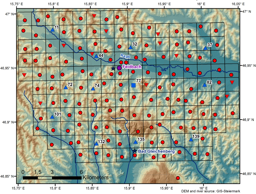
The WegenerNet climate station network Feldbach region is a pioneering weather and climate observation experiment at very high resolution located in Eastern Styria near the city of Feldbach in Southeast Austria, a region characteristic for experiencing a rich variety of weather and climate patterns. The network comprises 156 meteorological stations measuring temperature, precipitation, and other parameters, in a tightly spaced grid within an area of 23 km x 18 km centered near the city of Feldbach (46.93°N, 15.90°E). With its stations every about two square-km (area of about 300 square-km in total), and each station with 5-min time sampling, the network provides regular measurements since January 2007. As of 2010 a complementary meteorological-hydrological network of several stations was added in the mountainous upper Styrian region of National Park Gesaeuse as contribution to the LTER site Johnsbachtal (the "sister site" LTER_EU_AT_029_001 of this site LTER_EU_AT_029_002, both affiliated with the LTSER Platform Eisenwurzen). As part of the Johnsbachtal site, the WegenerNet Johnsbachtal consists of fourteen mountain-proof stations within a region-scale of about 10 km, ranging from valley altitudes below 700 m to mountain tops higher than 2100 m. The WegenerNet at both sites together provides strong value for both alpine foreland and mountain region studies.
-
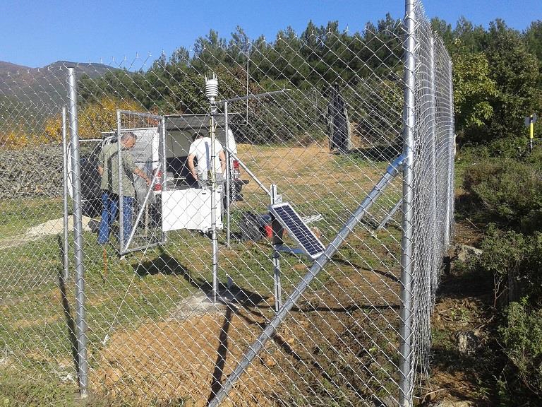
The Pinios Hydrologic Observatory (PHO) covers an area of 53 sq.km and is situated within a complex geological/geomorphological environment with forest and agricultural landscapes dominating. PHO was established in year 2015 with the joint efforts of Agrosphere Institute (IBG-3) of Forschungszentrum Jülich (Germany) and Soil & Water Resources Institute of Hellenic Agricultural Organization “DEMETER” (Greece), aiming primarily at developing deep knowledge of water balance at the river basin scale and to improve understanding of the major hydrodynamic mechanisms, thus to improve hydrological modeling and ultimately sustainable water resources management. Moreover, and since agriculture constitutes the major economic activity in PHO, agro-hydrology constitutes one of its top-priority research topics. PHO is located in the River Pinios basin (RPB), which is one of the most productive basins in Greece having a spatial extent of about 11,000 sq.km. RPB is facing a wide range of problems related to water resources management including groundwater overexploitation and quality deterioration triggered by prolonged droughts and poor management practices in the mid-1980s, which affect and jeopardize the regional socio-economic stability and growth. PHO is envisaging to investigate and address critical scientific questions on how to effectively preserve water and soil resources of the basin and to efficiently manage water availability on the basis of natural recharge occurrence.
-
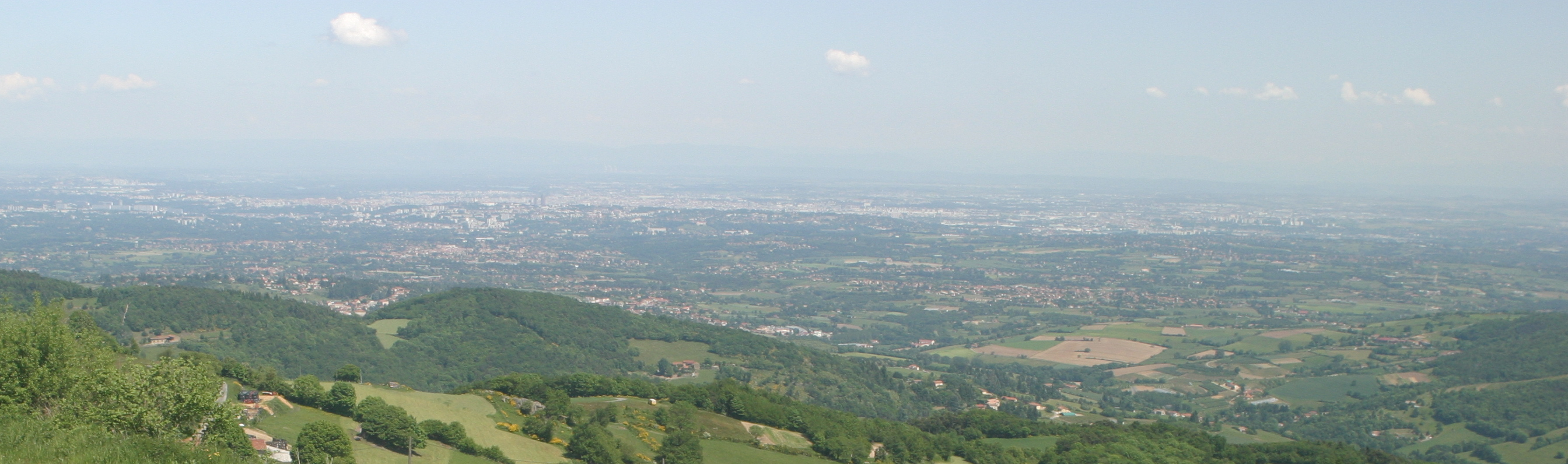
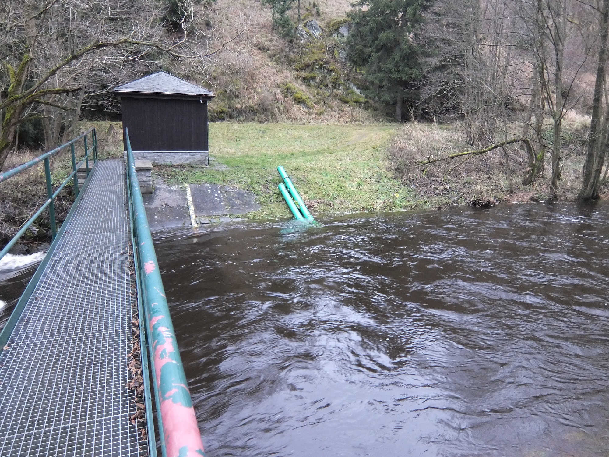
The Yzeron catchment (150 km2) is located to the south-west of Lyon city, France. It forms part of the Observatoire de Terrain en Hydrologie Urbaine (OTHU, 2011) long term observatory. It is representative of French periurban areas and is characterised by a marked topography. The outlet reaches the Rhône river at the elevation of 162 meters and the highest point culminates at 917 m above see level. The slope map calculated from a 25 m resolution Digital Elevation Model (DEM), derived from IGN BDTopo® shows that more than 50% of the catchment has slopes larger than 10%. The geology is contrasted with crystalline formations (granite, gneiss ) in the western part of the catchment and more alluvial and glaciar formations in the eastern part. The land use is heterogeneous. The upstream and western part of the basin is limited by a range of hills covered with forests. The intermediate part is mainly covered with grassland and cultivated lands, mixed with urban nucleus. Thin green corridors remain along rivers, covered with deciduous trees. The downstream part is mainly covered with densely urbanized areas. A fast progression of urbanisation is observed since the eighties. The area is prone to sharp Mediterranean-type flood events due to its steep topography in the upstream part and limited soil water storage capacity overall. The water coming from combined sewer overflow devices is rich of sediments and pollutions, causing quality problems in the rivers, especially during summer storms, where most of the water reaching the river comes from urbanised areas via SODs. Increased erosion of the river banks has also been evidenced with impact on the ecosystems. The catchment is instrumented since 1997 in particular in two sub-catchments with different land uses (Mercier: agriculture and forest) and Chaudanne (agriculture and urban) with rainfall and discharge data. Some information about physico-chemical characteristics are also available.
-
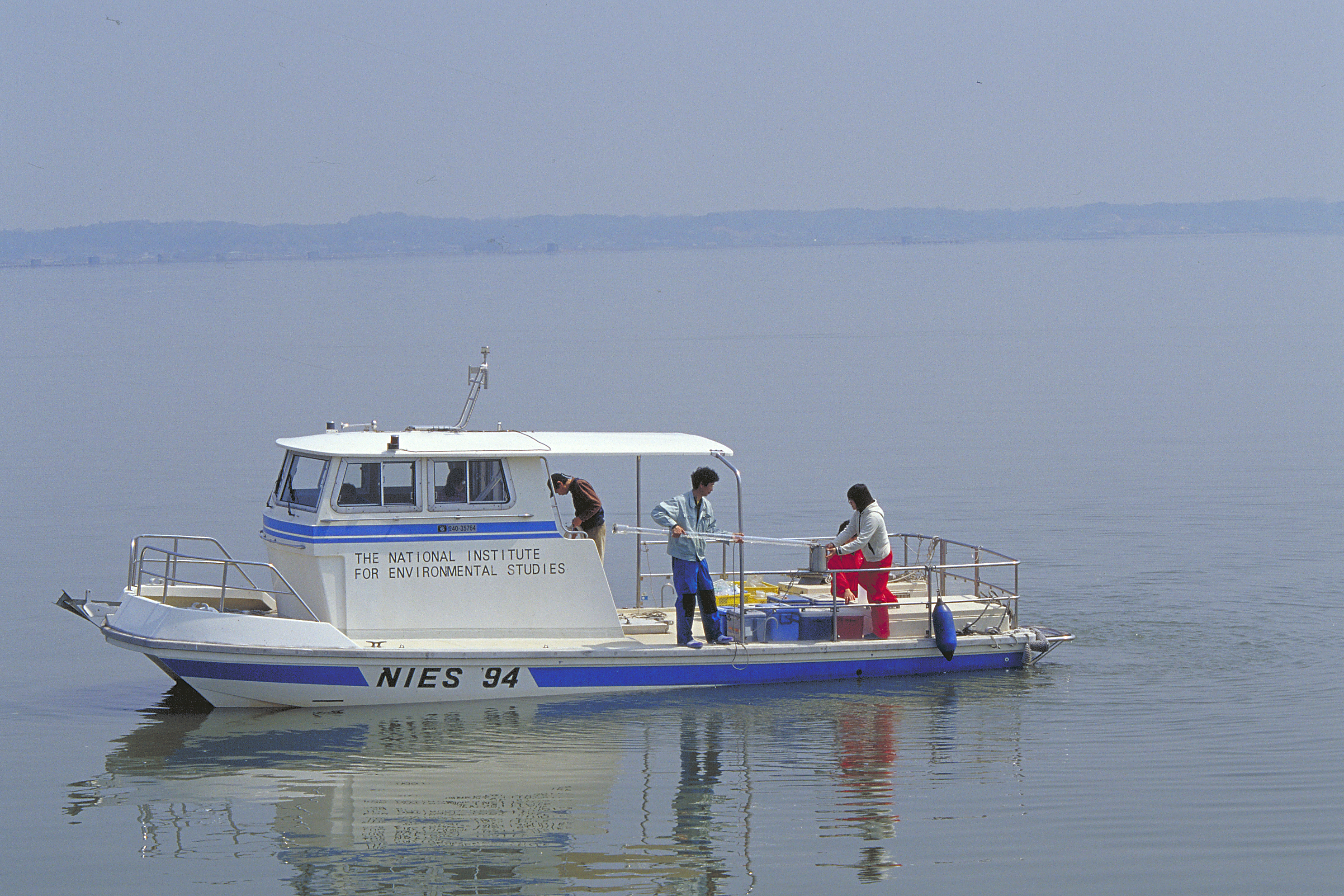
We have been monitoring Lake Kasumigaura, the second largest lake in Japan, monthly for nearly four decades. We have monitored not only environmental variables, water quality, nutrients, and heavy metals, but also plankton (e.g., bacteria, heterotrophic nanoflagellates, ciliates, picoplankton, phytoplankton, zooplankton, mysids), primary production, benthos (chironomids and oligochetes), and fish. To increase data availability and the numbers of data users, we created an English web database (http://db.cger.nies.go.jp/gem/moni-e/inter/GEMS/database/kasumi/index.html) in this research period, and strengthened our relationships with international observational networks. We also provided monitoring data to the Japan Long-Term Ecological Research Network (JaLTER; http://www.jalter.org/index.php?ml_lang=en) and published two data papers in the international journal Ecological Research (Takamura et al. 2012 a, b). We have also started to register fish monitoring data in the Global Biodiversity Information Facility (GBIF) (http://www.gbif.org/dataset/f648085b-8e1c-4a79-bc8d-f45d36296564) .