
soil water potential
Type of resources
Available actions
Topics
Keywords
Contact for the resource
Provided by
Years
Formats
Representation types
-
CARBON FLUXES IN TWO SUCCESSIONAL STAGES OF VEGETATION IN THE PODGORSKI KRAS. Research site represents karst grassland and different stages of secondary succession, occasionally affected from forest fires. It is located on karst plateau close to Podgorje village in the sub-mediterranean region of south-west Slovenia. The site is equipped with two Eddy Covariance towers which measure the carbon fluxes in two successional stages of vegetation. The area has undergone major human influences due to its position at the transition between the Mediterranean and central Europe. In fact, agricultural practices, such as overgrazing in the past centuries, led to pronounced destruction of the vegetation cover, causing severe soil erosion and resulting into a stony and bare landscape. However a succession is taking place and different vegetation types, ranging from grasslands to secondary oak forests, are now present. The bedrock is mainly composed of Paleocene and Eocene limestone. The chemical weathering known as karst phenomena led to the formation of Leptosols and Cambisols, which represent insoluble fractions of carbonates. As a result, the soil is superficial, with depths ranging from 0 cm to several decimeters in soil pockets between rocks. The organic matter represents about 12–15% of the topsoil. The climate is referred to as sub-mediterranean, with a mean annual temperature of 10.5 °C, a mean daily temperature of 1.8 °C and 19.9 °C in January and June respectively, and an average annual precipitation around 1370 mm. The growing season ranges from March or April to October.
-
Soil data of LTER Zöbelboden, Austria. Soil inventory is carried out since 1992 on regular positions (approx 65) in the catchment measuring soil chemistry. Soil water chemistry is measured in forest plots (2-3) using lysimeter sampling and analyses on a bi-weekly to monthly basis. Soil hydraulic characterizations exist for the major soil types in the catchment. Soil CO2 and N2O respiration data is available for some years
-
The total NPHK is currently (since 2020) about 12,000 ha, but the eLTER site corresponds to the former perimeter of the NPHK and represents an urbanised protected area of about 60km2 (or 6,000ha) located in the Province of Limburg in the East of Belgium. The NPHK (inaugurated in 2006 and extended from 6000ha to its current 12000ha in 2020), located in a former coal mining area is surrounded by 10 municipalities with more than 200,000 inhabitants, equivalent to a population density of 450/km2 . The park covers a rich variety of habitats, including heathlands, deciduous forest, coniferous forest and fens and evidently the corresponding diversity of fauna and flora. Several research groups from universities and institutes are monitoring and measuring abiotic and biotic parameters throughout the different ecosystems. Research on ecosystem services are also playing a major role, including tourism and mobility.
-
In Britz we study the water consumption (evapotranspiration) of important commercial tree species since 1974. The main feature are the nine large-scale lysimeters, installed at a depth of over 5 m with a surface area of 100 m² (10x10 m) each. They are planted with 0.3 ha experimental stands of Scots pine (Pinus sylvestris) (3 lysimeters), European beech (Fagus sylvatica) (2), European larch (Larix decidua) (2), and Douglas fir (Pseudotsuga menziesii) (2) spaced corresponding to the forestry practice at that time. About 15 years ago one Larch lysimeter was clear-cut and replanted with sessile oak (Quercus petraea). On two Scots Pine lysimeters, European beech was planted building now the understory. The areas surrounding the lysimeters were planted in a similar fashion. Seepage water collecting at the bottom of the lysimeter flows down a shaft and is measured mechanically by a tipping counter and registered electronically. Soil moisture is measured with probes to a total depth of 5 m. Precipitation in the open field and the stand is recorded with Hellmann rain gauges. In addition, the station is equipped with devices assessing individual tree water transport and growth (sap-flow sensors, dendrometers), an Eddy-Fluy-Tower and much more. The studies are aimed at revealing the effects of different tree species and mixtures on the ground and landscape water balance. Moreover, the effects of drought on tree performance and tree-internal water budgets are of interest. However, recently we added acoustic monitoring, a pollen collector, regular UAV flights to our assessments and are always open to more co-operations.
-
The site was established in 2000 and is situated in Waldviertel (northern Lower Austria), the current stand being a Norway spruce monoculture. The bedrock is poor in nutrients and further nutrient loss from litter raking as well as anthropogenic furtherance of conifers has led to unstable monocultures and the disappearance of deciduous species. The main research questions center around reintroduction of deciduous species, soil amelioration and nutrient cycling. The site is instrumented with climate stations as well as on-line soil water content measurements and soil temperature measurements. Further data include detailed chemical soil analyses, tracer experiment data, growth data and LAI measurements. In 2007 a large part of the stand was broken by wind (Cyrill). Currently measurements aim to quantify and qualify the effects of the windthrow to soils and rejuvenation. To date, the site has hosted 2 international and 3 national projects.
-
The site Bily Kriz (Bílý Kříž) is located in Moravian-Silesian Beskids Mountains. Ecosystem type: Managed secondary pure Norway spruce stand. Prevailing species: Norway spruce (Picea abies [L.] Karst.) Height of the stand: 17 m (2016) Understory: Vaccinium myrtillus L. Year of plantation: 1981 by 4 years old seedlings
-
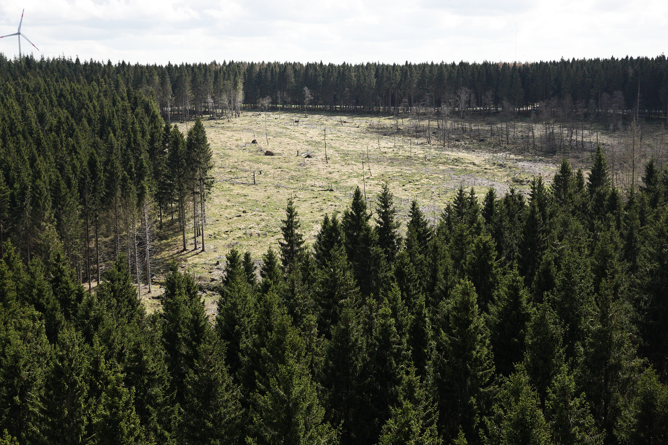
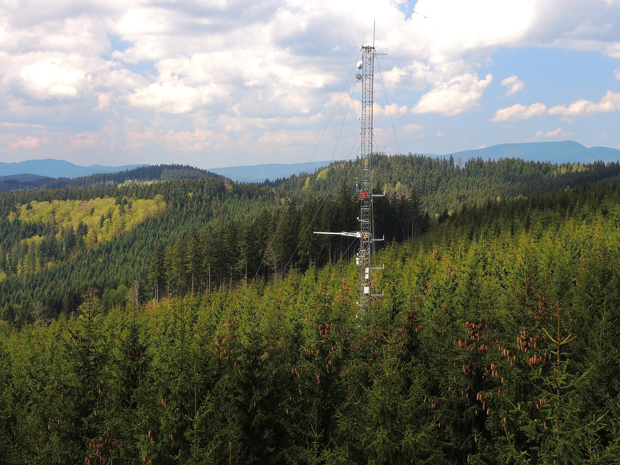
The Wüstebach catchment is located in the Eifel National Park and covers an area of 38.5 ha, with mean altitude of about 610 m. The geology is dominated by Devonian shale, which is covered by a periglacial solifluction layer of about 1–2 m thickness. Cambisols and Planosols have developed on the hillslopes, whereas Gleysols and Histosols have formed in the valley. The main soil texture is silty clay loam and the litter layer has a thickness between 0.5 and 14 cm. The mean annual precipitation is about 1200 mm. Norway Spruce planted in 1946 is the prevailing vegetation type. During late summer/early autumn of 2013, trees were almost completely removed in an area of 9 ha by the national park forest management in order to promote the natural regeneration of near-natural deciduous forest from spruce monoculture forest.
-
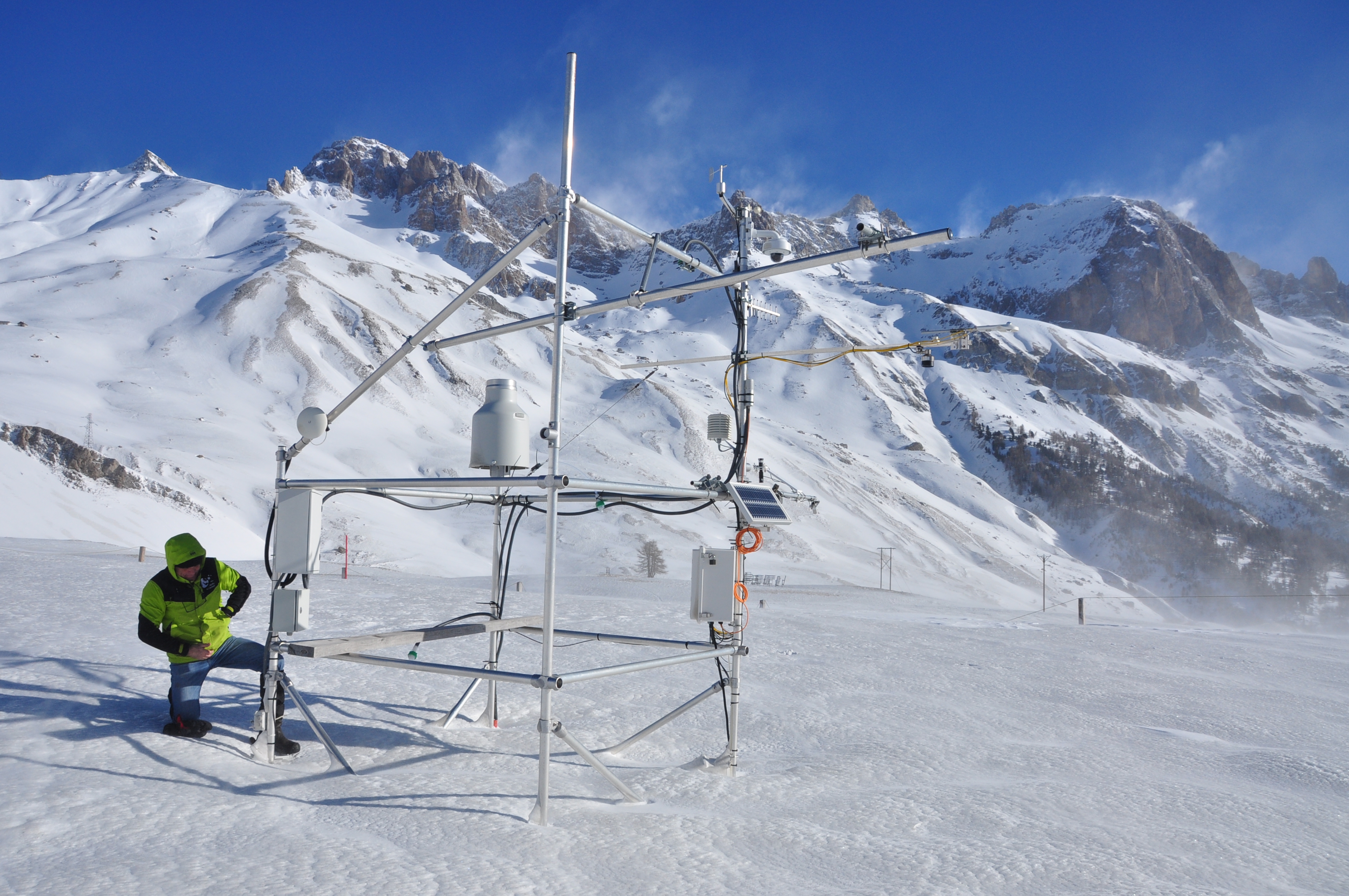
The research station of Lautaret Garden is a set of infrastructures and human resources at the service of alpine environmental research, spread over two sites open all year round. One is located on the campus of the University Grenoble Alpes (dept 38), it is divided into greenhouses, arboretum, experimental zone. The other is located at the Lautaret pass (dept 05) at an altitude of 2100m. The site of altitude gathers an Alpine Botanical Garden, three buildings, an experimental zone and natural area. This structure provides field support for scientific projects, two laboratories, accommodation for 46 people, hydrology and climate data and also botanical expertise. It organizes, in its multimedia room and meeting rooms, trainings, thematic schools, conferences, seminars. The research themes developed mainly concern the ecology of environments in relation to climate, socio-ecosystems, adaptation of living organisms, the physical environment and biogeochemical cycles. Some projects have been carried out since 1980, others operate on a multi-year basis. The station also welcomes foreign researchers within the framework of the Transnational access.
-
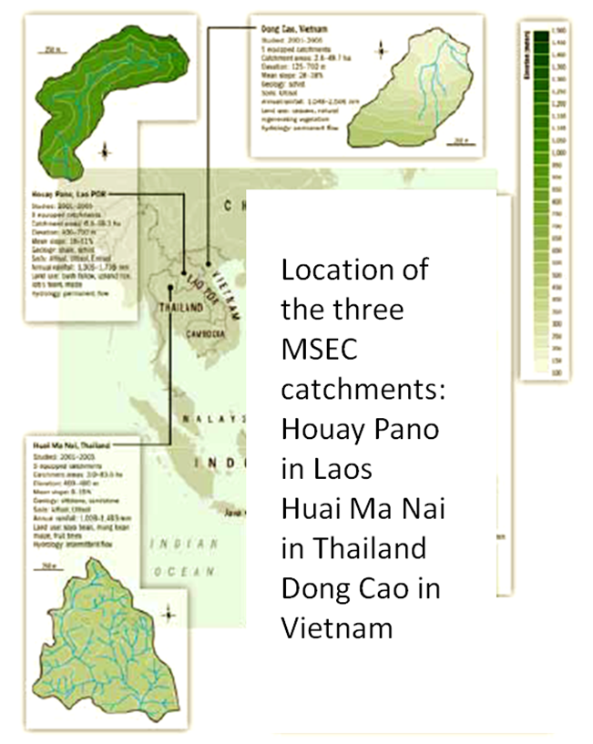
Dong Cao is a small agricultural catchment (47 ha) of northern Vietnam, located at 70 km from Hanoi, in a sloping land environment. The objective is to monitor the impacts of land use changes (from cassava to fodder and tree plantations) and possible climate changes upon hydrological and sedimentary fluxes and budgets. The catchment has an elevation of 125 m to 485 m and slopes range from 15 to 120%. Monitoring devices include an automatic meteorological station, and weirs to monitor discharge, suspended sediment and bedload. More information is available on https://mtropics.obs-mip.fr/ and in the following paper: Valentin, C., et al., 2008. Runoff and sediment losses from 27 upland catchments in Southeast Asia: Impact of rapid land use changes and conservation practices. Agric. Ecosyst. Environ. 128, 225–238. https://doi.org/10.1016/j.agee.2008.06.004
-
Quercus robur and Pinus silvestris forests on glacio-fluvial sediments