
solar radiation
Type of resources
Available actions
Topics
Keywords
Contact for the resource
Provided by
Years
Formats
Representation types
Update frequencies
-
Daily predictions based on meteorological forecast model - NetCDF
-
Solar radiation data (Wm-2) from the UK Environmental Change Network (ECN) Wytham site. These data are collected by Automatic Weather Stations at all of ECN's terrestrial sites using a standard protocol. They represent continuous hourly records from 1991 to 2015. ECN is the UK's long-term environmental monitoring programme. It is a multi-agency programme sponsored by a consortium of fourteen government departments and agencies. These organisations contribute to the programme through funding either site monitoring and/or network co-ordination activities. These organisations are: Agri-Food and Biosciences Institute, Biotechnology and Biological Sciences Research Council, Cyfoeth Naturiol Cymru - Natural Resources Wales, Defence Science & Technology Laboratory, Department for Environment, Food and Rural Affairs, Environment Agency, Forestry Commission, Llywodraeth Cymru - Welsh Government, Natural England, Natural Environment Research Council, Northern Ireland Environment Agency, Scottish Environment Protection Agency, Scottish Government and Scottish Natural Heritage.
-
Solar radiation data (Wm-2) from the UK Environmental Change Network (ECN) Moor House site. These data are collected by Automatic Weather Stations at all of ECN's terrestrial sites using a standard protocol. They represent continuous hourly records from 1991 to 2015. ECN is the UK's long-term environmental monitoring programme. It is a multi-agency programme sponsored by a consortium of fourteen government departments and agencies. These organisations contribute to the programme through funding either site monitoring and/or network co-ordination activities. These organisations are: Agri-Food and Biosciences Institute, Biotechnology and Biological Sciences Research Council, Cyfoeth Naturiol Cymru - Natural Resources Wales, Defence Science & Technology Laboratory, Department for Environment, Food and Rural Affairs, Environment Agency, Forestry Commission, Llywodraeth Cymru - Welsh Government, Natural England, Natural Environment Research Council, Northern Ireland Environment Agency, Scottish Environment Protection Agency, Scottish Government and Scottish Natural Heritage.
-
Data of mean daily air temperature, wind speed, precipitation and solar radiation at the Stations Heuberg, Kuhwald and Mehlbeerleiten from 1990 to 2017
-
The dataset comprises 5 variables, corresponding to: Air temperature (°C), Precipitation (mm), Relative humidity (%), Global (solar) radiation (W/m2), Wind speed (m/s)
-
Data from a meteostation from the Bavarian Forest National Park Administration.
-
Located 2 km east of the Science Campus of the University of Poitiers, the Hydrogeological Experimental Site (HES) occupies an area of 12 hectares on land belonging to the University. From the geologic viewpoint the SEH occupies the north flank of the “Seuil du Poitou”, a huge Mesozoic carbonate plateau marking the transition between the Aquitaine and Paris sedimentary basins. The studies conducted at the SEH focus mainly on the Dogger Aquifer. The experimental layout now comprises 35 boreholes, including two vertical and two inclined cored holes.
-
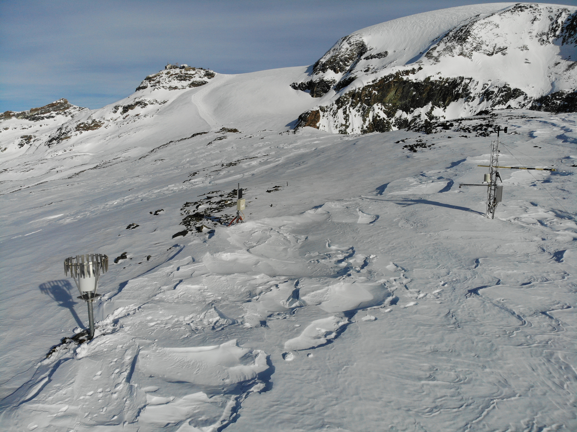
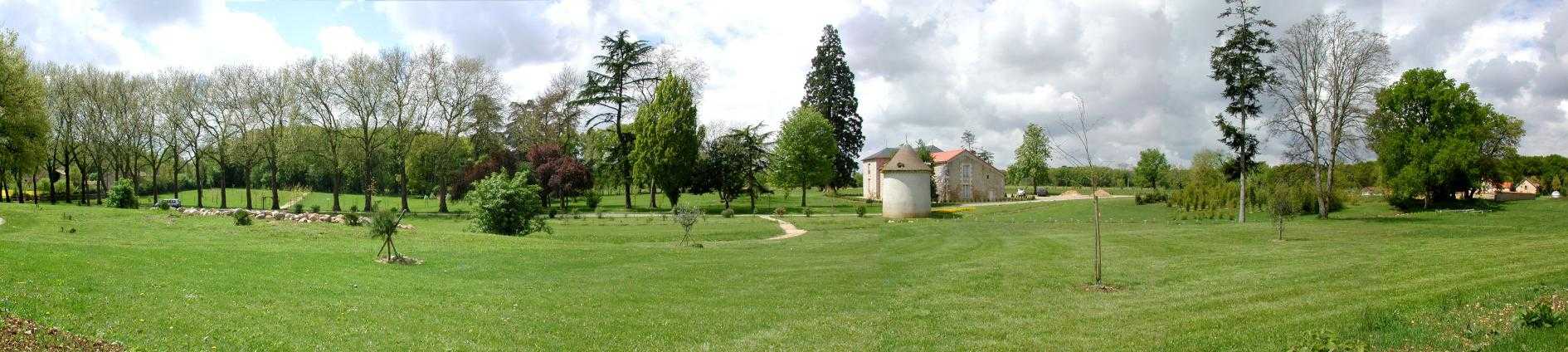
Cime bianche, Colle Superiore di Cime Bianche, (Valtournenche, Aosta), +398720 +5086095; Valle d'Aosta region
-
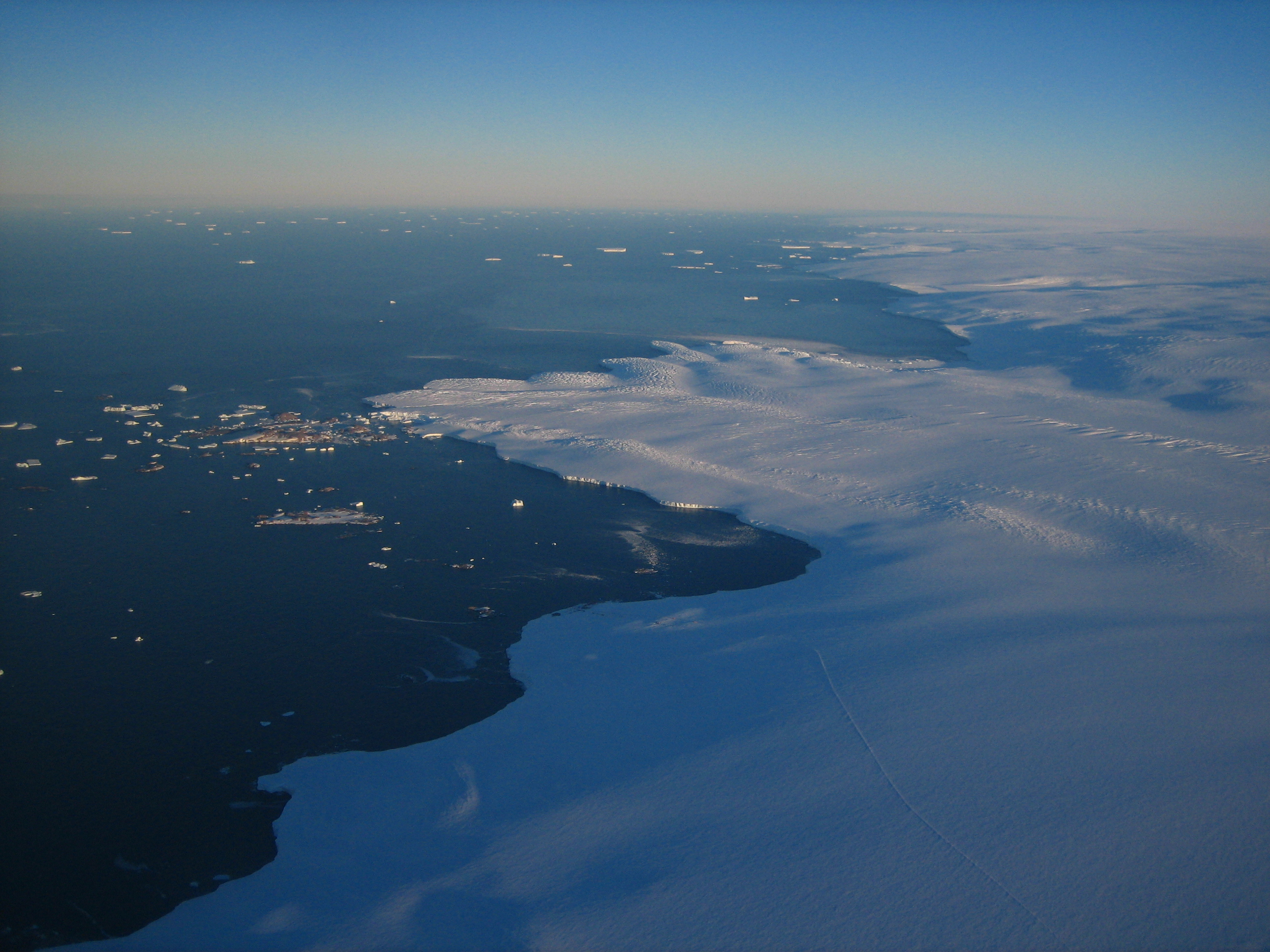
Cap Prud'homme (CAP) is located on the coast of the Antractic Ice sheet (Dumont d'Urville station). Mass balance is measured alo,g 3 different stake networks at the camp and over 150 km inland. Meteorological information are recorded at 2 stations. Dynamics of the ice is measured on the Astrolabe glacier. CAP is a part of the French Glacier Observatory GLACIOCLIM/CRYOBS-CLIM.
-
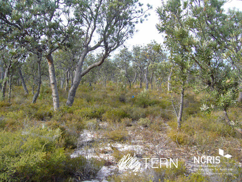
Gingin Banksia Woodland SuperSite is located on the Swan Coastal Plain, approximately 10 km southwest of Gingin, near Perth, Western Australia, sited on land traditionally owned by the Yued group of the Noongar people. The site has an elevation of 51 m and 2 km from the University of Western Australia International Gravity Wave Observatory. The Gingin Banksia Woodland SuperSite is located in a natural woodland of high species diversity (overstorey dominated by Banksia spp.) that overlays the Gnangara groundwater mound, Perth’s most important groundwater resource. The mean annual precipitation is 641mm for this coastal heath woodland. The overstorey is dominated by Banksia spp. mainly B. menziesii, B. attenuata, and B. grandis with a height of around 7 m and leaf area index of about 0.8. There are occasional stands of eucalypts and acacia that reach to 10 m and have a denser foliage cover. There are many former wetlands dotted around the woodland, most of which were inundated all winter and some had permanent water 30 years ago. The water table has now fallen below the base of these systems and they are disconnected and are no longer permanently wet. The fine sediments, sometimes diatomaceous, hold water and they have perched water tables each winter. There is a natural progression of species accompanying this process as they gradually become more dominated by more xeric species. The soils are mainly Podosol sands, with low moisture holding capacity. Field capacity typically about 8 to 10%, and in summer these generally hold less than 2% moisture. The water table is at about 8.5 m below the surface, and a WA Dept of water long-term monitoring piezometer is near the base of the OzFlux tower. The Swan Coastal Plain bioregion consists of five main geomorphic entities that are roughly located parallel to the coastline including three coastal sand dune systems with ages increasing inland from the coast. Banksia Woodlands is restricted to the Swan Coastal Plain IBRA bioregion and immediately adjacent areas, including the Dandaragan plateau. Vegetation consists of a prominent tree layer of Banksia with scattered eucalypts and other tree species present within or emerging above the Banksia canopy, and a diverse understorey including sclerophyllous shrubs, graminoids and forbs. The Gingin SuperSite is collocated with the Land Ecosystem Atmosphere Program (LEAP) - Gingin. The traditional owners at Gingin are the Yued group of the Noongar People.