
specific conductivity
Type of resources
Available actions
Topics
Keywords
Contact for the resource
Provided by
Years
Formats
Representation types
-
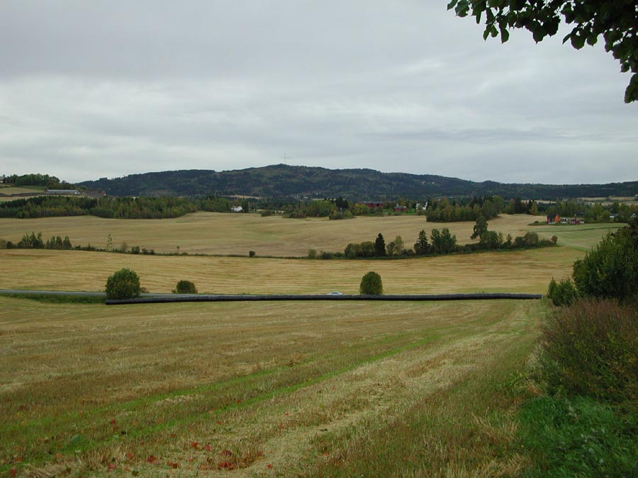
grain and grass dominated catchment located in the south-eastern part of Norway, monitored by The Norwegian Agricultural Environmental Monitoring Programme (JOVA)
-
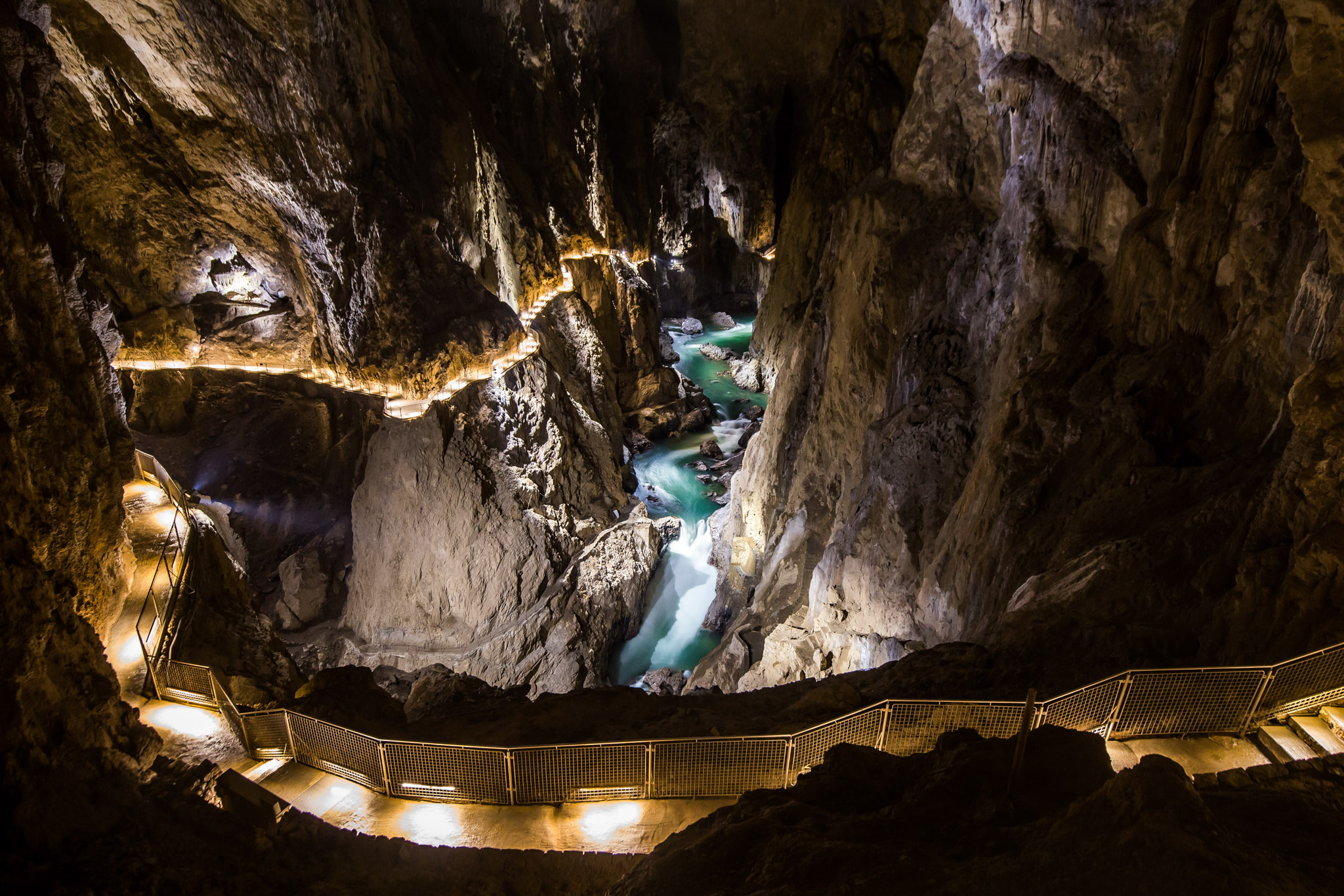
The Škocjan Caves (Škocjanske jame) are a unique natural phenomenon, the creation of the Reka River. The Reka River springs from below the Snežnik plateau and flows some fifty-five kilometres on the surface. After reaching the Karst, that is the limestone surface, the river not only deepens its riverbed through erosion, but also by means of corrosion – it dissolves the limestone. The Reka River blind valley is the largest in Slovenia. In the distant past, probably in the Early Pleistocene, that is a few hundred thousand years ago, the ceiling of the cave collapsed some 200 metres from the sinks; as a result, the collapse dolines Velika dolina (up to 165 metres deep) and Mala dolina (120 metres) were created, separated by a natural bridge, a remnant of the original cave ceiling. Above the caves, between the wall above the sink and the walls of Mala dolina, lies the village of Škocjan. Close to the houses, there is another entrance to the underground, a ninety-metre-deep abyss called Okroglica, which ends just above the underground Reka River. At the bottom of Velika dolina, the Reka River finally disappears underground and resurfaces again thirty-four kilometres away at the springs of the Timava River, not far from the Adriatic coast. Škocjan Caves and karst above them in the area of the Škocjan Caves Park, are on the edge of the Classical Kras (Karst). They are in the close contact with imperable flysch and permeable limestone, in the so-called contact karst. Caves are composed of several parts: the greater part is flooded, but upstream are also dry caves. Due to their exceptional significance, the Škocjan Caves were entered on UNESCO’s list of natural and cultural world heritage sites in 1986. International scientific circles have thus acknowledged the importance of the Caves as one of the natural treasures of planet Earth. Škocjan Caves are also the first underground wetland in the list of RAMSAR and included as Karst biosphere reserve in the program MAB - Man and Biosphere. The importance of Škocjanske caves is in their position, they act as a sink and they are part of the Karst aquifer, they are a unique heritage, which includes also rich groundwater communities.
-
Cabras Lagoon is located on the west coast of Sardinia (Italy), in the Gulf of Oristano (39°56’37’’N, 08°28’43’’E), and occupies about 2280 ha, with a mean water depth and maximum of 1.6 and 3 m respectively. The watershed of the site extends over approximately 430 km2. The input of freshwater into the lagoon is scarce and irregular because of the semi-arid Mediterranean climate. Most of the freshwater comes from the small Mare ‘e Foghe River, located in the north. The predominance of agriculture in the region and the release of poorly depurated urban waste account for the high nutrient loads deposited in Cabras Lagoon. The resident population of about 38,000 inhabitants is grouped in 19 urban centres, the largest being Cabras, which is located on the southeast coastal side of the lagoon. During the twentieth century, the lagoon and its watershed underwent several modifications as a consequence of human activities that affected the hydrology and hydraulics of the region. In addition, in the late 1970s, water exchange with the sea was altered by the dredging of a large canal, the Scolmatore (spillway), which connected the lagoon with the adjacent Gulf of Oristano. The canal was constructed to avoid flooding of adjacent land during the heavy rainfall that occurs in winter. In addition, a cement dam was built into the Scolmatore to prevent further increases in the lagoon’s salinity and artificial barriers were constructed to control the fish catch, thereby impeding direct communication between the lagoon and the sea. Now the only link to the sea is via four very narrow creeks that flow into the large canal from the southern part of the lagoon over the barrier. The lagoon has a high economic rating due to ex¬tensive fishery activities, involving about 300 people and those involved in related enterprises. In the site, in addition to the guard houses and warehouses of fishermen, there is also a restaurant, where the products of fishery in the lagoon are offered. In 1998, fish productivity reached 40,000 kg km-2, corresponding to a catch of 850 tonnes but these values fell to around 20,000 kg km-2 and less than 80 tonnes after 1999. In fact, its high trophic status has often exposed the lagoon to important dystrophic crises, which have caused large reductions in its fishing productivity. Scientific monitoring has been carried out since the strong dystrophic crisis that affected Cabras Lagoon during the summer of 1999, killing the whole aquatic biota. A long-term series of data is available and derives from high-frequency measurements and samplings to assess environmental and biological parameters. In particular the data concern the main trophic descriptors (Secchi depth, temperature, pH, conductivity, dissolved oxygen and saturation, alkalinity, NH4-N, NO2-N, NO3-N, total nitrogen, soluble reactive phosphorus, total phosphorus, dissolved silica) and phytoplankton abundances, as chlorophyll a, cell densities and biomass, class and species composition. The activity was interrupted in 2009.
-
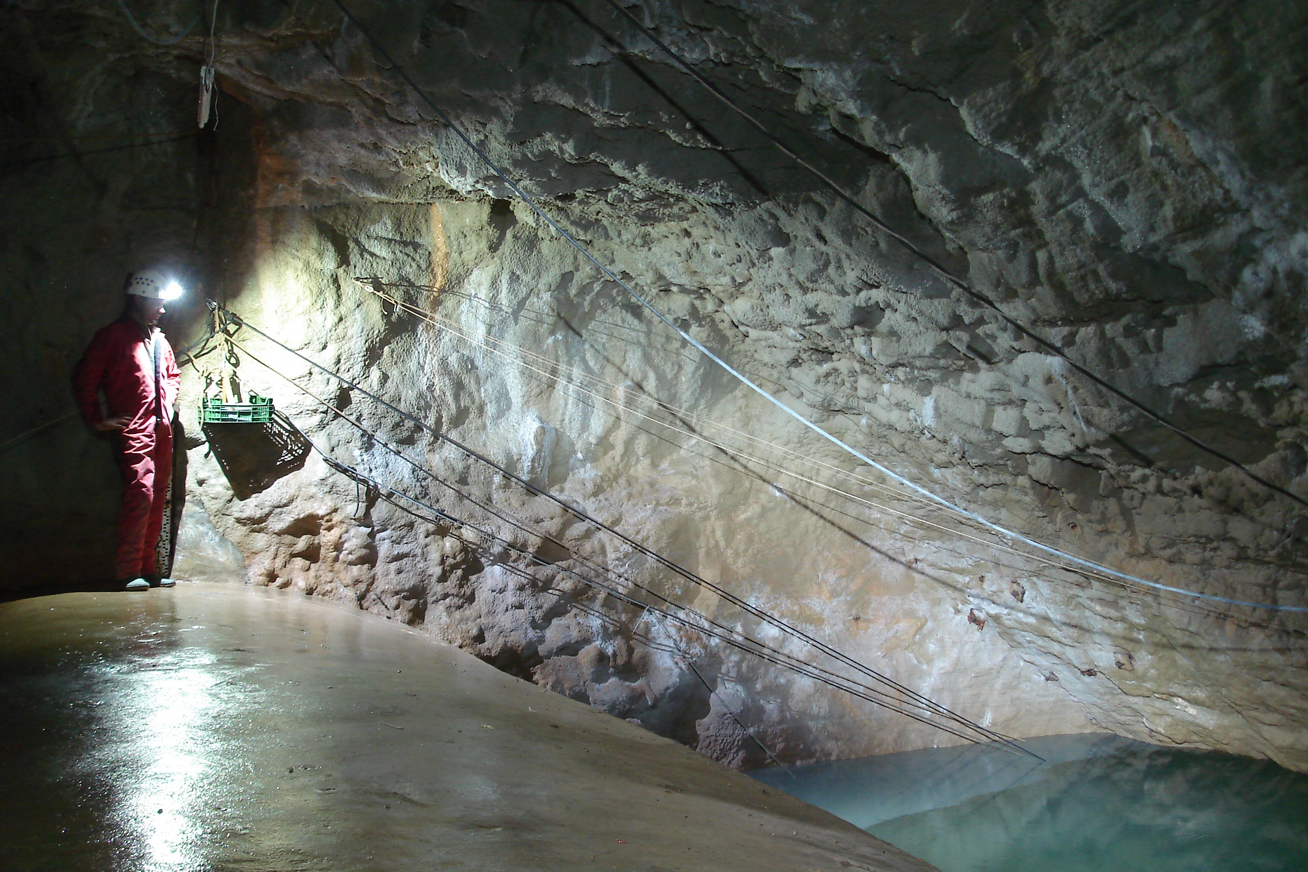
The Mediterranean and coastal site of Port-Miou is a wide regional carbonate aquifer, with a catchment area around 400 km², in south of France (Provence, France). It extends mainly over natural land, in the vicinity of one of the main city of France (Marseille), facing recent urban expansion and future groundwater resources management issues. Top of the recharge area culminates at 1100 m asl, and the main outlets are submarine springs. Karst features are observed in surface (polje, intermittent rivers, sinkholes, karren, caves) and underground. Many karst networks have been explored in the unsaturated zone of the aquifer, but also in the saturated zone below the sea level. Karst features and conduits drive the groundwater flows to the main outlets. The Port-Miou submarine springs outflow from huge flooded karst conduits, explored by cave diving over several kilometers inland, and to -235 m deep. Groundwater is brackish, polluted by seawater intrusion. The Port-Miou observation site includes flow rate, salinity and temperature monitoring at the main brackish spring, in an in-situ underground laboratory located 500 m inland from the seashore, directly in the main karst conduit. Rainfall is also recording in the catchment area, and rain water samples are collected for water isotopes observation.
-
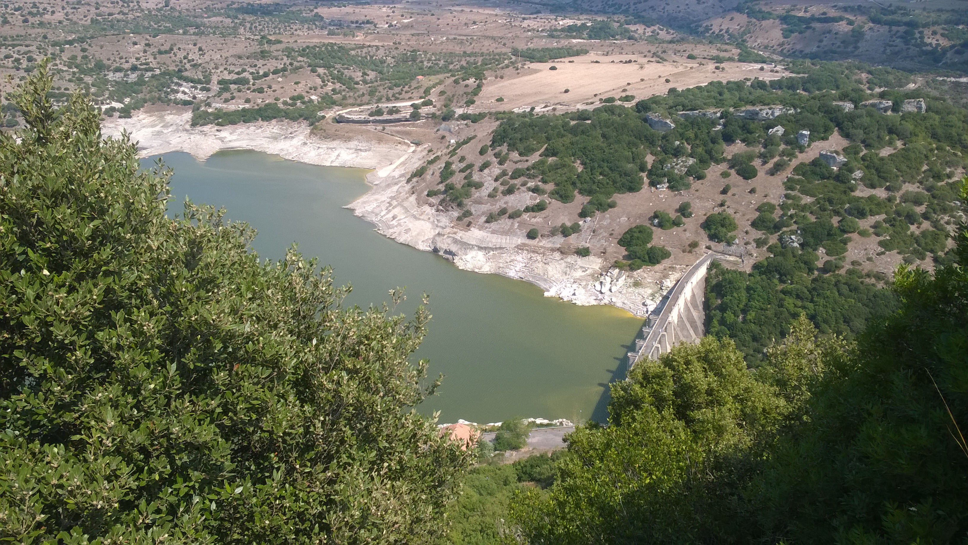
Lake Temo (IT10-006-A) is located in north-west Sardinia. The construction of the dam began in 1971 and ended in 1984. The reservoir lies at 226 m a.s.l. and has an area of 4.81 km2, a mean depth of 15.8 m and a maximum capacity of 91 x 106 m3. Its catchment extends for 142 km2.
-
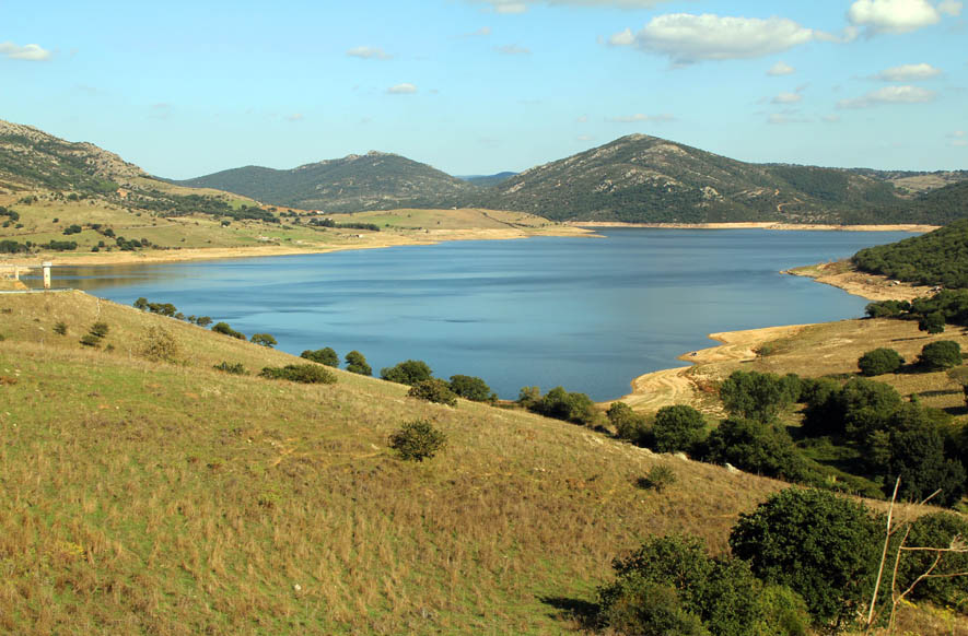
Lake Cuga (IT10-003-A) is located in the north-western part of Sardinia. The reservoir was built in 1965, but its first filling was in 1975. It lies at an altitude of 114 m a.s.l. and is extended for about 58 x 106 m2, with a maximum and average depth of 45 m and 11 m, respectively. It has a volume of 34 x 106 m3. The waters are used mainly for irrigation and drinking supplies. Cuga Lake is classified as eutrophic since the early years of its filling.
-
Lake Monte Lerno (IT10-004-A) is located in the North East part of Sardinia in the municipality of Pattada. Its construction was completed in 1980. The catchment area is extended for 160 km2. The reservoir lies at 563 m a.s.l. and has a maximum area of 4.4 km2, a mean depth of 14.9 m and a volume of 89.5 x 10⁶ m3 of water. Its waters are used for drinking and irrigation. Lake Monte Lerno is classified as eutrophic.
-
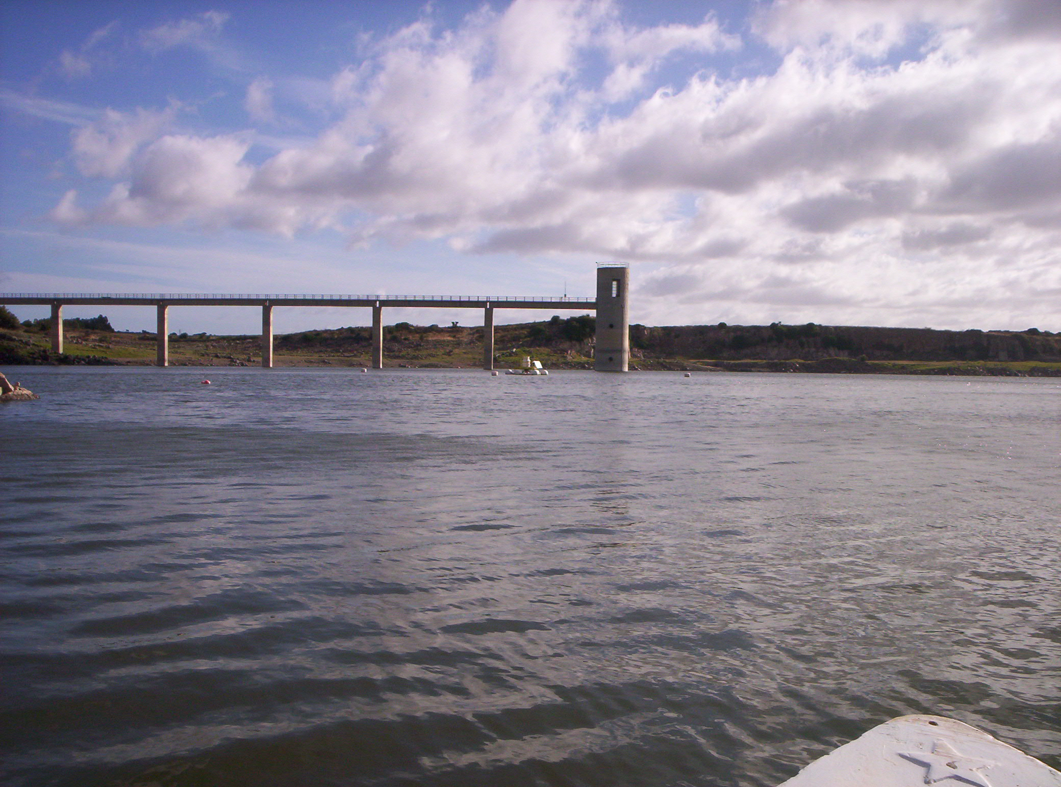
Lake Cedrino (IT10-002-A) is the result of the dam on the Cedrino River built in 1984. The lake is located in the eastern centre of Sardinia. It has a surface area of 1.5 km2 and a volume of 20 x 106 m3 when it is filled to the maximum share (103 m a. s.l.), and a mean depth of 26.5 m. The catchment covers about 627 km2.
-
Santa Giusta occupies an area of 8 km2, with a mean depth of 1 m. Rio Pauli Maiori and Rio Pauli Figu are the two primary freshwater inputs, both located on the lagoon’s east side (Fig. 1b). Santa Giusta also experienced substantial human modification during the 20th century, resulting in profound ecosystem alterations. The Pesaria channel, which originally connected the lagoon to the sea through the Tirso River outlet was deepened, widened, and separated from the river. An industrial harbour was subsequently built, which was connected to the lagoon through an industrial canal controlled by bulkheads. A fish catch system was constructed in the final portion of the Pesaria channel. In 1995, a diversion canal for Oristano urban wastes (the main urban town in the catchment) was built. Despite the canal, the high inorganic nutrient concentrations and algal biomass remained unchanged (Sechi et al. 2001). Macrobenthic algae and phytoplankton are the most important primary producers in Santa Giusta. Sechi et al. (2001) reported several fish kill events associated with harmful algal species blooms in this lagoon. Santa Giusta sediments show high levels of TOC and OM, especially in surface layers (1‒2 cm) in the north and south lagoon areas (Magni et al. 2008). Lugliè et al. (2002) showed Santa Giusta sediment grain sizes exhibited a degree of heterogeneity, but the finer fractions were primarily located in the south-central lagoon area, consistent with central and peripheral canals dredged in the 1970s to facilitate seawater flow into the lagoon. From 1990, the trophic status of the lagoon was always kept under control. It was thus possible to monitor the course of the trophy after the waste was diverted. Even recently (summer 2010) serious events of fish death there were. A long-term series of data is available and derives from high-frequency measurements and samplings to assess environmental and biological parameters. In particular the data concern the main trophic descriptors (Secchi depth, temperature, pH, conductivity, dissolved oxygen and saturation, alkalinity, NH4-N, NO2-N, NO3-N, total nitrogen, soluble reactive phosphorus, total phosphorus, dissolved silica) and phytoplankton abundances, as chlorophyll a, cell densities and biomass, class and species composition.
-
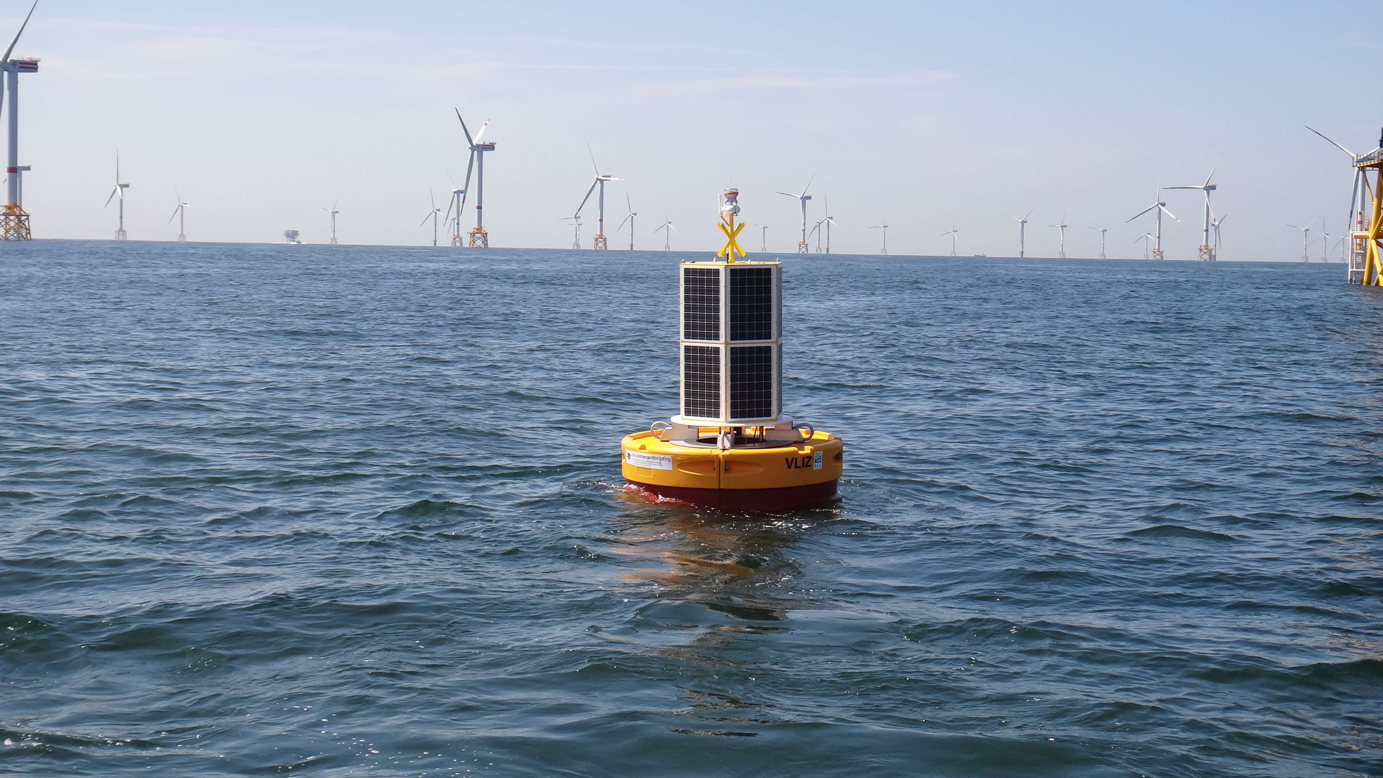
The site consists of a marine databuoy equipped with a suite of sensors that monitor water quality parameters and acoustic receivers for the detection of Porpoises and tagged fish. The buoy is moored near an offshore windmill farm, approx. 30km off the coast on the Belgian Continental Shelf.