
stream order
Type of resources
Available actions
Topics
Keywords
Contact for the resource
Provided by
Years
Formats
Representation types
-
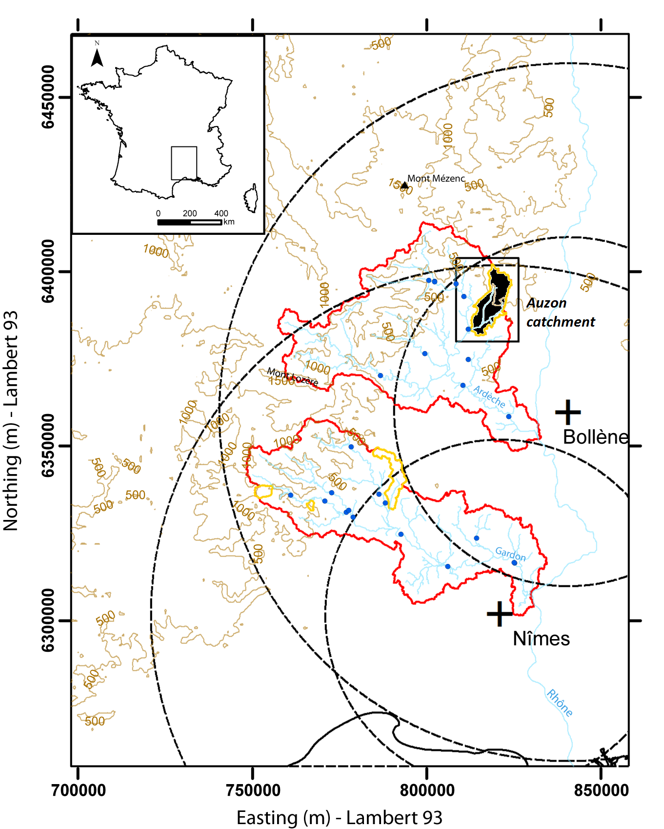
Hydrometeorological and hydrosedimentary observations within 3 embedded catchments: Gazel, Claduègne and Auzon (3.4, 43, and 116 km²). Mediterranean climate with heavy rainfall and flash floods in automn. The upper part of the catchment is characterized by basalt formations, after which a sharp transition occurs where the lower two thirds is made up of sedimentary limestone rock. The soil types are heavily infuenced by the geology of the catchment. Main land use types are pastures,vineyards and forest. More information at http://mistrals.sedoo.fr/?editDatsId=1438
-

Hydrometeorological observations within 6 embedded catchments (from 0.3 to 3.9 km2). Mediterranean climate with heavy rainfall and flash floods in automn. The geology is mainly granite. The land use is mainly forest. This site is typical of the Cévennes region. More information at http://www.ohmcv.fr
-
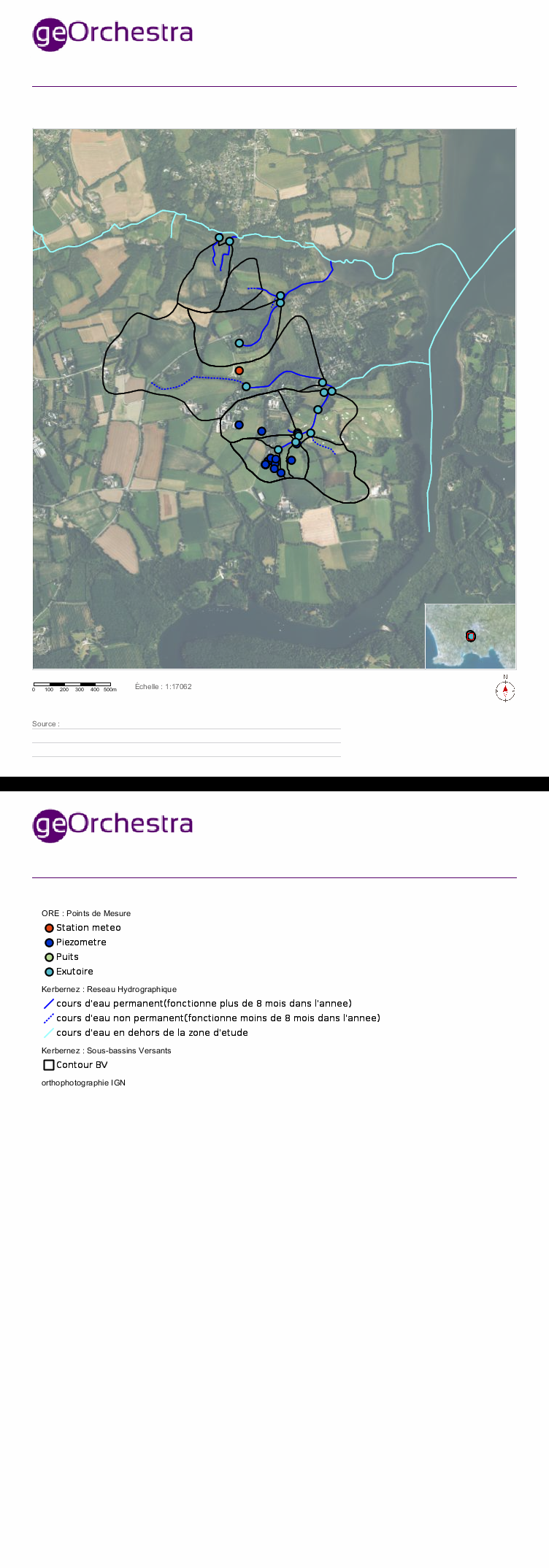
Located in South West of Brittany, western France, the elementary catchments of Kerbernez are underlain by old bedrock and is characterised by a oceanic, humid and temperate climate and by an intensive agriculture. In every catchment, the hydrology is controlled by a shallow aquifer made of the unconsolidated weathered bedrock. The water table in the aquifer is close to the soil surface in bottom land areas of catchment. During storm event, surface runoff occurs mainly over the saturated soils of bottom lands. The Environmental Research Observatory (ERO) AgrHyS focuses on the response times of changing Agro-Hydro-Systems (defined as a catchment influenced by agricultural activity) for hydro-chemical fluxes.
-
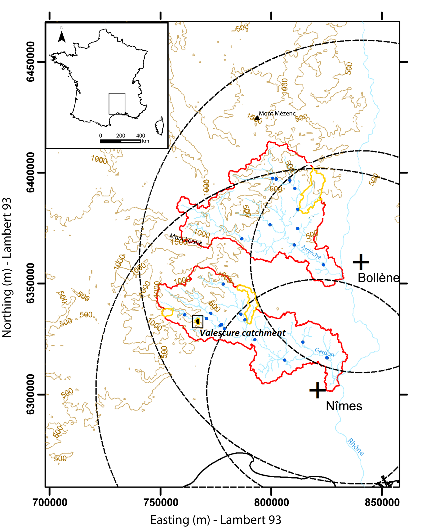
Hydrometeorological observations within 3 embedded catchments (0.9, 2.6 and 14.5 km2). Mediterranean climate with heavy rainfall and flash floods in automn. The geology is mainly shale. The land use is mainly forest. This site is typical of the Cévennes region. More information at http://www.ohmcv.fr
-
NINA Aquatic Research Station, Ims provides advanced research facilities on aquatic research, primarily focused on fish ecology
-
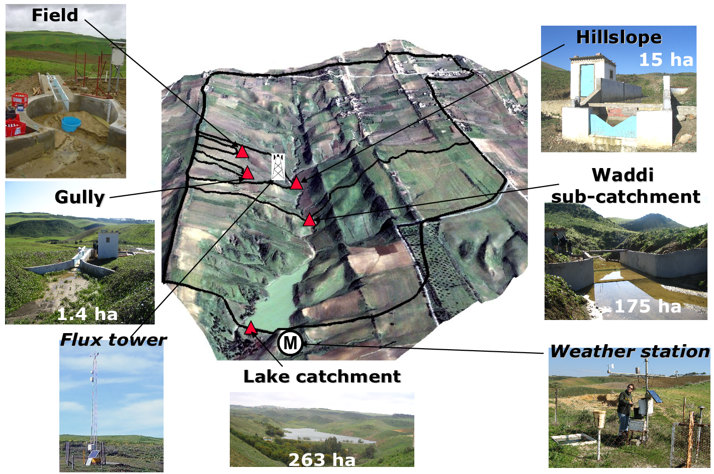
Small agricultural catchment (263 ha) in a Mediterranean environment with 20 years of data: impact of global change (climate and anthropogenic activities as agricultural practices) on water and erosion balance, fluxes and quality. Soils: Calcic Cambisols (63.5%), Regosols (25.5%), Eutric Regosols (9.6%) and Chromic Vertisols (1.4%). Main cultures: cereals and leguminous. Continuous automatic measurements at nested scales from plot to catchment outlet (surface runoff, shallow groundwaters, surface-atmosphere fluxes) and continuous monitoring of anthropogenic activities . More information available on http://www.obs-omere.org. Kamech experimental catchment belongs to the French SOERE-RBV Network.
-
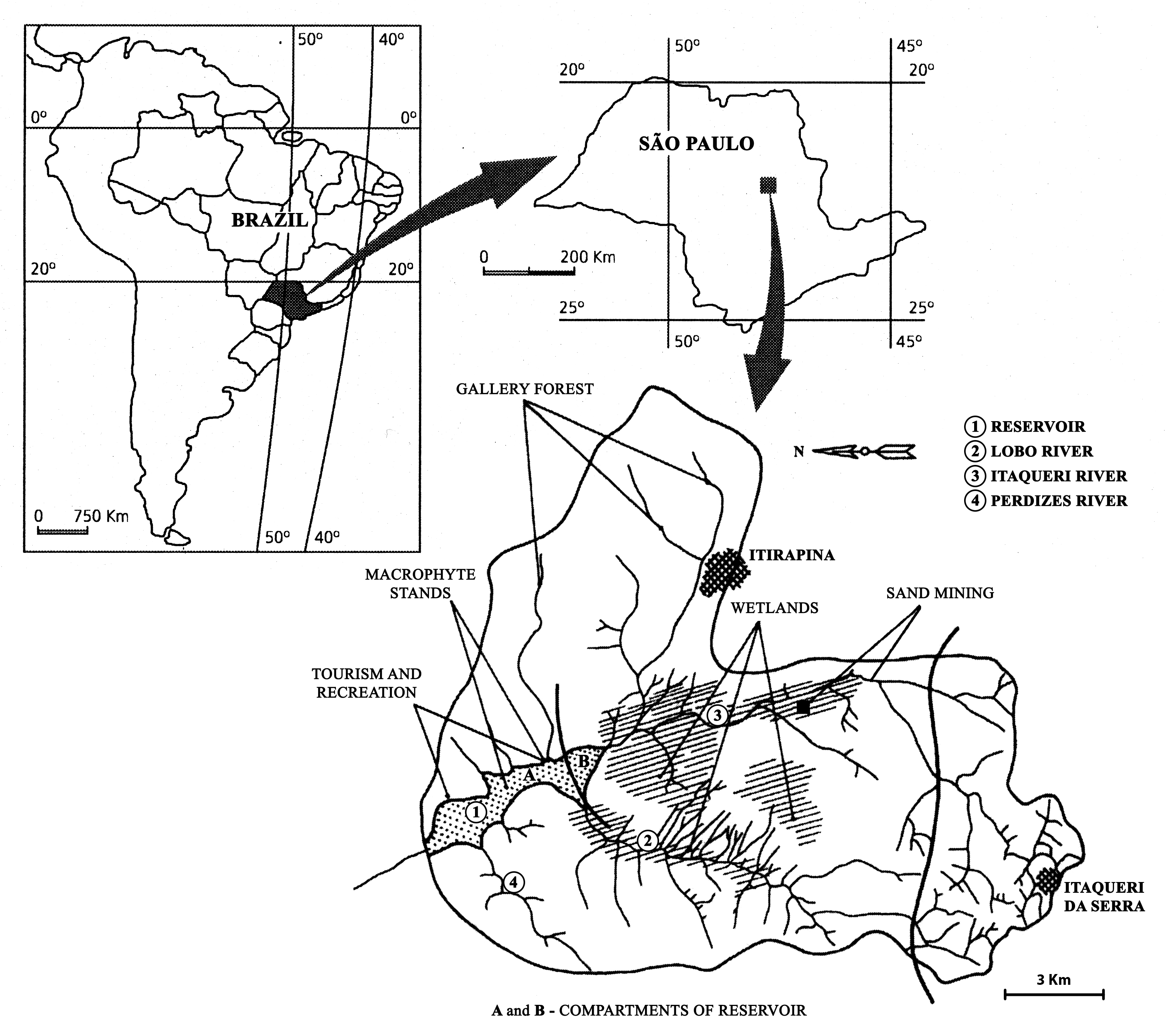
The watershed is located in the center of São Paulo State, Southeast of Brazil. The coordinates are: Lat. 22º 10' 08,5" S; Long. 47º 57' 11,7" W. The drainage density is 0.75km/km2. The maximum altitude is 800m. Basin declivity is 0.00575m/m. The local climate is characterised by alternating dry and wet periods, the wetter period falling in summer and autumn, and the winter and spring seasons being mainly dry. Annual precipitation is around 1500 mm per year. Temperatures are typically between 15 °C and 17 °C during the coldest winter month (July); in the warmest summer month (January), water temperatures between 21 °C to 23 °C are recorded. Potential evapotranspiration is between 500 mm to 1000 mm per year. According to the Koppen classification, the climate is described as ‘warm with a dry period’. The watershed is dominated by holocenic sandy sediments. In the lowland areas, hydromorphic and organic soils predominate. Soils derived from basalt intrusion occur in some areas of the watershed, as red soil hotspots. The natural vegetation is characteristically a savanna type, the Cerrado, typical of the continental regions of Brazil, consisting of bushes and trees adapted to a long (six months) dry season with periodic fires. Given the hydrogeochemical character of the watershed, the ionic strength and the nutrient content of the water of Lobo-Broa Reservoir are correspondingly low.
-
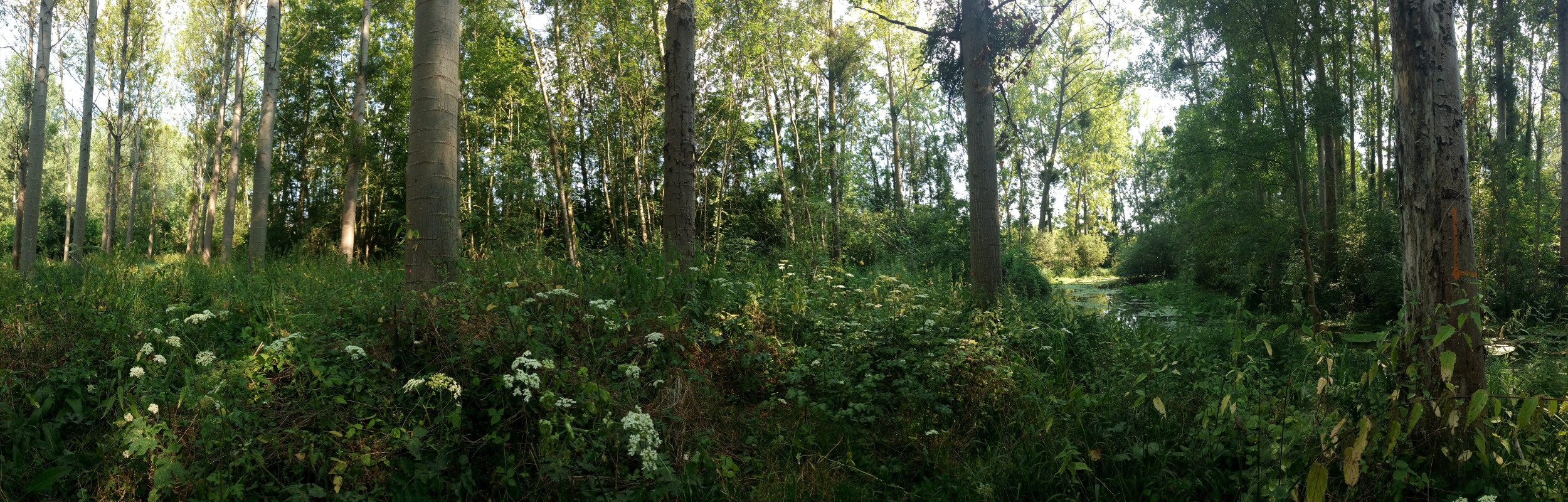
The Bassée floodplain is a large area in the Seine river basin (~ 50 km long and 5-10 km wide). Series of hydrological installations (dikes, channelization, damming, drainage, sand and gravel pits) have considerably reduced the flooding in the plain which nervertheless remains an important resource in the Seine river basin for freshwater and biodiversity. The level of anthropization increases from upstream to downstream. Projects for new hydrological installation (damming, channelization) still exist, which supports a high monitoring activity in this area.
-
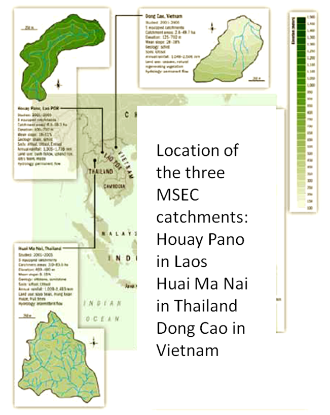
Dong Cao is a small agricultural catchment (47 ha) of northern Vietnam, located at 70 km from Hanoi, in a sloping land environment. The objective is to monitor the impacts of land use changes (from cassava to fodder and tree plantations) and possible climate changes upon hydrological and sedimentary fluxes and budgets. The catchment has an elevation of 125 m to 485 m and slopes range from 15 to 120%. Monitoring devices include an automatic meteorological station, and weirs to monitor discharge, suspended sediment and bedload. More information is available on https://mtropics.obs-mip.fr/ and in the following paper: Valentin, C., et al., 2008. Runoff and sediment losses from 27 upland catchments in Southeast Asia: Impact of rapid land use changes and conservation practices. Agric. Ecosyst. Environ. 128, 225–238. https://doi.org/10.1016/j.agee.2008.06.004
-
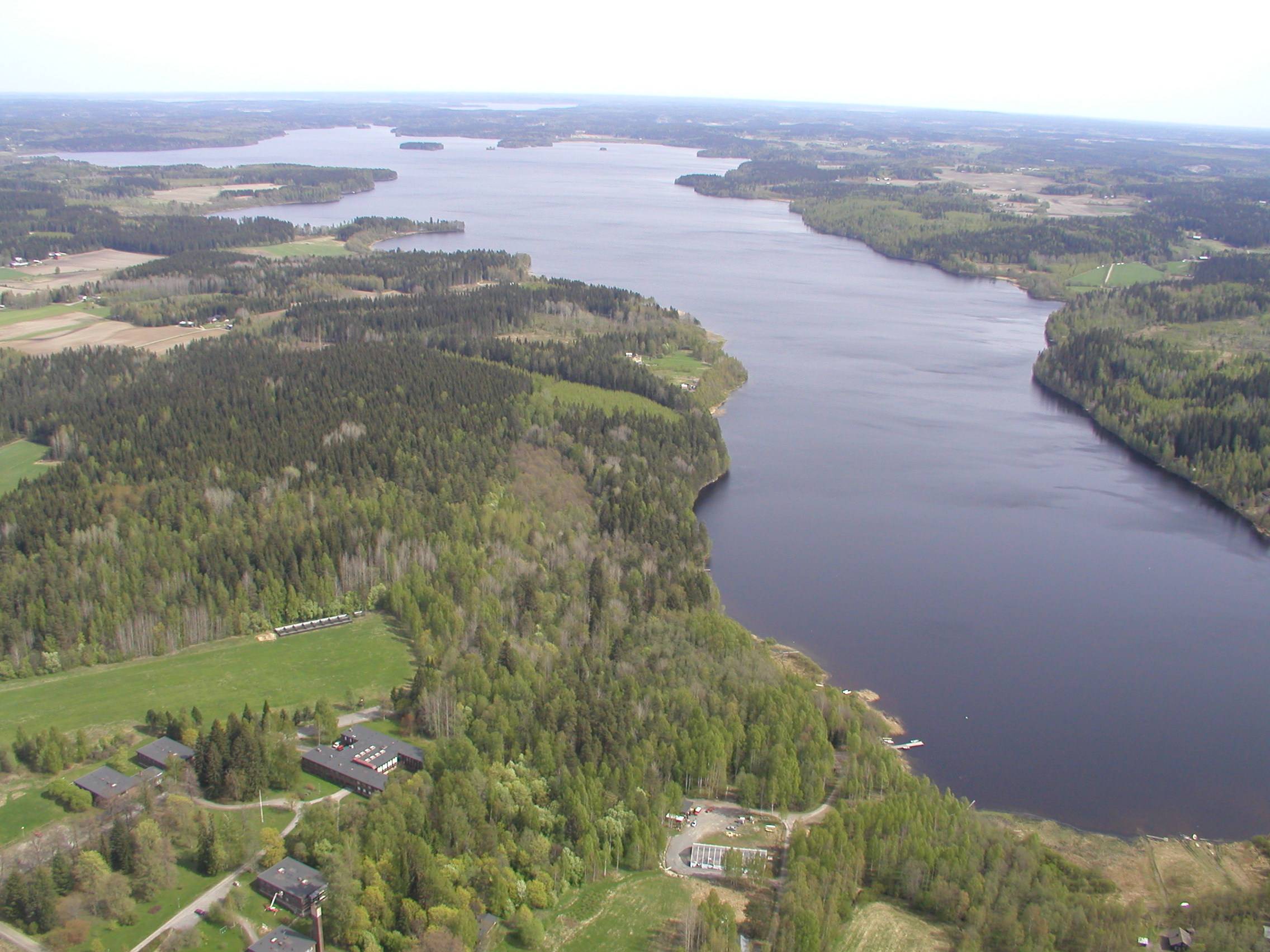
The Lammi LTER area is located 130 km north of Helsinki, 35 km east of the city of Hämeenlinna and 40 km west of the city of Lahti in uplands between two major river basins, i.e. rivers Kokemäenjoki and Kymijoki. The Lammi LTER area consists of several core sites/areas from which the Evo Forest and Lake Area (EVO) is the largest one and has a special value in terms of long term ecological studies. Another important study area is Lake Pääjärvi and its surroundings. The EVO area is among the largest coniferous forest areas in southern Finland. Lake Pääjärvi and its surroundings have been studied since early 1960s as a result of the establishment of the Lammi Biological Station in 1953 by the University of Helsinki.