
sunshine duration
Type of resources
Available actions
Topics
Keywords
Contact for the resource
Provided by
Years
Formats
Representation types
-
Sunshine duration of meteorological Station Rudolfshütte
-
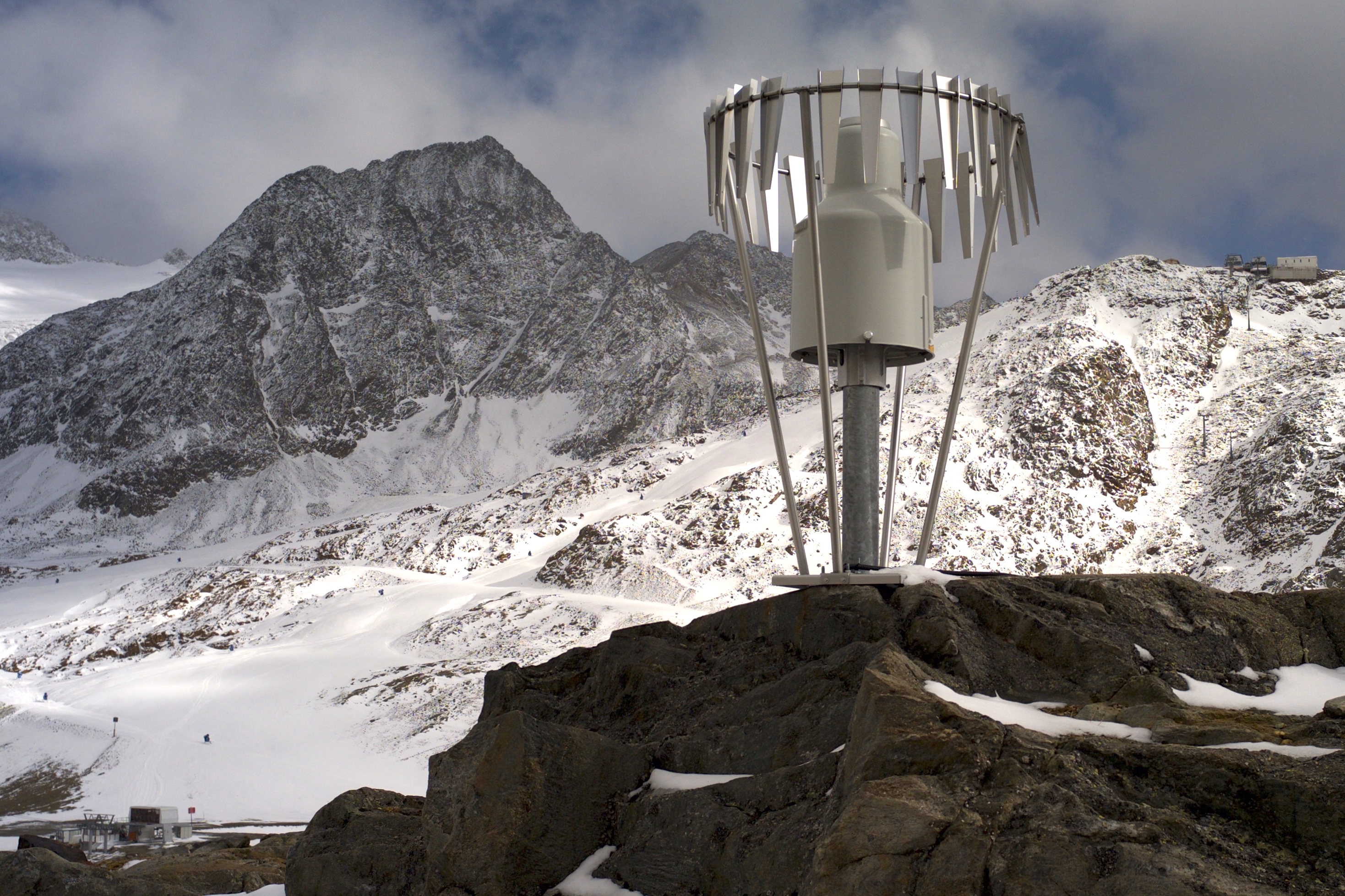
Meteorological Station Rudolfshütte (GeoSphere Austria) A TAWES (Teilautomatisches Wetter-Erfassungs-System) station measures a variety of meteorological parameters to provide comprehensive meteorological data. These measurements include: + Air Temperature + Relative Humidity + Wind Speed and Direction + Precipitation + Air Pressure + Solar Radiation + Soil Temperature + Visibility + Cloud Cover + Snow Depth: Measured using ultrasonic or laser sensors.
-
Daily meteorological data (2m height) between 1995 to 2016 with air temperature (mean, minimum, maximum), precipitation, global radiation, sunshine duration, humidity, air pressure, wind velocity and direction
-
Metadata of air meteorological parameters recorded at the clearing area “Wildwiese”, which is situated on the plateau (850–956 m a.s.l.) of the LTER site Zöbelboden. The data can be viewed and downloaded via the link provided using the station name “ZOE_0939” and “ZOE_0922P00”, respectively.
-
SITES Lönnstorp research station is situated in the Scanian agricultural landscape between Malmö and Lund and has a focus on the design, sustainable development and assessment of arable cropping systems, in conventional and organic farming. The research station is available for research within ecology, agronomy, environmental science, agroecology and other disciplines. SITES Lönnstorp research station have access to 60 hectares of conventional and 18 hectares of organic farm land, mainly cultivated with annual crops, representative for agricultural practise in southern Sweden. The station is also a part of SITES, Swedish Infrastructure for Ecosystem Science. SITES is a nationally co-ordinated infrastructure for terrestrial and limnological field research. In 2016, SAFE (SITES Agroecological Field Experiment) was established at the research station. SAFE make it possible to compare four different agroecosystems, a conventional reference system, an organic system, a perennial system and an agroecological intensified system.
-
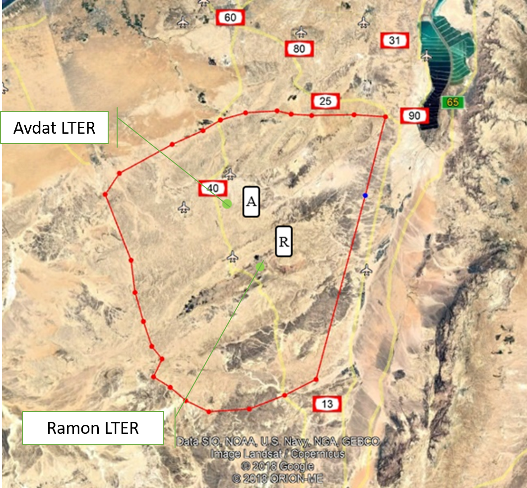
The Negev Highlands (NH) LTSER platform is situated between the Sinai Peninsula to the west and the Arava – Dead Sea depression to the east. This is a rocky terrain, covering an area of 17,000 sq. km with series of ridges at an altitude of 400-1000 m above sea level. As part of the Saharo-Arabian desert belt, the climate across the NH is arid to hyper-arid region: January’s mean daily temperature is 10 °C and July’s mean daily temperature is 25 °C The potential evaporation is approximately 2200 mm/y, and mean annual precipitation is 70–130 mm, with large inter annual variations. The rainy season occurs during the winter months, from November to March. The area is rich with unique natural landscapes. One of the most prominent of these are the Makhteshim, which is the largest erosion craters in the world. In addition to its unique landscapes, it is also a habitat for various species of flora and fauna that are adapted to arid zones and highlands, some of which are endemic to the area. The Negev Highland LTSER platform includes two LTER sites: Avdat Site in the arid zone and Makhtesh Ramon site in the hyper arid zone. Archaeological remains indicate that humans lived in the area for at least 1.4 million years. Today, about 10,000 residents live here, in towns, agricultural communities, small Bedouin tribal villages and tourist-agricultural farms. Most of it is concentrated along the main route (Route No. 40), while much of the area beyond the roads is either designated nature reserves or firing zones. The two main livelihoods in NH today are agriculture - mainly vines and olives, and tourism; Both are greatly affected by climate change. Agriculture relies on desalinated seawater imported into the area. However, it is affected by the climate in several ways: 1) flash floods cause increased soil erosion. 2) Long periods of drought during the winter, cause increased evaporation and therefore large water consumption. This is when the price of water is the main expense of the farmers, and increasing it may make agriculture unprofitable. 3) The uncertainty regarding the amount of precipitation and their timing, characterizes the arid environment. Recent climate changes are increasing this uncertainty and therefore make it very difficult for farmers to plan their land cultivation and expenses. Climatic uncertainty poses a significant challenge also for tourism operators; Jews and Bedouins, as well. This is due to the multiplicity of events of extreme climatic conditions (extreme cold or extreme heat), which repel tourists from reaching the area. And, a multitude of years when there is not enough precipitation to generate the famous spring bloom of the area. For the past 7 years, the NH LTSER's researchers have been working closely with three stakeholder groups in the area: winegrowers in the valleys, the Negev Highlands Tourism Association and Bedouin tourism operators. In Green Transformation we will actively engage with this group, through tow case studies: 1) The Desert Miracle farm - which will serve as a monitoring and dissemination knowledge farm; In a collaboration with the owner of the farm, R and D agriculture in the NH and the Center for Flood Research (DSASC). 2) Tourism in the NH; In collaboration with the NH Tourism Association. Through joint work with these NGOs, we will develop a long-term monitoring program and educational materials. The topics we will deal with: reducing soil erosion and increasing soil moisture, by using appropriate agricultural methods to multiply flash floods, which will be distributed to additional farmers in the area through activities at the monitoring farm. and to tourists through workshops of the Tourism Association. In the case of tourists, the aspect to be monitored is the number of tourists who come to the area in relation to the weather conditions. Together with the Tourist Association we will develop tourist-monitoring system. The high sensitivity of the arid region to climate change and the great exposure of the impact of these changes on animals, plants and humans, invite possible tourist-educational activities aimed at transformation in ways of thinking and behaving. An environmental education program and educational tools will be developed together with the Tourist Association. Their impact will be monitored in collaboration between the NH LTSER platforms researchers and tourism operators.
-
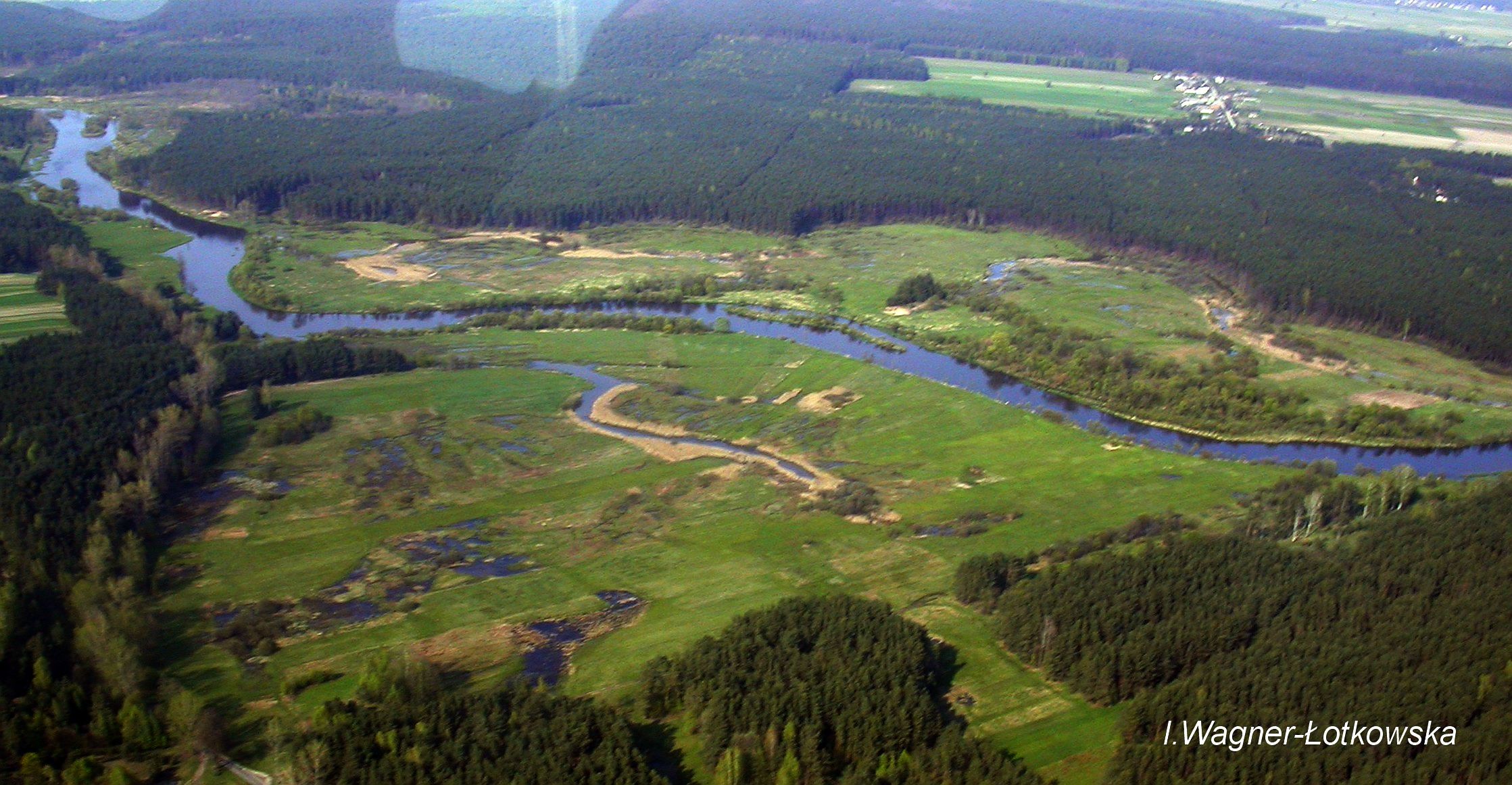
The Pilica River watershed is located in central Poland (length:342 km, catchment area: 9258km2). Its mean and maximum discharge is 21.2 and 139m3 s−1, respectively. Agriculture is found in over 60% of the Pilica catchment, and results in an increased supply of nutrients, humic substances, and other pollutants from non-point sources to the river and the Sulejow Reservoir, which is a spare drinking-water reservoir for the Lodz agglomeration and a recreational area. The LTER site includes the experimental floodplain of the Pilica River valley (51°18'58.46''N and 19°54'10.54''E), located in the middle reach of the river, upstream of the reservoir.
-
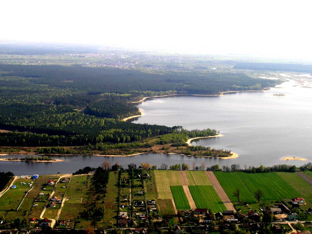
The site is situated in lowlands of Central Poland and arranged around the Sulejowki Reservoir. It has been build in 1969-1974 on the Pilica River mainly as a source of drinking water for the City of Lodz (the third biggest city in Poland) and other cities like Tomaszow, Piotrkow, Sulejow, and a power generator. With time it became also an important touristic and recreational place. The research area includes the reservoir and its direct catchment, where smaller plots have been located for analysing surface flow, groundwaters, and the role of land/water ecotones in regulation of nutrient cycling. There is number of sampling sites/points located also on the reservoir, 3 of them are permanent since 1980's and serve as a source of data on water chemistry, the others are sampled periodically for certain purposes, e.g. fish (including 1+), phytoplankton, zooplankton, sediment depositon, groundwater level, groundwater chemistry.
-
In the Rofental (Ötztal Alps) a consortium of the three institutions, and open to research partners worldwide, concentrates on studying and monitoring cryospheric, atmospheric and hydrological processes and changes with particular attention to the complex topography and climate settings of the Alpine terrain. First documents from glaciers in the Rofental, Ötztal Alps, date back as far as 1601 and regular observations and systematic studies had begun more than 150 years ago. First geodetic maps where generated in the late 19th century, first rain gauges were mounted in 1929 and glacier mass balance time series of Hintereis-, Vernagt- and Kesselwandferner are among the longest uninterrupted world-wide, building a basis for regional hydrological studies, for glacier-climate and ice dynamic research, and for estimating the world wide glacier’s contribution to sea level rise. By 2014, networks of stakes and pits for mass balance monitoring are maintained at Hochjoch-, Hintereis-, Kesselwand- and Vernagtferner by the consortium members. Runoff gauges at Vernagtferner and in Vent (operated by the Hydrological Office of Tyrol) and a network of rain gauges in the Rofental basin are the basis for high mountain hydrological studies. A varying number of automatic weather stations on and in the surroundings of the glaciers are operated by the Rofental consortium. The glaciers in the Rofental are frequently used as a test site for process studies, model development and evaluations and for new remote sensing or ground based methods in glaciological research. A series of airborne LIDAR derived high resolution DTMs of Hintereisferner and its surroundings are available since 2001. They are subject of ongoing evaluations and method comparison studies as well as for monitoring and studying periglacial morphodynamics. The generated data are available from the consortium partners, glaciological key results are annually reported to the World Glacier Monitoring Service (WGMS). A research station on Hintereisferner (with observer status in the Horizon 2020 INTERACT network) and one at Vernagtbach serve as logistic bases for fieldwork. In recent studies, socio-ecological research aspects – e.g. in relation with the use of water for energy production and tourism – comprise the natural scientific investigations.
-
This site is located on the territory of National Park “Rila”, Bulgaria. Parangalitsa has been a reserve since 1933. It is situated on part of the southwestern slopes of Rila mountain, covering 1,509 hectares. It contains some of the oldest pine tree forests in Europe with an average age of over 200 years. The site is a part of the network of bioecological stations of Forest Research Institute – BAS and research is focused on highly productive coniferous forests with unique biomass. In the main experimental plots, long-term complex studies were conducted during the period 1979 - 1998, a large-scale database was created and a number of significant scientific results were obtained. In the period 2000 - 2018, separate targeted studies were carried out - focused on some ecosystem processes, which allows the analysis and evaluation of the functioning of ecosystems to be don