
surface air temperature
Type of resources
Available actions
Topics
Keywords
Contact for the resource
Provided by
Years
Formats
Representation types
-
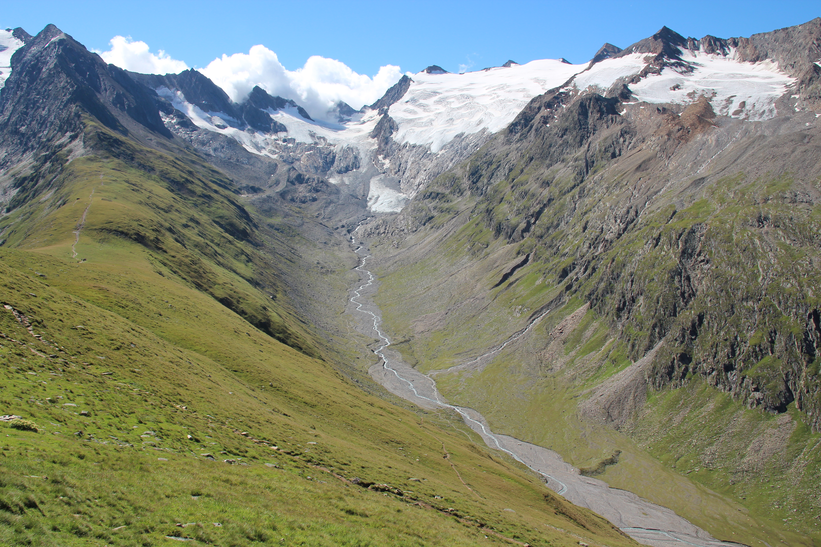
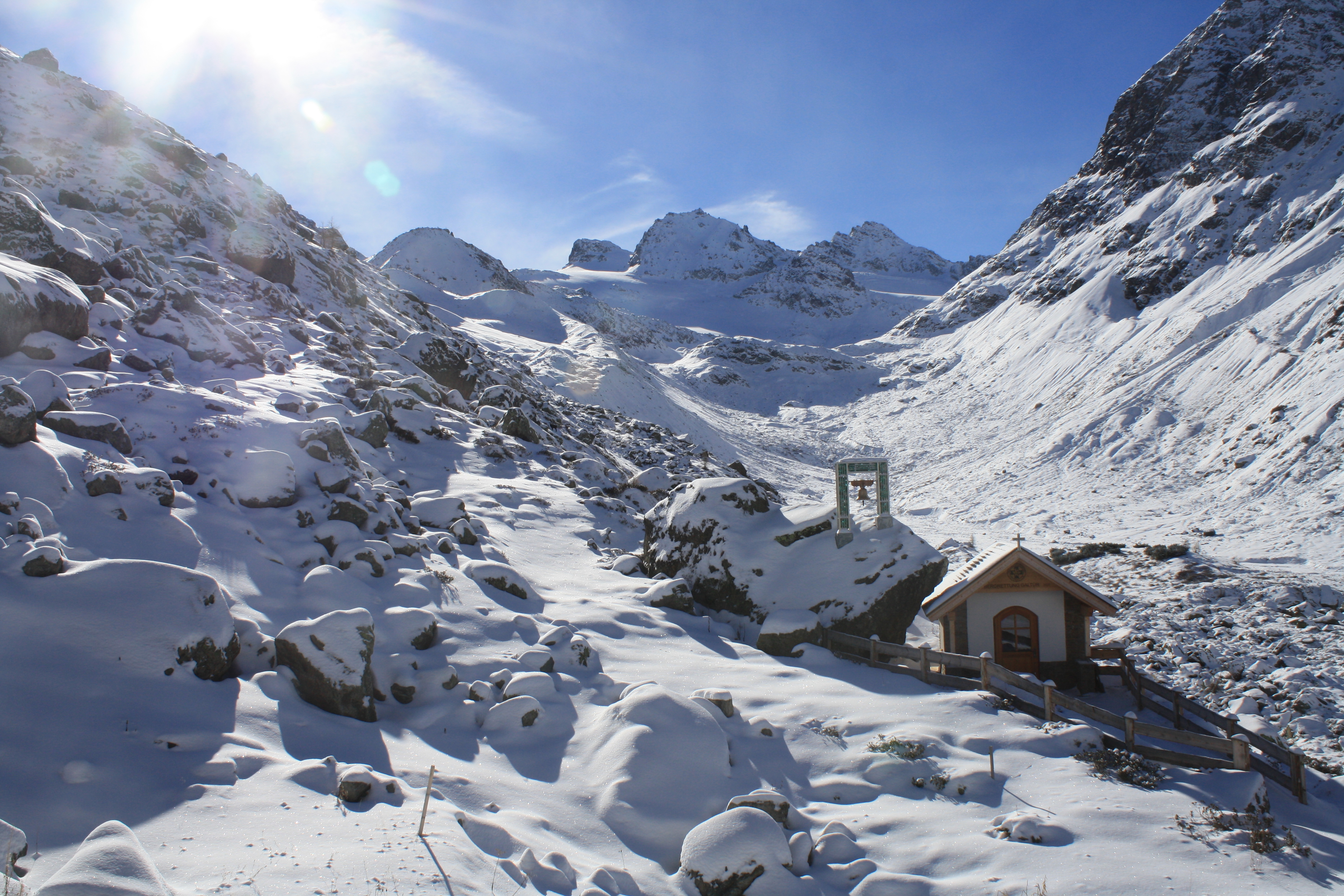
Obergurgl lies about 1930 m a.s.l., very much at the head of the Ötz-valley (municipality of Sölden) in the central Alps. The research areas of the LTER site Obergurgl are located at the slopes, glacier valleys and glaciers south and south-west of Obergurgl. A variety of logger stations (mostly wheather stations) are installed at different locations at the site, some of them measuring since 1953. Various research project, most of them performed by researchers of the University of Innsbruck, are carried out in this area. Habitat types are alpine grassland, alpine forests, pasture and dwarf shrub heath, glacier forelands and glaciers. The LTER site Obergurgl is managed by the Alpine Research Centre Obergurgl (http://www.uibk.ac.at/afo/), a branch office of the University of Innsbruck (http://www.uibk.ac.at/). The Alpine Research Centre Obergurgl is located at the edge of the village Obergurgl. It is consolidated with the University Centre Obergurgl (http://www.uz-obergurgl.at/), a congress centre and hotel with up to 100 beds. Indoor infrastructure are a lecture hall, a seminar room, a small laboratory and small libraries.
-
The Jornada Basin Long-Term Ecological Research (LTER) program is part of a national network of long-term ecological research sites funded by the US National Science Foundation (NSF). The Jornada LTER program has been continuously funded since 1982 to develop general principles governing changes between grassland and shrubland ecosystems based on long-term data collected in the Chihuahuan Desert. Research themes at the Jornada LTER focus on vegetation change, climate and land use impacts on ecosystem function, and the role of dryland processes in structuring communities and landscapes. We translate our findings to dryland ecosystems around the world, and forecast the dynamics of future ecosystem states in response to changing climate and land use. The Jornada Basin is located in southern New Mexico, USA, approximately 25 km northeast of the city of Las Cruces (32.6 N -106.7 W, elevation 1315 m). Annual precipitation is 24 cm and maximum temperatures average 13 C in January and 36 C in June. The study site is near the northern extent of the Chihuahuan Desert, which is the largest of the North American warm deserts, in a region has undergone large shifts in the relative dominance of grasslands and shrublands over the past century. We partner closely with the USDA-ARS Jornada Experimental Range (JER) and the NMSU Chihuahuan Desert Rangeland Research Center (CDRRC), allowing us to benefit from a long history of rangeland research, and to contribute to science-based management and sustainability practices.The Jornada Basin LTER project is administered by New Mexico State University.
-
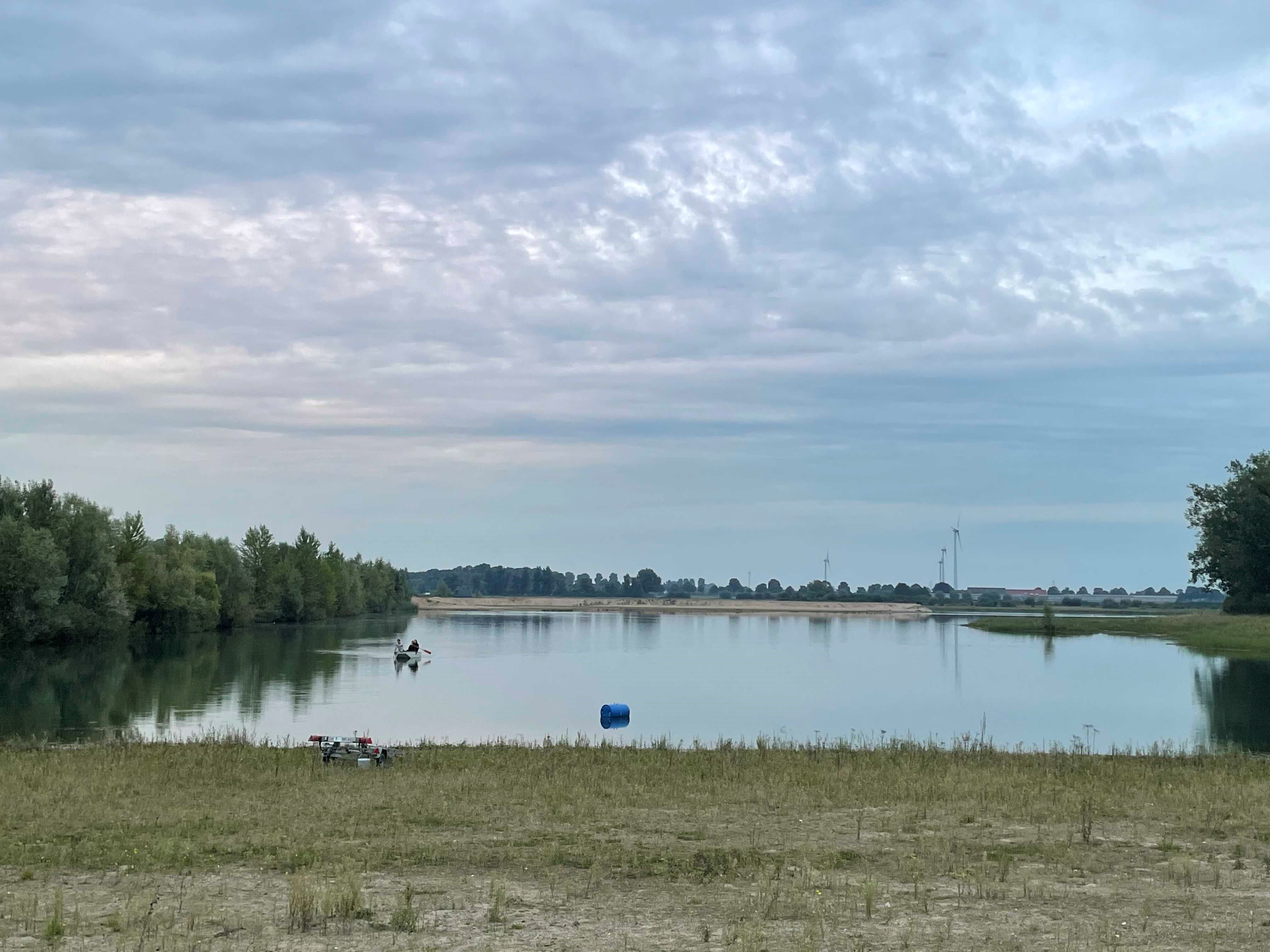
How do freshwater ecosystems react to changing environmental conditions and to what extent can these changes be captured in the dynamics of eco-evolutionary processes? The project REES ('Rhine Eco-Evolutionary System') aims at the long-term assessment of eco-evolutionary interactions in the Rhine as a limnic habitat under consideration of diverse associated water bodies. The study area includes the main flow channel of the Rhine (km 845, North Rhine-Westphalia), as well as Rhine oxbows, Rhine water-fed gravel pit lakes in ecological succession and the surrounding floodplain (Rees, district of Kleve). The Ecological Research Station Rees-Grietherbusch of the Institute of Zoology (University of Cologne) and the Nature Conservation Center District Kleve e.V. form the central infrastructure of the study area. In addition, the Ecological Rhine Station of the University under the direction of Prof. Dr. Arndt is also associated to the project, which enables direct sampling and experimental recording of the main Rhine flow channel. The extensive system of standing and flowing freshwater bodies covered in the REES study site allows the investigation of dynamic variations in biodiversity composition at all levels, from species diversity of communities to genomic diversity at the molecular level of individuals and populations. Along a selected trophic cascade, representative species will be long-term observed and analyzed ecologically and especially also (population-)genomically. The incorporation of ecological genomics is the core aspect of this LTER-D project, which is intended to capture the feedback of evolutionary changes on the ecological system. Population genomic approaches can be used to infer both evolutionary and ecological processes from genomic data. To cope with the dimension of this project, REES is designed as an interdisciplinary collaboration project and currently counts seven project partners with corresponding subordinate projects.
-
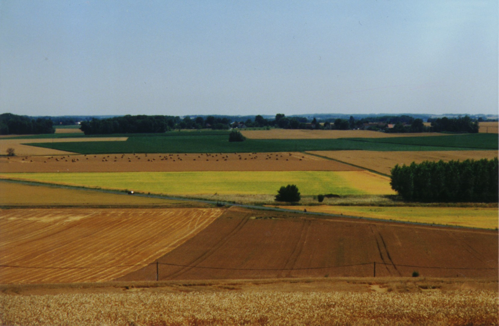
The ORACLE observatory is located 70 km East of Paris, France. Most of the area, in a sedimentary basin, is made of a relatively flat plateau (Alt. 140 m a.m.s.l.), which is incised by the Grand Morin and the Petit Morin rivers (Alt 100m). Several aquifers are associated with layered tertiary formations (Eocene and Oligocene). The Morin Rivers are affluents of the Marne River, known to have contributed to large historical floods in Paris in the 20th century. The observatory is mainly rural (76%) with small towns, villages and hamlets, the whole covering 7% of the area. Forests cover up to 20% of the area. The dominance of agricultural activity within the catchments means that diffuse pollution is regarded as the main environmental pressure. Several perennial device of environment observation are installed since 1962. This site is used for multivariable observations (water cycle, water quality, biodiversity, agricultural practices, sociology…) and multiscale observations (from the canopy to the aquifer, from one m² to 1200 km²). Temporary observations also exist, like soil property measurements, remote sensing data, depending on the specific collaborative projects between different research and operational units. These two observation approaches, the perennial and the temporary ones, are a real advantage to investigate environmental issues. The Observatory and its embedded sub-catchments allow to conceptualize the change in scale and to study sub-catchments with different behaviors.
-
Umbrella site of Rofental - Austria, Obergurgl - Austria & GLORIA Master Site Schrankogel (AT-SCH), Stubaier Alpen - Austria
-
The research station of Lautaret Garden is a set of infrastructures and human resources at the service of alpine environmental research, spread over two sites open all year round. One is located on the campus of the University Grenoble Alpes (dept 38), it is divided into greenhouses, arboretum, experimental zone. The other is located at the Lautaret pass (dept 05) at an altitude of 2100m. The site of altitude gathers an Alpine Botanical Garden, three buildings, an experimental zone and natural area. This structure provides field support for scientific projects, two laboratories, accommodation for 46 people, hydrology and climate data and also botanical expertise. It organizes, in its multimedia room and meeting rooms, trainings, thematic schools, conferences, seminars. The research themes developed mainly concern the ecology of environments in relation to climate, socio-ecosystems, adaptation of living organisms, the physical environment and biogeochemical cycles. Some projects have been carried out since 1980, others operate on a multi-year basis. The station also welcomes foreign researchers within the framework of the Transnational access.
-
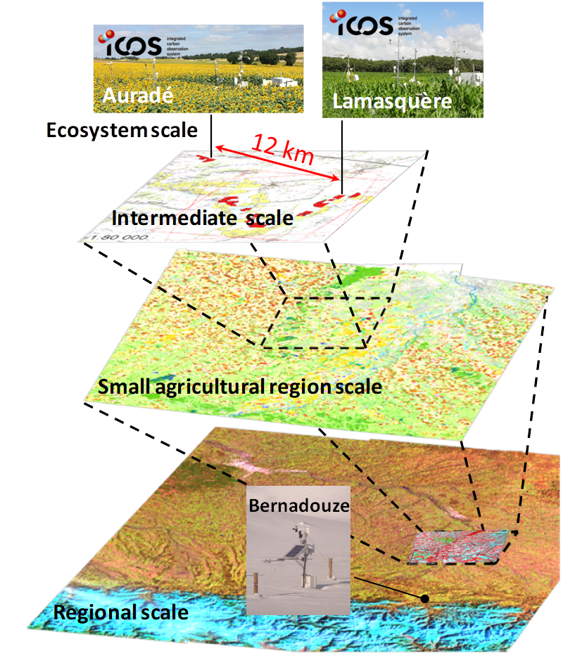
The Regional Spatial Observatory (OSR), labeled in 2007 by the National Institute of Sciences of the univers (INSU), is supported by the Center of Spatial Studies of the BIOSPHERE (CESBIO, OMP). The mission of the OSR aims at documenting on the long term the effects of the climate change and the increasing anthropogenic pressures on the hydrologic and agro-ecologic evolutions in the South-West of France near Toulouse, for various spatial and temporal scales.
-

The ZA PYGAR covers the whole Garonne river basin up to the upper part of the Gironde estuary (La Reole station). Within this territory, research is structured around 4 main sites: the Pyrénées mountains, covering the upstream part of the Garonne river basin (PYRénées site), the farmland of the foothills of the Pyrénées (Vallées et Coteaux de Gascogne site), the Garonne river (Axe Fluvial Garonne site) and the basin of two tributaries of the Garonne river in the Massif Central moutains (Aveyron-Viaur site).
-
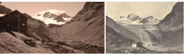
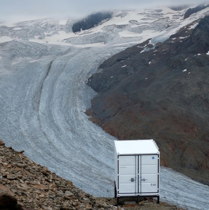
The site is located at the main Alpine ridge in Silvretta group right at the border between Austria and Switzerland. Jamtalferner glacier and it's forefield is subject to scientific reseach for more than 100 years. Current monitoring includes climate, hydrology, glacier mass balance, permafrost, paleoglaciology, society and biotic succession in the periglacial area. In addition to that, several short time research projects are carried out, e.g. concerning glacier albedo. The site inlcudes the are from the highest peaks at 3384 m a.s.l. and the valley further down to the communities of Galtür and Ischgl (1263 m a.s.l.). More information can be found at the website of the environmental education program Jamtal www.umweltbildung-jamtal.info.
-
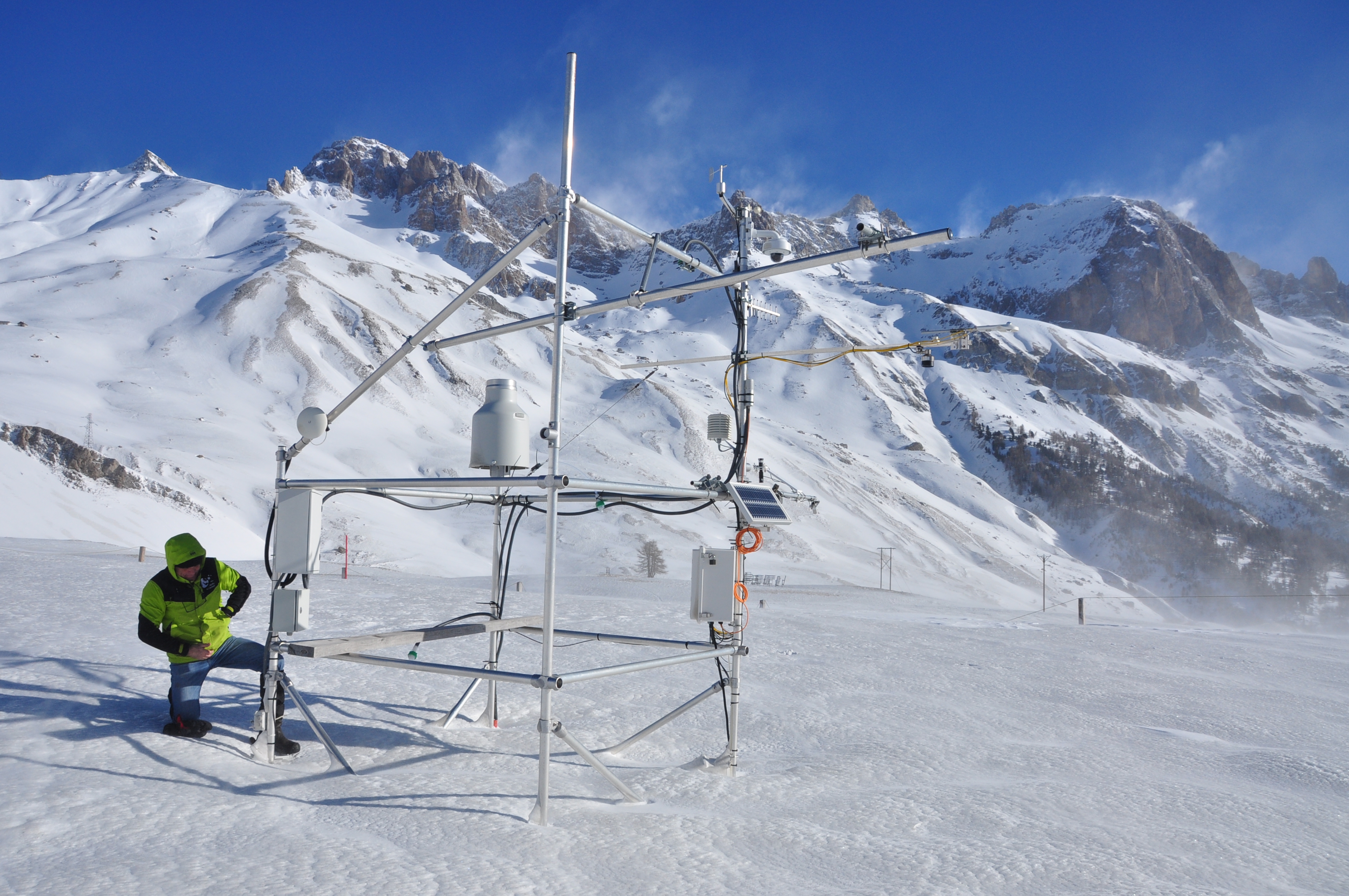
The LTSER platform Oberes Paznaun includes the communities of Ischgl and Galtür (225 km²), and covers an elevation range from 1263 to 3384 m.a.sl.. The village of Galtür is one of the highest permanently inhabited places in the Alps. Fluchthorn, the highest peak of the largely glacier-covered Silvretta, was taken down by about 30m in 2023, when a major rock fall occurred as a result of reducing permafrost. Both the effects of climate and those of land use change affect the very sensitive livelihoods in the are, exposed as they are to natural hazards, such as avalanches, rock fall and floods. The region was economically weak until winter tourism boomed from the 1970s. Skiing as dominant source of income now has an impact on land use as well as on social and economic structures in the region. Management issues arise from the high number of incoming tourists. Local stakeholder networks involved in spatial planning and hazard management are also part of the LTSER Platform. The local Alpinarium museum is dedicated to presenting the livelihoods of mountain communities and acts as a local hub for linking science and society. Apart from the long-term monitoring of the environmental parameters, initiated in 1895 with glacier length changes, the socio-economic research in the Paznaun area dates back to the 1960s. Socio-economic and socio-ecological research in the region focuses on the multiple feedbacks between environmental and socio-economic changes in the region. The avalanche disaster of Ischgl and Galtür in 1999 affected disaster management and related structures in many ways, not only for the region, but for all of Austria, for instance leading to the foundation of crisis intervention teams. The question of how to deal with impacts of climate change, for example on hydrology and water management, is part of research projects in the area connecting stakeholders and scientists. The overarching aim of the platform Oberes Paznaun is linking up geosphere, atmosphere, hydrosphere and biosphere research with local political and administrative processes for sustainable development in a warming future.