
survival rate
Type of resources
Available actions
Topics
Keywords
Contact for the resource
Provided by
Years
Formats
Representation types
-

The Hölstein site is located in in the eastern part of the Swiss Jura mountains (47°26’16.4’’, 7°46’31.1’’; 540 m a.s.l.), in a mixed, temperate forest with an exceptionally high biodiversity and a vigorous tree regeneration. The research plot has a size of 1.6 ha and comprises 540 mature trees. The main tree species are Fagus sylvatica and Picea abies with an admixture of Abies alba, Quercus petraea, Pinus sylvestris, Acer pseudoplatanus, Carpinus betulus, Fraxinus excelsior and Sorbus torminalis. A canopy crane is installed in the center of the research area to access the tree canopies for in situ measurements and for sampling of leaf material. Rainout shelters will be installed in 2019 for conducting a long-term throughfall exclusion experiment.
-
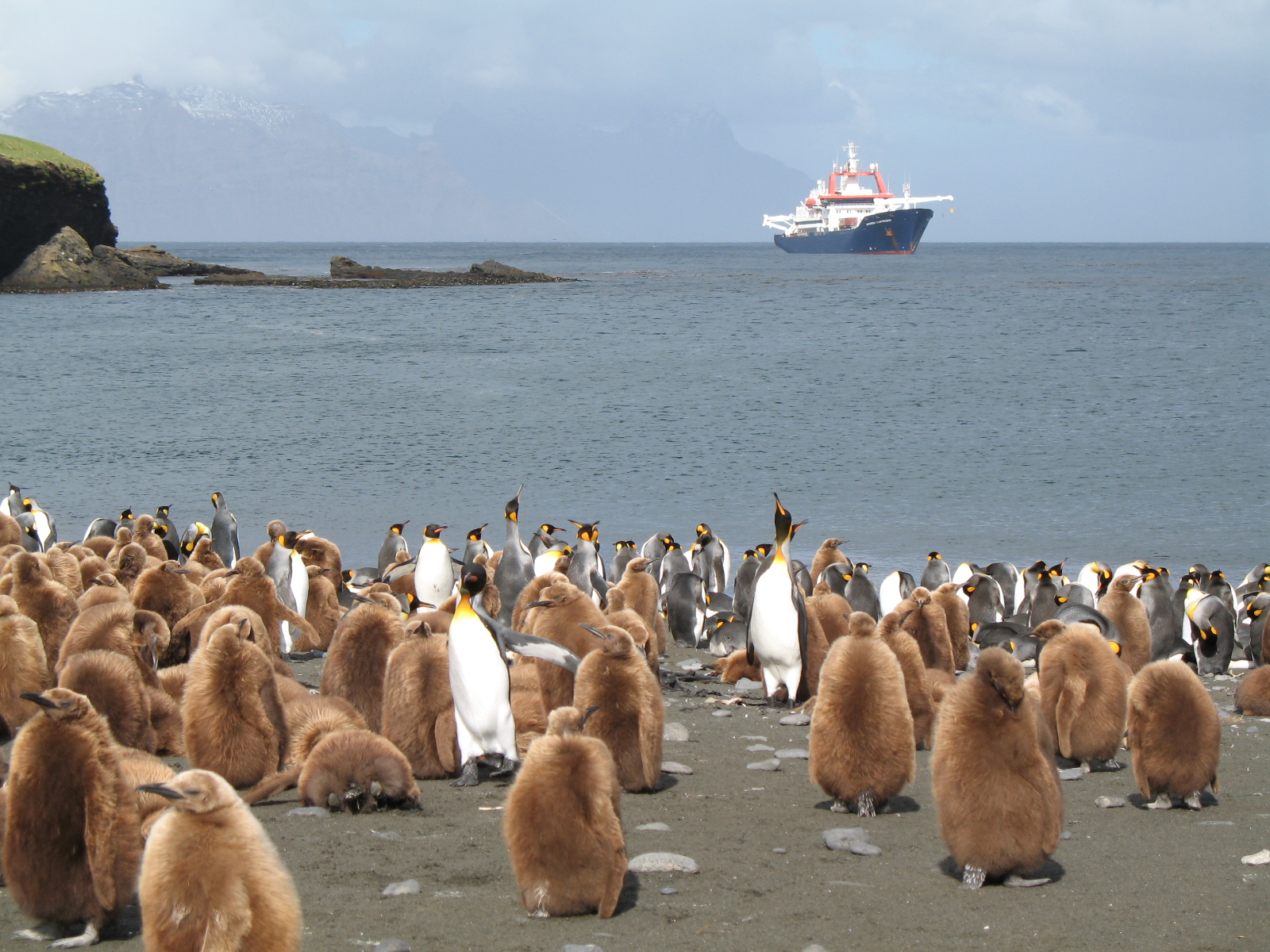
The LTSER Zone Antarctique belongs to LTER-France network and is located in Antarctica (Adelie Land), French sub-Antarctic Islands (Crozet archipelago, Kerguelen Islands, Saint-Paul et Amsterdam Islands) and southern ocean. General information below concerns Kerguelen Islands. The ZATA measures the impacts of climate change and human activities on antarctic and sub-antarctic ecosystems.
-
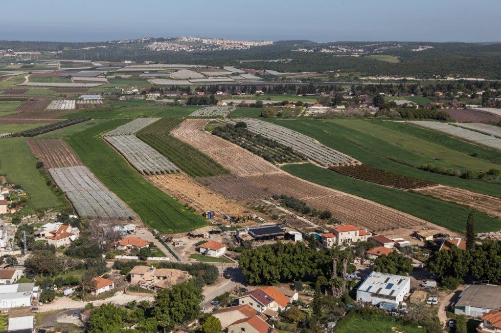
The Ramat Hanadiv LTSER platform is a unique texture of the region surrounding Hanadiv Valley and Taninim River basin. It integrates nature values with agriculture, rural communities, and heritage sites. The platform extends over an area of apprx. 15,500 hectares, including Ramat Hanadiv Nature Park and five neighboring municipal Councils: 1. Binyamina Givat-Ada (Urban; Local Council ) 2. Zikhron Ya’akov (Urban; Local Council ) 3. Hof Hacarmel (Rural; Regional Council) 4. Jisr A-Zarqa )Arab village; Local Council) 5. Alona (Rural; Regional Council) Ramat Hanadiv LTER site is located in the heart of the platform, at the southern tip of the Carmel Mountain Ridge. Ramat Hanadiv spreads over approximately 450 hectares of typical natural Mediterranean vegetation, surrounding the Memorial Gardens in which Baron Benjamin Edmond de Rothschild and his wife are buried. With mean annual rainfall of 500-600 mm and mean annual temperature of 170C-190C, Ramat Hanadiv Nature Park is characterized by diverse habitats and communities.
-
The site is a revitalized young steppe habitat patch, dominated by fescue (Festuca rupicola). The average altitude is around 100 m. The site is a grazing spot and it was recently used for the reintroduction of the European ground squirrel (Spermophilus citellus) to the area after 70 years. Other important species present at the site include Vojvodina blind mole rat (Nannospalax (leucodon) montanosyrmiensis) and Spring meadow saffron (Bulbocodium versicolor).
-
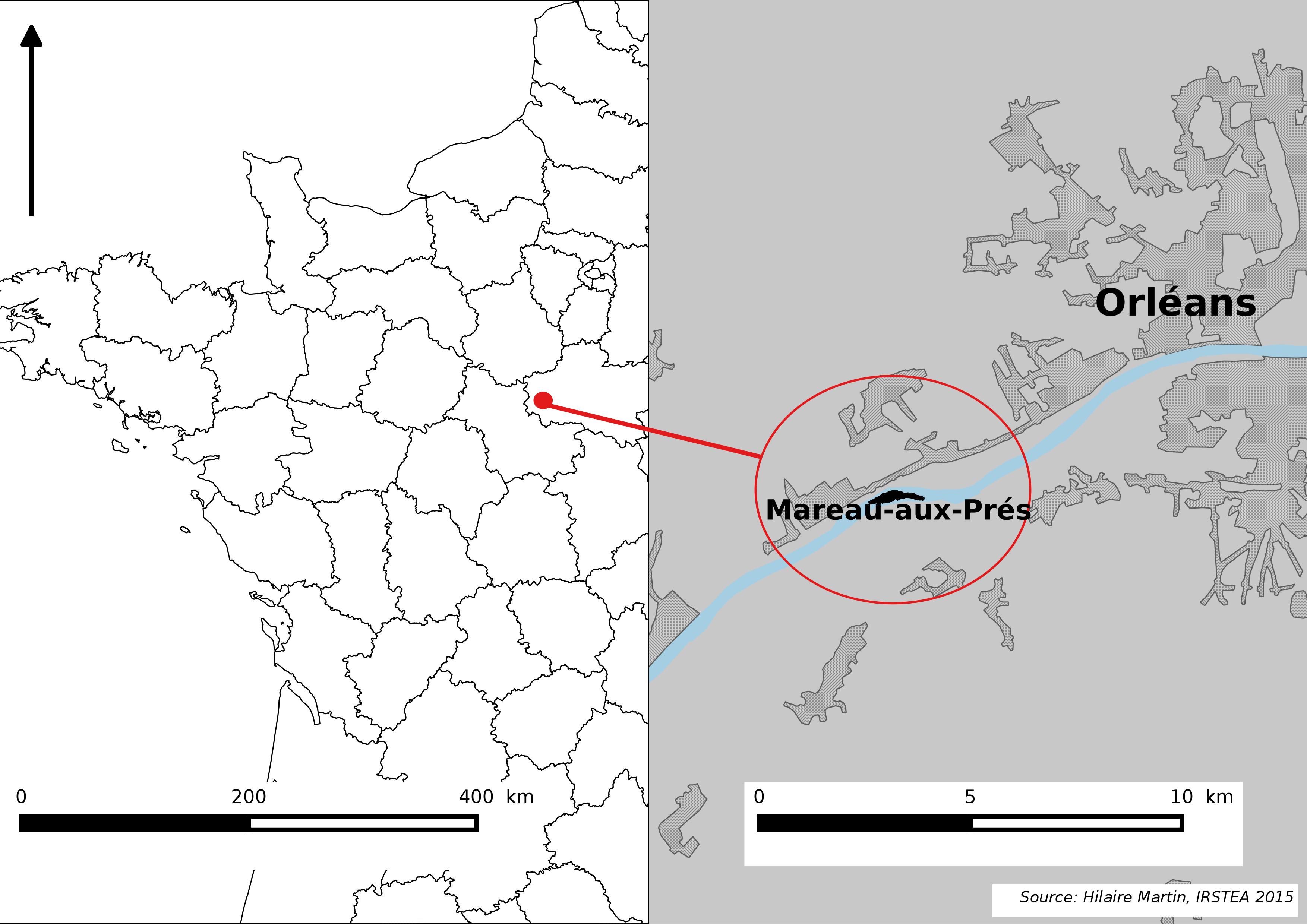
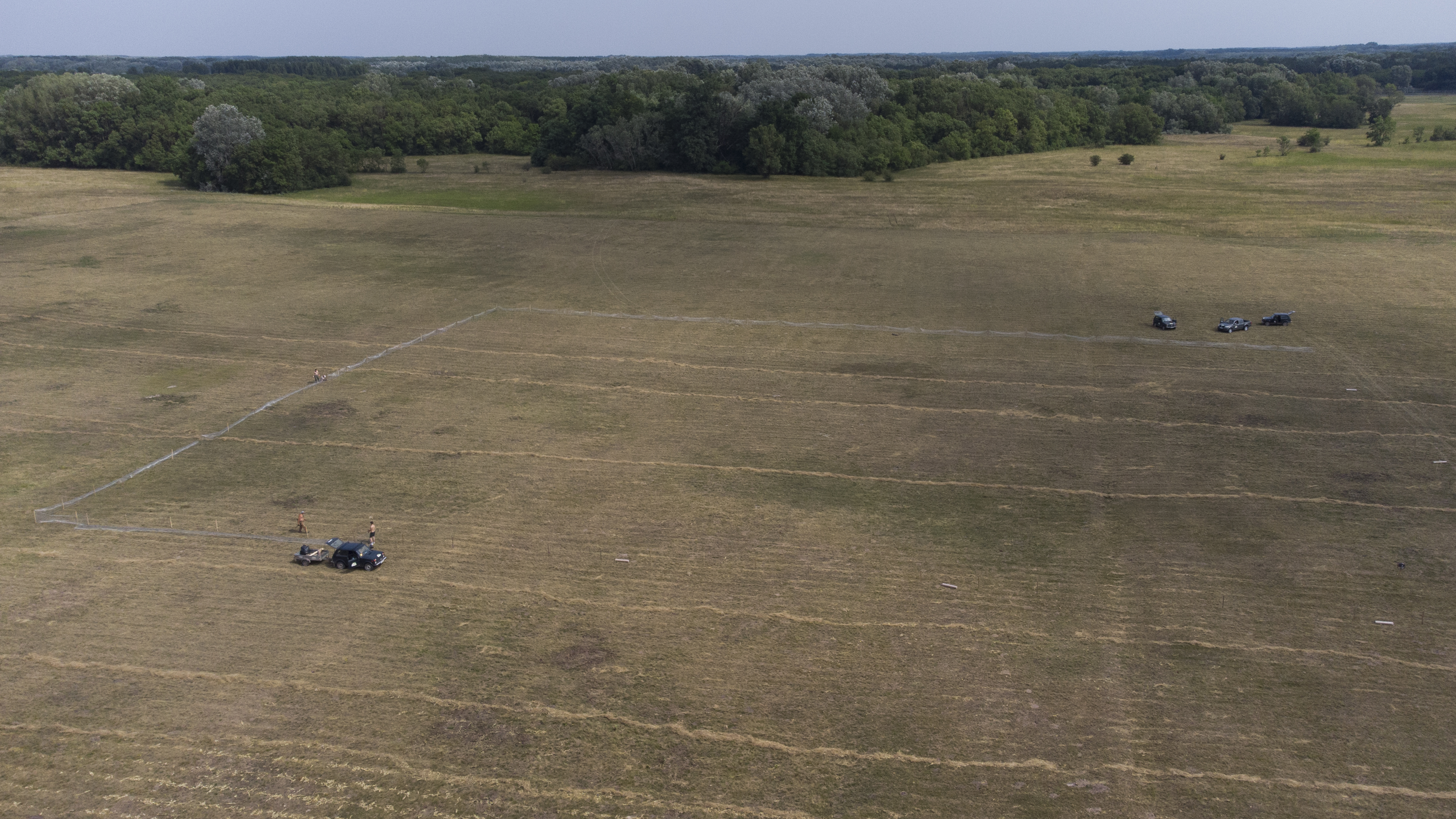
The Mareau-aux-Prés islands, along the Loire river, are characterized by a multiple channel pattern, where natural limestone riffles influence the morphology and spatial distribution of vegetated islands, secondary channels and alluvial bars. Within these islands, in september 2012, fluvial management operations (FMO) were launched. The vegetation of the central sandy-gravelly bar (3 ha area) was uprooted and the bar level lowered in order to maintain the flow capacity of the river. A new sandy-gravelly bar appeared in spring 2013, ideal field support for studying long-term ecological issues. A multidisciplinary research program (‘BioMareau’ project) is currently being conducted from 2012 to 2019, focusing on biodiversity recolonization and on interactions and feedbacks between biotic and abiotic compartments.
-

As the largest contiguous pine forest in Switzerland, the Pfyn forest in Canton Valais (46° 18' N, 7° 36' E, 615 m ASL) offers the best conditions for such measurements. In light of this, a WSL research team installed a long-term experiment of 20 years duration in the Pfyn forest. The average temperature here is 9.2°C, the yearly accumulated precipitation is 657 mm (average 1961-1990). The pines in the middle of the forest are about 100 years old and 10.8 m high. The test area has 876 trees covering 1.2 ha divided into 8 plots of 1'000 m2 each (Image 4). Between the months of April and October four of these plots are irrigated by a sprinkler system providing an additional 700 mm of water, annually. In the other four plots, the trees grow under natural, hence relatively dry conditions.
-
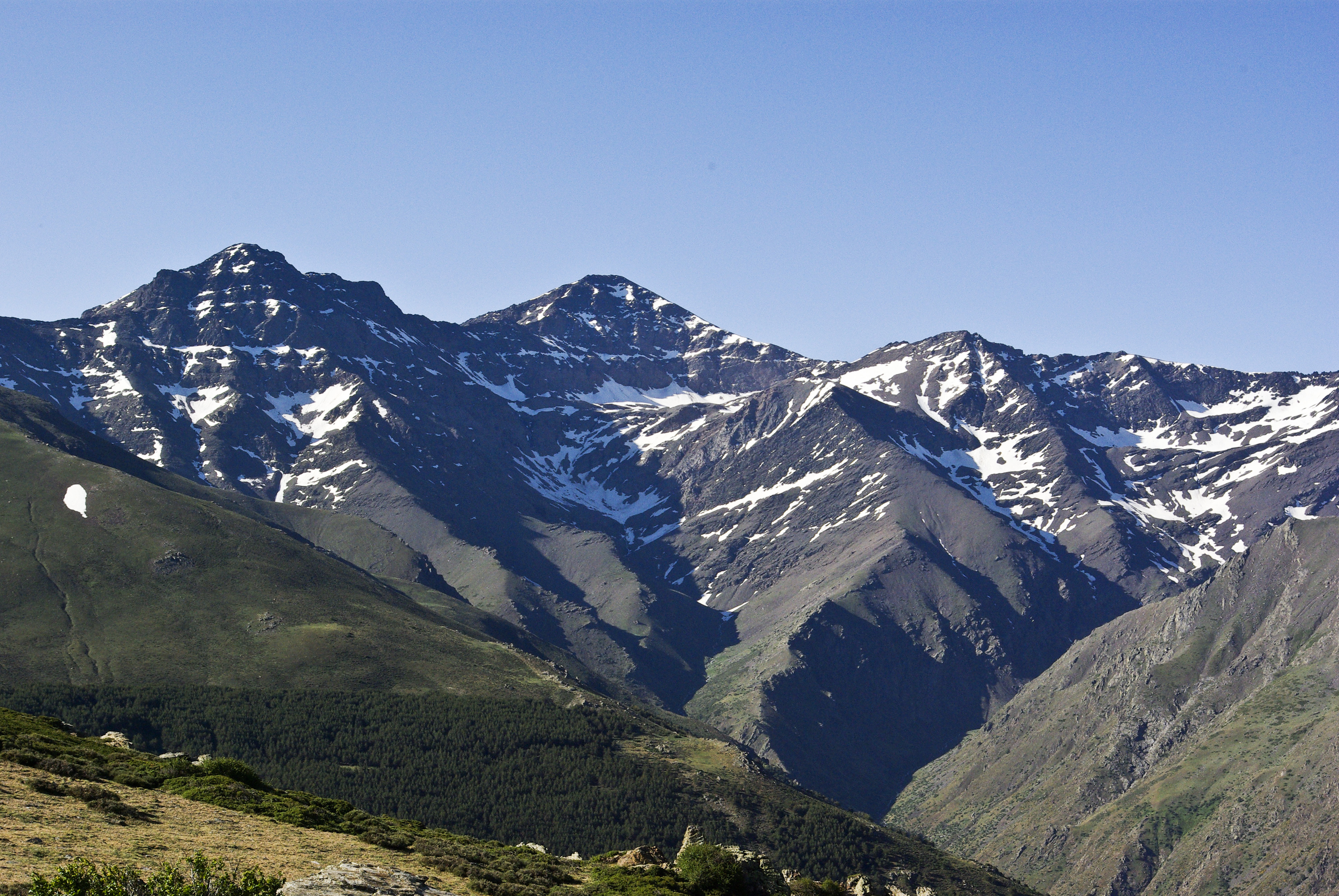
Mountain site, alpine forests Sierra Nevada (Andalusia, SE Spain), is a mountainous region with an altitudinal range between 860 m and 3482 m a.s.l. covering more than 2000 km2. The climate is Mediterranean, characterized by cold winters and hot summers, with pronounced summer drought (July-August). The annual average temperature decreases in altitude from 12-16ºC below 1500 m to 0ºC above 3000 m a.s.l., and the annual average precipitation is about 600 mm. Additionally, the complex orography of the mountains causes strong climatic contrasts between the sunny, dry south-facing slopes and the shaded, wetter north-facing slopes. Annual precipitation ranges from less than 250 mm in the lowest parts of the mountain range to more than 700 mm in the summit areas. Winter precipitation is mainly in the form of snow above 2000 m of altitude. The Sierra Nevada mountain range hosts a high number of endemic plant species (c. 80; Lorite et al. 2007) for a total of 2,100 species of vascular plants (25% and 20% of Spanish and European flora, respectively), being considered one of the most important biodiversity hotspots in the Mediterranean region. This mountain range has several legal protections: Biosphere Reserve MAB Committee UNESCO; Special Protection Area and Site of Community Importance (Natura 2000 network); and National Park. The area includes 61 municipalities with more than 90,000 inhabitants. The main economic activities are agriculture, tourism, cattle raising, beekeeping, mining, and skiing.
-

Berchtesgaden National Park was established in 1978 and is the only German national park located at the Alps. It comprises three major valleys and covers an elevantional range from 600 to 2700 m. Ecosystems include montane mixed forest and subalpine coniferous forest, alpine grasslands, pastures and rocky habitats. The Department for Research and Monitoring is linked to the Techincal University of Munich. It conducts monitoring on climate, hydrology, ecosystem dynamics and biodiversity. Main research topics include drivers of natural ecosystem dynamics, human impacts on ecosystems and climate change effects on ecosystems.
-

Monitoring stations in Aukštaitija NP started functioning in 1993. Aukstaitija station (LT01) was founded in strict reserve zone of Aukstaitija national park in Ažvinčių old forest, Versminis river closed basin. The area of the basin is 101.5 ha. The lowest place is at 159.5 m, the highest - 188.6 m above sea level. Geographical co-ordinates of the basin are: longitude - 26*03*20* - 26*04*50*, latitude - 55*26*00* - 55*26*53*. The climate is characterised as average cold with high humidity and abundant precipitation. The average air temperature is 5.8 C, average precipitation - 682 mm. Length of vegetation period - 189 days. Side glavioacvalic accumulation forms with sand, gravel and stones are typical for river basin and in the western part of the basin, with the decrease of surface altitude transfers into fliuvioglacial terrace delta plain with fine sand, and at the source- into marsh accumulation forms with organic sediments. At the eastern side of the basin, which has higher altitudes, the typical for this basin glavioacvalic accumulation forms transfer into gravel sand. Carbonates start foaming at 45 cm depth (Gulbinas et al., 1996). The saturation of the river water with the oxygen is very weak. The average yearly oxygen concentration equals to 2.9 mg/l (minimal allowable concentration – 6 mg/l). The pH value of the water fluctuates from 7.10-7.75 mg/l, which indicates the alkalisation of the water. Concentration of hydro-carbonate ions varies in the intervals of 148-224 mg/l. Concentrations of sulphates and chlorides are very small. Calcium and magnesium ions are dominating in the media of cations. Concentration of natrium ions is insignificant – 2 mg/l 9DLK=120 mg/l), concentration of kalium ions reaches only tenths of mg/l (DLK=50 mg/l). According to the size of mineralisation the river water could be described as having average mineralisation levels. Concentrations of nitrogen materials (ammonium nitrogen, nitrates) are small, compared to maximum allowable concentrations (DLK) set for surface waters. Concentrations of phosphates are small. Silicium concentrations fluctuate from 2 mg/l to 9 mg/l (Čeponienė, 1997). Main ecosystems Coniferous multi-layered forest stands are prevailing in the basin, which are mainly pine trees with a mixture of spruce. Those stands usually have a second and third tree layer with abundant under layer vegetation. Spruce stands are also of complicated structure. The second and third spruce layer with abundant under layer vegetation are common. Remarkable amounts of territory are occupied by mixed conifer-deciduous or mixed conifer forests. Pure birch stands in more wet habitats in the vicinity of Versminis river source can also be found. According to the forest stand age they are old pure overmature or with accompanying forest stands of several age classes. It is mainly multi-aged and multi-layered over mature pine and spruce stands. In addition The study was based on monitoring data on crown defoliation of more than 3000 Scots pine (Pinus sylvestris L.) trees from 20 permanent observation stands (POS) annually obtained between 1994 and 2009 in Aukstaitija national park (ANP), located in the eastern part of Lithuania (Fig. 1). Over 16yr period mean values of crown defoliation of every sample pine stand were computed annually. Therefore the total number of treatments made N=320. These stands were classified according to stand maturity: 4 sapling stands (45 to 50 years – Table 1, section “Stand maturity”, group 1), 5 middle aged stands (61 – 80 years – group 2), 4 premature stands (81-100 years – group 3), 3 mature stands (101-120 years – group 4) and 4 over mature stands (> 121 years – group 5). Main characteristics of the considered stands are compiled in table 1. All stands represent the prevailing in Lithuania Pinetum vaccinio-myrtilosum forest type.