
thickness of soil horizon
Type of resources
Available actions
Topics
Keywords
Contact for the resource
Provided by
Years
Formats
Representation types
-
Modelled combined soil depth-soil type map
-
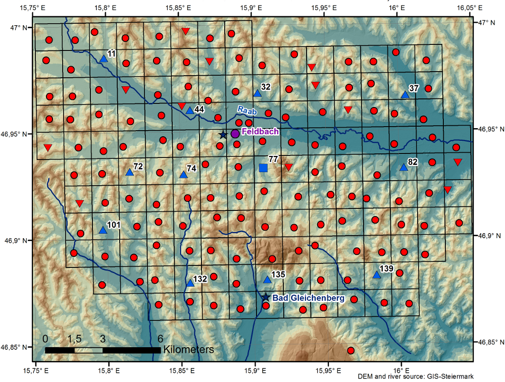
The WegenerNet climate station network Feldbach region is a pioneering weather and climate observation experiment at very high resolution located in Eastern Styria near the city of Feldbach in Southeast Austria, a region characteristic for experiencing a rich variety of weather and climate patterns. The network comprises 156 meteorological stations measuring temperature, precipitation, and other parameters, in a tightly spaced grid within an area of 23 km x 18 km centered near the city of Feldbach (46.93°N, 15.90°E). With its stations every about two square-km (area of about 300 square-km in total), and each station with 5-min time sampling, the network provides regular measurements since January 2007. As of 2010 a complementary meteorological-hydrological network of several stations was added in the mountainous upper Styrian region of National Park Gesaeuse as contribution to the LTER site Johnsbachtal (the "sister site" LTER_EU_AT_029_001 of this site LTER_EU_AT_029_002, both affiliated with the LTSER Platform Eisenwurzen). As part of the Johnsbachtal site, the WegenerNet Johnsbachtal consists of fourteen mountain-proof stations within a region-scale of about 10 km, ranging from valley altitudes below 700 m to mountain tops higher than 2100 m. The WegenerNet at both sites together provides strong value for both alpine foreland and mountain region studies.
-
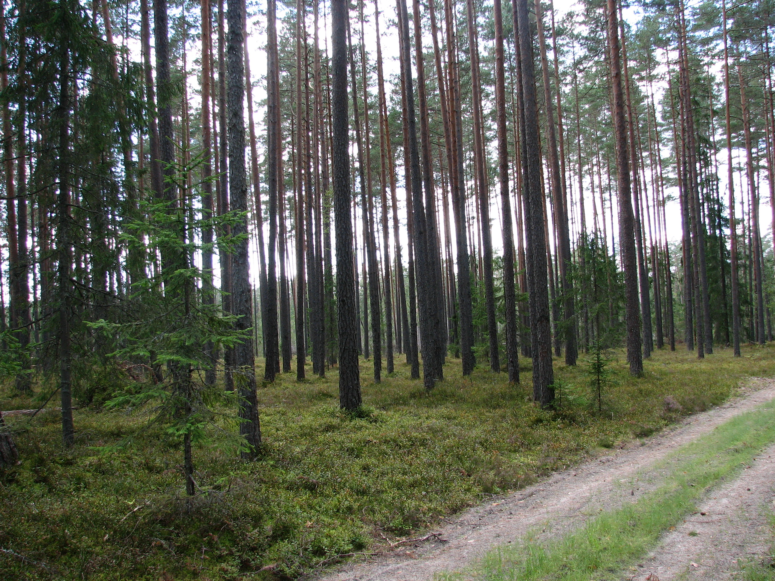
Three Scots pine (Pinus sylvestris) forest sites (30-40 year old, 50-70 year-old, and 150-200 year-old)on sandy podzolic soils in the central part of the North Vidzeme Biosphere Reserve.
-
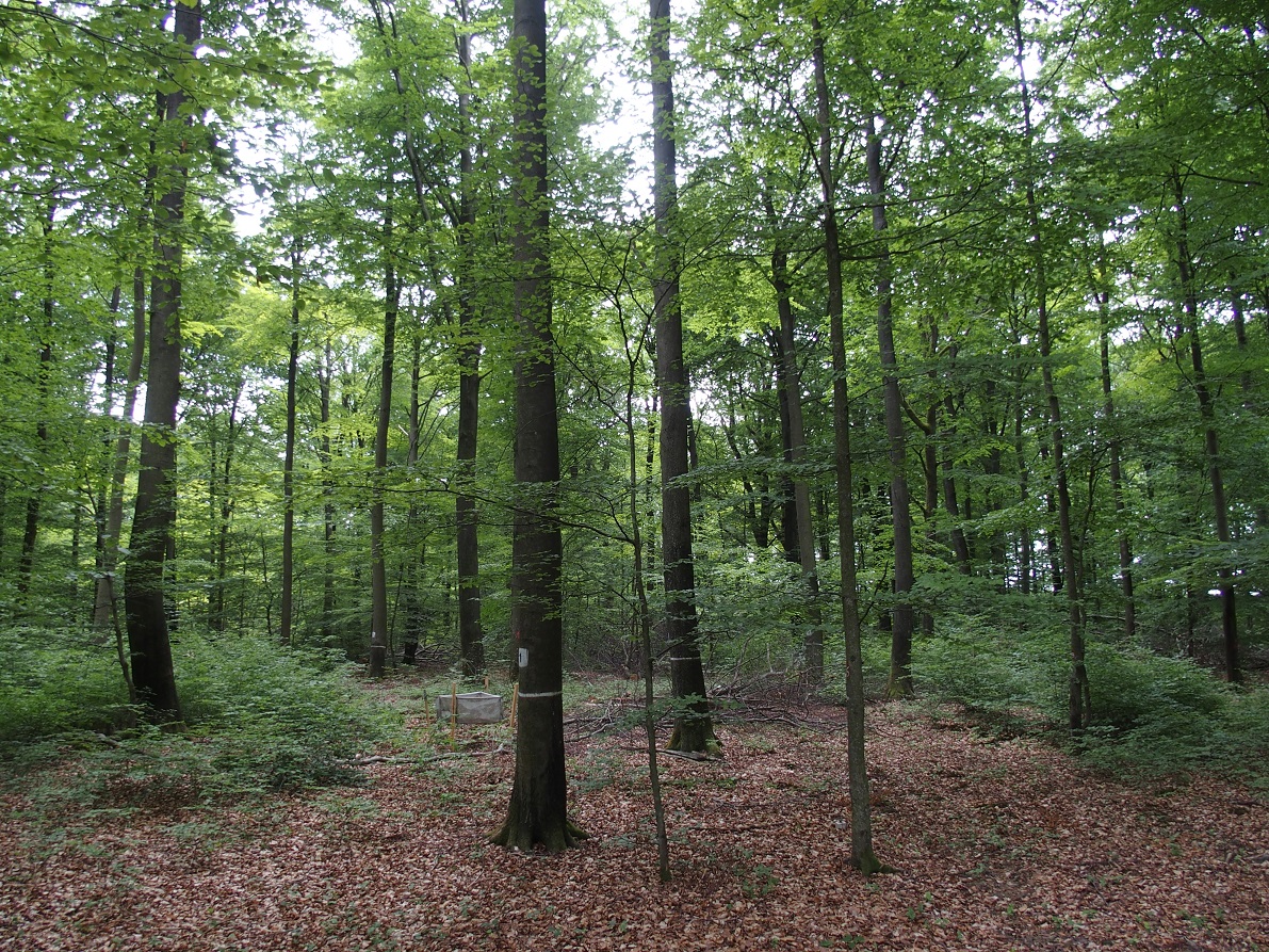
ICP forest monitoring plots: 0.5 ha of fenced stand + 20 m buffer area. Managment, data collection and reserch activities carried on by catholic university of Louvain (UCL)
-

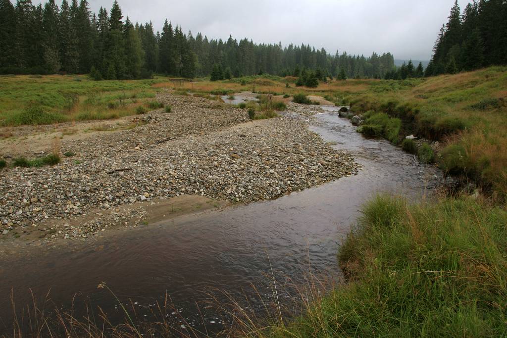
Hydrometeorological and biogeochemical observations within 5 embedded catchments (from 0.2 to 14.5 km2). Alpine Mediterranean climate with heavy rainfall and flash floods in automn. The geology is mainly granite. The land use is mainly grassland and forest. More information at http://www.ohmcv.fr
-
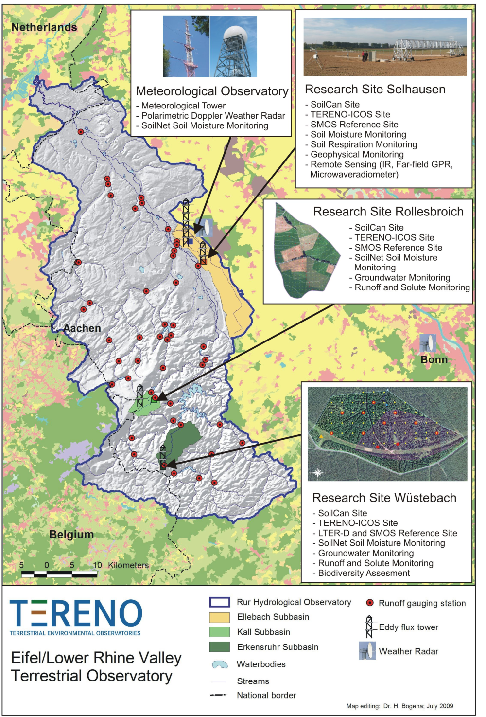
The central monitoring site of the Eifel/Lower Rhine Valley Observatory is the catchment area of the River Rur. It covers a total area of 2354 km² and exhibits a distinct land use gradient: The lowland region in the northern part is characterised by urbanisation and intensive agriculture whereas the low mountain range in the southern part is sparsely populated and includes several drinking water reservoirs. Furthermore, the Eifel National Park is situated in the southern part of the Rur catchment serving as a reference site. Intensive test sites are placed along a transect across the Rur catchments in representative land cover, soil, and geologic settings: In order to obtain spatially distributed information about river discharge rates, the Rur catchment is partitioned into a nested set of sub-catchments that will span distinct assemblages of hydrologic features and several orders of magnitude in drainage area. More detailed measurements and characterisation of smaller, focal catchments are embedded within progressively larger catchments, allowing the critical evaluation and development of scaling strategies. Additionally, for the analysis of the groundwater flow system and groundwater exchange rates on a regional scale, the monitoring of natural tracers of ground and surface waters will be carried out.
-
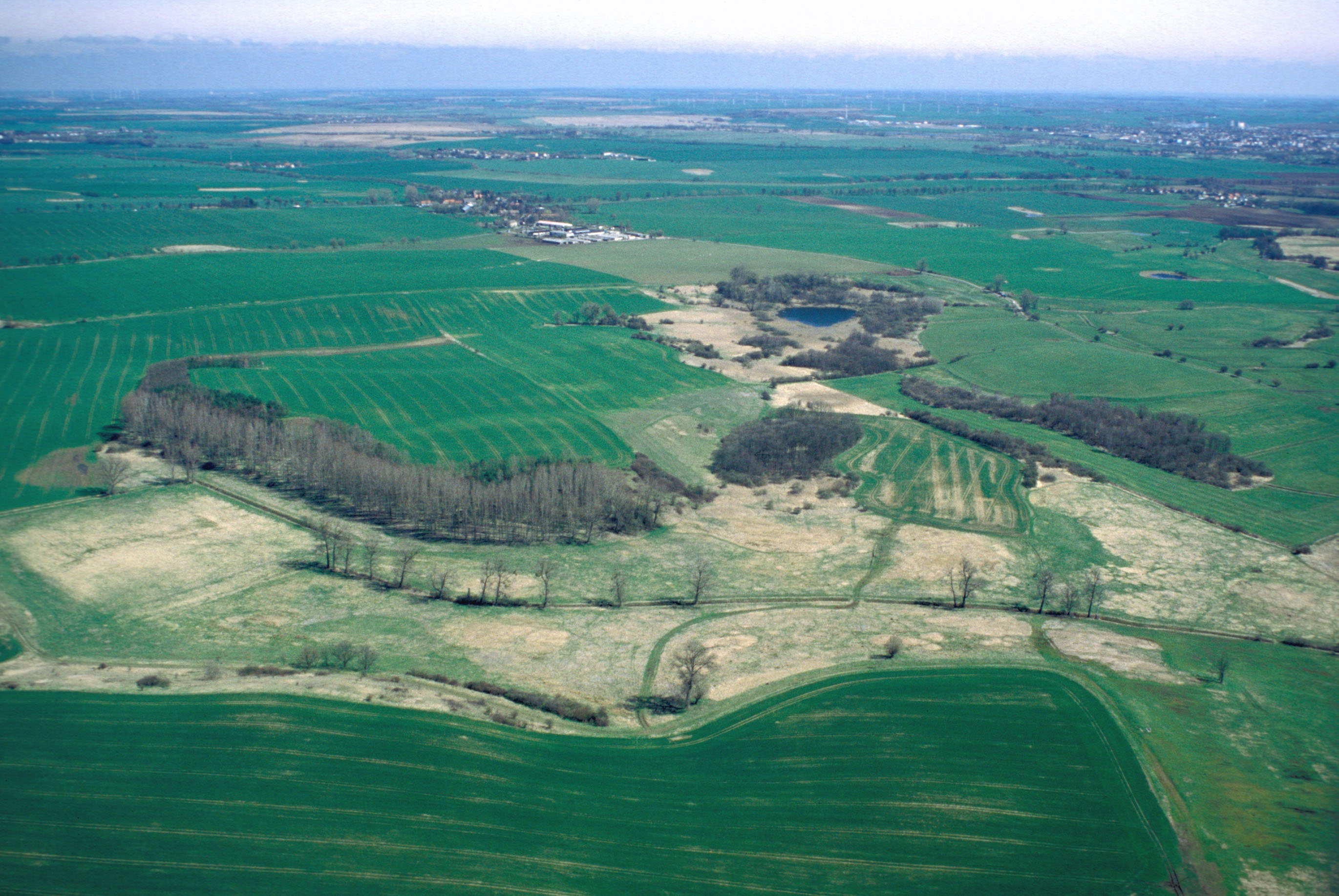
The site covers the whole catchment of the small river “Quillow” and it is called “AgroScapeLab Quillow”. It is located in the north-east lowlands (Uckermark) which is about 90 km North of Berlin and has an area of about 160 km2. It’s a hummocky landscape characterized by gently rolling hills which are the results of glaciation during the Pleistocene. Unconsolidated sediments in a complex setting dominate. The soil pattern of the Quillow catchment is related to topography and the heterogeneity of Pleistocenic deposits. Albic Luvisols, Calcaric Regosols, Calcic Luvisols and Gleyic-Colluvic Regosols can be found. Another result of the ice age forces are the kettle holes (little ponds) which developed in drainless depressions. 74 % of the land is in agricultural use. Small forest patches can be found in the western and southwestern part of the catchment, grassland more in the eastern lowlands. In general the area is only sparsely populated. The ZALF research platform is located in Dedelow
-
The Šumava Biosphere Reserve, which includes the Šumava National Park, was established as a Czech LTSER platform in 2008. Its territory covers most of the Czech part of the Bohemian Forest (Šumava in Czech, Böhmerwald in German) along the historical border of Bohemia with Bavaria (Germany) and Austria. The Bohemian Forest creates the most extensive forest landscape in Central Europe, where primeval mountain forest remnants, glacial lakes, peat bogs, and mountain secondary grasslands are home to various communities of vegetation and animal species. The centre of this region is preserved as the Šumava National Park (680 km2). Human colonisation and exploitation of the Bohemian Forest has a long history accelerated during the Middle Age and caused gradual changes in land use. Deforestation and agriculture as well as local population peaked before the beginning of the last century (before the World War I), while after the World War II came to a significant reduction of the settlement. In consequence of historical and economical changes in the region, dramatic land use changes, such as land abandonment or boom of tourism, have largely affected regional development in the recent past. Due to the serious changes in settlement and land use, this region is worth to study also socio-economic issues, e.g., land abandonment and secondary succession, current changes in farming, sustainable forest management, tourist and transport pressure (parking, biking and skiing facilities), etc. In particular, developers’ plans for new downhill-skiing areas or large-scale die out of mountain spruce forests may be considered as serious social-economic conflicts. The Bavarian Forest National Park (242 km2) is the nearest partner of the Šumava NP. More and more research and monitoring projects are operated transboundary following the natural distribution of biotopes as well as natural migration of wild animals in the region of both NPs. The main focus of long-term research and monitoring is on ecosystem processes such is natural regeneration of mountain forests after wind storm disturbances and spruce bark beetle outbreaks, as well as on changes of water regime and species diversity in response to climatic changes. Changes in ecosystem services and better awareness of the National parks for public are the most discussed topics of currently emerging socio-economical studies. Common Czech-Bavarian LTSER platform Silva Gabreta has been initiated. A name was adopted from the peer-reviewed journal Silva Gabreta (silvagabreta.npsumava.cz) published by the Šumava NP since 1996, which is a joint publication base for regional studies (mostly in English, partly in Czech or German with English summary).
-
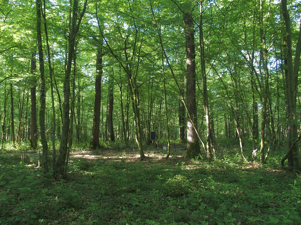
ICP forest monitoring plots: 0.5 ha of fenced stand + 20 m buffer area. Managment, data collection and reserch activities carried on by catholic university of Louvain (UCL)
-
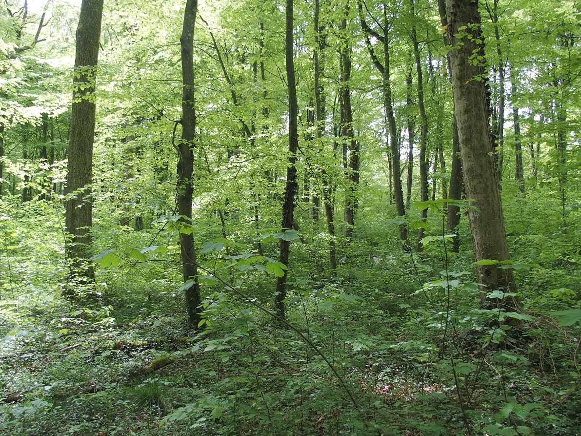
ICP forest monitoring plots: 0.5 ha of fenced stand + 20 m buffer area. Managment, data collection and reserch activities carried on by catholic university of Louvain (UCL)