
total alkalinity
Type of resources
Available actions
Topics
Keywords
Contact for the resource
Provided by
Years
Formats
Representation types
-
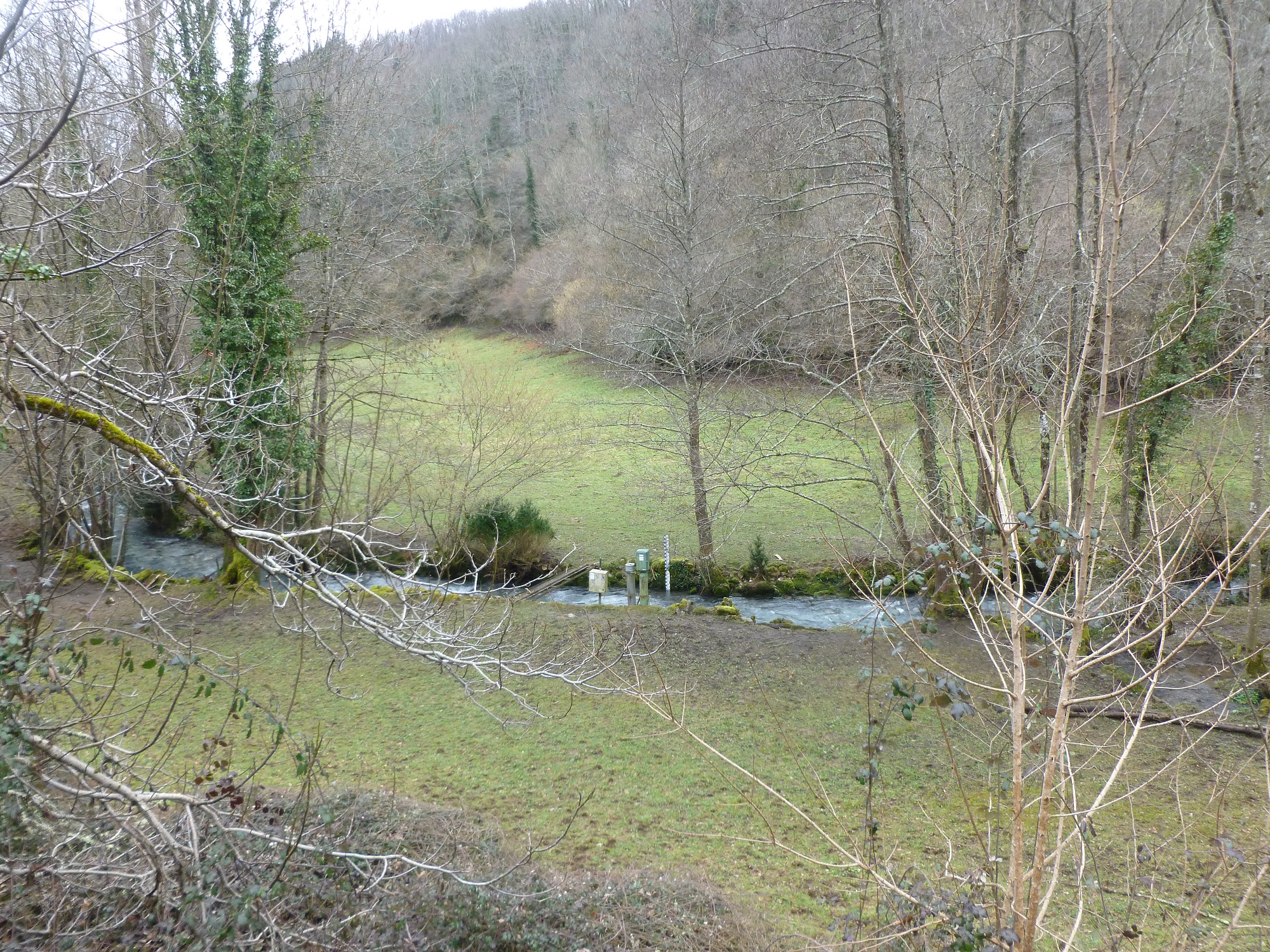
The Baget catchment is managed by the Laboratory of Functional Ecology and Environment (EcoLab), a joint Research Unit between the Institute of Ecology and Environment (INEE) of CNRS, the National Polytechnic Institute of Toulouse and the University Toulouse III-Paul Sabatier, in collaboration with BRGM (Occitania regional agency), the laboratory Geosciences and Environment Toulouse (GET) and the Station of Theoretical and Experimental Ecology (SETE) in Moulis (Ariège, France). The Baget catchment (Pyrénées, Ariège, France) is a mountain ecosystem of middle altitude (Alt.= 1000 m) receiving around 1000mm of precipitation per year. Located close to Balagué village at 10 km West from Saint-Girons, the Baget catchment (13.25 km2) is drained by a karstic network which supplied the surface runoff of Lachein stream (specific discharge: 36 l.s-1.km-2). It is a tributary of the Lez which joins the Salat River, right tributary of the Garonne River. From 1968, this experimental site was intensively equipped by the CNRS underground Laboratory of Moulis (today SETE). The device is composed of one main weir at the outlet, 3 full excess controls, 3 piezometers of which one inside the abyss, and one subterranean loss. This karstic watershed has been surveyed since 1968 for some hydro-climatic parameters, particularly air temperature, precipitations and stream discharge at the outlet. Some geochemical parameters (pCO2, chemical and isotopic compositions of waters) and some hydro-biological and ecological data (invertebrates, particularly Crustacea) have been surveyed for periods during the last 40 years by the CNRS underground Laboratory of Moulis. Since 2011, Baget catchment belongs to the French Network of Catchments (RBV) and it is included in the certified National Observatory Service SNO Karst. Then, new parameters are measured twice a month or with higher frequencies during some flood events (major cations and anions, alkalinity, pH, conductivity, dissolved organic carbon, total suspended matter, H, O, C isotopes…). Since 2014, a multi-parameter probe has been installed with different sensors to measure continuously water level, pH, conductivity, turbidity, dissolved oxygen, nitrate and chloride. These continuous measurements are calibrated twice a month with laboratory analyses. The water discharge is measured by BRGM-Occitania because the Baget karst is part of the French patrimonial network of ground-waters and it belongs to the piezometric network managed by BRGM. The Baget catchment is very sensitive to limit conditions of surface drainage and to land covers. It offers the possibility to develop an eco-systemic survey, which integrates the hydrology, the geochemistry and the ecology of a mountain ecosystem in the SW of France. In this region, climate and land use changes will have significant impacts on biodiversity, ecosystem functioning and biogeochemical cycles for the next decades The Baget catchment is an international field site of the Critical Zone Exploration Network CZEN (http://www.czen.org/content/aurade-experimental-catchment) and it is one of the sites of the French SNO-KARST (Service National d'Observation) labellised by INSU-CNRS. It belongs to the French Research Infrastructure OZCAR and it is also a site of the French LTSER ZA PYGAR "Zone Atelier Pyrénées-Garonne".
-
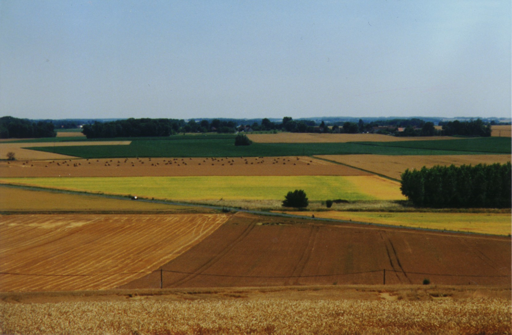
The ORACLE observatory is located 70 km East of Paris, France. Most of the area, in a sedimentary basin, is made of a relatively flat plateau (Alt. 140 m a.m.s.l.), which is incised by the Grand Morin and the Petit Morin rivers (Alt 100m). Several aquifers are associated with layered tertiary formations (Eocene and Oligocene). The Morin Rivers are affluents of the Marne River, known to have contributed to large historical floods in Paris in the 20th century. The observatory is mainly rural (76%) with small towns, villages and hamlets, the whole covering 7% of the area. Forests cover up to 20% of the area. The dominance of agricultural activity within the catchments means that diffuse pollution is regarded as the main environmental pressure. Several perennial device of environment observation are installed since 1962. This site is used for multivariable observations (water cycle, water quality, biodiversity, agricultural practices, sociology…) and multiscale observations (from the canopy to the aquifer, from one m² to 1200 km²). Temporary observations also exist, like soil property measurements, remote sensing data, depending on the specific collaborative projects between different research and operational units. These two observation approaches, the perennial and the temporary ones, are a real advantage to investigate environmental issues. The Observatory and its embedded sub-catchments allow to conceptualize the change in scale and to study sub-catchments with different behaviors.
-
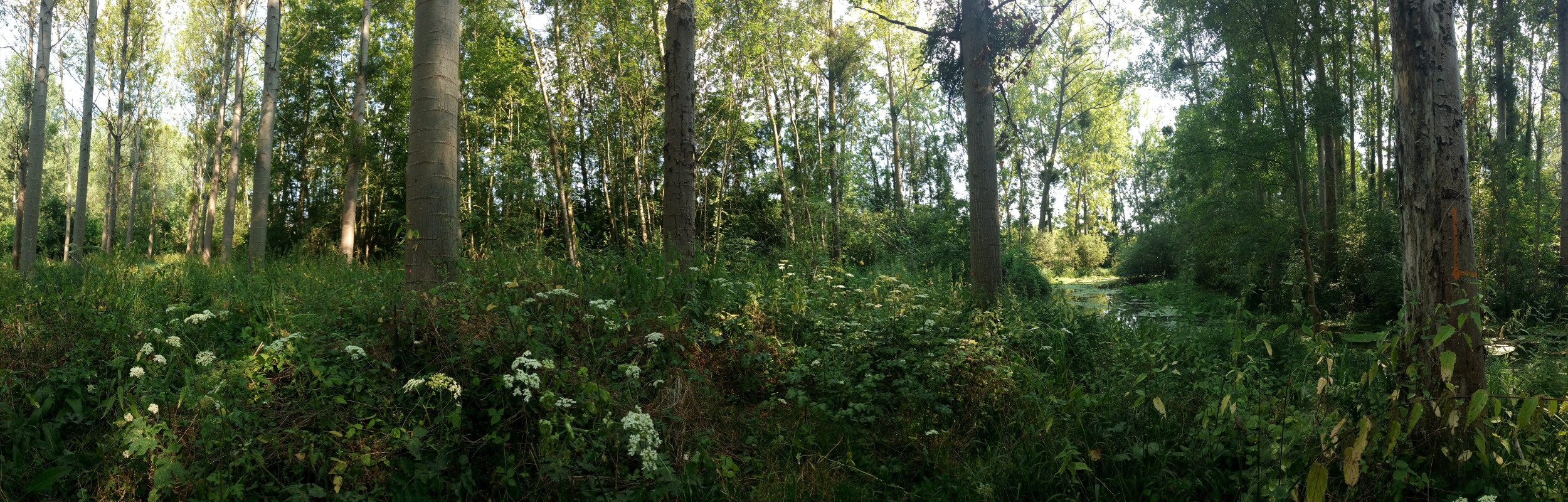
The Bassée floodplain is a large area in the Seine river basin (~ 50 km long and 5-10 km wide). Series of hydrological installations (dikes, channelization, damming, drainage, sand and gravel pits) have considerably reduced the flooding in the plain which nervertheless remains an important resource in the Seine river basin for freshwater and biodiversity. The level of anthropization increases from upstream to downstream. Projects for new hydrological installation (damming, channelization) still exist, which supports a high monitoring activity in this area.
-
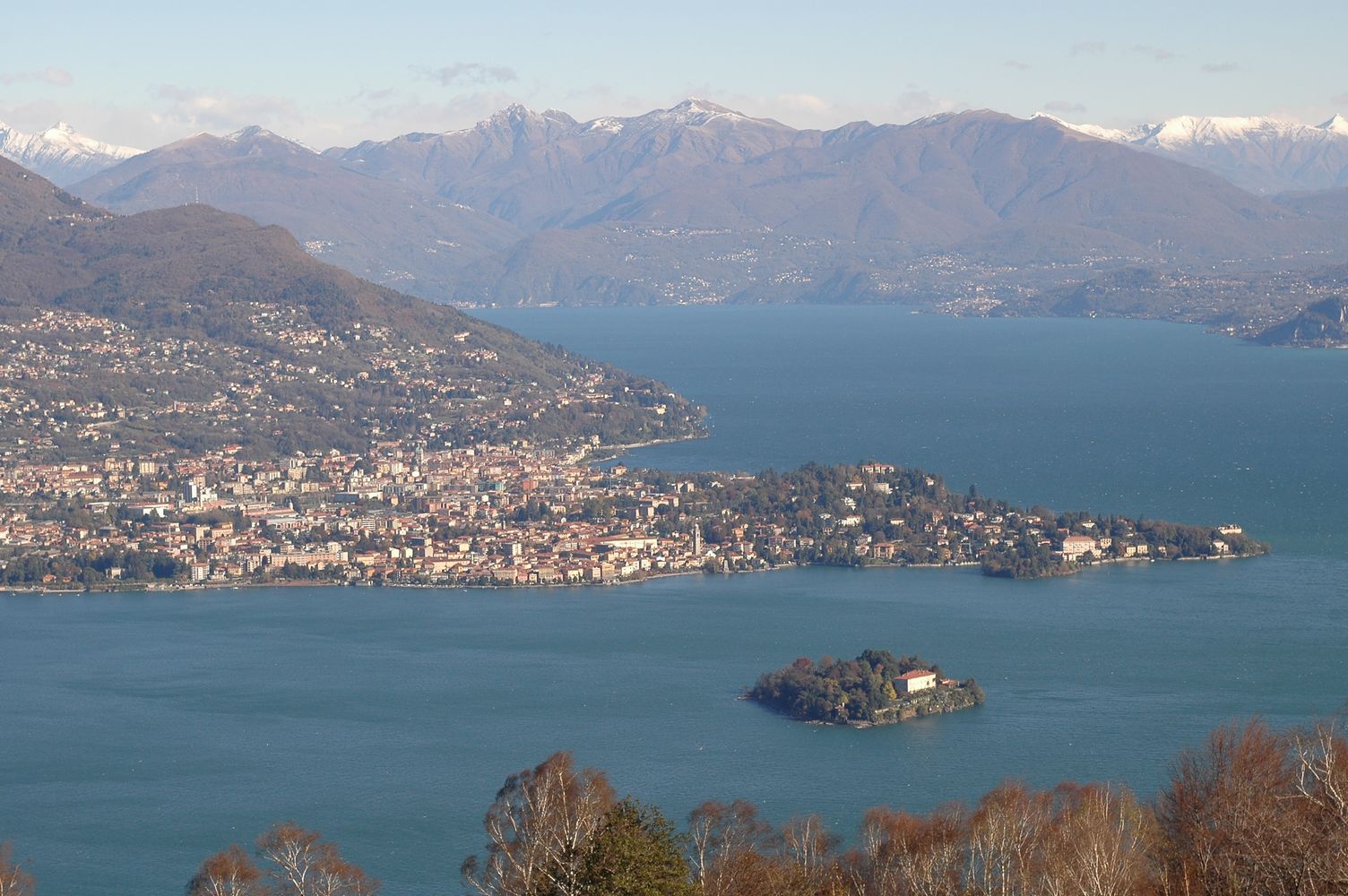
Lake Maggiore was studied since the beginning of last century although not systematically. Regular research started by the foundation in 1938 of the Italian Institute of Hydrobiology "Dr. Marco De Marchi" located in Verbania Pallanza. A limnographic (level and temperature profile) and weather station came into operation in 1952. Studies on plankton and on hydrochemistry of Lake Maggiore continued between the 1950s and the 1970s, showing the progressive eutrophication of the lake. Thanks also to the research of the institute, in the 1980s effective actions to control the eutrophication were undertaken, with the large-scale activation of waste water treatment plants. In the same period a program, still active, of systematic monitoring and research sponsored by the CIPAIS (International Commission for the Protection of the Italian Swiss Waters) started: it allowed collecting an uninterrupted and long-time series, with high sampling frequency, of data related to meteorology, hydrology, physic and chemistry of the lake, organic carbon and bacterial populations, phyto-and zooplankton. The analysis of these time series highlighted an oligotrophication process leading to the current state of oligotrophy of Lake Maggiore. Recent studies also showed the effects of global warming on Lake Maggiore, which went towards the gradual warming of deep hypolimnion as well as the raising of the average temperature of the surface layers.
-
Lake Beyşehir, the largest freshwater lake in Turkey as well as in the Mediterranean basin, has a surface area of approximately 650 km2 and mean and max depth of 5–6 and 8–9 m, respectively. The catchment is situated in a semidry Mediterranean climate having an average temperature of 11 °C and an annual total precipitation of 490 mm during 1960–2012. In this period, precipitation values fluctuated between 317 and 716 mm (Beyşehir meteorology station, www.mgm.gov.tr), and the lowest annual average temperature was recorded in 1992 (8.5 °C) the highest in 2010 (13.1 °C). The catchment area of the lake is 4704 km2. The northern and eastern parts of the catchment are flat and intensively used for crop farming, while the western part of the catchment is dominated by mountains covered with forests and small areas of low-intensity agriculture. Nearly half of the catchment (42.7%) is covered by range-brush, 25.5% by agricultural land, and 13.5% by water (including Lake Beyşehir, the inflows, and wetlands), while forested areas (evergreen and deciduous forests) constitute 11.2%. The elevation ranges between 1027 and 2958 m.a.s.l., with an average elevation of 1370 m.
-
The aim of the Brigalow Catchment Study is to determine the effects of land clearing and land use change on hydrology, water quality, soil fertility and crop and animal productivity in the Brigalow Belt bioregion of central Queensland, Australia
-
Lake Orta is a deep subalpine lake, located in Northern Italy, at a mean altitude of 290 m a.s.l. Its perimeter is 33,8 km, surface area 18,14 km2, volume 1,29 km3. Lake Orta has a maximum depth of 143 m and a mean depth of 71 m. Lake Orta is well known for being polluted by industrial discharges (copper sulphate and ammonia) since the late 1920: as a consequence, the pH of the lake water dropped down till 4 and the food web was almost completely destroyed, except for some few, strongly adapted species. The pollution stopped around mid 1980s and a liming intervention was carried out in 1989-1990, to neutralize the acidic waters of the lake. The recovery was very fast, new species started to colonise the lake just after the liming. The lake, however, is still at risk, due to the large amount of heavy metals stored in the sediments.
-

The ZA PYGAR covers the whole Garonne river basin up to the upper part of the Gironde estuary (La Reole station). Within this territory, research is structured around 4 main sites: the Pyrénées mountains, covering the upstream part of the Garonne river basin (PYRénées site), the farmland of the foothills of the Pyrénées (Vallées et Coteaux de Gascogne site), the Garonne river (Axe Fluvial Garonne site) and the basin of two tributaries of the Garonne river in the Massif Central moutains (Aveyron-Viaur site).
-
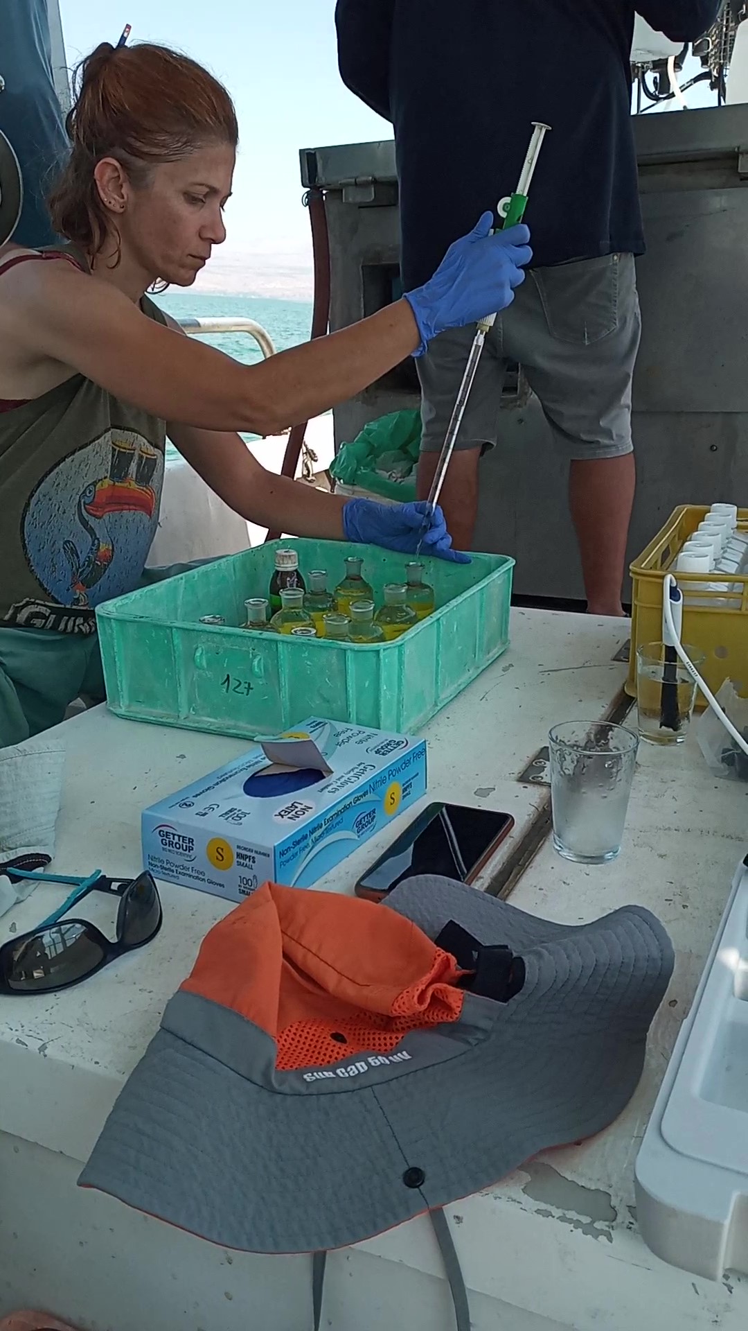
The Kinneret Limnological Laboratory (KLL) is situated at the ‘Sapir’ Site (Tabha) on the shores of Lake Kinneret (Sea of Galilee). The Lake Kinneret monitoring program conducted by KLL has been operating since Jan. 1969. The program has provided a unique database and information, due to the sampling resolution, accuracy of the measurements, and their continuity, it is used to make operational decisions and environmental policy. The monitoring program includes several stations around the lake and from numerous depths and includes fixed on-lake, high-resolution, and manual sampling of water samples analyzed in the laboratory. The Kinneret monitoring program has expanded in recent years and currently has four fixed on-lake and online sampling platforms, strategically placed, each with thermistor chains and multi-probe sensor systems including one that is a profiling system. Also, the program includes collaboration with the Ministry of Agriculture to carry out monitoring of fish and fisheries in the lake. As the lake suffers typically from two seasonal cyanobacteria blooms, (i.e., a winter Microcystis bloom and a summer N-fixing cyanobacteria bloom) routing monitoring of cyanobacteria biomass and toxins is conducted and adaptive to the extent of the bloom. This is carried out simultaneously with satellite imaging over the lake.
-

Historically, the role of the Galapagos Islands has been considered critical due to the evolutionary diversification induced by natural and historical isolation. The Galapagos National Park was established in 1959, based on its historical importance associated with Charles Darwin's voyage and its rare and endemic biodiversity, composed of unique vertebrate and plant communities (Rozzi et al. 2010). In 1978, the Galapagos Islands were declared a UNESCO World Heritage Site, a critical factor associated with this national park (Rozzi et al. 2010). The Galapagos Islands are a pristine area with local and regional climates influenced by the interaction of ocean currents and winds driven by the Inter-Tropical Convergence Zone; ITCZ (Conroy et al. 2008, Trueman and d'Ozouville 2010). The long-term programme includes forty natural aquatic ecosystems (lakes, ponds, lagoons and swamps) that will be sampled on the islands of San Cristobal, Santa Cruz, Isabela and Floreana, where possible along a lowland-highland gradient. The number of sampling points will vary according to environmental heterogeneity and the presence of a littoral region, among other factors.