
total carbon
Type of resources
Available actions
Topics
Keywords
Contact for the resource
Provided by
Years
Formats
Representation types
-
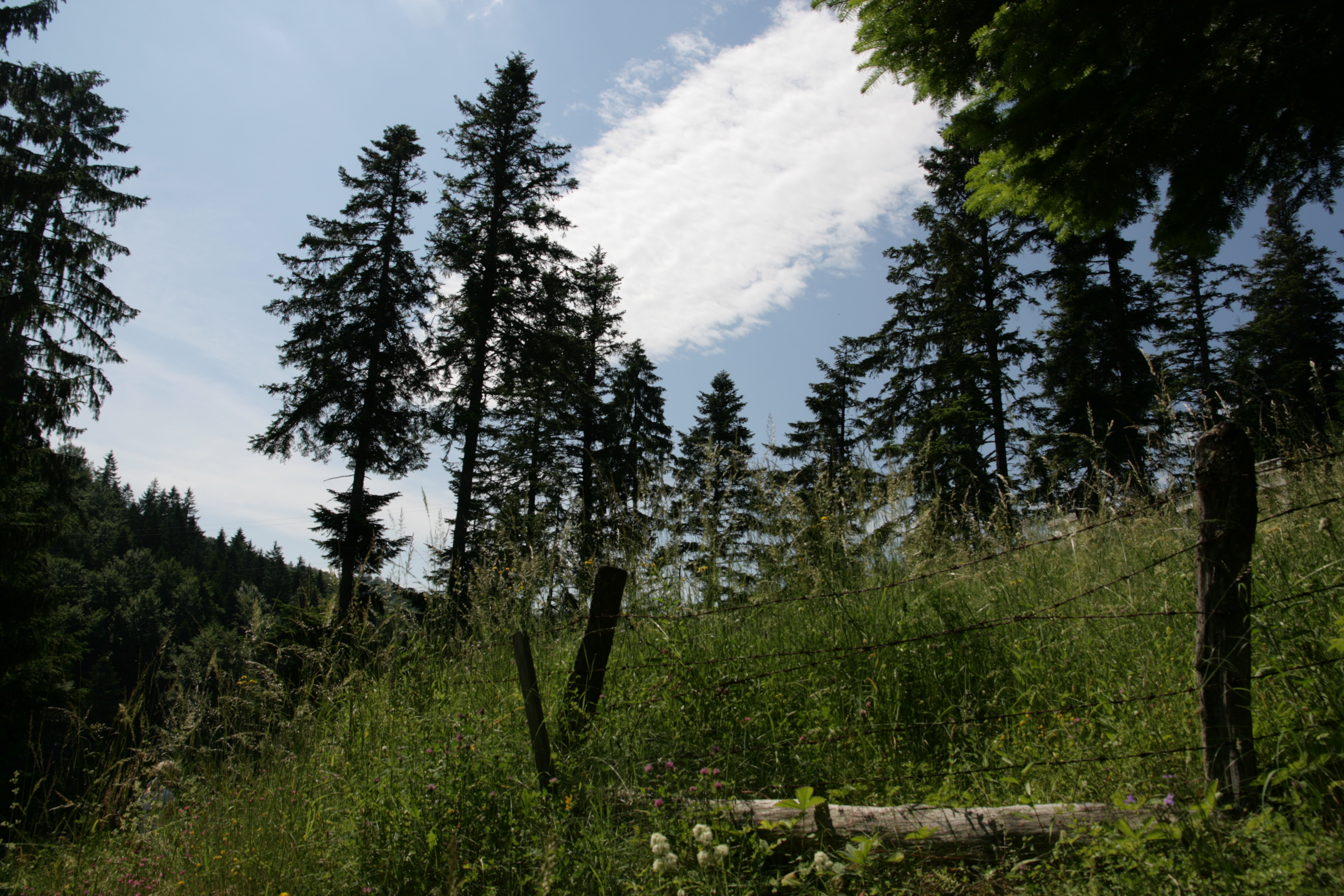
Tara mountain is a part of Dinaric Alps with an average height of 1200 m above sea level and is a typical forested area located in western Serbia. Its forests are among the best preserved and most productive forests in Europe and represent the greatest natural value of Tara. The area has a temperate continental climate with subalpine influences. High humidity is caused by currents from the Drina canyon and daily mist. More than 75% of the area is covered with mixed forest of beech, fir and spruce. Tara is a well known refugium for many relict and endemic plant species among which the most valuable and recognizable is the endemic and relict Serbia spruce, Picea omorica (Pancic) Purkyně with very limited range to about only 60 ha.
-
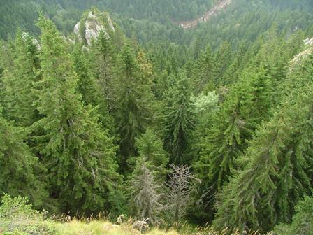
Kopaonik is the largest and the longest mountain range in Serbia located in its central part. It is proclaimed a national park in 1981. The observatory site in Kopaonik is located in strictly protected spruce forest, on the lower distribution of spruce zone on the border zone with beach forest. The mountain is characterized by alternating climate conditions; from warmer sub-mediterranean climate in the lowest part of the mountain to cold subalpine climate in high elevation areas. Vertical profile of the mountain with different climate zones and geological diversity resulted in high habitat diversity. The largest part of the area is covered by climatologically adapted mixed deciduous and coniferous forest having obvious zonal transition. A large number of endemic and relict plant species makes Kopaonik one of the most significant biodiversity centers in Serbia. Main threats to the area besides soil erosion present logging, deforestation and tourism.
-
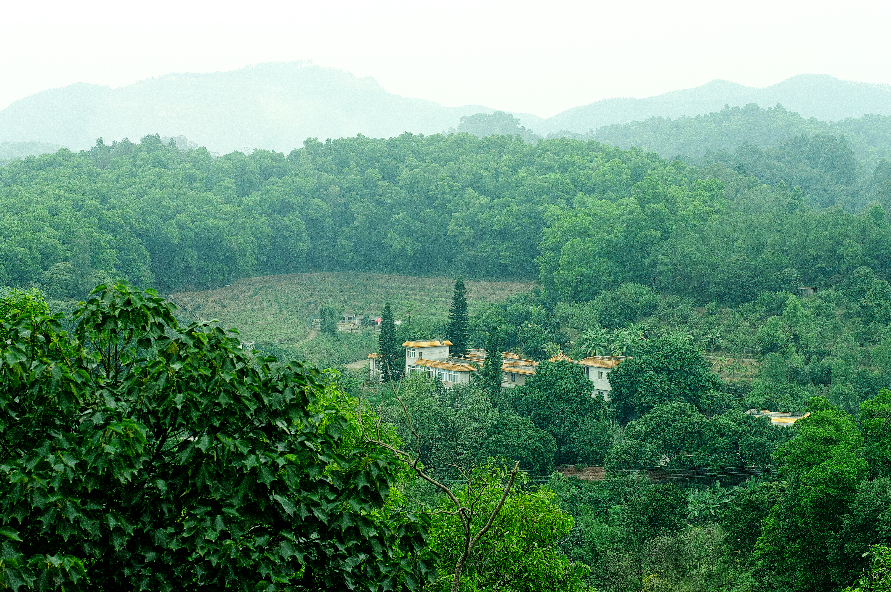
Heshan station (112 °54' E, 22 °41' N) is located in Heshan County, Guangdong Province, China. It is one of the core stations of the Chinese Ecological Research Network (CERN) of the Chinese Academy of Sciences (CAS.). The station was co-established by South China Institute of Botany (Renamed as South China Botanical Garden in 2002), CAS and Heshan Institute of Forest Science in 1984 based on the experience and knowledge of previous studies in a degraded costal ecosystem. Natural Conditions:The station is located in the central part of Guangdong Province with a typical climate of south subtropical monsoon. The soil is laterite. The mean annual temperature is 21.7 C, the mean rainfall is 1700 mm, and the mean evaporation is 1600 mm. The region is a hilly agricultural zone with 78.6% of hilly land, 17.1% of farming land and 4.3% of water body. The zonal vegetation is evergreen broad-leaved forest of typical subtropics. Research Areas:The research areas of the station include but not limited to the followings: 1) Study on canopy water flux of Acacia mangiun forest in the hilly lands of South China by applying sap flow technique; 2) Ecosystem carbon cycling; 3) Conservation genetics of cryptocarya chinensis population in lower subtropical fragmented forest; 4) N2O emission from main types of agricultural and forest lands in tropical and lower subtropical region of China; 5) comparative study on restoration progress between degraded tropical and subtropical ecosystems; 6) effects of landfills on soil biota and water quality; 7) impacts of forest composition on restoration progress; 8) mechanisms of adaptation of invasive species; 9) effects of girdling and defoliation on plant resource use efficiency and soil processes (root exudation, soil respiration and soil biota); 10) confounding effects of manure application on eucalyptus forest and on NEP (Net Ecosystem productivity); 11) nematodes as bio-indicators of different ecosystems.
-
The Ross Sea is one of the two main epicontinental seas of the Antarctic continent. It is characterized by an high medium depth (ca. 500m) and by inverse slope, in fact the maximum depths are located close to the continent while the lower near the continental slope. The waters primary productivity is controlled by seasonally ice that during austral winter cover all the area, inhibiting the passage of the light and therefore precluding productivity processes. The site is a multi-site observatory constituted by four mooring sites and and the Terra Nova Bay Macro Area.
-
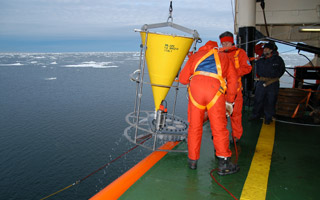
The Mooring B is located in the North-central Ross Sea in the Joides Basin. The mooring is equiped with sediment traps, currentometers, trasmissometer, fluorimeter and CTD. The study of mooring can be consider part of the activities conduct in the framework of the research project "ABIOCLEAR - Antarctic biogeochemical cycles - climatic and paleoclimatic reconstructions. (Resp. M. Ravaioli)". Such Project is the natural prosecution of previous research activity carried out from 1987. Objectives : Study of the particle fluxes towards the marine bottom sediment, in particular with the aim to obtain quali/quantitative estimate of the biogenica component coming from the primary production. Analysis of the vertical rain rate processes and, therefore, the marine cycle of the main biogenic particles such as Carbon and Silica. Try to obtain mass budgets of these parameters, estimating their cycle in the water column until the burial processes in sediments. From apparent accumulate rate calculated in the bottom sediment we will tried to discriminate the real vertical fluxes (Rain Rate) from the horizontal input from sediment remobilization processes. Acquisition and elaboration of long time series of data. Collection of bottom Sediment samples to estimate the variations of the productivity and the paleoproductivity in the area. Historical time series of Mooring B: Primary productivity data (every three years), fitoplancton, New and regenerated productivity, Seasonal, annual and interannual fluxes measure, monthly Particles samples, current velocity, water salinity, temperature and torbidity, Water-sediment interface measure. Biogeochemical parameters. Radiometrical Data, Mineralogical and grain size characterization. Nutrient, metals. Biostratigraphy interpretations. Lidar data are also available from 1997.
-
The Kellogg Biological Station (KBS) is located in southwest Michigan in the eastern portion of the U.S. cornbelt, 50 km east of Lake Michigan in the SW corner of the state (42° 24′ N, 85° 24′ W, elevation 288 m). Annual rainfall at KBS averages 1,005 mm/y with about half falling as snow; potential evapotranspiration (PET) exceeds precipitation for about 4 months of the year. Mean annual temperature is 10.1 °C. KBS is 1600 ha of cropping systems, successional communities, and small lakes. Surrounding KBS is a diverse, rural-to-semirural landscape typical of the U.S. Great Lakes and upper Midwest regions. The diversity of land use, soil and vegetation types, and aquatic habitats within a 50-km radius of the Station is high. Most of southwest Michigan is on the pitted outwash plain of the morainic system left by the last retreat of the Wisconsin glaciation, circa 12,000 years ago. Soils in the area developed on glacial till, and include well- and poorly-drained alfisols, mollisols, and entisols. Most regional soils are sandy loam and silty clay loam of moderate fertility, principal Station soils are Typic Hapludalfs. Land use around KBS ranges from urban (Kalamazoo, with a metropolitan population of 180,000, is 20 km south of the Station) to rural; vegetation ranges from cultivated and early successional old fields to older growth oak-hickory and beech-maple forests; and aquatic habitats include more than 200 bodies of water of different morphometries, alkalinities, and degrees of eutrophication within 50 km. Cropping systems in the area are typical of the U.S. cornbelt — mainly corn/soybean rotations with wheat of varying importance, and alfalfa an important forage crop. KBS yields are typical of non-irrigated yields elsewhere in the North Central Region. KBS LTER research is carried out in a variety of experimental systems. The most important of these is the Main Cropping System Experiment (MCSE), which was started in 1989 and consists of 11 different cropping systems or successional plant communities, ranging from annual corn-soybean-wheat rotations to late-successional deciduous forest. All communities are replicated within the landscape.
-
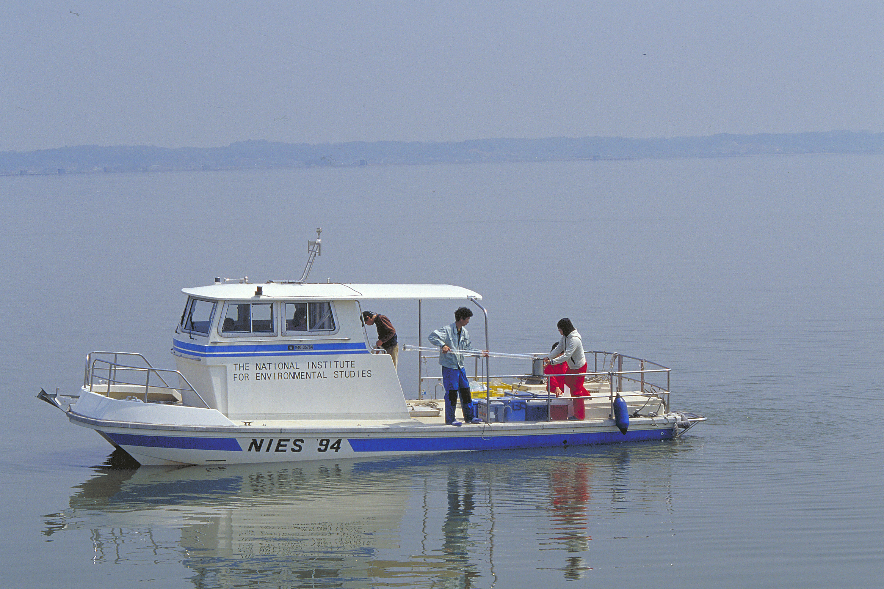
We have been monitoring Lake Kasumigaura, the second largest lake in Japan, monthly for nearly four decades. We have monitored not only environmental variables, water quality, nutrients, and heavy metals, but also plankton (e.g., bacteria, heterotrophic nanoflagellates, ciliates, picoplankton, phytoplankton, zooplankton, mysids), primary production, benthos (chironomids and oligochetes), and fish. To increase data availability and the numbers of data users, we created an English web database (http://db.cger.nies.go.jp/gem/moni-e/inter/GEMS/database/kasumi/index.html) in this research period, and strengthened our relationships with international observational networks. We also provided monitoring data to the Japan Long-Term Ecological Research Network (JaLTER; http://www.jalter.org/index.php?ml_lang=en) and published two data papers in the international journal Ecological Research (Takamura et al. 2012 a, b). We have also started to register fish monitoring data in the Global Biodiversity Information Facility (GBIF) (http://www.gbif.org/dataset/f648085b-8e1c-4a79-bc8d-f45d36296564) .
-
SITES Lönnstorp research station is situated in the Scanian agricultural landscape between Malmö and Lund and has a focus on the design, sustainable development and assessment of arable cropping systems, in conventional and organic farming. The research station is available for research within ecology, agronomy, environmental science, agroecology and other disciplines. SITES Lönnstorp research station have access to 60 hectares of conventional and 18 hectares of organic farm land, mainly cultivated with annual crops, representative for agricultural practise in southern Sweden. The station is also a part of SITES, Swedish Infrastructure for Ecosystem Science. SITES is a nationally co-ordinated infrastructure for terrestrial and limnological field research. In 2016, SAFE (SITES Agroecological Field Experiment) was established at the research station. SAFE make it possible to compare four different agroecosystems, a conventional reference system, an organic system, a perennial system and an agroecological intensified system.
-
Plynlimon is at the headwaters of the Rivers Severn and Wye. The infrastructure at Plynlimon consists of 10 instrumented research catchments representing different land use options on the same geological parent material. It is the UK’s Critical Zone Observatory, part of the EU and global network of CZOs and is an ExpeER site. The infrastructure records high temporal resolution river flow and meteorological data (40 year data record) and stream water and precipitation chemistry for cations, anions, trace metals, nutrients, pH and alkalinity (30 year data record) and some data for suspended sediment. The site has an extensive spatial data library including topography, digital terrain model (DTM), soils, geology and vegetation/land-use available, open access, through the Environmental Information Data Centre (https://catalogue.ceh.ac.uk/documents/91961a0f-3158-4d00-984d-91eb1e03e8bd). Sub sites in the catchments represent a range of upland management types: mature/clear cut/replanted conifer forest; acid grassland; eroding peatland; improved grassland.Samples analysed for a wide range of major, minor and trace components. Bulk precipitation and cloudwater chemistry is also measured at one location.
-
The Słowiński National Park monitoring was established in 1993 and consists of a monitoring station, where the measuring equipment is located, i.e., Wind Speed Meter (Young) pyranometer (LiCo) hygrometers, etc., permanent plots in the 90-year-old spruce and pine stands where bulk deposition, throughfall and soil solution are collected on the monthly basis. The investigations of health status of trees and floral characteristic have been carried out since 1994. The analyses are carried out in a certified laboratory of the Institute for Ecology of Industrial Areas, Katowice (Certificate No AB 325).