
total organic carbon
Type of resources
Available actions
Topics
Keywords
Contact for the resource
Provided by
Years
Formats
Representation types
-
Total carbon concentration data of the Gesäuse-Johnsbachtal site.
-
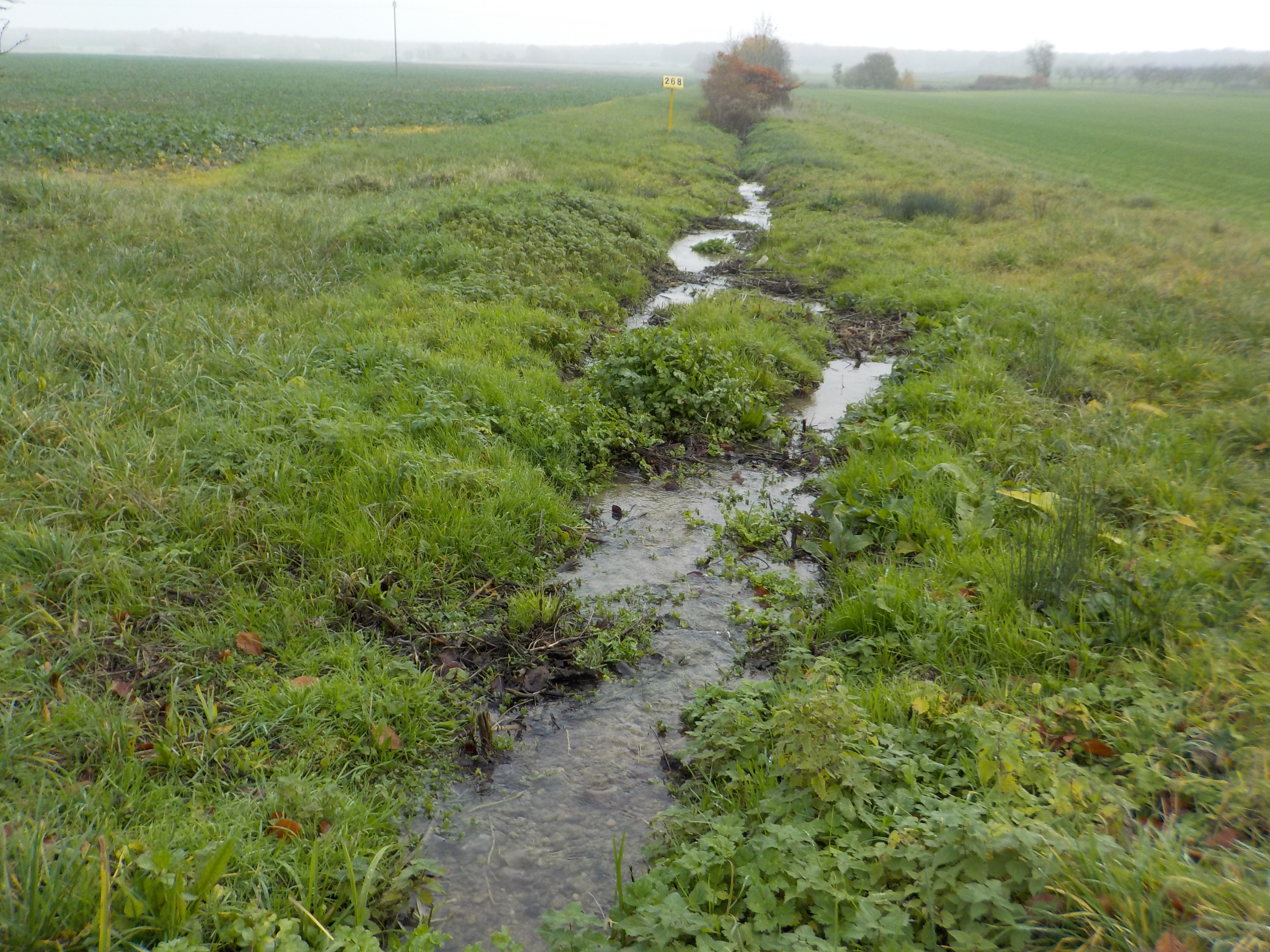
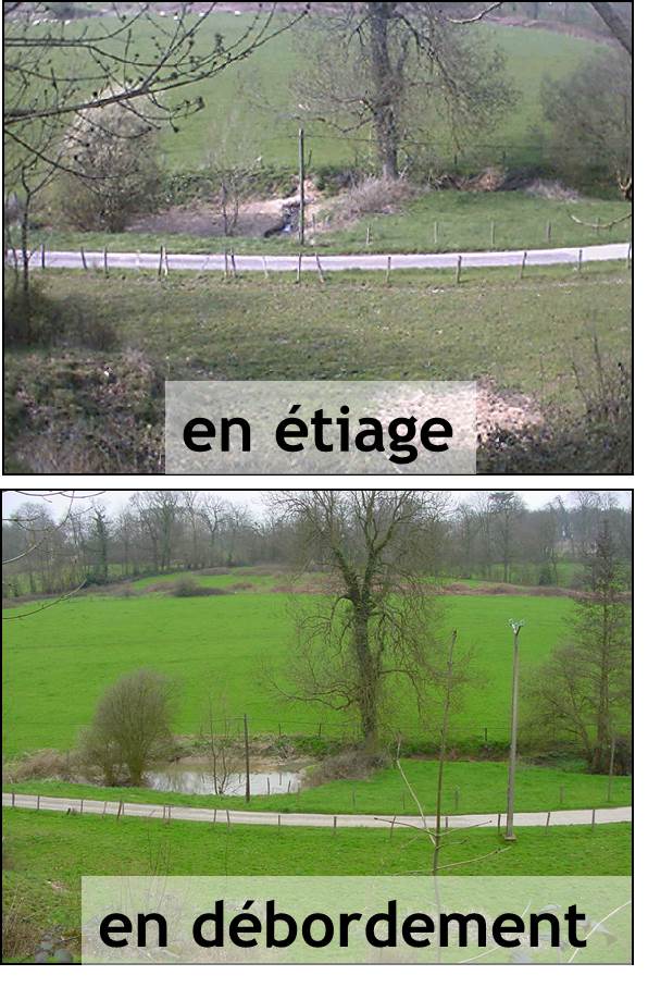
The state forest of La Reine is a humid forest of about 5000 ha located in the south of the plain of Woëvre and at the foot of the Meuse hills in France. Numerous ponds and puddles are scattered throughout the forest and it is crossed by many small, more or less natural streams. Upstream of the forest, these waterways are impacted by human activities (large-scale farming, housing without collective sanitation in particular). Since 2019, the Moselle Basin Workshop Zone has been working on the implementation of a workshop site to understand the bio-hydrogeological functioning of three of these streams, particularly in terms of natural purification. Sampling campaigns are regularly organized in the streams and in ponds.
-
Field work - repeated measurements and multiple point measurements
-
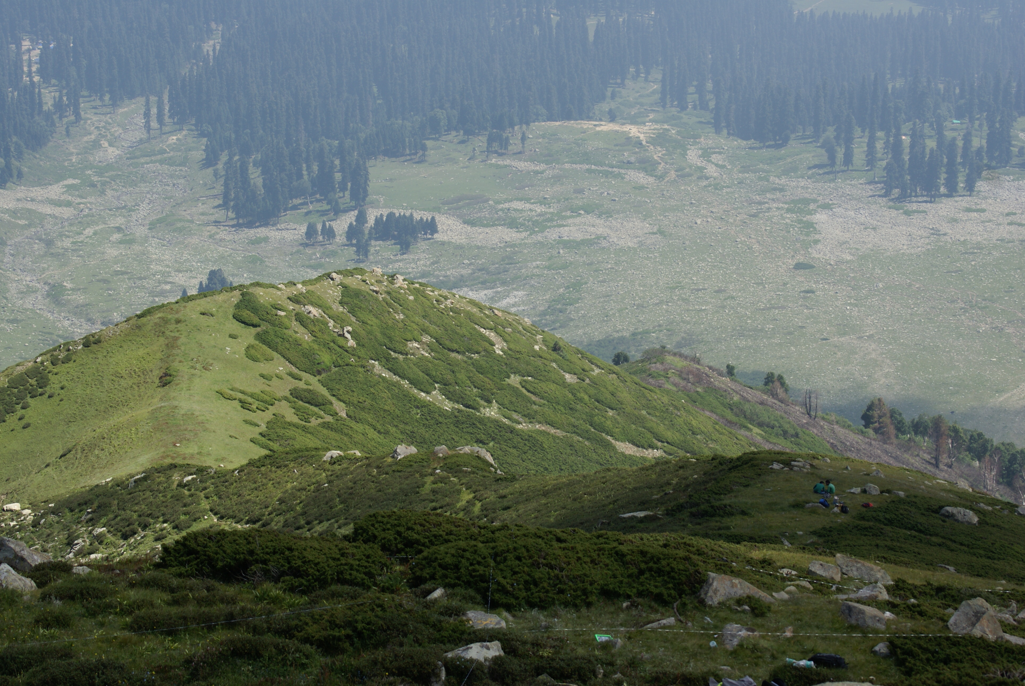
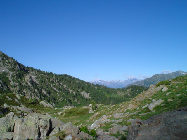
Dynamics of alpine tree line has been reported from several mountain ranges in Europe, in North America, New Zealand as well as in the Alps (Grabherr et al. 1994). This led to the formation of the GLORIA (Global Observation Research Initiative in Alpine Environments) project, dedicated to initiate a global indicator network towards research on the effects of climate change through an international co-operation. Indian part of Himalaya was not having any site towards this mission till 2013. Therefore, based on some Indian studies which also indicated this trend in more pronounced manner, the need of having Indian network was felt. It was in this context as a part of network project across the Indian Himalayan states under the banner of HIMADRI (Himalayan Alpine Dynamics Research Initiative) a long-term monitoring site was established in Kashmir Himalaya at Gulmarg, a famous hill resort. This particular work plan (TeaComposition initiative) is conducted at this selected HIMADRI site. Gulmarg lies on the north east side of the Pir Panjal Range and is about 60 kms west of Srinagar city. It encompasses the upper catchment area of Ferozpur Nullah and the forests that surround the Gulmarg meadow. The vegetation in Gulmarg mainly comprises of coniferous temperate mountain forests of Blue Pine (Pinus Wallichiana), sub-alpine forests of Silver Fir (Abies pindrow) and Himalayan Birch (Betula utilis), followed by alpine scrub and meadows.
-
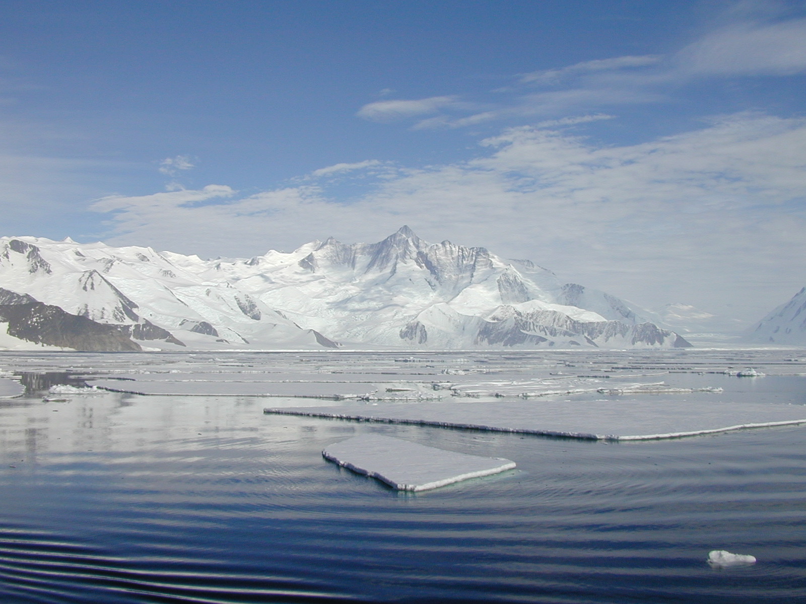
The mooring A is located in an open sea area close to Franklin Island, characterized by both clay bottom sediment and a flat morphology. The station can be considered as representative of the productivity and sedimentary conditions of the southern part of the Ross Sea, one of the areas considered to be affected by greater productivity rate.The study of mooring can be consider part of the activities conduct in the framework of the research project "ABIOCLEAR - Antarctic biogeochemical cycles - climatic and paleoclimatic reconstructions. (Resp. M. Ravaioli)". Such Project is the natural prosecution of previous research activity carried out from 1987. Objectives : Study of the particle fluxes towards the marine bottom sediment, in particular with the aim to obtain quali/quantitative estimate of the biogenica component coming from the primary production. Analysis of the vertical rain rate processes and, therefore, the marine cycle of the main biogenic particles such as Carbon and Silica. Try to obtain mass budgets of these parameters, estimating their cycle in the water column until the burial processes in sediments. From apparent accumulate rate calculated in the bottom sediment we will tried to discriminate the real vertical fluxes (Rain Rate) from the horizontal input from sediment remobilization processes. Acquisition and elaboration of long time series of data. Collection of bottom Sediment samples to estimate the variations of the productivity and the paleoproductivity in the area. Historical time series of Mooring A: Primary productivity data (every three years), fitoplancton, New and regenerated productivity, Seasonal, annual and interannual fluxes measure, monthly Particles samples, current velocity, water salinity, temperature and torbidity, Water-sediment interface measure. Biogeochemical parameters. Radiometrical Data, Mineralogical and grain size characterization. Nutrient, metals. Biostratigraphy interpretations. Lidar data are also available from 1997.
-
Runoff and runoff chemistry at LTER Zöbelboden, Austria
-
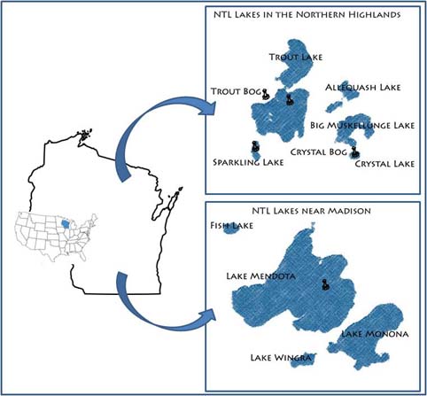
Our primary study sites include a set of seven northern Wisconsin and four southern Wisconsin lakes and their surrounding landscapes. The project, which started in 1981, is administered by the Center for Limnology at the University of Wisconsin-Madison.
-

Uhlířská (Jizerské Mts.) is a typical mountain catchment underlain by acidic bedrock and strongly acidified during the second half of the 20th century. Two thirds of the catchment were deforested in 1980s and subsequently reforested by Norway spruce (Picela abies) monoculture. Research here has been mostly focused on fluxes of ecologically important elements and water. The monitored characteristics include bulk and throughfall precipitation amount and chemistry, runoff amount and chemistry as well as soil chemistry, forest biomass and element pools but also plant community composition. Biogeochemical (MAGIC) and hydrological models (BROOK90) have been applied to predict future chemistry and hydrology under different scenarios of atmospheric deposition, forest growth and climate change. Hydrological processes of surface and subsurface runoff formation are studied in the catchment as a whole and in detail at the experimental hillslope Tomšovka using standard hydrologic and isotopic methods, incl. water transit time evaluation and groundwater age dating. Hydrology research focuses on water and heat flux in soil profile as well as on processes in the soil-plant-atmosphere system. Geophysical methods are used to reveal subsurface structures.
-
The Chalk Karst observatory groups different karst sites on the Cretaceous Chalk located at the Paris Basin (Norville, Radicatel, Yport, Saint-Martin-Le-Nœud). These karst watersheds range from 10 to 200 km2 and the land use consists of agriculture and grazing under oceanic climate. There are characterized by chalk plateaus covered with clay-with-flints owing to chalk weathering constituting a fairly impervious layer and with quaternary silts. These surficial formations range from 3 to 20 meters depth and are highly susceptible to crusting, compaction, and erosion, particularly during autumn and winter. A numerous swallow holes locally penetrates the chalk through the above-mentioned impervious layer, resulting in a strong connection of the surface with the aquifer inducing infiltration of turbidity releases at spring and well used to drinking water (up to 500 NTU). These Chalk karst sites are one the sites of the French SO-KARST labellised by INSU-CNRS and are a part of the French RBV-Network and ZA Seine.
-
Mars, Mont Mars, (Fontainemore, Aosta)