
total radiation irradiance
Type of resources
Available actions
Topics
Keywords
Contact for the resource
Provided by
Years
Formats
Representation types
-
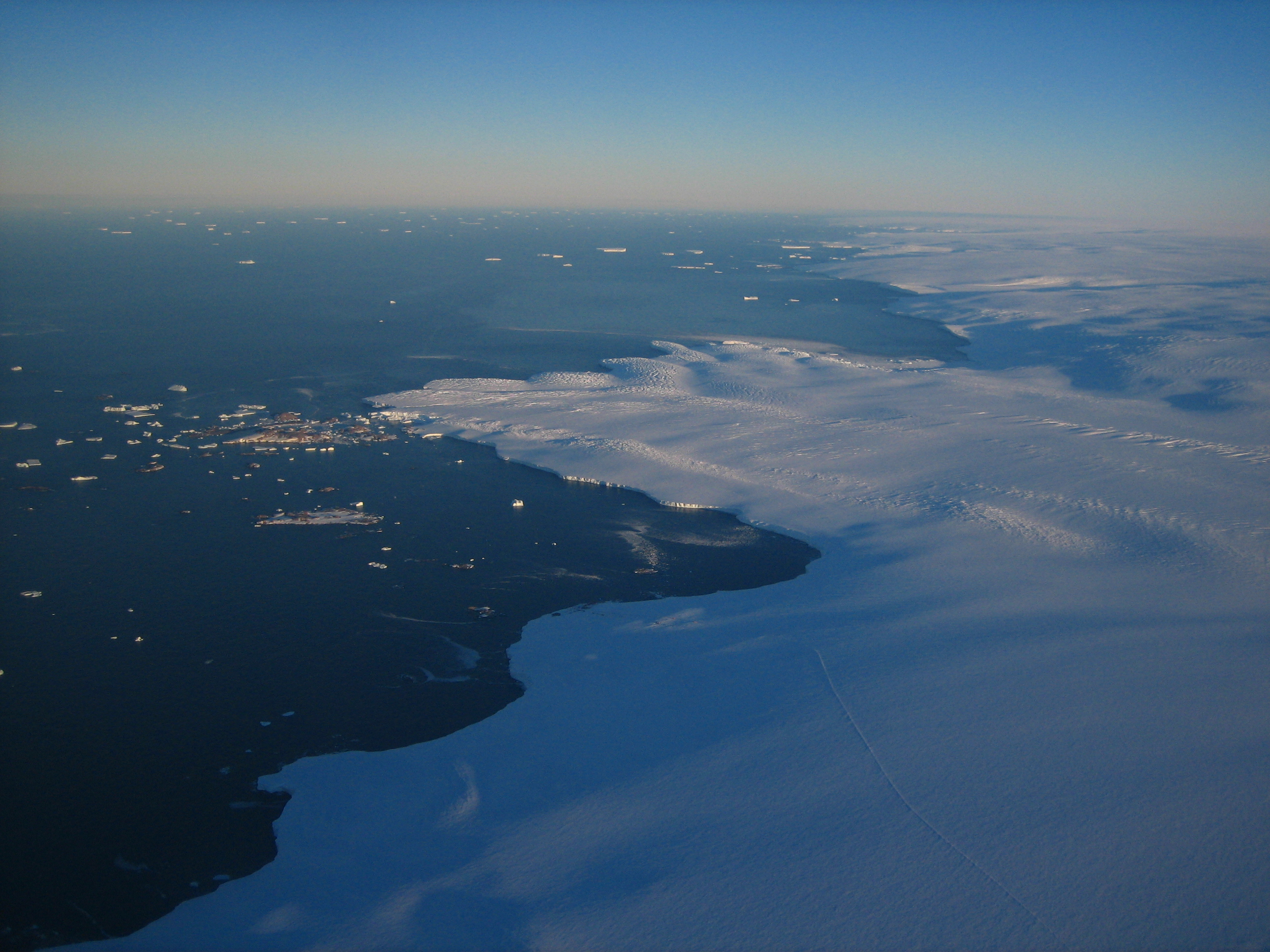
Cap Prud'homme (CAP) is located on the coast of the Antractic Ice sheet (Dumont d'Urville station). Mass balance is measured alo,g 3 different stake networks at the camp and over 150 km inland. Meteorological information are recorded at 2 stations. Dynamics of the ice is measured on the Astrolabe glacier. CAP is a part of the French Glacier Observatory GLACIOCLIM/CRYOBS-CLIM.
-
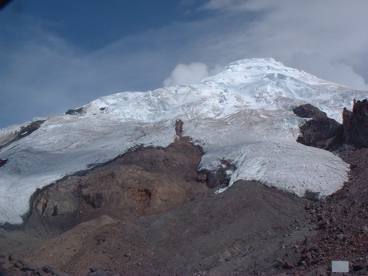
Antizana 15 alpha Glacier is one of the 17 tongues of the Antizana volcanoe in Ecuador, from 4820 to 5760 m a.s.l..
-
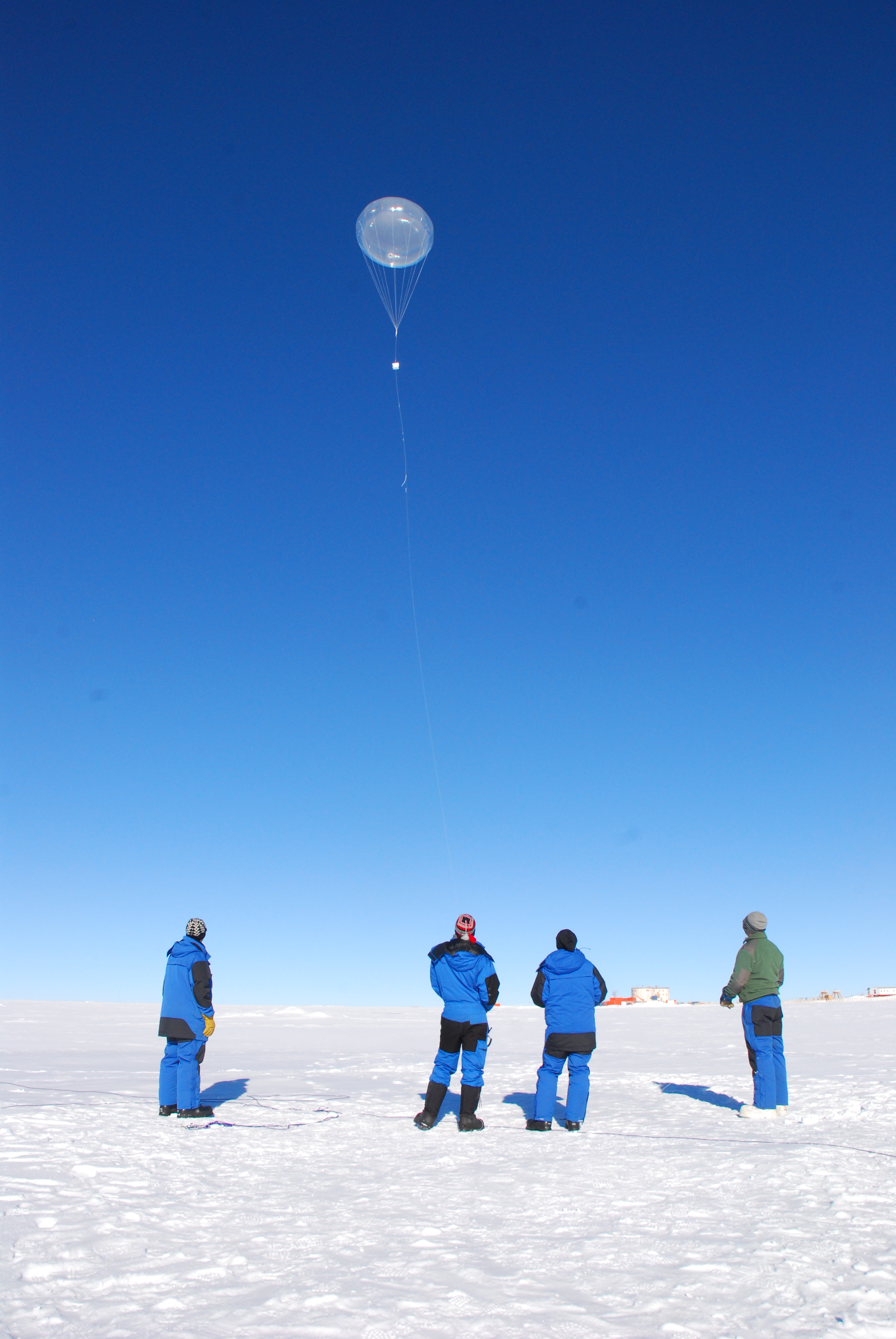
Concordia is a joint French-Italian research facility opened in 2005 on the Antarctic Plateau, Antarctica (-75.1, 123.33), managed together by PNRA (Italian National Antarctic Programme) and IPEV (Institut Polaire Francais Paul Emile Victor). It is built at 3,233 m above sea level on the third highest summit of Antarctica: Dome C.
-
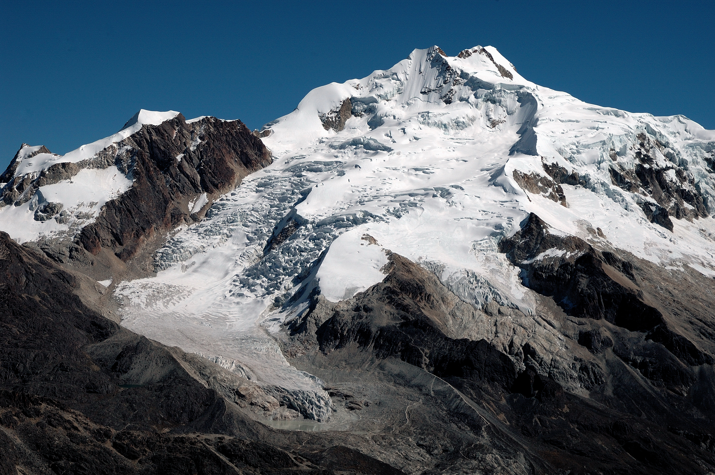
Zongo Glacier is located in the Huayna Potosi region (Cordillera Real, Bolivia) 30 km north of La Paz city, between the dry Altiplano plateau in the west and the wet Amazonian basin in the east, under outer tropics meteorological conditions (strong seasonality in precipitation, low seasonality in temperature).
-
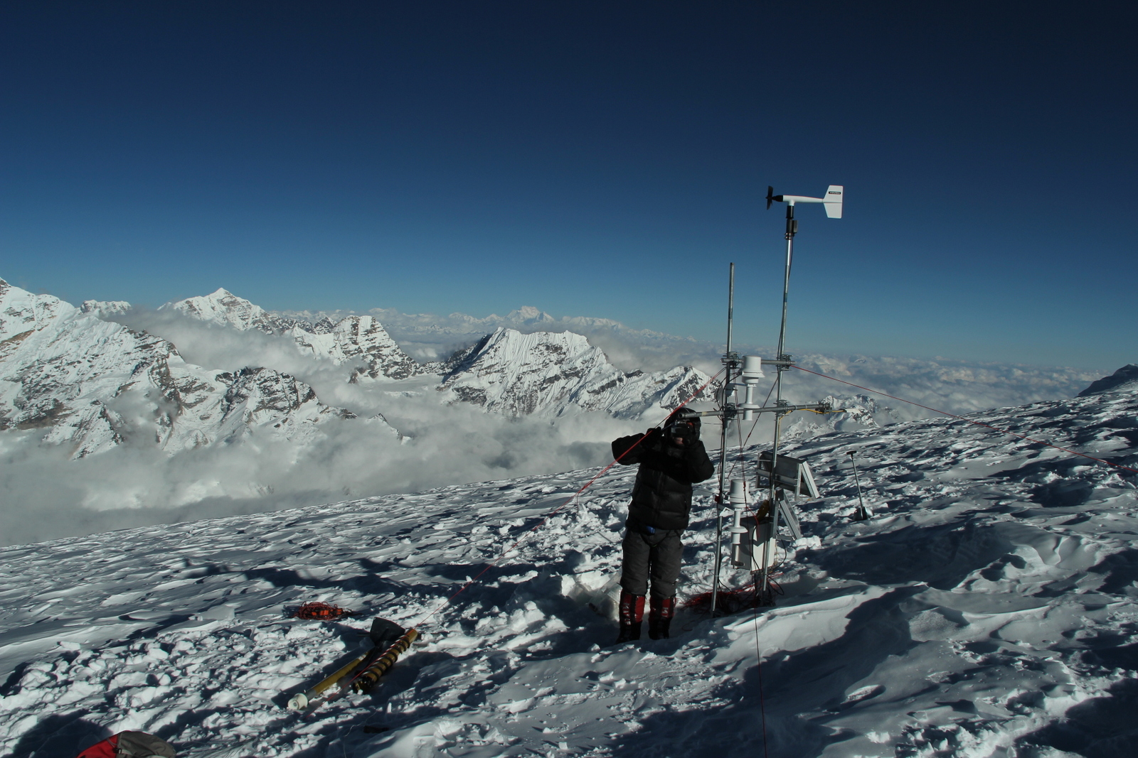
Mera glacier (MER) is located in Nepal, near the Khumbu valley. This glacier is free debris cover. Mas sbalance and dynaic measurements were initiaited in 2007. In addition, meteorological observations complete the data base. 2 weather stations are on the moraine and on the glacier itself. MER is a part of the French Glacier Observatory GLACIOCLIM/CRYOBS-CLIM. All the series on Mera glacier (MER) are unique and necessary for glaciological studies because Himalaya is still partly unknown in terms of future evolution. Data permit to calibrate models in order to determine future glacier evolution. Mera data are also unique to test hydrological model in the catchment.
-
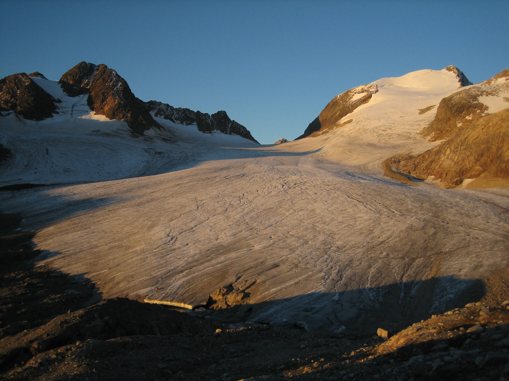
Saint-Sorlin glacier (SSO) is located in the Arvan valley, between 2700 and 3400 m altitude. The glacier is situated in the Grandes Rousses massif, and one of the glaciers with longest records of glacier mass balance worldwide. Data series are continuous and cover few decades (more than 50 years of mass balance measurements).This site is also characterized by the complete glaciological parameters performed annually to complete annual and seasonnal mass balance : ice velocity, ice thickness variation, snout position.In addition, meteorological observations complete the data base. 1 weather station, running since 2005, is located on the moraine, close to the snout of the glacier. SSO is a part of the French Glacier Observatory GLACIOCLIM/CRYOBS-CLIM.
-
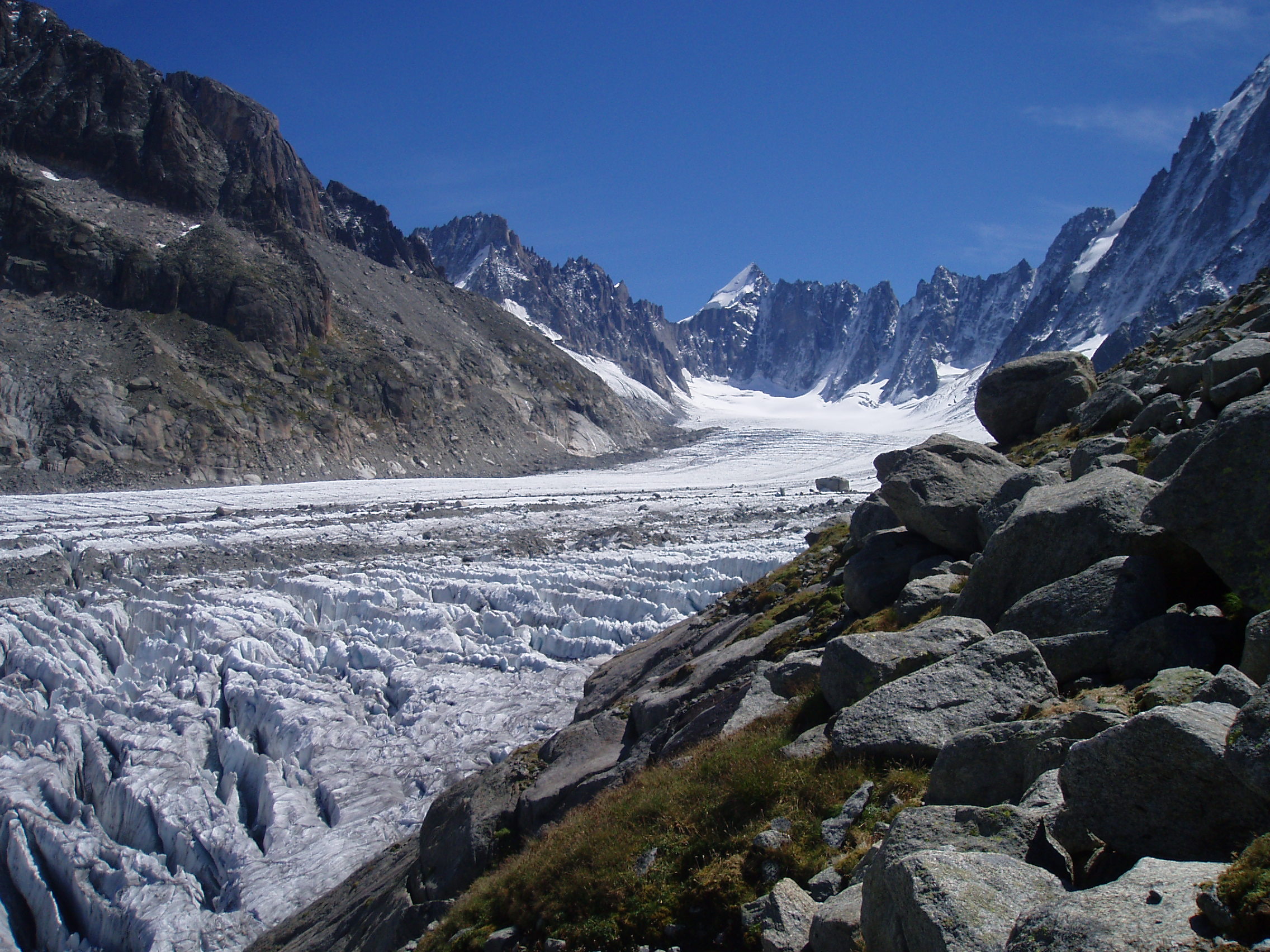
Argentiere glacier (ARG) is located in the Mont-Blanc valley (France), between 1500 and 3400 m altitude. The glacier is one of the glaciers with longest records of glacier mass balance worldwide. Data series are continuous and cover few decades.This site is also characterized by the complete glaciological parameters performed annually to complete annual and seasonnal mass balance : ice velocity, ice thickness variation, snout position.In addition, meteorological observations complete the data base. 1 weather station, running since 2006, is located on the moraine. ARG is a part of the French Glacier Observatory GLACIOCLIM/CRYOBS-CLIM.
-
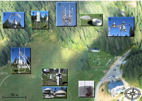
The Col de Porte pilot site is located near Grenoble, in the Chartreuse massif (elevation : 1325m, latitude : 45°30’N, longitude : 5°77’ E). At this mountain site located in a grassy meadow surrounded by a coniferous forest; all the measurements are located within an flat area of 50 × 50 m. Meteorological and snow parameters are recorded hourly since 1961. These parameters are : - Air temperature and relative humidity of air - Incoming and outcoming short and long-wave radiations - Wind speed and direction - Precipitation - Snow depth, snow water equivalent - Settlements and snow temperatures of the different layers of the snowpack Weekly snowpack profiles are also carried out, including major stratigraphic properties of snow (temperature, density, liquid water content, snow type). All sensors are located within a radius of a few tens of meters. (1) Geonor precipitation gauges (3 sensors) and OTT2 (1 sensor), (2) PG2000 heated and non-heated precipitation gauges, (3) windspeed measurements at the top of the 10 m meteorological mast and at the same level of the precipitation gauges, (4) lysimeters (2 sensors), (5) snow depth and surface temperature sensors and settling disks, (6) temperature and relative humidity of air sensors placed in the shelter, (7) Incoming and outcoming longwave and shortwave radiation sensors placed on the rotating arm, (8) close-up on the 4 components radiation sensors, (9) building (cold room, data acquisition, lab space), (10) cosmic rays counter for SWE measurements, (11) former experimental area for the study of road/snow interactions, (12) automatic snow and weather station Nivose for testing purposes (generally used in remote mountain areas), (13) forest area impacted by the cut in 1999, (14) snow pit area, Fore more information refer to : Morin, S., Lejeune, Y., Lesaffre, B., Panel, J.-M., Poncet, D., David, P., and Sudul, M.: An 18-yr long (1993-2011) snow and meteorological dataset from a mid-altitude mountain site (Col de Porte, France, 1325 m alt.) for driving and evaluating snowpack models, Earth Syst. Sci. Data, 4, 13-21, doi:10.5194/essd-4-13-2012, 2012
-
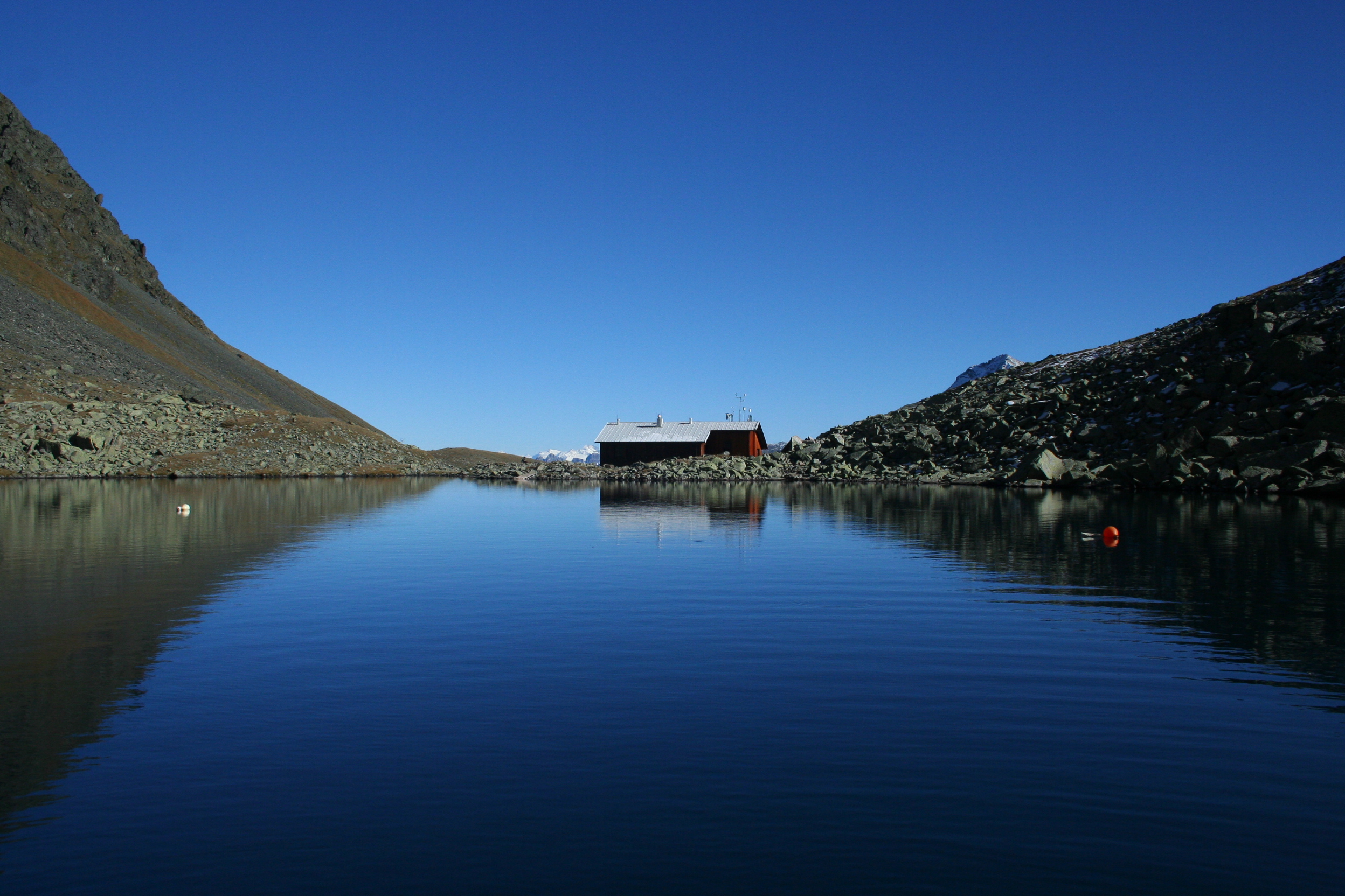
The mountainous Gossenköllesee is located in the Stubaier Alps at an elevation of 2,417 m. The research station on the shore of Gossenkoellesee provides an ideal platform to conduct research related to global change as shown in mountaineous regions. The former UNESCO Gossenköllesee Biosphere Reserve (the smallest in the world) was established in 1977 in order to guarantee long-term ecological research. In the year 2014 this label has been withdrawn due to the incompatibility with the Sevilla strategy to define biosphere reserves. It was defined with an area of 85ha ranging from 2.417 m (lake level) to 2,828 m above sea level (Pirchkogel) at 4714'N and 1101'E. The former Biosphere Reserve comprised the lake itself with the adjacent catchment area. It is characteristic for high alpine regions and has a largely intact natural environment. The centre of scientific interest is the long-term change of alpine lakes, streams and entire catchments. The two lakes, Vorderer and Hinterer Finstertaler See, were converted into a reservoir for hydroelectric power generation in 1974, and dam construction flooded the existing limnological research station, established in 1959 on the shore of the Vorderer Finstertaler See. A new station was built in 1975 on the opposite slope of the Kühtai Valley, the socalled Limnological Station Gossenköllesee, and was completely reshaped and enlarged in 1995. In 2016 it has been entitled after Prof. Roland Pechlaner. After twenty-five years, this is still an attractive and highly relevant subject for both ecological research and environmental protection. During the Ice Age the whole area was glaciated. After the ice retreated at the beginning of the Holocene several lakes were formed, four of which still exist today; the largest of these is Gossenköllesee. The bedrock of the drainage area is granitic and consists of crystalline schist and gneiss. The moraine forming the natural dam of Gossenköllesee is composed of amphibolites, granite gneiss and mica slate. The lake is subpolar, oligotrophic and dimictic in character with a maximum depth of 9.9 m and an area of 16,700 m². It is covered for up to eight months of the year with an alternating sheet of ice, snow and slush, which has a critical influence on light transmission, stratification and nutrient exchange of the pelagic zone. The lake has no surface inflows and outflows, except a small outlet during snowmelt. It harbours one of the last populations of the Danubian brown trout (Salmo trutta), probably descended from fish stocked by the Emperor Maximilian in A.D.1500. It is accessible all year round, lying within an hour’s walking distance from the small village of Kühtai, a well-known ski resort situated about 30 km west of Innsbruck that can be reached daily by car and public transport. Gossenköllesee and its catchment area is a centre of alpine research with a fully equipped research station at the shore of the lake that undertakes the collection (and to some extent analysis) of sensitive samples and maintains automated observation of climate and hydrology on site. The station has accommodation for up to six people, and was modernized and equipped with telephone, modem and electrical energy in 1994, allowing for emission-free heating and operation of the equipment. Additionally, since 2016 we run an automatic weather based on a platform on the lake. A webcam provides online pictures. GLOBAL CHANGE RESEARCH IN MOUNTAIN HABITATS Since 1992, Gossenköllesee has been a key site in various EU projects (ALPE, MOLAR, EMERGE) and is included in the Integrated Project EUROLIMPACS and the Network of Excellence ALTER-NET (6th Framework Programme). Over the last three decades the atmospheric deposition, lakes, streams, soils and vegetation of this area have been subjects of MSc dissertations, PhD theses and international projects. Beginning in 2004, Gossenköllesee, which is unique as a centre of scientific education, will be the principal site for research focus of the Innsbruck University (ALPINER RAUM–ALPINE SPACE). The importance of the station for research and teaching can be illustrated by numerous interviews and TV documentaries. Since 2015 it is member of GLEON (Global Lake Ecological Observation Network) as the only Austrian high mountain lake. The lake and its catchment area lay entirely in the alpine zone, that is, above the present and possibly also the historical treeline. It harbours several alpine plant species such as rhododendron, dwarf shrubs and typical representatives of alpine grass heath. Approximately 10 per cent of the catchment area is covered by thin soils, mostly raw and podsolic soils with low pH. The surroundings are characterized by large rocks and moraines, which offer shelter to marmots, chamois, ermines, foxes and adders. The site, which is part of the local agrarian community, is bordered by a ski resort and can be reached during winter after a short journey using skies or snowshoes. During the summer Gossenköllesee is accessible on foot via a narrow trail (one-hour walk), and in good weather conditions (in late summer) is even accessible by jeep. As a result of the moraine, the lake and the station are hidden from view and therefore rarely visited by hikers or skiers. During the summer sheep graze in Kühtai, and some go as far as the Gossenköllesee catchment, thus providing additional nutrient input.
-
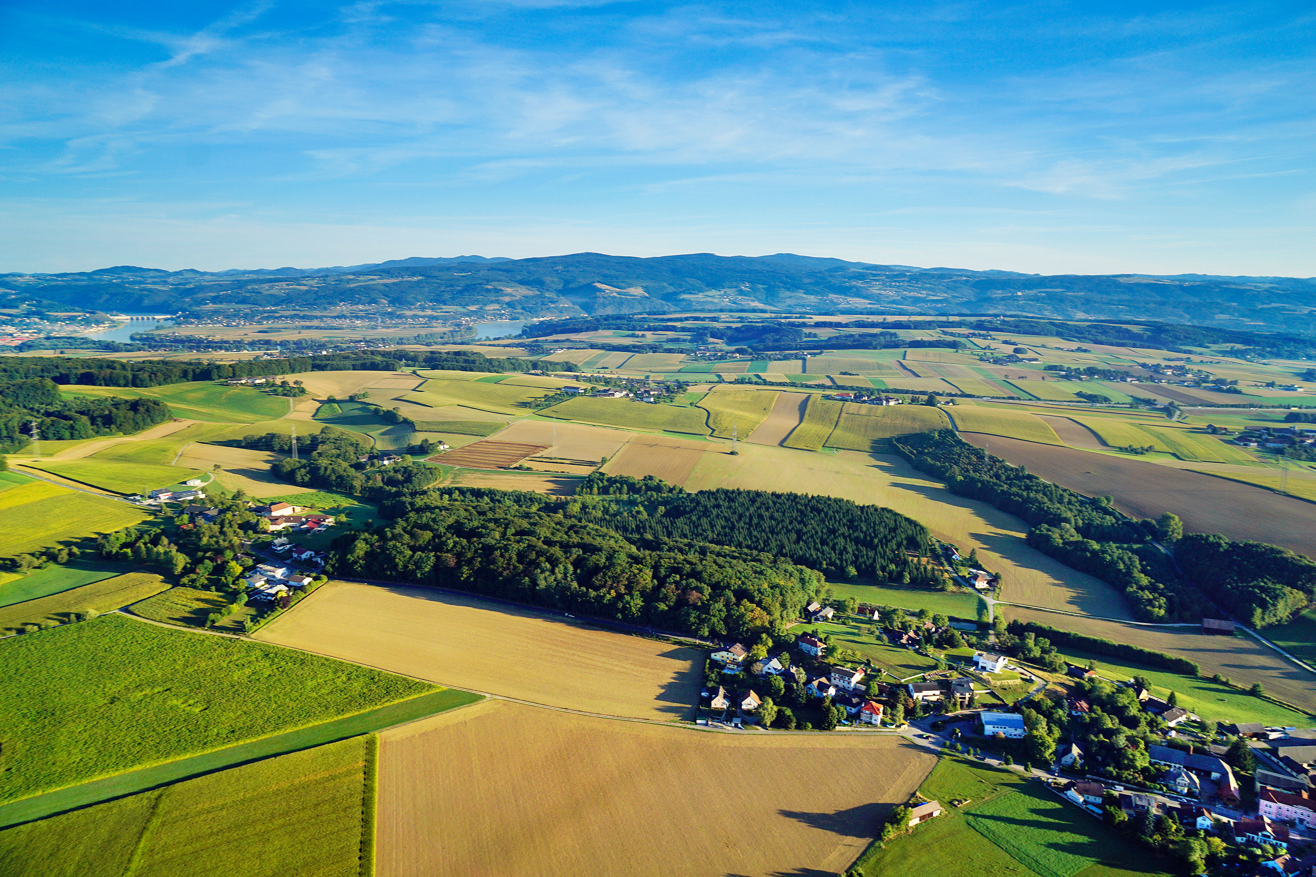
The Petzenkirchen HOAL (Hydrology Open Air Laboratory) catchment is situated in the western part of Lower Austria (48°9' N, 15°9' E). The catchment area at the outlet (termed MW) is 66 ha. The elevation of the catchment ranges from 268 to 323ma.s.l. with a mean slope of 8 %. At present, 87% of the catchment area is arable land, 5% is used as pasture, 6% is forested and 2% is paved. The crops are mainly winter wheat and maize. The climate can be characterised as humid with a mean annual temperature of 9.5°C and a mean annual precipitation of 823mm/yr from 1990 to 2014. Precipitation tends to be higher in summer than in winter. Crop evapotranspiration (ETc) estimated by the FAO (1998) method using local climate data and crop growth information for this period was 471mm/yr. Annual evapotranspiration estimated by the water balance ranged from 435 to 841 with a mean of 628mm/yr (1990–2014) (assuming deep percolation is negligible). The natural surface water outlet of the catchment is known as the Seitengraben stream. Mean annual flow from the catchment in this stream is 4.1 L/s (or 195mm/yr) (1990–2014). Mean flows tend to peak in the spring. The largest flood events on record occurred in 1949 and 2002 with estimated peak discharges of 2.800 and 2.000 L/s, respectively. The highest discharge in recent times occurred in summer 2013 with 660 L/s. The subsurface consists of Tertiary sediments of the Molasse zone and fractured siltstone. The dominant soil types are Cambisols and Planosols with medium to poor infiltration capacities. Gleysols occur close to the stream. (Blöschl et al., 2016)