
tree condition
Type of resources
Available actions
Topics
Keywords
Contact for the resource
Provided by
Years
Formats
Representation types
-
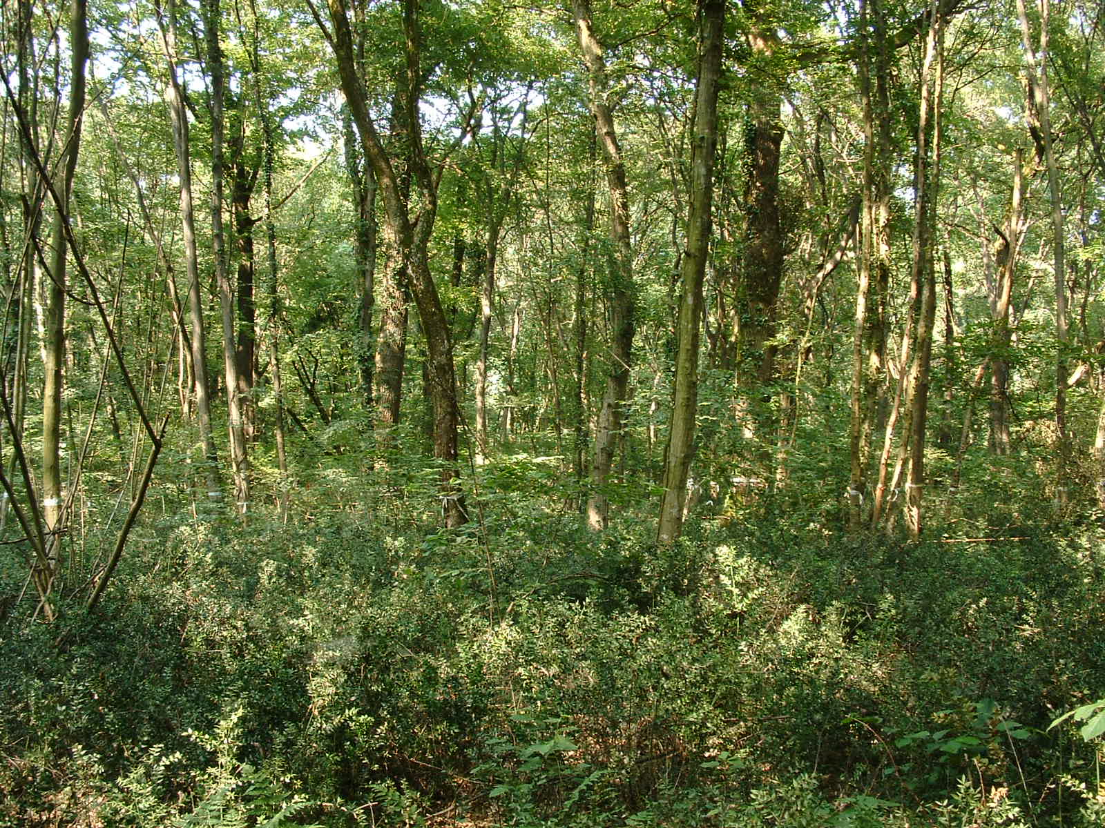
Bosco Fontana is an ancient primary woodland and represents one of the last remnants of the original Po plain forest. The historic events that have influenced the area are the fragmentation and the decrease of the forest habitat surface, the modification in the forest composition and structure. One of the most relevant events happened is the heavy storm in 1949, which uprooted more than 1500 m3 of wood, leaving “naked” a 50 ha area. The consequent reforestation with allochthonous species (plane tree and red oak) constitutes another alteration of the natural ecosystem. The allochthonous species are progressively eliminated to reconstitute the original oak-hornbeam woodland. From a faunistic point of view, the area represents a “tank” of forest species disappeared or extremely rare in the other areas. The central grassland, used for grazing till 70s, is now treated with scheduled mows.
-
None
-
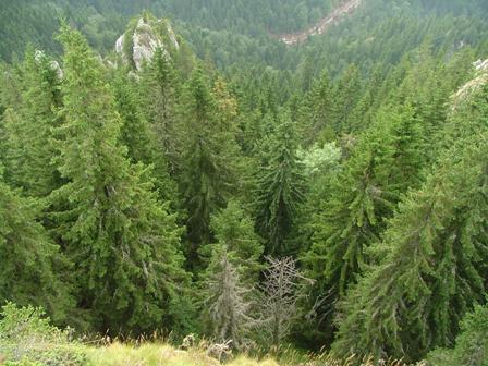
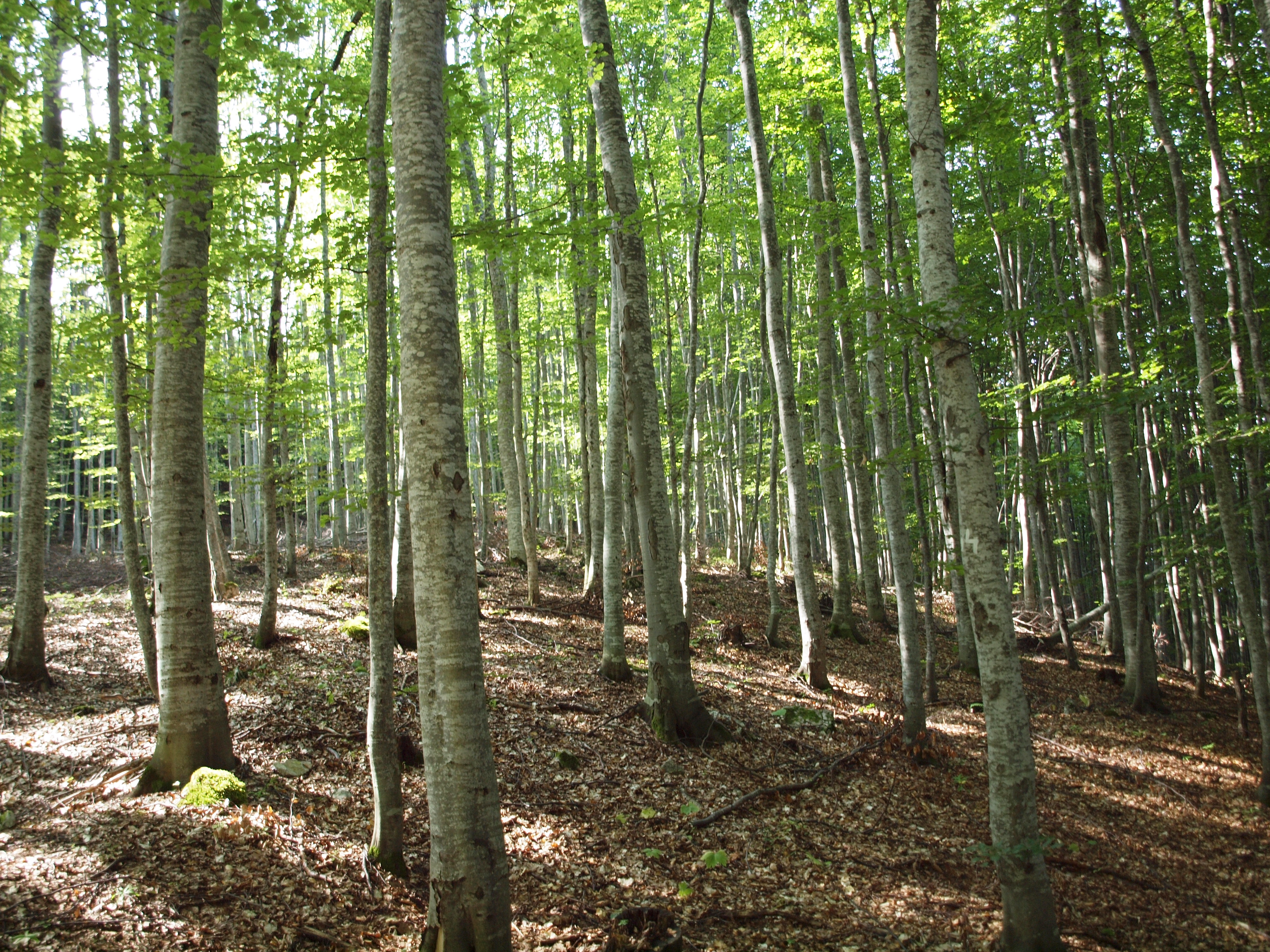
Tara mountain is a part of Dinaric Alps with an average height of 1200 m above sea level and is a typical forested area located in western Serbia. Its forests are among the best preserved and most productive forests in Europe and represent the greatest natural value of Tara. The area has a temperate continental climate with subalpine influences. High humidity is caused by currents from the Drina canyon and daily mist. More than 75% of the area is covered with mixed forest of beech, fir and spruce. Tara is a well known refugium for many relict and endemic plant species among which the most valuable and recognizable is the endemic and relict Serbia spruce, Picea omorica (Pancic) Purkyně with very limited range to about only 60 ha.
-
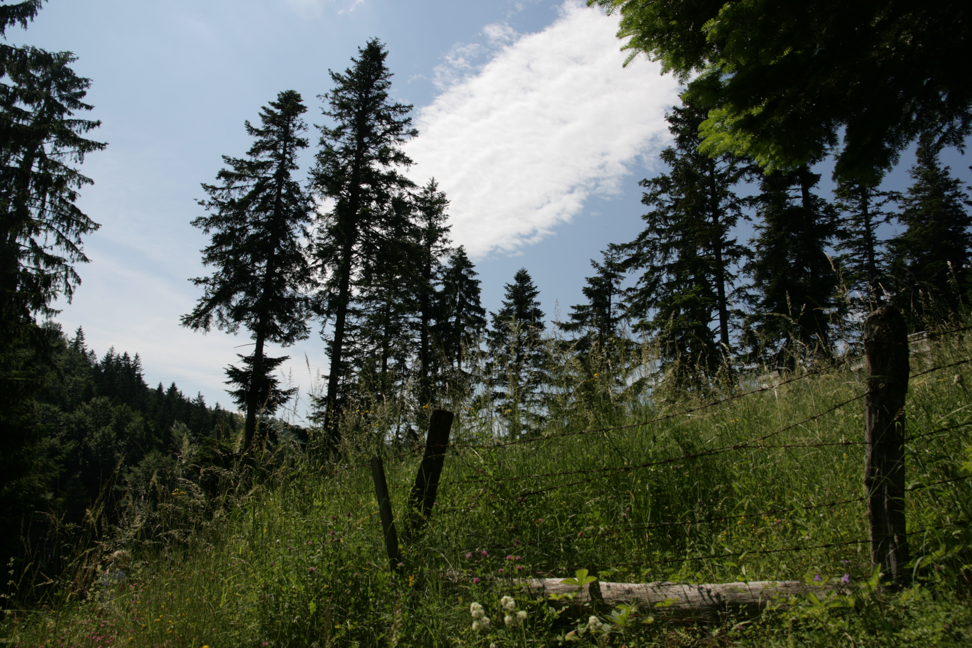
Kopaonik is the largest and the longest mountain range in Serbia located in its central part. It is proclaimed a national park in 1981. The observatory site in Kopaonik is located in strictly protected spruce forest, on the lower distribution of spruce zone on the border zone with beach forest. The mountain is characterized by alternating climate conditions; from warmer sub-mediterranean climate in the lowest part of the mountain to cold subalpine climate in high elevation areas. Vertical profile of the mountain with different climate zones and geological diversity resulted in high habitat diversity. The largest part of the area is covered by climatologically adapted mixed deciduous and coniferous forest having obvious zonal transition. A large number of endemic and relict plant species makes Kopaonik one of the most significant biodiversity centers in Serbia. Main threats to the area besides soil erosion present logging, deforestation and tourism.
-
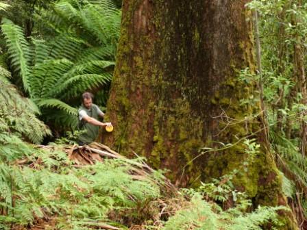
The Victorian Tall Eucalypt Forest Plot Network is located in the Central Highlands of Victoria, Australia and its research infrastructure is comprised of stratified 1-ha long-term plots within 3-ha monitoring sites. Between 2012 and 2018 the Victorian Tall Eucalypt Forest Plot Network was a member of the Long Term Ecological Research Network (LTERN), Australia, a facility of the Australian Government's Terrestrial Ecosystem Research Network (TERN).
-
Network of cold scree slope observation. Cold scree slopes are debris slopes which lower part is overcooled by seasonally alternating air circulations. "Abyssal" ecosystems develop on the cooled part, with dwarf trees, arctic-alpine plant, moss and lichen associations, on moor type humus. These sites show a unique combination of geomorphologically induced microclimate, vegetation, soil and soil microfauna. The network of monitoring sites is distributed over the French Alps and Jura mountains.
-
Installed in 1991, Fundata-beech represents an ICP-Forests level II plot, being selected as core plot in Futmon Project. Main parameters investigated in this plot are: crown condition, air chemistry, biodiversity, terrestrial biomass, soil properties, total nitrogen input, phenology, meteorology. The main research topics are: pollution effects, ecosystem structure, biodiversity driven by land use, biodiversity driven by climate change, forest ecology
-
floral characteristics, dry and wet deposition, health status of trees, soil characteristics, coniferous,
-
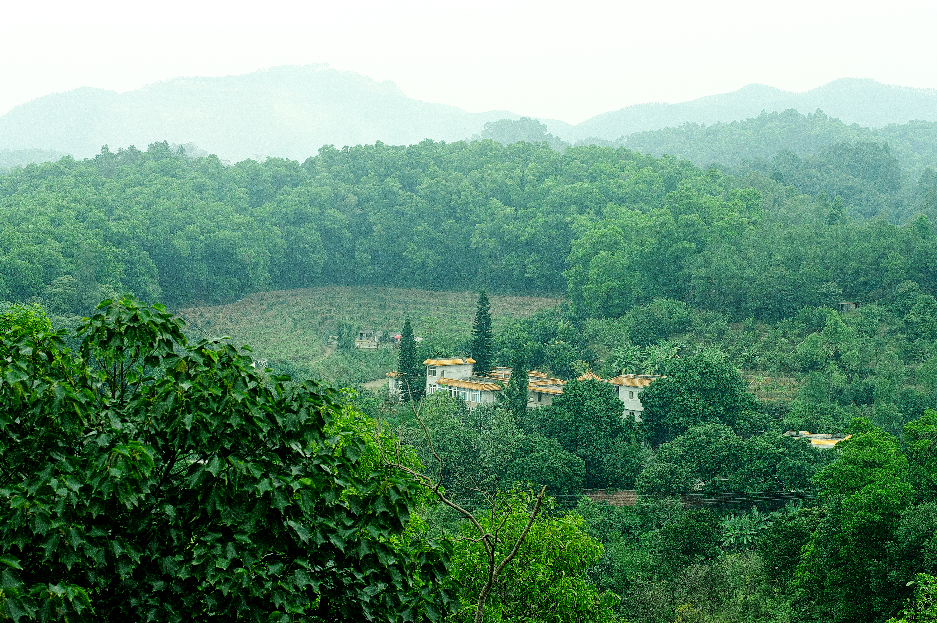
Heshan station (112 °54' E, 22 °41' N) is located in Heshan County, Guangdong Province, China. It is one of the core stations of the Chinese Ecological Research Network (CERN) of the Chinese Academy of Sciences (CAS.). The station was co-established by South China Institute of Botany (Renamed as South China Botanical Garden in 2002), CAS and Heshan Institute of Forest Science in 1984 based on the experience and knowledge of previous studies in a degraded costal ecosystem. Natural Conditions:The station is located in the central part of Guangdong Province with a typical climate of south subtropical monsoon. The soil is laterite. The mean annual temperature is 21.7 C, the mean rainfall is 1700 mm, and the mean evaporation is 1600 mm. The region is a hilly agricultural zone with 78.6% of hilly land, 17.1% of farming land and 4.3% of water body. The zonal vegetation is evergreen broad-leaved forest of typical subtropics. Research Areas:The research areas of the station include but not limited to the followings: 1) Study on canopy water flux of Acacia mangiun forest in the hilly lands of South China by applying sap flow technique; 2) Ecosystem carbon cycling; 3) Conservation genetics of cryptocarya chinensis population in lower subtropical fragmented forest; 4) N2O emission from main types of agricultural and forest lands in tropical and lower subtropical region of China; 5) comparative study on restoration progress between degraded tropical and subtropical ecosystems; 6) effects of landfills on soil biota and water quality; 7) impacts of forest composition on restoration progress; 8) mechanisms of adaptation of invasive species; 9) effects of girdling and defoliation on plant resource use efficiency and soil processes (root exudation, soil respiration and soil biota); 10) confounding effects of manure application on eucalyptus forest and on NEP (Net Ecosystem productivity); 11) nematodes as bio-indicators of different ecosystems.
-
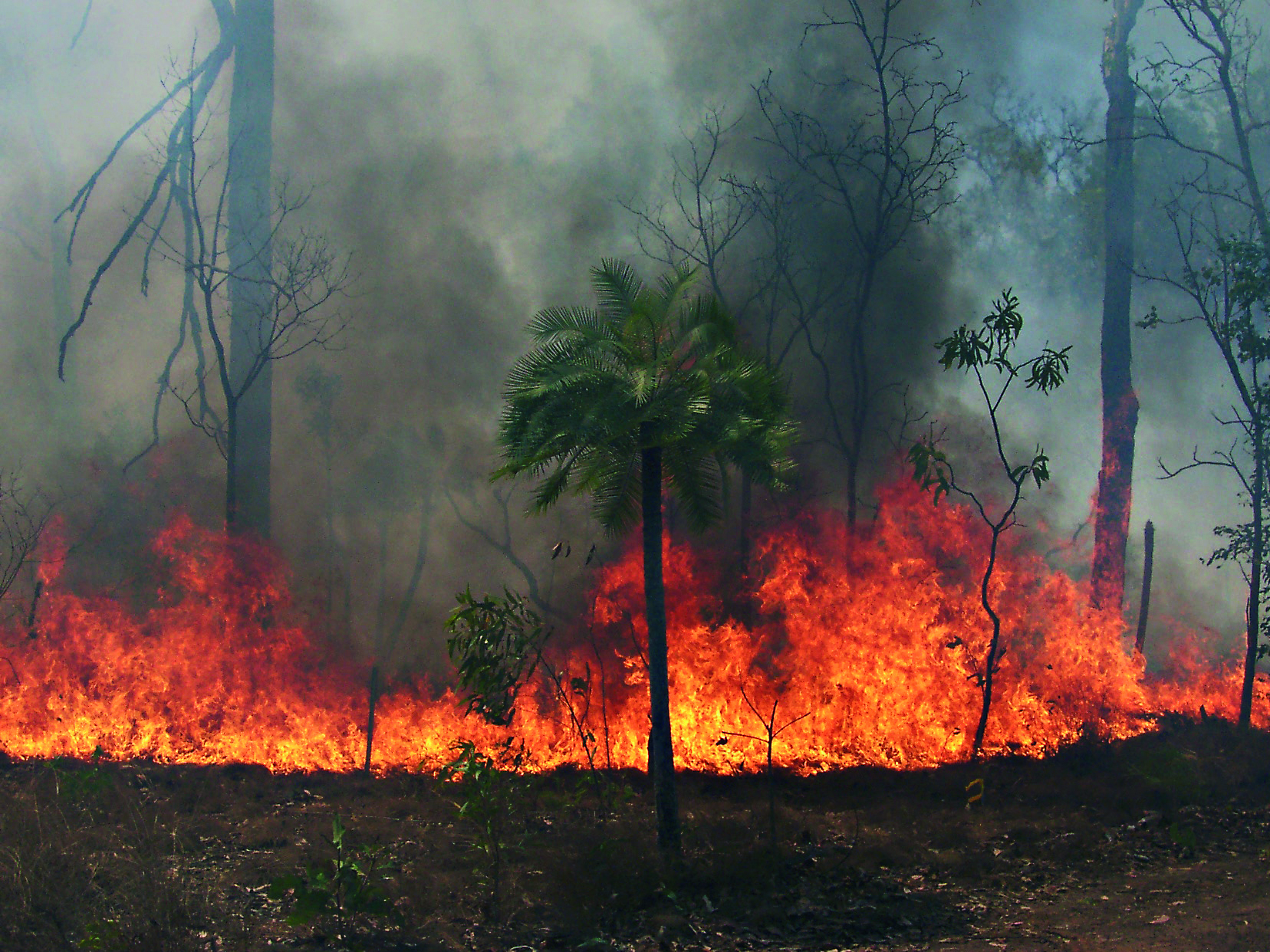
The Three Parks Savanna Fire-Effects Plot Network extends across three national parks (Kakadu, Litchfield and Nitmiluk) in the Top End of the Northern Territory. The fire monitoring program comprises two complementary components: satellite based mapping of fire events and on-ground assessment of change in biota at a set of permanent plots. Temporal visits are as follows: • 6 months (fire occurrence), • 4 months (fire mapping), • 5 years (vegetation), • opportunistic (fauna). Between 2012 and 2018 the Three Parks Savanna Fire-Effects Plot Network was a member of Long Term Ecological Research Network (LTERN), Australia, a facility of the Australian Government's Terrestrial Ecosystem Research Network (TERN).