
tree distribution
Type of resources
Available actions
Topics
Keywords
Contact for the resource
Provided by
Years
Formats
Representation types
-
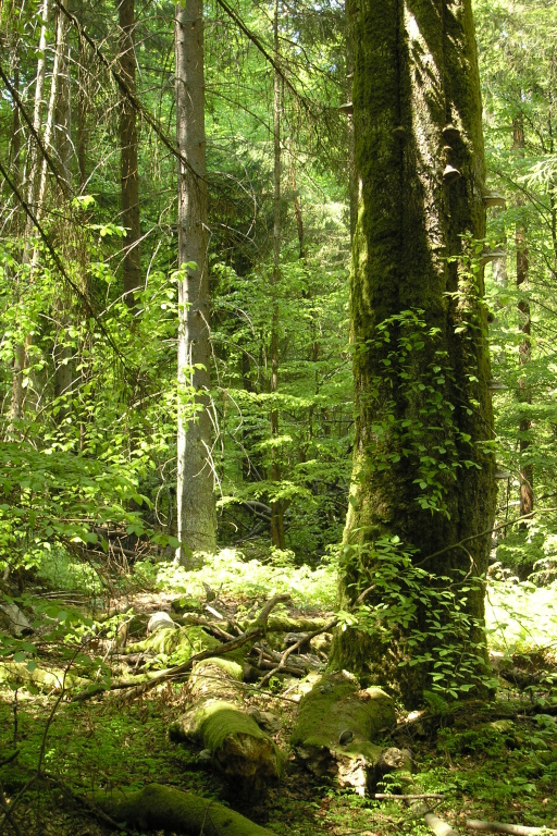
Nearly one hundred hectares of natural spruce-fir-beech forests have survived in the former Nové Hrady domain, owing to the enlightened owner count Buquoy, who founded here the Czech oldest natural forest reserves as early as in 1838. Similarly to the Bohemian Forest (Šumava in Czech), human colonization came to remote forests of the Novohradské Mts. as late as in the 15th century and, during the 18th century, abundant glassworks caused the most intensive pressure on the forests. For centuries, ship builders visited the utmost mountains’ corners to find tall and straight fir stems suitable for ship masts. Both Žofín and Hojná Voda were declared as reserves at the same time in 1838, yet timber had been taken from these sites even in the half of the 19th century. Both sites have been left to spontaneous development since the 1880s. Remarkable disturbance in the natural forests became in January 2007 when the hurricane Kyrill blew over. Substantial southern and south-western parts of the Žofín natural forest got down. Now we can study large-disturbance dynamics, the potential of bark beetle resistance in mixed forest, and many other unanswered questions.
-
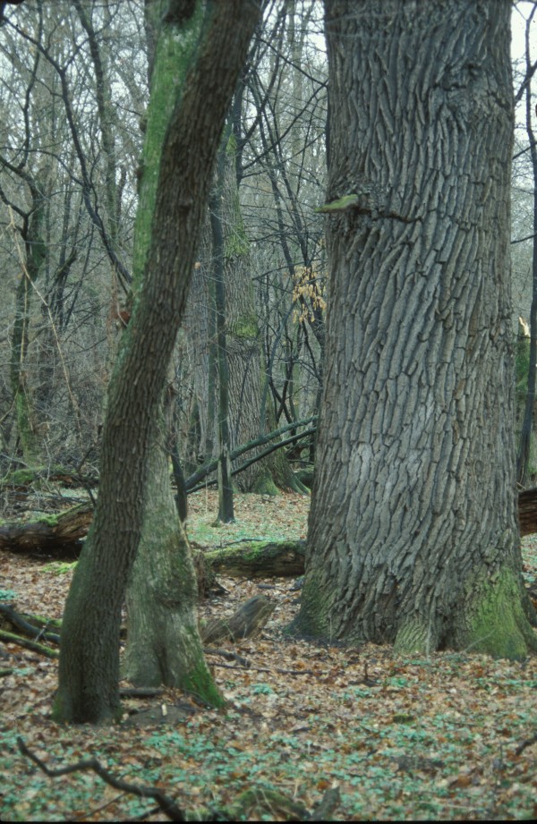
The central Europe’s largest complex of floodplain forest covers an area between the Morava River and Dyje River upstream their confluence. Permanent high water table and (more or less) periodical floods on either river have determined this phenomenon. As the Morava River was channelized and the Dyje River was dammed (the Nové Mlýny reservoirs), common floods have been replaced with the simulated flood regime right on the Dyje River. The LTER sites Ranšpurk and Cahnov–Soutok represent hardwood alluvial floodplain forest. European hornbeam, ash, and field maple have substituted formerly dominant species – pedunculate oak and smooth elm. As the oaks formed the grazed forest framework, their recent generation has spent the rest of their lives. Both sites have been left to spontaneous development since 1932. Because the plots, situated inside of a deer and fallow deer game-park, offered quiet spot for game stalls and natural regeneration became absolutely blocked, the reserves have been fenced.
-
Localities Boubín and Milešice represent particularly Acidic and Fresh nutrient medium spruce-beech forests. These forest stand types are very important in the scope of both area and wood-producting stands of the Czech Republic. Especially the Boubín (Kubani) natural forest represents a very valuable and felling aloof forest stand. It was just founded as a forest research reserve. Owing to the verderer Josef John, who processed the first detailed dendrometry in the Boubín natural forest in 1847, we have got unique data sets for the time series of over 160 years. The hurricane Emma blew over the sites in March 2008 and left notable traces behind reserves' current states. The wind did not inflict large disturbances – it broke forest stands into pieces with various intensity. Both sites are fenced – especially Milešice, the site located inside a game-park, had to be necessarily protected against the deer game pressure. The Stožec-Medvědice natural forest brings a view on mountain talus forest with principal tree species sycamore maple, spruce, and elm.
-
Three natural forest reserves – Mionší, Razula, and Salajka – represent current Carpathian fir-beech forests. They were historically influenced by a Walachian colonization that came to the Beskydy Mts. from south and affected forests by sheep grazing, litter raking, and gathering beech firewood. Although excess felling was not realized in these natural forests, species structure was affected in favour of fir during modern times. Since the 1930s, all three LTER sites have been left to spontaneous development. Beech has returned as the main species of these stands. Exceeding numbers of deer game populations, which represent main indirect human influence in these reserves, block growing out of fir seedlings considerably. Various ways of seedling protection are tested inside the sites; however, no selective interventions on advanced growth are practiced. Indispensable positive influence should play a gradual return of natural predators of deer game (lynx, wolf, and also bear) into the western Carpathians.
-
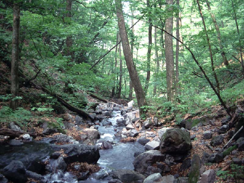
Riparian forest in cool-temparate zone.The study site (35°57'30"N, 138°45'32"E) is located in a riparian zone along a small stream (Ooyamazawa) of the Nakatsugawa branch of the Arakawa River, in Chichibu Mountains, central Japan. This site is located in the protected Chichibu-Tama National Park and ranged from 1210-1530 m above sea level. This riparian forest in this area phytosociologically belongs to the Chrysosplenio-Fraxinetum spaethianae, a typical riparian forest. Dominant canopy species in this area are Fraxinus platypoda, Pterocarya rhoifolia and Cercidiphyllum japonicum over 30 m in tree height. The subcanopy specie are Acer shirasawanum and Acer mono, and the understory is primarily composed of Acer carpinifolium and Acer argutum. The area around the study plot is no human disturbances such as logging or erosion control works. This study site is a part of the Monitoring Sites 1000 Project launched by the Ministry of the Environment, Japan, and also is one of a Japan Long-Term Ecological Research (JaLTER) Sites.
-
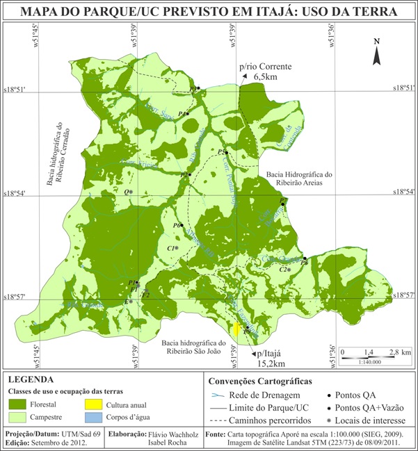
The PELD Jataí site is located in Atlantic Forest remnants in the southern state of Goiás, Brazilian central plateau. Covering about 20,000 hectares of not continuous forests, distributed among the geographic coordinates 18o 55'S and 51o 42'W, with altitudes ranging from 520 to 650 m. The fragments are mostly immersed for pasture matrix. The climate is classified as Aw, tropical savanna, with marked seasonality, rain in summer and dry in winter, typically found in the Brazilian Cerrado. December and January are the months with the highest frequency of rainfall, and June to August there is less rainfall intensities. The annual average rainfall is 1650 mm. The site consists of different forest vegetation types in good conservation status, as woody savanna, deciduous and semideciduous forests; flooded and non-flooded gallery forests and riparian forests along the Rio Corrente, a tributary of the Rio Paranaiba. There are also small fragments of cerrado stricto sensu.
-
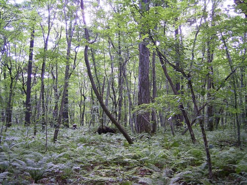
Tomakomai Research Site is located in a national forest in the city of Tomakomai, Hokkaido. It is part of the national forest compartment 1205, forest group, which is managed by the Eastern Iburi District Forest Office of the Hokkaido Forest Office. The Tomakomai Research Site is a mixed broad-leaved and conifer-leaved forest that consists of Picea jezoensis (Sieb. et Zucc.) Carr. mixed in with cool temperate broad-leaved trees such as Acer mono, Prunus ssiori Fr. Schm., and Cercidiphyllum japonicum Sieb. et Zucc. The volcanic plain outside the City of Tomakomai contains soils that have been disturbed primarily by the eruption of Mt. Tarumae. Around that are expansive man-made forests of Larix kaempferi (Lamb.) Carr., Abies sachalinensis, etc., but there is no record that the 43 ha forest group which contains the research site has been cut. From summer to autumn, the forest floor is covered with Dryopteris crassirhizoma Nakai, with scattered patches of Sasa senanensis (Franch. et Savat.) Rehd. This research is maintained jointly by the Hokkaido Research Center of the FFPRI and the Graduate School of Environmental Earth Science of Hokkaido University.
-
GIS layer - map of forest types. Forest typology based on abiotic habitat parameters such as soil fertility and moisture, widely used by the forestry sector. Also available are thematic GIS layers showing historic forest and forestry data, as well as more current data on forest management (incl. timber harvesting) and such parameters as dominant species: height, age, trunk circumference (standard breast level measurement), proportion of coverage, etc.
-
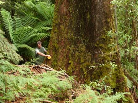
The Victorian Tall Eucalypt Forest Plot Network is located in the Central Highlands of Victoria, Australia and its research infrastructure is comprised of stratified 1-ha long-term plots within 3-ha monitoring sites. Between 2012 and 2018 the Victorian Tall Eucalypt Forest Plot Network was a member of the Long Term Ecological Research Network (LTERN), Australia, a facility of the Australian Government's Terrestrial Ecosystem Research Network (TERN).
-
The mature and old-growth forests dominated by Quercus serrata, Fagus Japonica, F. crenata and other species. In total, more than 60 tree species are found in the 6-ha plot.