
vapor pressure deficit
Type of resources
Available actions
Topics
Keywords
Contact for the resource
Provided by
Years
Formats
Representation types
-
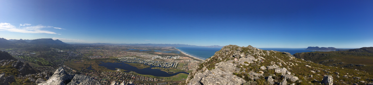
The Table Mountain Chain comprises a network of public and private land within the Cape Peninsula. The land area is approximately 340 km2 and the marine component is approximately 980 km2. The coastline is approximately 130 km. The land area is surrounded by the intensive agriculture and urban development of the City of Cape Town. Because of the proximity of the city the area has a long history of research carried out by universities, research institutions and nature conservation agencies.
-
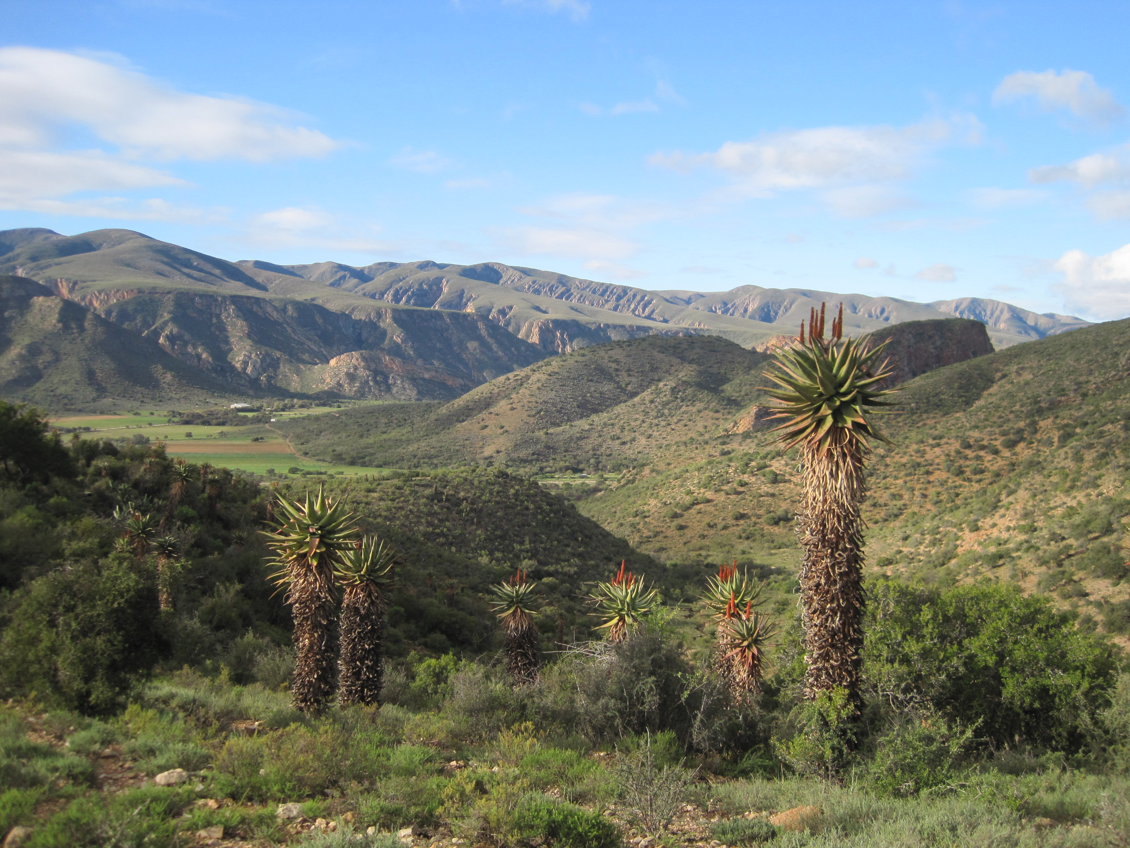
This site covers the catchment area of the Baviaanskloof River and surrounding Baviaanskloof Mega-Reserve area, where ecological, agricultural and social systems are managed collaboratively in order to promote sustainable use of the landscape.
-
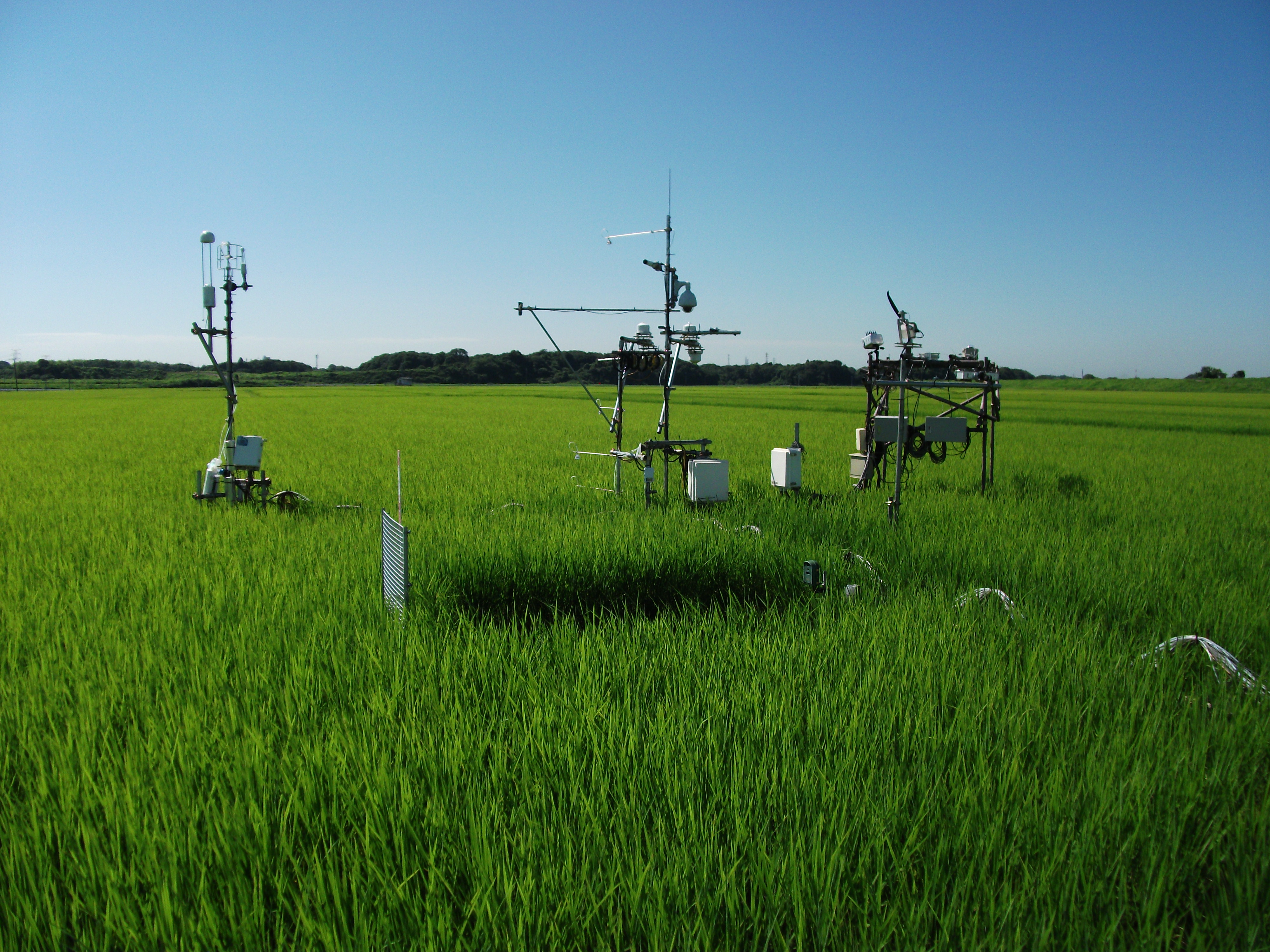
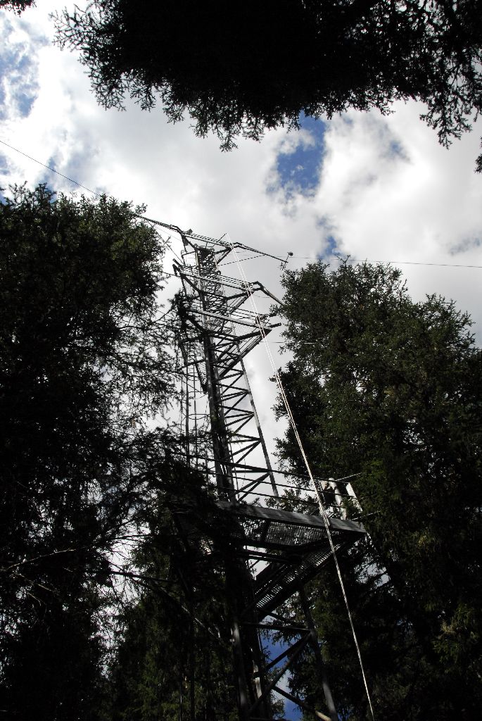
The Mase rice paddy site is a flux station in the AsiaFlux micrometeorological tower network. Located in a regularly cultivated rice paddy area of the Kanto plain in Japan, the site was established in 1999. The initial motivation was to quantify the energy and carbon balance in the rice paddy (ca, 54 a) where the tower was situated. Because of the accessibility and line-power availability, the site has involved many researchers and students from universities and institutes, broadening its target to studies on satellite and field remote sensing, ecosystem modelling, and nutrient cycling.
-
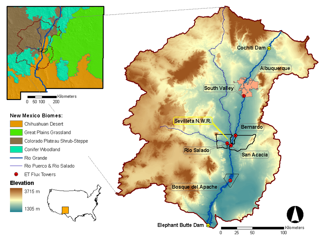
Desert grassland, shrubland, woodland, forest and riparian habitats in central New Mexico, USA
-
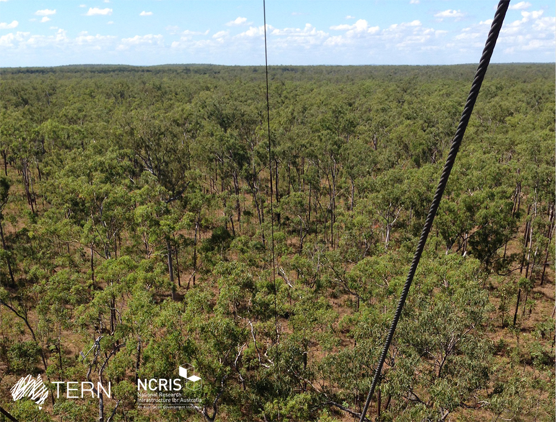
The Litchfield Savanna SuperSite is a member of the Australian SuperSite Network (SuperSites, http://www.supersites.net.au/), a facility within the Australian Terrestrial Ecosystem Network (TERN, http://www.tern.org.au/). The Litchfield Savanna SuperSite represents high rainfall, frequently burnt, tropical savanna. At 1.9 million km2, tropical savanna is the dominant ecosystem type across northern Australia. Understanding biogeochemical cycles, impacts of fire on sequestration, vegetation and fauna is a national priority. The site is a 5 km x 5 km block of relatively uniform open-forest savanna inside the park, and about 80 km south of Darwin. The infrastructure will help scientists understand the dynamics of vegetation structure and floristics by linking field observations with infrastructure measuring fluxes of carbon, water and energy. The fluxes will be linked to remotely sensed observations of vegetation cover and leaf area taken from the ground, aircraft and space. Key research objectives include: • What are the impacts of prevailing fire regimes (primarily frequency, but also intensity, extent, heterogeneity) on vegetation structure and composition, habitat quality, fragmentation and vertebrate faunal biodiversity? • How does vegetation structure, climate drivers and fire regime influence savanna carbon sequestration rate? • How can fire management contribute to greenhouse gas abatement and carbon sequestration in savanna ecosystems? • What are the impacts of climate change on fire regimes and subsequent feedbacks to savanna carbon and water cycles? Litchfield National Park encompasses the traditional boundaries of 4 Aboriginal language groups: Werat, Koongurrukun, Waray and Mak Mak Marranunggu
-
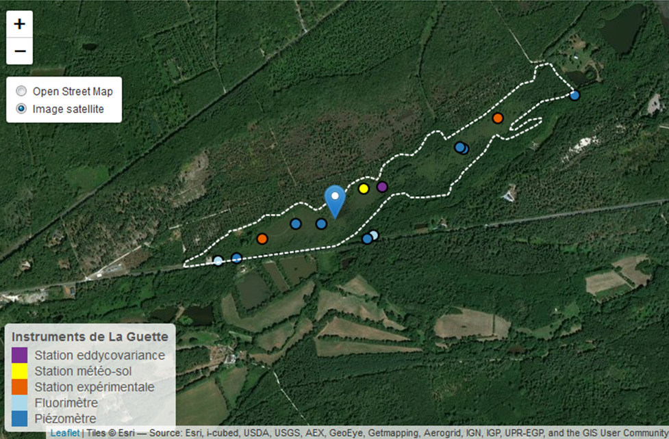
This is a peatland located in Sologne, 80 km south of Orléans. La Guette peatland is one of the four sites of the SNO Tourbières (CNRS). All the sites of the SNO Tourbières are part of OZCAR (French Observatory on the critical zone). The site was hydrologicaly disturbed. Restoration works took place in 2014. A labeling procedure has began to become associated site of ICOS.
-
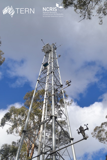
The Victorian Dry Eucalypt SuperSite is a member of the Australian SuperSite Network (SuperSites, http://www.supersites.net.au/), a facility within the Australian Terrestrial Ecosystem Network (TERN, http://www.tern.org.au/) and has two nodes (Whroo and Wombat). The Victorian Dry Eucalypt SuperSite - Whroo site near Shepparton was established in 2011. The vegetation is dominated by two main Eucalypt species: Eucalyptus microcarpa (Grey Box) and Eucalyptus leucoxylon (Yellow Gum). Smaller numbers of Eucalyptus sideroxylon (Ironbark) and Acacia pycnantha (Golden Wattle) are also found on site. The surrounding area includes the Whroo Historical area, and Rushworth State containing remnant native vegetation. Key research objectives include: • What are the elements of structure, composition, functions and processes of the dry eucalypt forests of South Eastern Australia required for the sustainable management of these ecosystems? • What is the carbon sink/source strength of a dry sclerophyll forest and what is their contribution to Australia’s National Carbon Inventory? • What is the magnitude of emission and/or uptake of non-CO2 greenhouse gases, such as nitrous oxide and methane of dry eucalypt forest? • How will climate variability, drought or fire influence the ecosystem processes of dry eucalypt forest? . The site is on the lands of the Ngurai-illam-wurrung Aboriginal people.
-
Síkfőkút LTER Europe site is a temperate deciduous forest site, unmanaged since the late 1960ies. It is situated in the Szőllőcske forest reserve area on the southern foothills of Bükk Mountains, NE Hungary. The site is covered by a mature coppice oak forest (105 years old) with Q. petraea and Q. cerris in the upper canopy layer and other woody species occurring in the secondary canopy layer and shrub layers (Acer sp., Cornus sp, Euonymus sp., Crataegus sp.) The site was seriously impacted by oak decline during 1980ies. The soil has been classified as a brown forest soil type according to the Hungarian Soil Classification System which corresponds to Luvisol according to FAO WRB. Long-term data are available on climate, soil variables and forest structural and functional characteristics (for period 1973-2016).
-
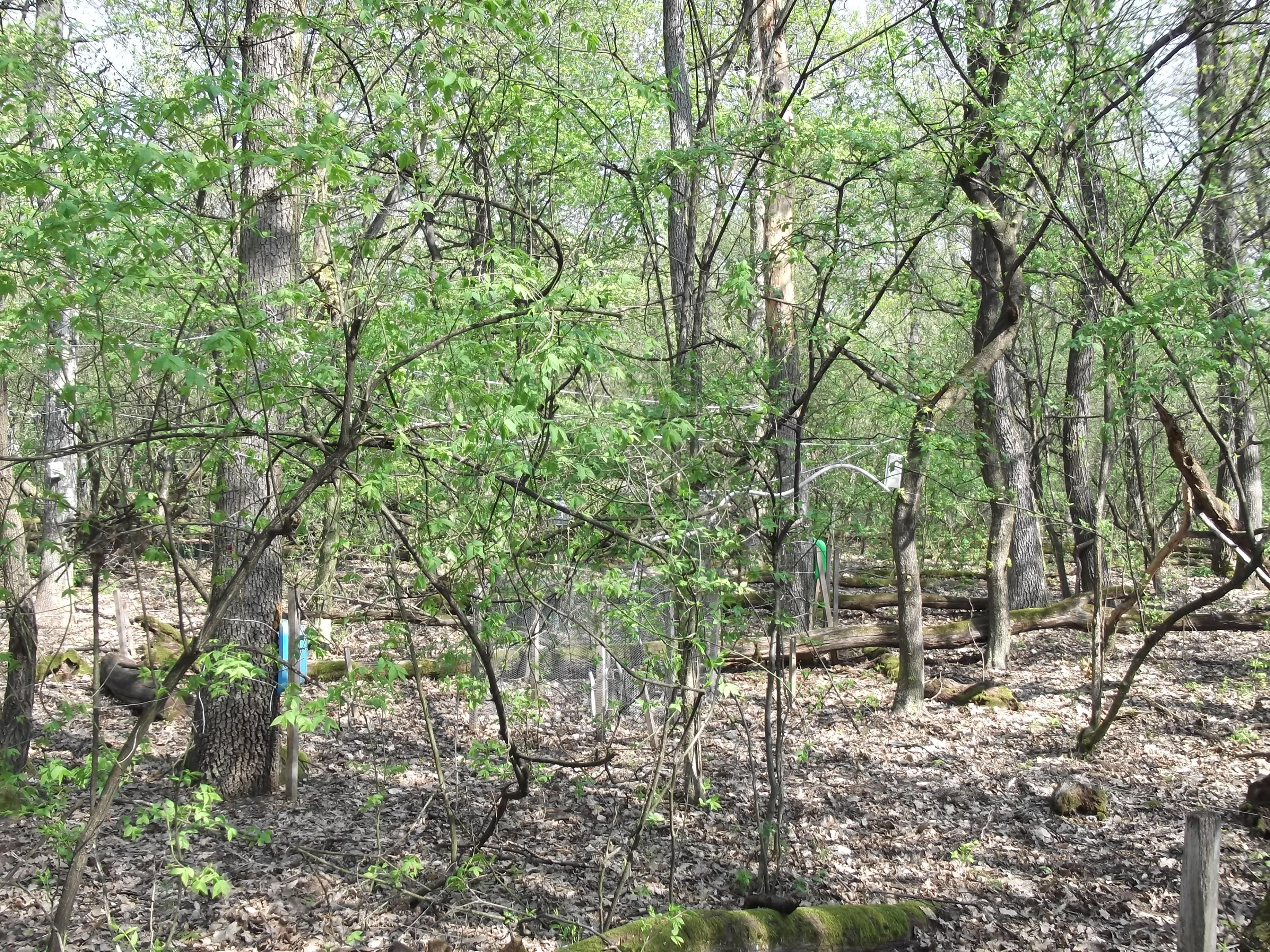
The LWF research programme provides, on the one hand, long-term data series from the last 20 years, together with a scientific interpretation to national and international policy makers. On the other hand, the available data and latest LWF infrastructure provide an attractive scientific platform for collaboration with both national and international partners. The site is located close to the city of Davos in the canton of Graubuenden, within a natural, coniferous forest stand which mainly consists of 200-390 year-old spruce (Picea abies) trees. Among others, the site is equipped with two meteorological measurement stations; one is located within the forest stand, the second is co-located in the nearby open-field, allowing to measure the forest stand effect on micro-climate. The following parameters are being measured (starting-end year): Atmospheric deposition (throughfall and bulk deposition) (2009-today), Circular vegetation plots (2008-today), Crown Condition Assessment (2006-today), Diameter and Height measurements (2004-today), EC-5 soil water content measurement (2008-today), EC-5 soil water content measurement (2008-today), Foliar analyses (2007-today), Leaf area index (LAI) (2008-today), Litterfall (2009-today), Manual circumference band measurement (2006-today), Matric potential (manual suction cups) (2009-today), O3 Injuries (2009-today), Ozone visible injury assessment (2009-today), Permanent vegetation quadrats (2008-today), Phenological observations (2009-today), Sapflow measurements (1998-today), Soil matrix chemistry (2007-today), Soil solution chemistry (lysimeters) (2010-today), Tree core sampling (), automated point dendrometer measurements (1998-today), automatic circumference band measurement (2006-today), Deadwood sampling (2009-today).
-
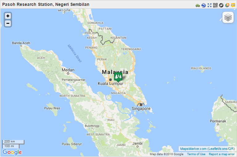
From 1970 to 1974, the Pasoh FRIM Research Station (Pasoh FRS) has been a site for intensive research of lowland rain forest ecology and dynamics under a joint research project between University of Malaya and the International Biological Programme (IBM). Pasoh forest was also the main study site for the Reproductive Biology of Forest Trees Project, a joint research project between University of Aberdeen and University of Malaya from 1974 to 1978. Since then, various research projects on biodiversity, forest productivity, flora, fauna, micrometeorology, soils, hydrology and nutrient cycling were conducted in collaboration with local universities.. In December 1977, Forest Research Institute Malaysia (FRIM) took over the management of the research station from University of Malaya. This was made possible through the collaboration with the Negeri Sembilan State Forestry Department. The Pasoh forest station has since become a leading tropical forest field research station. This could not have been possible without the commitment from the state forestry department to gazette 1,840 ha of the Pasoh reserve as a Research Forest. All research activities are monitored by the Pasoh Research Committee (PRC) in FRIM since 1999. The Director of the Negeri Sembilan Forestry Department is also a Committee member. The main attraction of the Pasoh Reserve is its floristically rich forest. A total of 335,256 stems 1 cm dbh (diameter at breast height) and above belonging to 814 species, 294 genera and 78 families has been recorded within an area of 50 ha. The most common plant families are the Euphorbiaceae and Annonaceae among the smaller trees, and the Dipterocarpaceae, Leguminosae and Burseraceae. The most common species is Xerospermum noronhianum (Sapindaceae) locally known as ‘rambutan pacat,/em>’, which accounts for 2.5% of the total number of plants. For trees above 30 cm dbh, the most abundant species is Shorea leprosula (meranti tembaga), a member of the Diptrerocarpaceae family. Being an isolated forest surrounded by oil palm estates and other land uses, forest gaps, formed by windthrow of a large tree or a group of trees, are a fairly common feature at Pasoh. Within these gaps, one can find many regenerating seedlings and saplings. Although Pasoh lacks charismatic animals such as tigers and elephants, it still harbours a good composition of small mammals, primates and birds Today Pasoh is not only the site of many research studies by both local scientists and scientists from abroad but is also an educational centre for school children, college and university students as well as the general public.