
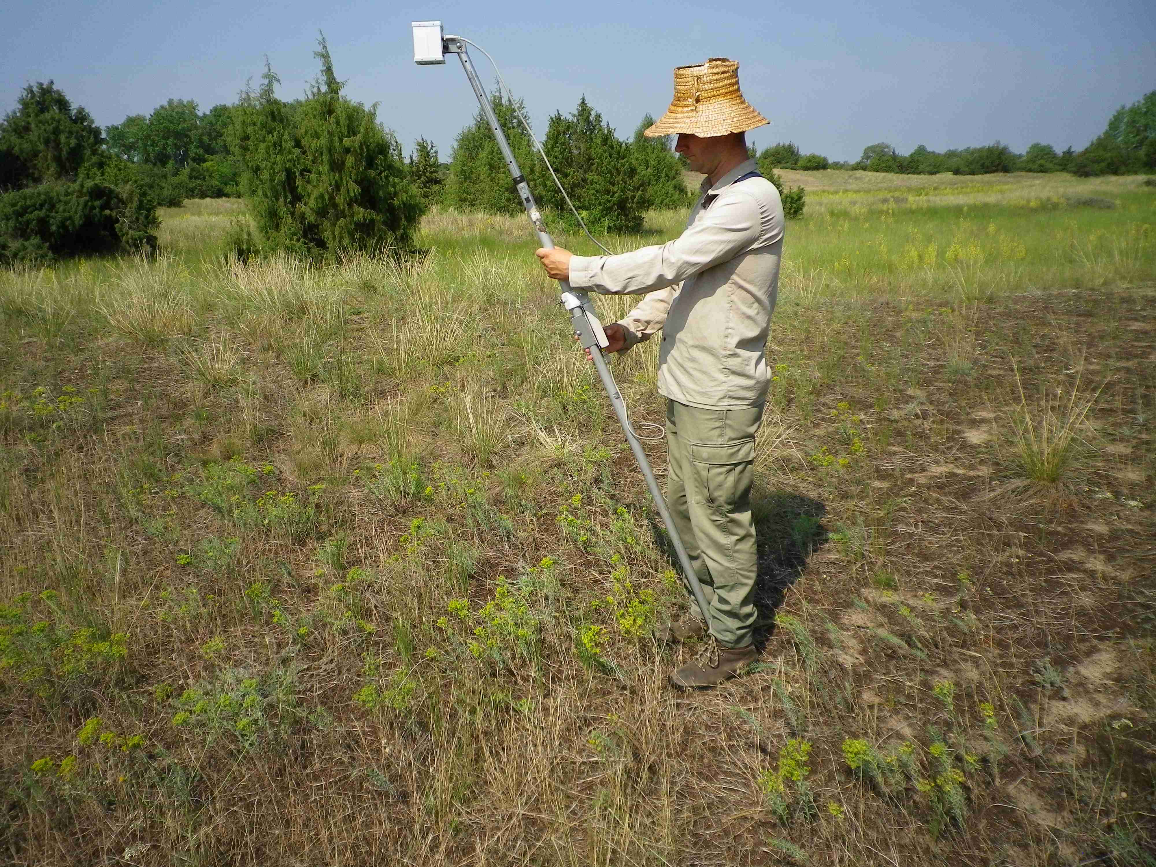
vegetation reflectance
Type of resources
Available actions
Topics
Keywords
Contact for the resource
Provided by
Years
Formats
Representation types
-
The Upland Heath Swamps Plot Network is located in the Dharawal National Park, near Sydney, NSW. Sampling of vegetation is stratified along the soil moisture gradient and across the range of structural variability in the vegetation. Thus, three categories of soil moisture and three categories of vegetation structure (based on the height and form of shrubs) are sampled in a factorial design at 60 sites in upland swamps scattered throughout the study area (Keith & Myerscough 1993). Temporal visits are conducted every 5 years or when fires occur. Between 2012 and 2018 the Upland Heath Swamps Plot Network was a member of Long Term Ecological Research Network (LTERN), Australia, a facility of the Australian Government's Terrestrial Ecosystem Research Network (TERN).
-
Orgovany-Agasegyhaza site for studying production-diversity relations and weather effect of productivity.
-
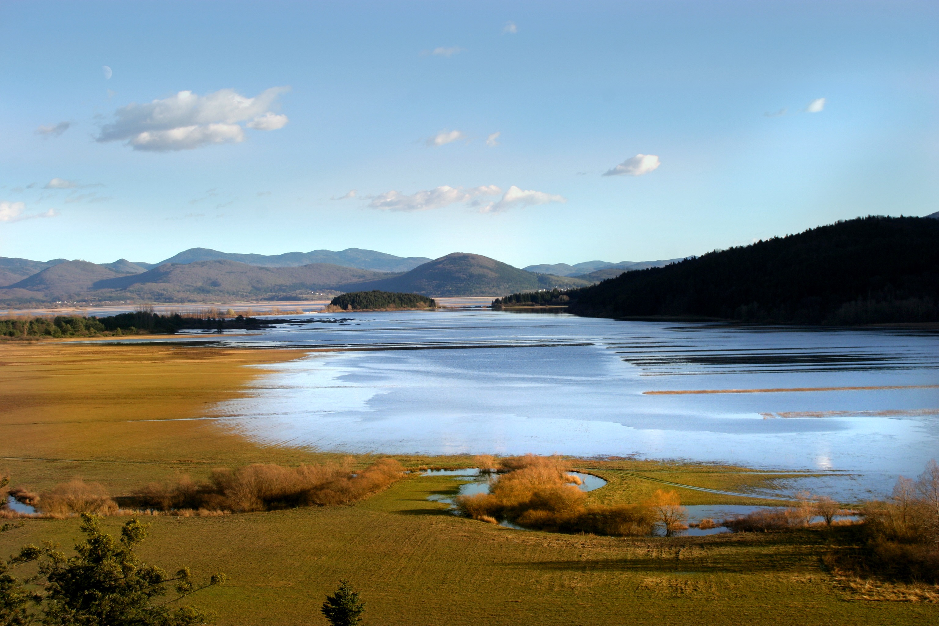
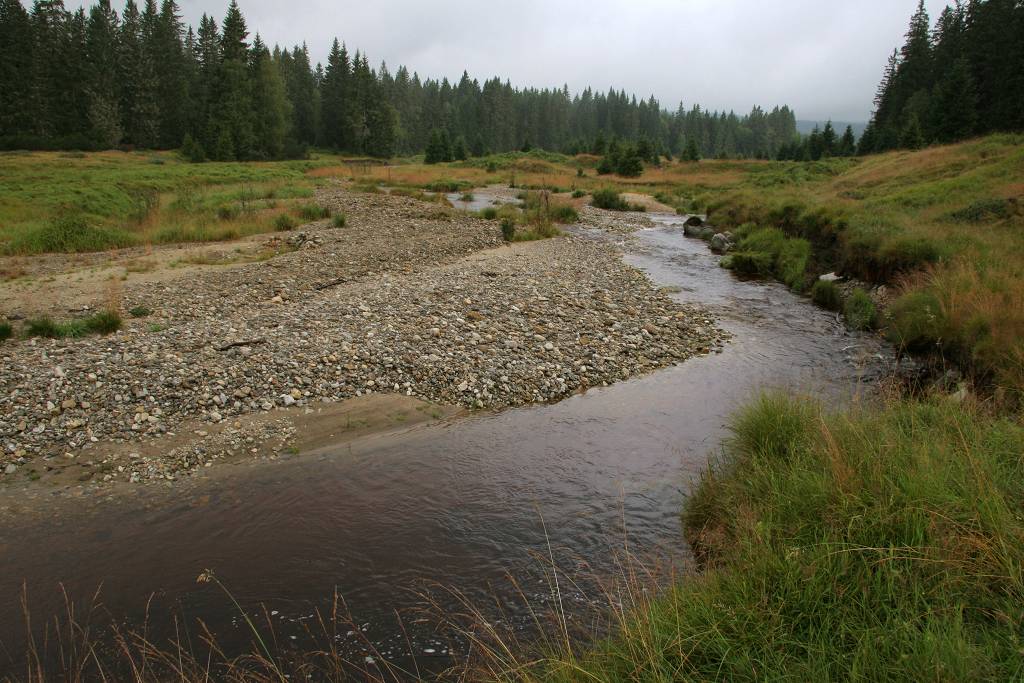
Lake Cerknica is intermittent lake appearing at the bottom of closed depression Cerkniško polje extending on the area of 38 km2. The karst features are associated with carbonate rock, both with limestone and dolomite. About 80 % of inflow consists of karst and only 15% of surface waters. The outflow is completely karstic. In spring and usually late in autumn the lake reaches normal level 550 m a.s.l., covering the area of 26 km2. Polje is flooded for 9 and dry for about 2 months, usually in summer. Lake Cerknica is a highly diverse ecosystem that changes in time and space. Vegetation pattern shows clear zonal distribution that depends on extent and frequency of flooding. The lake supports rich fauna with many endangered species, providing temporary shelters and food for protected large carnivores, such as brown bear, wolf, lynx and numerous species of water birds. In recent decades, flood and drought events have become increasingly irregular altering processes and conditions for many species.
-
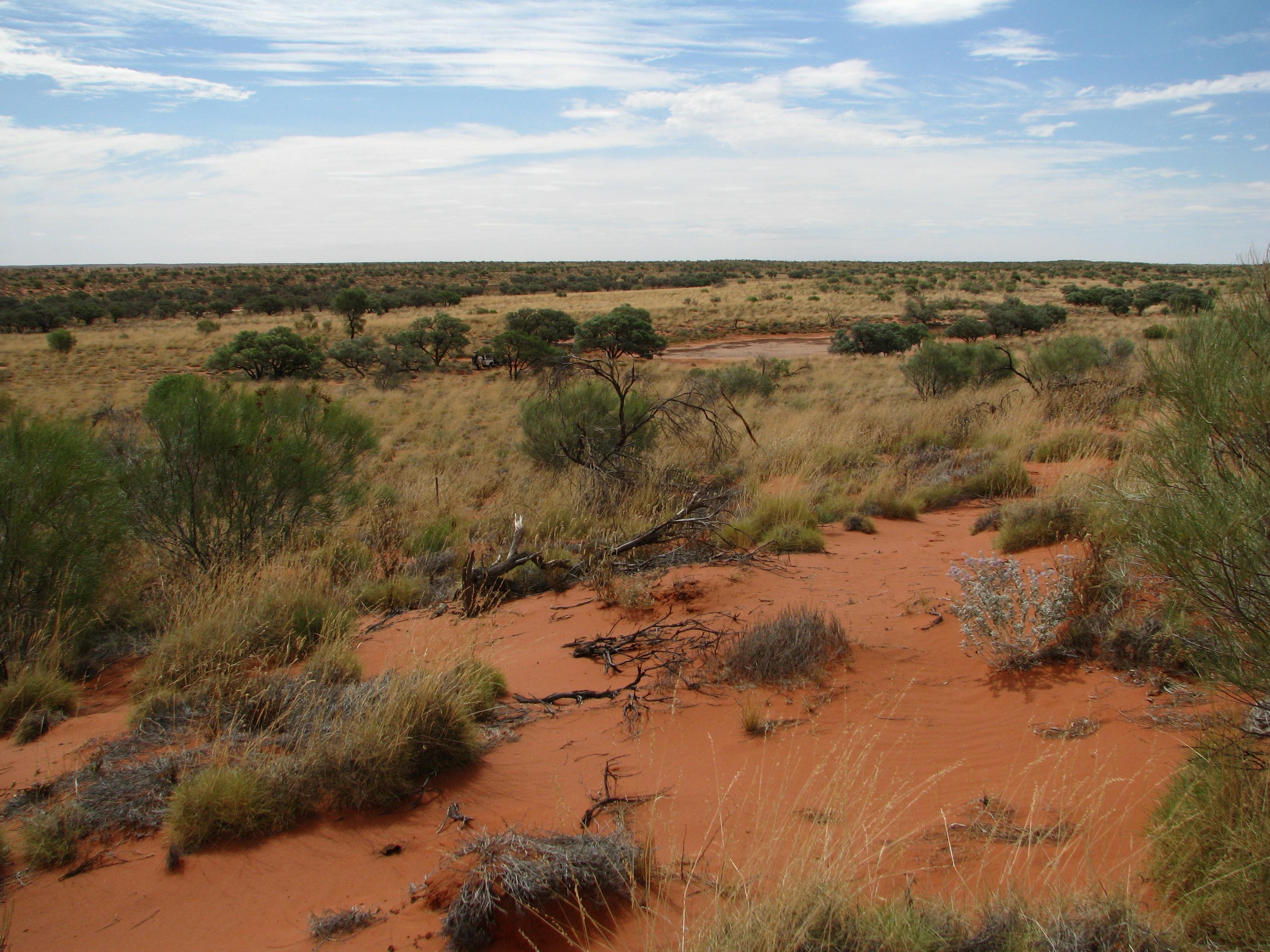
The Desert Ecology Plot Network is located in the Simpson Desert in central Australia. The vegetation in the study region is dominated by hard spinifex (Triodia basedowii E. Pritz), with scattered small woodlands of Georgina gidgee (Acacia georginae F.M. Bailey) interspersed throughout (Figure 9.1). The long-term plots for which data are provided as part of LTERN infrastructure are all located within the spinifex hummock grasslands, but additional survey plots, situated in gidgee woodlands, exist and have been surveyed since 2006 and are revisited whenever possible. Temporal visits are conducted annually. The Desert Ecology Plot Network was a member of Long Term Ecological Research Network (LTERN), Australia, a facility of the Australian Government's Terrestrial Ecosystem Research Network (TERN).
-
The Kellogg Biological Station (KBS) is located in southwest Michigan in the eastern portion of the U.S. cornbelt, 50 km east of Lake Michigan in the SW corner of the state (42° 24′ N, 85° 24′ W, elevation 288 m). Annual rainfall at KBS averages 1,005 mm/y with about half falling as snow; potential evapotranspiration (PET) exceeds precipitation for about 4 months of the year. Mean annual temperature is 10.1 °C. KBS is 1600 ha of cropping systems, successional communities, and small lakes. Surrounding KBS is a diverse, rural-to-semirural landscape typical of the U.S. Great Lakes and upper Midwest regions. The diversity of land use, soil and vegetation types, and aquatic habitats within a 50-km radius of the Station is high. Most of southwest Michigan is on the pitted outwash plain of the morainic system left by the last retreat of the Wisconsin glaciation, circa 12,000 years ago. Soils in the area developed on glacial till, and include well- and poorly-drained alfisols, mollisols, and entisols. Most regional soils are sandy loam and silty clay loam of moderate fertility, principal Station soils are Typic Hapludalfs. Land use around KBS ranges from urban (Kalamazoo, with a metropolitan population of 180,000, is 20 km south of the Station) to rural; vegetation ranges from cultivated and early successional old fields to older growth oak-hickory and beech-maple forests; and aquatic habitats include more than 200 bodies of water of different morphometries, alkalinities, and degrees of eutrophication within 50 km. Cropping systems in the area are typical of the U.S. cornbelt — mainly corn/soybean rotations with wheat of varying importance, and alfalfa an important forage crop. KBS yields are typical of non-irrigated yields elsewhere in the North Central Region. KBS LTER research is carried out in a variety of experimental systems. The most important of these is the Main Cropping System Experiment (MCSE), which was started in 1989 and consists of 11 different cropping systems or successional plant communities, ranging from annual corn-soybean-wheat rotations to late-successional deciduous forest. All communities are replicated within the landscape.
-
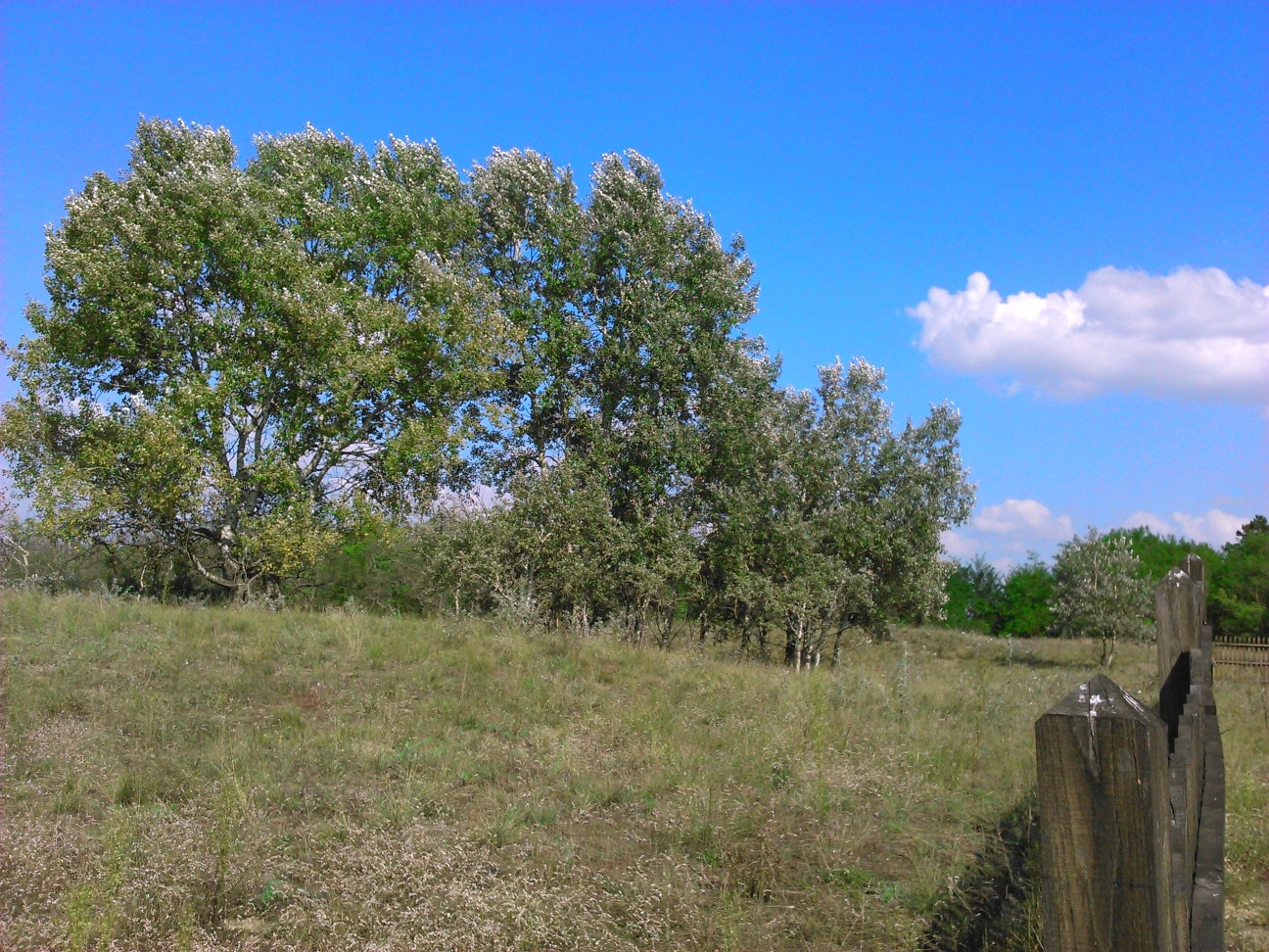
LTER Fulophaza is a high diversity site, both in terms of habitats and species, in the Kiskunság Sand Ridge. It harbors some of the central facilities of the KISKUN LTER, such as the meteorological station and the field research station with accommodation opportunities, as well as highly equipped experimental sites, and a couple of long term monitoring sites and field experiments.
-
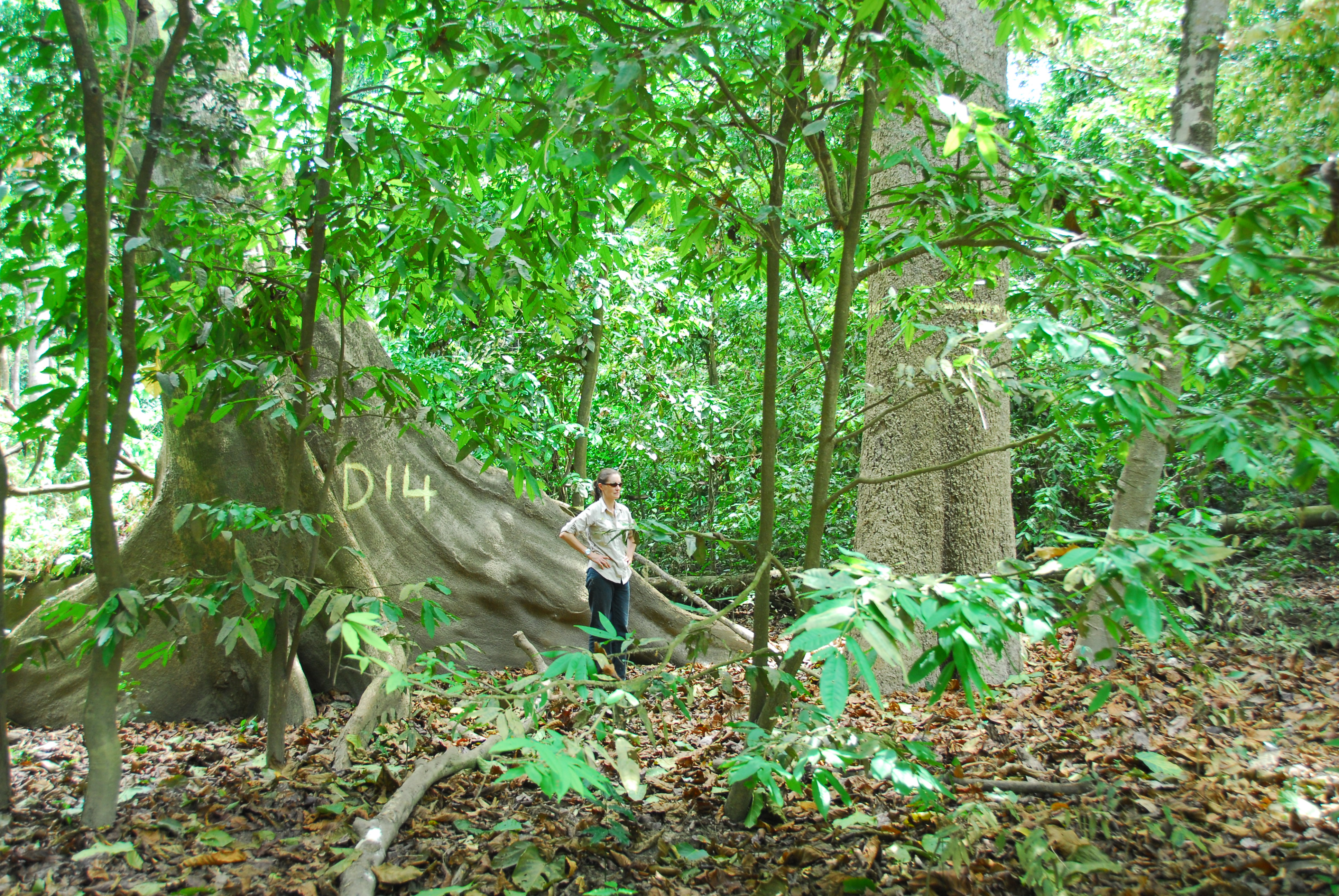
The Connell Rainforest Plot Network is a member of Long Term Ecological Research Network (LTERN), Australia (http://www.ltern.org.au), a facility of the Australian Government's Terrestrial Ecosystem Research Network (TERN), (http://www.tern.org.au). The long-term forest dynamics plot at O'Reilly's is located in the subtropical rainforest near O’Reilly’s Guest House in Lamington National Park, 65 km south of Brisbane. It consists of two 1-ha plots spaced approximately 600 m apart, but for analyses they have always been treated as a single unit. This plot has never been logged, but some selective logging has occurred just outside the plot boundary. Temporal visits occur between 1 to 6 years.
-
The Šumava Biosphere Reserve, which includes the Šumava National Park, was established as a Czech LTSER platform in 2008. Its territory covers most of the Czech part of the Bohemian Forest (Šumava in Czech, Böhmerwald in German) along the historical border of Bohemia with Bavaria (Germany) and Austria. The Bohemian Forest creates the most extensive forest landscape in Central Europe, where primeval mountain forest remnants, glacial lakes, peat bogs, and mountain secondary grasslands are home to various communities of vegetation and animal species. The centre of this region is preserved as the Šumava National Park (680 km2). Human colonisation and exploitation of the Bohemian Forest has a long history accelerated during the Middle Age and caused gradual changes in land use. Deforestation and agriculture as well as local population peaked before the beginning of the last century (before the World War I), while after the World War II came to a significant reduction of the settlement. In consequence of historical and economical changes in the region, dramatic land use changes, such as land abandonment or boom of tourism, have largely affected regional development in the recent past. Due to the serious changes in settlement and land use, this region is worth to study also socio-economic issues, e.g., land abandonment and secondary succession, current changes in farming, sustainable forest management, tourist and transport pressure (parking, biking and skiing facilities), etc. In particular, developers’ plans for new downhill-skiing areas or large-scale die out of mountain spruce forests may be considered as serious social-economic conflicts. The Bavarian Forest National Park (242 km2) is the nearest partner of the Šumava NP. More and more research and monitoring projects are operated transboundary following the natural distribution of biotopes as well as natural migration of wild animals in the region of both NPs. The main focus of long-term research and monitoring is on ecosystem processes such is natural regeneration of mountain forests after wind storm disturbances and spruce bark beetle outbreaks, as well as on changes of water regime and species diversity in response to climatic changes. Changes in ecosystem services and better awareness of the National parks for public are the most discussed topics of currently emerging socio-economical studies. Common Czech-Bavarian LTSER platform Silva Gabreta has been initiated. A name was adopted from the peer-reviewed journal Silva Gabreta (silvagabreta.npsumava.cz) published by the Šumava NP since 1996, which is a joint publication base for regional studies (mostly in English, partly in Czech or German with English summary).
-
SITES Lönnstorp research station is situated in the Scanian agricultural landscape between Malmö and Lund and has a focus on the design, sustainable development and assessment of arable cropping systems, in conventional and organic farming. The research station is available for research within ecology, agronomy, environmental science, agroecology and other disciplines. SITES Lönnstorp research station have access to 60 hectares of conventional and 18 hectares of organic farm land, mainly cultivated with annual crops, representative for agricultural practise in southern Sweden. The station is also a part of SITES, Swedish Infrastructure for Ecosystem Science. SITES is a nationally co-ordinated infrastructure for terrestrial and limnological field research. In 2016, SAFE (SITES Agroecological Field Experiment) was established at the research station. SAFE make it possible to compare four different agroecosystems, a conventional reference system, an organic system, a perennial system and an agroecological intensified system.
-
Processing of time series of satellite and airborne images, with different spatial and spectral resolution, in order to derive water quality maps based on physically based algorithms parametrised with specific optical properties of lake Garda. Generation of spatial and temporal information of different water quality parameters of surface water column and coastal zone. Dedicated actives of calibration and validation of satellite images, algorithms and products.