
vegetation structure
Type of resources
Available actions
Topics
Keywords
Contact for the resource
Provided by
Years
Formats
Representation types
-
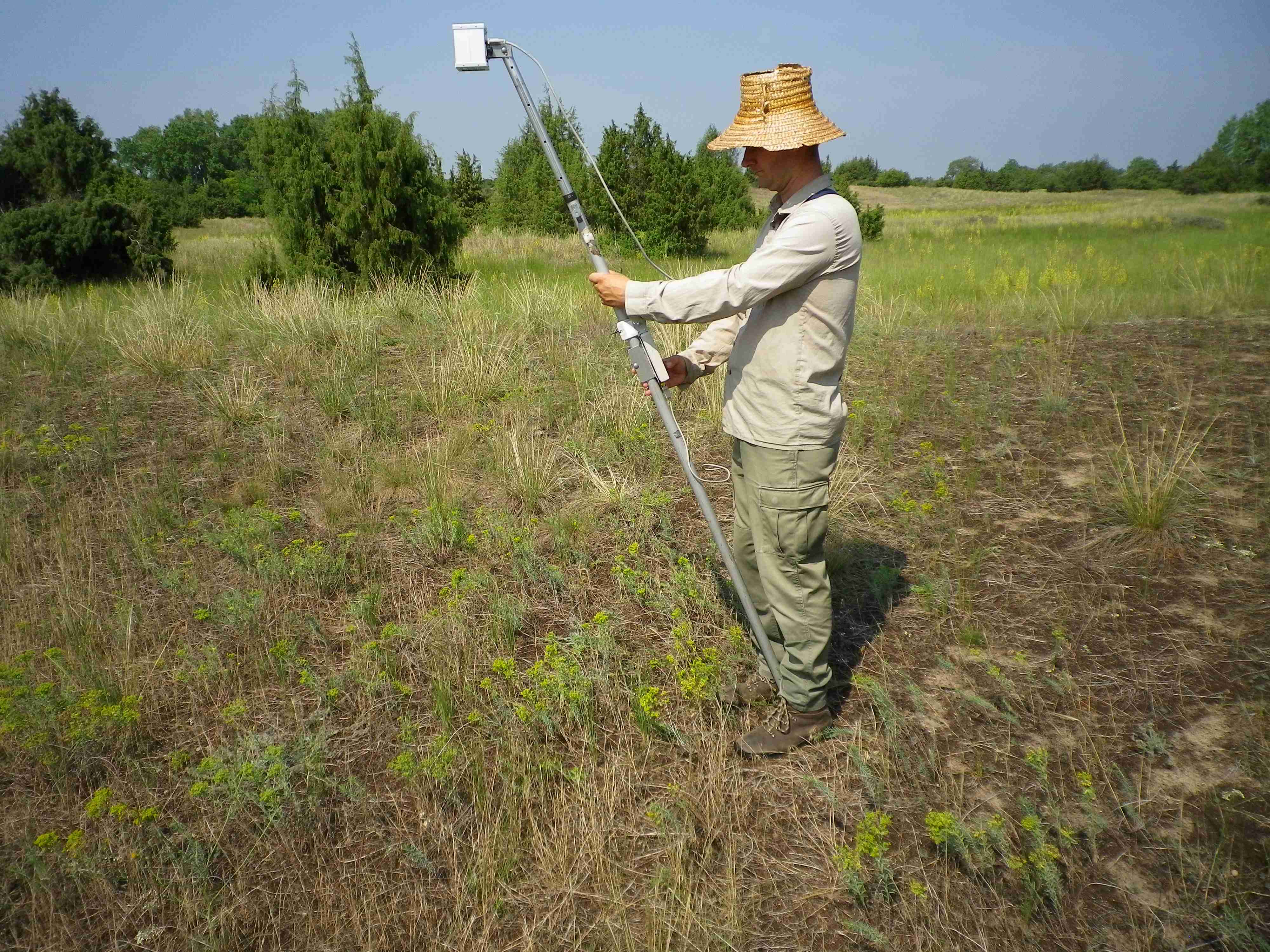
Orgovany-Agasegyhaza site for studying production-diversity relations and weather effect of productivity.
-
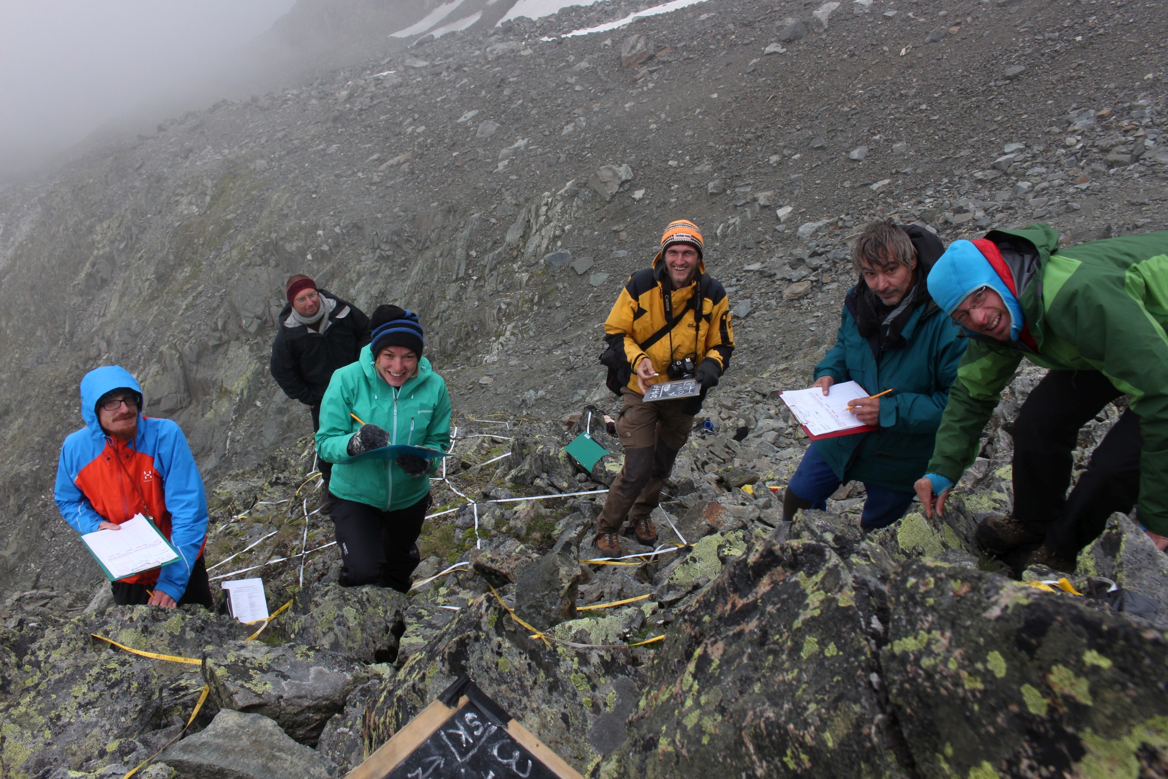
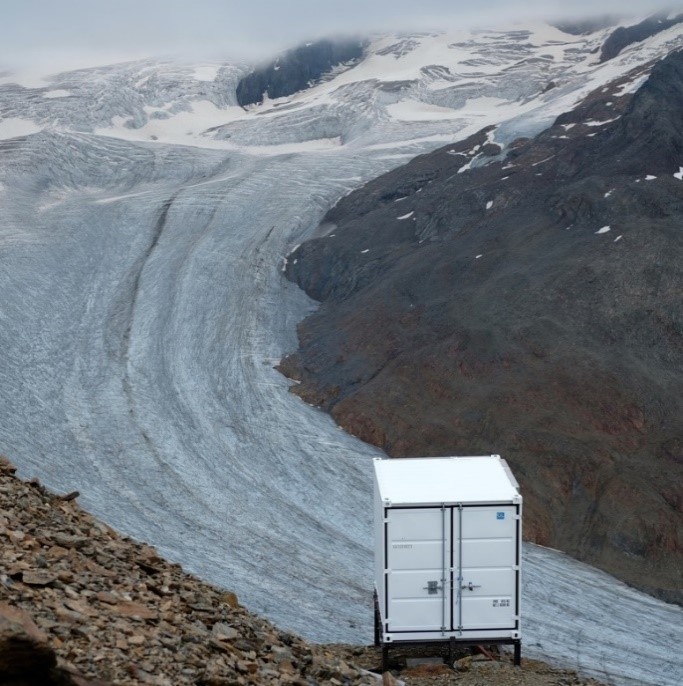
GLORIA Master Site.The 3497m-peak Mount Schrankogel belongs to the highest mountains of the Austrian Alps. Its northern and eastern side is surrounded by glaciers and glacier forelands. Its southern to western faces, however, are not interrupted by glacier Established in 1994 as the first comprehensive alpine to nival long-term monitoring site for high-altitude vegetation in the Alps, with ca. 1000 permanent plots of 1x1m arranged in transects of 30x3m or smaller ranging from 2900m to 3450m. Main purpose is ecological climate impact research. In 2001 it became a master site of the GLORIA network: e.g. method development and testing for species recording in 1x1m plots for GLORIA was partly conducted on Schrankogel. The first major resurvey of plots was made in 2004, the second resurvey was conducted in 2014. Besides long-term monitoring, several other research approaches were/are carried out at the Schrankogel site, such as species and vegetation modeling, vegetation mapping, phenological studies of alpine and nival plants, exclosure studies for grazing impacts at the lower altitudes of the site, soil studies, snow pattern studies (two permanent snow cameras), surface and soil-temperature measurements. In 2014, the the scope was extended to other organism groups such as soil microbiota, soil mesofauna (Oribatida and Collembola in particular), and surface-dwelling arthropods. Site setup, resurveys, or other activities were/are supported by: the Austrian Academy of Sciences through a national grant of the International Geosphere–Biosphere and the UNESCO MaB Programmes, by the Austrian and through the Institute of Mountain Research (IGF) of the Academy; by the Austrian Federal Ministry of Science and Research; the Austrian Federal Ministry of Agriculture, Forestry, Environment and Water Management; the Swiss MAVA Foundation; the Government of Tyrol; the project ALARM (Assessing Large-Scale Risks for Biodiversity with Tested Methods; No. GOCE-CT-2003-506675) in the FP-6 of the EU; the Austrian Climate Research Programme (ACRP: GZ B368633 ACRP6 - SCHRANKOGEL_20YEARS - KR13AC6K11076). For further details on Schrankogel_GLORIA see: http://www.gloria.ac.at/?a=42&b=56
-
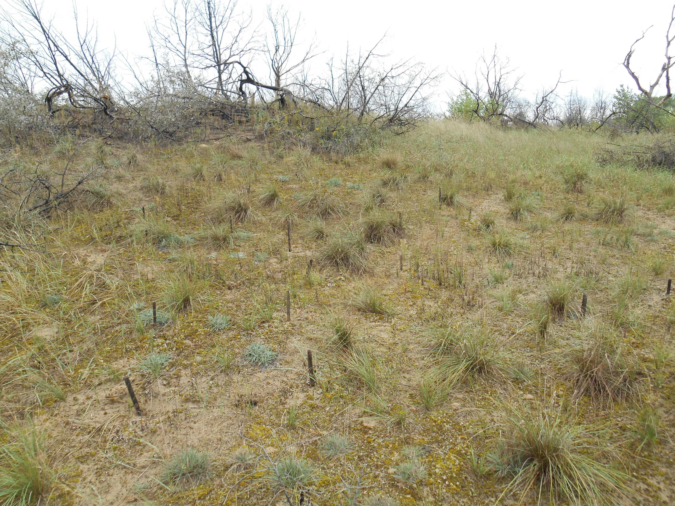
3 sites with 10 ha altogether; follow the long-term changes on sand steppe gaps of juniper-poplar forest in order to study the effect of fire
-
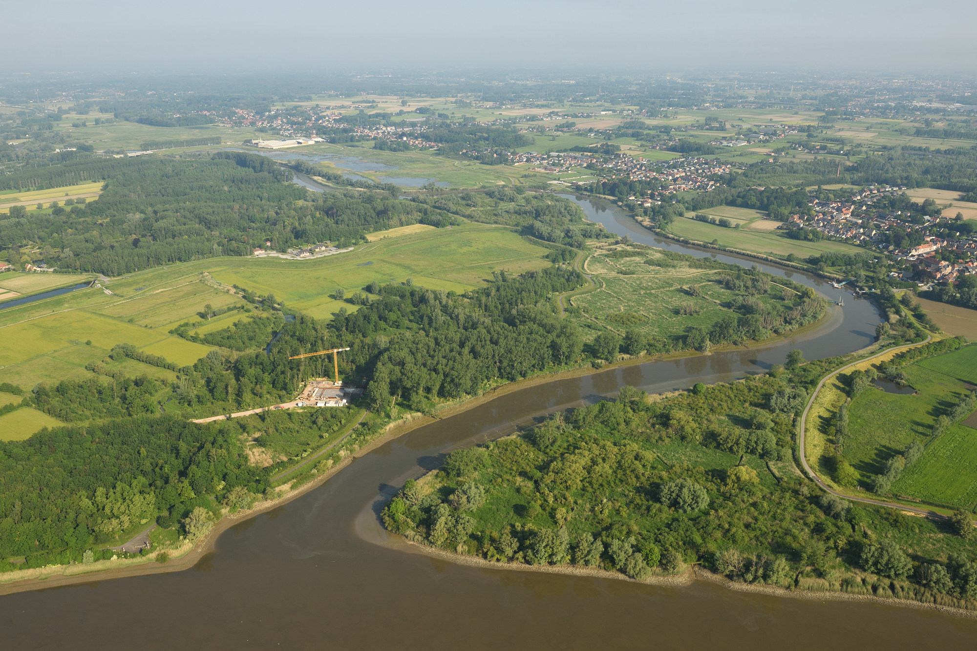
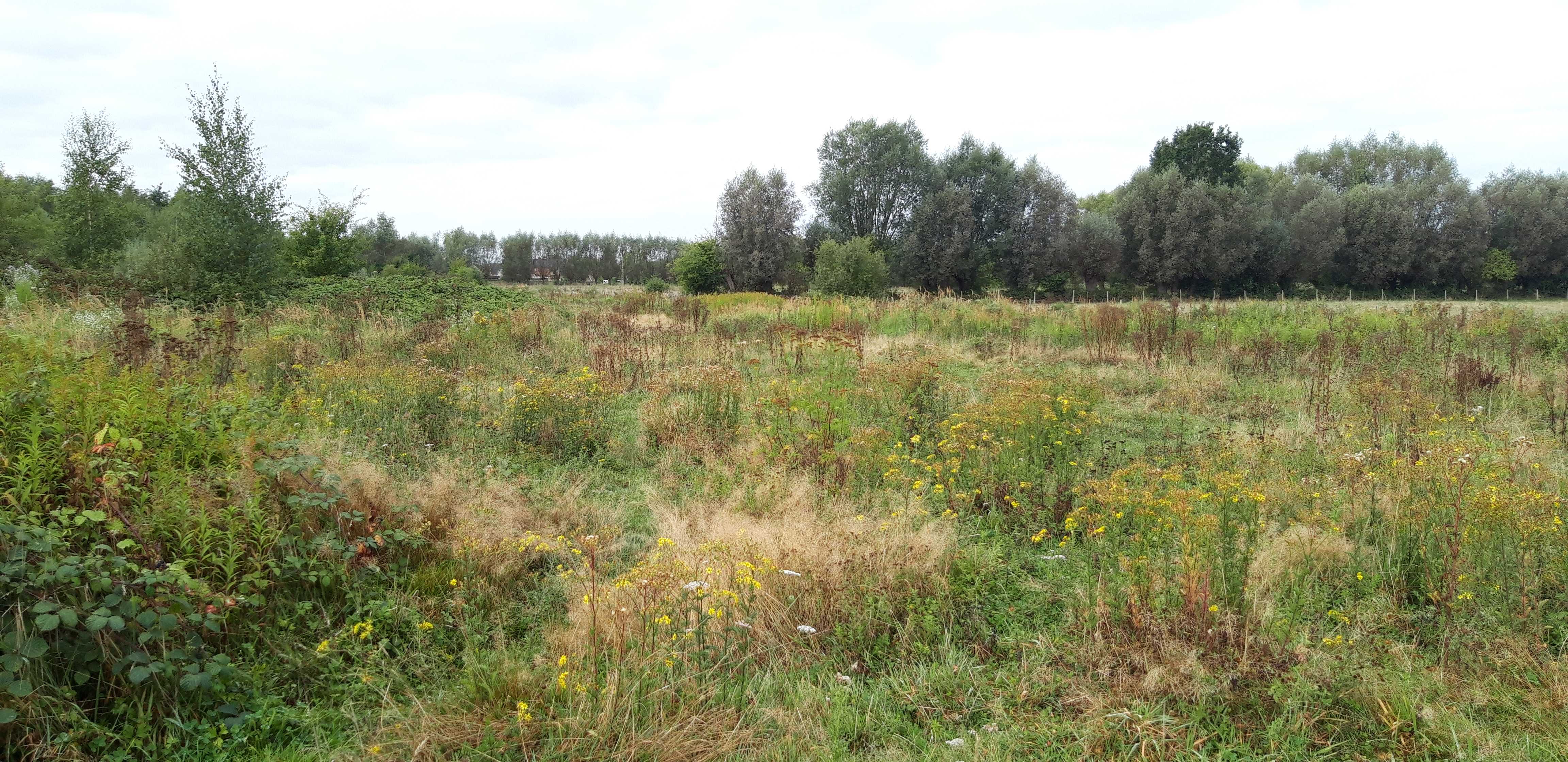
The Durme debouchment is a subsite (12 ha) of the Scheldt Estuary and its alluvial plains. The setup for deployed in the context of eLTER_RI is a cross-shore open-air laboratory open for other researchers and students to experiment in a long-term in-situ setup. The responses studied are on the level of sediment, infauna of tidal flats, (ground)water levels, carbon (including microphytobenthos and green-house gases), (ground)water quality and marsh vegetation (plant biodiversity, biomass). An end-goal is to provide long term field data to develop numerical eco-morphodynamic model(s) that is/are able to predict the effect of changed water budgets on carbon sequestration or greenhouse gas emissions, biodiversity (by eDNA), macro-invertebrate production and changes in tidal wetland plant species distribution and production in a cross-shore approach.
-
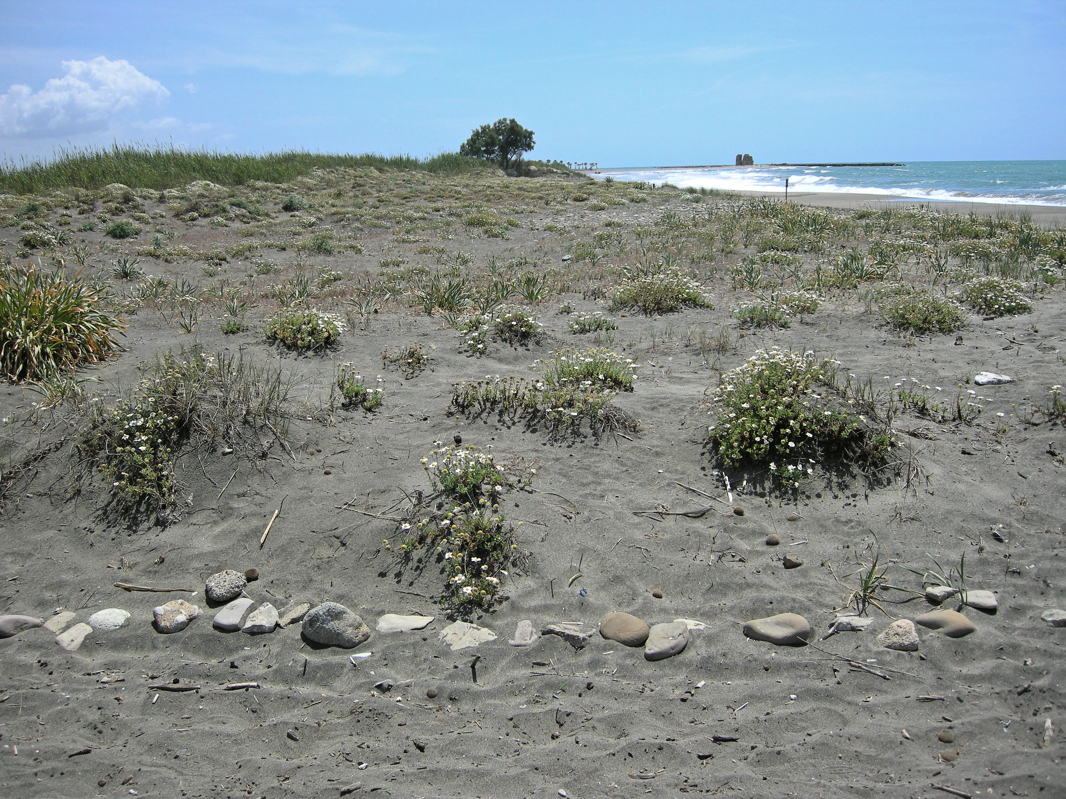
The site, located along the Tyrrhenian coast, north of Rome city, is a Special Protection Area (SPA) for migratory and nesting birds (Anatidae, Ardeidae). The wetland area is one of the last stretches of the Lazio wetlands which have been progressively reclaimed and cultivated during the last century. The flora and the fauna of the site is not only highly specialized but also highly endangered, with a relevant ecological value evidenced in previous studies. The site includes coastal dune habitats of European interest, as the annual vegetation of drift lines, the embryonic shifting dunes, the mobile dunes with Ammophila arenaria and the dune grasslands. There are also habitats related to wet and mud soils, as Mediterranean salt meadows and reed beds dominated by Phragmites australis.
-
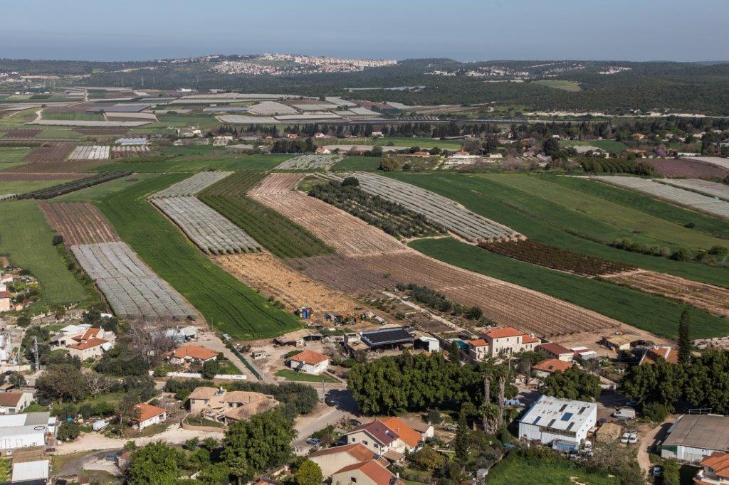
The Ramat Hanadiv LTSER platform is a unique texture of the region surrounding Hanadiv Valley and Taninim River basin. It integrates nature values with agriculture, rural communities, and heritage sites. The platform extends over an area of apprx. 15,500 hectares, including Ramat Hanadiv Nature Park and five neighboring municipal Councils: 1. Binyamina Givat-Ada (Urban; Local Council ) 2. Zikhron Ya’akov (Urban; Local Council ) 3. Hof Hacarmel (Rural; Regional Council) 4. Jisr A-Zarqa )Arab village; Local Council) 5. Alona (Rural; Regional Council) Ramat Hanadiv LTER site is located in the heart of the platform, at the southern tip of the Carmel Mountain Ridge. Ramat Hanadiv spreads over approximately 450 hectares of typical natural Mediterranean vegetation, surrounding the Memorial Gardens in which Baron Benjamin Edmond de Rothschild and his wife are buried. With mean annual rainfall of 500-600 mm and mean annual temperature of 170C-190C, Ramat Hanadiv Nature Park is characterized by diverse habitats and communities.
-
The Hohes Holz is a mixed beech forest, with an intensive research site with respect to carbon and water cycle at the northern border of the Bode catchment close to Magdeburg, Germany. It is certified as class 1 ecosystem station in ICOS.
-
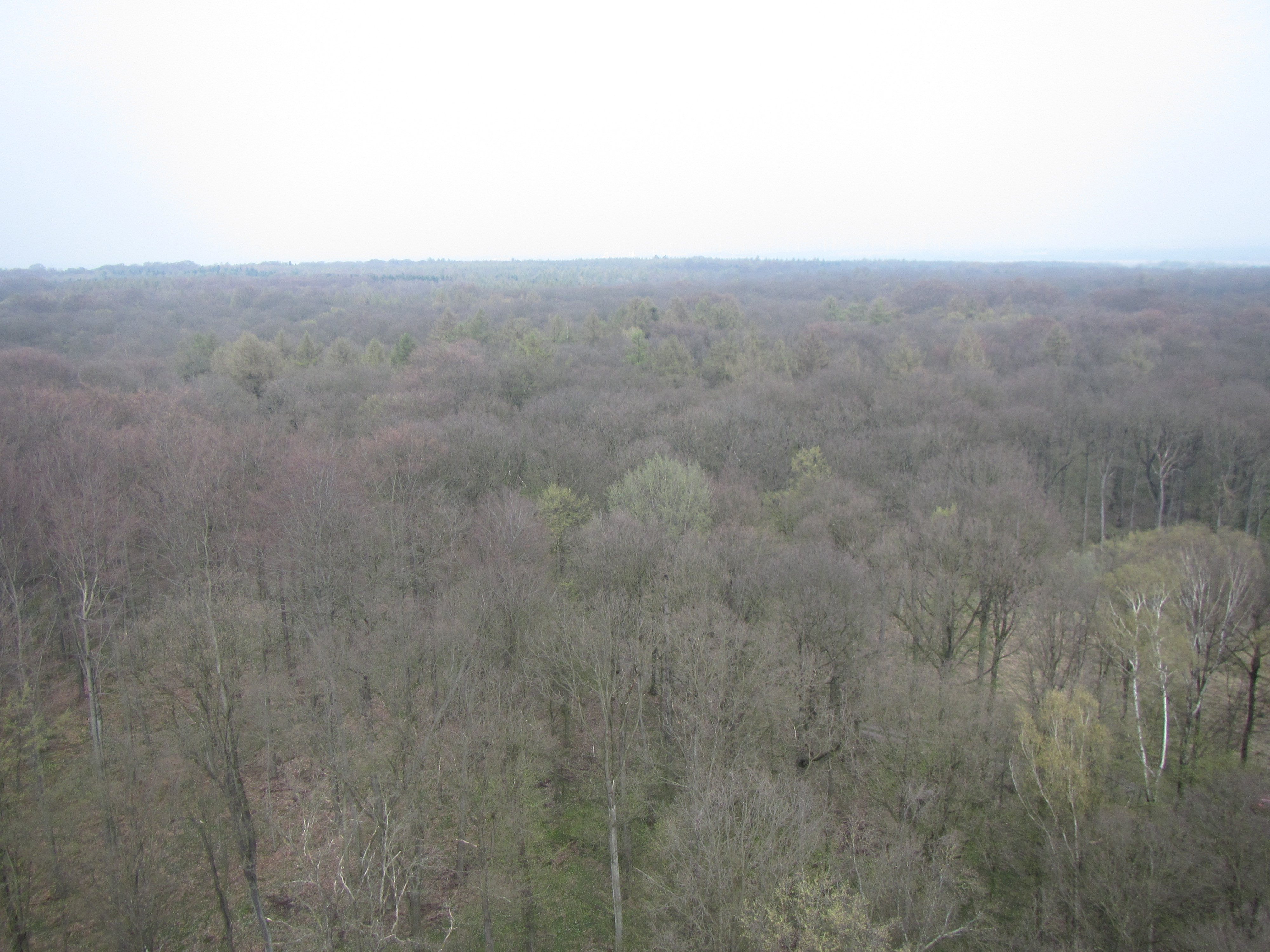
The Nature reserve Bos t’Ename is situated on the Belgian loess belt about 25 km south of Ghent. It has an area of 160 ha. 60 ha mixed deciduous ‘ancient forest’ forest, 40 ha restoration of woodpasture on former agricultural land, 35 ha regeneration of forest in a silt quary, 25 ha semi open cultural landscape (meadows, hedges,…). "Bos t'Ename" belongs to one of the classified lanscapes of Flanders The woodland where previously managed as coppice with standards. The history is exceptionally well studied. It is managed as multifunctional forest containing strict forest reserves an coppice with standards.
-
Umbrella site of Rofental - Austria, Obergurgl - Austria & GLORIA Master Site Schrankogel (AT-SCH), Stubaier Alpen - Austria
-
The Presidential Estate of Castelporziano stretches itself over an area of about 6100 ha and is located approximately 24 km from the city of Rome. The territory is characterized by remarkable natural features. It shows most of the typical Mediterranean ecosystems (relict strips of lowland forest with hygrophilous vegetation, deciduous and evergreen mixed oak woods, Mediterranean scrub, dune vegetation). Until recently (2019), there were large surfaces of stone pine unfortunately destroyed by the combined action of alien pest Toumeyella parvicornis with Tomicus destruens, the main pest of Mediterranean pine forests. Inside the Estate, there are two Special Areas of Conservation (SACs): one concerning the coastal strip (IT6030027) and the other one concerning hygrophulous oak-woods (IT6030028). In addition to including the two SACs, the Estate is in its entirety Special Protection Area (SPA - IT 6030084). From a botanical point of view this area, together with the neighbouring Castelfusano territory, represents what remains of the vast forest system that covered the entire delta of the Tiber and the surrounding areas. The land is mostly flat, but in the North there are modest reliefs that are not higher than 85 m. on sea level. A complex set of ancient dunes and a chain of more recent dunes stretch out along the coastline. There are many temporary and permanent natural pools and wetland areas with seasonal floodings caused by meteoric water and groundwater, which usually dry out during summer and represent sites with the greatest biodiversity. From an ecological point of view, those “relict wetland areas” play actually a very important role for biodiversity because of plant species which are typical of hydrosoil and in the past were widespread but have now almost disappeared.