
water acidity
Type of resources
Available actions
Topics
Keywords
Contact for the resource
Provided by
Years
Formats
Representation types
-
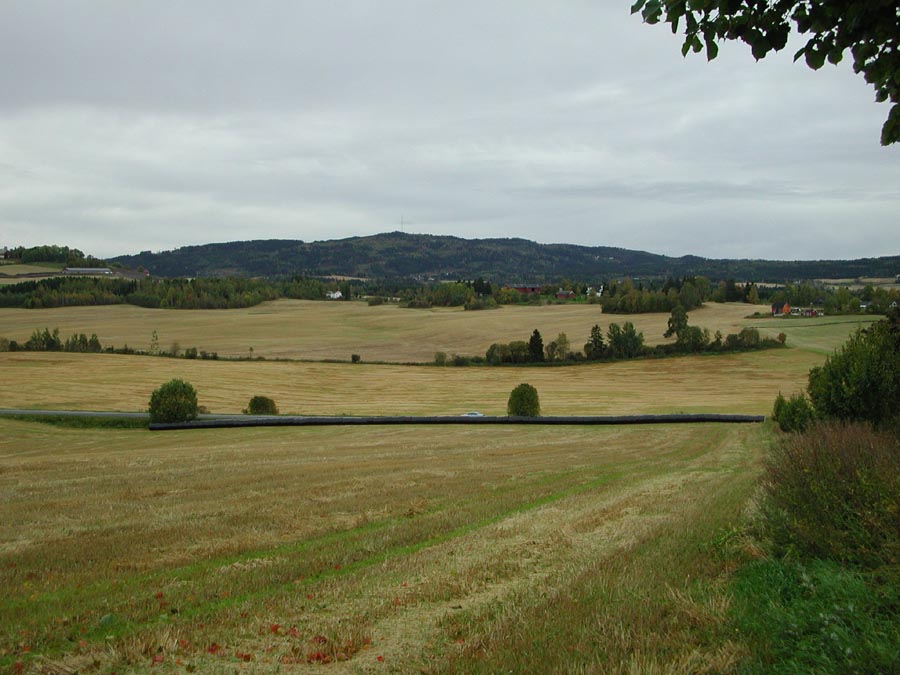
grain and grass dominated catchment located in the south-eastern part of Norway, monitored by The Norwegian Agricultural Environmental Monitoring Programme (JOVA)
-
Runoff and runoff chemistry at LTER Zöbelboden, Austria
-
The site of the Boknis Eck Time Series (BE) is located at the entrance of the Eckernförde Bay (54°31.2' N, 10°02.5' E) in the southwestern Baltic Sea. It has a water depth of 28 m with muddy sediments. Riverine inputs into the Eckernförde Bay are negligible and thus the overall hydrographic setting at BE is dominated by the regular inflow of North Sea water through the Kattegat and the Great Belt. Seasonal stratification occurs usually from mid-March until mid-September and causes pronounced hypoxia which sporadically become anoxic.
-
To support the marine biodiversity and ecosystem dynamics research community in Belgium, the Flanders Marine Institute (VLIZ) has set up a local marine biodiversity observatory.
-
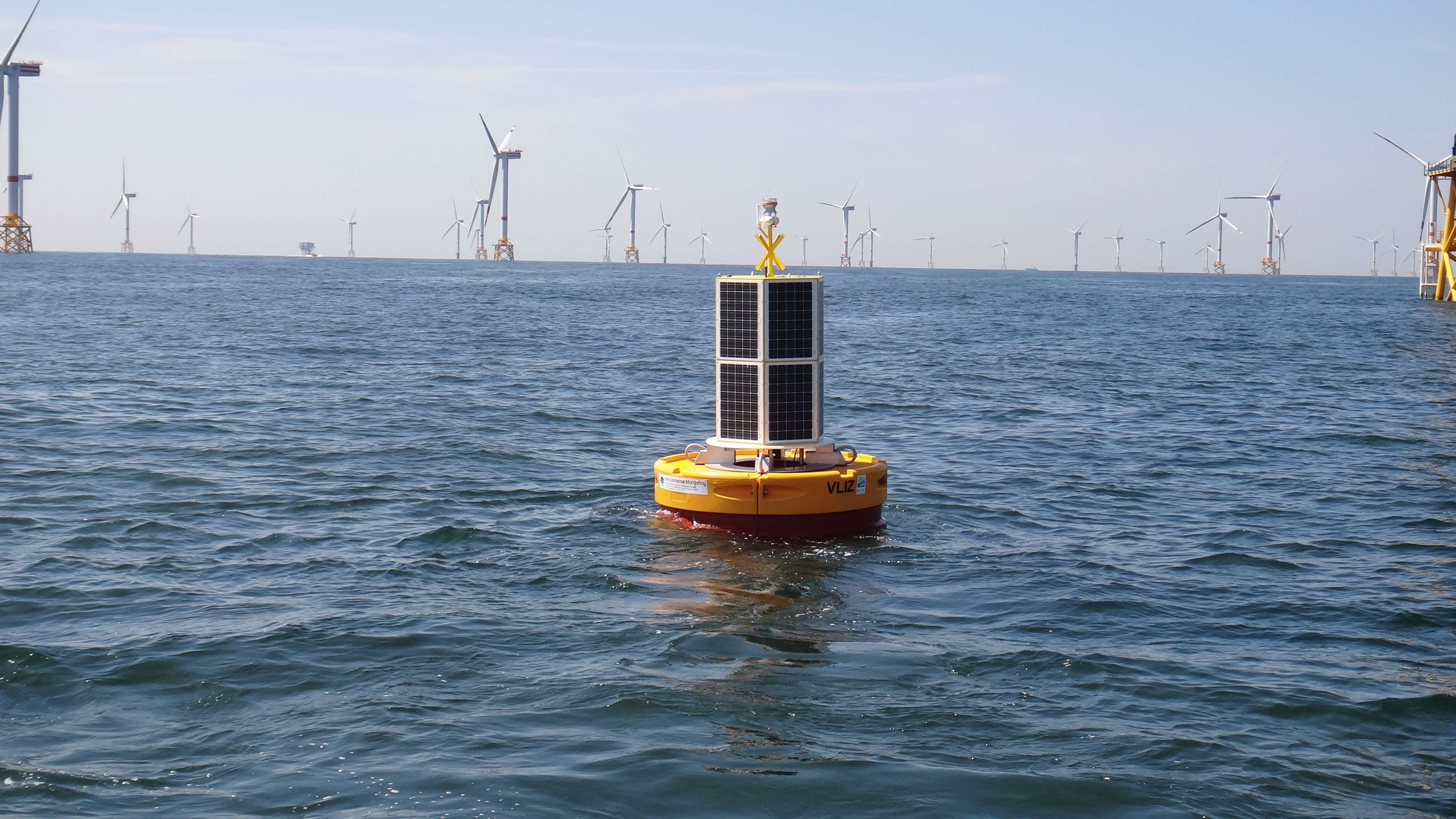
The site consists of a marine databuoy equipped with a suite of sensors that monitor water quality parameters and acoustic receivers for the detection of Porpoises and tagged fish. The buoy is moored near an offshore windmill farm, approx. 30km off the coast on the Belgian Continental Shelf.
-
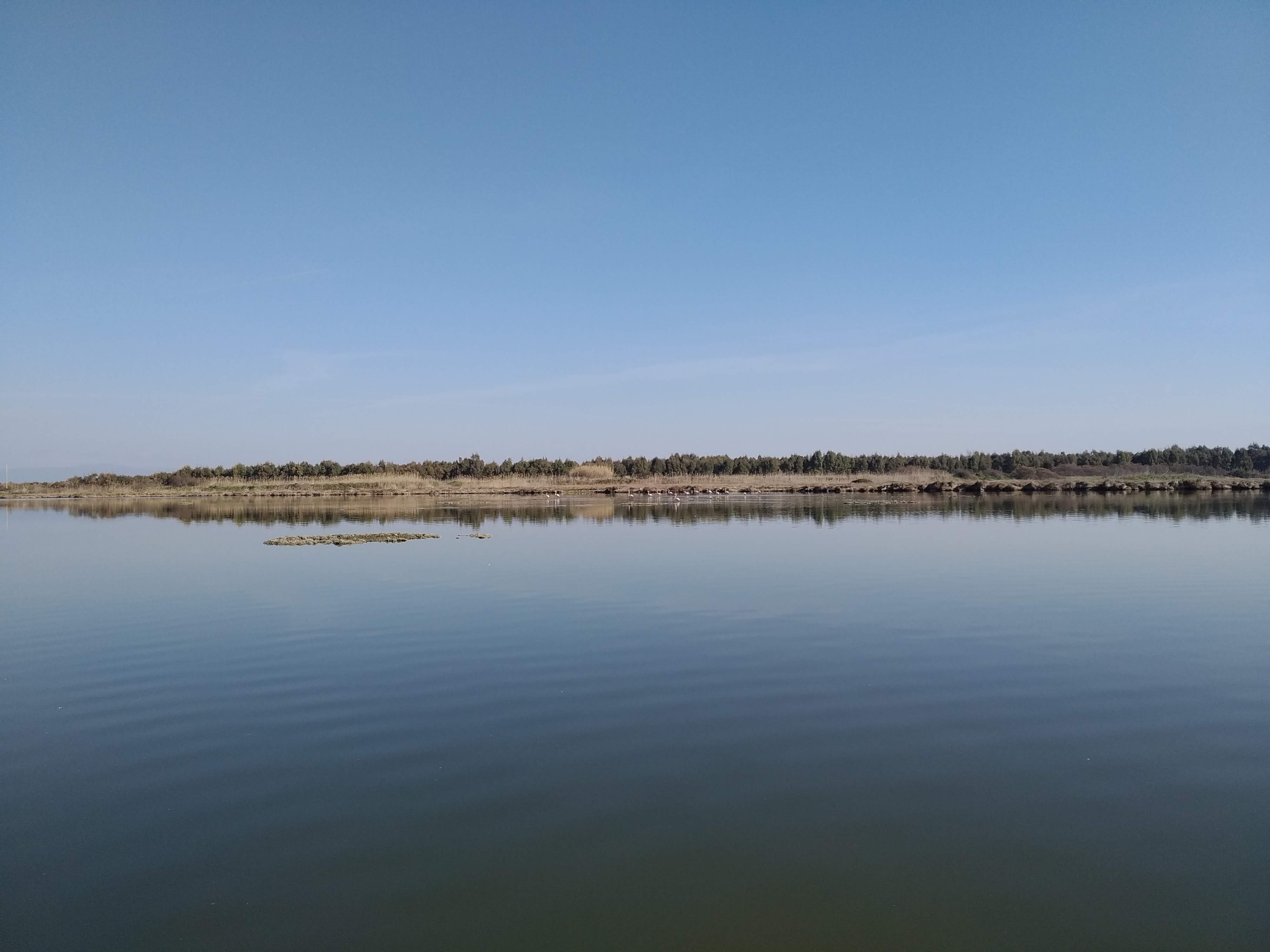
S’Ena Arrubia Lagoon is located along the central western coast of Sardinia (39.83° N, 8.57° E); it is 1.2 km2 in area and has a mean depth of 40 cm. Freshwater input is supplied from the watershed by two rivers: Rio Sant’Anna (also called Diversivo), which drains an area of 78.4 km2 and showed no runoff from April 2001 to March 2002; and the Canale delle Acque Basse (also called Idrovora), which drains 50 km2 mostly originating from the drying up of a pond over 3000 ha wide and dedicated mainly to farming and cattle-breeding. This channel is below sea level and water is pumped from it into the lagoon. A large part of the catchment area is used for intensive arable farming and cattle breeding, and as a result, the freshwater in the Idrovora canal is very rich in nutrients. The water in the lagoon is exchanged with sea water by means of a sea-mouth canal built in the 1970s (length = 230m, width = 25m, depth = 1.3m). Engineering works were carried out in 2000 to widen the sea mouth of the lagoon in order to improve tidal flushing and thus reduce its high trophic levels and improve its hydrodynamics. The dimensions of the new inlet vary in different places. It is 30 m wide and 0.70 m deep near the lagoon, 60 m wide and 2 m deep in the central part and 32 m wide and 1.30 m deep at the sea mouth. Climate is Mediterranean with long hot summer and short mild rainy winter, generally precipitation and consequent water inflows are low, the year average is 650 mm. S’Ena Arrubia Lagoon is very eutrophic because of the intense arable and stock-rearing activities in its watershed and dystrophic crises and fish kills occur occasionally. Anoxia and dystrophic crises were observed as early as the 1960s. The principal human activities in this wetland are fishing, outdoor recreation, education and scientific research. From 1990, a long-term series of data is available and derives from high-frequency measurements and samplings to assess environmental and biological parameters. In particular the data concern the main trophic descriptors (Secchi depth, temperature, pH, conductivity, dissolved oxygen and saturation, alkalinity, NH4-N, NO2-N, NO3-N, total nitrogen, soluble reactive phosphorus, total phosphorus, dissolved silica) and phytoplankton abundances, as chlorophyll a, cell densities and biomass, class and species composition. The collection of data was interrupted in 2003.
-
grain dominated catchment located in the south-eastern part of Norway, monitored by The Norwegian Agricultural Environmental Monitoring Programme
-
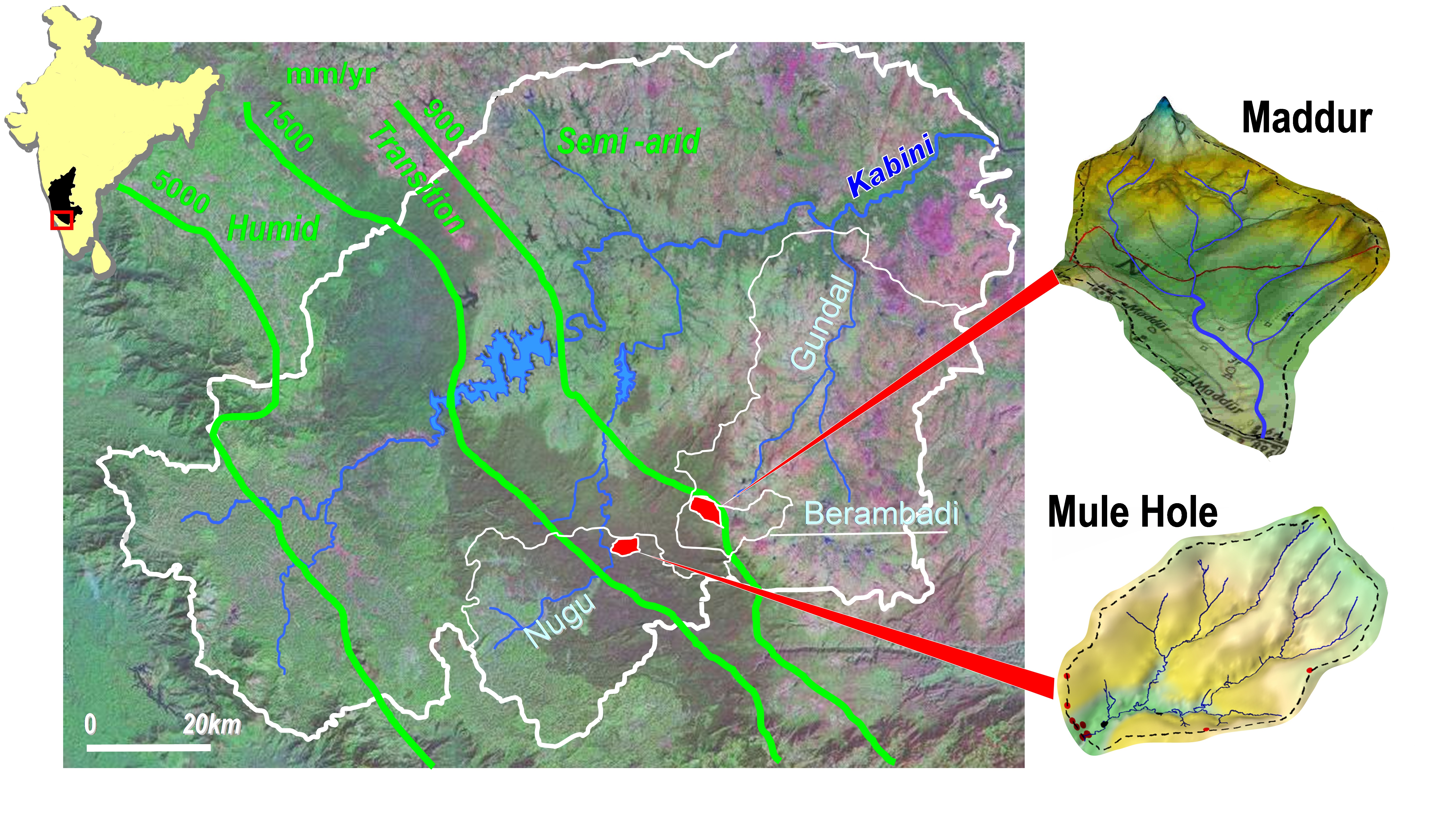
Paired experimental watersheds in sub-humid tropical climate, plus nested watersheds, located in South India in the Kabini watershed. The experimental watersheds are: (1) Mule Hole (semi-deciduous dry forest), monitored since 2003, 4.3 km2; (2) Maddur (cultivated), monitored since 2005, 7.1 km2; (3) Berambadi (higher order of/including Maddur watershed), monitored since 2010, 80km2; for evaluating the influence of agriculture on water and biogeochemical cycle in sub-humid tropics, and the effect of the monsoon variability on these cycles
-
The Kasuya Research Forest (KRF) is located in the northern part of Kyushu Island. The elevation ranges from 30 to 553m. About 100ha of there forests is on hilly Tertiary mountains lower than 100m in altitude, and other forests are on the steep mountains over the Paleozoic strata. Most of the natural forests consist of warm temperate evergreen broad-leaved trees such as Quercus sp., Castanopsis sp., Machilus thunbergii, Morella rubra, etc. The drier ridge sites are covered by deciduous broad-leaved trees such as Carpinus tschonoskii, Quercus serrata, Castanea crenata, etc. Plantation forests composed predominantly of Cryptomeria japonica and Chamaecyparis obtusa cover about 70% of the total forest area.
-
UK ECN site. The River Esk rises on the uplands of the North York Moors National Park and is the only major river in the county of Yorkshire that drains directly into the North Sea. The catchment is sparsely populated without the pressures of industrialisation and urbanisation affecting other rivers in the Region. Open moorland characterises much of the catchment and is an important habitat for a wide variety of wildlife. Within the Esk valley there are six Sites of Special Scientific Interest (SSSIs), two of which extend south and cross the boundary of the Derwent catchment. The source of the Esk is upstream of Westerdale, where a series of small streams (becks) known as the Esklets merge to form the River Esk. Many of these moorland streams are affected by natural "flushes" of acidity, as well as iron run-off from natural ironstone strata and old mineral workings, making some of these becks an ochreous-orange colour after periods of rainfall. The combination of the two factors restrict the invertebrate fauna in these head-streams. The majority of the River Esk downstream of the Esklets has very good water quality, with the diverse invertebrate fauna dominated by mayflies, stoneflies, caddisflies and other pollution sensitive groups. This good water quality is also very important in sustaining other species such as salmon, sea trout, dippers and otters. The ECN site is at Briggswath (NGR: NZ 868 081), approximately 2km upstream of the tidal limit. At this point the river is approximately 15m wide, and in normal summer flows the depths vary between 20cm and 30cm.