
water albedo
Type of resources
Available actions
Topics
Keywords
Contact for the resource
Provided by
Years
Formats
Representation types
-
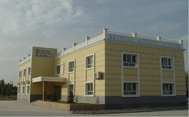
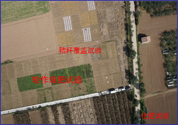
The station has a arid moderate climate, with a annual temperature of 11.2 ℃ but higher in summer and lower in winter relative to areas with the same latitude. Due to dramatic temperature fluctuation in spring and autumn, frozen damage resulted from low temperature in spring and early cooling in autumn often occurs. The annual mean precipitation is as low as 45.7 mm, thus rivers are charged mainly by precipitation in mountains and snowmelt. Frozen-free day, sunshine duration and annual mean wind velocity are, respectively, 207 d, 2940 h and 2.4 m/s. Disaster weather includes dust storm in spring, hail and accidentally continuous high temperature in summer.Aksu station (E80°51′, N40°37′, 1028 m a.s.l.), found in 1982 and affiliated with Xinjiang Institute of Ecology and Geography, was listed in the top-5 stations for irrigation experiment in Xinjiang and became a member of special environment and disaster detection network, CAS in 2002. After development of years, it entered National Field Station Network and Chinese Ecosystem Research Network (CERN) in 2005. The station is located in the source area of Tarim River where its three headstreams (i.e., Aksu, Yeerqiang and Hetian River) converge, and the vastest oasis develops in Tarim Basin under the hyperarid environments. This area is typical of Tarim Basin for dramatic watercourse meandering and great agro-water consumption, thus forming a ideal experimental field for monitoring and researching water, salt and nutrient processes in oasis cropland system, as well as for exploring sustainable oasis agriculture, theory and technologic demonstration of water-saving irrigation.
-
Processing of time series of satellite and airborne images, with different spatial and spectral resolution, in order to derive water quality maps based on physically based algorithms parametrised with specific optical properties of lake Garda. Generation of spatial and temporal information of different water quality parameters of surface water column and coastal zone. Dedicated actives of calibration and validation of satellite images, algorithms and products.
-
Changwu station was found in 1984 as one of field experiment stations of Institute of Soil and Water Conservation, Chinese Academy of Sciences (ISWC, CAS). It joined the Chinese Ecosystem Research Network (CERN) organized by CAS in 1991 and the National Ecosystem Research Network of China (CNERN) in 2005 by the Ministry of Science and Technology of the People’s Republic of China. The station located in Wangdong Village, Hongjia town, Changwu County, Shaanxi Province, 200 km away from Xi’an city. Its location is E107°41′ and N35°12′, south of the Loess Plateau. It belongs to the warm temperate semi-humid continental monsoon climate. Mean annual precipitation is 580mm and temperature 9.1℃, frost-free day 171. The elevation is about 1200 m and the depth of ground water is 50-80m. Main crops are winter wheat, spring maize, potato, sorghum, millet, beans and so on. The zonal soil is called Heilu soil with a parent material of clay loam Malan loess paleosol soil with an average depth in excess of 100m that were deposited during the Quaternary period. It belongs to the high table land - gully region, and a typical rain-fed agricultural area on the Loess Plateau. Wangdong small watershed, which the station located in, is 6.3km2. Three landform types are high table land, slop land called “Liang” and valley, which occupy the total area of watershed with 35%, 35.6% and 29.4%, respectively. The soil is deep and has good physical properties, like reservoir, support the agro-ecological system.
-
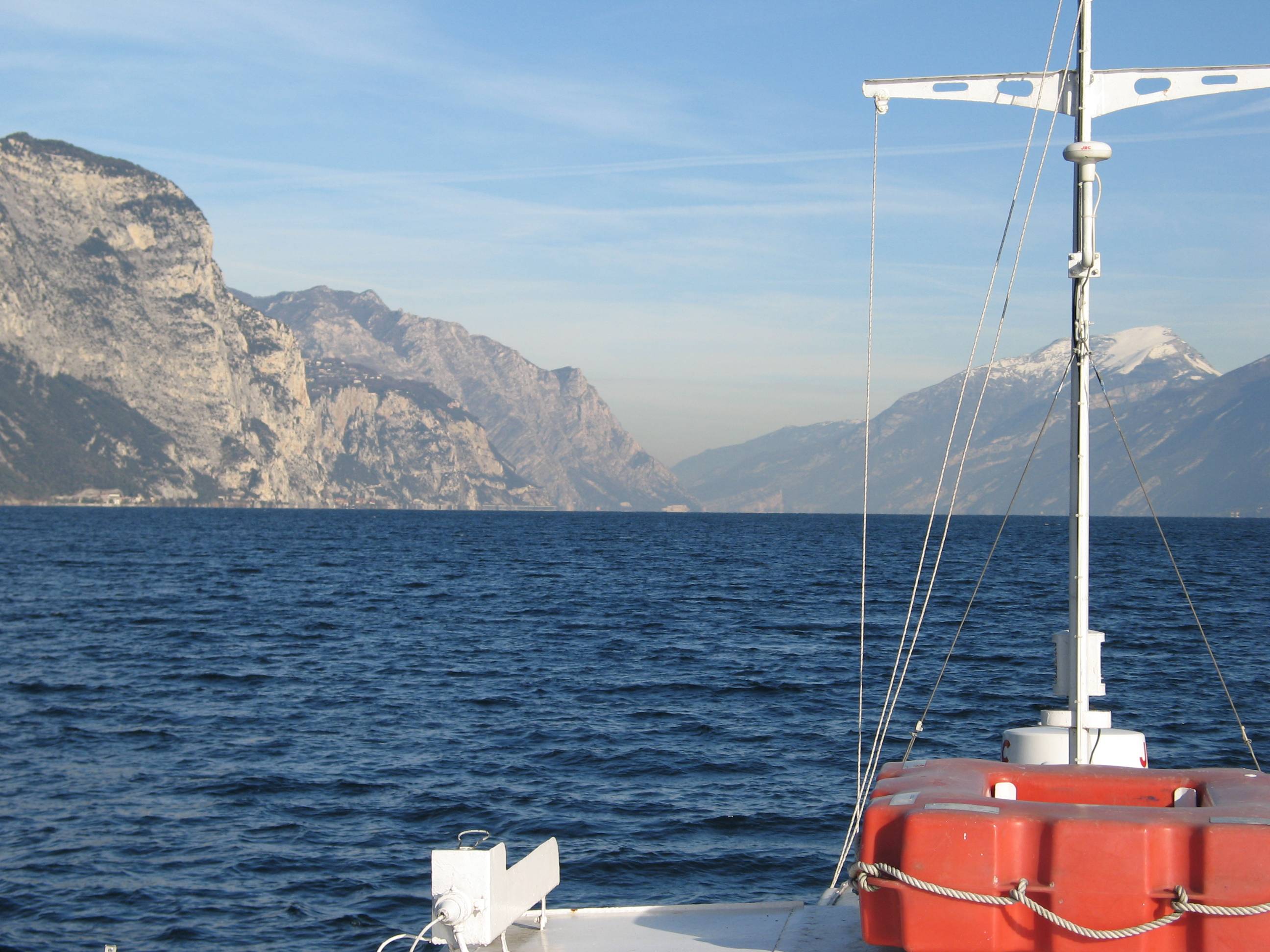
Lake Garda has the largest volume (49 billions of cubic meters) and the most extensive area (368 km2) of Italian lakes. Along with lakes Orta, Maggiore, Lugano, Como, Iseo and Idro, it forms part of the group of deep lakes located south of the Alps in one of the most densely populated and highly productive area of Italy. With a total volume of over 124 billions of cubic meters, these lakes constitute one of the largest freshwater supplies in Europe. Their waters are used for agriculture, industry, fishery and drinking. Moreover, they are an important resource for recreation and tourism thanks to both attractive landscape and water quality. In Lake Garda, sporadic studies were carried out irregularly by various Institutions up to the end of the 1980s. Since the beginning of the 1990s, continuous monthly samplings and measurements were carried out by the Department of Biology of the Padova University (Responsible, Nico Salmaso), with the collaboration of ARPAV. Since 2005 the whole limnological research is performed by the Limnological research group of the Agrarian Institute of S. Michele all’Adige – E. Mach Foundation (S. Michele all’Adige, Trento; coordinator, Nico Salmaso). Since the 1970s, Lake Garda showed an increase in the trophic status, with mean annual concentrations of total phosphorus in the whole water column increasing from ca. 10 µg P/L to 20 µg P/L. In the last 4-5 years of observations, TP showed a stabilisation of the concentrations, around 18 µg P/L. At the community level, annual phytoplankton cycles underwent a unidirectional and slow shift mainly due to changes in the species more affected by the nutrient enrichment of the lake. After a first and long period of dominance by conjugatophytes (Mougeotia) and diatoms (Fragilaria), phytoplankton biomass in recent years was sustained by cyanobacteria (Planktothrix). Other important modifications in the development of phytoplankton were superimposed on this pattern due to the effects of annual climate fluctuations principally mediated by the deep mixing events at spring overturn. Main specific research objectives in this LTER station include: -Changes in the physical, chemical and biological variables at different temporal scales, from months to decades and centuries (paleoecology). Update of the time series of hydrological, climatological and limnological data, whith special attention to lake evolution and effects on biotic communities in relation to ongoing climatic changes. Definition of predictive models. - Identification of the environmental and biotic mechanisms favouring the development of cyanobacteria (including the recent appearence of blooms and new species). Identification of the factors selecting for the development of toxic strains, the production and concentrations of epato- and neurotoxins, and their impact on trophic webs and water usability. The limnological field facilities of the limnological research group include 2 rubber dinghies, 2 multi-parameter probes, a fluoroprobe, a FlowTracker Handheld ADV Sonntek, underwater Quantum sensors, a Kajak corer and an Eckman dredge for sediment sampling. The unit also has several laboratories. These include the hydrobiology and microscopy laboratory, equipped for analyses of basic limnological variables (photosynthetic pigments, dry weight, dissolved oxygen, water turbidity, macrophytes) and of phytoplankton, picoplankton and periphyton samples (microscopes, invertoscopes, fluorescent microscopy, image analysis). The analytical and environmental chemistry laboratory is equipped for analysis of the major ions and nutrients (phosphorus, nitrogen and silica), as well as organic molecules (with focus on cyanotoxins) by means of spectrophotometry, ion chromatography and Liquid Chromatography-Mass Spectrometry (LC-MS). We have access to genetic laboratories equipped with the principal analytical tools, i.e. PCR, electrophoresis, and sequencing. The data collected at monthly frequency since 1991 includes water temperature and oxygen. Phytoplankton was collected since 1993, while complete data recording (including chemistry and zooplankton) begun in 1995.
-
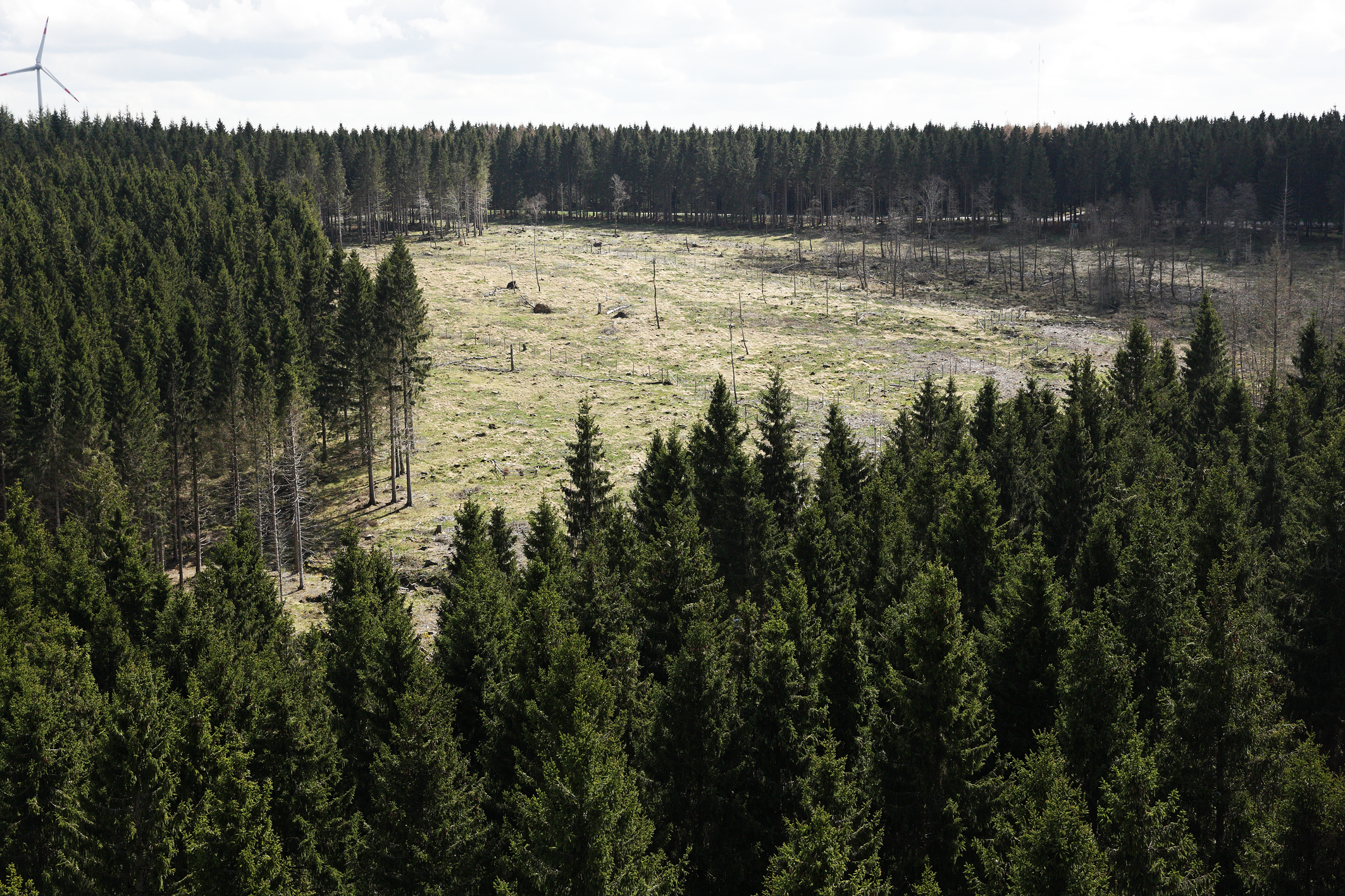
The Wüstebach catchment is located in the Eifel National Park and covers an area of 38.5 ha, with mean altitude of about 610 m. The geology is dominated by Devonian shale, which is covered by a periglacial solifluction layer of about 1–2 m thickness. Cambisols and Planosols have developed on the hillslopes, whereas Gleysols and Histosols have formed in the valley. The main soil texture is silty clay loam and the litter layer has a thickness between 0.5 and 14 cm. The mean annual precipitation is about 1200 mm. Norway Spruce planted in 1946 is the prevailing vegetation type. During late summer/early autumn of 2013, trees were almost completely removed in an area of 9 ha by the national park forest management in order to promote the natural regeneration of near-natural deciduous forest from spruce monoculture forest.
-
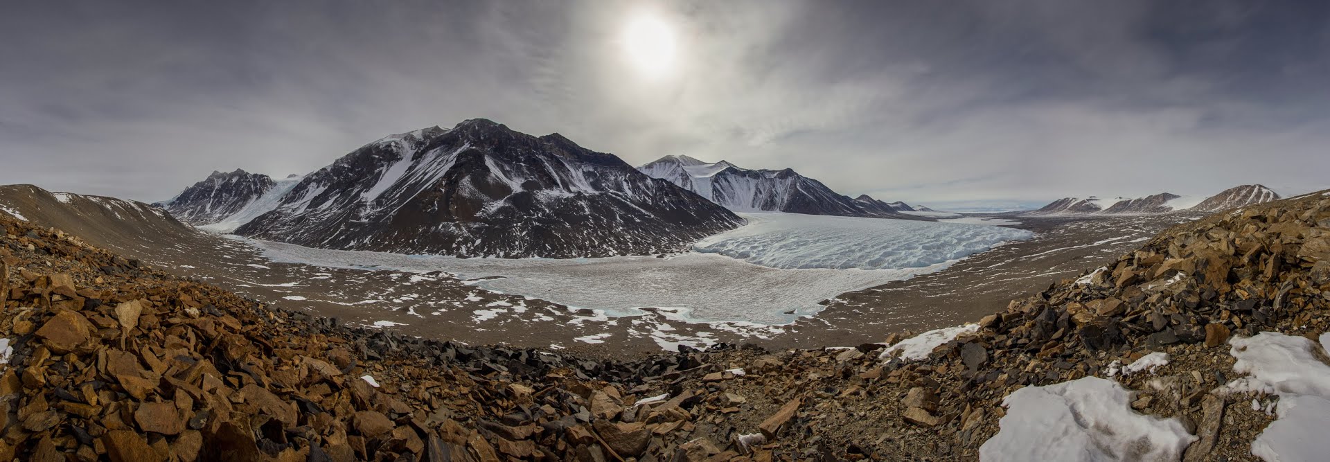
The McMurdo Dry Valleys (MDVs) (78°S, 162°E) represent the largest (4500 km^2) ice-free area on the Antarctic continent. The MDV landscape is a mosaic of glaciers, soil and exposed bedrock, and stream channels that connect glaciers to closed-basin, permanently ice-covered lakes on the valley floors. Mean annual air temperatures are cold (ranging from -15 to -30°C on the valley floors), and precipitation is low (~50 mm annual water equivalent as snow). Summer air temperatures typically hover around freezing and winter air temperatures are commonly < -40°C. While the water columns of the lakes are liquid and biologically active year round, glacial meltwater streams flow and soils thaw only during the austral summer. There are no vascular plants, but microbial mats are abundant in lakes and streams. Mat organisms are transported by wind onto glacier and lake ice surfaces where they actively metabolize in liquid water pockets (cryoconites) that form during the summer months. In the streams, which desiccate for ~10 months each year, cyanobacterial mats host extensive diatom and soil invertebrate communities. Lakes provide a habitat for diverse phototrophic and heterotrophic plankton communities that are adapted to annual light-dark cycles and temperatures near 0°C. Soils are inhabited by nematodes, rotifers, and tardigrades, all of which are metabolically active during summer. The McMurdo Dry Valleys LTER (MCM) began studying this cold desert ecosystem in 1993 and showed that its biocomplexity is inextricably linked to past and present climate drivers. In the fifth iteration of the MCM LTER program, we are working to determine how the MDVs respond to amplified landscape connectivity resulting from contemporary climate variation.
-
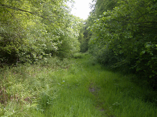
UK ECN site. Alice Holt forest lies in the Weald between the North and South Downs in southern England. Alice Holt Forest Park covers 851 hectares of mainly Corsican pine but approximately 140 ha. of original 1820 oak still remain. The ancient forest is now a truly multi-purpose woodland where research, conservation, timber production and recreation co-exist. The target sampling square is located in 90 hectares of 80 year old semi-natural oak woodland. Gault clay dominates the underlying geology. For the past 25 years intensive monitoring has been carried out under a variety of programs at this highly instrumented site. The site is part of a network of such highly monitored forests across both the UK and Europe. The Alice Holt site is owned by the Forestry Commission and is run by Forest Research under the Integrated forest monitoring programme. Collaboration with other research programs is actively encouraged.
-
Protected in 1968, Doñana National Park (537 km2) is a UNESCO Biosphere Reserve, a Ramsar Site and a Natural World Heritage Site. It contains the largest wetland in Western Europe, a intricate matrix of marshlands (270 km2), phreatic lagoons, a 25 km-long dune ecosystem with its respective shoreline and representative Mediterranean terrestrial plant communities. Doñana is both a critical stopover site for Palearctic birds migrating to Africa and an important overwintering site for waterfowl. Doñana LTSER platform comprises both the protected area and the surrounding territories (2736 km2) where a complex landscape matrix composed by rice fields, fisheries, irrigated crops, berry greenhouses, vineyards, olives and pine afforestations hold the tributary streams that pour their water to the fluvial marshland, the main figure of Doñana. Doñana surroundings hold over 180000 permanent inhabitants. Inside the protected land, the main 3 ecosystems sustain more than 1550 species of vascular plants, 900 species of arthropods, up to 400 breeding and migratory bird species, 38 mammal species, 72 species of fishes, 40 reptile and amphibian species.
-

Historically, the role of the Galapagos Islands has been considered critical due to the evolutionary diversification induced by natural and historical isolation. The Galapagos National Park was established in 1959, based on its historical importance associated with Charles Darwin's voyage and its rare and endemic biodiversity, composed of unique vertebrate and plant communities (Rozzi et al. 2010). In 1978, the Galapagos Islands were declared a UNESCO World Heritage Site, a critical factor associated with this national park (Rozzi et al. 2010). The Galapagos Islands are a pristine area with local and regional climates influenced by the interaction of ocean currents and winds driven by the Inter-Tropical Convergence Zone; ITCZ (Conroy et al. 2008, Trueman and d'Ozouville 2010). The long-term programme includes forty natural aquatic ecosystems (lakes, ponds, lagoons and swamps) that will be sampled on the islands of San Cristobal, Santa Cruz, Isabela and Floreana, where possible along a lowland-highland gradient. The number of sampling points will vary according to environmental heterogeneity and the presence of a littoral region, among other factors.
-
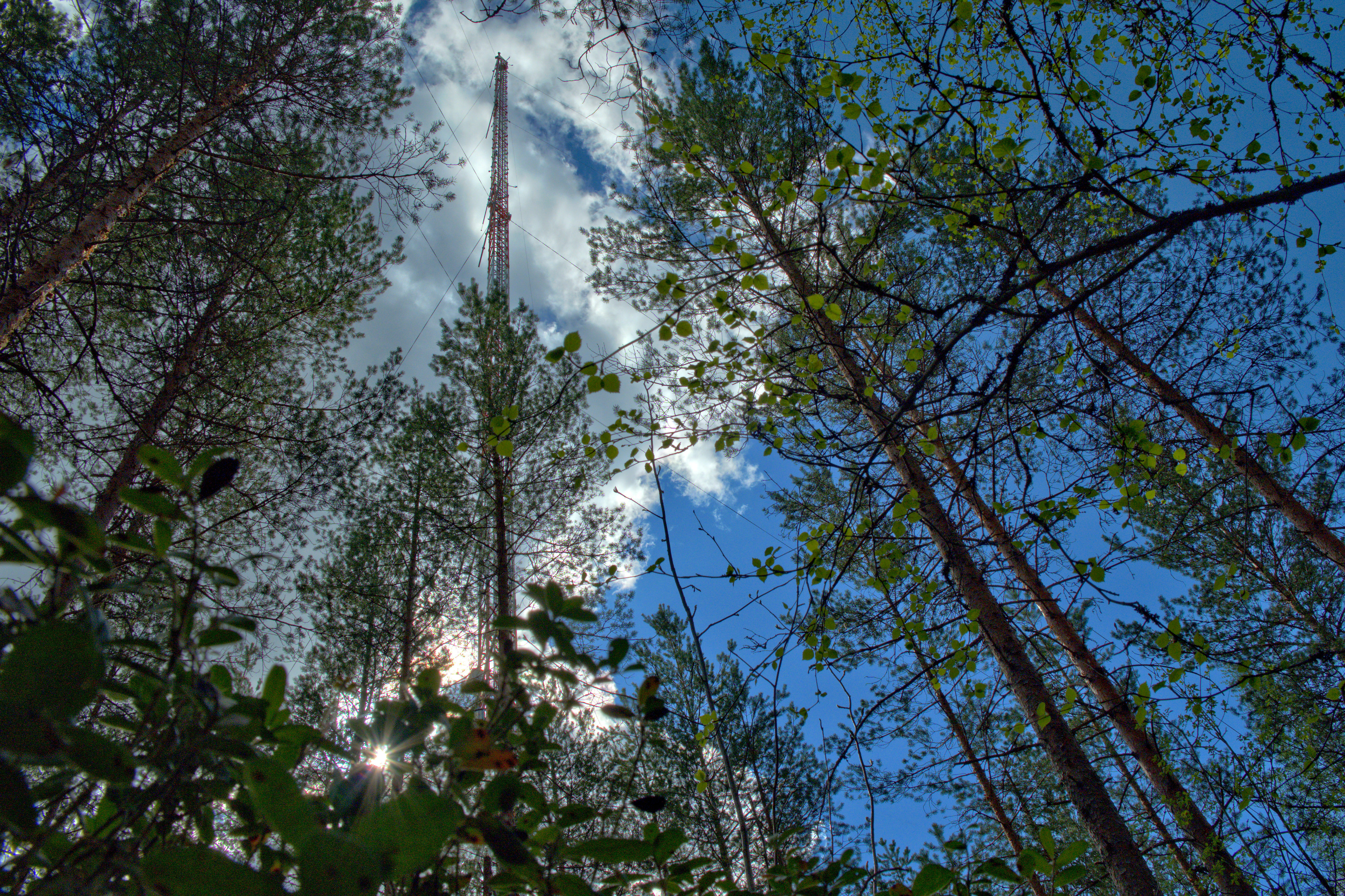
The Hyytiälä SMEAR II site (Station for Measuring Ecosystem-Atmosphere Relations) is situated in the Hyytiälä Forestry Field Station of the University of Helsinki. The site consists is a managed, 60-yr old Scots pine forest stand. The main idea of SMEAR type infrastructures is continuous, comprehensive measurements of fluxes, storages and concentrations in the land ecosystem–atmosphere continuum. The forest measurements are operated continuously since 1996, and include e.g. leaf, stand and ecosystem scale measurements of greenhouse gases, volatile organic compounds, pollutants (e.g. O3, SO2, NOx) and aerosols, in addition to full suite of meteorological measurements. The biogeochemical cycles and vegetation–soil–atmosphere interactions are studied both experimentally and with long-term observations. The site has full carbon, water and nitrogen budgets made over 10 years, and it is a full ICOS ecosystem and atmospheric station. Ecosystem and atmosphere measurements also exist nearby in two open oligotrophic fen sites and a humic lake with forested catchment. Most of the measured data can be retrieved from: https://smear.avaa.csc.fi/