
water colour
Type of resources
Available actions
Topics
Keywords
Contact for the resource
Provided by
Years
Formats
Representation types
-
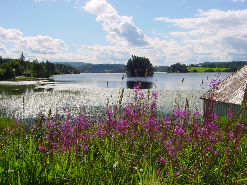
This is a long-term monitoring study of freshwater zooplankton and phytoplankton population changes after introduction of the mysid, Mysis relicta Lovén, 1862 in lake Jonsvatnet. It is an oligotrophic lake located in central Norway (63° 22’ N, 10° 37* E), 150 m above sea level. The lake has three basins divided by narrow sounds with depths of 1 – 3 m. The major basin is Store Jonsvatnet with surface area of 12,4 km2 and the two smaller ones are Lille Jonsvatnet and Kilvatnet with surface areas of 1,6 km2 and 0,8 km2 respectively. The maximum depths of the three basins are 97 m, 37 m and 34 m respectively and the average depth of the lake is 37 m. Method: Plankton are sampled at one station in each lake basin. All samples are taken during the period June-October, twice a month in June - August, once a month in September and one sampling of mysids in late October. Zooplankton is sampled with a 1 m long tube sampler (volume 5 l). A vertical column of water extending from 0 to 20 m depth is consistently sampled every 1 m. Samples from 5 m layers are mixed together and treated as one sample. Phytoplankton is sampled with a water sampler (volume 1.6 l). A vertical column of water extending from 0 to 10 m depth is consistently sampled every 1 m. Samples from 5 m layers are mixed together and treated as one sample. Mysis relicta is sampled in Lille Jonsvatnet with vertical net hauls (net opening 1 m2, mesh size 500 µm) from 1 m above bottom to to the surface.
-
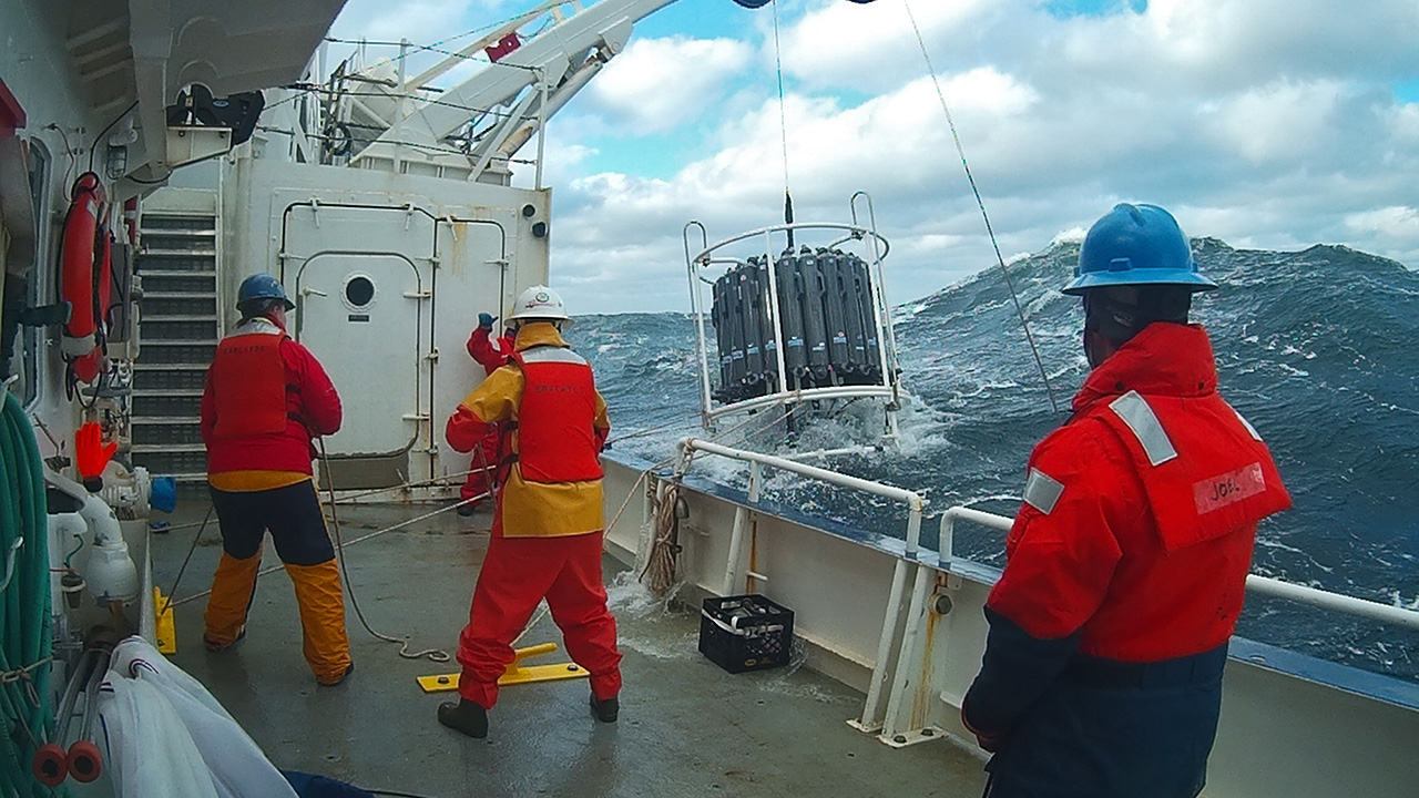
The Northeast US Shelf (NES) ecosystem spans the Middle Atlantic Bight and Gulf of Maine, is a large portion of the NW Atlantic Shelves Province, and is in a coastal biome. The waters over the NES provide an array of ecosystem services including fishing, energy development, shipping, waste disposal, recreation, and conservation. The NES ecosystem, like other productive temperate shelf ecosystems, is characterized by strong seasonality along with high levels of variability in physical forcing at timescales from days to decades, including climate impacts.
-
The Neusiedler See - Seewinkel National Park is the first cross-border National Park in Austria and the first Austrian National Park recognised by the IUCN. It covers in total about 90km² on Austrian territory. About 50% of the area (about 4500 ha) is a Nature Reserve Zone, which remains untouched by humans. This zone is dominated by the southernmost Austrian part of the reed belt from Lake Neusiedl. The Conservation Zones are mainly cultural landscapes and require landscape conservation measures and habitat management like pasturing, mowing, cutting reed or water retention. These measures are taken to preserve the cultural landscape and its biodiversity that has developed over centuries. Important habitats like 160 km² of reed belt and around 40 periodically dry soda lakes, as well as sand habitats, dry and wet meadows can be found closely associated with vineyards, cropland, touristic infrastructure and rural settlements. Long-term monitoring programs regarding bird populations, fish ecology or the grazing management enable the cross-border National Park Neusiedler See - Seewinkel to provide biological data from flora and fauna. Furthermore, all soda lakes are monitored frequently regarding salinity, oxygen, temperature, color etc. and biological parameters such as species diversity and quantity of macrozoobenthos. Due to the mosaique of protected and non-protected areas, the boundaries of the National Park area are difficult to define on the shown map.
-
Processing of time series of satellite and airborne images, with different spatial and spectral resolution, in order to derive water quality maps based on physically based algorithms parametrised with specific optical properties of lake Garda. Generation of spatial and temporal information of different water quality parameters of surface water column and coastal zone. Dedicated actives of calibration and validation of satellite images, algorithms and products.
-
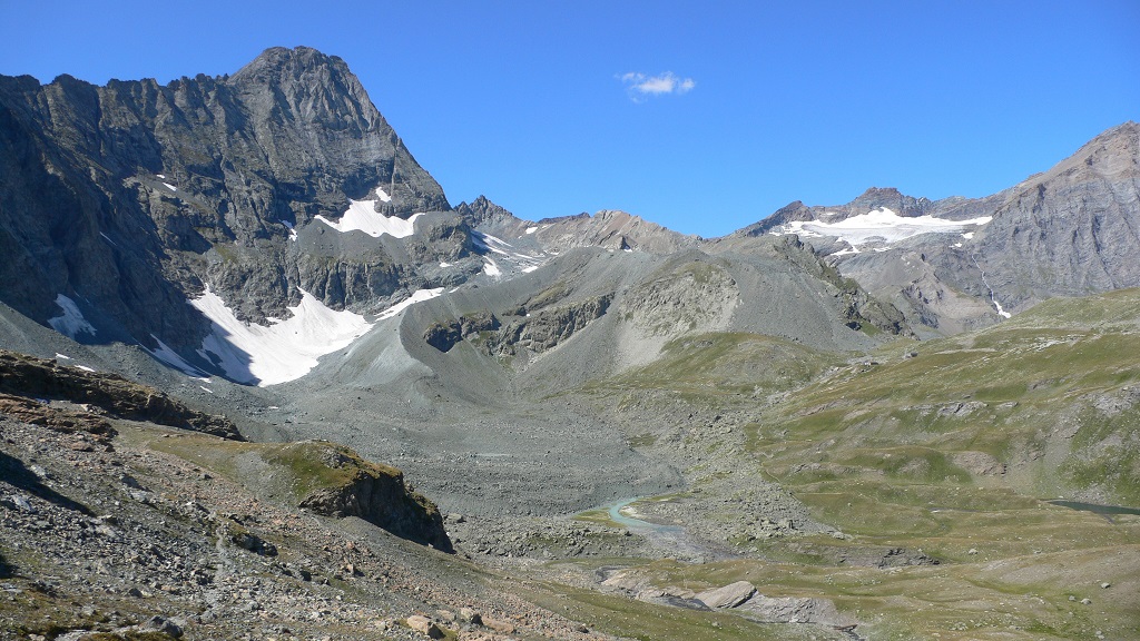
The Bessanese high-elevation experimental site is located in the Western European Alps (Graian Alps, municipality of Balme, Italy). This site is representative of the glacial and periglacial environments of the Alps. In this site, glaciers have been the main morphogenetic agent: the head of the basin hosts a well-developed glacial cirque, while the LIA has left an imposing moraine on the left side of the glacier as an indelible mark in the landscape. Additional cryogenic and atmospheric processes, running waters and gravity have contributed to shape the study area. These latter processes are becoming more and more important, compared to glacier shaping, in the present context of climate change, which led to an impressive-areal and volume reduction of the glacier. Most of the area once occupied by the glacier is now covered with debris which, in many cases, is ice-cored, or contains ice lenses. Downstream of the main lake of the basin, located at an elevation of about 2580 m, the debris forms a large and characteristic rock glacier. Among gravitative processes, rockfalls are particularly common and relevant from the hazard point of view in the study area. dataset available on Pangaea repository: 1. Nigrelli, Guido; Chiarle, Marta; Merlone, Andrea; Coppa, Graziano; Musacchio, Chiara (2022) – Rock temperature variability in the alpine cryosphere. Pangaea Data Publisher for Earth & Environmental Science, https://doi.pangaea.de/10.1594/PANGAEA.950246 2. Nigrelli, Guido; Barbero, Secondo; Chiarle, Marta (2021) – Solar radiation at the Bessanese high-elevation experimental site (Italy). Pangaea Data Publisher for Earth & Environmental Science, https://doi.org/10.1594/PANGAEA.930679 3. Nigrelli, Guido; Chiarle, Marta; Merlone, Andrea; Coppa, Graziano; Musacchio, Chiara (2018) – Rock and debris temperature in the alpine cryosphere. Pangaea Data Publisher for Earth & Environmental Science, https://doi.org/10.1594/PANGAEA.894317
-
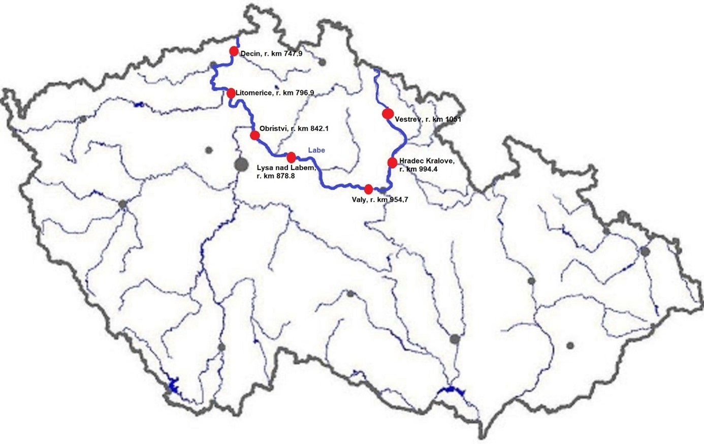
The Elbe River is one of the major rivers in Central Europe. It springs at an altitude of about 1,400 meters in the Giant Mountains in the north of the Czech Republic. It flows through eastern, middle, and northern Bohemia, and its catchment area includes most of Bohemia. The Elbe traverses the northeastern part of Germany and flows into the North Sea. The total river length is 1,094 km. In the Czech Republic, the monitored river length is 371 km and the catchment area includes 49,933 km2. The average flow at the Czech-German borders is 311 m3 s-1. Many weirs dam the watercourse of Elbe River in the Czech Republic. This artificial intervention is crucial for the characteristics of the riverbed, its width, depth, and bottom substrate. The width of the riverbed in the monitored area ranges from approx. 10 m on the upper course to approx. 150 m on the lower course and river sections above the weirs. The depth of the river varies from 0.5 m in the upper parts and below the weirs to more than 5 m in the lower course and above the weirs. The bottom substrate varies from the stony, gravelly, and sandy fractions in shallow and fast-running sections to muddy/silty fractions in slow-running sections above the weirs. The main tributaries of the Elbe in Bohemia are Metuje, Orlice, Jizera, Ploučnice, Vltava, Ohře and Bílina rivers. The catchment area is densely populated. The river is exposed to various sources of pollution (organic, agricultural, and industrial) and hydromorphological pressures (straightening, shortening, regulation of meanders, and fragmentation of river continuity). There are seven permanent monitoring sites on the Elbe River in the Czech Republic: Děčín (river kilometer 747.9), Litoměřice (796.9), Obříství (842.1), Lysá nad Labem (878.8), Valy (954.7), Hradec Králové (994.4) and Vestřev (1051). The Elbe basin long term environmental research has been organised by the Ministry of Environment of the Czech Republic and cooperation institutions since 1993. More than 600 physicochemical parameters, including sensory properties of water, are regularly monitored in at least nine different types of matrices (water, sediment, periphyton, floats, sedimentable floats, benthos, fish tissues, fish fry, and Dreissena polymorpha tissue) and using passive samplers. Among the main monitored characteristics belong balances of macroelements (carbon, nitrogen, oxygen, phosphorus), concentrations of inorganic salts, heavy metals and various organic pollutants such as pesticides, personal care products (including drugs) and other anthropogenic substances in the environment. Characteristics such as abundance and species composition are regularly monitored in fish, macrophytes, macrozoobenthos, phytobenthos and plankton.
-
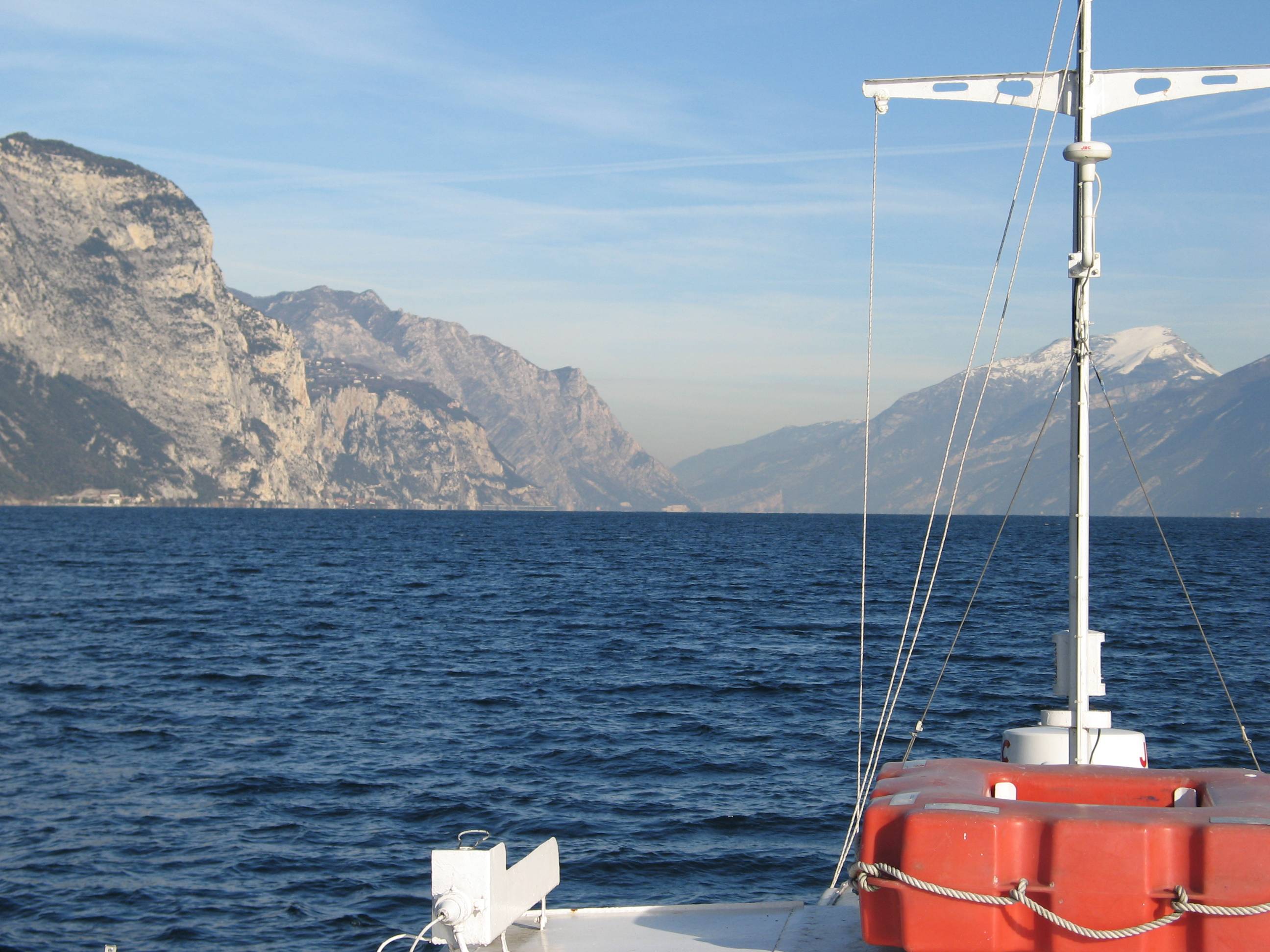
Lake Garda has the largest volume (49 billions of cubic meters) and the most extensive area (368 km2) of Italian lakes. Along with lakes Orta, Maggiore, Lugano, Como, Iseo and Idro, it forms part of the group of deep lakes located south of the Alps in one of the most densely populated and highly productive area of Italy. With a total volume of over 124 billions of cubic meters, these lakes constitute one of the largest freshwater supplies in Europe. Their waters are used for agriculture, industry, fishery and drinking. Moreover, they are an important resource for recreation and tourism thanks to both attractive landscape and water quality. In Lake Garda, sporadic studies were carried out irregularly by various Institutions up to the end of the 1980s. Since the beginning of the 1990s, continuous monthly samplings and measurements were carried out by the Department of Biology of the Padova University (Responsible, Nico Salmaso), with the collaboration of ARPAV. Since 2005 the whole limnological research is performed by the Limnological research group of the Agrarian Institute of S. Michele all’Adige – E. Mach Foundation (S. Michele all’Adige, Trento; coordinator, Nico Salmaso). Since the 1970s, Lake Garda showed an increase in the trophic status, with mean annual concentrations of total phosphorus in the whole water column increasing from ca. 10 µg P/L to 20 µg P/L. In the last 4-5 years of observations, TP showed a stabilisation of the concentrations, around 18 µg P/L. At the community level, annual phytoplankton cycles underwent a unidirectional and slow shift mainly due to changes in the species more affected by the nutrient enrichment of the lake. After a first and long period of dominance by conjugatophytes (Mougeotia) and diatoms (Fragilaria), phytoplankton biomass in recent years was sustained by cyanobacteria (Planktothrix). Other important modifications in the development of phytoplankton were superimposed on this pattern due to the effects of annual climate fluctuations principally mediated by the deep mixing events at spring overturn. Main specific research objectives in this LTER station include: -Changes in the physical, chemical and biological variables at different temporal scales, from months to decades and centuries (paleoecology). Update of the time series of hydrological, climatological and limnological data, whith special attention to lake evolution and effects on biotic communities in relation to ongoing climatic changes. Definition of predictive models. - Identification of the environmental and biotic mechanisms favouring the development of cyanobacteria (including the recent appearence of blooms and new species). Identification of the factors selecting for the development of toxic strains, the production and concentrations of epato- and neurotoxins, and their impact on trophic webs and water usability. The limnological field facilities of the limnological research group include 2 rubber dinghies, 2 multi-parameter probes, a fluoroprobe, a FlowTracker Handheld ADV Sonntek, underwater Quantum sensors, a Kajak corer and an Eckman dredge for sediment sampling. The unit also has several laboratories. These include the hydrobiology and microscopy laboratory, equipped for analyses of basic limnological variables (photosynthetic pigments, dry weight, dissolved oxygen, water turbidity, macrophytes) and of phytoplankton, picoplankton and periphyton samples (microscopes, invertoscopes, fluorescent microscopy, image analysis). The analytical and environmental chemistry laboratory is equipped for analysis of the major ions and nutrients (phosphorus, nitrogen and silica), as well as organic molecules (with focus on cyanotoxins) by means of spectrophotometry, ion chromatography and Liquid Chromatography-Mass Spectrometry (LC-MS). We have access to genetic laboratories equipped with the principal analytical tools, i.e. PCR, electrophoresis, and sequencing. The data collected at monthly frequency since 1991 includes water temperature and oxygen. Phytoplankton was collected since 1993, while complete data recording (including chemistry and zooplankton) begun in 1995.
-
Coniferous forests and mire.
-
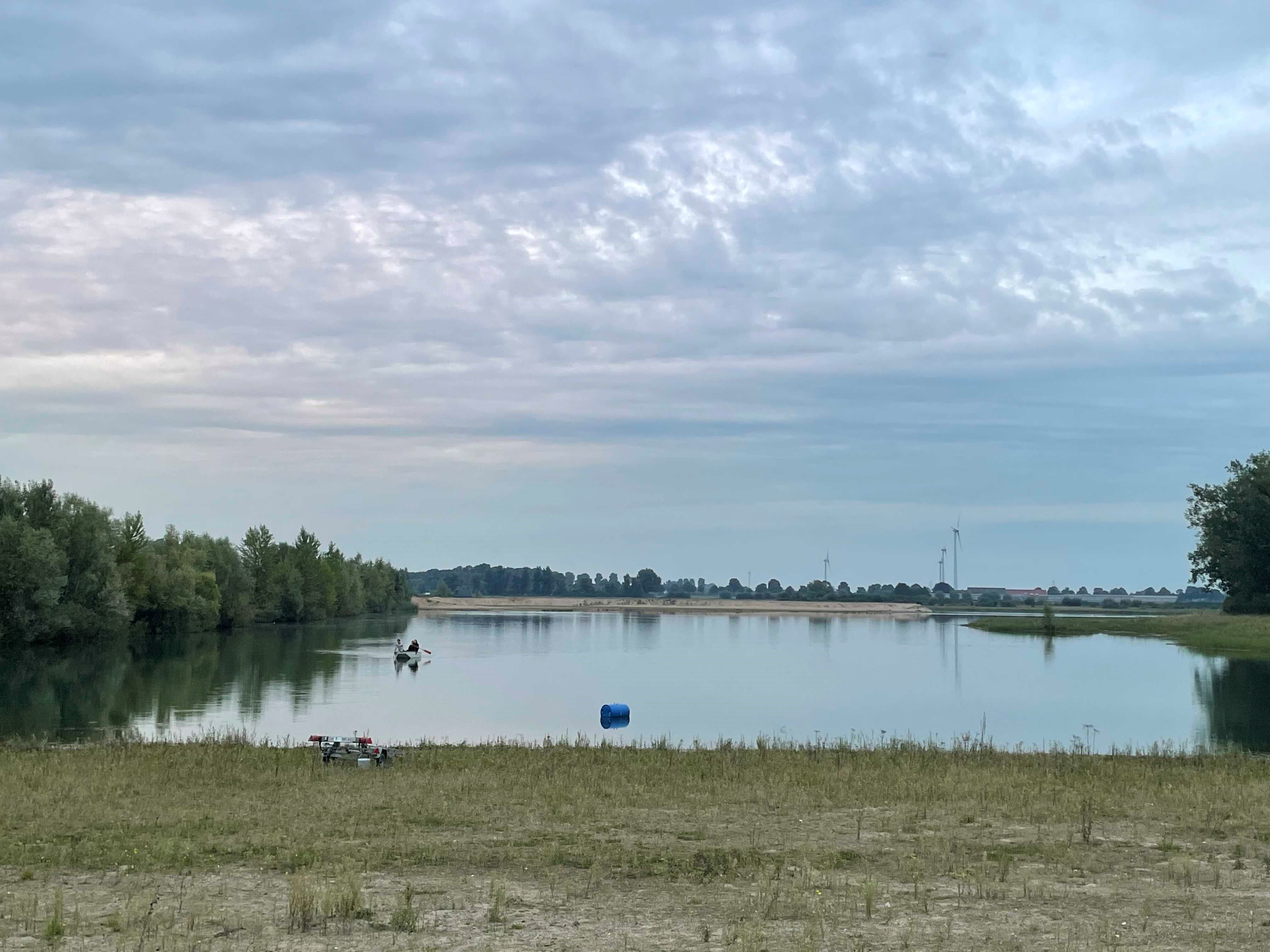
How do freshwater ecosystems react to changing environmental conditions and to what extent can these changes be captured in the dynamics of eco-evolutionary processes? The project REES ('Rhine Eco-Evolutionary System') aims at the long-term assessment of eco-evolutionary interactions in the Rhine as a limnic habitat under consideration of diverse associated water bodies. The study area includes the main flow channel of the Rhine (km 845, North Rhine-Westphalia), as well as Rhine oxbows, Rhine water-fed gravel pit lakes in ecological succession and the surrounding floodplain (Rees, district of Kleve). The Ecological Research Station Rees-Grietherbusch of the Institute of Zoology (University of Cologne) and the Nature Conservation Center District Kleve e.V. form the central infrastructure of the study area. In addition, the Ecological Rhine Station of the University under the direction of Prof. Dr. Arndt is also associated to the project, which enables direct sampling and experimental recording of the main Rhine flow channel. The extensive system of standing and flowing freshwater bodies covered in the REES study site allows the investigation of dynamic variations in biodiversity composition at all levels, from species diversity of communities to genomic diversity at the molecular level of individuals and populations. Along a selected trophic cascade, representative species will be long-term observed and analyzed ecologically and especially also (population-)genomically. The incorporation of ecological genomics is the core aspect of this LTER-D project, which is intended to capture the feedback of evolutionary changes on the ecological system. Population genomic approaches can be used to infer both evolutionary and ecological processes from genomic data. To cope with the dimension of this project, REES is designed as an interdisciplinary collaboration project and currently counts seven project partners with corresponding subordinate projects.
-
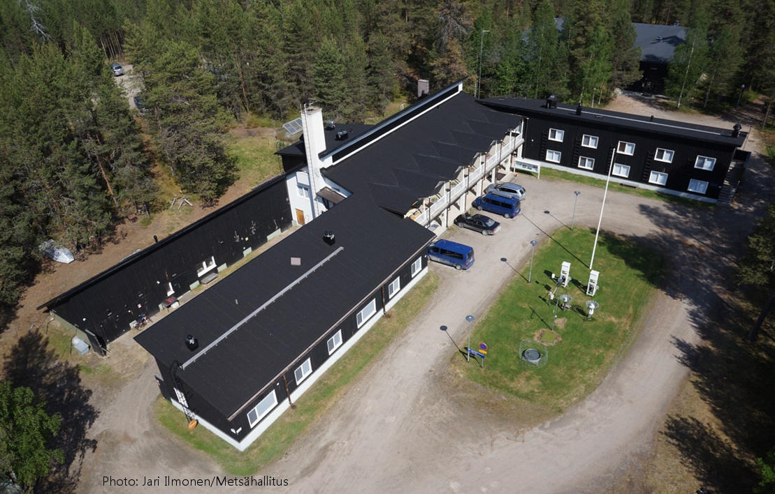
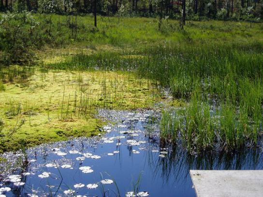
Oulanka Research Station is part of the Infrastructure Platform and is situated in Kuusamo as a regional unit of the University of Oulu. The station is located in the Oulanka river valley within the Oulanka National Park (66°22'N, 29°19'E). The area lies within the boreal coniferous forest-zone (Taiga), where Norway spruce and Scots pine prevail. In the Oulanka river valley there are, also many alluvial meadows, stream mouths and crags supporting luxurious plant communities. The bedrock is calcium-rich in places. Bogs, fens and marshes as well as numerous springs, ponds and lakes, brooks and rivers characterize the landscapes. All these factors together create a diverse and exceptional rich environment with rich flora and fauna.In terms of temperature Oulanka has a continental climate. The coldest and warmest ever measured temperatures are -48.0°C and 32.1°C. The difference between the mean temperature of coldest (January, -15°C) and the warmest (July, 15°C) month is 30°C. The mean temperature for the whole year is c. -0.5°C (1967-2009).