
water depth
Type of resources
Available actions
Topics
Keywords
Contact for the resource
Provided by
Years
Formats
Representation types
-
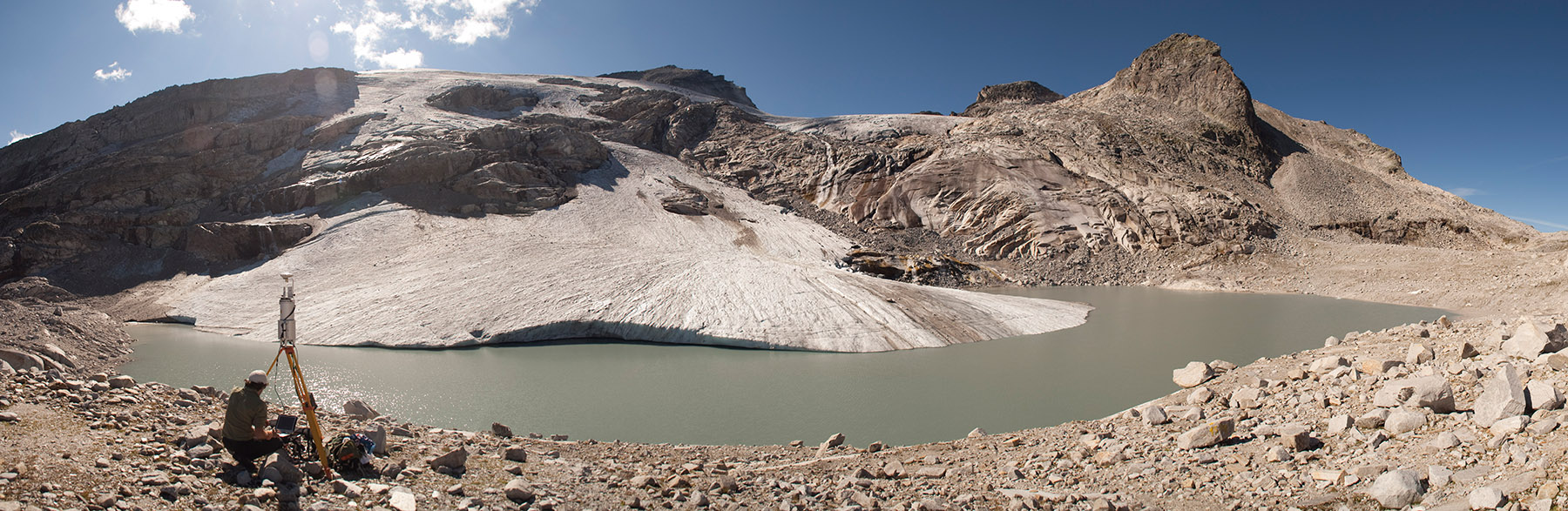
The formation of a periglacial lake was forced at the glacier terminus in recent years by the fast disintegration of the glacier. The development of the untere Eisboden See is well documented. Since August 2002, a runoff gauge installed by the Hydrographical Service of Salzburg has recorded the discharge at the outlet of the new Unterer Eisboden See.
-
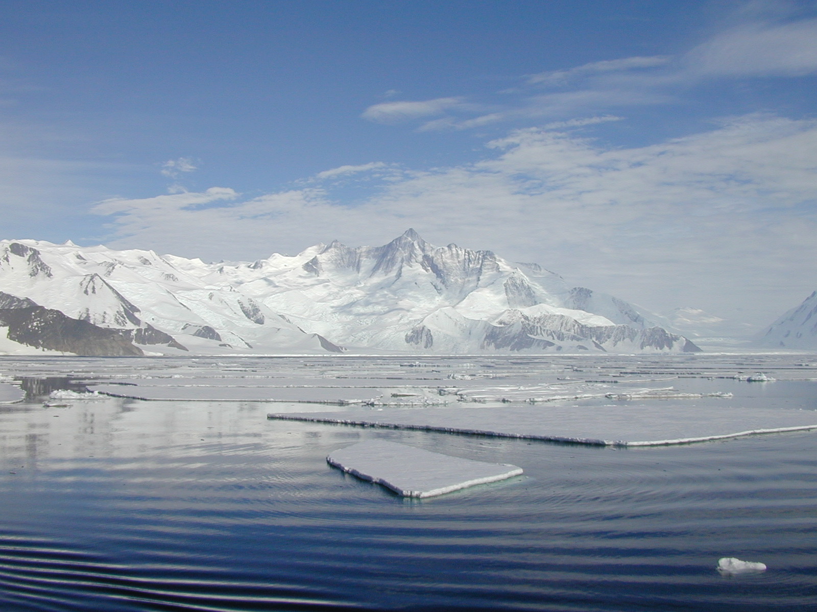
The Mooring D is located in the western Ross Sea in Terra Nova Bay. The mooring is equipped with sediment traps, currentometers, trasmissometer, fluorimeter and CTD.
-
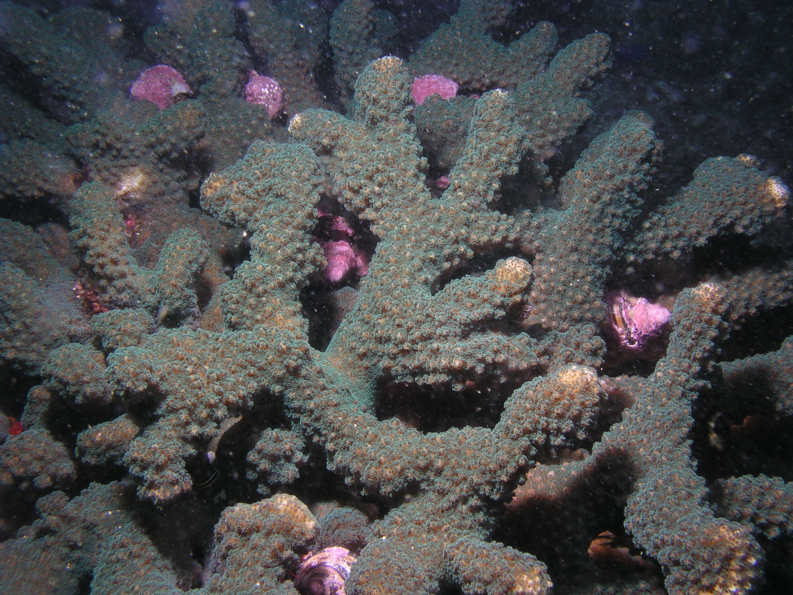
Arrecifes coralinos y rocosos del Pacífico Mexicano desde Baja California hasta Chiapas. El trabajo se desarrolla en cuatro principales regiones: Sur del Golfo de California, Islas Revillagigedo, Bahía de Banderas y Bahías de Huatulco. Cabo Pulmo es el de mayor extensión. Tiene registradas 67 especies de corales en 368 localidades.
-
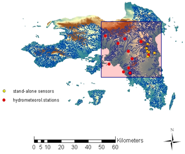
The Hydrological Observatory of Athens (HOA) is operated by the Centre for Hydrology and Informatics (CHI) of the National Technical University of Athens (NTUA). It is located in the region of Attica, covering the greater Athens area and the Rafina basin. The region of Attica is characterized as a Mediterranean eco-region, which includes three main land use types: urban, peri-urban and rural. Forests are limited to the mountainous areas of Parnitha, Penteli and Ymittos, which are frequently threatened by devastating wildfires, affecting the local ecosystems, hydrology, soil erosion and climate conditions. The hydrographic network is fragmented, mainly consisting of small coastal basins and streams. The most important water body is river Kifisos, which is a heavily modified water body running through a heavily urbanized environment.
-
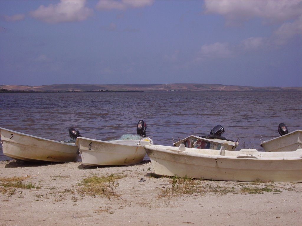
Cabras Lagoon is located on the west coast of Sardinia (Italy), in the Gulf of Oristano (39°56’37’’N, 08°28’43’’E), and occupies about 2280 ha, with a mean water depth and maximum of 1.6 and 3 m respectively. The watershed of the site extends over approximately 430 km2. The input of freshwater into the lagoon is scarce and irregular because of the semi-arid Mediterranean climate. Most of the freshwater comes from the small Mare ‘e Foghe River, located in the north. The predominance of agriculture in the region and the release of poorly depurated urban waste account for the high nutrient loads deposited in Cabras Lagoon. The resident population of about 38,000 inhabitants is grouped in 19 urban centres, the largest being Cabras, which is located on the southeast coastal side of the lagoon. During the twentieth century, the lagoon and its watershed underwent several modifications as a consequence of human activities that affected the hydrology and hydraulics of the region. In addition, in the late 1970s, water exchange with the sea was altered by the dredging of a large canal, the Scolmatore (spillway), which connected the lagoon with the adjacent Gulf of Oristano. The canal was constructed to avoid flooding of adjacent land during the heavy rainfall that occurs in winter. In addition, a cement dam was built into the Scolmatore to prevent further increases in the lagoon’s salinity and artificial barriers were constructed to control the fish catch, thereby impeding direct communication between the lagoon and the sea. Now the only link to the sea is via four very narrow creeks that flow into the large canal from the southern part of the lagoon over the barrier. The lagoon has a high economic rating due to ex¬tensive fishery activities, involving about 300 people and those involved in related enterprises. In the site, in addition to the guard houses and warehouses of fishermen, there is also a restaurant, where the products of fishery in the lagoon are offered. In 1998, fish productivity reached 40,000 kg km-2, corresponding to a catch of 850 tonnes but these values fell to around 20,000 kg km-2 and less than 80 tonnes after 1999. In fact, its high trophic status has often exposed the lagoon to important dystrophic crises, which have caused large reductions in its fishing productivity. Scientific monitoring has been carried out since the strong dystrophic crisis that affected Cabras Lagoon during the summer of 1999, killing the whole aquatic biota. A long-term series of data is available and derives from high-frequency measurements and samplings to assess environmental and biological parameters. In particular the data concern the main trophic descriptors (Secchi depth, temperature, pH, conductivity, dissolved oxygen and saturation, alkalinity, NH4-N, NO2-N, NO3-N, total nitrogen, soluble reactive phosphorus, total phosphorus, dissolved silica) and phytoplankton abundances, as chlorophyll a, cell densities and biomass, class and species composition. The activity was interrupted in 2009.
-
The mooring A is located in an open sea area close to Franklin Island, characterized by both clay bottom sediment and a flat morphology. The station can be considered as representative of the productivity and sedimentary conditions of the southern part of the Ross Sea, one of the areas considered to be affected by greater productivity rate.The study of mooring can be consider part of the activities conduct in the framework of the research project "ABIOCLEAR - Antarctic biogeochemical cycles - climatic and paleoclimatic reconstructions. (Resp. M. Ravaioli)". Such Project is the natural prosecution of previous research activity carried out from 1987. Objectives : Study of the particle fluxes towards the marine bottom sediment, in particular with the aim to obtain quali/quantitative estimate of the biogenica component coming from the primary production. Analysis of the vertical rain rate processes and, therefore, the marine cycle of the main biogenic particles such as Carbon and Silica. Try to obtain mass budgets of these parameters, estimating their cycle in the water column until the burial processes in sediments. From apparent accumulate rate calculated in the bottom sediment we will tried to discriminate the real vertical fluxes (Rain Rate) from the horizontal input from sediment remobilization processes. Acquisition and elaboration of long time series of data. Collection of bottom Sediment samples to estimate the variations of the productivity and the paleoproductivity in the area. Historical time series of Mooring A: Primary productivity data (every three years), fitoplancton, New and regenerated productivity, Seasonal, annual and interannual fluxes measure, monthly Particles samples, current velocity, water salinity, temperature and torbidity, Water-sediment interface measure. Biogeochemical parameters. Radiometrical Data, Mineralogical and grain size characterization. Nutrient, metals. Biostratigraphy interpretations. Lidar data are also available from 1997.
-
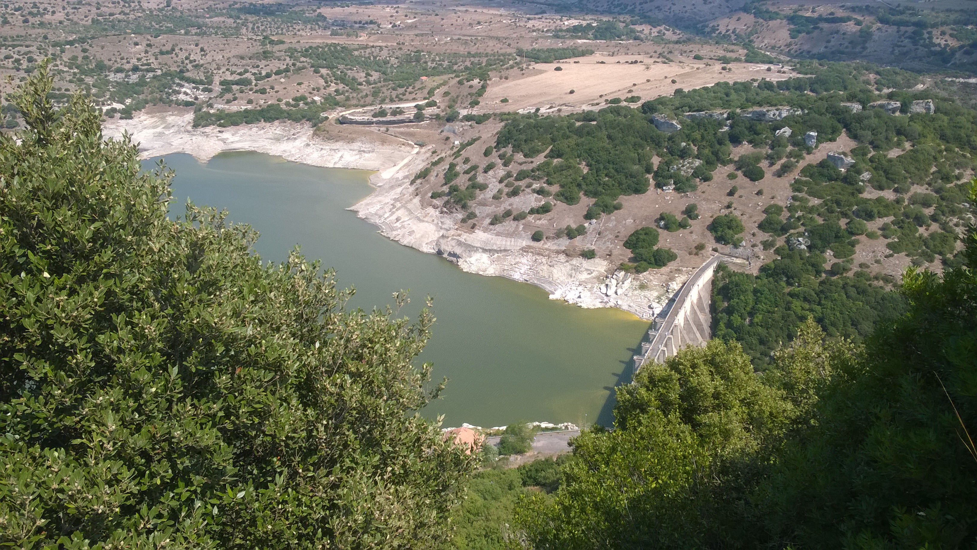
Lake Temo (IT10-006-A) is located in north-west Sardinia. The construction of the dam began in 1971 and ended in 1984. The reservoir lies at 226 m a.s.l. and has an area of 4.81 km2, a mean depth of 15.8 m and a maximum capacity of 91 x 106 m3. Its catchment extends for 142 km2.
-
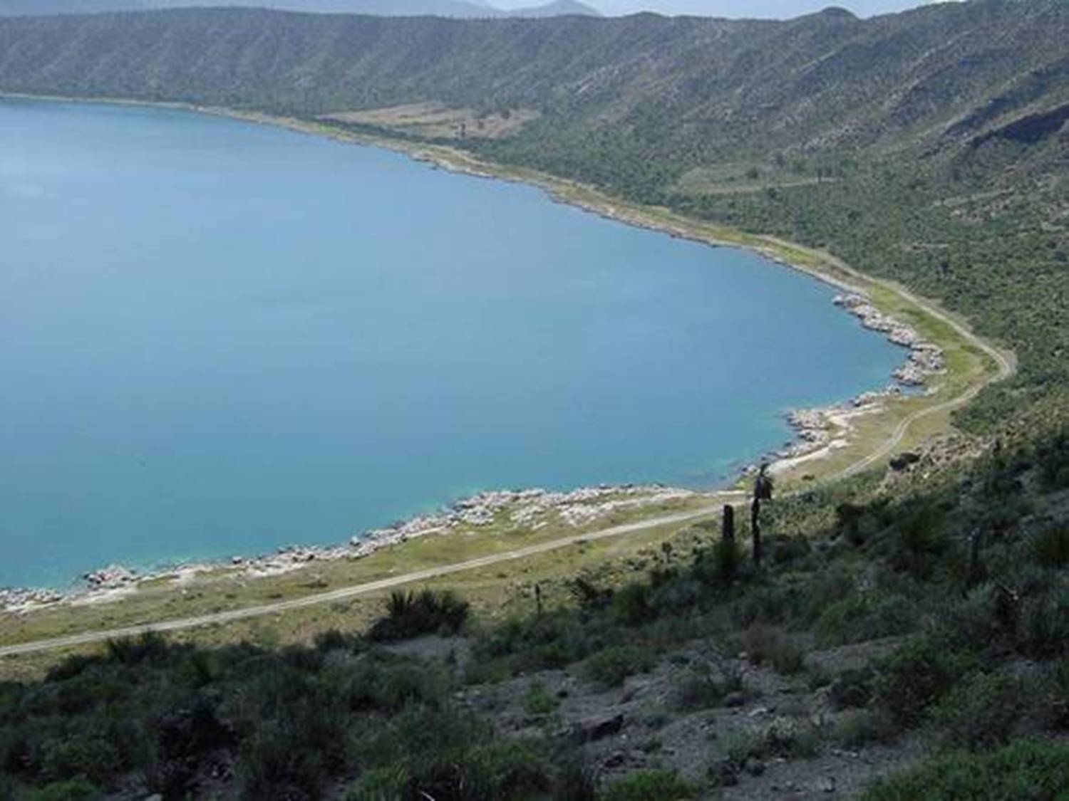
Lago Alchichica se localiza a una elevación de 2300 msnm con una profundidad 62 m y es de agua salobre.Habitan organismos endémicos y se encuentran rocas calizas de particular interés por los microorganismos que viven en ellas. Se encuentra en la Cuenca Oriental de Puebla.
-
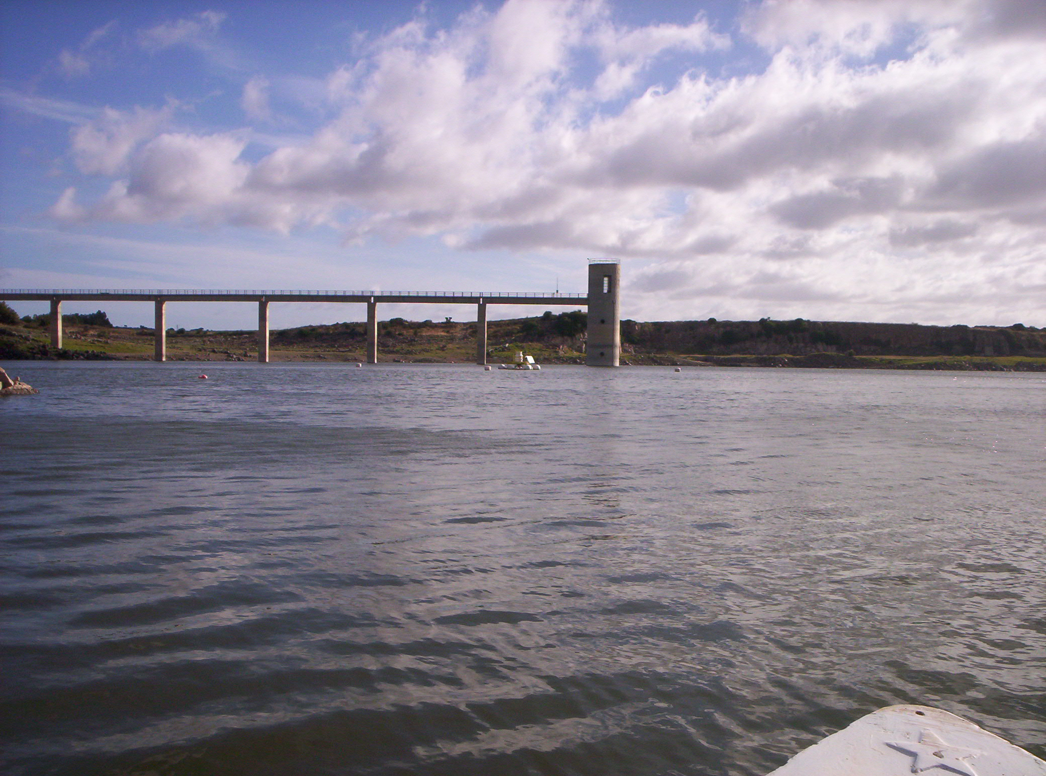
Lake Cuga (IT10-003-A) is located in the north-western part of Sardinia. The reservoir was built in 1965, but its first filling was in 1975. It lies at an altitude of 114 m a.s.l. and is extended for about 58 x 106 m2, with a maximum and average depth of 45 m and 11 m, respectively. It has a volume of 34 x 106 m3. The waters are used mainly for irrigation and drinking supplies. Cuga Lake is classified as eutrophic since the early years of its filling.
-
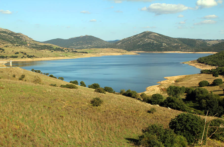
Lake Monte Lerno (IT10-004-A) is located in the North East part of Sardinia in the municipality of Pattada. Its construction was completed in 1980. The catchment area is extended for 160 km2. The reservoir lies at 563 m a.s.l. and has a maximum area of 4.4 km2, a mean depth of 14.9 m and a volume of 89.5 x 10⁶ m3 of water. Its waters are used for drinking and irrigation. Lake Monte Lerno is classified as eutrophic.