
water level
Type of resources
Available actions
Topics
Keywords
Contact for the resource
Provided by
Years
Formats
Representation types
-
Monthly water depth (cm) obtained from surveys for the period 1995-2009
-
River water level measured monthly at different stations for the period 1932-2014
-
We provide long-term data for the water level of Srebarna Lake (2010-2020).
-
Hydrological Station Gsengbrücke
-
Water level - surface water (running water) data of Weidedom and Gsengbrücke
-
measurments of gauging station GA (Gurgler Ache) level measurments & spring discharge measurments (dailiy means, monthly maximum and minimum values)
-
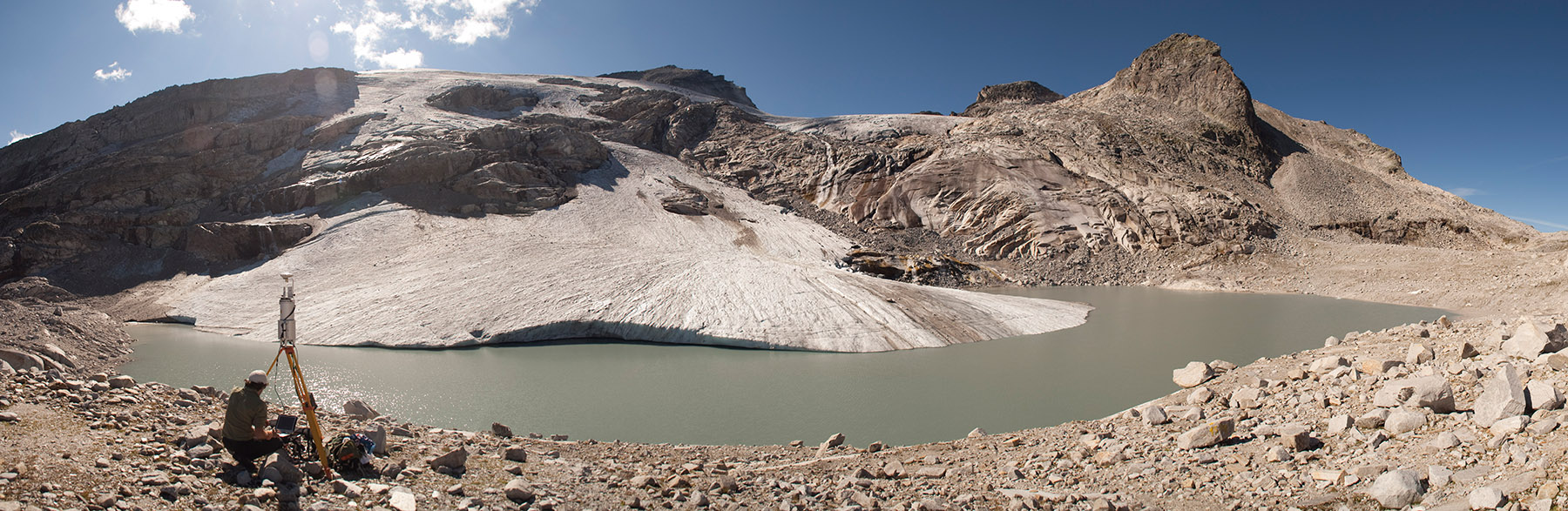
The formation of a periglacial lake was forced at the glacier terminus in recent years by the fast disintegration of the glacier. The development of the untere Eisboden See is well documented. Since August 2002, a runoff gauge installed by the Hydrographical Service of Salzburg has recorded the discharge at the outlet of the new Unterer Eisboden See.
-
Hydrological Station Bachbrücke
-
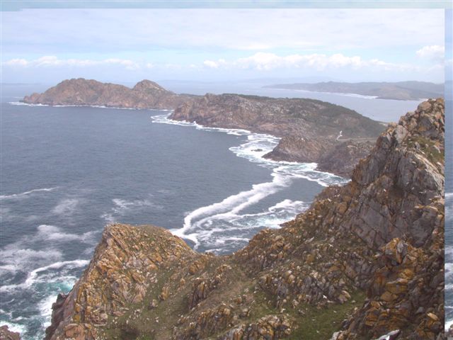
The Atlantic Islands of Galicia were declared a national park in 2002 in order to protect one of the best examples of Atlantic Ocean-associated ecosystems. Although on land there are highly valuable and exceptional ecosystems relating to cliffs, dunes and scrub, it is the marine setting that hosts the greatest biodiversity. Situated off the Rías Baixas (Lower Estuaries), the archipelagos Cíes, Ons, Sálvora and Cortegada, create a natural barrier to the ocean, thereby accentuating the rías’ estuary influence. The terrain features dune systems, cliffs with gorse and heather scrub, while the marine environment hosts a rocky seabed with large communities of brown algae (Sacorhiza polyschides and Laminaria spp.), which are home to a great variety of living things. The marine currents deposit sand in the most sheltered parts, and together with the important Mäerl beds consisting of the remains of calcareous algae, create a shifting substrate to which living things must adapt.
-
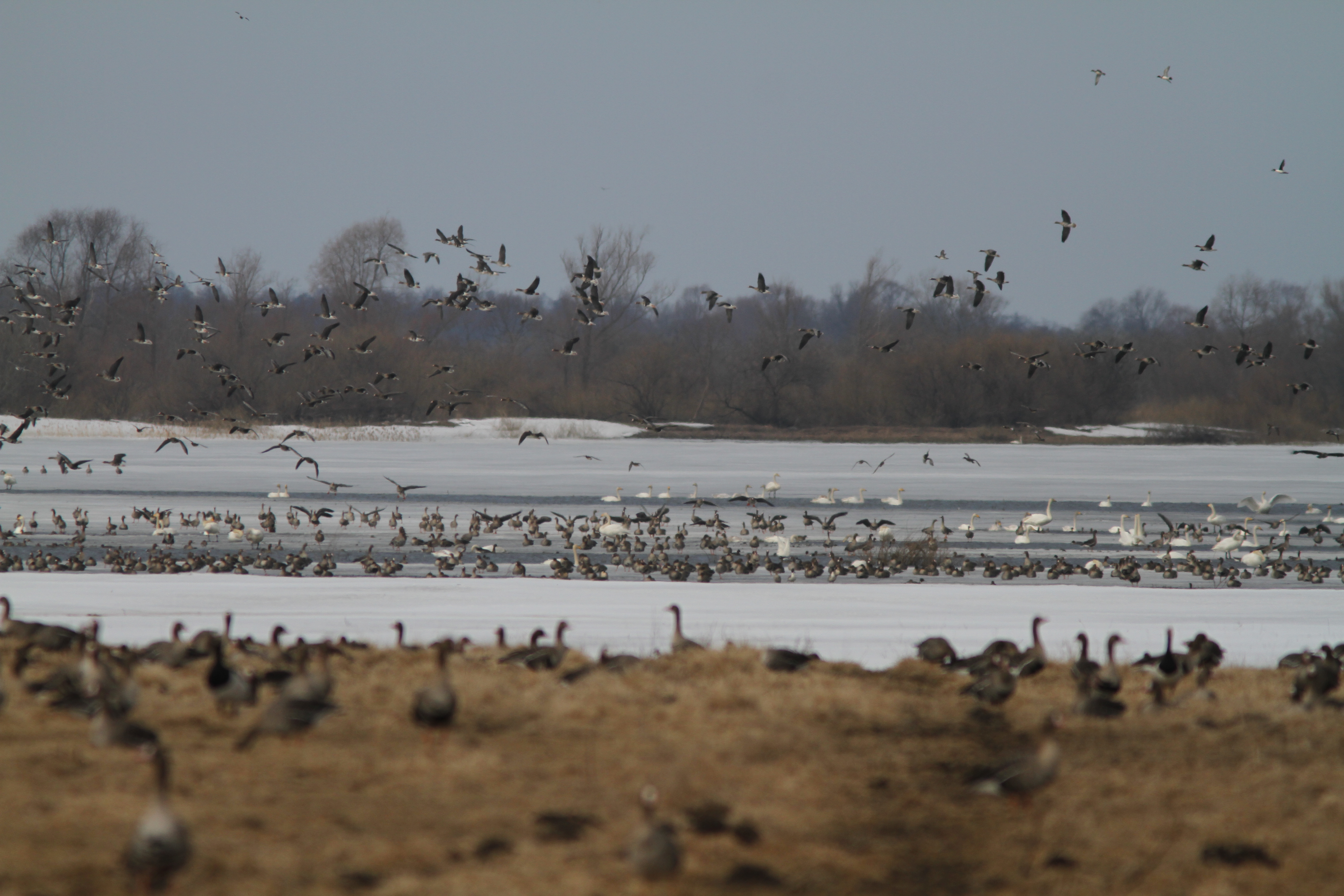
Arrived to the littoral region you will see a unique Nemunas delta with its major branches Atmata and Skirvytė and the island Rusnė surrounded by them. This landscape is created by water - there are many interlaced rivers, lakes - the lagoon of Krokų lanka and many other smaller lakes. There are also old river beds, marshes and fens. During the spring floods the regional park will provide you with unforgettable impressions. Your gaze will be able to travel flooded delta meadows full of rear water birds without hindrance. The delta is famous because of rare breeding birds abundance and because it is an important place for travelling birds. Under the Ramsar Convention criteria the delta was added to the wet areas of international importance list in 1993. This unique, versatile regional park landscape that still retains its natural dynamics must be preserved. The Nemunas River delta area with adjacent floodplains is the most important stopover site for numerous species of waterbirds in the South Eastern Baltic Region.