
water parameter
Type of resources
Available actions
Topics
Keywords
Contact for the resource
Provided by
Years
Formats
Representation types
-
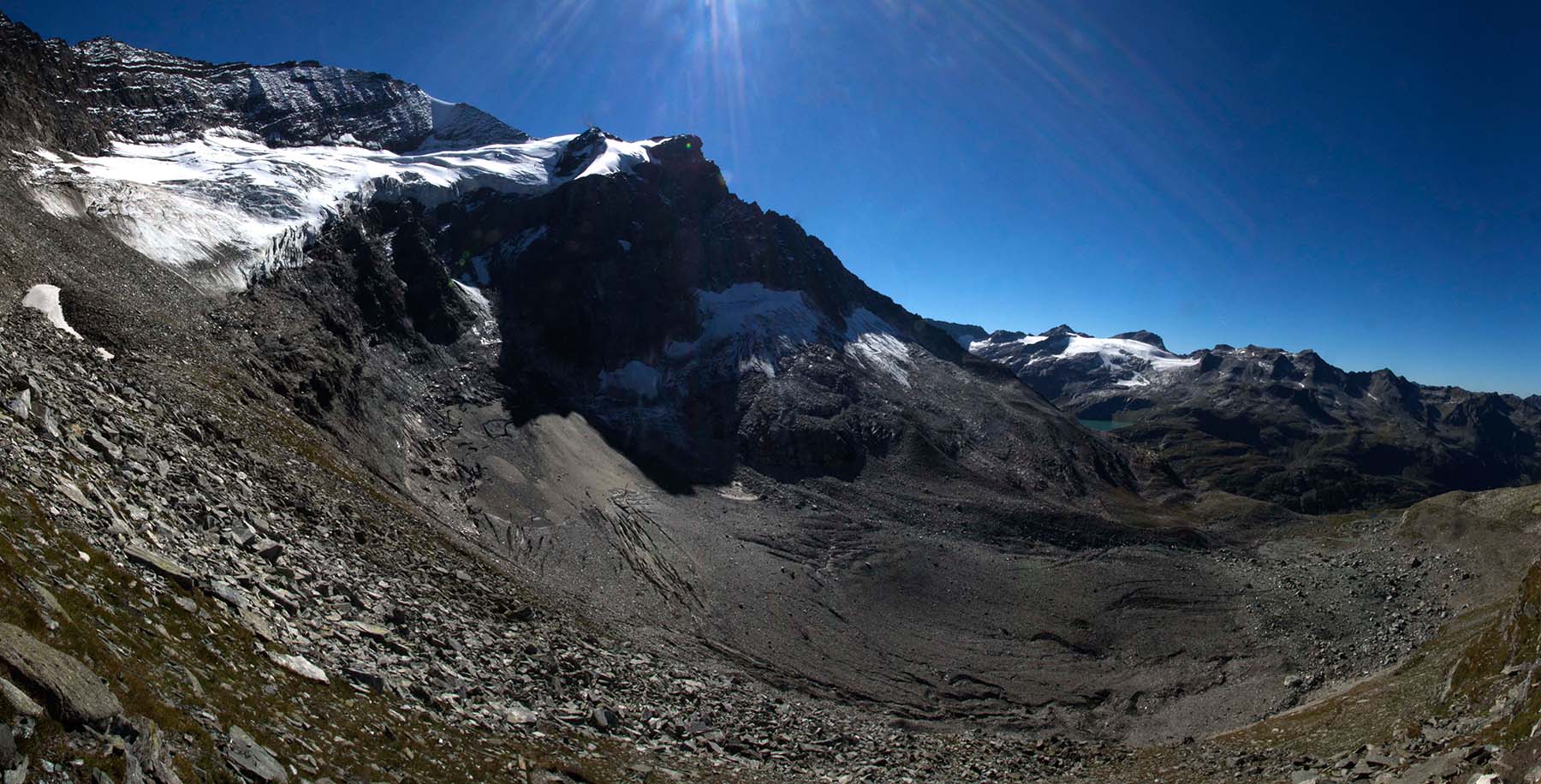
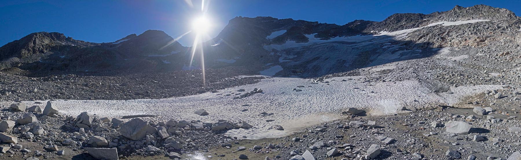
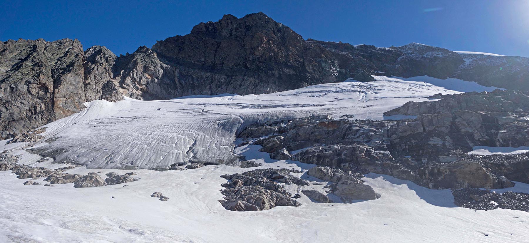
Reconstituted glacier by ice avalanches from Oberes Riffelkees(Totenlöcher). The Untere Riffelkees is a heavyly debris covered glacier tongue(Bergsturz around 1906). The glaicer is situated in the western Glocknergruppe in the upper Stubach Valley.
-
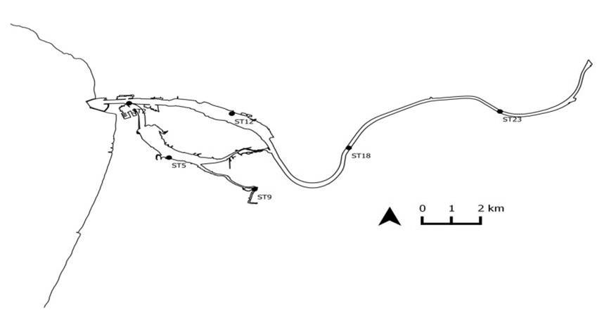
3M_RECITAL - MINHO, MONDEGO, AND MIRA ESTUARIES observatory: Long term vaRiation of ECOLOGICAL sTAtus as a response to naturaL and human induced changes. Implications for management and restoration. Mondego estuary site: The Mondego River drains a basin of approximately 6670 Km2 and its valley is considerably steep in upstream sections, forming a large alluvial plain consisting of good agricultural land in downstream areas. Since the 1960s, the Mondego catchment area underwent a large scale morphological modification, involving the construction of stone walls, to regulate the river water flow and enlarge harbor facilities, and water reservoirs to control floods, improve the uses of water resources, and produce electric power, which modified the riverbed topography and changed the system hydrodynamics. The river contributes presently with a high anthropogenic loading of nutrients and several chemicals into its relatively small estuary (1600 ha, splitting in two arms separated by an island in the terminal part), causing eutrophication. Besides, the estuary - Western coast of Portugal - North Atlantic Ocean Eco-region - supports industrial activities, salt-works, and aquaculture farms, and is the location of Figueira da Foz, a harbour and a centre of seasonal touristic activity. A comprehensive study on the Mondego estuary environmental quality has been carried out during the last two decades, focusing on water quality, hydraulics and sediments dynamics, plankton communities (phyto, zoo, and ichtyoplankton), the term evolution of the benthic communities (intertidal and subtidal), and the changes in macrophytes’ beds (Zostera noltei) and green macroalgae distribution in relation to morphological alterations.
-
not ready
-
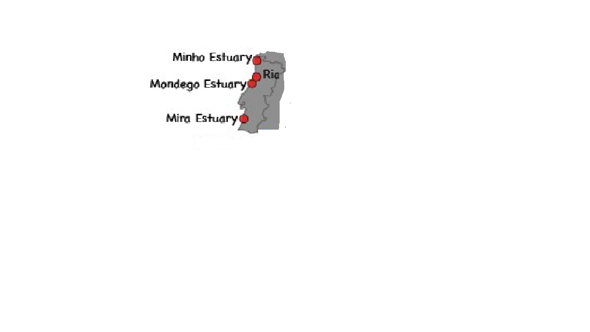
3M_RECITAL - MINHO, MONDEGO, AND MIRA ESTUARIES observatory: Long term vaRiation of ECOLOGICAL sTAtus as a response to naturaL and human induced changes. Implications for management and restoration. The Minho River estuary is located in the western Iberian margin (SW Europe), in the border region between the Minho (north of Portugal) and Galicia (Spain) regions. It is classified as a mesotidal estuary, covering a total area of 23 km2. The estuary has a great socio-economic importance, providing goods and services to about 80,000 of persons. It has also a high ecological value, mainly due to its large diversity of habitats and biodiversity (it is included in NATURA 2000; it is classified as a “Zona de Protecção Especial para Aves” (ZEP), an “Important Bird Area” (IBA) and is a CORINE Biotope). The high productivity of this estuary makes it a refuge place for nursery and feeding of marine species, essential to ecosystem functioning. The Minho estuary is still relatively low impacted by anthropogenic activities, however, in the last decades, the environmental pressures and impacts have been increasing, with the most important at the present being: physical and hydrological alterations mainly due to the construction of dams and other facilities to support human activities (e.g. fluvial transport of people and goods, touristic activities, etc); the presence of non-native (exotic) invasive species that have been contributed to the decline of several native species, including some with high economic and conservational interest; and organic and chemical contamination produced or increased by anthropogenic activities (industrial, urban and agricultural sources) still found in low concentrations in water, sediments and organisms but with a general increasing trend over the years; and alterations resulting from global climate changes.This ecosystem has been intensively studied, especially in the last two decades, in relation to hydromorphological characteristics, water quality, communities diversity and functioning, populations health, pollution, among other aspects. However, more knowledge is still needed on environmental chemical contamination and on the effects of complex mixtures of those pollutants in wild populations, communities and ecosystem functioning. In addition, more attention should be given to alterations resulting from global climate changes, in particular in relation to extreme events (e.g. heat waves, floods) and interactions between pollution, invasive species, and abiotic factors variation. Knowledge on plants and microorganisms (especially pathogens and parasits) is lacking. Mondego estuary site is located in the Western coast of Portugal - North Atlantic Ocean Eco-region - supports industrial activities, salt-works, and aquaculture farms, and is the location of Figueira da Foz, a harbour and a centre of seasonal touristic activity. The Mondego River drains a basin of approximately 6670 Km2 and its valley is considerably steep in upstream sections, forming a large alluvial plain consisting of good agricultural land in downstream areas. Since the 1960s, the Mondego catchment area underwent a large scale morphological modification, involving the construction of stone walls, to regulate the river water flow and enlarge harbour facilities, and water reservoirs to control floods, improve the uses of water resources, and produce electric power, which modified the riverbed topography and changed the system hydrodynamics. The river contributes presently with a high anthropogenic loading of nutrients and several chemicals into its relatively small estuary (1600 ha, splitting in two arms separated by an island in the terminal part), causing eutrophication. A comprehensive study on the Mondego estuary environmental quality has been carried out during the last two decades, focusing on water quality, hydraulics and sediments dynamics, plankton communities (phyto, zoo, and ichtyoplankton), the term evolution of the benthic communities (intertidal and subtidal), and the changes in macrophytes’ beds (Zostera noltei) and green macroalgae distribution in relation to morphological alterations. The Mira estuary is a small system (2 km2) located at the Southwestern coast of Portugal that extends between Vila Nova de Milfontes at the mouth and Odemira at its upper limit. It is a narrow entrenched system, with a length of more than 40 km and a mean depth of about 6 m. Saline variability is higher in the middle estuary and sediments are usually dominated by mud and/or fine sand, except in both ends of the system where coarse sediment particles predominate. Near the river mouth presents ecologically important seagrass beds of Zostera marina and Zostera noltii in the subtidal and intertidal areas, respectively. Given the knowledge already available for fishes, benthic macroinvertebrates and saltmarshes communities in the Mira estuary, these are the biologic groups that will be studied with more detail in order to monitor their evolution and assess the hypothetic influence of climatic change and human activities in such evolution. In addition, zooplankton studies will be performed to investigate the impact of the hydromedusae exotic invader Blackfordia virginica in the different compartments of the Mira estuary ecosystem. It is usually considered a well preserved system due to reduced human population and industry. It has high conservation status because the entire estuary is included in a nature protected area (Parque Natural do Sudoeste Alentejano e Costa Vicentina) limiting fishing activities that currently are not allowed. The major threat to this ecosystem is the increasing touristic pressure in all the southwestern coast of Portugal, which may have serious implications to the estuarine water quality. Moreover, several fish farms were installed and agriculture (mainly rice fields) and forestry activities (mainly eucalyptus plantations) occupy an important extension of the water margins. The upstream estuarine areas show a slight contamination by heavy metals due to previous mineral extraction activities in the river basin. Several studies have been conducted in the estuary since the 1980’s. Little information is available for phytoplankton and macroalgae but data about saltmarshes and seagrass beds are much more abundant. Zooplankton data is also scarce but has increased in recent years, particularly with studies on the exotic invasive species Blackfordia virginica. Meiofauna was only studied in Zostera beds but benthic macroinvertebrates and fishes have been studied in more detail along the entire estuarine gradient. Nevertheless, investigation of modifications in these communities related with climate change, human activities and introduction of exotic species must proceed.
-
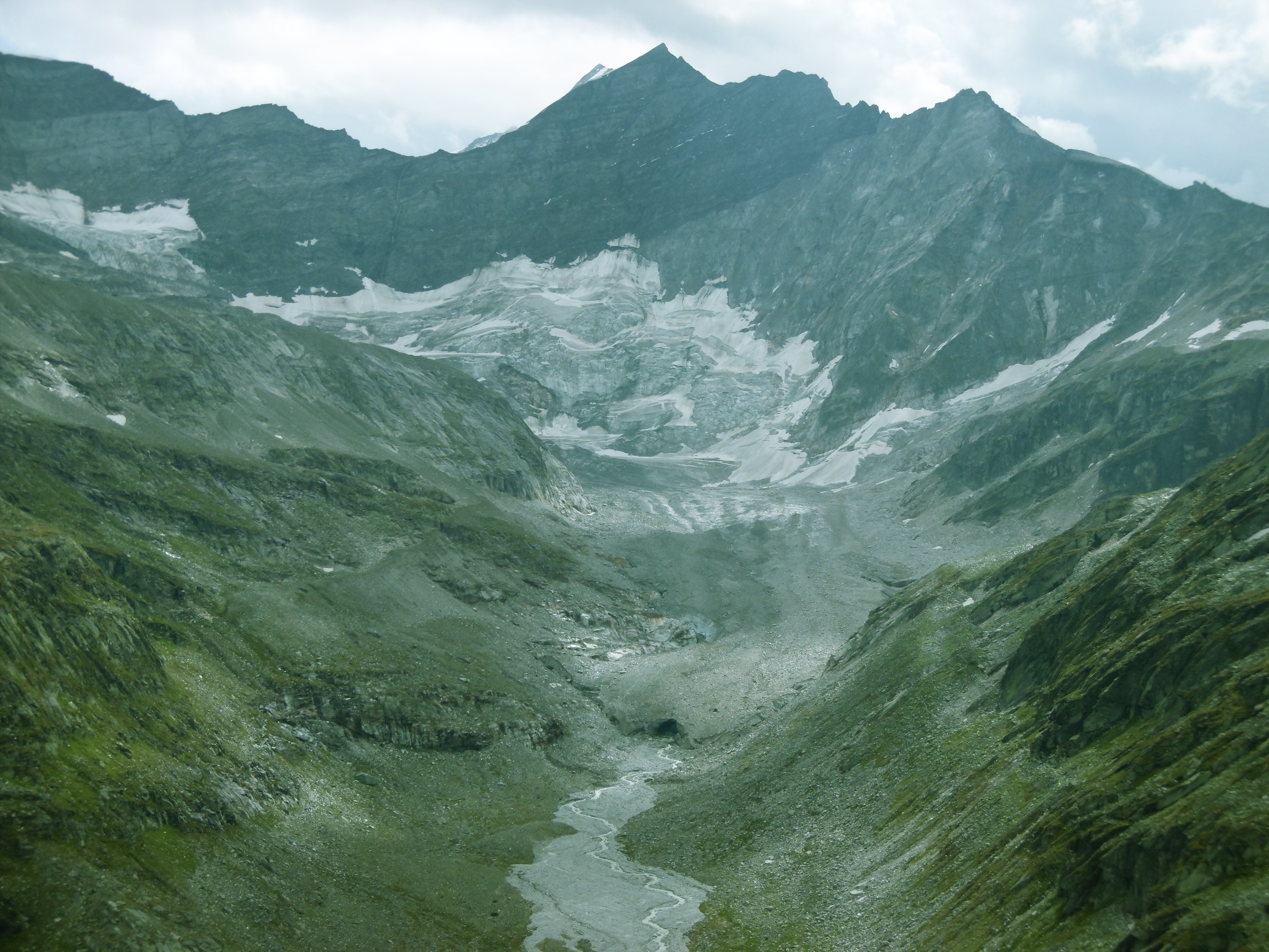
The Ödenwinkelkees is a special glacier typ: a valley, cirque and debris covered glacier on the main northern crest of the hohe Tauern in the upper most stubach valley.
-
The Landeggkess (Landeckkees) is the middle glacier of several disconected small parts of a former bigger cirque glacier. The glacier is situated at the headwall of Ödtal, a tributary of the Stubachtal in the Granatspitzgruppe.
-
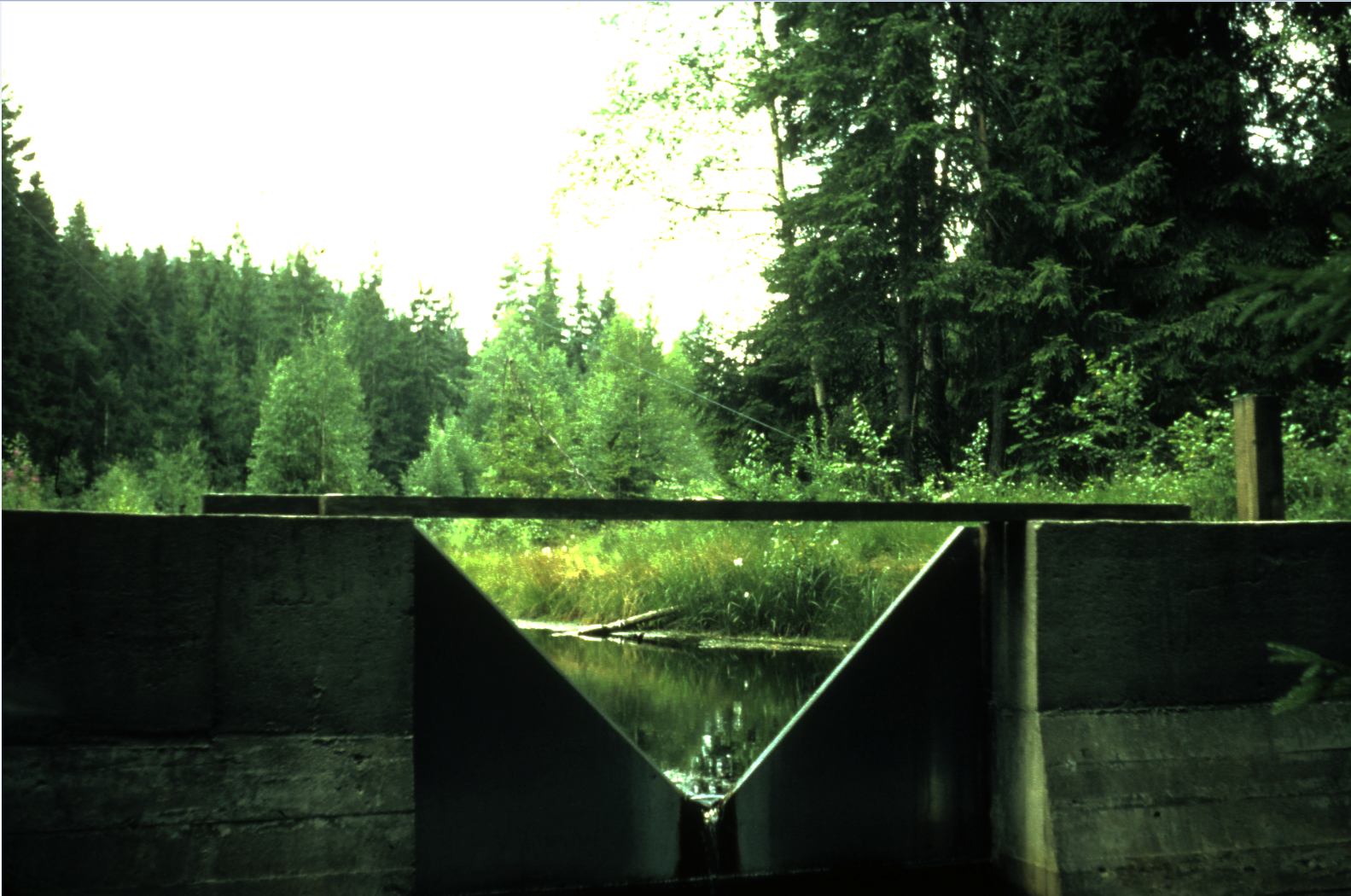
Catchment stream monitoring of water chemistry. Forested catchment on acid-sensitives soils, 200-300 masl
-
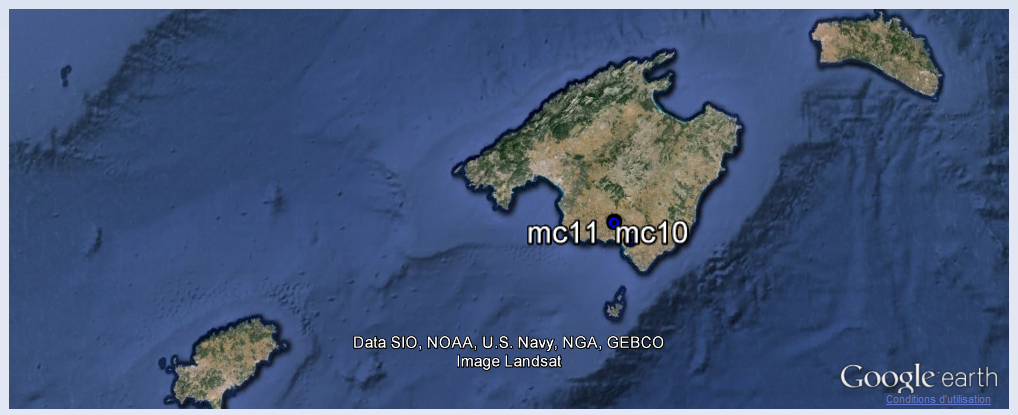
The Majorca site (12,000 m2) is located at Ses Sitjoles, in the southeast of the island. It offers an aquifer in a Miocene reefal limestone setting, highly permeable, with a number of meter-scale karstic cavities. Intensive farming and irrigation in this area have led to over-exploitation of the water tables, which has caused intrusions of salt water up to 15 km from the coast, resulting in chloride pollution of the water tables. The experimental site includes a network of twelve 100-m boreholes, six of which are fully cored. The site is monitored by a team from UMR Géosciences Montpellier.
-
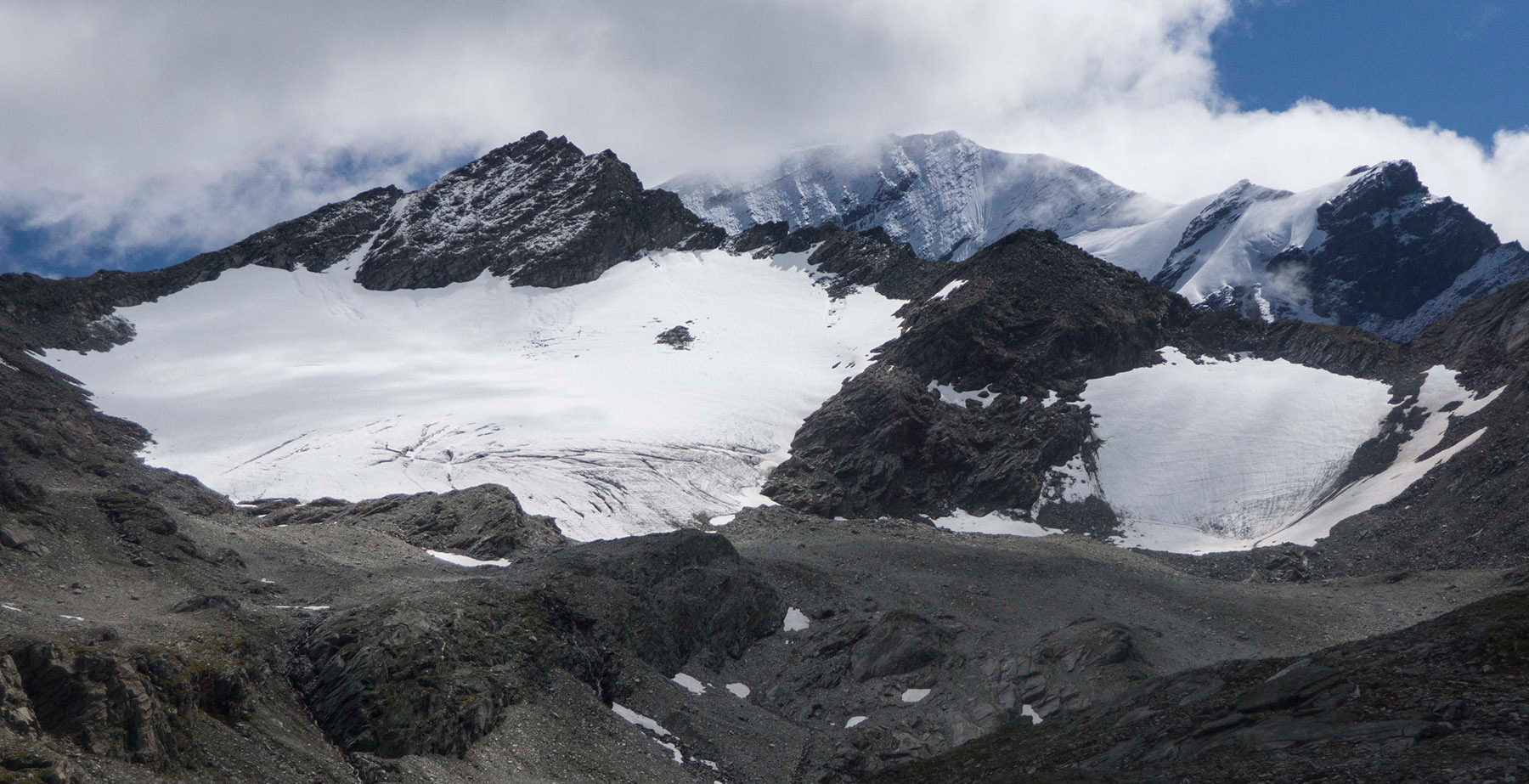
The Kleineiserkees has disintegrated into two small cirque glaciers in the 2010s. They are located in the western Glocknergruppe in the upper Stubach Valley.
-
The Totenkopfkees is a cirque glacier located in the eastern Glocknergruppe in the upper most Stubach Valley in the vicinity of the Ödenwinkelkees.