
water quality
Type of resources
Available actions
Topics
Keywords
Contact for the resource
Provided by
Years
Formats
Representation types
-
This dataset contains information about water quality indicators in an arid Mediterranean basin of southeastern Spain.
-
This dataset contains geochemical data for surface water, springs and groundwater. Grab sampling monthly surveys performed at Koiliaris Critical Zone Observatory from 2004 till 2021.
-
Water turbidity data based on survey (at different stations located inside the Danube Delta) measured in NTU for the period 2003-2004
-
Yearly water turbidity data from 1840 to 2014 from a network of stations located on Danube River and Danube Delta.
-
None
-
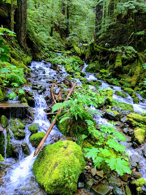
The NEON site McRae Creek (MCRA) is a relocatable aquatic site located within the HJ Andrews Experimental Forest, 80 km east of Eugene, OR in the Western Cascade Mountains. It is a third-order stream that drains an old-growth coniferous forested watershed. HJ Andrews is a 15,800 acres ecological research site that is administered by Oregon State University, the USDA Forest Service's Pacific Northwest Research Station, and the Willamette National Forest. It has been a part of the National Science Foundation's Long-Term Ecological Research Program since 1980. It mainly consists of dense forests filled with cedar, hemlock, and Douglas fir trees; many of which are at least 300 years old and can grow as high as 75 meters. The Domain hosts a total of three other field sites, one more aquatic and two terrestrial; all of which are located in Washington state. Remote sensing surveys of this site collect lidar, spectrometer and high resolution RGB camera data. This site has one meteorological station located in the riparian area. The met station is outfitted with a subset of the same sensors used at terrestrial sites. Measurements include wind speed and direction, air temperature, barometric pressure, relative humidity, shortwave radiation, and PAR. This site has one upstream sensor station and one downstream sensor station. Measurements include PAR, temperature, water quality [specific conductivity, chlorophyll a, dissolved oxygen content, pH, turbidity, and fluorescent dissolved organic matter (only downstream)], and nitrate is measured at the downstream station. Due to logistical and permitting issues, this aquatic site does not have groundwater wells. Field ecologists collect the following types of observational data at this site: aquatic organisms (Aquatic Microbes (surface water),macroinvertebrates microalgae, plants and macroalgae, zooplankton. Biogeochemical data on plants,sediment water and particulates.As well as physical aquatic data on bathymetric maps, stage,secchi depth and depth profiles, and riparian assessment.
-
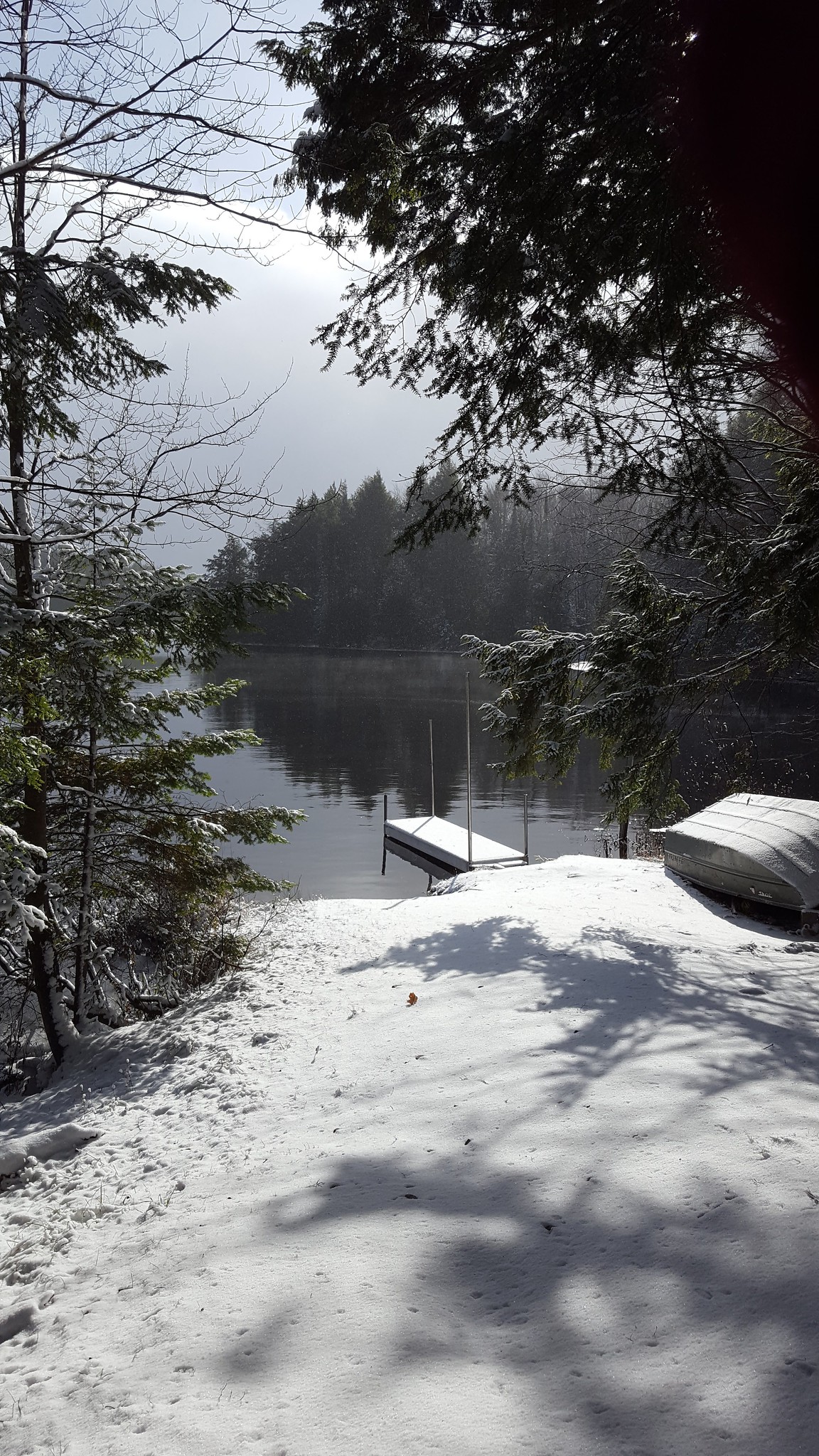
Crampton Lake is the core aquatic site in NEON's Great Lakes Domain 05 located on property of the University of Notre Dame Environmental Research Station (UNDERC), which serves as NEONs core terrestrial site in the Great Lakes Domain. Most of Crampton Lake is in Vilas County, Wisconsin, but a small portion of the northern shore of the lake is across the border, in Gogebic County, Michigan. UNDERC is approximately 7500 acres of mixed and hardwood forests as well as open water and wetlands. Crampton Lake Crampton Lake is approximately 26 hectares surface area. The max depth is about 17.5 meters and average depth around 5 m. Structurally, there are two significant bays and one island. There are two deep holes which account for the max depth while much of the bottom is 1-10 m deep. This site has one meteorological station located in the riparian area and one meteorological station above water on a buoy. The met stations are outfitted with the a subset of the same sensors used at terrestrial sites. Measurements include wind speed and direction, air temperature, barometric pressure, relative humidity, shortwave radiation, and PAR. Remote sensing surveys of this site collect lidar, spectrometer and high resolution RGB camera data. This site has one buoy-mounted sensor station and an inlet station and outlet station. At the buoy, the automated instrument measurements are: PAR at water surface, PAR below water surface, temperature at a specific depth in surface water, water quality (specific conductivity, chlorophyll a, dissolved oxygen content, pH turbidity, and fDOM), and nitrate. At the inlet and outlet stations, the measurements are: PAR below water surface, elevation of surface water, and temperature in surface water. Eight groundwater wells throughout the site collect specific conductivity, water tempertaure, and elevation of groundwater.
-
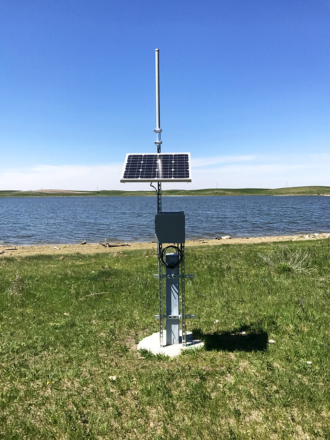
Pringle Creek is a core aquatic field site within NEON's Domain 7: Southern Plains. Pringle Creek is a low gradient, small wadeable stream in Wise County, TX, that drains a watershed of 18.1 km2 of mixed oak forest, savanna, and riparian woodland with portions protected by the Caddo-LBJ National Grassland. It is located 12 miles west of CLBJ, a terrestrial field site. This site has one meteorological station located in the riparian area and one meteorological station above water on a buoy. The met stations are outfitted with the a subset of the same sensors used at terrestrial sites. Measurements include wind speed and direction, air temperature, barometric pressure, relative humidity, shortwave radiation, and PAR.Remote sensing surveys of this site collect lidar, spectrometer and high resolution RGB camera data. Seven groundwater wells throughout the site collect specific conductivity, water tempertaure, and elevation of groundwater. This site has one buoy-mounted sensor station and an inlet station and outlet station. At the buoy, the automated instrument measurements are: PAR at water surface, PAR below water surface, temperature at a specific depth in surface water, water quality (specific conductivity, chlorophyll a, dissolved oxygen content, pH turbidity, and fDOM), and nitrate. At the inlet and outlet stations, the measurements are: PAR below water surface, elevation of surface water, and temperature in surface water. Field ecologists collect the following types of observational data at this site: aquatic organisms (Aquatic Microbes (surface water),macroinvertebrates microalgae, plants and macroalgae, zooplankton. Biogeochemical data on plants,sediment water and particulates.As well as physical aquatic data on bathymetric maps, stage,secchi depth and depth profiles, and riparian assessment. Field ecologists collect the following types of observational data at this site: aquatic organisms (Aquatic Microbes (surface water), macroinvertebratesmicroalgae, plants and macroalgae, zooplankton. Biogeochemical data on plants,sediment water and particulates. As well as physical aquatic data on bathymetric maps, stage,secchi depth and depth profiles, and riparian assessment.Total data products planned for this site:
-
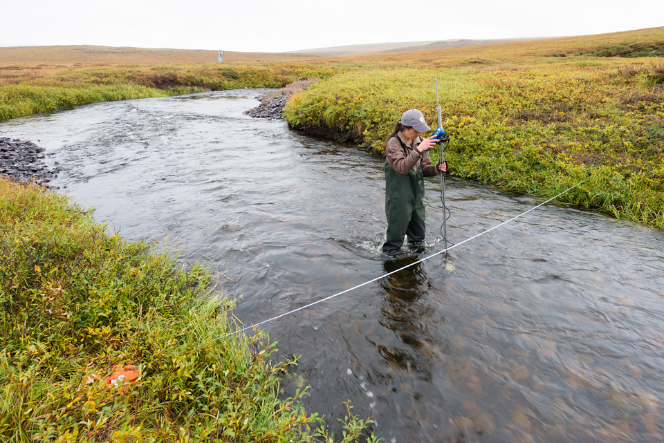
Oksrukuyik Creek is a wadeable stream located a short drive from the Toolik Field Station, an environmental science facility operated by the University of Alaska, Fairbanks. Teams working out of Toolik have studied the biological and biogeochemical attributes of Oksrukuyik Creek for decades. NEON data will contribute to these studies to help better understand tundra streams, which are rapidly changing along with the Arctic climate. Remote sensing surveys of this site collect lidar, spectrometer and high resolution RGB camera data. This site has one meteorological station located in the riparian area and one meteorological station above water on a buoy. The met stations are outfitted with the a subset of the same sensors used at terrestrial sites. Measurements include wind speed and direction, air temperature, barometric pressure, relative humidity, shortwave radiation, and PAR. This site has one buoy-mounted sensor station and an inlet station and outlet station. At the buoy, the automated instrument measurements are: PAR at water surface, PAR below water surface, temperature at a specific depth in surface water, water quality (specific conductivity, chlorophyll a, dissolved oxygen content, pH turbidity, and fDOM), and nitrate. At the inlet and outlet stations, the measurements are: PAR below water surface, elevation of surface water, and temperature in surface water. Eight groundwater wells throughout the site collect specific conductivity, water tempertaure, and elevation of groundwater. Field ecologists collect the following types of observational data at this site: aquatic organisms (Aquatic Microbes (surface water),macroinvertebrates microalgae, plants and macroalgae, zooplankton. Biogeochemical data on plants,sediment water and particulates.As well as physical aquatic data on bathymetric maps, stage,secchi depth and depth profiles, and riparian assessment.
-
The Teakettle 2 Creek (TECR) catchment is entirely located within the Teakettle Experimental Forest (TEF), which is located in the north part of the Kings River watershed. The TEF is owned and operated by the United States Forest Service (USFS) Pacific Southwest (PSW) Research Station. The PSW Research Station is part of the research and development arm of the Forest Service, which operates six other research stations and 81 experimental forests and ranges, including the Teakettle Experimental Forest (TEF). A large, ongoing experiment at the TEF is comparing the effects of fire and tree thinning on the ecosystem. The Teakettle 3 creek, just northeast of TECR, is currently being monitored and controlled for projects that are managed by the USFS PSW and the Kings River Experimental Watershed (KREW). The KREW is an ecosystem project examining the effects of fire and tree thinning on streams and riparian areas. Total data products planned for this site: 78