
water salinity
Type of resources
Available actions
Topics
Keywords
Contact for the resource
Provided by
Years
Formats
Representation types
-
The Mooring D is located in the western Ross Sea in Terra Nova Bay. The mooring is equipped with sediment traps, currentometers, trasmissometer, fluorimeter and CTD.
-
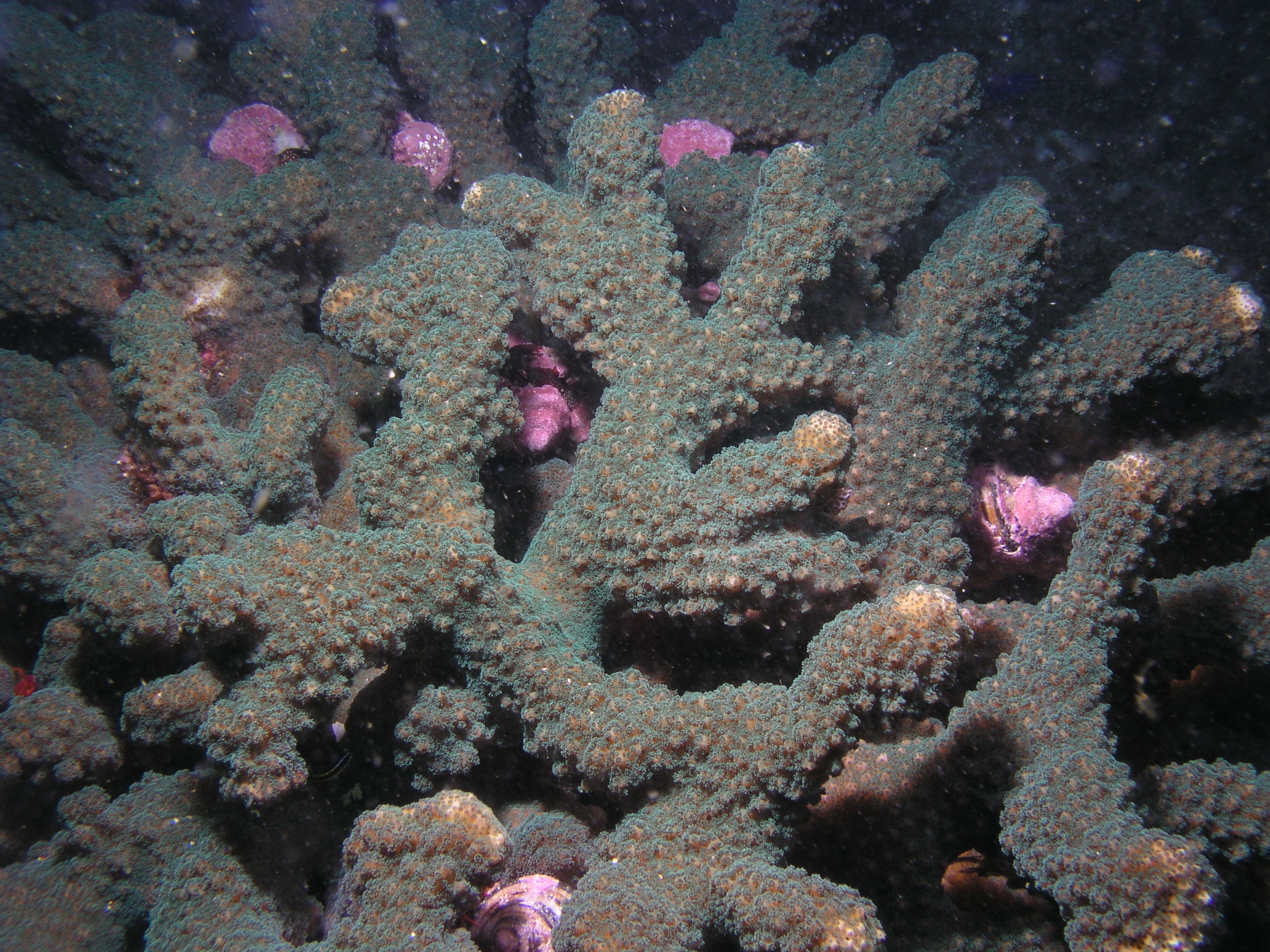
Arrecifes coralinos y rocosos del Pacífico Mexicano desde Baja California hasta Chiapas. El trabajo se desarrolla en cuatro principales regiones: Sur del Golfo de California, Islas Revillagigedo, Bahía de Banderas y Bahías de Huatulco. Cabo Pulmo es el de mayor extensión. Tiene registradas 67 especies de corales en 368 localidades.
-
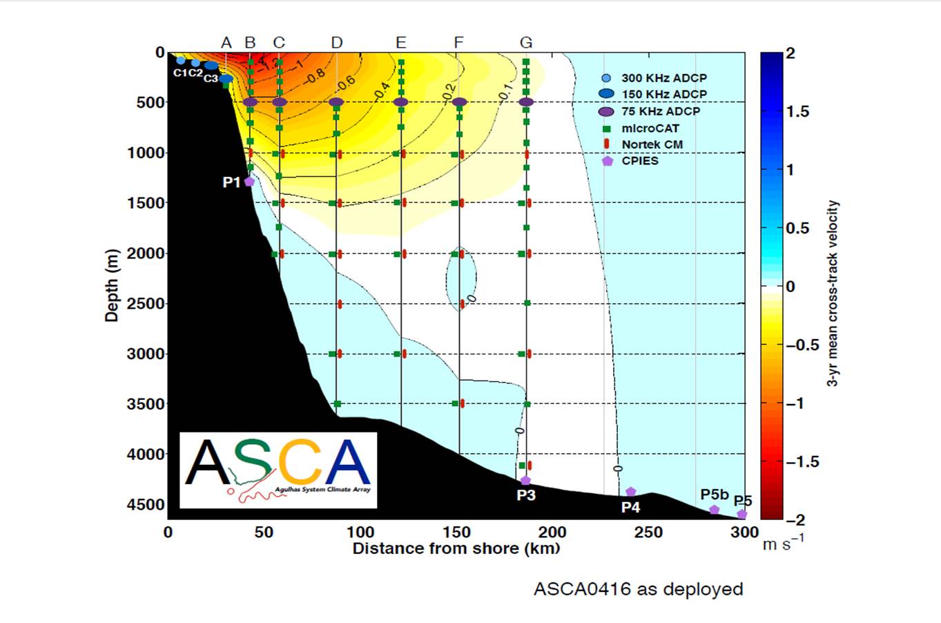
The ASCA shelf and tall moorings extend 200 km offshore of Hamburg just south of East London on the East coast of South Africa, along the decending TOPEX/Jason satellite ground track # 96, through the core of the Agulhas Current, with Current- and Pressure-recording Inverted Echo Sounders (CPIES) measurements extending the array to 300 km offshore. There are two shelf and seven full-depth tall moorings, interspersed with five CPIES, measuring pressure, current velocities, temperatures and salinities.
-
The mooring A is located in an open sea area close to Franklin Island, characterized by both clay bottom sediment and a flat morphology. The station can be considered as representative of the productivity and sedimentary conditions of the southern part of the Ross Sea, one of the areas considered to be affected by greater productivity rate.The study of mooring can be consider part of the activities conduct in the framework of the research project "ABIOCLEAR - Antarctic biogeochemical cycles - climatic and paleoclimatic reconstructions. (Resp. M. Ravaioli)". Such Project is the natural prosecution of previous research activity carried out from 1987. Objectives : Study of the particle fluxes towards the marine bottom sediment, in particular with the aim to obtain quali/quantitative estimate of the biogenica component coming from the primary production. Analysis of the vertical rain rate processes and, therefore, the marine cycle of the main biogenic particles such as Carbon and Silica. Try to obtain mass budgets of these parameters, estimating their cycle in the water column until the burial processes in sediments. From apparent accumulate rate calculated in the bottom sediment we will tried to discriminate the real vertical fluxes (Rain Rate) from the horizontal input from sediment remobilization processes. Acquisition and elaboration of long time series of data. Collection of bottom Sediment samples to estimate the variations of the productivity and the paleoproductivity in the area. Historical time series of Mooring A: Primary productivity data (every three years), fitoplancton, New and regenerated productivity, Seasonal, annual and interannual fluxes measure, monthly Particles samples, current velocity, water salinity, temperature and torbidity, Water-sediment interface measure. Biogeochemical parameters. Radiometrical Data, Mineralogical and grain size characterization. Nutrient, metals. Biostratigraphy interpretations. Lidar data are also available from 1997.
-
The site of the Boknis Eck Time Series (BE) is located at the entrance of the Eckernförde Bay (54°31.2' N, 10°02.5' E) in the southwestern Baltic Sea. It has a water depth of 28 m with muddy sediments. Riverine inputs into the Eckernförde Bay are negligible and thus the overall hydrographic setting at BE is dominated by the regular inflow of North Sea water through the Kattegat and the Great Belt. Seasonal stratification occurs usually from mid-March until mid-September and causes pronounced hypoxia which sporadically become anoxic.
-
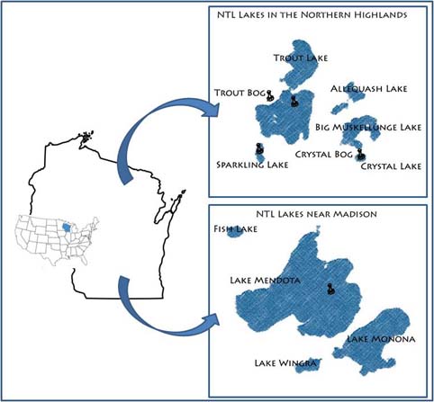
Our primary study sites include a set of seven northern Wisconsin and four southern Wisconsin lakes and their surrounding landscapes. The project, which started in 1981, is administered by the Center for Limnology at the University of Wisconsin-Madison.
-
Helgoland Roads summary The Helgoland Roads time-series, located at the island of Helgoland in the German Bight, approximately 60 km off the German mainland (54°11'N 7°54'E), is one of the richest temporal marine datasets available. The time-series was initiated in 1962 at the Helgoland Roads site, which is located between the main island of Helgoland and a small sandy outcrop, the so-called 'dune'. The location near Helgoland is of particular interest because the site is essentially in a transitional zone between coastal and oceanic conditions, which is seen most clearly in the salinity patterns at Helgoland Roads. Initially, the sampling frequency was thrice weekly, but this was increased to daily in the early 1970s. Since then, the high sampling frequency has provided a unique opportunity to study long-term trends in abiotic and biotic parameters, but also ecological phenomena, such as seasonal interactions between different foodweb components, niche properties, and the dynamics and timing of the spring bloom (Grüner et al. 2011; Mieruch et al. 2010; Tian et al. 2008; Wiltshire et al. 2015; Wiltshire et al. 2010). The measured parameters comprise phytoplankton, temperature, salinity, and nutrient analyses. Inorganic nutrients. The taxon list now contains over 350 entities (with 230 distinct species). Both the phytoplankton and chemical dataseries are fully quality-controlled, based on original data sheets and metadata (Wiltshire and Dürselen, 2004; Raabe and Wiltshire, 2009). The phytoplankton time-series is augmented by the biological parameters zooplankton, rocky shore macroalgae, macro-zoobenthos, and bacteria, providing a unique opportunity to investigate longterm changes at an ecosystem scale. Some historic data sets are also available and have been archived in the online repository Pangaea, alongside all core phytoplankton and environmental data sets for Helgoland Roads (Kraberg et al. 2015). Analyses by Wiltshire et al. (2010) have demonstrated the statistical significance of these changes, with temperature since 1962 amounting to 1.7°C (Wiltshire et al., 2010). In tandem with the increases in temperature and salinity, nutrient dynamics at Helgoland Roads have also changed considerably, with phosphate concentrations having declined significantly since 1962. Long-term trends are also seen in the biota, with Diatoms in particular having exhibited an increase in abundance, with a concomitant increase in positive trend for total Dinoflagellates (see also (Wiltshire et al. 2008)). This was not a gradual change, but a rapid shift from negative to positive anomalies around 1998. The exact causes for this are still under investigation. Breaking this down to monthly trends, the swing seems to be largely driven by shifts in autumn and winter. There was also a significant shift in seasonal densities of individual Diatom species (Guinardia delicatula, Paralia sulcata) and in the numbers of large Diatoms (e.g. Cocinodiscus wailesii), which are difficult for copepods to graze. The large Diatom Mediopyxis helysia has recently been observed for the first time and now occurs almost throughout the year, with an intensive bloom in spring 2010 (Kraberg et al. 2012). Generally speaking, the spring Diatom bloom now appears to start later, if the preceding autumn was very warm (Wiltshire and Manly, 2004). It is worth noting that species introductions are also occurring in the zooplankton, with the ctenophore Mnemiopsis leidyi being the most obvious new species (Boersma et al. 2007). References Boersma M, Malzahn AM, Greve W, Javidpour J (2007) The first occurrence of the ctenophore Mnemiopsis leidyi in the North Sea Helgoland Marine Research Grüner N, Gebühr C, Boersma M, Feudel U, Wiltshire KH, Freund JA (2011) Reconstructin g the realized niche of phytopankton species from environmental data: fitness versus abundance approach Limnology and Oceanography methods 9:432-442 Kraberg A, Carstens K, Tilly K, Wiltshire KH (2012) The diatom Mediopyxis helysia at Helgoland Roads: a success story? Helgoland Marine Research 66:463-468 Kraberg AC, Rodriguez N, Salewski CR (2015) Historical phytoplankton data from Helgoland Roads: Can they be linked to modern time series data? Journal of Sea Research 101:51-58 Mieruch S, Freund JA, Feudel U, Boersma M, Janisch S, Wiltshire KH (2010) A new method for describing phytoplankton blooms: Examples from Helgoland Journal of Marine Systems 79:36-43 Tian Y, Kidokoro H, Watanabe T, Iguchi N (2008) The late 1980s regime shift in the ecosystem of Tsushima warm current in the Japan/ East Sea: Evidence from historical data and possible mechanisms Progress in Oceanography 77:127-145 Wiltshire KH, Boersma M, Carstens K, Kraberg AC, Peters S, Scharfe M (2015) Control of phytoplankton in a shelf sea: Determination of the main drivers based on the Helgoland Roads Time Series Journal of Sea Research 105:42-52 Wiltshire KH et al. (2010) Helgoland Roads: 45 years of change in the North Sea Estuaries and Coasts DOI 10.1007/s12237-009-9228-y Wiltshire KH et al. (2008) Resilience of North Sea phytoplankton spring bloom dynamics: An analysis of long-term data at Helgoland Roads Limnology and Oceanography 53:1294-1302
-
To support the marine biodiversity and ecosystem dynamics research community in Belgium, the Flanders Marine Institute (VLIZ) has set up a local marine biodiversity observatory.
-
Santa Giusta occupies an area of 8 km2, with a mean depth of 1 m. Rio Pauli Maiori and Rio Pauli Figu are the two primary freshwater inputs, both located on the lagoon’s east side (Fig. 1b). Santa Giusta also experienced substantial human modification during the 20th century, resulting in profound ecosystem alterations. The Pesaria channel, which originally connected the lagoon to the sea through the Tirso River outlet was deepened, widened, and separated from the river. An industrial harbour was subsequently built, which was connected to the lagoon through an industrial canal controlled by bulkheads. A fish catch system was constructed in the final portion of the Pesaria channel. In 1995, a diversion canal for Oristano urban wastes (the main urban town in the catchment) was built. Despite the canal, the high inorganic nutrient concentrations and algal biomass remained unchanged (Sechi et al. 2001). Macrobenthic algae and phytoplankton are the most important primary producers in Santa Giusta. Sechi et al. (2001) reported several fish kill events associated with harmful algal species blooms in this lagoon. Santa Giusta sediments show high levels of TOC and OM, especially in surface layers (1‒2 cm) in the north and south lagoon areas (Magni et al. 2008). Lugliè et al. (2002) showed Santa Giusta sediment grain sizes exhibited a degree of heterogeneity, but the finer fractions were primarily located in the south-central lagoon area, consistent with central and peripheral canals dredged in the 1970s to facilitate seawater flow into the lagoon. From 1990, the trophic status of the lagoon was always kept under control. It was thus possible to monitor the course of the trophy after the waste was diverted. Even recently (summer 2010) serious events of fish death there were. A long-term series of data is available and derives from high-frequency measurements and samplings to assess environmental and biological parameters. In particular the data concern the main trophic descriptors (Secchi depth, temperature, pH, conductivity, dissolved oxygen and saturation, alkalinity, NH4-N, NO2-N, NO3-N, total nitrogen, soluble reactive phosphorus, total phosphorus, dissolved silica) and phytoplankton abundances, as chlorophyll a, cell densities and biomass, class and species composition.
-
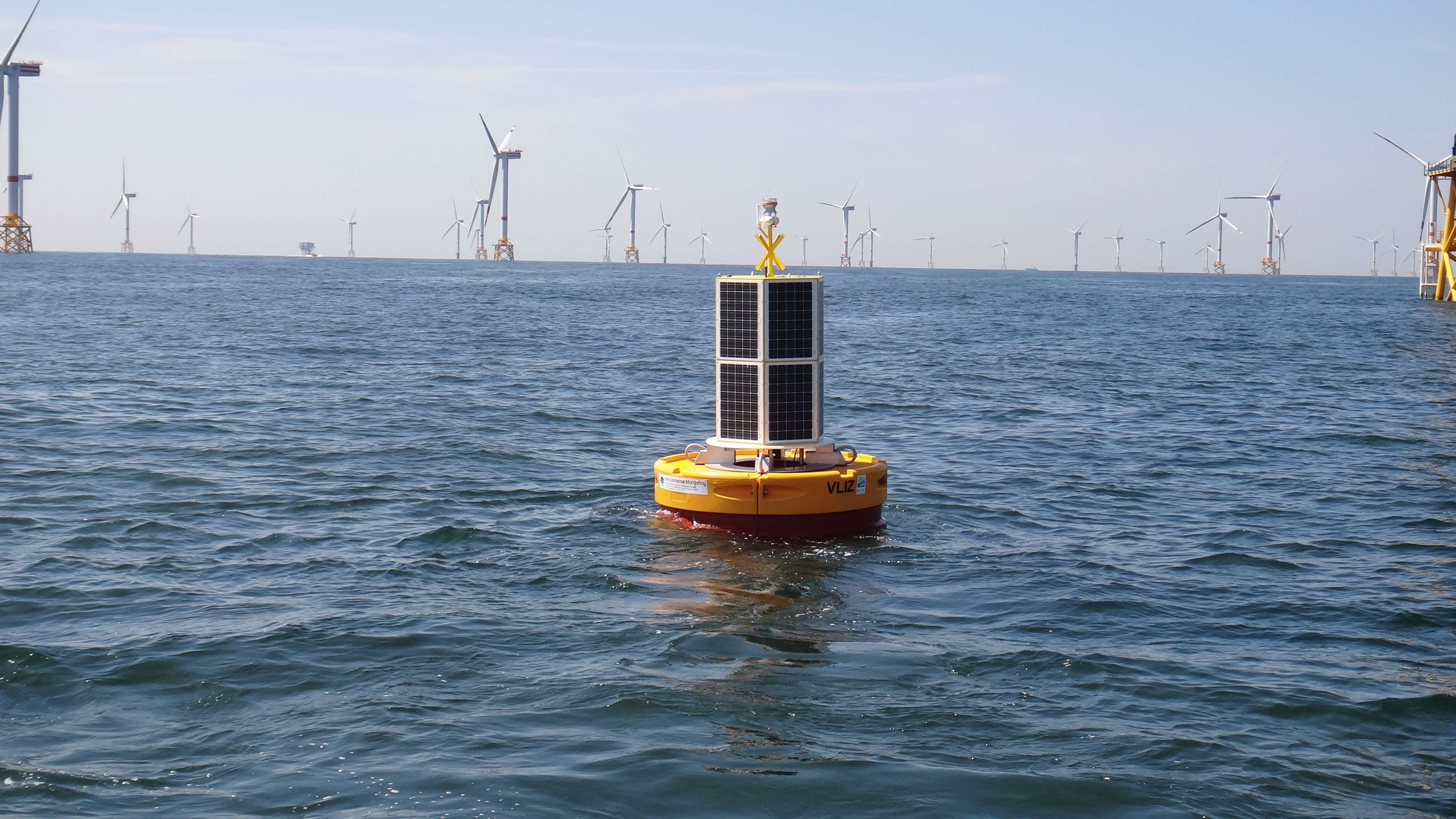
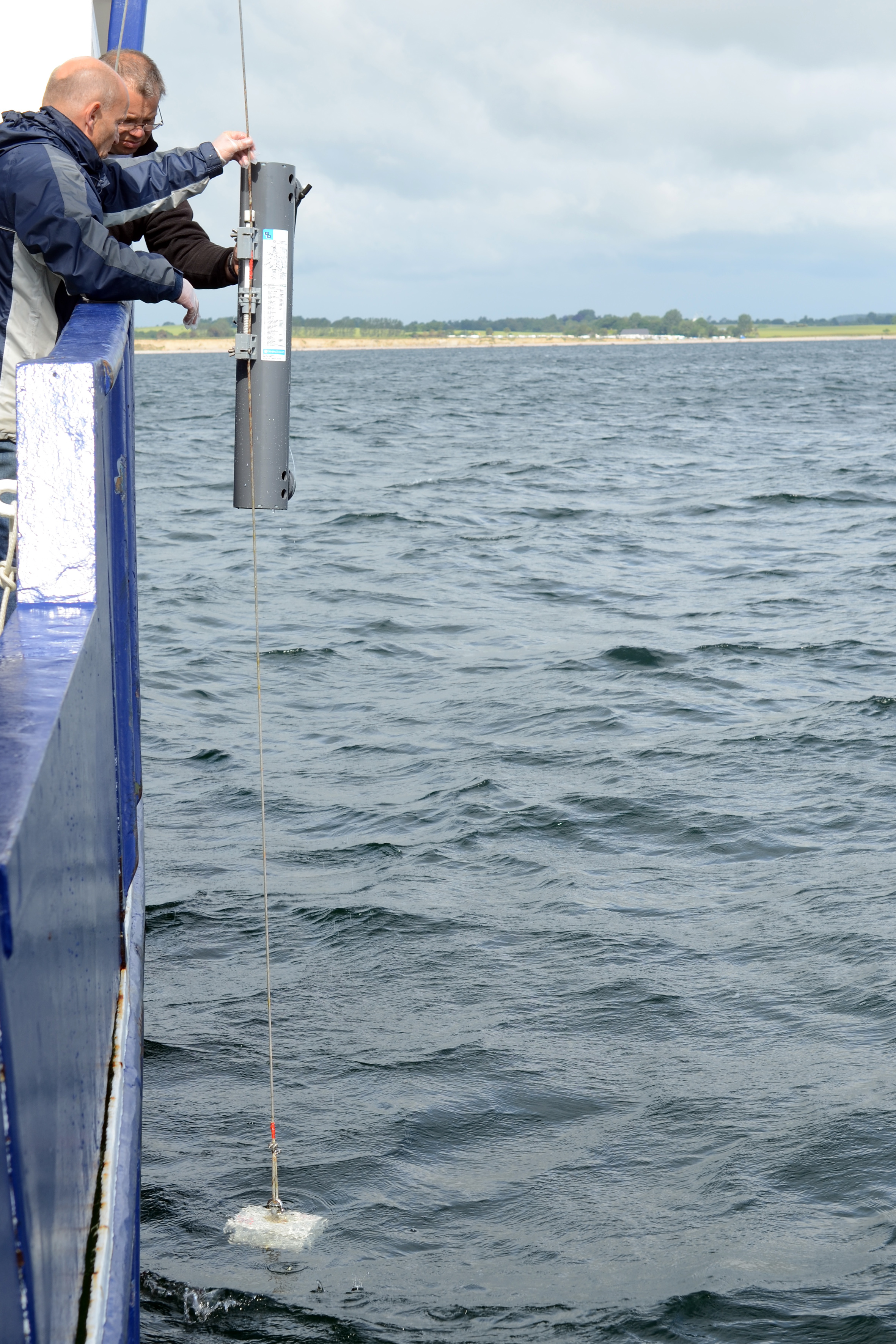
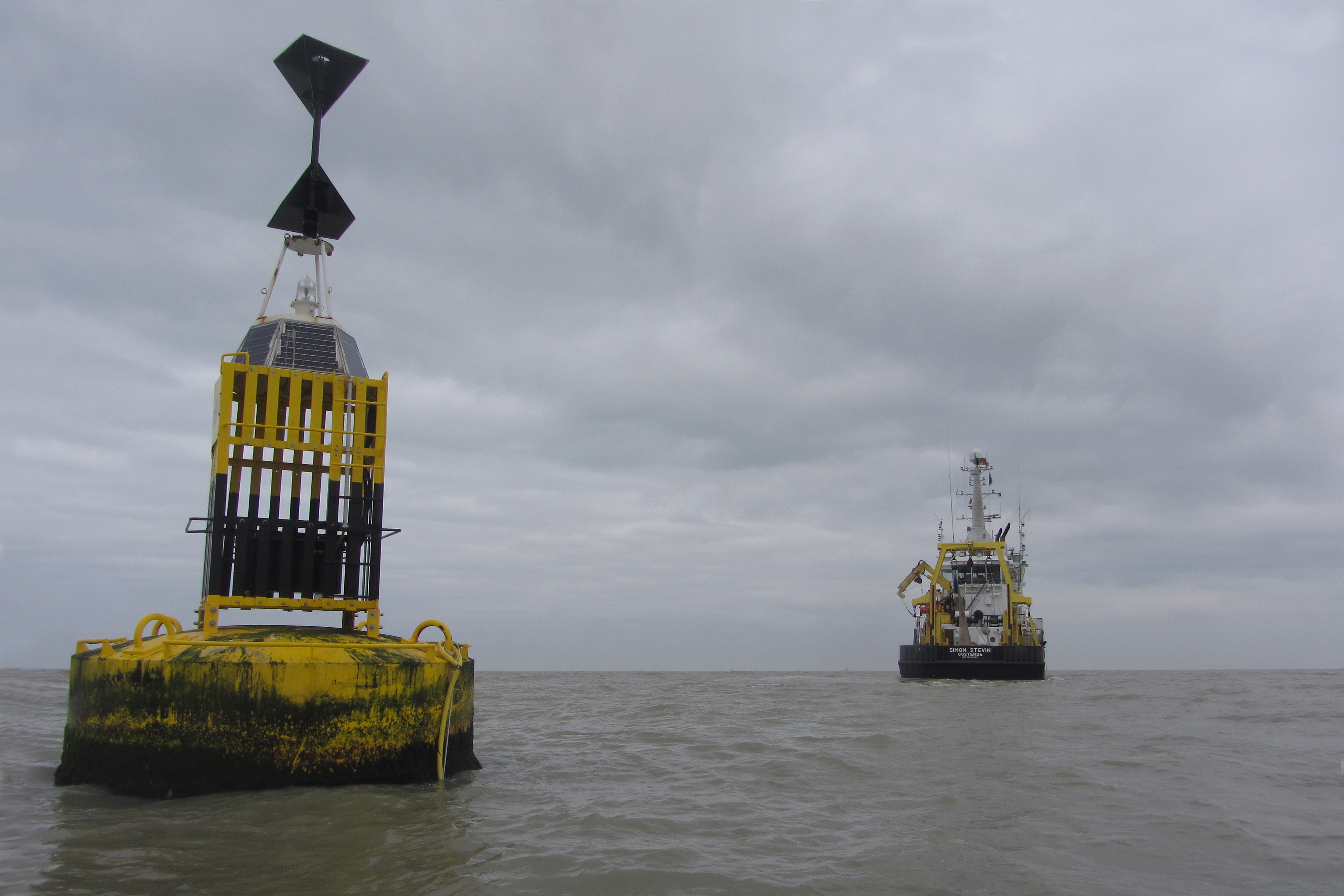
The site consists of a marine databuoy equipped with a suite of sensors that monitor water quality parameters and acoustic receivers for the detection of Porpoises and tagged fish. The buoy is moored near an offshore windmill farm, approx. 30km off the coast on the Belgian Continental Shelf.