
water transmissivity
Type of resources
Available actions
Topics
Keywords
Contact for the resource
Provided by
Years
Formats
Representation types
-
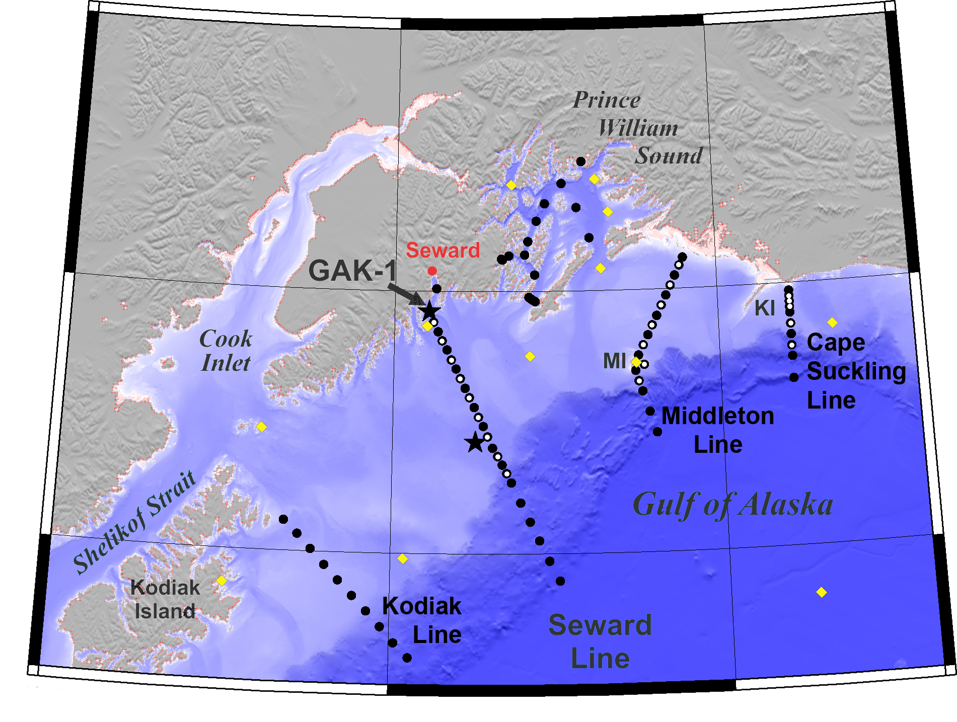
In the NGA study area, the biological community is highly productive. The lower levels of the food chain (phytoplankton and zooplankton) support the iconic fish, crabs, seabirds, and marine mammals of Alaska. Large increases in phytoplankton during the spring and sustained production during the summer support zooplankton that transfer energy up the food chain. Substantial amounts of this organic matter also sink to feed animals on the sea bottom.
-
The station has a arid moderate climate, with a annual temperature of 11.2 ℃ but higher in summer and lower in winter relative to areas with the same latitude. Due to dramatic temperature fluctuation in spring and autumn, frozen damage resulted from low temperature in spring and early cooling in autumn often occurs. The annual mean precipitation is as low as 45.7 mm, thus rivers are charged mainly by precipitation in mountains and snowmelt. Frozen-free day, sunshine duration and annual mean wind velocity are, respectively, 207 d, 2940 h and 2.4 m/s. Disaster weather includes dust storm in spring, hail and accidentally continuous high temperature in summer.Aksu station (E80°51′, N40°37′, 1028 m a.s.l.), found in 1982 and affiliated with Xinjiang Institute of Ecology and Geography, was listed in the top-5 stations for irrigation experiment in Xinjiang and became a member of special environment and disaster detection network, CAS in 2002. After development of years, it entered National Field Station Network and Chinese Ecosystem Research Network (CERN) in 2005. The station is located in the source area of Tarim River where its three headstreams (i.e., Aksu, Yeerqiang and Hetian River) converge, and the vastest oasis develops in Tarim Basin under the hyperarid environments. This area is typical of Tarim Basin for dramatic watercourse meandering and great agro-water consumption, thus forming a ideal experimental field for monitoring and researching water, salt and nutrient processes in oasis cropland system, as well as for exploring sustainable oasis agriculture, theory and technologic demonstration of water-saving irrigation.
-
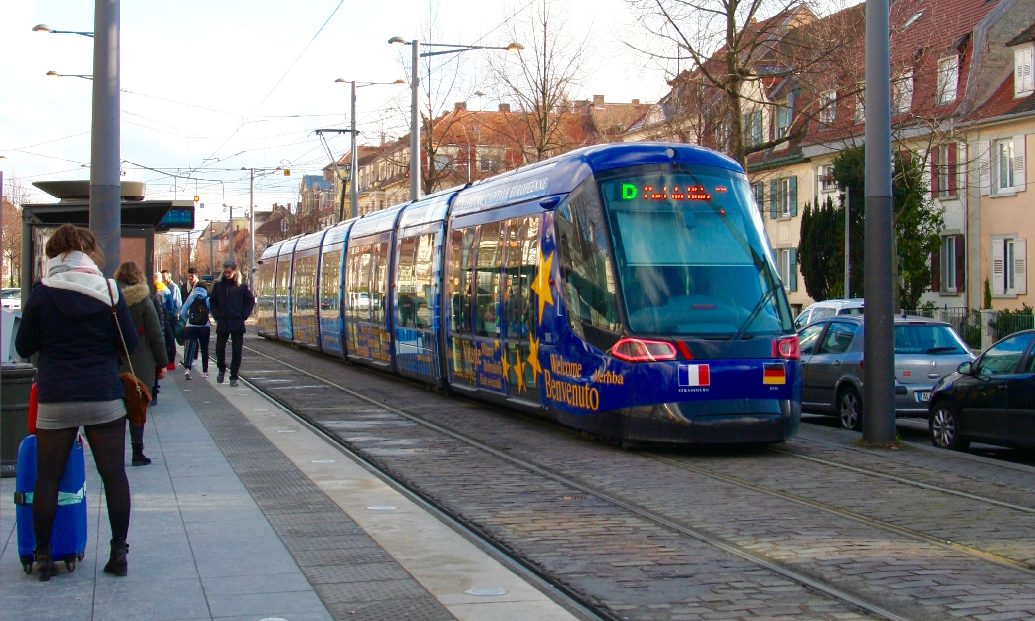
The LTSER Zone Atelier Environnementale Urbaine belongs to LTER-France network and is located in eastern France.The Zone Atelier Environnementale Urbaine ZAEU was created in 2010. It focuses on urban area and urban socioecosystem research questions. The main objective is to define how to facilite an harmonious development according to the city needs without badly impacting the natural system around. The Eurometropole of Strasbourg is a close partner of the ZAEU: local authorities participate to the research experimentations and observation campains. Six working groups are dealing with natural systems in order to better understand the urban ecosystem (biodiversity, hydrology, air and climate, urban metabolism) and the socio system (social and economic dimensions of the society and the individuals, groups behavior and values, politics strategies). In the working groups, we study issues like hydrological system processes in the urban area, population health, energy consomption and production at the city scale, pollutions and contaminations of the various spheres, refusal management with regards to the context of global changes, sustainable development and transitions (economy, ecology, energy).
-
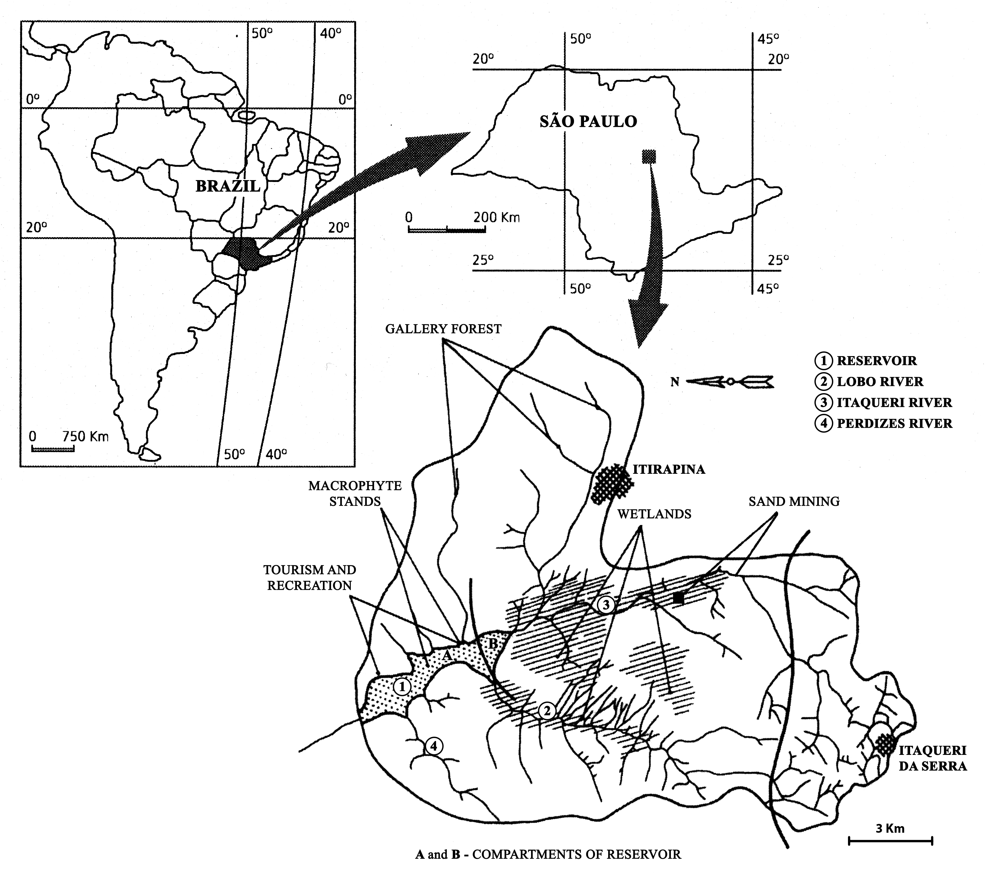
The watershed is located in the center of São Paulo State, Southeast of Brazil. The coordinates are: Lat. 22º 10' 08,5" S; Long. 47º 57' 11,7" W. The drainage density is 0.75km/km2. The maximum altitude is 800m. Basin declivity is 0.00575m/m. The local climate is characterised by alternating dry and wet periods, the wetter period falling in summer and autumn, and the winter and spring seasons being mainly dry. Annual precipitation is around 1500 mm per year. Temperatures are typically between 15 °C and 17 °C during the coldest winter month (July); in the warmest summer month (January), water temperatures between 21 °C to 23 °C are recorded. Potential evapotranspiration is between 500 mm to 1000 mm per year. According to the Koppen classification, the climate is described as ‘warm with a dry period’. The watershed is dominated by holocenic sandy sediments. In the lowland areas, hydromorphic and organic soils predominate. Soils derived from basalt intrusion occur in some areas of the watershed, as red soil hotspots. The natural vegetation is characteristically a savanna type, the Cerrado, typical of the continental regions of Brazil, consisting of bushes and trees adapted to a long (six months) dry season with periodic fires. Given the hydrogeochemical character of the watershed, the ionic strength and the nutrient content of the water of Lobo-Broa Reservoir are correspondingly low.
-
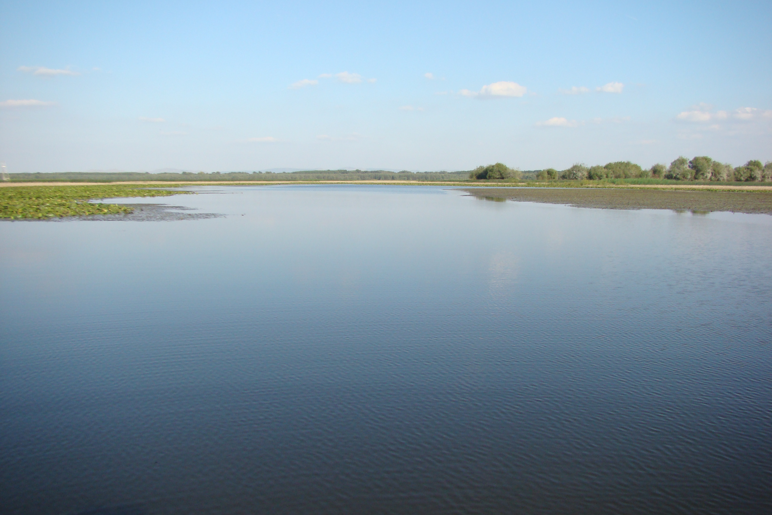
"Braila Islands" site with a total surface of over 2600 km2 is situated in the South-East of Romania corresponding to a 78 km long Danube sector that stretches between Harsova (kilometer 253) and Braila (kilometer 175) cities. This socio-ecological system is inhabited by near 300,000 people and comprises heavily modified ecosystems (e.g. Big Island of Braila, former wetland transformed into agricultural land) but also systems under a natural functional regime (e.g. Small Islands of Braila), being of a crucial natural and socio-economical value. The Danube river along the Braila Islands section has been ranked as a heavily modified water body according to criteria 2.1 (embankment works) due to the hydro-technical works on more than 79% of the river stretch sector and a candidate to “heavily modified” according with the WFD criteria 2.2 (regulation works) as a result of dredging of 21% of the river bed for intensive navigation. The main remnant of the natural floodplains consists in the wetlands from the Small Island of Braila Natural Park with a total surface of 210 km2 and the floodplains between the riverbanks and dikes of almost 93 km2.
-
The national park Hunsrück-Hochwald is situated in the north-east of the nature park Saar-Hunsrück. 90 percent of the national parks area belong to Rhineland-Palatinate and 10 percent to the Saarland. Founded in March 2015, it is Germanys youngest national park. The basis of its foundation has been a treaty between Rhineland-Palatinate and the Saarland, which was passed through in January 2015. The special quality of the foundation is shown in the successful public participation. The national park contains the biggest occurance of wildcats in Europe. The visitor can see a great woodrush beech forest with moors, rocks and meadows of arnica. Because of the fact, that the forest is left to his own ressources, it offers safe and natural habitats to rare animal and plant species which can be observed. Furthermore, data about the condition of the forest, the air quality and analyses of bodies of water are collected, too.
-
The Ploemeur-Guidel observatory (Britanny, France) is focusing on surface-depth relationships in a fractured crystalline geological context and oceanic climate. It is built on 2 sub-sites, one highly anthropized, the other in natural state. In Ploemeur, groundwater has been pumped since 1991, supplying more than 1 million m3 of clean drinking water annual at a sustainable rate. Such high productivity is explained the specific fractured network in granite and micaschists, draining deep geological layers (~400 m). Extracted water quality is very good, with limited nitrate concentration, in a region that has been strongly affected by widespread pollution. Guidel site is in a similar, but natural context. Deep iron-rich groundwater is upflowing, creating surface and deep groundwater-dependent ecosystems, and feeding a classified coastal wetland. Both sites have a very dense equipment to study rapid to long-term surface-depth exchanges: a flux tower, unsaturated zone monitoring, a network of ~50 shallow (<10m) and deep boreholes (>80m), hydrochemical, temperature and deformation. An well-characterized fractured experimental site offers the possibility to conduct experiments to test innovative instruments and develop new methodologies
-
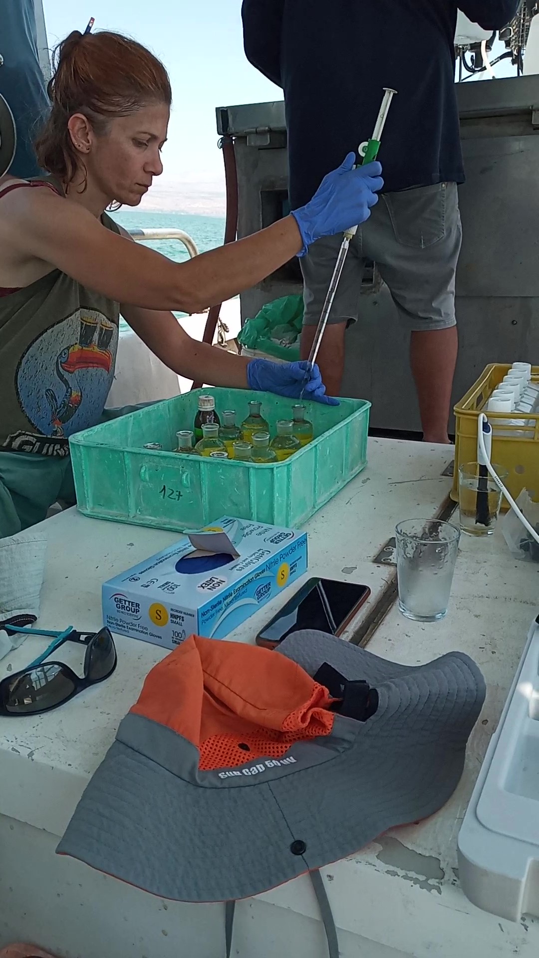
The Kinneret Limnological Laboratory (KLL) is situated at the ‘Sapir’ Site (Tabha) on the shores of Lake Kinneret (Sea of Galilee). The Lake Kinneret monitoring program conducted by KLL has been operating since Jan. 1969. The program has provided a unique database and information, due to the sampling resolution, accuracy of the measurements, and their continuity, it is used to make operational decisions and environmental policy. The monitoring program includes several stations around the lake and from numerous depths and includes fixed on-lake, high-resolution, and manual sampling of water samples analyzed in the laboratory. The Kinneret monitoring program has expanded in recent years and currently has four fixed on-lake and online sampling platforms, strategically placed, each with thermistor chains and multi-probe sensor systems including one that is a profiling system. Also, the program includes collaboration with the Ministry of Agriculture to carry out monitoring of fish and fisheries in the lake. As the lake suffers typically from two seasonal cyanobacteria blooms, (i.e., a winter Microcystis bloom and a summer N-fixing cyanobacteria bloom) routing monitoring of cyanobacteria biomass and toxins is conducted and adaptive to the extent of the bloom. This is carried out simultaneously with satellite imaging over the lake.