
water transparency
Type of resources
Available actions
Topics
Keywords
Contact for the resource
Provided by
Years
Formats
Representation types
-
The Mooring D is located in the western Ross Sea in Terra Nova Bay. The mooring is equipped with sediment traps, currentometers, trasmissometer, fluorimeter and CTD.
-
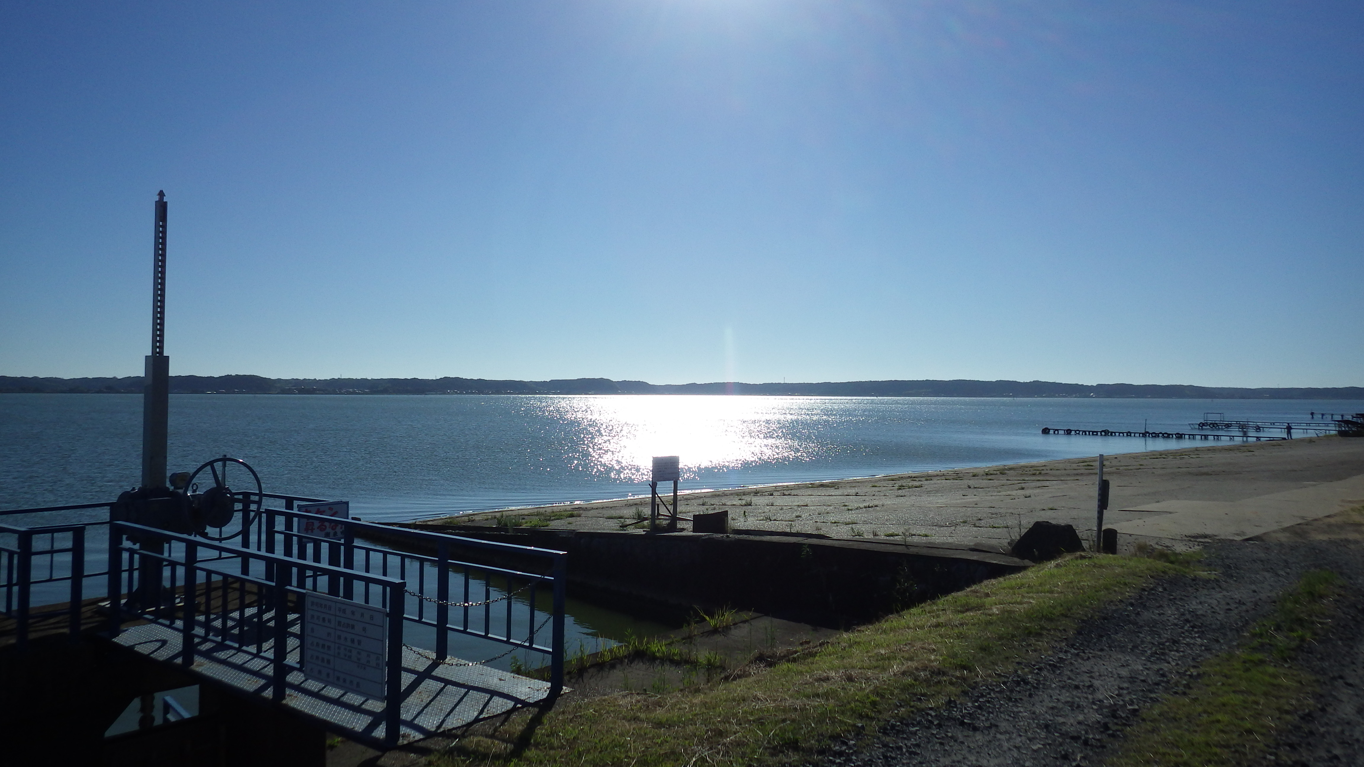
Lake Kitaura is typical eutrophic lake in Japan. The maximum and average depth is 10 m and 4.5 m, respectively.
-
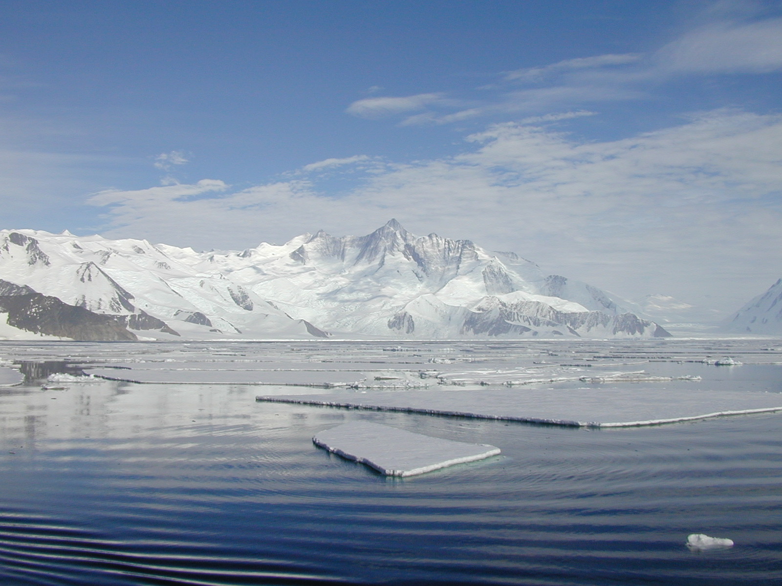
The mooring A is located in an open sea area close to Franklin Island, characterized by both clay bottom sediment and a flat morphology. The station can be considered as representative of the productivity and sedimentary conditions of the southern part of the Ross Sea, one of the areas considered to be affected by greater productivity rate.The study of mooring can be consider part of the activities conduct in the framework of the research project "ABIOCLEAR - Antarctic biogeochemical cycles - climatic and paleoclimatic reconstructions. (Resp. M. Ravaioli)". Such Project is the natural prosecution of previous research activity carried out from 1987. Objectives : Study of the particle fluxes towards the marine bottom sediment, in particular with the aim to obtain quali/quantitative estimate of the biogenica component coming from the primary production. Analysis of the vertical rain rate processes and, therefore, the marine cycle of the main biogenic particles such as Carbon and Silica. Try to obtain mass budgets of these parameters, estimating their cycle in the water column until the burial processes in sediments. From apparent accumulate rate calculated in the bottom sediment we will tried to discriminate the real vertical fluxes (Rain Rate) from the horizontal input from sediment remobilization processes. Acquisition and elaboration of long time series of data. Collection of bottom Sediment samples to estimate the variations of the productivity and the paleoproductivity in the area. Historical time series of Mooring A: Primary productivity data (every three years), fitoplancton, New and regenerated productivity, Seasonal, annual and interannual fluxes measure, monthly Particles samples, current velocity, water salinity, temperature and torbidity, Water-sediment interface measure. Biogeochemical parameters. Radiometrical Data, Mineralogical and grain size characterization. Nutrient, metals. Biostratigraphy interpretations. Lidar data are also available from 1997.
-
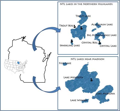
Our primary study sites include a set of seven northern Wisconsin and four southern Wisconsin lakes and their surrounding landscapes. The project, which started in 1981, is administered by the Center for Limnology at the University of Wisconsin-Madison.
-
To support the marine biodiversity and ecosystem dynamics research community in Belgium, the Flanders Marine Institute (VLIZ) has set up a local marine biodiversity observatory.
-
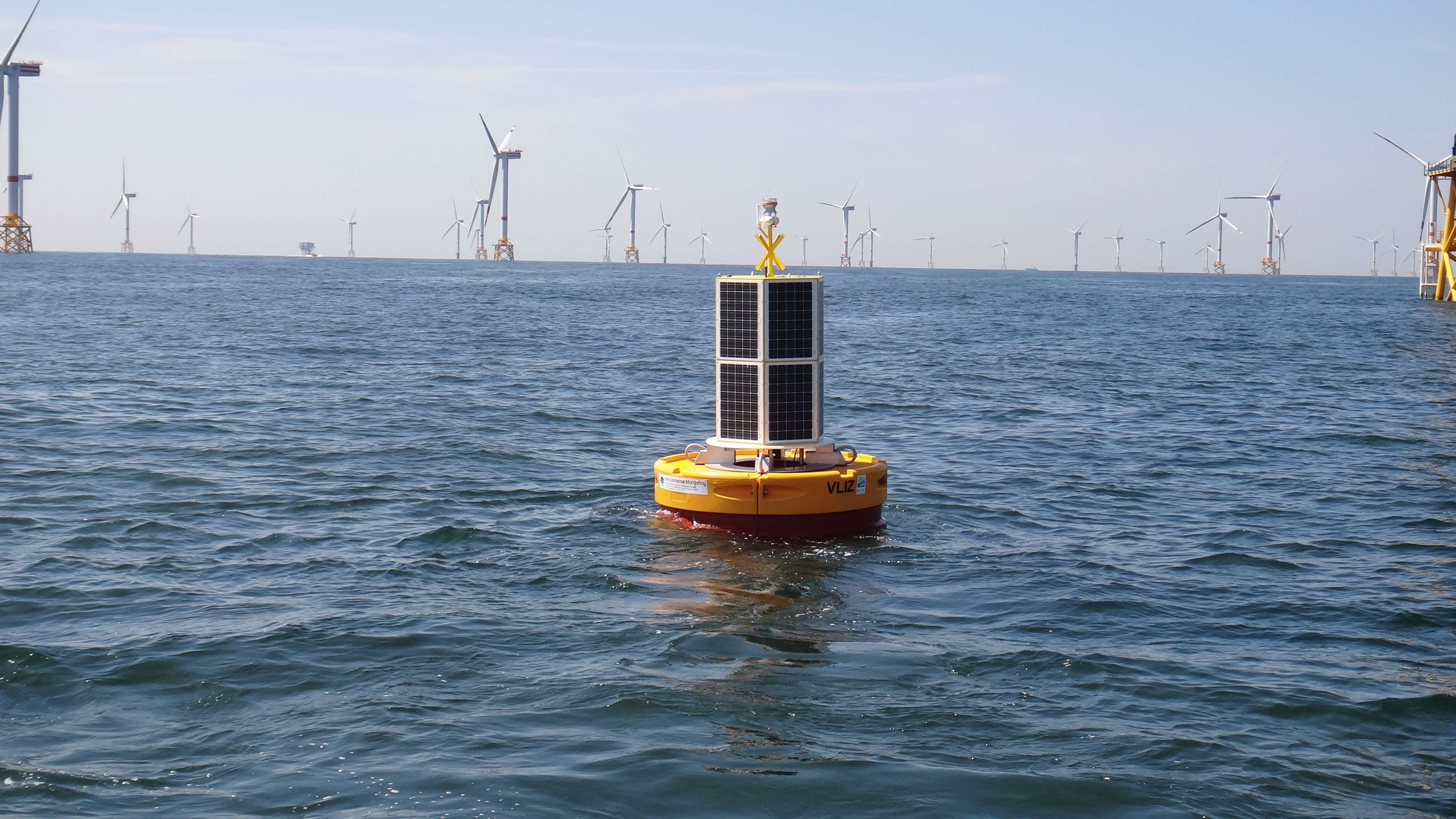
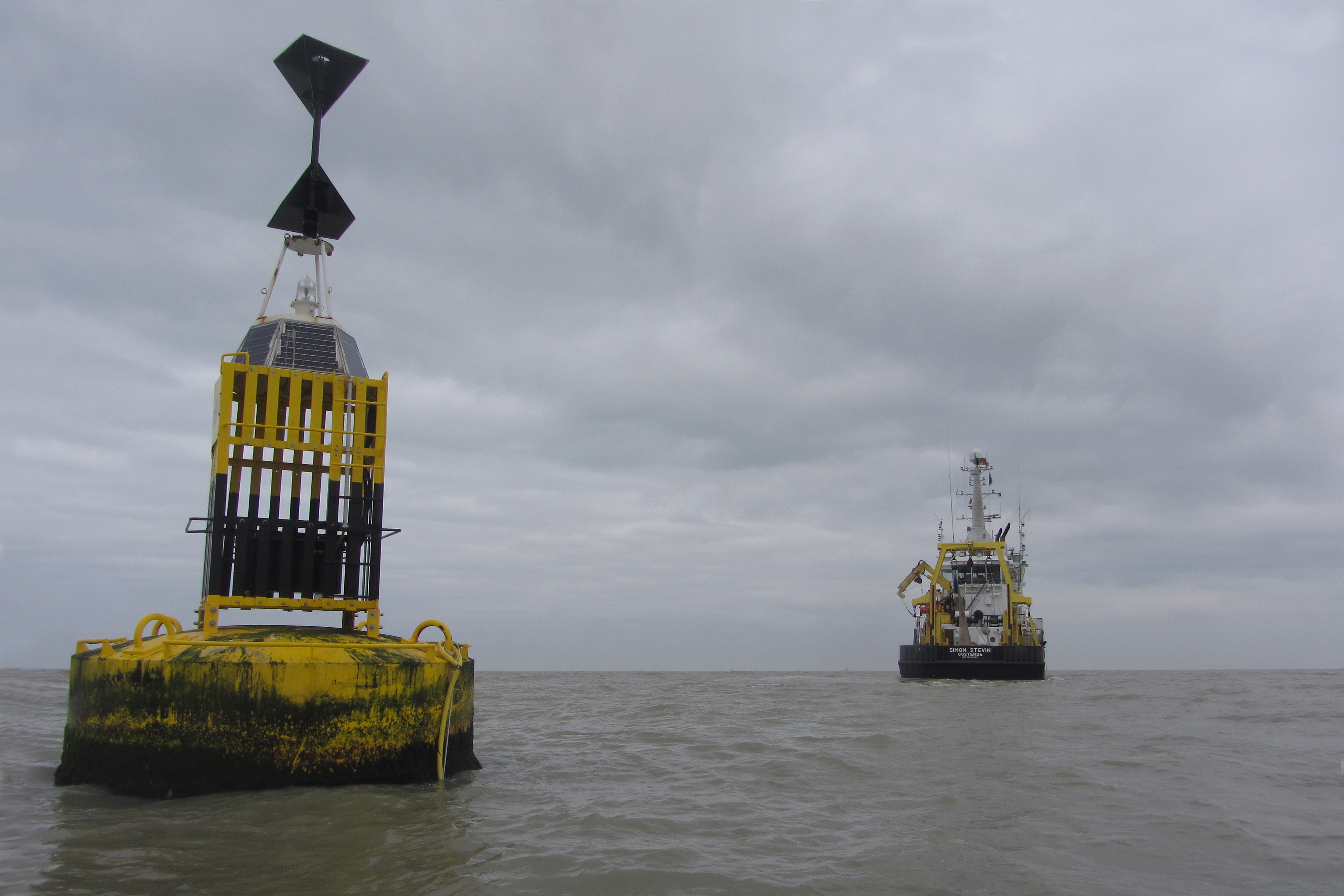
The site consists of a marine databuoy equipped with a suite of sensors that monitor water quality parameters and acoustic receivers for the detection of Porpoises and tagged fish. The buoy is moored near an offshore windmill farm, approx. 30km off the coast on the Belgian Continental Shelf.
-
Measurements of lake physics (including e.g. water temperature, alkalinity, conductivity, oxygen and Secchi depth) are part of lake monitoring, which is usually carried out by monthly sampling at many regular lake sites (5 to 17 sites depending on the intensity of the measurements over the years). The integrated sample represents the whole water column of this polymictic shallow lake with a mean lake depth of 1.2m. The measurement satisfy the analytical standards of Ö-Norm in Austria. In case of water temperature, also depth profiles were measured during some sampling periods.
-
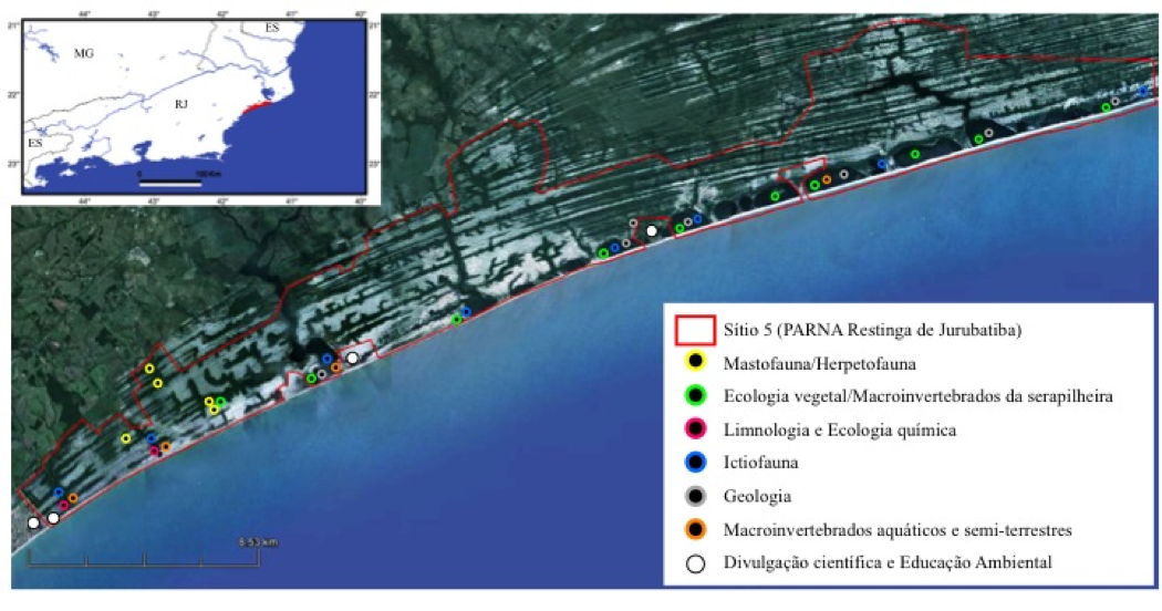
On the quaternary coastal plains of the northern of Rio de Janeiro State, the Restinga de Jurubatiba National Park Brazil encompass 11 vegetational units varying from shrub vegetation (locally known as "restinga") to inundated forest and 18 coastal lagoons which differ largelly in salinity. Organisms such as reptiles, amphibians, mammals, fish, aquatic and terrestrial plants and processes (carbon cycling) have being study since 1999 under this site of the Brazilian Long Term of Ecological Studies innitiative.
-
UK ECN site. The River Esk rises on the uplands of the North York Moors National Park and is the only major river in the county of Yorkshire that drains directly into the North Sea. The catchment is sparsely populated without the pressures of industrialisation and urbanisation affecting other rivers in the Region. Open moorland characterises much of the catchment and is an important habitat for a wide variety of wildlife. Within the Esk valley there are six Sites of Special Scientific Interest (SSSIs), two of which extend south and cross the boundary of the Derwent catchment. The source of the Esk is upstream of Westerdale, where a series of small streams (becks) known as the Esklets merge to form the River Esk. Many of these moorland streams are affected by natural "flushes" of acidity, as well as iron run-off from natural ironstone strata and old mineral workings, making some of these becks an ochreous-orange colour after periods of rainfall. The combination of the two factors restrict the invertebrate fauna in these head-streams. The majority of the River Esk downstream of the Esklets has very good water quality, with the diverse invertebrate fauna dominated by mayflies, stoneflies, caddisflies and other pollution sensitive groups. This good water quality is also very important in sustaining other species such as salmon, sea trout, dippers and otters. The ECN site is at Briggswath (NGR: NZ 868 081), approximately 2km upstream of the tidal limit. At this point the river is approximately 15m wide, and in normal summer flows the depths vary between 20cm and 30cm.
-
UK ECN site. The River Stinchar is situated in South Ayrshire. It rises close to Loch Doon and flows for 46km before entering the Firth of Clyde at Ballantrae. It has a catchment area of 340km2 and its average flow is 11.2 cumecs. The catchment is largely rural with only a few small and scattered communities. Farming is mostly dairy cattle and sheep rearing, and there have been some pollution problems associated with the latter in particular through spillages of sheep dip chemicals. The upper part of the catchment is extensively forested with conifers for commercial use. The granitic geology and the maturity of the trees have resulted in low pH values in the uppermost routine sampling point. Part of the flow of the upper reaches of the river is diverted by an aqueduct to feed water into the Loch Braden water supply reservoir. The ECN site is situated in the lowest reach of the river where the acidity has been buffered by the base cations in the lower part of the catchment.