
water velocity
Type of resources
Available actions
Topics
Keywords
Contact for the resource
Provided by
Years
Formats
Representation types
-
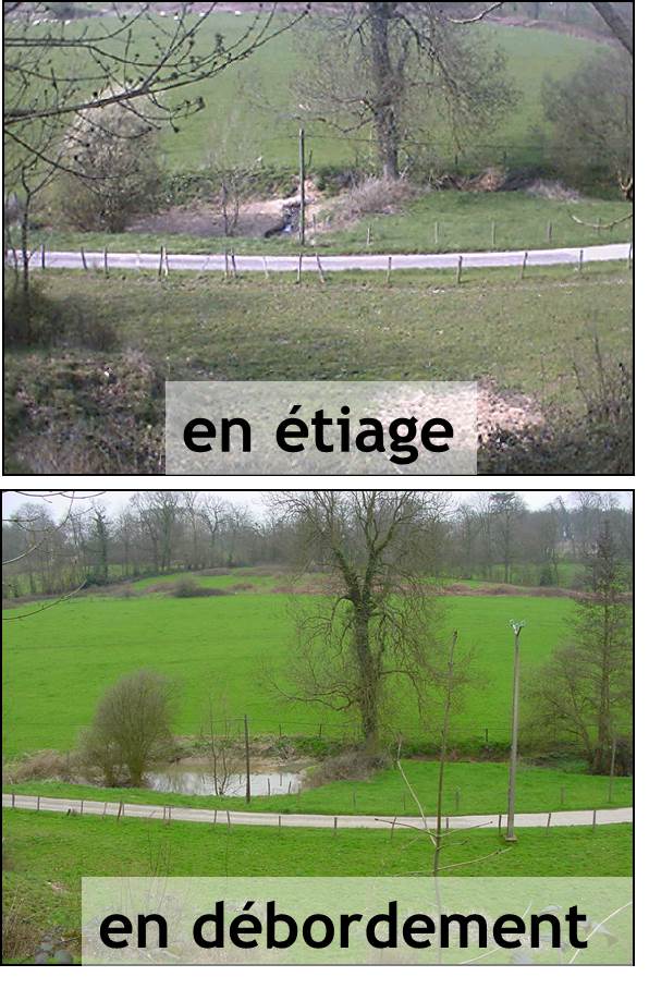
The Chalk Karst observatory groups different karst sites on the Cretaceous Chalk located at the Paris Basin (Norville, Radicatel, Yport, Saint-Martin-Le-Nœud). These karst watersheds range from 10 to 200 km2 and the land use consists of agriculture and grazing under oceanic climate. There are characterized by chalk plateaus covered with clay-with-flints owing to chalk weathering constituting a fairly impervious layer and with quaternary silts. These surficial formations range from 3 to 20 meters depth and are highly susceptible to crusting, compaction, and erosion, particularly during autumn and winter. A numerous swallow holes locally penetrates the chalk through the above-mentioned impervious layer, resulting in a strong connection of the surface with the aquifer inducing infiltration of turbidity releases at spring and well used to drinking water (up to 500 NTU). These Chalk karst sites are one the sites of the French SO-KARST labellised by INSU-CNRS and are a part of the French RBV-Network and ZA Seine.
-
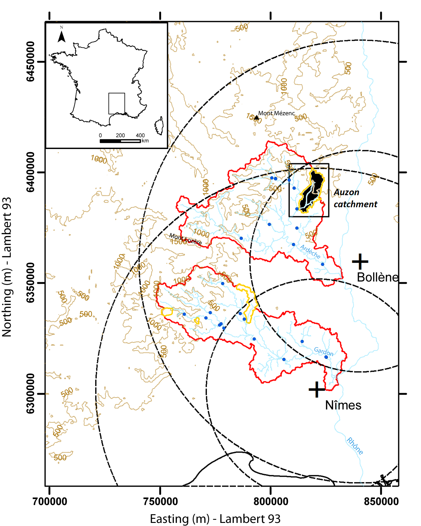
Hydrometeorological and hydrosedimentary observations within 3 embedded catchments: Gazel, Claduègne and Auzon (3.4, 43, and 116 km²). Mediterranean climate with heavy rainfall and flash floods in automn. The upper part of the catchment is characterized by basalt formations, after which a sharp transition occurs where the lower two thirds is made up of sedimentary limestone rock. The soil types are heavily infuenced by the geology of the catchment. Main land use types are pastures,vineyards and forest. More information at http://mistrals.sedoo.fr/?editDatsId=1438
-
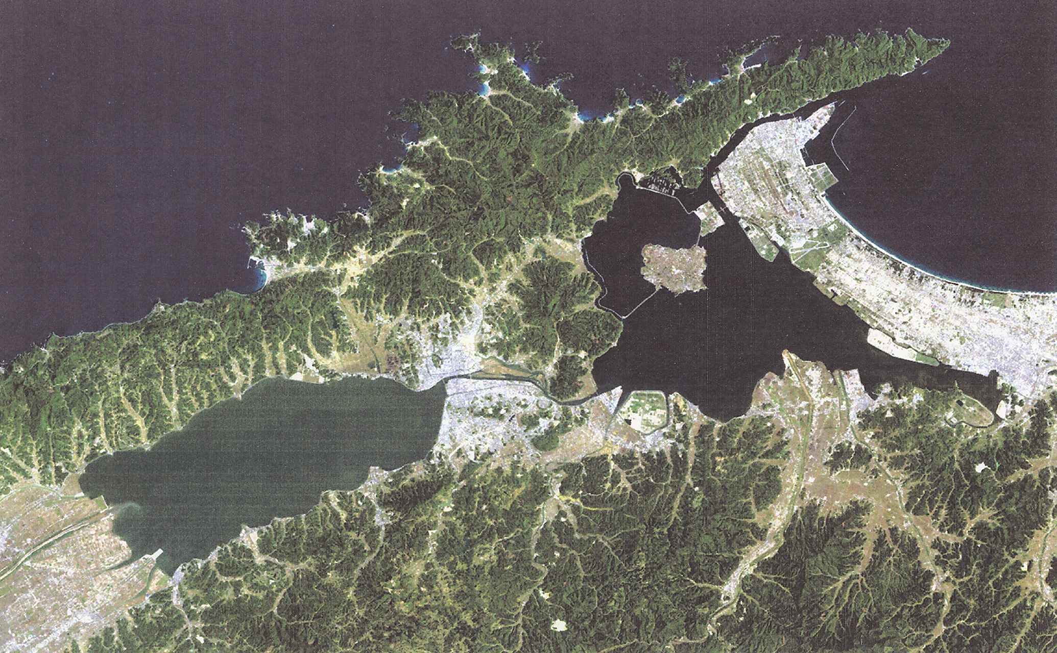
Lake Shinji and Lake nakaumi are coupled coastal lagoon lake systems in Japan, and these lakes have suffered detrimental efects by human activities, especially during the last 40 years, because of the big national projects aiming at desalination and reclamation of these lakes. In the year 2000, however, the land reclamation project in Lake Nakaumi was officially discontinued, leaving Honjou area unreclaimed. Shortly thereafter, desalination project was also terminated. This was the end of a large and expensive series of public works projects, and in 2005, these two lakes were included in the list of wetlands of international importance, and the efforts to restore the lakes are undergone.
-
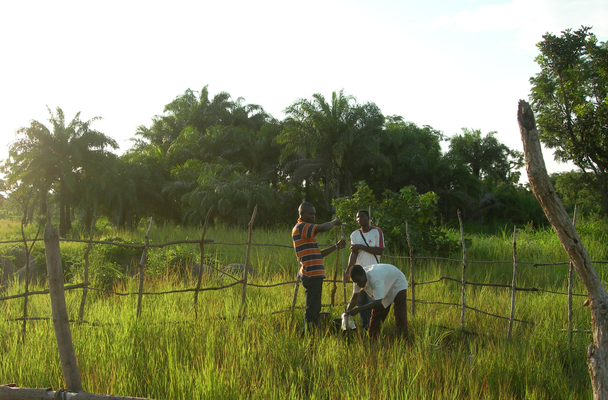
The Oueme mesoscale site (Benin) is part of the AMMA-CATCH observation network. Its characteristics are as follows a 14000 km² basin in sudanian climate on a crystaline basement. The studies focus on the hydrological cycle, the water budget and the hydrological processes.
-
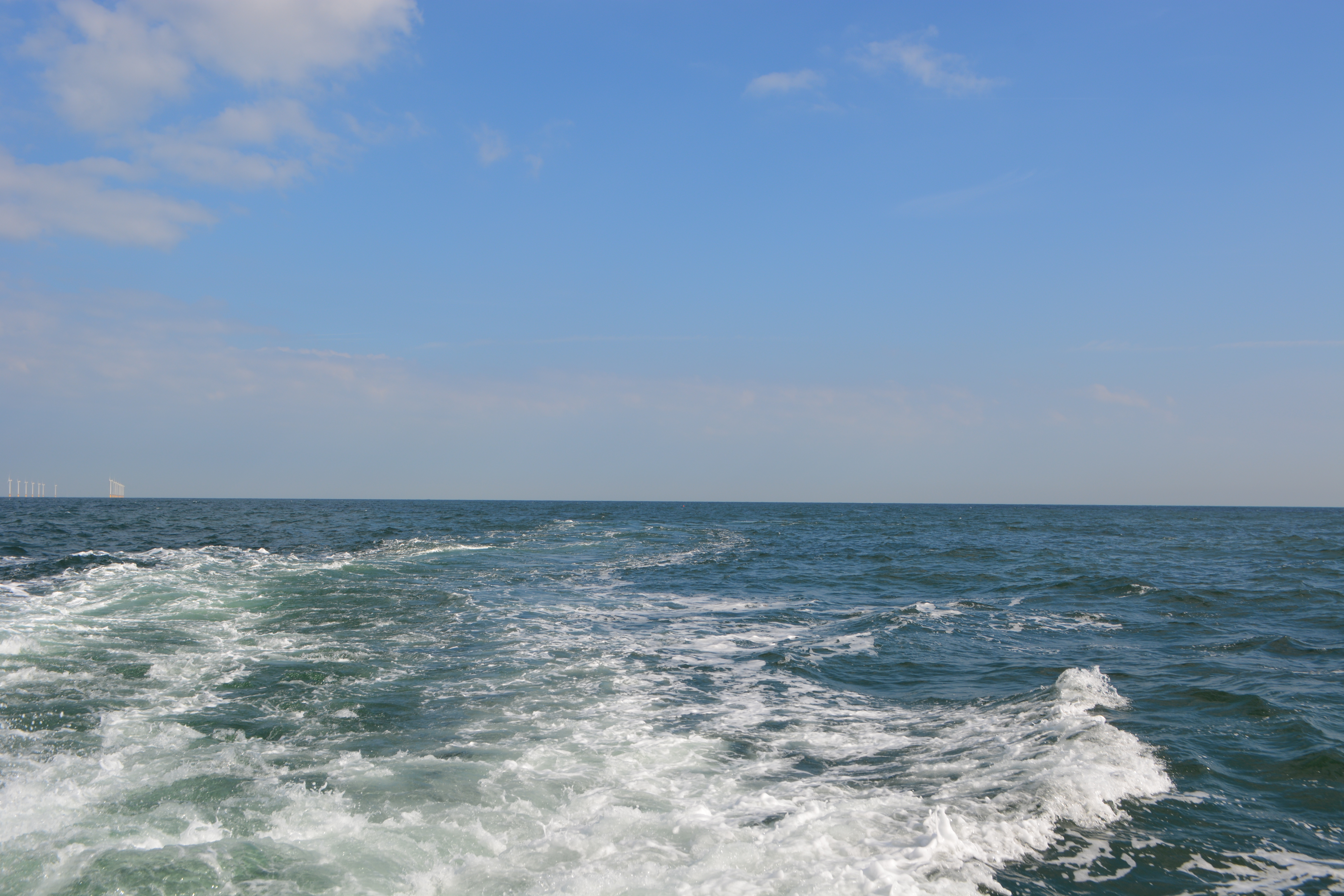
The Belgian part of the North Sea (BPNS) covers the most south-western part of the North Sea and is bordered by the English Channel to the south-west and by the central part of the North Sea to the north-east. The BPNS is mainly influenced by water from the ‘channel’ and from freshwater inputs from the Yzer and Scheldt. Long term data series are being collected for this site at different locations, making use of Thornthon Buoy, Simon Stevin Research vessel and an operational Marine Observatory that includes monthly surveys on the BPNS and an array of sensor networks.
-

Huai Ma Nai is a small agricultural catchment (93 ha) of northern Thailand, 60 km from the city of Phrae, in a sloping land environment. The objective is to the impacts of land use changes, from mung bean and soya bean to maize, upon hydrological and sedimentary budgets. Agricultural practices are very intensive, based on high quantities of fertilizers, herbicides and pesticides, and mechanized cultivation. The mean slope is 12.9%%. Soils are thin Alfisols and Ultisols with sandy clay loam to clayey texture, high coarse fragment content, low pH, high bulk density and low-medium cation exchange capacity. Monitoring devices include an automatic meteorological station since 2001, and weirs and flume to monitor discharge from nested catchments, suspended sediment and bedload. More information is available on https://mtropics.obs-mip.fr/ and in the following paper: Valentin, C., et al., 2008. Runoff and sediment losses from 27 upland catchments in Southeast Asia: Impact of rapid land use changes and conservation practices. Agric. Ecosyst. Environ. 128, 225–238. https://doi.org/10.1016/j.agee.2008.06.004
-
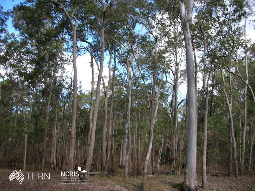
The South East Queensland Peri-urban SuperSite is a member of the Australian SuperSite Network (SuperSites, http://www.supersites.net.au/), a facility within the Australian Terrestrial Ecosystem Network (TERN, http://www.tern.org.au/). The SEQ Peri-urban Supersite’s (SEQP) core infrastructure is located at the sub-tropical 50 ha Samford Ecological Research Facility (SERF) of the Queensland University of Technology in Brisbane (https://www.qut.edu.au/research/why-qut/infrastructure/samford-ecological-research-facility). SERF is located at the western extent of the Pine longitudinal transect north of Brisbane where the urban footprint is rapidly expanding. The transect extends from the upper reaches of the Pine River catchment through the Samford Valley to Central Moreton Bay. The traditional custodians of the Samford Valley are the Yugara nation. Clan relations may well have extended into and from the neighbouring Jinibara and Kabi Kabi. The Supersite focuses on the impact of urban development and low frequency, high flow (ephemeral) events on terrestrial biogeochemistry, biodiversity and downstream water quality. Rapid population growth in SEQ is expected to continue particularly in peri-urban areas. The development, transformation of land use and exploitation of resources associated with this population growth will intensify the pressure on catchment, aquatic and coastal environments, potentially leading to significant habitat fragmentation, water quality issues, biodiversity loss and loss of economic and amenity values. The vulnerability of SEQ’s high biodiversity ecosystems will be compounded by climate change in the region. Key research questions: • Can ecosystem services be maintained in an urbanising environment? • How do carbon and energy balances change under different land uses in transition from a natural dry sclerophyll forest to a peri-urban area? • What impact will Brisbane’s peri-urban development have on water quality and soil borne greenhouse gases (carbon dioxide, nitrous oxide and methane) and surrounding vegetation? • What are the long-term effects of urbanisation on remnant vegetation? • What impact does pasture composition and management have on greenhouse gas emissions? • How will changes in the climate, land-use (e.g. from rural to residential) affect soil nutrient balances and water leaving the catchment? • How can bio-acoustic monitoring be used for measuring ecosystem biodiversity and health?
-
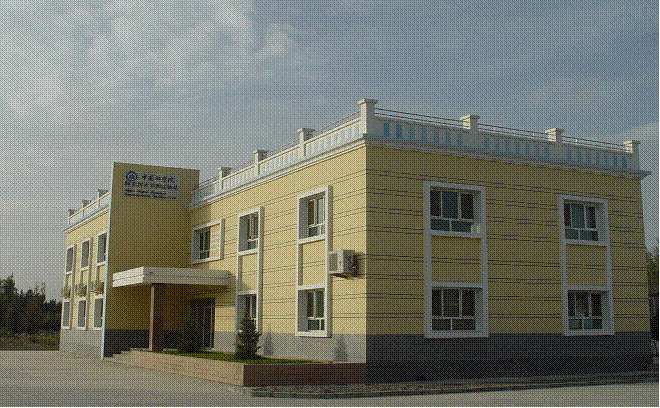
The station has a arid moderate climate, with a annual temperature of 11.2 ℃ but higher in summer and lower in winter relative to areas with the same latitude. Due to dramatic temperature fluctuation in spring and autumn, frozen damage resulted from low temperature in spring and early cooling in autumn often occurs. The annual mean precipitation is as low as 45.7 mm, thus rivers are charged mainly by precipitation in mountains and snowmelt. Frozen-free day, sunshine duration and annual mean wind velocity are, respectively, 207 d, 2940 h and 2.4 m/s. Disaster weather includes dust storm in spring, hail and accidentally continuous high temperature in summer.Aksu station (E80°51′, N40°37′, 1028 m a.s.l.), found in 1982 and affiliated with Xinjiang Institute of Ecology and Geography, was listed in the top-5 stations for irrigation experiment in Xinjiang and became a member of special environment and disaster detection network, CAS in 2002. After development of years, it entered National Field Station Network and Chinese Ecosystem Research Network (CERN) in 2005. The station is located in the source area of Tarim River where its three headstreams (i.e., Aksu, Yeerqiang and Hetian River) converge, and the vastest oasis develops in Tarim Basin under the hyperarid environments. This area is typical of Tarim Basin for dramatic watercourse meandering and great agro-water consumption, thus forming a ideal experimental field for monitoring and researching water, salt and nutrient processes in oasis cropland system, as well as for exploring sustainable oasis agriculture, theory and technologic demonstration of water-saving irrigation.
-
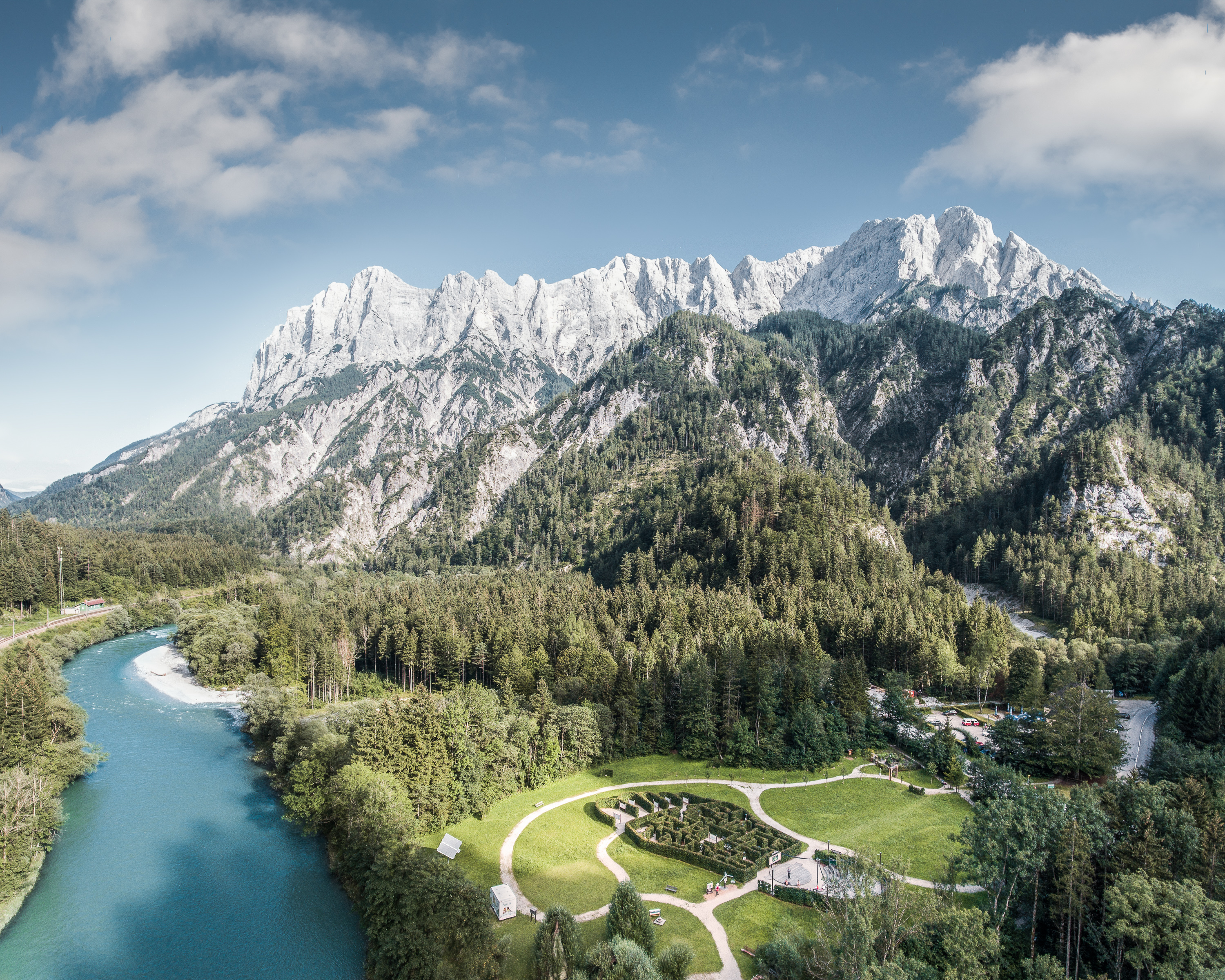
The Gesäuse Nationalpark and the Johnsbach valley belong to the Ennstal Alps, a part of the Northern Limestone Alps. They are situated in the province of Styria in the center of Austria. Together, they form the joint test site named Gesäuse-Johnsbachtal. This region is characterized by a mountainous landscape which is cut by the river “Enns”. In the north, it borders Eisenwurzen Nature Park and is only 6 km away from the Kalkalpen, a National Park in Upper Austria. In the south, the borders are the Eisenerzer Alps. The total area of the site is about 155 km². The terrain shows a great elevation range from 600-700 m in the Johnsbach valley to over 2300 m in the summit region of the Gesäuse, with Hochtor (2369 m) being the highest mountain. Due to the great range of altitude differences within small areas the Gesäuse-Johnsbachtal shows extremely diverse habitats and, consequently, species of animals and plants. In general, the landscape is dominated by mountain forests along with high Alpine rock formations and meadows. These complex topographic, hydrological, geological, geomorphological and meteorological conditions pose a scientific challenge for all kinds of environmental monitoring and modeling.
-
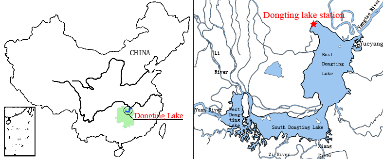
Dongting Lake Station (29º30'N, 112º48'E) located in East Dongting Lake in Yueyang City, Hunan Province. The station has good geographical advantage, convenient transportation, for about 180 kilometers from Changsha, the capital of Hunan Province. Dongting Lake located in the northeast of Hunan Province, the south shore of Jing River (in the middle of the Yangtze River) is the second largest freshwater lake of China.