
wind direction (mean and gust)
Type of resources
Available actions
Topics
Keywords
Contact for the resource
Provided by
Years
Formats
Representation types
-
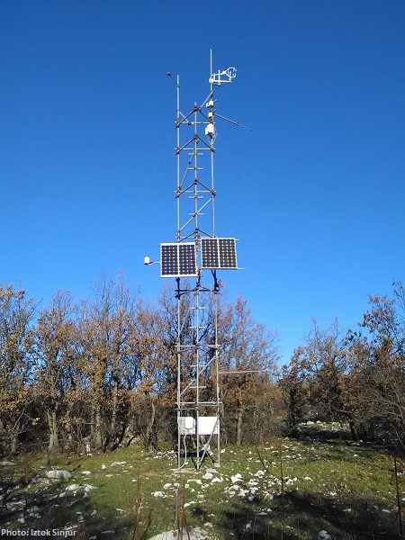
The meteorological sensors are located on the roof of the main building of the Biological Station (N 47,7691; E 16,7662; Position (elevation): 122 msl) in the close vicinity of Lake Neusiedl. The parameters that are on-line recoded every 15 minutes are as follows: Air humidity (%RH), Global radiation (W/m²), Air temperature (°C), Wind speed ([Average] (km/h), Wind direction (°), Rain yearly (mm), Precipitation (mm); time resolution: 15 minutes. There are also two traditional weather stations at the station and on the jetty, which are maintained by the Hydrolographic Service Burgenland and enable parameters such as temperature, humidity, precipitation and water level to be recorded. In addition to the Adcon weather station on the roof of the station, there are currently 3 other stations in operation in Seewinkel. These positions are: • Unterer Stinkersee (N 47,8018; E 16,7842) • Neudegg (N 47,7029; E 16,8098) • Östliche Fuchslochlacke (N 47,7907; E 16,8624)
-
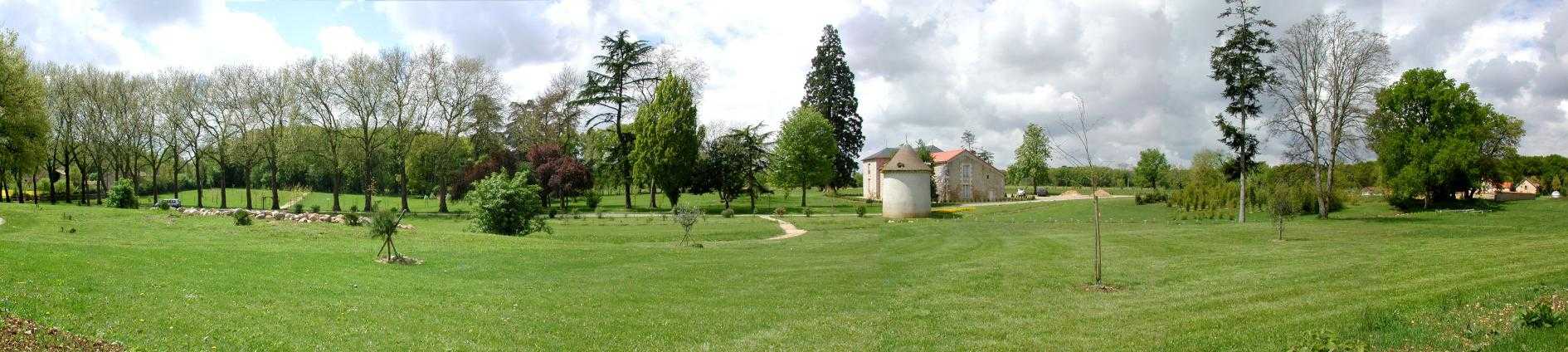
Located 2 km east of the Science Campus of the University of Poitiers, the Hydrogeological Experimental Site (HES) occupies an area of 12 hectares on land belonging to the University. From the geologic viewpoint the SEH occupies the north flank of the “Seuil du Poitou”, a huge Mesozoic carbonate plateau marking the transition between the Aquitaine and Paris sedimentary basins. The studies conducted at the SEH focus mainly on the Dogger Aquifer. The experimental layout now comprises 35 boreholes, including two vertical and two inclined cored holes.
-
Preila EMEP station (LT-15) on air chemistry and deposition are provided
-
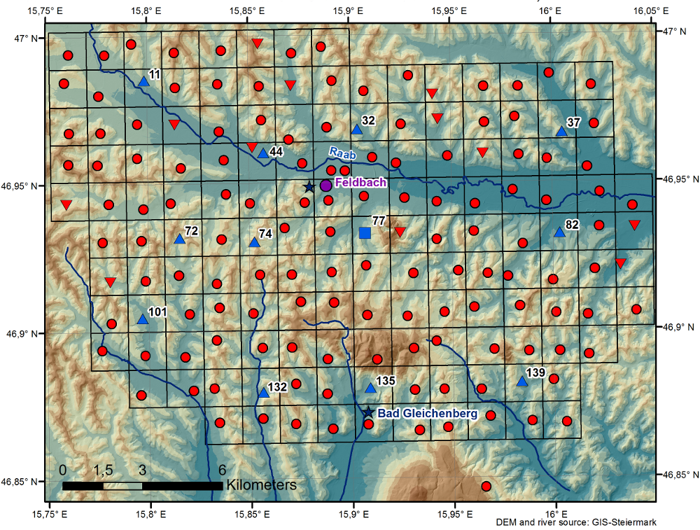
The WegenerNet climate station network Feldbach region is a pioneering weather and climate observation experiment at very high resolution located in Eastern Styria near the city of Feldbach in Southeast Austria, a region characteristic for experiencing a rich variety of weather and climate patterns. The network comprises 156 meteorological stations measuring temperature, precipitation, and other parameters, in a tightly spaced grid within an area of 23 km x 18 km centered near the city of Feldbach (46.93°N, 15.90°E). With its stations every about two square-km (area of about 300 square-km in total), and each station with 5-min time sampling, the network provides regular measurements since January 2007. As of 2010 a complementary meteorological-hydrological network of several stations was added in the mountainous upper Styrian region of National Park Gesaeuse as contribution to the LTER site Johnsbachtal (the "sister site" LTER_EU_AT_029_001 of this site LTER_EU_AT_029_002, both affiliated with the LTSER Platform Eisenwurzen). As part of the Johnsbachtal site, the WegenerNet Johnsbachtal consists of fourteen mountain-proof stations within a region-scale of about 10 km, ranging from valley altitudes below 700 m to mountain tops higher than 2100 m. The WegenerNet at both sites together provides strong value for both alpine foreland and mountain region studies.
-
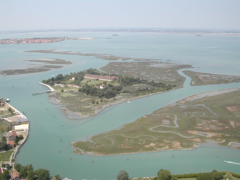
The research activities in the lagoon, as well as the understanding of natural phenomena, are directed to the study of the ecological effects of the major pressures acting on the system, including which the input of nutrients from agricultural and urban sources, industrial activity and port (Porto Marghera, Venice Maritime Station, the commercial port in Chioggia), the release of pollutants accumulated in sediments, the intense traffic ships and smaller boats,, the morphological trivialization. In recent decades the Tapes philippinarum has generated problems related to collection techniques. Is focusing attention to the increasing presence of alien species both plant that animals.
-
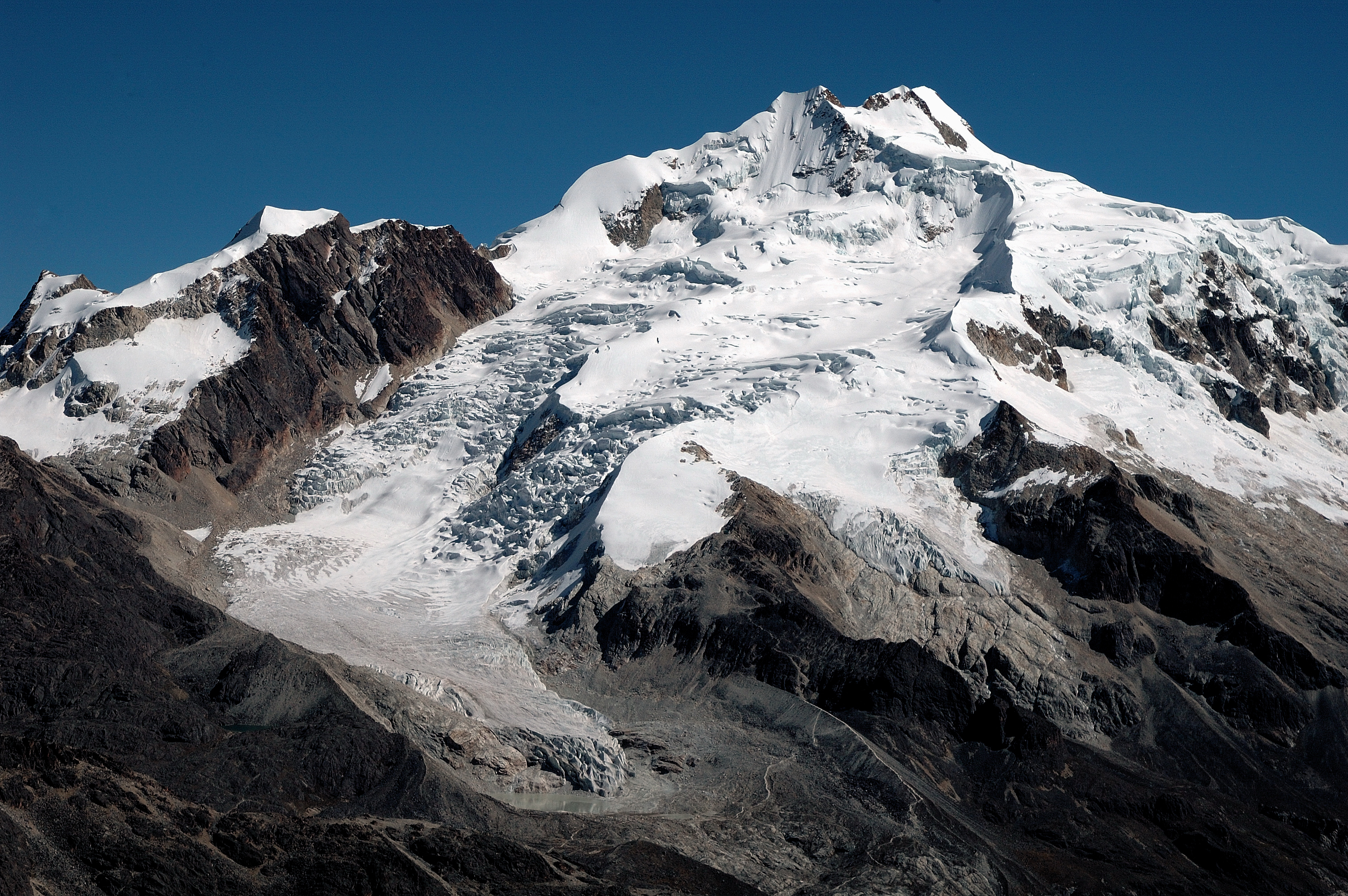
Zongo Glacier is located in the Huayna Potosi region (Cordillera Real, Bolivia) 30 km north of La Paz city, between the dry Altiplano plateau in the west and the wet Amazonian basin in the east, under outer tropics meteorological conditions (strong seasonality in precipitation, low seasonality in temperature).
-
CARBON FLUXES IN TWO SUCCESSIONAL STAGES OF VEGETATION IN THE PODGORSKI KRAS. Research site represents karst grassland and different stages of secondary succession, occasionally affected from forest fires. It is located on karst plateau close to Podgorje village in the sub-mediterranean region of south-west Slovenia. The site is equipped with two Eddy Covariance towers which measure the carbon fluxes in two successional stages of vegetation. The area has undergone major human influences due to its position at the transition between the Mediterranean and central Europe. In fact, agricultural practices, such as overgrazing in the past centuries, led to pronounced destruction of the vegetation cover, causing severe soil erosion and resulting into a stony and bare landscape. However a succession is taking place and different vegetation types, ranging from grasslands to secondary oak forests, are now present. The bedrock is mainly composed of Paleocene and Eocene limestone. The chemical weathering known as karst phenomena led to the formation of Leptosols and Cambisols, which represent insoluble fractions of carbonates. As a result, the soil is superficial, with depths ranging from 0 cm to several decimeters in soil pockets between rocks. The organic matter represents about 12–15% of the topsoil. The climate is referred to as sub-mediterranean, with a mean annual temperature of 10.5 °C, a mean daily temperature of 1.8 °C and 19.9 °C in January and June respectively, and an average annual precipitation around 1370 mm. The growing season ranges from March or April to October.
-
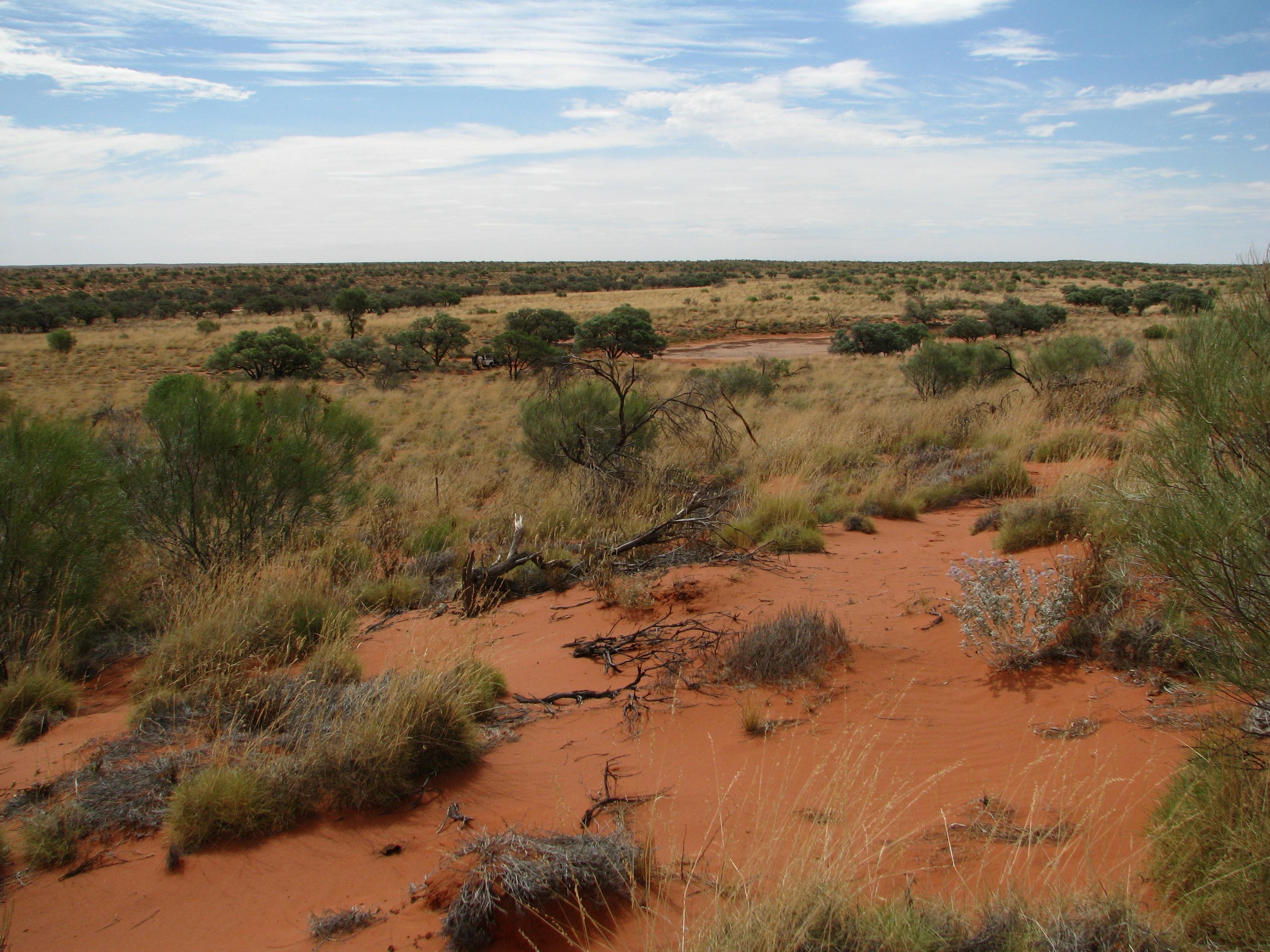
The Desert Ecology Plot Network is located in the Simpson Desert in central Australia. The vegetation in the study region is dominated by hard spinifex (Triodia basedowii E. Pritz), with scattered small woodlands of Georgina gidgee (Acacia georginae F.M. Bailey) interspersed throughout (Figure 9.1). The long-term plots for which data are provided as part of LTERN infrastructure are all located within the spinifex hummock grasslands, but additional survey plots, situated in gidgee woodlands, exist and have been surveyed since 2006 and are revisited whenever possible. Temporal visits are conducted annually. The Desert Ecology Plot Network was a member of Long Term Ecological Research Network (LTERN), Australia, a facility of the Australian Government's Terrestrial Ecosystem Research Network (TERN).
-
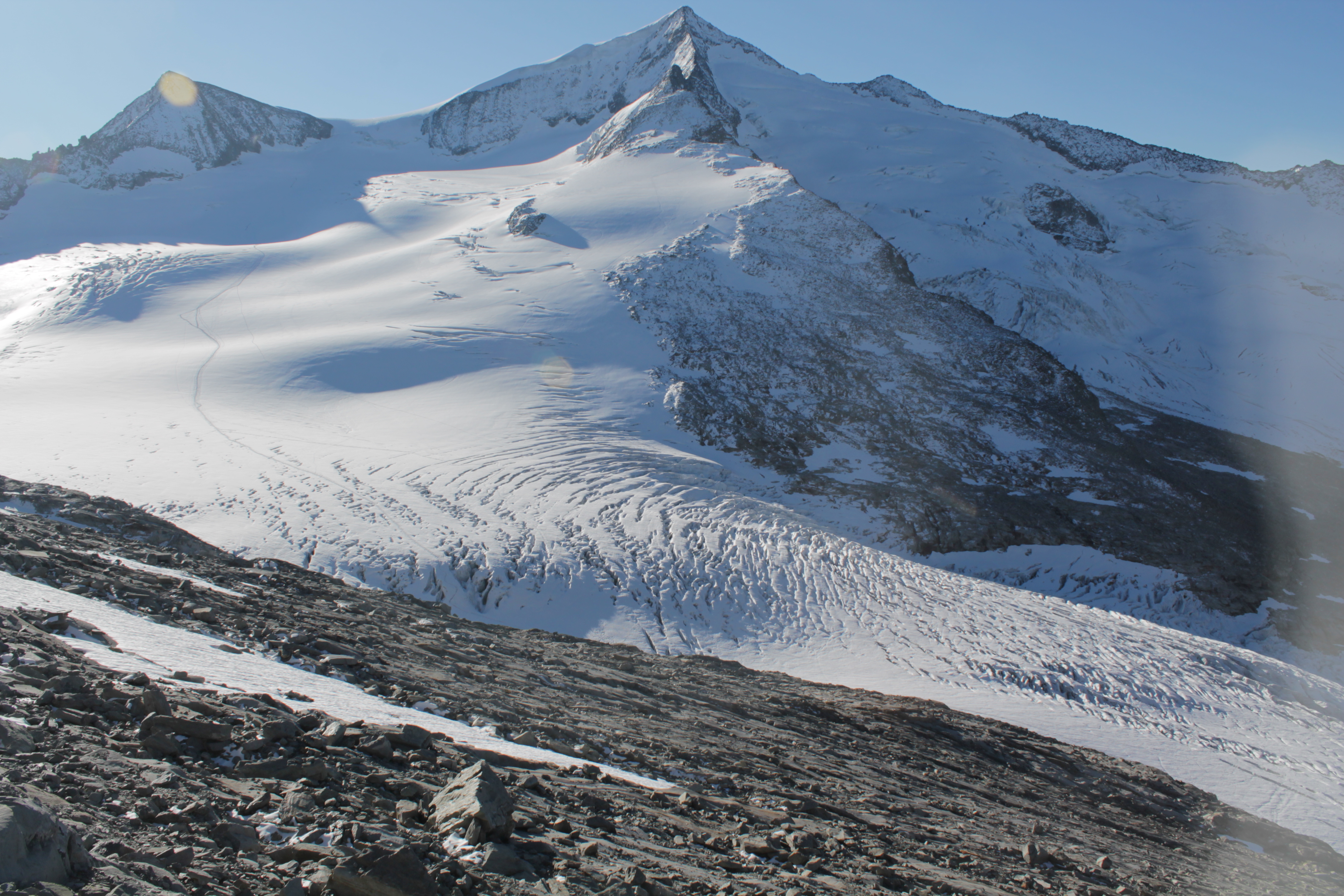
The Venedigerkees in the Hohe Tauern National Park is the easternmost tributary glacier to the former tongue of Obersulzbachkees. As a result of the strong retreat of Obersulzbachkees, the glacier disintegrated into several tributary glaciers, with a large lake remaining at the location of a famous serac zone, the 'Türkische Zeltstadt'. Mass balance of the Venedigerkees is measured since 2011/12 with the direct or glaciological method. Furthermore, an automatic weather station was built between Venedigerkees and Keeskogel in 2018.
-
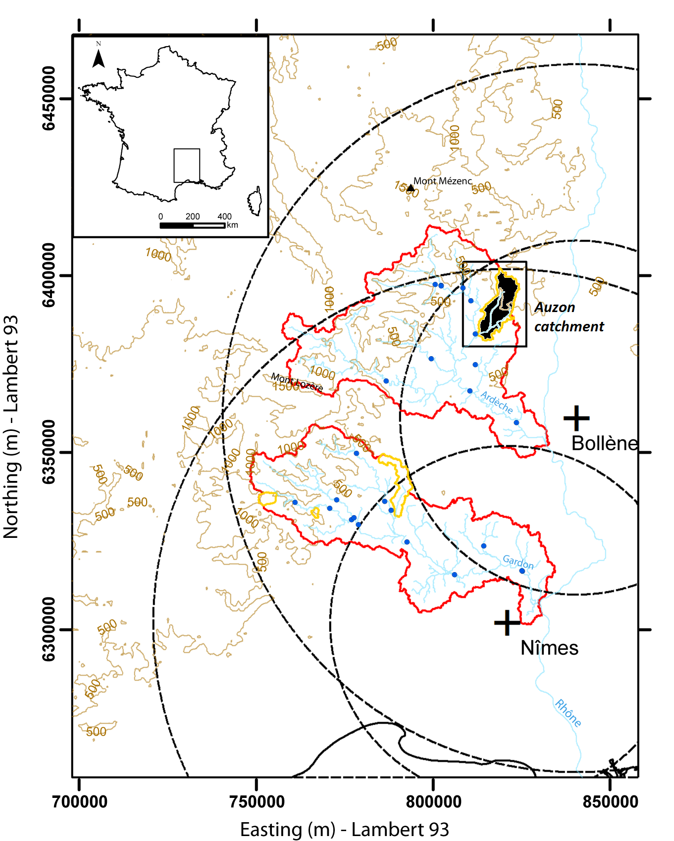
Hydrometeorological and hydrosedimentary observations within 3 embedded catchments: Gazel, Claduègne and Auzon (3.4, 43, and 116 km²). Mediterranean climate with heavy rainfall and flash floods in automn. The upper part of the catchment is characterized by basalt formations, after which a sharp transition occurs where the lower two thirds is made up of sedimentary limestone rock. The soil types are heavily infuenced by the geology of the catchment. Main land use types are pastures,vineyards and forest. More information at http://mistrals.sedoo.fr/?editDatsId=1438