
Agrosphere Institute (IBG-3)
Type of resources
Available actions
Topics
Keywords
Contact for the resource
Provided by
Years
Formats
Representation types
-
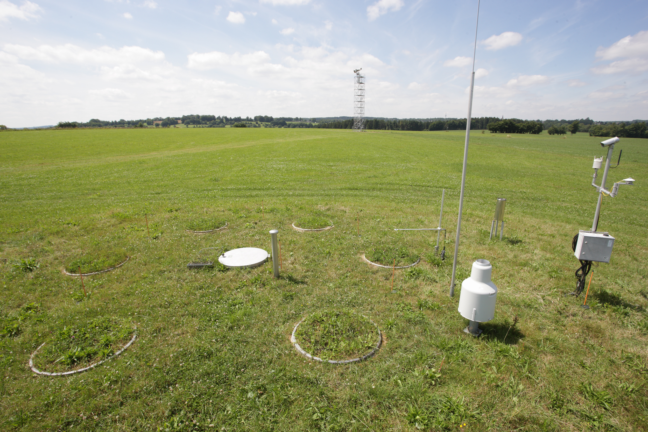
The Rollesbroich site is located in the low mountain range “Eifel” near the German-Belgium border and covers the area of the small Kieselbach catchment (40 ha) with altitudes ranging from 474 to 518 m.a.s.l.. The climate is temperate maritime with a mean annual air temperature and precipitation of 7.7 °C and 1033 mm, respectively, for the period from 1981 to 2001. Soils are dominated by (stagnic) Cambisols and Stagnosols on Devonian shales with occasional sandstone inclusions that are covered by a periglacial solifluction clay–silt layer. The mountainous grassland vegetation is dominated by perennial ryegrass (Lolium perenne) and smooth meadow grass (Poa pratensis). The study site is highly instrumented. All components of the water balance (e.g. precipitation, evapotranspiration, runoff, soil water content) are continuously monitored using state-of-the-art instrumentation, including weighable lysimeters, runoff gauges, cosmic-ray soil moisture sensors, a wireless sensor network that monitors soil temperature, and soil moisture at 189 locations in different depths (5, 20 and 50 cm) throughout the study site. Periodically also different chamber measurements were made to access soil or plant gas exchange.
-
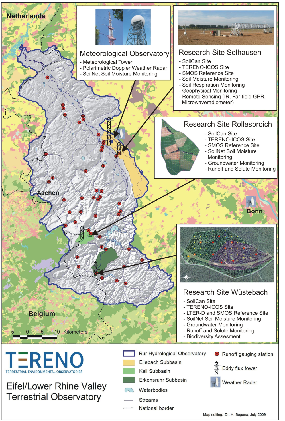
The central monitoring site of the Eifel/Lower Rhine Valley Observatory is the catchment area of the River Rur. It covers a total area of 2354 km² and exhibits a distinct land use gradient: The lowland region in the northern part is characterised by urbanisation and intensive agriculture whereas the low mountain range in the southern part is sparsely populated and includes several drinking water reservoirs. Furthermore, the Eifel National Park is situated in the southern part of the Rur catchment serving as a reference site. Intensive test sites are placed along a transect across the Rur catchments in representative land cover, soil, and geologic settings: In order to obtain spatially distributed information about river discharge rates, the Rur catchment is partitioned into a nested set of sub-catchments that will span distinct assemblages of hydrologic features and several orders of magnitude in drainage area. More detailed measurements and characterisation of smaller, focal catchments are embedded within progressively larger catchments, allowing the critical evaluation and development of scaling strategies. Additionally, for the analysis of the groundwater flow system and groundwater exchange rates on a regional scale, the monitoring of natural tracers of ground and surface waters will be carried out.