
Australian National Collaborative Research Infrastructure Strategy (NCRIS)
Type of resources
Available actions
Topics
Keywords
Contact for the resource
Provided by
Years
Formats
Representation types
-
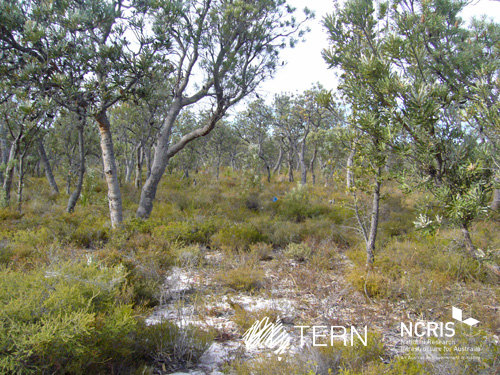
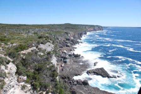
Gingin Banksia Woodland SuperSite is located on the Swan Coastal Plain, approximately 10 km southwest of Gingin, near Perth, Western Australia, sited on land traditionally owned by the Yued group of the Noongar people. The site has an elevation of 51 m and 2 km from the University of Western Australia International Gravity Wave Observatory. The Gingin Banksia Woodland SuperSite is located in a natural woodland of high species diversity (overstorey dominated by Banksia spp.) that overlays the Gnangara groundwater mound, Perth’s most important groundwater resource. The mean annual precipitation is 641mm for this coastal heath woodland. The overstorey is dominated by Banksia spp. mainly B. menziesii, B. attenuata, and B. grandis with a height of around 7 m and leaf area index of about 0.8. There are occasional stands of eucalypts and acacia that reach to 10 m and have a denser foliage cover. There are many former wetlands dotted around the woodland, most of which were inundated all winter and some had permanent water 30 years ago. The water table has now fallen below the base of these systems and they are disconnected and are no longer permanently wet. The fine sediments, sometimes diatomaceous, hold water and they have perched water tables each winter. There is a natural progression of species accompanying this process as they gradually become more dominated by more xeric species. The soils are mainly Podosol sands, with low moisture holding capacity. Field capacity typically about 8 to 10%, and in summer these generally hold less than 2% moisture. The water table is at about 8.5 m below the surface, and a WA Dept of water long-term monitoring piezometer is near the base of the OzFlux tower. The Swan Coastal Plain bioregion consists of five main geomorphic entities that are roughly located parallel to the coastline including three coastal sand dune systems with ages increasing inland from the coast. Banksia Woodlands is restricted to the Swan Coastal Plain IBRA bioregion and immediately adjacent areas, including the Dandaragan plateau. Vegetation consists of a prominent tree layer of Banksia with scattered eucalypts and other tree species present within or emerging above the Banksia canopy, and a diverse understorey including sclerophyllous shrubs, graminoids and forbs. The Gingin SuperSite is collocated with the Land Ecosystem Atmosphere Program (LEAP) - Gingin. The traditional owners at Gingin are the Yued group of the Noongar People.
-
Mitchell Grass Rangeland SuperSite is situated near Longreach in western Queensland in the Mitchell Grass Downs IBRA bioregion, that covers approximately 47 M ha (14% of Queensland and 6% of Australia). The mean annual precipitation is 444 mm. The nearest Bureau of Meteorology station (Longreach Aero 036031) is approximately 10 km away. The black vertosol soil supports sheep and beef cattle grazing in the area. The SuperSite is located at the Longreach Pastoral College (previously the Queensland Department of Primary Industries Rosebank Research Station) with a history of CSIRO research sites in the area. Traditional owners at this site are the Iningai people.
-
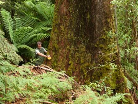
The Victorian Tall Eucalypt Forest Plot Network is located in the Central Highlands of Victoria, Australia and its research infrastructure is comprised of stratified 1-ha long-term plots within 3-ha monitoring sites. Between 2012 and 2018 the Victorian Tall Eucalypt Forest Plot Network was a member of the Long Term Ecological Research Network (LTERN), Australia, a facility of the Australian Government's Terrestrial Ecosystem Research Network (TERN).
-
The Nanangroe Plantation Plot Network is located in the southwest slopes of NSW west of Lake Burrinjuck and includes four exotic Pine Plantations (Nanangroe, Cotway, East Bungongo and Bungongo), as well as private properties adjacent to those plantations. Its research infrastructure is comprised of an array of stratified 2-ha long-term plots. Temporal visits occur annually / biennially (rotating sampling program). Between 2012 and 2018 the Nanangroe Plantation Plot Network was a member of Long Term Ecological Research Network (LTERN), Australia, a facility of the Australian Government's Terrestrial Ecosystem Research Network (TERN)).
-
The Jervis Bay Booderee National Park Plot Network is located in Jervis Bay Territory, NSW, Australia and its research infrastructure are structure plots (1 m × 1 m, 20 m × 20 m) nested within 1-ha sites. Temporal visits are as follows: * Vegetation - 3 years • Birds - Annual • Arboreal spotlighting - 2 years • Reptiles - Annual • Terrestrial mammals - 2 years The Jervis Bay Booderee National Park Plot Network was a member of Long Term Ecological Research Network (LTERN), Australia, a facility of the Australian Government's Terrestrial Ecosystem Research Network (TERN).
-
The Upland Heath Swamps Plot Network is located in the Dharawal National Park, near Sydney, NSW. Sampling of vegetation is stratified along the soil moisture gradient and across the range of structural variability in the vegetation. Thus, three categories of soil moisture and three categories of vegetation structure (based on the height and form of shrubs) are sampled in a factorial design at 60 sites in upland swamps scattered throughout the study area (Keith & Myerscough 1993). Temporal visits are conducted every 5 years or when fires occur. Between 2012 and 2018 the Upland Heath Swamps Plot Network was a member of Long Term Ecological Research Network (LTERN), Australia, a facility of the Australian Government's Terrestrial Ecosystem Research Network (TERN).
-
The Mallee Plot Network is located in the red aeolian sand dunefield landscape of the Scotia district within Tarawi Nature Reserve, Scotia Wildlife Sanctuary and Danggali Conservation Park in south-western New South Wales and adjacent areas of South Australia. The study area sits on the south-eastern edge of the Australian arid zone and is close to the arid limits of distribution of the mallee woodland biome, which stretches across the temperate semiarid belt of southern Australia (Noble 1984). Mallee woodlands typically occur in regions In the Scotia district and its surrounding region, mallee woodlands occur within a landscape mosaic that includes patches of woodland dominated by Casuarina pauper (belah) and shrublands dominated by Maireana sedifolia and M. pyramidata (bluebush) (Westbrooke et al. 1998). These latter vegetation types occur on gently undulating sandplains with a calcareous crust not far below the soil surface. In contrast, mallee woodlands dominate transverse east–west oriented dunefields. The dunes are characterised by deep, red sandy loams dominated by Eucalyptus socialis (pointed mallee), E. dumosa and E. costata—occasionally with Callitris verrucosa - with a mixed understorey of hummock grasses and shrubs, and a largely ephemeral ground layer of tussock grasses and forbs. The intervening swales have finer-textured red loams and generally support a wider range of eucalypts including E. oleosa and E. gracilis, but C. verrucosa is absent. Their understoreys typically include a higher density and diversity of shrubs but lack hummock grasses, and the ground layer is typically sparse. Detailed descriptions of vegetation and landscapes are included in Westbrooke et al. (1998). Temporal visits were initially staggered, then annual for 3 years and is now decadal. Between 2012 and 2018 the Mallee Plot Network was a member of Long Term Ecological Research Network (LTERN), Australia, a facility of the Australian Government's Terrestrial Ecosystem Research Network (TERN)..
-
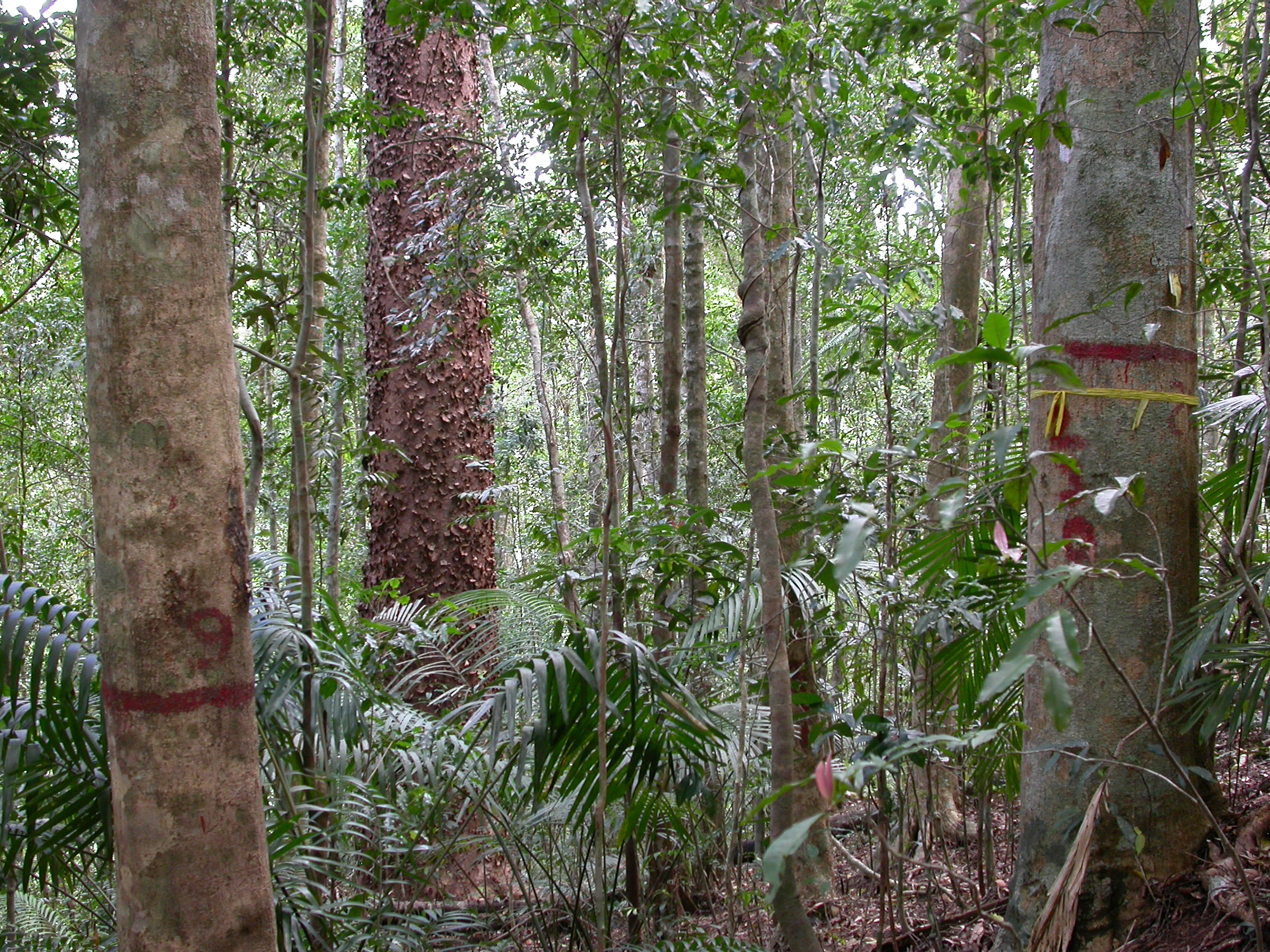
The Connell Rainforest Plot Network long-term forest dynamics plot of Davies Creek is located in the Dinden National Park circa 25 km southwest of Cairns, Northern Queensland. Temporal visits occur between 1 to 6 years. Between 2012 and 2018 the Connell Rainforest Plot Network was a member of Long Term Ecological Research Network (LTERN), Australia, a facility of the Australian Government's Terrestrial Ecosystem Research Network (TERN).
-
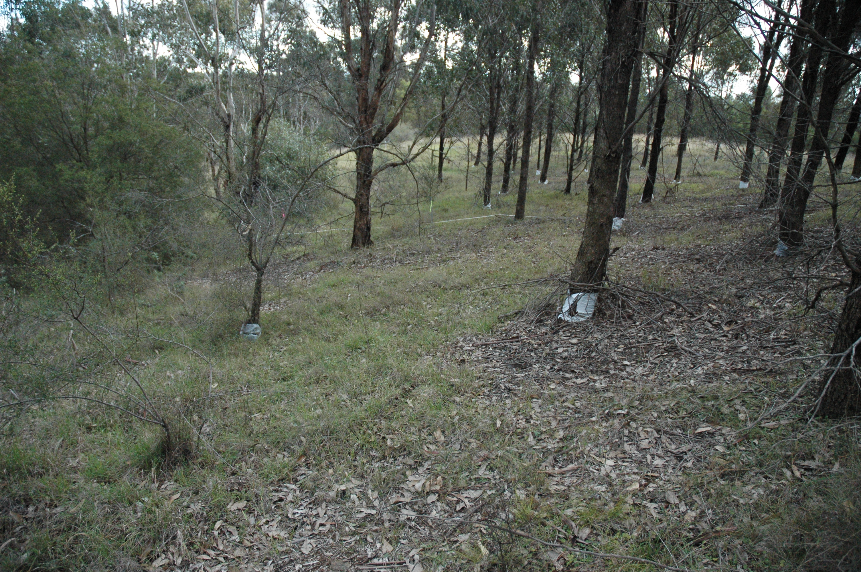
The Woodland Restoration Plot Network is located in the Cumberland Plain, Western Sydney, NSW, Australia with the objective to develop robust methods for evaluating the success of native woodland restoration on retired agricultural land and apply them to a major restoration project of an endangered ecological community. The plot network aims to determine whether the composition and structure of restoration plantings undertaken between 1992 and 2002 are on a trajectory from abandoned exotic pasture towards comparatively undisturbed remnant vegetation. The data gathered will inform future restoration efforts. Between 2012 and 2018 the Woodland Restoration Plot Network was is a member of Long Term Ecological Research Network (LTERN), Australia, a facility of the Australian Government's Terrestrial Ecosystem Research Network (TERN).
-
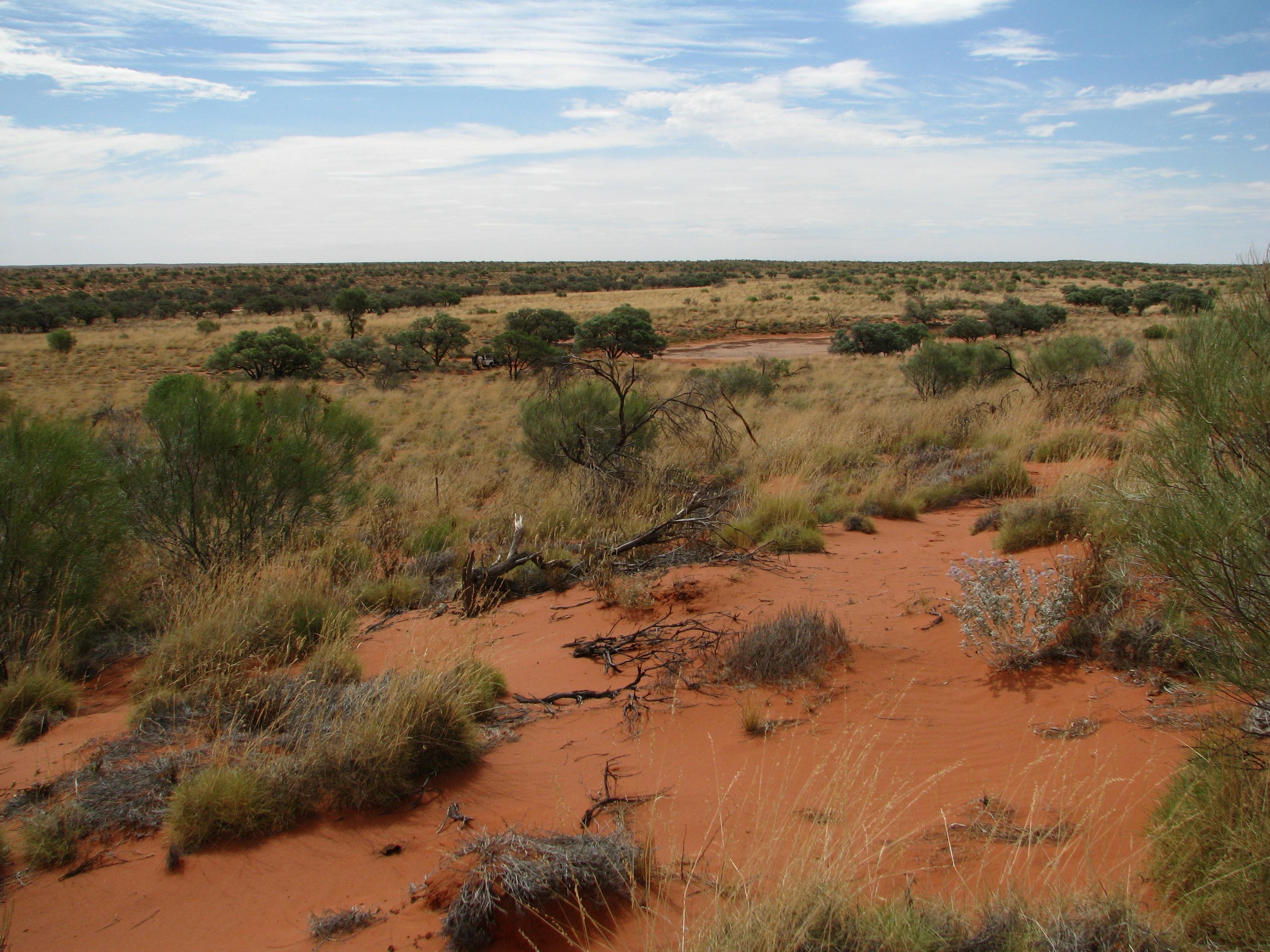
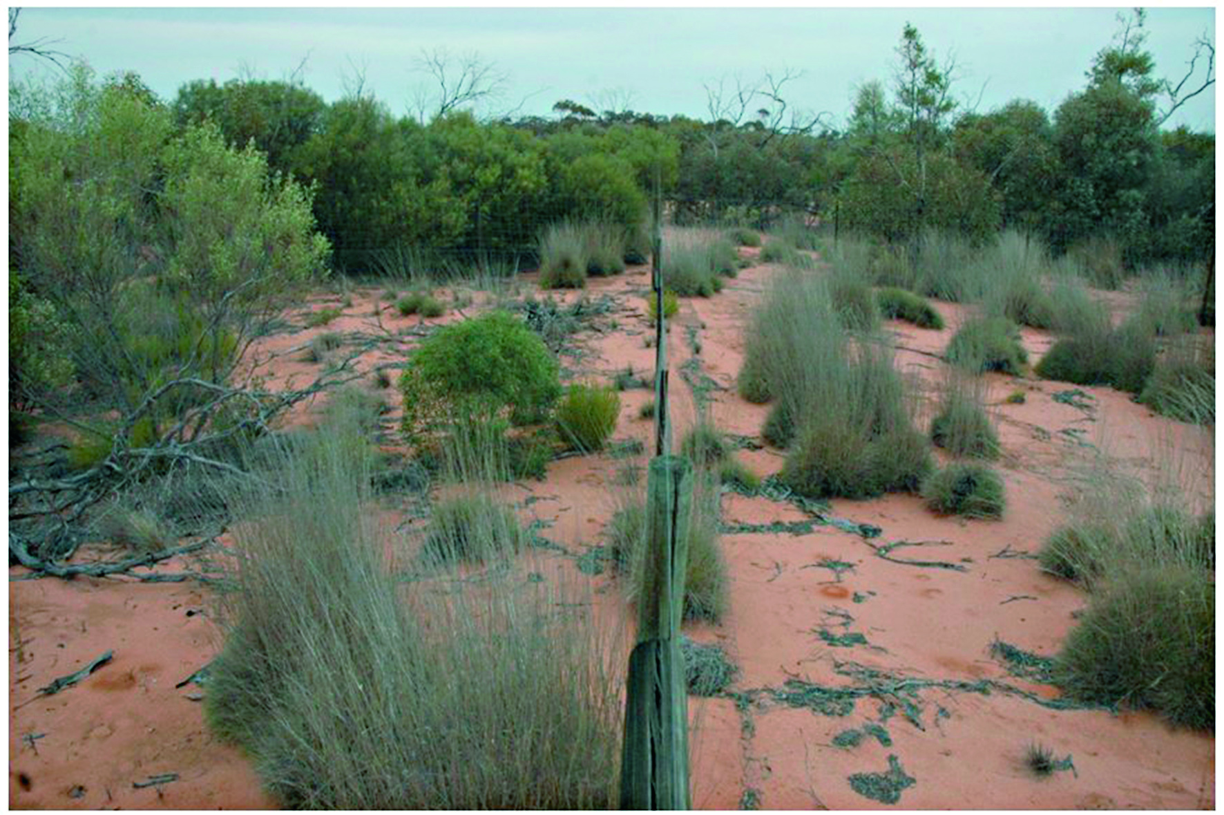
The Desert Ecology Plot Network is located in the Simpson Desert in central Australia. The vegetation in the study region is dominated by hard spinifex (Triodia basedowii E. Pritz), with scattered small woodlands of Georgina gidgee (Acacia georginae F.M. Bailey) interspersed throughout (Figure 9.1). The long-term plots for which data are provided as part of LTERN infrastructure are all located within the spinifex hummock grasslands, but additional survey plots, situated in gidgee woodlands, exist and have been surveyed since 2006 and are revisited whenever possible. Temporal visits are conducted annually. The Desert Ecology Plot Network was a member of Long Term Ecological Research Network (LTERN), Australia, a facility of the Australian Government's Terrestrial Ecosystem Research Network (TERN).