
Autonomous Province of Bolzano - Bozen
Type of resources
Available actions
Topics
Keywords
Contact for the resource
Provided by
Years
Formats
Representation types
-
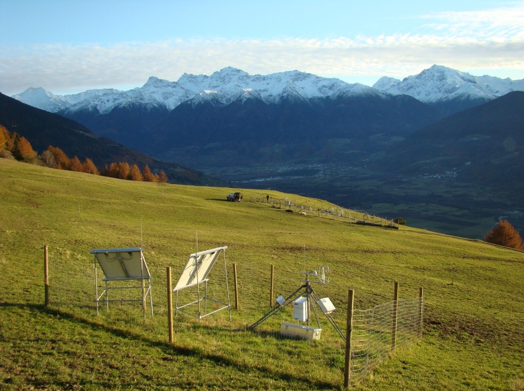
Muntatschinig (Monteschino) is a 25m x 15m grassland site (managed meadow) on 1480m. The site was first established in 2008 as a weather station and is still the most extensive of the four sites. In 2010 the University of Innsbruck installed an eddy covariance station. Nine automatic lysimeters were added to measure evapotranspiration and water use efficiency. Since 2012 a rain-out shelter system has been used for simulating spring and summer droughts. This site is one of the sites along the elevation transect used for grassland transplantation experiments.
-
Saldur Catchment covers an area of app. 100 km2 and includes different elevations, topographic aspects and ecosystems (meadows, pastures, forests and glacier forefields).Measurements started in 2010. In total there are 17 weather stations distributed throughout various ecosystem types (cultivated meadows, pastureland, forest, glacier forefield), which enables analyses at a plot level up to a complete landscape level. Measurements are primarily used to validate hydrological models and to model various ecosystem services such as productivity, water availability and protection against natural hazards. This site is also equipped with five units to measure sap flow in the stem and an automatic dendrometer; the data are used to investigate the influence of climate factors on common coniferous trees in the area.
-
The first data in the Matsch| Mazia valley was collected in the year 2008. Originally aimed at studying climatic change impacts on dry mountain grassland, the measuring activities have been strongly expanded throughout the years. Today's activities on the site include process-oriented ecological research covering time (historical analysis, actual processes and future scenarios ) and space (from plot to landscape scale among different ecosystems) within a human-influenced catchment. The valley is situated in the central Alps in the westernmost part of South Tyrol in North Italy. Matsch is a side valley of the Vinschgau valley, and extends over 90 km2 reaching from 950 m.a.s.l. to 3700 m.a.sl. at the highest peak. The main village Matsch is located at 1600 m and has 458 inhabitants.Due to its protected location in the central Alps, the Mazia/Matsch valley represents one of the driest spots within the whole alpine range, with a mean annual precipitation of 525mm at 1500m.a.s.l (1950-2010)
-
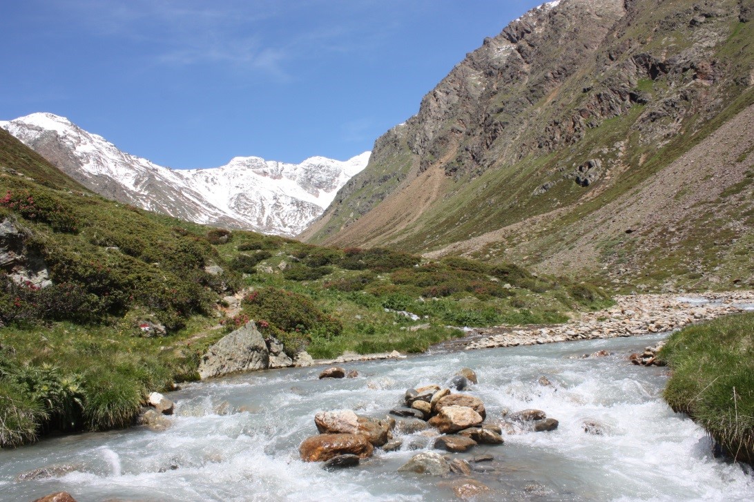
The Saldur River is 22 km long and flows from its source at the glacier (app. 2700m) to the river mouth at 900m. The Saldur river has been a focal point for investigations since the 1980s for various biological and chemical laboratories of the Autonomous Province of Bolzano. There are four main measurement points along the 22km river. One point serves as a regional and national biological water quality monitoring station. The EURAC Institute for Alpine Environment became involved in 2011, collecting additional physical, chemical and biological parameters. In addition to the four main measurement points, which are located in the upper areas of the catchment, there are now sixteen additional points in the river’s main tributaries.