
CNRS - Institut écologie et environnement (INEE)
Type of resources
Available actions
Topics
Keywords
Contact for the resource
Provided by
Years
Formats
Representation types
-
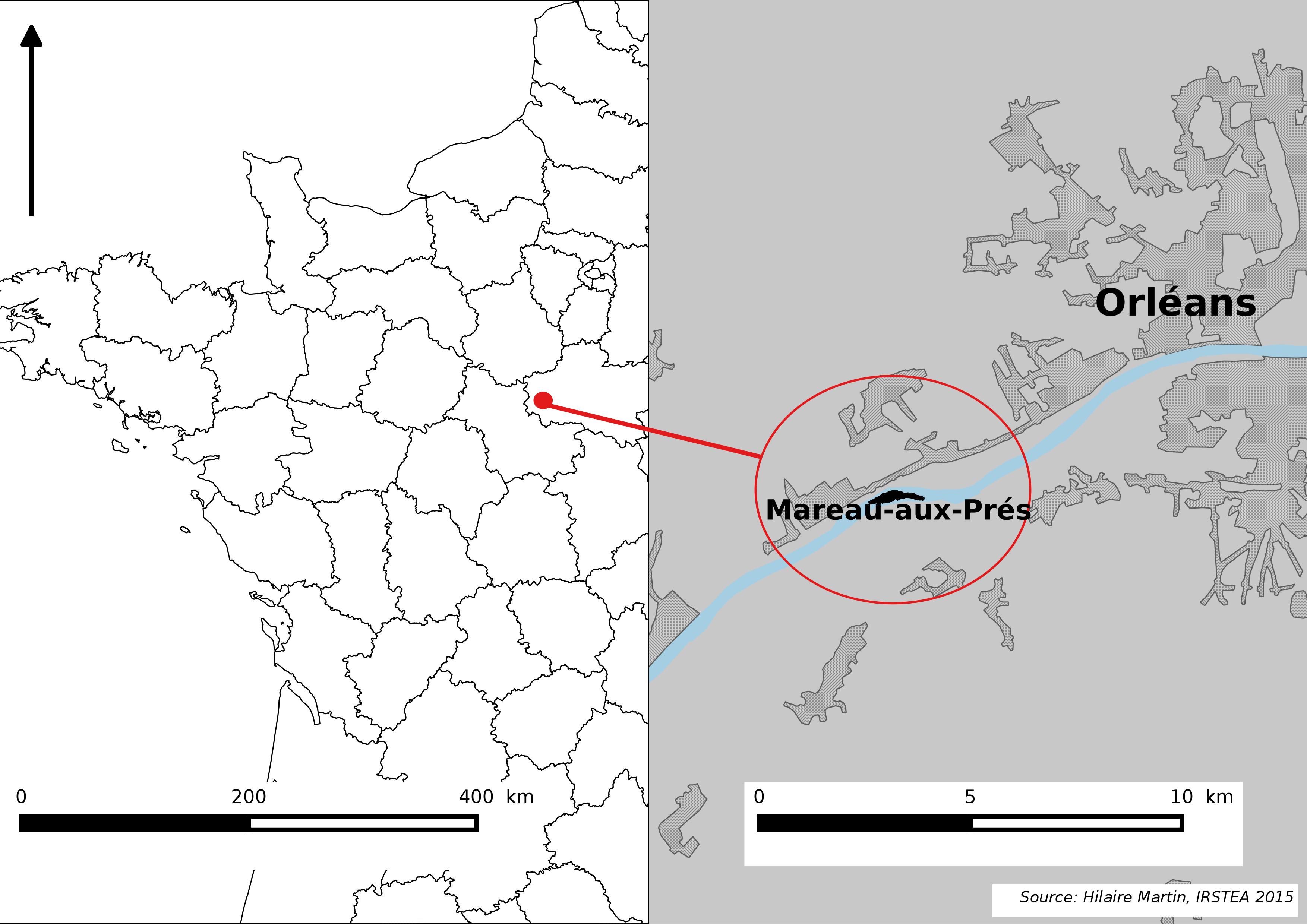
The Mareau-aux-Prés islands, along the Loire river, are characterized by a multiple channel pattern, where natural limestone riffles influence the morphology and spatial distribution of vegetated islands, secondary channels and alluvial bars. Within these islands, in september 2012, fluvial management operations (FMO) were launched. The vegetation of the central sandy-gravelly bar (3 ha area) was uprooted and the bar level lowered in order to maintain the flow capacity of the river. A new sandy-gravelly bar appeared in spring 2013, ideal field support for studying long-term ecological issues. A multidisciplinary research program (‘BioMareau’ project) is currently being conducted from 2012 to 2019, focusing on biodiversity recolonization and on interactions and feedbacks between biotic and abiotic compartments.
-
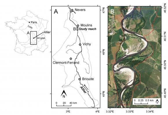
This study site is in the south of the city of Moulins, including the National Nature Reserve of the Val d'Allier which protects 1,450 hectares over approximately 28 km along the lower course of the Allier River. The Allier river is considered as the last wild river of Europe because of its strong fluvial dynamics and remaining free meandering river segments. The studied sector within the nature reserve is still very mobile, with a strong lateral dynamic, where the width of the divagation can be of the order of one kilometer. At this scale, it is unique in Europe.
-
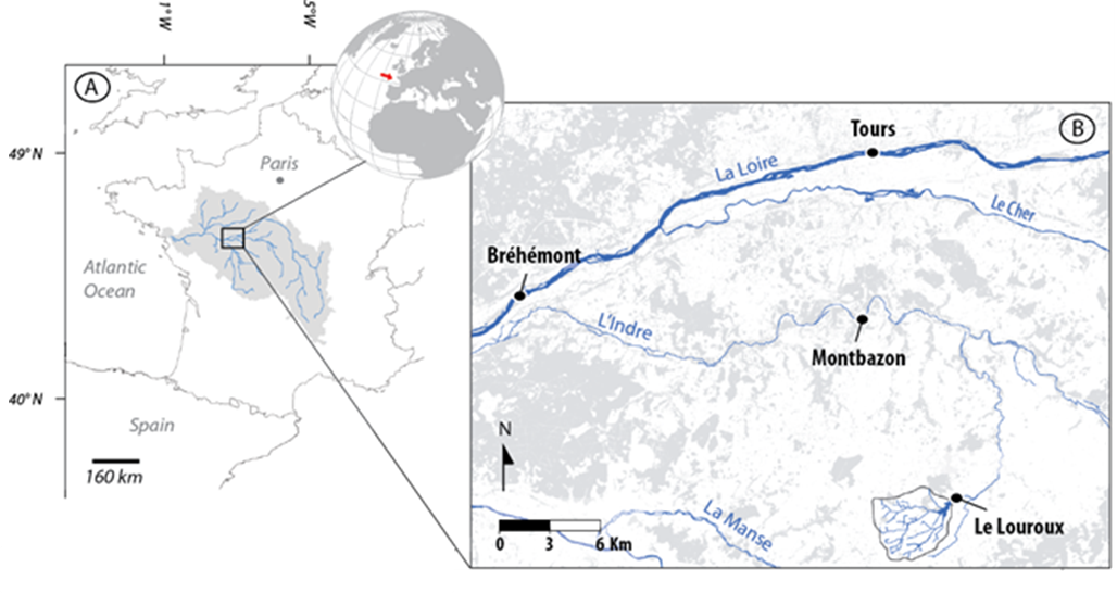
The 25 km² Louroux catchment is located in central France. It is a typical lowland, intensively cultivated catchment with an 11th century pond at its outlet. As in many similar environments, this catchment underwent large landscape changes since the second half of the 20th century: implementation of drainage systems, stream redesign and land reallocation. This resulted in changes in sediment transfer processes and in widespread morphological alterations of water bodies. There is still little combined knowledge on the intensity, processes & sources of sediments in these environments although these are necessary to implement efficient mitigation strategies. Long term sedimentation rates are studied through analysis of sediments accumulated in the pond. Current suspended sediment fluxes are monitored with a high frequency through five hydrosedimentary stations. Fingerprinting techniques are used to trace the origin of sediments.
-
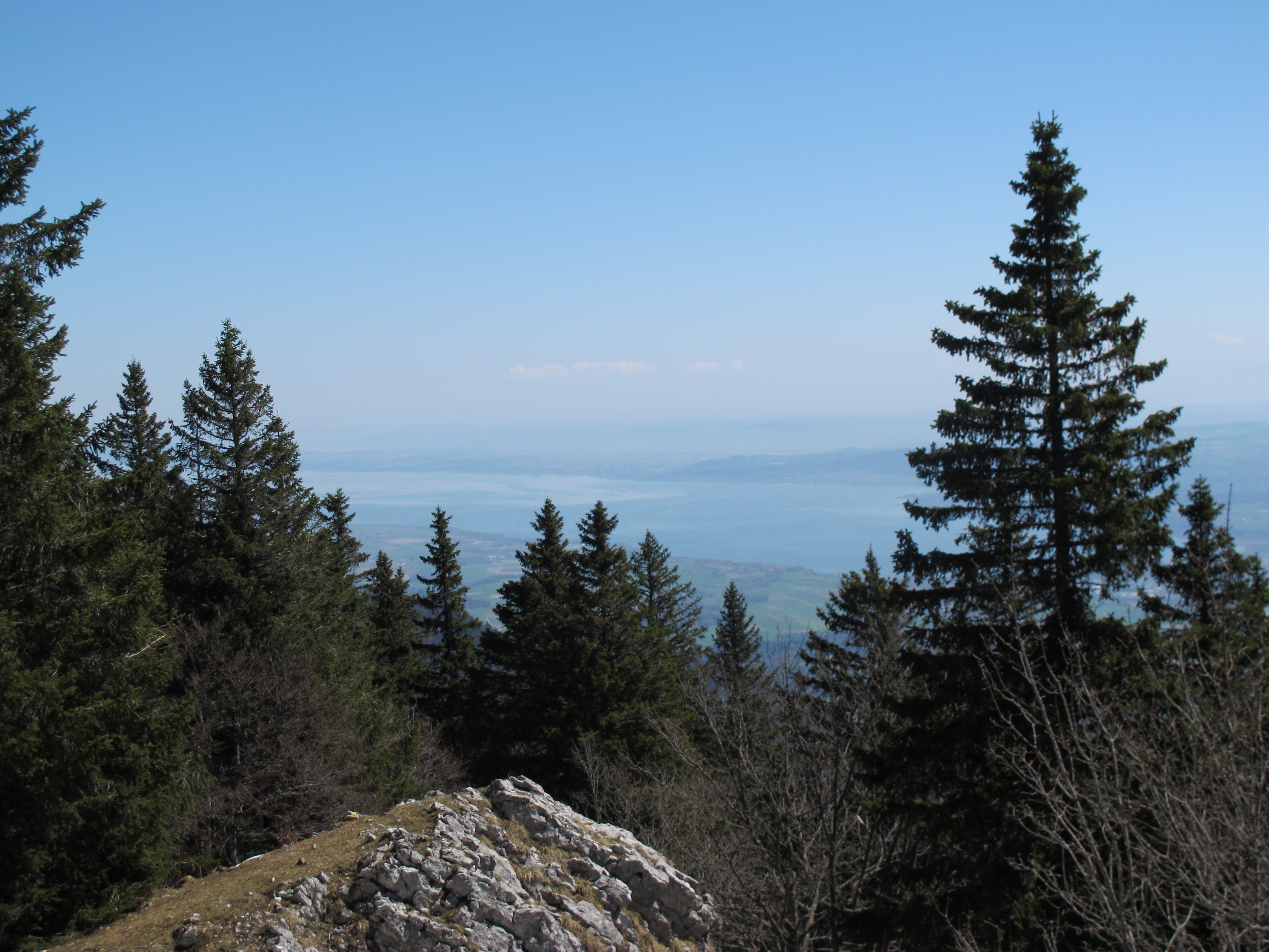
Socio-ecological interactions in ecosystems of mid-altitude mountains The LTSER Zone Atelier Arc Jurassien belongs to LTER-France network and is located in eastern France.The LTSER site Jurassian Arc (ZAAJ stands for Zone atelier Arc jurassien, in French) is designed to promote long-term interdisciplinary research into the environment and ecosystems in relation to society issues. It federates a network of research partnerships around interactions between the environment, society and the dynamics of moutain socio-ecological systems.ZAAJ helps to capitalise on field data and to analyze and promote the results from long-term observation schemes at the interface between ecology, the environment and society. Benefiting of more than 25 years of experience on the issue, accredited by the CNRS Ecology and Environment Institute (INEE) in 2013, ZAAJ is a cluster of five research units totalling 40 researchers.
-
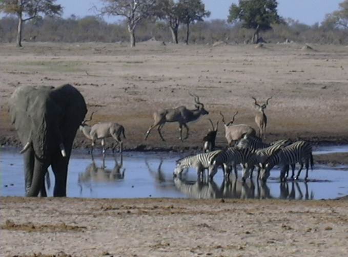
The LTSER Zone Atelier Hwange (ZAHWG) belongs to LTER-France network and is located in western Zimbabwe, in Sub-Saharan Africa, and is centered around Hwange National Park. The ecosystem is dominated by dystrophic savannas (mostly wooded savannas and dry woodlands) with discrete water sources. Surrounding land-uses include forestry areas, subsistence agro-pastoral farming, private ranches and hunting concessions, and mining. The ZAHG conducts an interdisciplinary research on the dynamics and resilience of this socio-ecological system organised, around a large protected area with re-known large mammal diversity and facing major social and climatic challenges for sustainable conservation
-
The AAA-LTER platform focuses on agricultural and urban landscape The objective of the proposed LTSER structure is to provide an internationally open, attractive and recognized scientific observatory of human/nature interactions. Through its representativeness of environmental issues of Atlantic terrestrial and aquatic landscapes and the complementarity of its eLTER sites, the AAA-LTSER is a unique showcase for decision makers to help them in defining regional decision frameworks and sustainable policies, and to promote technical and social innovation as well as science education. The AAA-LTSER embraces regional social-ecological dimensions whose diversity of landscape use and planning covers a unique set of interconnected aquatic and terrestrial systems. lt concentrates multiples supports and cofunding from the European Union, the State, the Brittany region and local institutions to improve and maintain high density of sensors, equipment and social studies that are crucial for better understanding human/nature interactions and train the next generation of scientists to work at these interfaces in inter- and trans-disciplinary approaches. To cover the major regional environments and interfaces (continent/ocean, urban/rural, subsurface/surface), the AAA-LTSER platform is founded on existing and complementary sites. They represent the different terrestrial, transitional and marine landscape structures, features and dynamics that shape this intensive anthropogenic region, and their related social-ecological issues. All these sites involve end-users and policy makers seeking for advanced understanding of social and ecological interactions and the definition, validation and promotion of sustainable policies.
-

Hydrometeorological and biogeochemical observations within 5 embedded catchments (from 0.2 to 14.5 km2). Alpine Mediterranean climate with heavy rainfall and flash floods in automn. The geology is mainly granite. The land use is mainly grassland and forest. More information at http://www.ohmcv.fr
-
The VCG platform is an area of molassic foothills, covering the Louge, Touch and Save watersheds; it is bounded to the south, east and north by the Garonne. The platform is located inside the Zone Atelier Pyrénées-Garonne, and it includes the Auradé watershed site.
-

Hydrometeorological observations within 6 embedded catchments (from 0.3 to 3.9 km2). Mediterranean climate with heavy rainfall and flash floods in automn. The geology is mainly granite. The land use is mainly forest. This site is typical of the Cévennes region. More information at http://www.ohmcv.fr
-
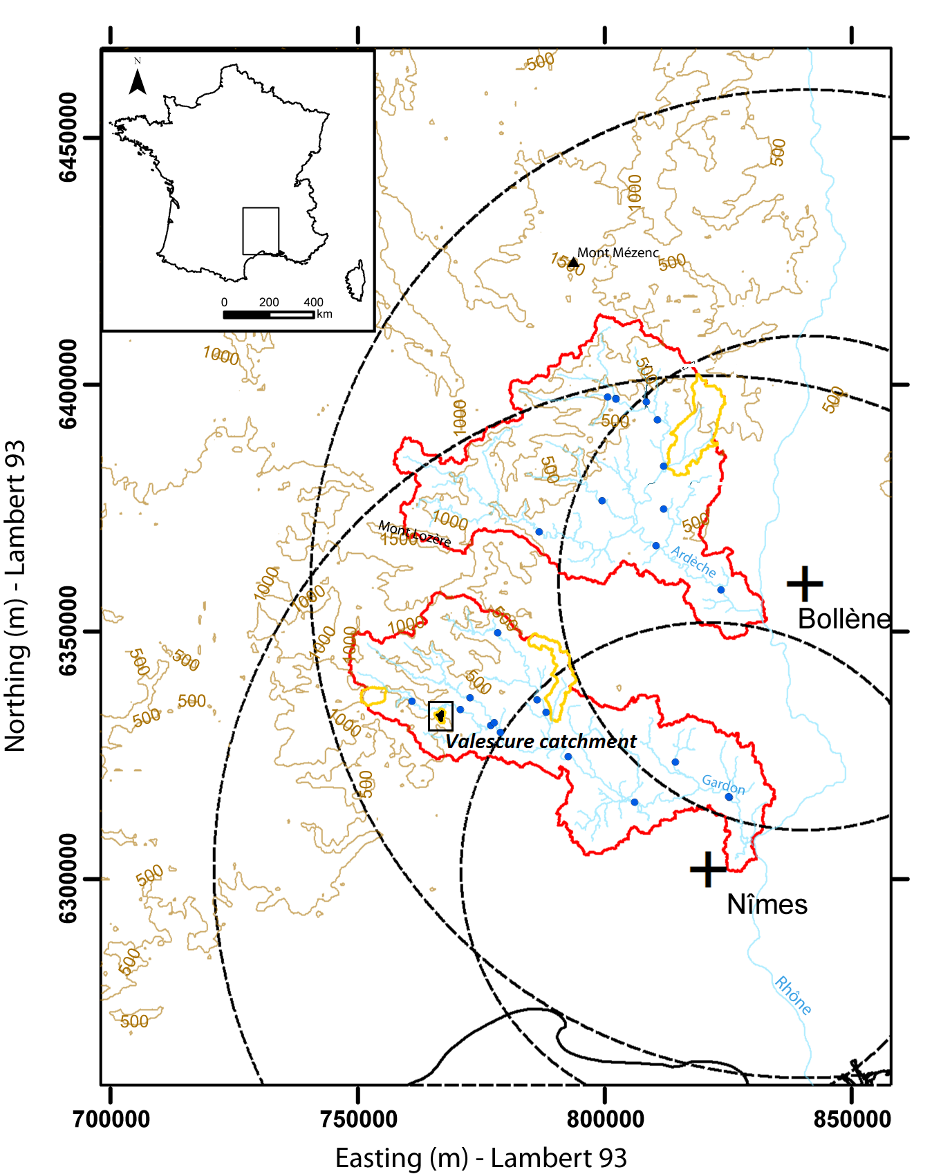
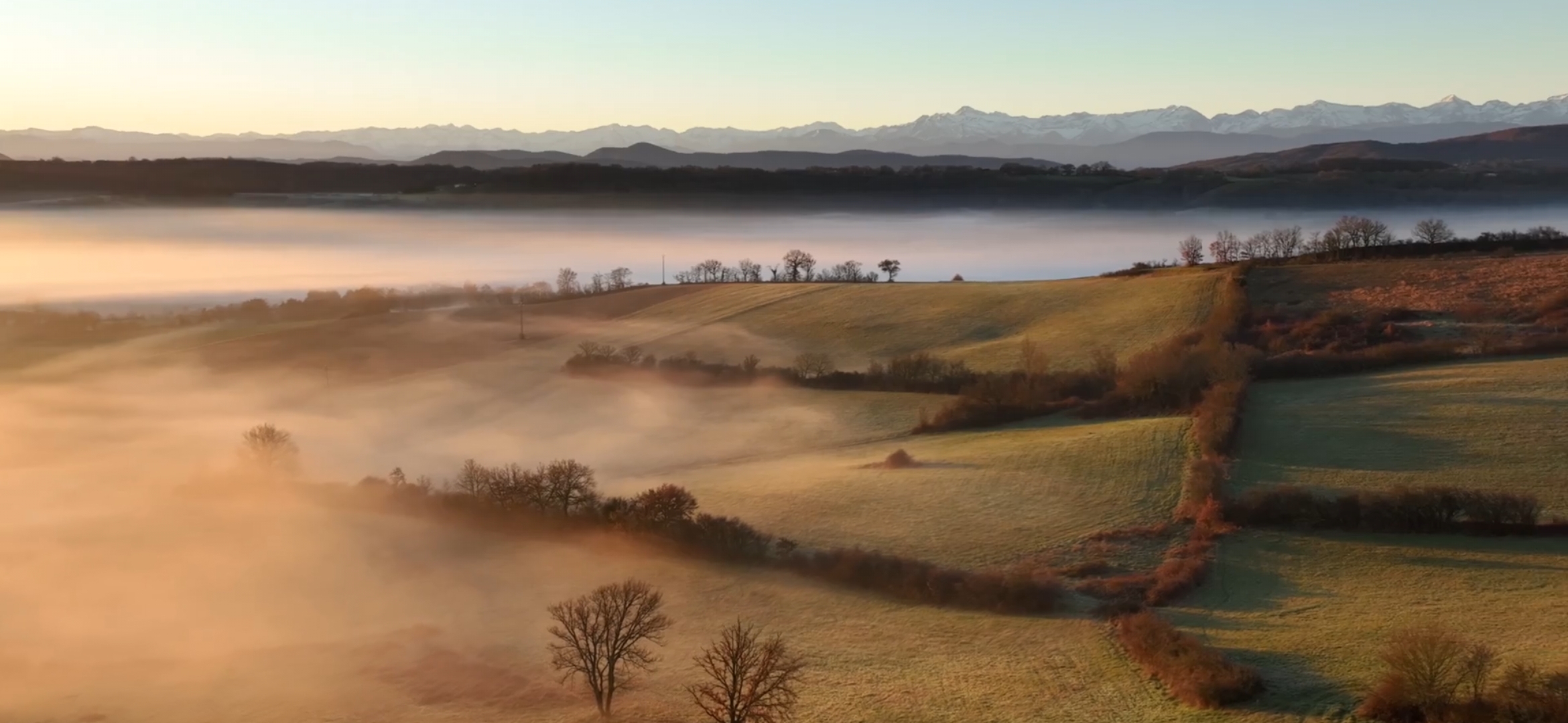
Hydrometeorological observations within 3 embedded catchments (0.9, 2.6 and 14.5 km2). Mediterranean climate with heavy rainfall and flash floods in automn. The geology is mainly shale. The land use is mainly forest. This site is typical of the Cévennes region. More information at http://www.ohmcv.fr