
CNRS - Institut National des Sciences de l'Univers (INSU)
Type of resources
Available actions
Topics
Keywords
Contact for the resource
Provided by
Years
Formats
Representation types
-
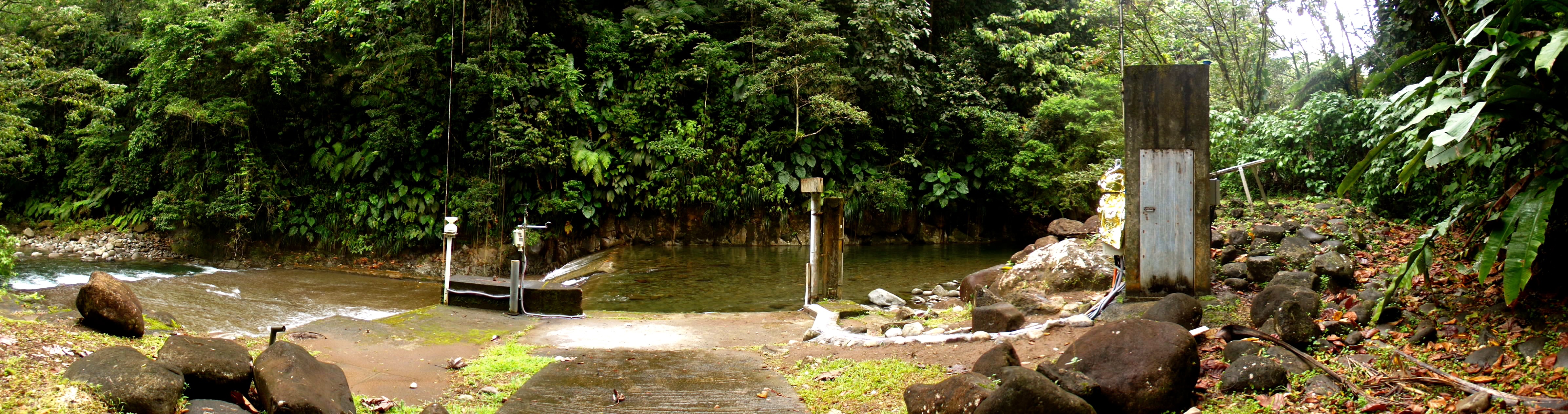
The Bras-David river is located on Basse-Terre Island (Guadeloupe archipelago, lesser Antilles arc). This volcanic island results from the ongoing subduction of the Atlantic plate under the Caribbean plate. The Bras-David river drains a watershed of 19 km2 on the windward side of the active Soufrière volcano. The catchment is essentially composed of Pleistocene andesitic and dacitic formations, covered by a thick ferralitic soil. The latter consists of highly weathered volcanoclastic debris flows containing rocky clasts at various stages of weathering. Vegetation is mainly dominated by tropical rainforest. The hydrologic regime is torrential: flow rate is characterized by abrupt variations due to tropical rains. Storms and hurricanes are particularly frequent during the rainy season from june to january.
-
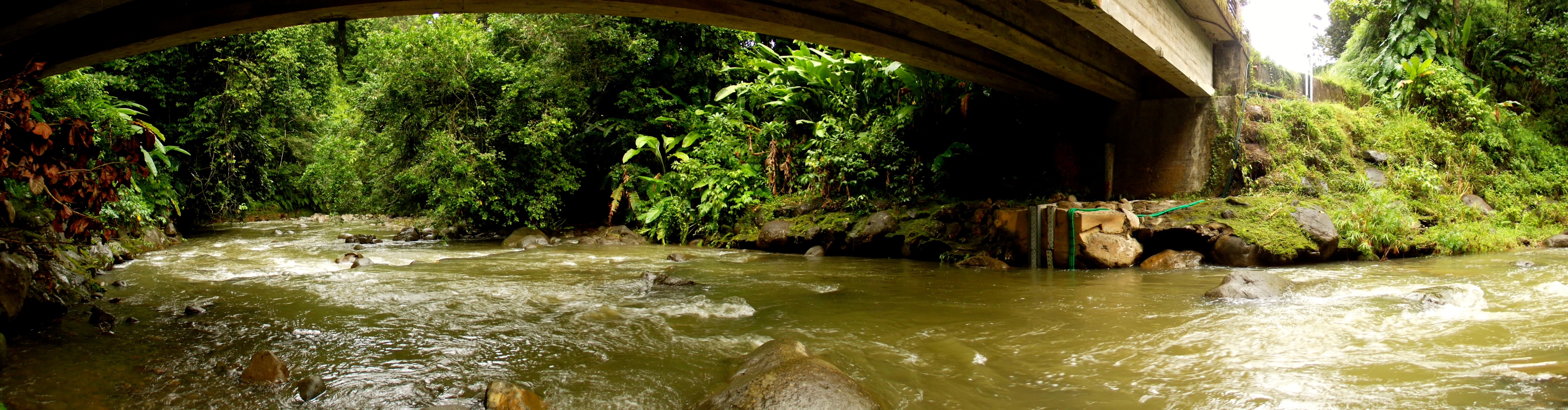
The Capesterre river is located on Basse-Terre Island (Guadeloupe archipelago, lesser Antilles arc). This volcanic island results from the ongoing subduction of the Atlantic plate under the Caribbean plate. Capesterre drains a watershed of 16.4 km2 located on the windward side of the active Soufrière volcano. The Capesterre catchment, mainly composed of lava and pyroclastic flows aged from 600 to 400 ky, is characterized by rather thin soils, typically ranging from 0.5 to 2 meters. Vegetation is dominated by tropical rainforest. The hydrologic regime is torrential: flow rate is characterized by abrupt variations due to tropical rains. Storms and hurricanes are particularly frequent during the rainy season from june to january.
-
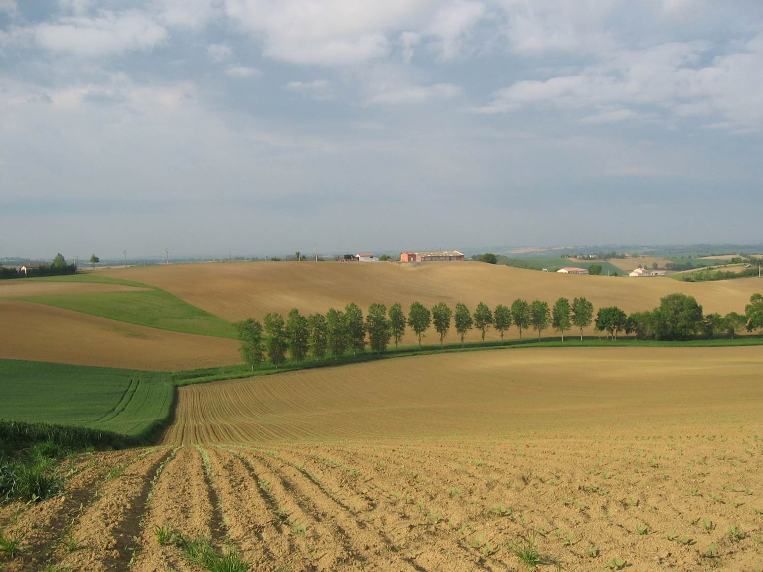
Small agricultural catchment (320 ha) with 30 years of data to study impact of climate change and agricultural practices on soil erosion, weathering rate and river fluxes. Continuous measurements with sensor: river discharge, Temperature, pH, conductivity, turbidity, dissolved oxygen, nitrate Weekly samples and high resolution sampling during storm runoff: major cations and anions, alkalinity, pH, dissolved silica, conductivity, total suspended solids, stable isotopes (13C of DIC, 2H and 18O of H2O, 15N of nitrates), heavy metals, some pesticide molecules Climatological station, rain collector for precipitation chemistry, soil solution station with lysimetric plate at different depths. Continuous measurement since 2004 of CO2, N2O, water vapor, energy exchange in the soil-vegetation-atmosphere continuum thanks to Eddycovariance and closed chamber methodologies (see OZCAR-RI Regional Spatial Observatory in the South West France contribution) Collaboration with the Aurade farmer association for fertilizer and pesticide inputs, cultivation, agricultural practices... Aurade experimental catchment and flux site are an international field site of the Critical Zone Exploration Network CZEN and of ICOS network, a field site of the French Research Infrastructure OZCAR and it is also a site of the French LTSER ZA PYGAR "Zone Atelier Pyrénées-Garonne". and a regional Platform of Research and Innovation-Midi Pyrénées.
-
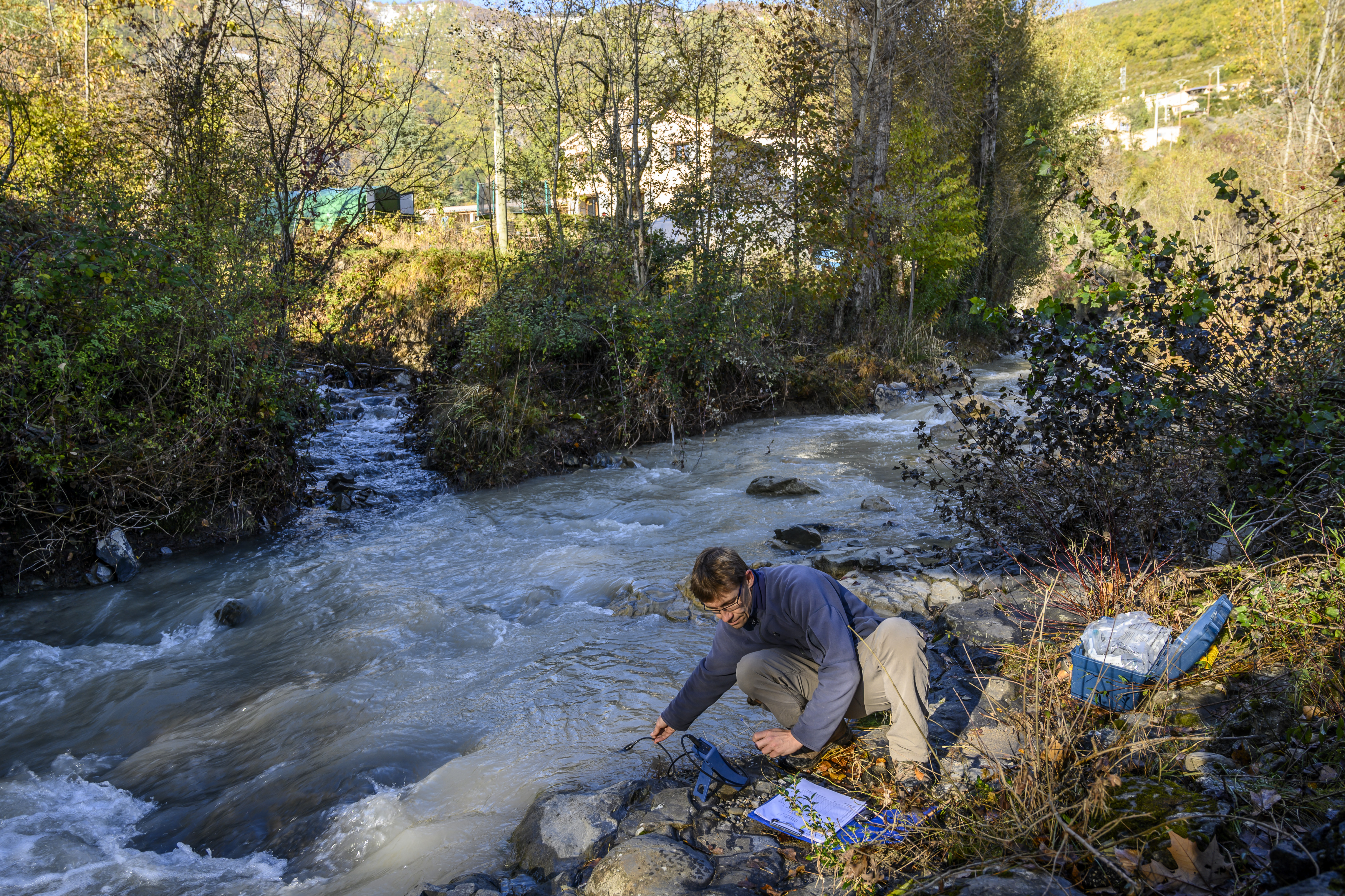
The Galabre site is part of Draix-Bleone observatory, located in the French South Alps, upstream of Digne, on the right side of the Bleone river. The hydrosedimentary station of La Robine-sur-Galabre was created in 2008 to measure water of sediment fluxes from the Galabre catchment, 20 km2. This catchment integrates a diversity of lithologies and land use that are characteristic of the Pre-Alps. The climate is mountainous and Mediterranean. The site is characterized by intense erosion and intermittent sediment fluxes. The variables that are monitored on the long-term include rainfall and meteorology, high-frequency water discharge and suspended sediment concentration (10 minutes), some physico-chemical properties of stream water and sediments.
-
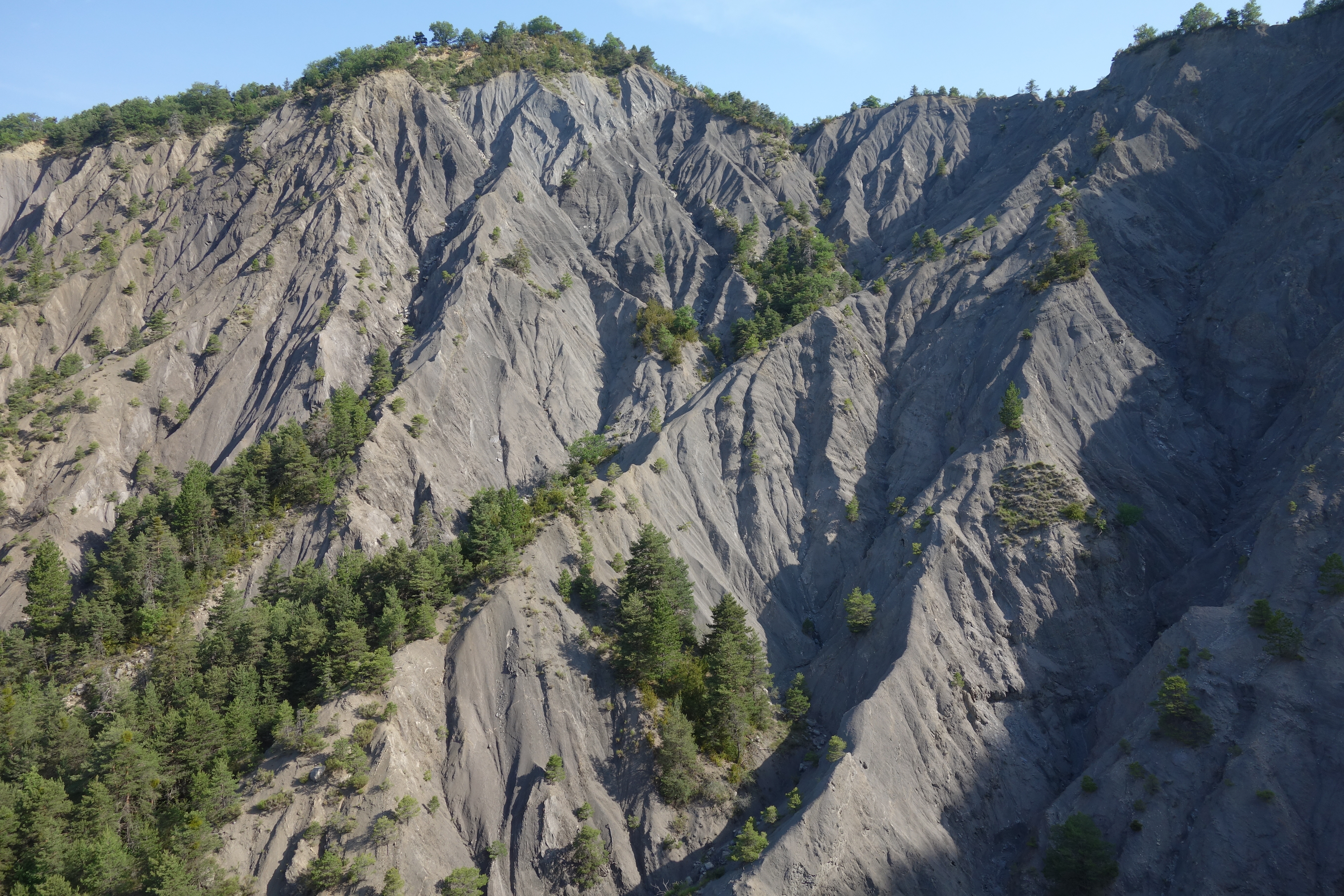
Draix site is part of Draix-Bleone observatory, located in the French South Alps, upstream of Digne, on the left side of the Bleone. Draix site was equipped in 1983 to study mountain erosion and sediment transport. It is composed of 4 catchments, which are equipped to measure water and sediment fluxes, at spatial scales ranging from 0.001 km2 to 1 km2, with contrasted land cover. These catchments are entirely situated on black marls that are very sensitive to weathering and erosion, resulting into a badland topography. One catchment was reforested at the end of the XIXth century whereas the other are mostly denuded. This site is characterized by intense erosion and intermittent sediment fluxes. The variables that are monitored on the long-term include rainfall and meteorology, high-frequency water discharge and suspended sediment concentration (1-10 minutes), event-scale bedload transport, and some physico-chemical properties of stream water and sediments.
-
The AAA-LTER platform focuses on agricultural and urban landscape The objective of the proposed LTSER structure is to provide an internationally open, attractive and recognized scientific observatory of human/nature interactions. Through its representativeness of environmental issues of Atlantic terrestrial and aquatic landscapes and the complementarity of its eLTER sites, the AAA-LTSER is a unique showcase for decision makers to help them in defining regional decision frameworks and sustainable policies, and to promote technical and social innovation as well as science education. The AAA-LTSER embraces regional social-ecological dimensions whose diversity of landscape use and planning covers a unique set of interconnected aquatic and terrestrial systems. lt concentrates multiples supports and cofunding from the European Union, the State, the Brittany region and local institutions to improve and maintain high density of sensors, equipment and social studies that are crucial for better understanding human/nature interactions and train the next generation of scientists to work at these interfaces in inter- and trans-disciplinary approaches. To cover the major regional environments and interfaces (continent/ocean, urban/rural, subsurface/surface), the AAA-LTSER platform is founded on existing and complementary sites. They represent the different terrestrial, transitional and marine landscape structures, features and dynamics that shape this intensive anthropogenic region, and their related social-ecological issues. All these sites involve end-users and policy makers seeking for advanced understanding of social and ecological interactions and the definition, validation and promotion of sustainable policies.
-

Hydrometeorological and biogeochemical observations within 5 embedded catchments (from 0.2 to 14.5 km2). Alpine Mediterranean climate with heavy rainfall and flash floods in automn. The geology is mainly granite. The land use is mainly grassland and forest. More information at http://www.ohmcv.fr
-
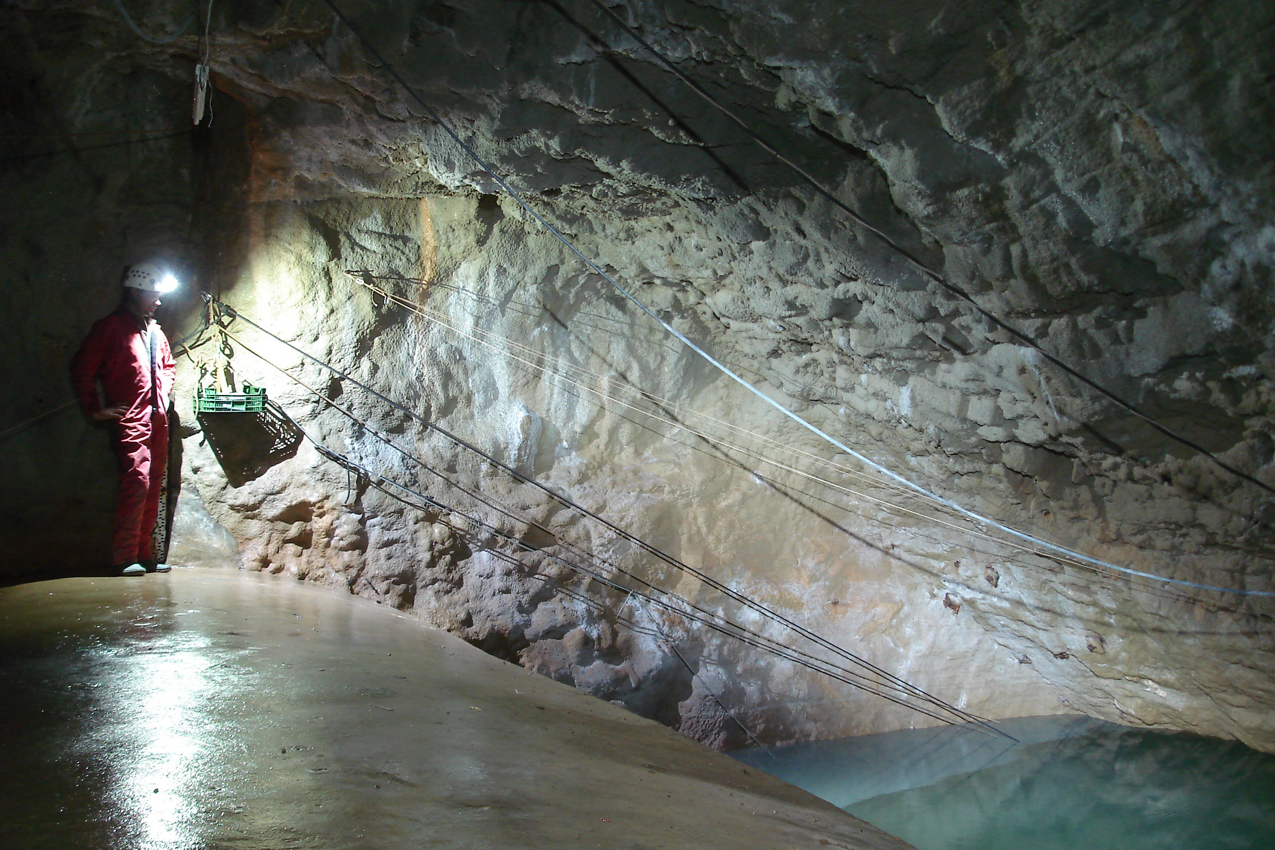
The Mediterranean and coastal site of Port-Miou is a wide regional carbonate aquifer, with a catchment area around 400 km², in south of France (Provence, France). It extends mainly over natural land, in the vicinity of one of the main city of France (Marseille), facing recent urban expansion and future groundwater resources management issues. Top of the recharge area culminates at 1100 m asl, and the main outlets are submarine springs. Karst features are observed in surface (polje, intermittent rivers, sinkholes, karren, caves) and underground. Many karst networks have been explored in the unsaturated zone of the aquifer, but also in the saturated zone below the sea level. Karst features and conduits drive the groundwater flows to the main outlets. The Port-Miou submarine springs outflow from huge flooded karst conduits, explored by cave diving over several kilometers inland, and to -235 m deep. Groundwater is brackish, polluted by seawater intrusion. The Port-Miou observation site includes flow rate, salinity and temperature monitoring at the main brackish spring, in an in-situ underground laboratory located 500 m inland from the seashore, directly in the main karst conduit. Rainfall is also recording in the catchment area, and rain water samples are collected for water isotopes observation.
-
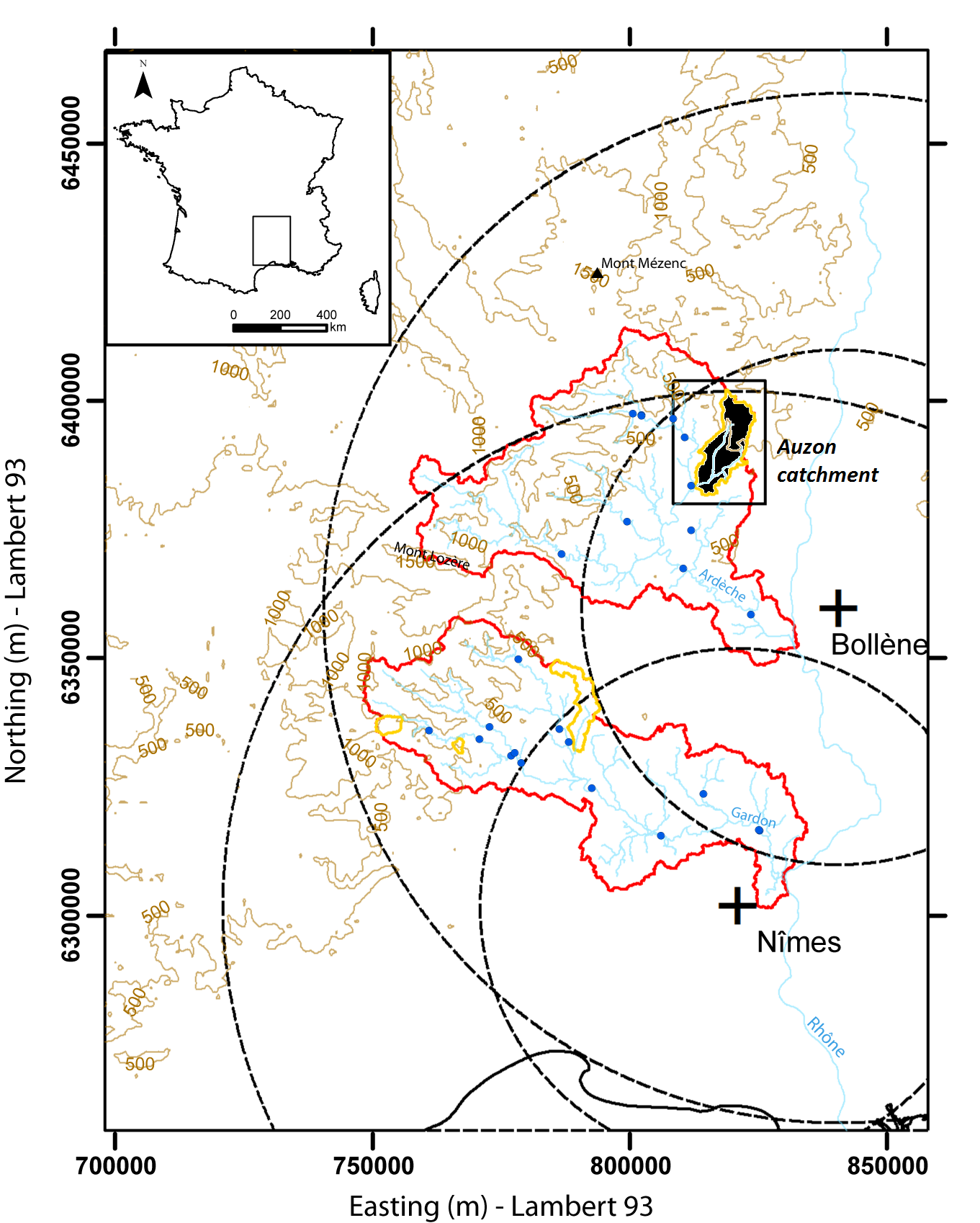
Hydrometeorological and hydrosedimentary observations within 3 embedded catchments: Gazel, Claduègne and Auzon (3.4, 43, and 116 km²). Mediterranean climate with heavy rainfall and flash floods in automn. The upper part of the catchment is characterized by basalt formations, after which a sharp transition occurs where the lower two thirds is made up of sedimentary limestone rock. The soil types are heavily infuenced by the geology of the catchment. Main land use types are pastures,vineyards and forest. More information at http://mistrals.sedoo.fr/?editDatsId=1438
-
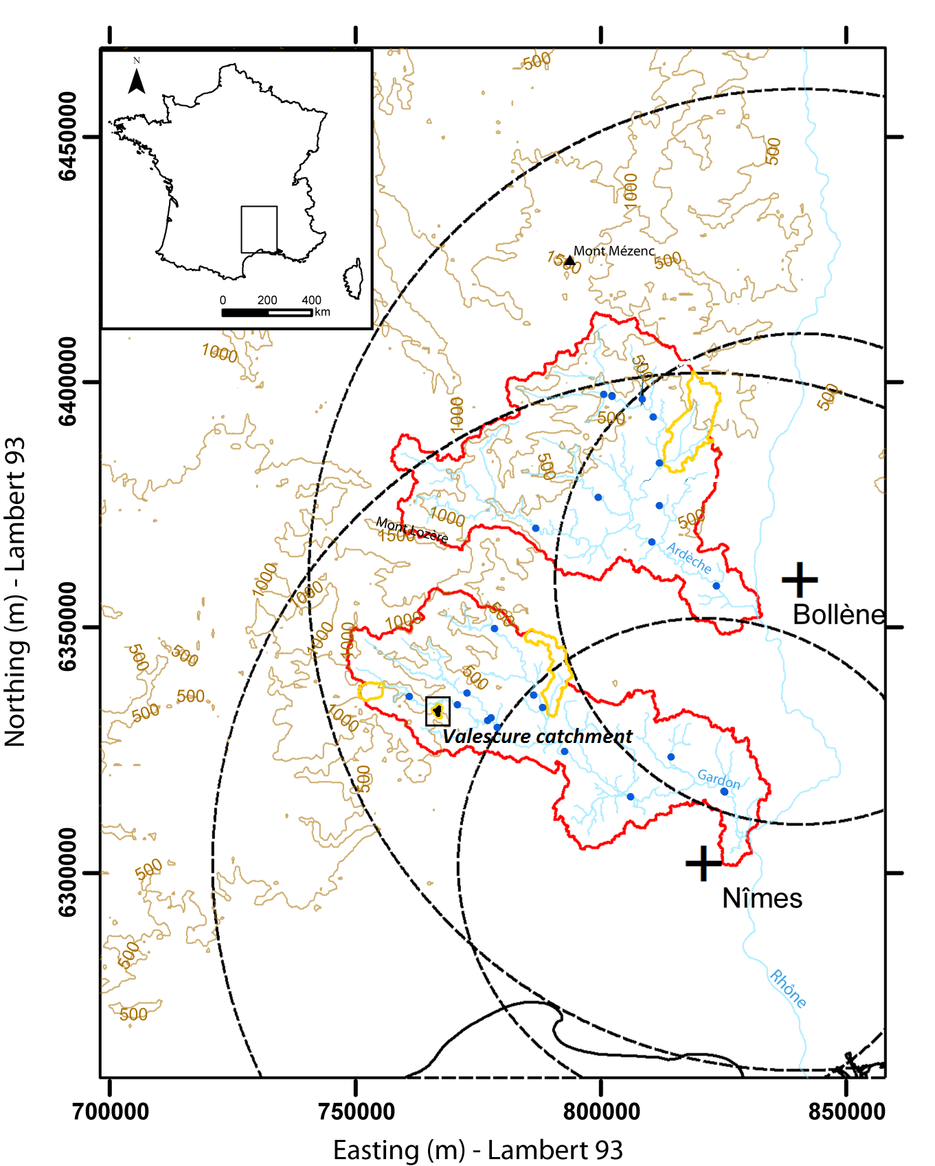
Hydrometeorological observations within 6 embedded catchments (from 0.3 to 3.9 km2). Mediterranean climate with heavy rainfall and flash floods in automn. The geology is mainly granite. The land use is mainly forest. This site is typical of the Cévennes region. More information at http://www.ohmcv.fr