
French National Centre for Scientific Research (CNRS)
Type of resources
Available actions
Topics
Keywords
Contact for the resource
Provided by
Years
Formats
Representation types
-
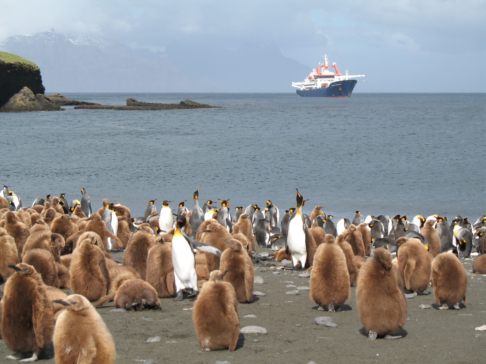
The LTSER Zone Antarctique belongs to LTER-France network and is located in Antarctica (Adelie Land), French sub-Antarctic Islands (Crozet archipelago, Kerguelen Islands, Saint-Paul et Amsterdam Islands) and southern ocean. General information below concerns Kerguelen Islands. The ZATA measures the impacts of climate change and human activities on antarctic and sub-antarctic ecosystems.
-
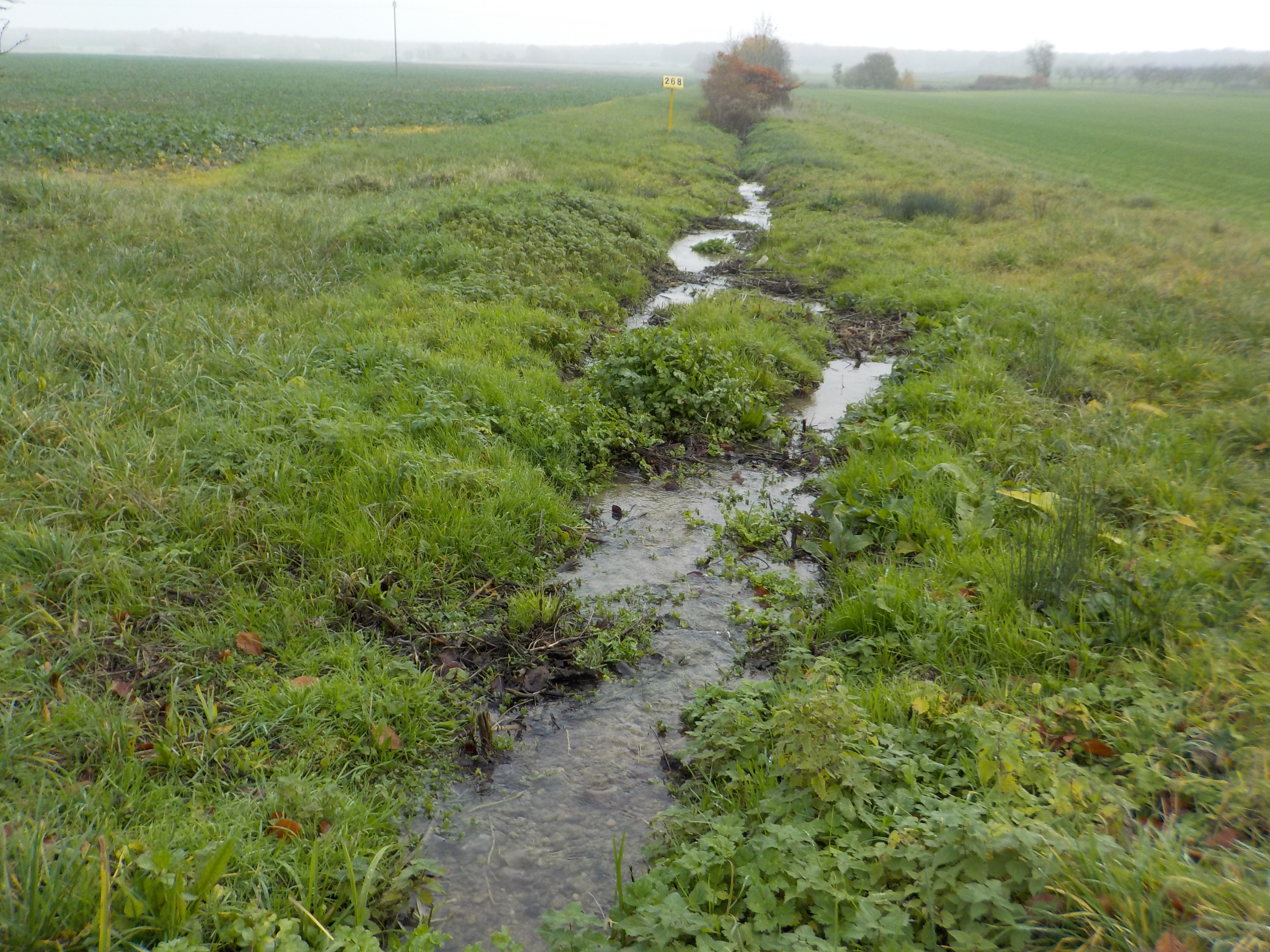
The state forest of La Reine is a humid forest of about 5000 ha located in the south of the plain of Woëvre and at the foot of the Meuse hills in France. Numerous ponds and puddles are scattered throughout the forest and it is crossed by many small, more or less natural streams. Upstream of the forest, these waterways are impacted by human activities (large-scale farming, housing without collective sanitation in particular). Since 2019, the Moselle Basin Workshop Zone has been working on the implementation of a workshop site to understand the bio-hydrogeological functioning of three of these streams, particularly in terms of natural purification. Sampling campaigns are regularly organized in the streams and in ponds.
-
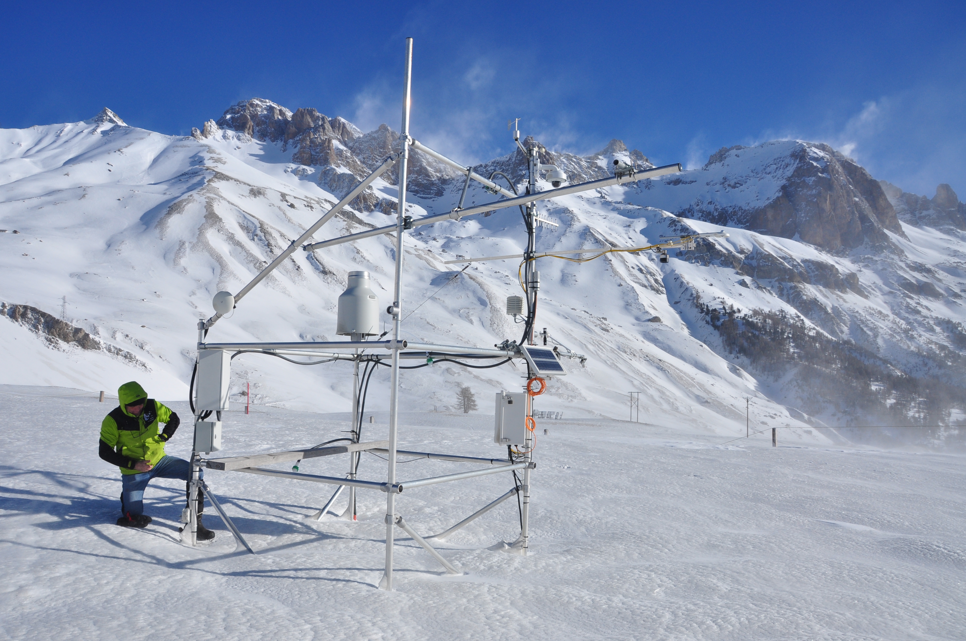
The research station of Lautaret Garden is a set of infrastructures and human resources at the service of alpine environmental research, spread over two sites open all year round. One is located on the campus of the University Grenoble Alpes (dept 38), it is divided into greenhouses, arboretum, experimental zone. The other is located at the Lautaret pass (dept 05) at an altitude of 2100m. The site of altitude gathers an Alpine Botanical Garden, three buildings, an experimental zone and natural area. This structure provides field support for scientific projects, two laboratories, accommodation for 46 people, hydrology and climate data and also botanical expertise. It organizes, in its multimedia room and meeting rooms, trainings, thematic schools, conferences, seminars. The research themes developed mainly concern the ecology of environments in relation to climate, socio-ecosystems, adaptation of living organisms, the physical environment and biogeochemical cycles. Some projects have been carried out since 1980, others operate on a multi-year basis. The station also welcomes foreign researchers within the framework of the Transnational access.
-

Mare Longue Forest is located in the South East of the island of La Réunion (French overseas, Indian Ocean) on the municipality of Saint-Philippe. It is the last remnant of lowland tropical rainforest for the Mascarene archipelago, located on a 364 year-old lava flow. The climate is warm (annual mean temperature ranges from 19 to 25 °C) and humid ( in summer reaching 90 to 95 % of relative humidity), precipitation varying between 408 mm at 130 m a.s.l to 18 000 mm at 1600 m a.s.l. Since 1958, a biological reserve of 21 ha has been established, which was then extended into a natural reserve in 1981, it is now since 2007 under the protection of the National Park of Réunion. The site is composed of a variety of forest habitats, from a primary forest with high diversity in woody plants (more than 50 species of indigenous and endemic species) and epiphytes with a 20 m canopy height, to planted forests of monospecific indigenous species, plantations of vanilla in forest, coastal vegetation. The forest of Mare Longue, in the only corridor land to sea on the island between 0 to 2600 m, with uninterrupted vegetation and where the impact of human is recent (from 1665). In the native forest 3 ha permanent plots have been monitored (MALO1 since 1990, MALO2 since 1999 and MALO3 since 2003) where all trees (> 50 000) are inventoried, tagged and measured for their diameters. A climatic station in the native forest at 250 m has been operating since 2011. In the closest town, the Research forest station of Mare Longue is welcoming researchers and students for their scientific stay on the island with all needed facilities.
-
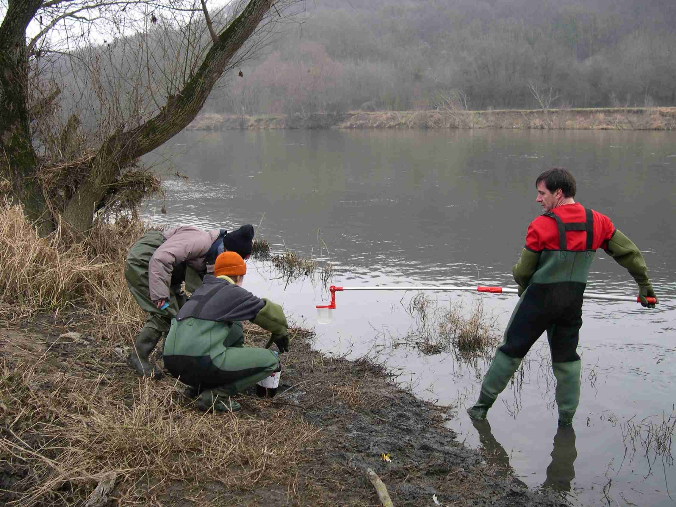
The LTSER Zone Atelier Bassin de la Moselle belongs to LTER-France network and is located in eastern France, Lorraine / Moselle. The ZAM acquires knowledge for better controls the impact of human activities on the quality of the water resources in Lorraine County (France), in the watershed of the Moselle River.
-

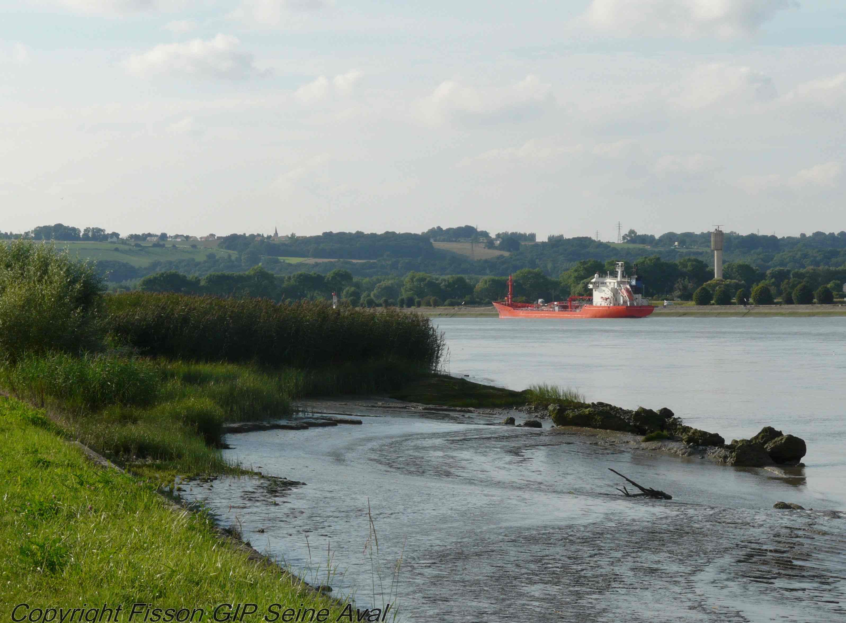
The Seine estuary is a megatidal estuary located in northern France. It is the third largest estuarine ecosystem in the country after the Gironde and Loire along the French Atlantic coast; its waters flow into the English Channel. The geographical zone of influence of the Seine estuary runs from just upstream of the Poses dam, at the limit of the tidal penetration into the estuary — 160 km upstream of Le Havre —to the eastern part of the Bay of Seine. It can be divided into three sections: the fresh water upstream section (125 km), the mixing zone characterized by varying salinity levels (35 km), and the marine downstream section under the influence of the Seine River. The megatidal regime generates a turbidity maximum in the mixing zone (middle estuary) between the marine and fluvial sections of the estuary. The Seine estuary is a typical estuarine ecosystem: highly stressed by natural fluctuations and anthropogenic pressures, and hosting a rich ecological system. The Seine valley and its estuary are of major economic importance for France, with the presence of two maritime ports. It’s watershed (79,000 km2) is the home to 17 million people, and accounts for 50 % of the river traffic in France, 40 % of the country's economic activity, and 30 % of its agricultural activities. In addition to the Greater Paris area (> 11 million inhabitants), which contributes heavily to the Seine estuary's upstream inputs, two other major river settlements — Rouen (500,000 inhabitants) and Le Havre (300,000 inhabitants) — are maritime ports of international importance. Due to economic development, the Seine estuary has been subjected to major hydrodynamic, ecological, biogeomorphological and biogeochemical changes. The importance of studying the effects of anthropogenic impacts on estuarine ecosystems has increased in the last decade, especially under the Water Framework Directive, which aims to achieve “good environmental status” of all European water bodies.
-
The LTSER Zone Atelier Seine belongs to LTER-France network and is located in Seine River Basin. The ZA Seine general aim is the study of a whole region. How its inhabitants construct the aquatic environment, as well as the quality of surface- and ground-waters may be seen as the dominant scientific question. The question is posed at various scales in space (from sub-catchments to the whole basin), and in time (from historical analysis starting in the Middle-Age to prospective studies for the next century).