
Helmholtz Association of German Research Centers
Type of resources
Available actions
Topics
Keywords
Contact for the resource
Provided by
Years
Formats
Representation types
-
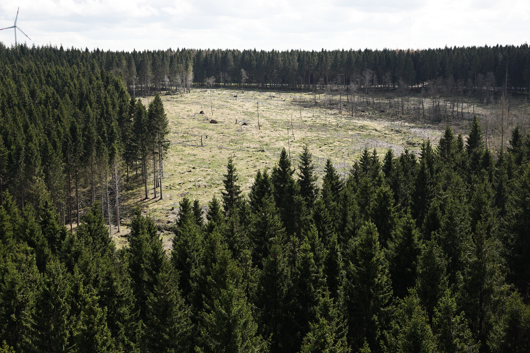
The Wüstebach catchment is located in the Eifel National Park and covers an area of 38.5 ha, with mean altitude of about 610 m. The geology is dominated by Devonian shale, which is covered by a periglacial solifluction layer of about 1–2 m thickness. Cambisols and Planosols have developed on the hillslopes, whereas Gleysols and Histosols have formed in the valley. The main soil texture is silty clay loam and the litter layer has a thickness between 0.5 and 14 cm. The mean annual precipitation is about 1200 mm. Norway Spruce planted in 1946 is the prevailing vegetation type. During late summer/early autumn of 2013, trees were almost completely removed in an area of 9 ha by the national park forest management in order to promote the natural regeneration of near-natural deciduous forest from spruce monoculture forest.
-
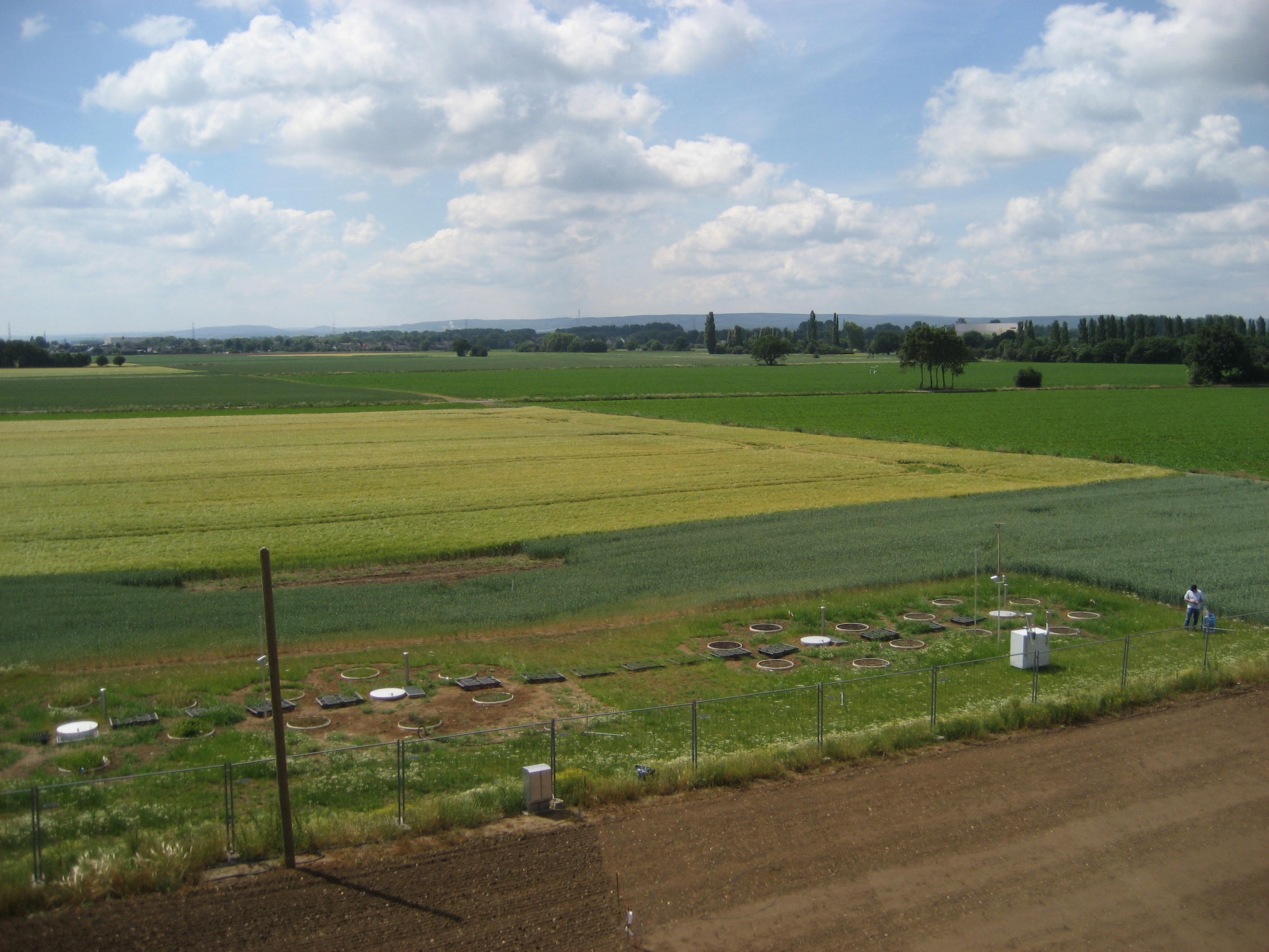
The Selhausen site represents the heterogeneous agricultural rural area of the lower Rhine valley. The climate is temperate maritime with a mean annual temperature of 10°C and annual precipitation of 700 mm for the period from 1961 to 2014 (meteorological tower, Forschungszentrum Jülich). The most important crops in the region of Selhausen are sugar beet (beta vulgaris), winter wheat (triticumavesticum), winter barley (hordeum vulgare), maize (zea mays) and rape seed (brassica napus). Only parts of the region are managed as grasslands. The underlying Quaternary sediments are mostly fluvial deposits covered with loess. Major soil types are luvisols and gleyed cambisols, partly with large contents of gravel. The land surface is generally flat with slopes up to 4° in the area of a former channel of the Rur River system. From 2007 to 2010 a first long-term eddy covariance study was conducted within the Selhausen region (measurements can be found at the European fluxes database cluster, ID: DE-Seh). In spring 2011 a new station (50.865°N, 6.447°E, 203m a.s.l.) was equipped with a CSAT3 sonic anemometer and LI7500 gas analyzer. Besides flux measurements and typical climate parameters (radiation, air temperature, air humidity, soil moisture, soil temperature etc.), also the phenological development of the crops and farming activities were recorded. The station fits now the standards of a Level-1 site for the European project ICOS (Integrated Carbon Observation System). As a pan-European long-term research infrastructure ICOS aims at providing harmonized and high-precision scientific data on carbon cycle and greenhouse gas budget and perturbations.