
South African Environmental Observation Network (SAEON)
Type of resources
Available actions
Topics
Keywords
Contact for the resource
Provided by
Years
Formats
Representation types
-
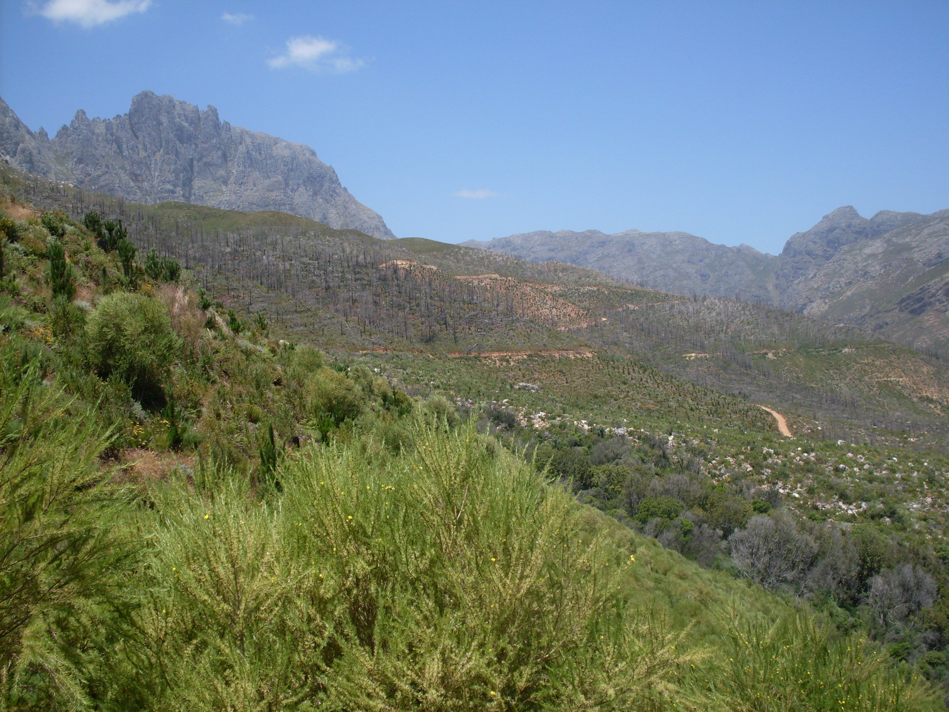
The Jonkershoek Valley site is located in a mountain catchment in the Cape Floristic Region and is the source of the Eerste River. The site was originally dominated by Boland Granite fynbos and Kogelberg Sandstone fynbos with patches of afrotemperate forest. From the 1930s, first order catchment experiments were established in the valley by the Jonkershoek Forestry Research Centre (JFRC) under the auspices of the South African Forestry Research Institute (SAFRI). The catchments were sequentially planted to pine species. Gauged weirs were built in the experimental catchments. Long term records exist for five gauged pine planted catchments and one natural fynbos catchment. The Swartboskloof catchment, located in the Jonkershoek valley, was the site of fire experiments in the 1970s and 80s.
-

SKA is situated in the Nama Karoo Biome approximately 80km North of Carnarvon. The SKA Meerkat site is a radio protected area situated in the Northern Cape province on which a part of the Square Kilometre Array has been built.
-
Please refer to the general site description of the Welverdiend-South African Wildlife College site.
-
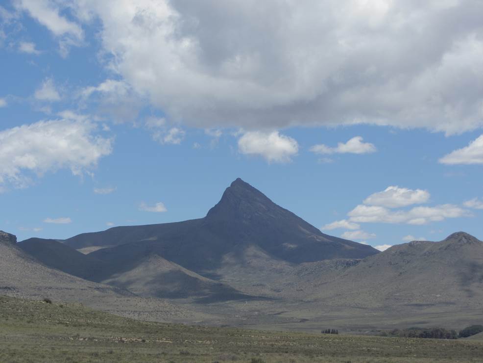
Compassberg, the highest peak in the Sneeuberg range, resembles a compass needle towering 2 502 metres high. The mountain harbours a diversity of species, including endemics such as the Compassberg Skolly (Thestor compassbergae) butterfly, found only the slopes of this mountain. Compassberg is located near the village of Nieu Bethesda, 55 km north of the town Graaff-Reinet in the Eastern Cape Province.
-
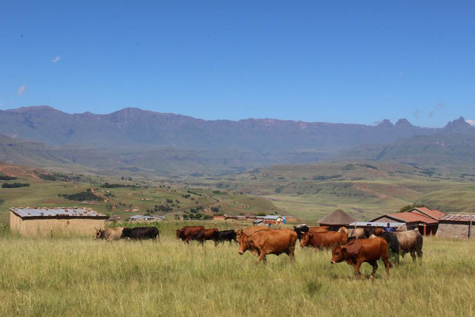
The Cathedral Peak research catchments in the northern uKhahlamba Drakensberg mountains, KwaZulu-Natal, South Africa have been a focus of observation research since the 1940’s. The Drakensberg mountains which fall in the grasslands biome, are a crucial water source area for South Africa, owing to the relatively high rainfall and ratio of rainfall to runoff conversion in this region. This portion of southern Africa's grassland biome also supports phenomenal levels of biodiversity. The research catchments themselves are primary, headwater catchments that fall within a protected area. The catchments were initially established to investigate the influence of various land management treatments on water but over time the research has broadened to a more interdisciplinary focus incorporating carbon–water–energy–biodiversity and the dynamics between these. Although the core of the observation and monitoring is sited in the catchments, the research extends beyond the protected area into communal, state, and privately owned lands. The land beyond the protected area is valued for agriculture, ranging from subsistence agriculture in impoverished villages to large-scale commercial agriculture. Scientific work in the landscape continues to grow and expand.
-
This site falls partly with the isimagaliso wetland park as well as within forestry areas on its boundary. SAEON is beuiling onf a >40 year ground water record and has added rain gauges to the site. It is a cimplimentory site to teh SAEON MCP site assessing the realtive impacts of land use land cover and climate on the ecosystem services in the area. Threats to Lake St Lucia Ramsar Site from proposed open cast mining operations in 1992 (CES, 1992) prompted a national and international outcry culminating in an international petition to “Save St Lucia” that led to its declaration as a World Heritage Site. This culminated in the proclamation and development of the iSimangaliso Wetland Park that protects the marine and coastal environments from Cape St Lucia to the Mozambique Border. The conservation policy in terms of the 1992 Conservation Development Plan was to protect a diversity of habitats such as coastal dune forests, coastal grasslands, hygrophilous grassland, coastal woodlands and shrublands. This vegetation mix would allow for the required habitat and feeding area for priority St Lucia animal species ...” (CES, 1992). Consequently, the St Lucia system, with its rich diversity of habitats, will be protected by national and international legislation for long-term global prosperity.
-
The SAEON Maputaland Coastal Plain site, Umhlabuyalingana Local Municipality, is a Long term hydro-ecological research platform focused on understanding the relative impacts of climate and land use land cover change on ecosystems services This is a groundwater driven system (sandy unconsolidated aquifer), forming part of the Zululand Aquifer Strategic Groundwater Source Area. There are no surface rivers importing water into the system hence is is dependent on local rainfall for recharge, making it sensitive to changes in rainfall patterns. The site incorporates lake Sibaya, South Africa's largest freshwater lake, which falls within the iSimangaliso Wetland Park, World heritage site and is a RAMSAR site. The region is typified by impoverished and vulnerable communities , with few sources of income. SAEON has instrumented the ground water catchment and its boundaries with raingauges, weather stations, surface renewal systems and an eddy covariance tower. We are also monitoring ground water levels in a number of established monitoring wells. Using a social ecological systems approached, and focused on co-learning, we have developed strong relations with three local communities within the area. The intention is to attract collaborators wishing to co locate instruments as well as perform multidisciplinary work or simply collaborate. We welcome diverse fields of expertise from earth systems science, biodiversity to social and economics sciences.