
University of Tsukuba
Type of resources
Available actions
Topics
Keywords
Contact for the resource
Provided by
Years
Formats
Representation types
-
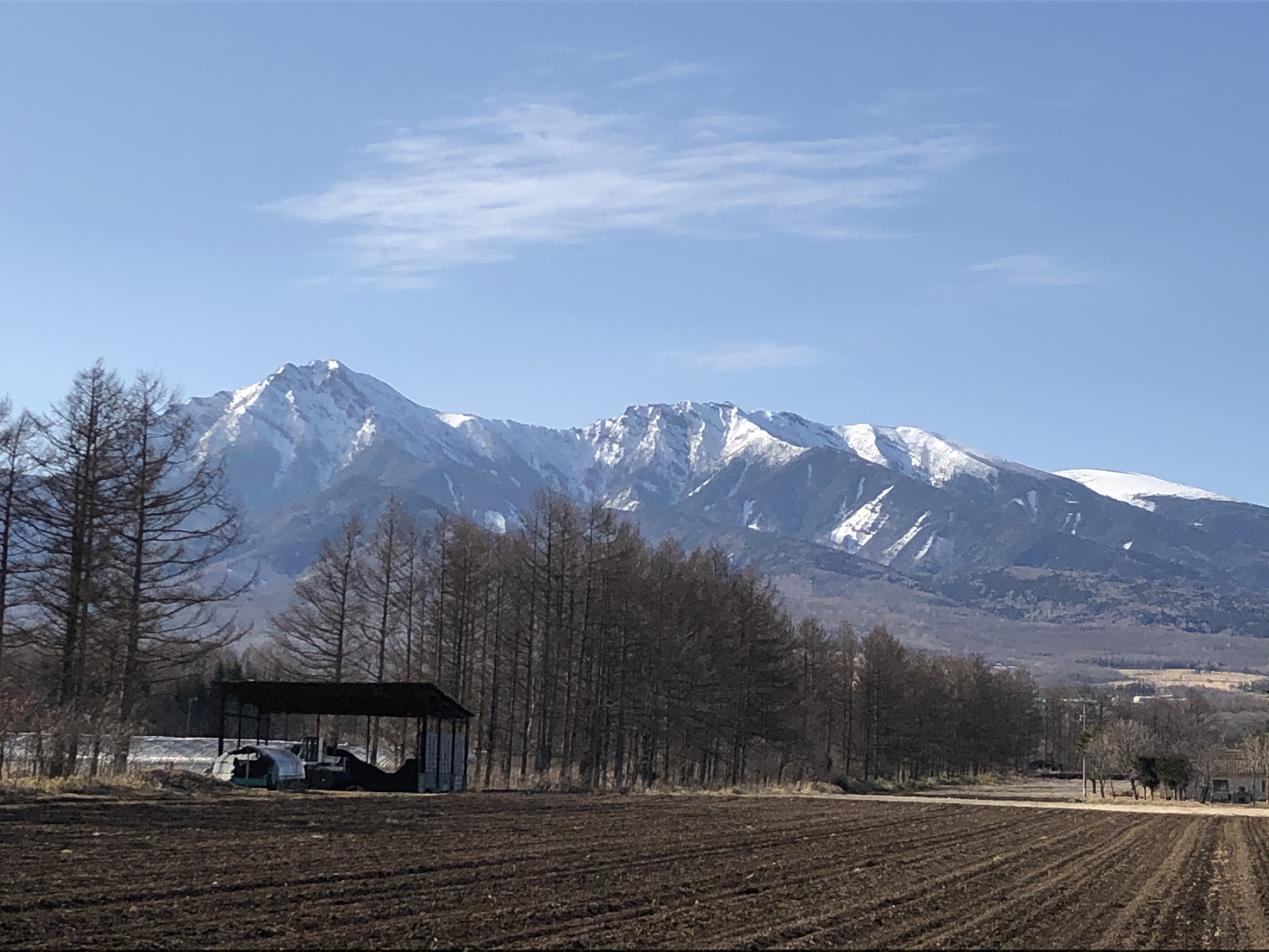
The Yatsugatake-Kawakami Forest of Mountain Science Center, University of Tsukuba, consists of three forest areas: the Yatsugatake Forest (80 ha) located in Minamimaki, Nagano Prefecture, Japan, the "Megumi-no-Mori" (14 ha) on the campus where the administration building is located, and the Kawakami Forest (189 ha) located in Kawakami, Nagano Prefecture, Japan. The Yatsugatake Forest is 1400-1450 m above sea level, and the Megumi-no-Mori is 1350 m above sea level. The forest is characterized by gentle slopes without remarkably topographic change and a mosaic of secondary deciduous broad-leaved forest dominated by oak (Quercus crispula) and Asian black birch (Betula davurica), and intermediate moor characterized by thatch herb (Moliniopsis japonica) and Japanese alder (Alnus japonica). Rare plants such as primrose (Primula sieboldii) and drosera (Drosera rotundifolia) are also found here. Black soil is distributed throughout the Yatsugatake Forest and Megumi-no-Mori. The Kawakami Forest is located between 1360 and 1700 m above sea level. 70% of the forest area is planted with Japanese larch (Larix kaempferi). The rest is a secondary deciduous broadleaf forest dominated by oak and birch. Some of the forests are dominated by a beech (Fagus crenata) stand, a natural Sawara cypress (Chamaecyparis pisifera) stand, and spruce (Picea alcokiana) stand. The forest is covered with brown and black soils, and the topography of the forest is more varied than that of the Yatsugatake Forest, including ridges and valleys. In the Kawakami Forest, an ecological survey of forest mammals is also being conducted. At these three forests, education and research are conducted on ecological surveys of trees, rare plants, and wildlife (population dynamics and conservation ecology), forest meteorological observations, and artificial forest management and operation.
-
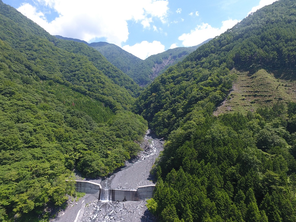
The Oi River upper river basin is sandwiched between two of Japan’s major fault lines, the Median Tectonic Line and the Itoigawa-Shizuoka Tectonic Line making the area subject to intense crustal deformation and the foundation in the area here collapses easily. Sandstone and shale formed on the ocean floor end of the Cretaceous period (approx. 60 million year ago) rose at an accelerated rate over the last several million years and at the same time severely corroded. As a result the Ikawa Forest Station boasts one of the country’s highest sediment yields and the sediment movement here is more active than any other university-owned field in Japan. A debris avalanche occurs virtually every year, and research is conducted on erosion control and topography that make use of this phenomenon. The movement of the forest’s soil and water is surveyed in exercises for acquiring knowledge and skills regarding the forest’s function and usage. We measure the effects climate change, changes in forest vegetation, and deforestation have on micro weather systems and soil movement, as well as carbon and nitrogen circulation. Topography and erosion control engineering research is also often conducted here.