
2013
Type of resources
Available actions
Topics
Keywords
Contact for the resource
Provided by
Years
Formats
Representation types
Update frequencies
-
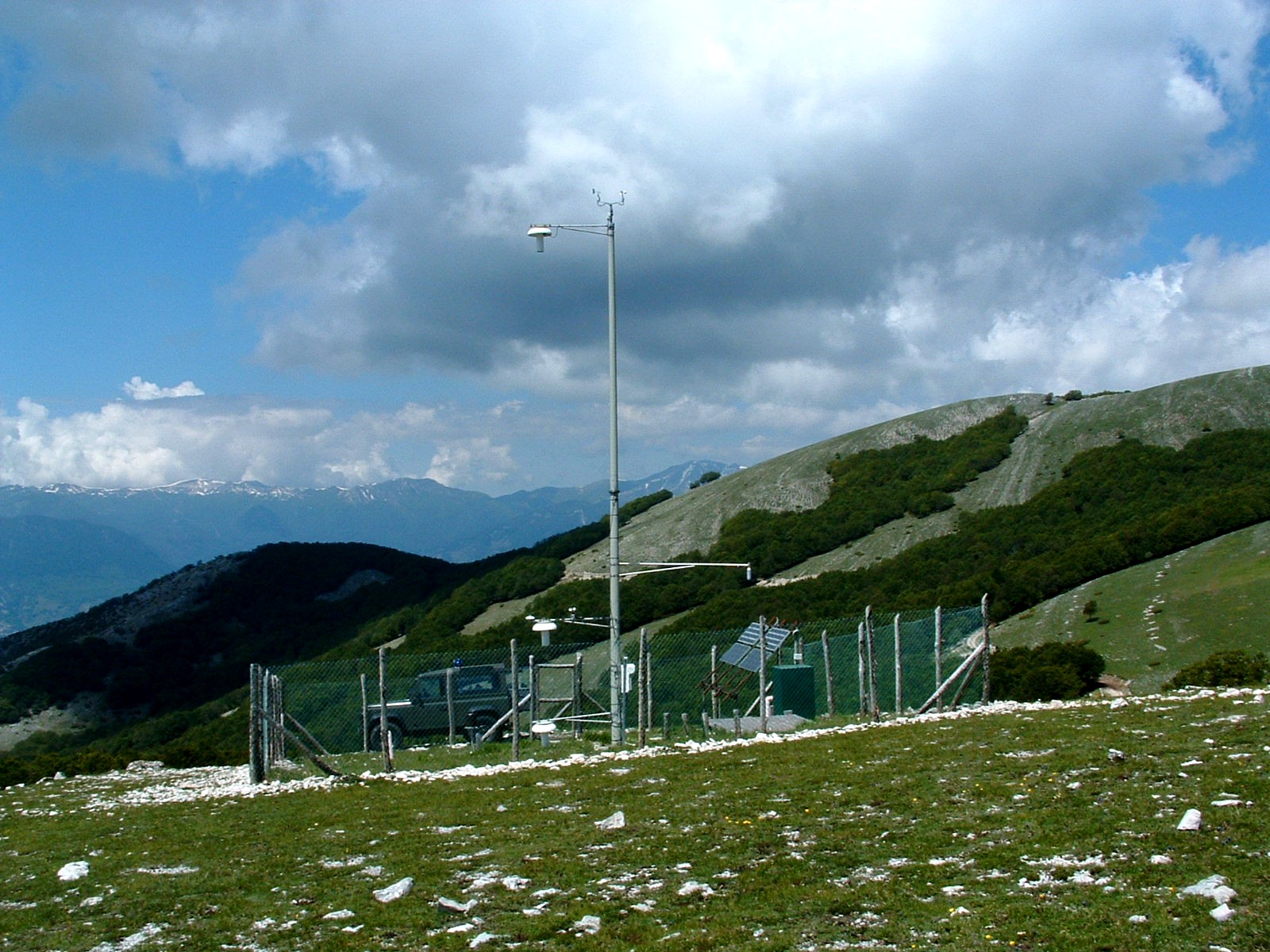
The site is the parent site of three research sites, performing long-term research and monitoring in Apennines forests (mostly beech - Fagus sylvatica L. - forests) and meadows located within those forests.
-
“The Ecotron” is a unique facility for controlled environment ecological experiments, designed to bridge the gap between the complexity of real field communities and the simplicity of laboratory or greenhouse studies. The facility has been extensively described in the scientific literature and includes 16 separate walk-in chambers with computer-controlled climatic conditions. Recent modifications of the facility allow it to emulate real weather data (temperature, humidity, light, rainfall and water table) for large mesocosms (up to 130 x 85 x 40cm).
-
3M_RECITAL - MINHO, MONDEGO, AND MIRA ESTUARIES observatory: Long term vaRiation of ECOLOGICAL sTAtus as a response to naturaL and human induced changes. Implications for management and restoration. Mondego estuary site: The Mondego River drains a basin of approximately 6670 Km2 and its valley is considerably steep in upstream sections, forming a large alluvial plain consisting of good agricultural land in downstream areas. Since the 1960s, the Mondego catchment area underwent a large scale morphological modification, involving the construction of stone walls, to regulate the river water flow and enlarge harbor facilities, and water reservoirs to control floods, improve the uses of water resources, and produce electric power, which modified the riverbed topography and changed the system hydrodynamics. The river contributes presently with a high anthropogenic loading of nutrients and several chemicals into its relatively small estuary (1600 ha, splitting in two arms separated by an island in the terminal part), causing eutrophication. Besides, the estuary - Western coast of Portugal - North Atlantic Ocean Eco-region - supports industrial activities, salt-works, and aquaculture farms, and is the location of Figueira da Foz, a harbour and a centre of seasonal touristic activity. A comprehensive study on the Mondego estuary environmental quality has been carried out during the last two decades, focusing on water quality, hydraulics and sediments dynamics, plankton communities (phyto, zoo, and ichtyoplankton), the term evolution of the benthic communities (intertidal and subtidal), and the changes in macrophytes’ beds (Zostera noltei) and green macroalgae distribution in relation to morphological alterations.
-
UK Upland Waters Monitoring Network (UK UWMN) site. The Allt na Coire nan Con catchment lies in the Strontian region of western Scotland and drains into the River Polloch, an inflow to Loch Shiel. The catchment covers 817 ha and rises from 10 m at the sampling point to a peak of 756 m in the east. The dominant soil types are subalpine soils, peaty podsols and peat gleys. Peat erosion occurs on the exposed uppermost reaches of the catchment. The underlying geology is primarily schists and gneisses, principally of the Moine series. Approximately 40% of the catchment is covered by mature and maturing coniferous forest (mainly spruce and larch) through which a number of access tracks have been placed. Some felling and replanting has taken place during the monitoring period in areas of the lower catchment, especially to the south of the stream. The non-afforested upper slopes are dominated by Molinia interspersed with Calluna and in wetter areas, Sphagnum. Deer graze at low intensity in these areas. Mean annual rainfall is c. 2580 mm.Some data are managed by UK ECN Data Centre. Note: The area is the size of the catchment.
-
Whim bog offers a globally unique comparison of how the main N forms affect semi-natural vegetation, with meteorological data and treatment history since 2002. A quantified ammonia concentration / deposition gradient, is provided, plus a wet deposition system, comparing oxidized (NaNO3) and reduced N (NH4Cl), where treatments are meteorology dependent. ie. wind direction and rainfall frequency define the treatment exposure(~120 events y-1). Wet plots are large (13m²) and there are 4 replicates per treatment. Opportunities exist to evaluate a whole range of ecosystem services from conservation to carbon sequestration, GHG emissions and water chemistry in addition to understanding how changes in vegetation affect the delivery of these services.
-
Zemaitija station (LT03) was founded in the strict reserve zone of Zemaitija national park, at the basin of right side Uođa river tributary - Juodupis brook. The area of the basin is 147.3 ha. The lowest place - 147.0 m, the highest elevation - 180.0 m above sea level. The geographical co-ordinates of the basin are: longitude - 21*51*56*-21*53*10*, latitude - 56*00*19*-56*01*05*. Zemaitija station is situated at 50 km distance from the Baltic Sea, which generally defines the climatic conditions of this territory. High humidity, cloudiness and abundant precipitation are typical for the assessment location. The perennial air temperature is 5.9 C, the perennial average amount of precipitation reaches up to 788 mm and is significantly higher than in other stations. The length of vegetation period is 187 days. The geomorphologic structure of the basin is also relatively complicated. Different than in other locations, in this station the marsh accumulation forms with organic sediments transfer into limnoglacial accumulative forms and glacioacval accumulative sandy hilly formations with typical limnoglacial sand. Saturation of Juodupis river water had very little mineralisation, with oxygen levels of 9.6 mg/l and average yearly mineralisation of 163 mg/l, and the pH fluctuated in the limits of 6.65-7.90, being slightly alkaline. Annual yearly concentration of nitrates is 0.37 mgN/l. Significant increases in the number of nitrate ions were indicated in 1997, i.e., concentration increased twice compared to 1996. Concentrations of nitrogen are not significant. Concentrations of common phosphor and silicon are very small. Conifers dominate the basin of this brook, which are mainly spruce with up to a 20-30% pine mixture. Abundant spruce under layer is common for these stands. A significant territory of the basin is also covered by pure spruce stands. However, as a rule in these forest stands we can find an abundant second spruce layer or under layer. The number of birch and black alder stands is even lower in Zemaitija station. They can be found only at the source of the river, where marsh habitat types are dominating. Forest stands with two or more age classes are dominating in Zemaitija station. This is mainly multi-layered spruce stands and pure pine or pine mixed with abundant spruce under layer forest stands. A slightly smaller territory is occupied by mature forest stands and young forests. The main vegetation communities are: sub-oceanic blueberry western taiga, marsh boreal spruce forests and boreal marsh Scotch pine forests. Eleven plant communities can be identified in the river basin.
-
Discrete water samples for nitrate (N-NO) analysis were collected at 0.5, 5, 10 and 15 meters in the Gulf of Trieste – time series station (station C1). The site is part of the LTER-North Adriatic site. Nitrite is measured colorimetrically after sample pre-filtration, using a segmented flow analyzer. Data are used to study biogeochemical nutrient cycles in the coastal Long Term Ecosystem Research station of the Gulf of Trieste, in the northernmost part of the Adriatic Sea and of the Mediterranean basin. Availability and partition of nitrogen in dissolved and particulate pools result from the concurrence of different forcing factors such as the general circulation, alternation between summer stratification and winter mixing, weather conditions, river discharge, diffuse and point-source continental inputs, sediment–water interactions and several biological processes. General information can be found at: http://nettuno.ogs.trieste.it/ilter/BIO/index.html"
-
Lake Trasimeno (Umbria, Italy) is a shallow meso-eutrophic lake of a remarkable naturalistic importance (Natura 2000 site, S.C.I., S.P.Z. and Regional Park). Despite its large extension, the lake is very shallow and its bathymetry very smooth, with a maximum nominal depth of 6.3 m, which can only be reached when the water level exceeds the artificial outlet threshold located at 257.50 m a.s.l.
-
nA
-
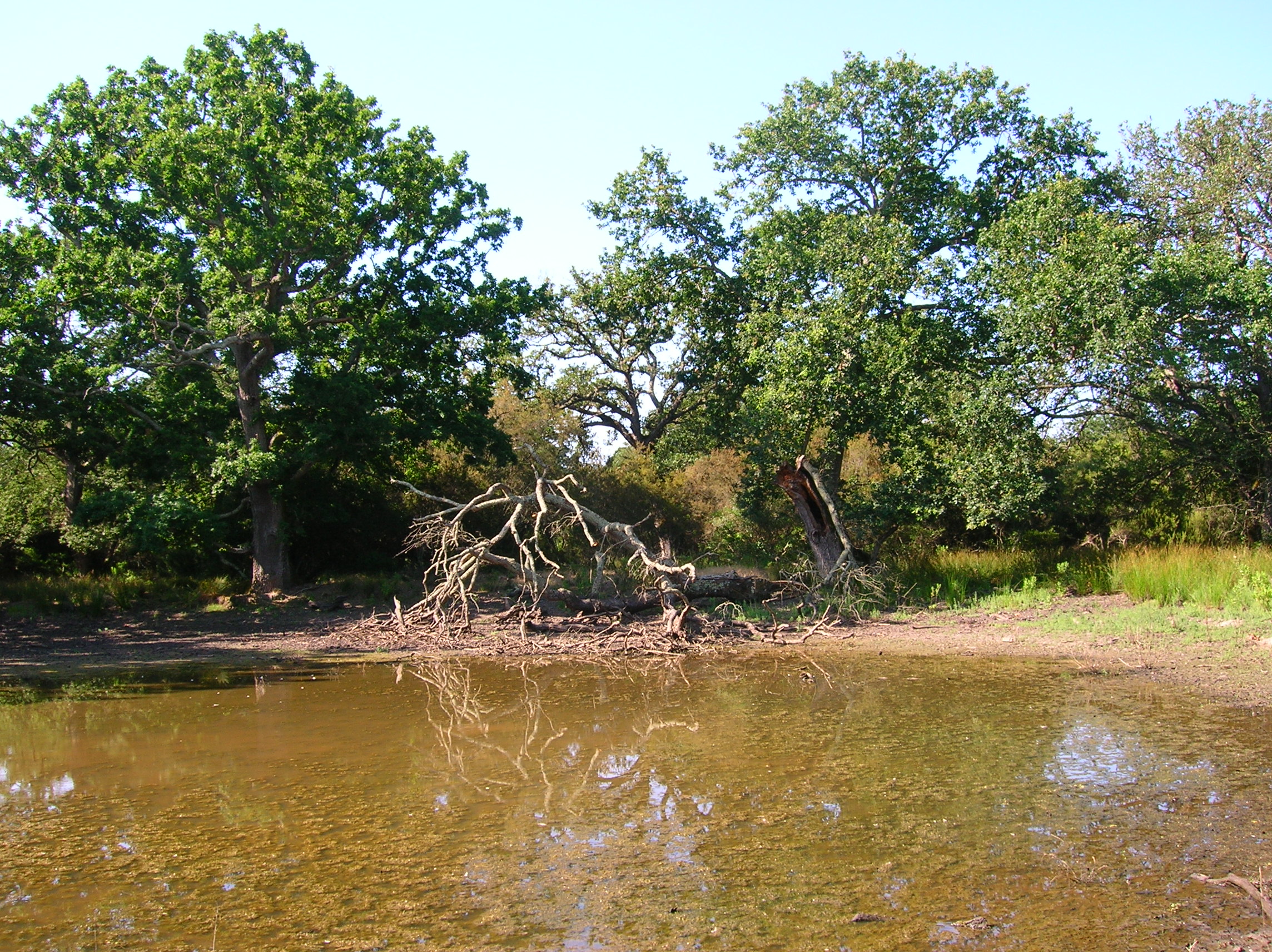
The Presidential Estate of Castelporziano stretches itself over an area of about 6100 ha and is located approximately 24 km from the city of Rome. The territory is characterized by remarkable natural features. It shows most of the typical Mediterranean ecosystems (relict strips of lowland forest with hygrophilous vegetation, deciduous and evergreen mixed oak woods, Mediterranean scrub, dune vegetation). Until recently (2019), there were large surfaces of stone pine unfortunately destroyed by the combined action of alien pest Toumeyella parvicornis with Tomicus destruens, the main pest of Mediterranean pine forests. Inside the Estate, there are two Special Areas of Conservation (SACs): one concerning the coastal strip (IT6030027) and the other one concerning hygrophulous oak-woods (IT6030028). In addition to including the two SACs, the Estate is in its entirety Special Protection Area (SPA - IT 6030084). From a botanical point of view this area, together with the neighbouring Castelfusano territory, represents what remains of the vast forest system that covered the entire delta of the Tiber and the surrounding areas. The land is mostly flat, but in the North there are modest reliefs that are not higher than 85 m. on sea level. A complex set of ancient dunes and a chain of more recent dunes stretch out along the coastline. There are many temporary and permanent natural pools and wetland areas with seasonal floodings caused by meteoric water and groundwater, which usually dry out during summer and represent sites with the greatest biodiversity. From an ecological point of view, those “relict wetland areas” play actually a very important role for biodiversity because of plant species which are typical of hydrosoil and in the past were widespread but have now almost disappeared.