
2015
Type of resources
Available actions
Topics
Keywords
Contact for the resource
Provided by
Years
Formats
Representation types
Update frequencies
status
Resolution
-
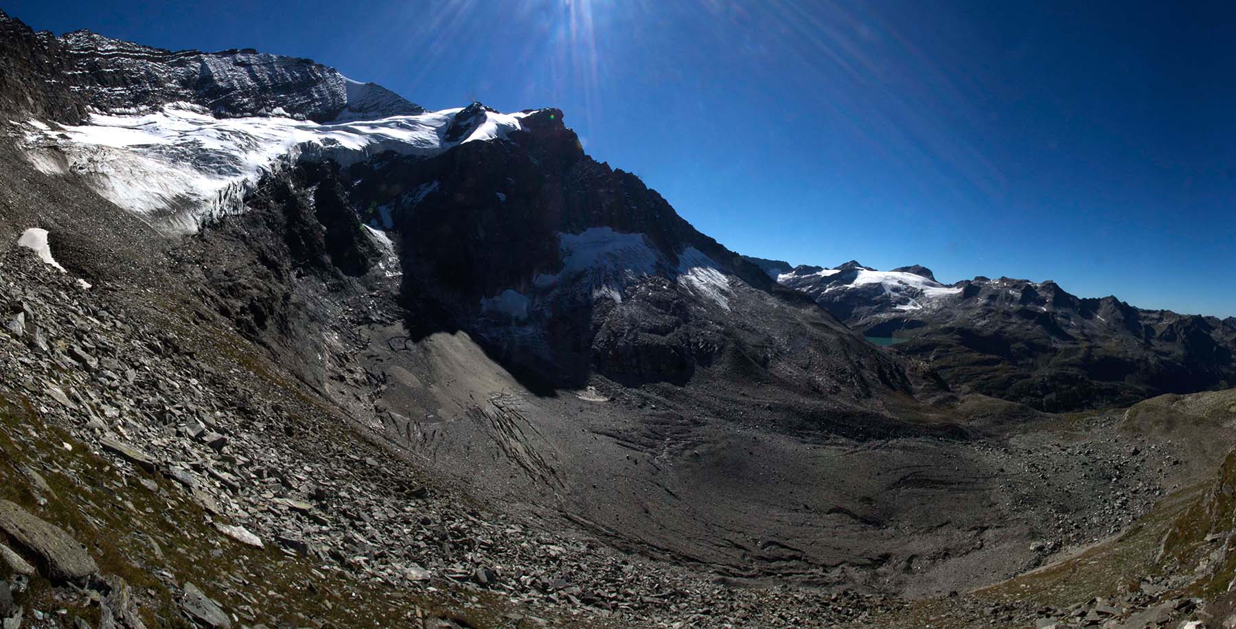
Reconstituted glacier by ice avalanches from Oberes Riffelkees(Totenlöcher). The Untere Riffelkees is a heavyly debris covered glacier tongue(Bergsturz around 1906). The glaicer is situated in the western Glocknergruppe in the upper Stubach Valley.
-
na
-
Data shows time periods when the lake was covered with ice
-
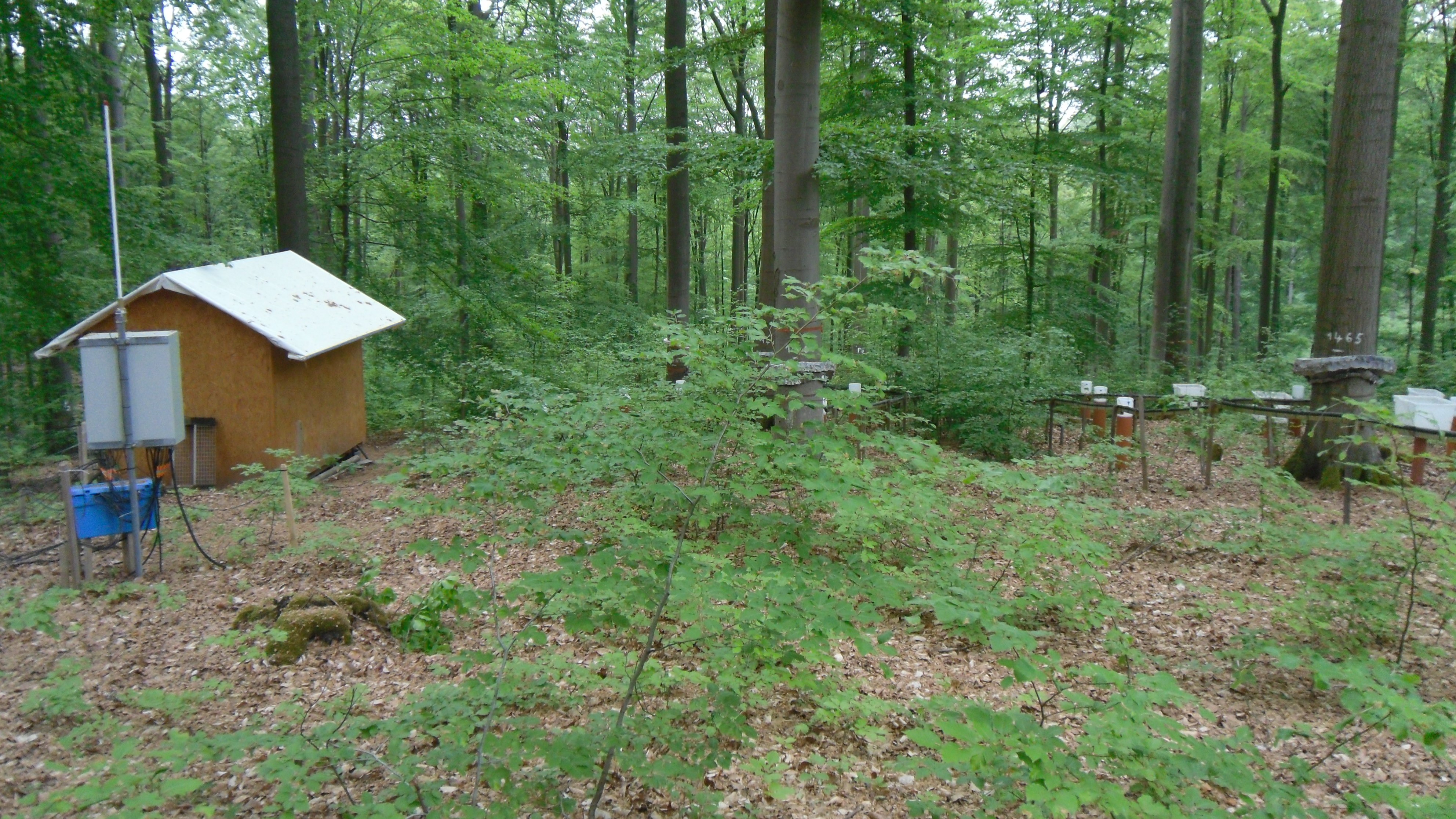
Krofdorf Forest hydrological research area 4 catchments: A1 (9 ha), A2 (20 ha), B1 (11 ha), B2 (14 ha)
-
During the long-term monitoring project in Obergurgl, the aboveground phytomass of vegetation at four study sites was collected in the year 2005. The project was established in 2000, with the aim to record vegetational development in subalpine to alpine altitudes in aspects on the effect of grazing and grazing exclosure. Phytomass-data regards to a study site at Schoenwieskopf and three bogs in the Rotmoos-Valley. Aboveground phytomass was recorded by cutting the sod with sissors. The sod was cutted close to the soil surface in areas of 25x25 cm, next to the existing permanent plots per study site. On each study site, 24 areas were collected. 12 within the established fenced, 12 outside the fences in the control area. The sod was then splitted in fractions: grasses, herbs and cryptogams. The phytomass was then dried in a compartment drier, 24 hours with 80°C. Then, dry weight was measured out.
-
In the Biosphere Reserve Gurgler Kamm near Obergurgl (Central Alps, Tyrol, Austria) multi factorial experiments were carried out in the lower alpine zone from 2005 to 2007 to investigate the effects of simulated trampling, seed addition, and a combination of these two treatments. Permanent plots of 1 m² were established within (= exclosures) and outside (= controls) of fences at three peat bog sites and in a Nardus stricta-community at about 2300 m a.s.l. In autumn 2005 the following treatments were performed in the exclosures and controls, respectively: - artificial gap creation, - sowing of seeds collected in the study area and in the surrounding, - a combination of gaps x sowing.
-
This dataset contains information about the water level of the Los Molinos spring (Sorbas, Spain) (1973-2014) and water chemical composition. In addition, measures of temperature and CO2 outside and inside the caverns of the karst system in gypsum of Sorbas, isotopic water composition and micro erosion are provided.
-
A detailed vegetation analysis of managed and abandoned mountain meadows and pastures has been conducted in the area of Obergurgl, on the left side of the Gurgler Valley at altitudes between 1840 m and 2400 m a.s.l. The objective of the study was to record and describe both the areas still managedn in varous ways and the abandoned areas under the aspect of plant sociology, and to emphasise the connection between land use and vegetation. Therefore 110 vegetation records were made from 26.06.2007 to 18.08.2007.
-
Since the mid-1990s a series of subalpine grassland sites have been established at the Kaserstattalm, Stubai Valley. They include hay meadows, pastures and abandoned grassland which have partley been reforested. The overarching aim of all studies is to assess effects of global changes on ecological processes and related functional relationships in mountain grasslands. Therefor basic shapefiles and maps were created. This dataset includes only shapefiles representing: historical land use map,soil maps (soil type, soil depth, and organic soil layer ) and vegetation cover.
-
Permanent plots were established in 1996. A total of 40 permanent plots were established on moraines ice-free for 35 and 50 years on vegetated and bare-ground areas. Half of them were treated with a seed mixture in 1996 and 1997. The vegetation was mapped and coverage was estimated in permanentplots in 1996 and from 2002-2014. Records were made by splitting the 25x25 cm plots in 5x5 cm segments (=subplots). Vegetation coverage was estimated by subplots and then summed up to the plot size of 25x25 cm. Plot description: 1v71 - 5v71: Plots with vegetation on glacier foreland moraine 1971 1vs71 - 5vs71: Plots with vegetation on glacier foreland moraine 1971 and sowing in 1996 and 1997 1b71 - 5b71: Plots without vegetation (bare ground) on glacier foreland moraine 1971 1bs71 - 5bs71: Plots without vegetation (bare ground) on glacier foreland moraine 1971 and sowing in 1996 and 1997 1v56 - 5v56: Plots with vegetation on glacier foreland moraine 1956 1vs56 - 5vs56: Plots with vegetation on glacier foreland moraine 1956 and sowing in 1996 and 1997 1b56 - 5b56: Plots without vegetation (bare ground) on glacier foreland moraine 1956 1bs56 - 5bs56: Plots without vegetation (bare ground) on glacier foreland moraine 1956 and sowing in 1996 and 1997