
canopy growth rate
Type of resources
Available actions
Topics
Keywords
Contact for the resource
Provided by
Years
Formats
Representation types
-
The Connell Rainforest Plot Network long-term forest dynamics plot of Davies Creek is located in the Dinden National Park circa 25 km southwest of Cairns, Northern Queensland. Temporal visits occur between 1 to 6 years. Between 2012 and 2018 the Connell Rainforest Plot Network was a member of Long Term Ecological Research Network (LTERN), Australia, a facility of the Australian Government's Terrestrial Ecosystem Research Network (TERN).
-
The Connell Rainforest Plot Network is a member of Long Term Ecological Research Network (LTERN), Australia (http://www.ltern.org.au), a facility of the Australian Government's Terrestrial Ecosystem Research Network (TERN), (http://www.tern.org.au). The long-term forest dynamics plot at O'Reilly's is located in the subtropical rainforest near O’Reilly’s Guest House in Lamington National Park, 65 km south of Brisbane. It consists of two 1-ha plots spaced approximately 600 m apart, but for analyses they have always been treated as a single unit. This plot has never been logged, but some selective logging has occurred just outside the plot boundary. Temporal visits occur between 1 to 6 years.
-
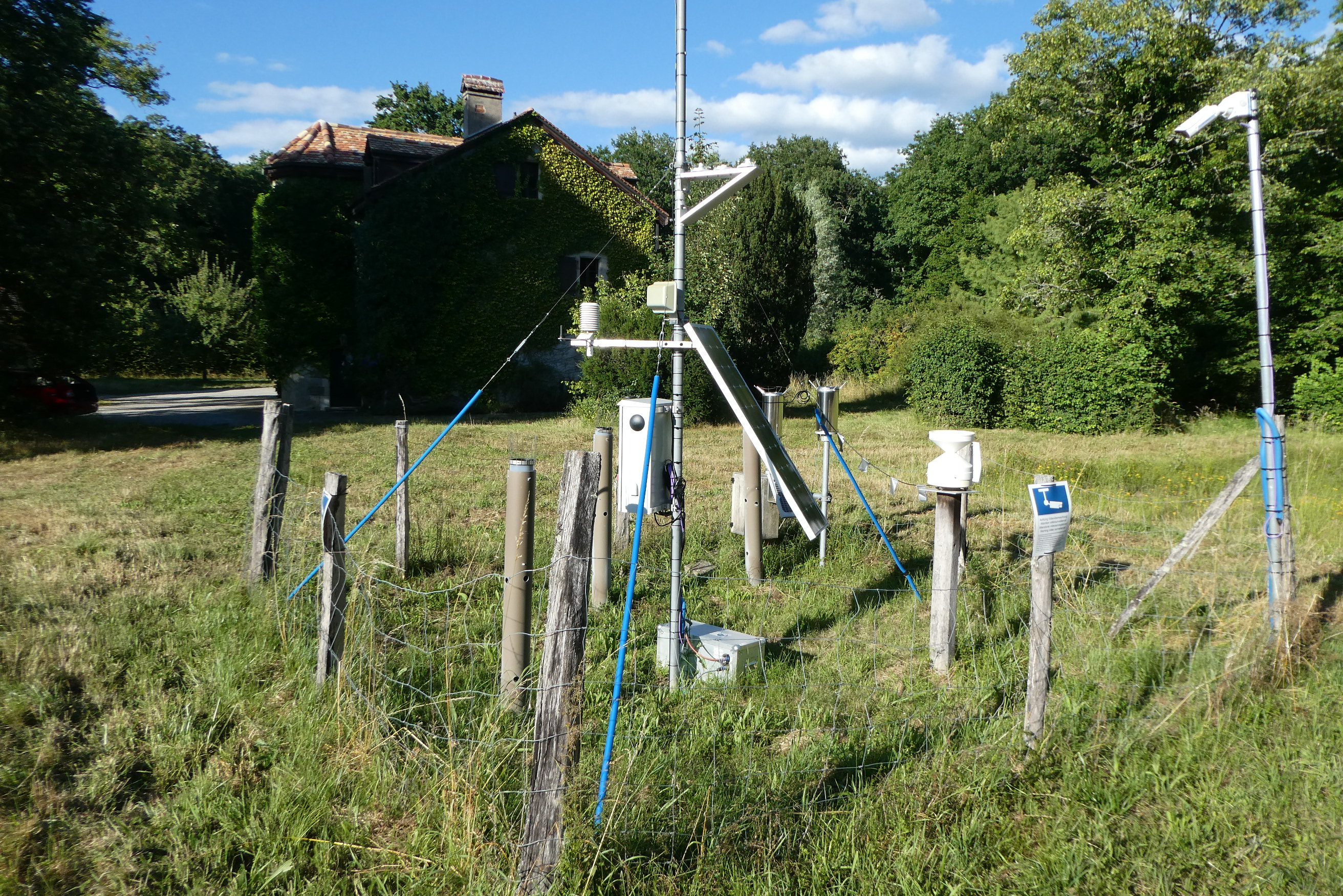
The LWF research programme provides, on the one hand, long-term data series from the last 20 years, together with a scientific interpretation to national and international policy makers. On the other hand, the available data and latest LWF infrastructure provide an attractive scientific platform for collaboration with both national and international partners. The site is located close to the city of Davos in the canton of Graubuenden, within a natural, coniferous forest stand which mainly consists of 200-390 year-old spruce (Picea abies) trees. Among others, the site is equipped with two meteorological measurement stations; one is located within the forest stand, the second is co-located in the nearby open-field, allowing to measure the forest stand effect on micro-climate. The following parameters are being measured (starting-end year): Atmospheric deposition (throughfall and bulk deposition) (2009-today), Circular vegetation plots (2008-today), Crown Condition Assessment (2006-today), Diameter and Height measurements (2004-today), EC-5 soil water content measurement (2008-today), EC-5 soil water content measurement (2008-today), Foliar analyses (2007-today), Leaf area index (LAI) (2008-today), Litterfall (2009-today), Manual circumference band measurement (2006-today), Matric potential (manual suction cups) (2009-today), O3 Injuries (2009-today), Ozone visible injury assessment (2009-today), Permanent vegetation quadrats (2008-today), Phenological observations (2009-today), Sapflow measurements (1998-today), Soil matrix chemistry (2007-today), Soil solution chemistry (lysimeters) (2010-today), Tree core sampling (), automated point dendrometer measurements (1998-today), automatic circumference band measurement (2006-today), Deadwood sampling (2009-today).
-
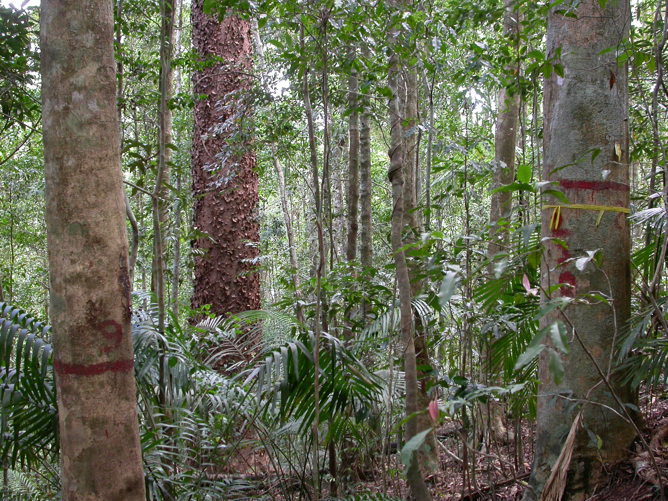
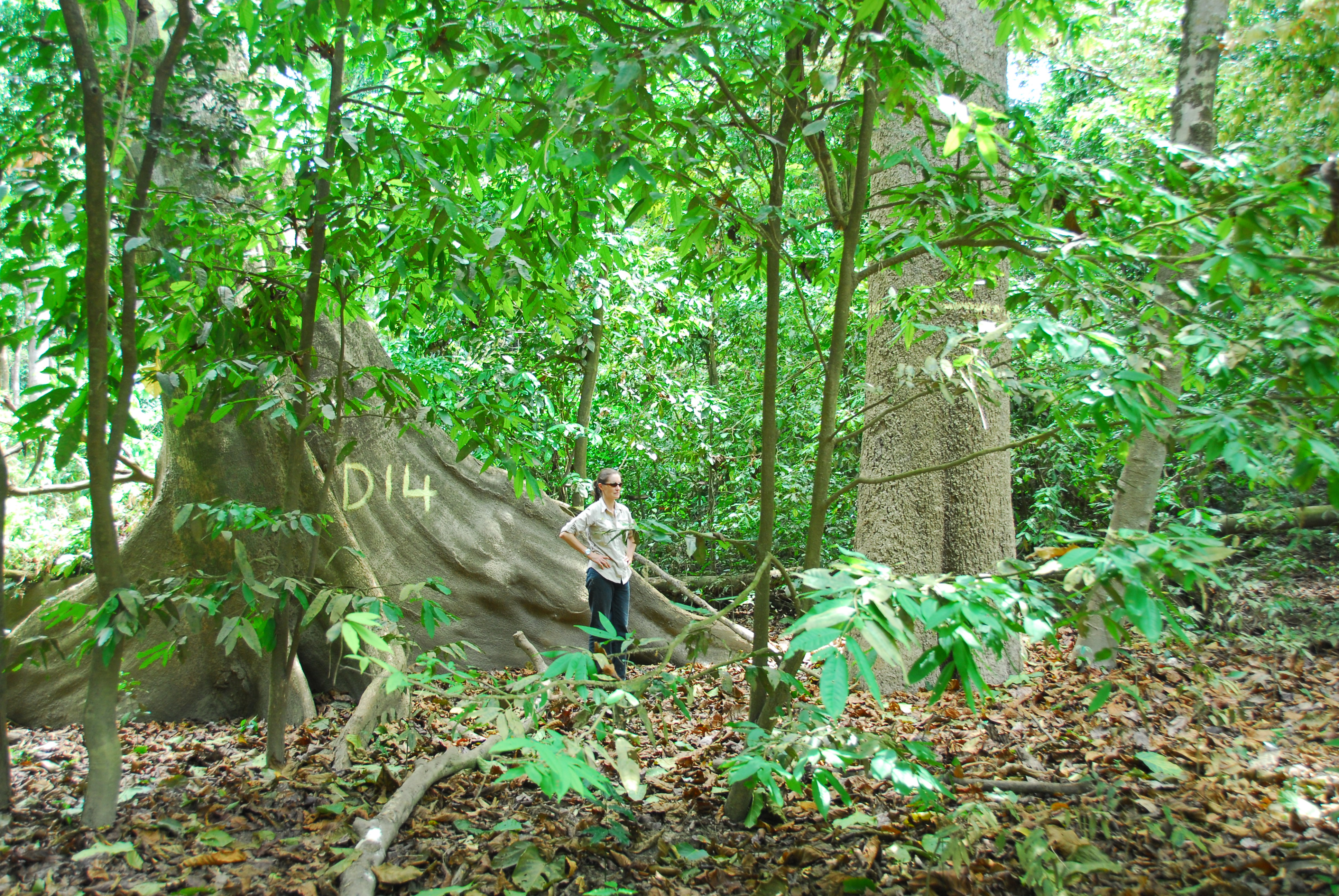
Except for minor disturbances associated with selective logging on two plots, the Tropical Rainforest Plot Network plots were established in old growth forest and all plots have thereafter been protected. Plots have been regularly censused and at each census the diameter at breast height of all stems is recorded. The data collected from the 20 plots provides an insight into the floristical composition, structure and long term forest dynamics of Australian tropical rainforests and allows direct comparisons to be made with long-term monitoring plots at a global scale. Temporal visits were initially conducted every 2 years, then every 5 years from 1990. Between 2012 and 2018 the Tropical Rainforest Plot Network is a member of Long Term Ecological Research Network (LTERN), Australia, a facility of the Australian Government's Terrestrial Ecosystem Research Network (TERN).
-
The site is located next to Wettingen in the canton of Aargau, within a natural, mixed forest stand which mainly consists of 150 year-old beech (Fagus sylvatica) and 120-170 year-old spruce (Picea abies) trees. Among others, the site is equipped with two meteorological measurement stations; one is located within the forest stand, the second is co-located in the nearby open-field, allowing to measure the forest stand effect on micro-climate. The following parameters are being measured since 2013: Soil solution chemistry (lysimeters), TREENET, atmospheric deposition (throughfall and bulk deposition), circular vegetation plots, crown condition assessment, diameter and height measurements, foliar analyses, leaf area index (LAI), litterfall, manual circumference band measurements, Ozone visible injury assessment, permanent vegetation quadrats, phenological observations, sapflow measurements, soil matrix chemistry, tree core sampling, automated point dendrometer measurements, automatic circumference band measurements.
-
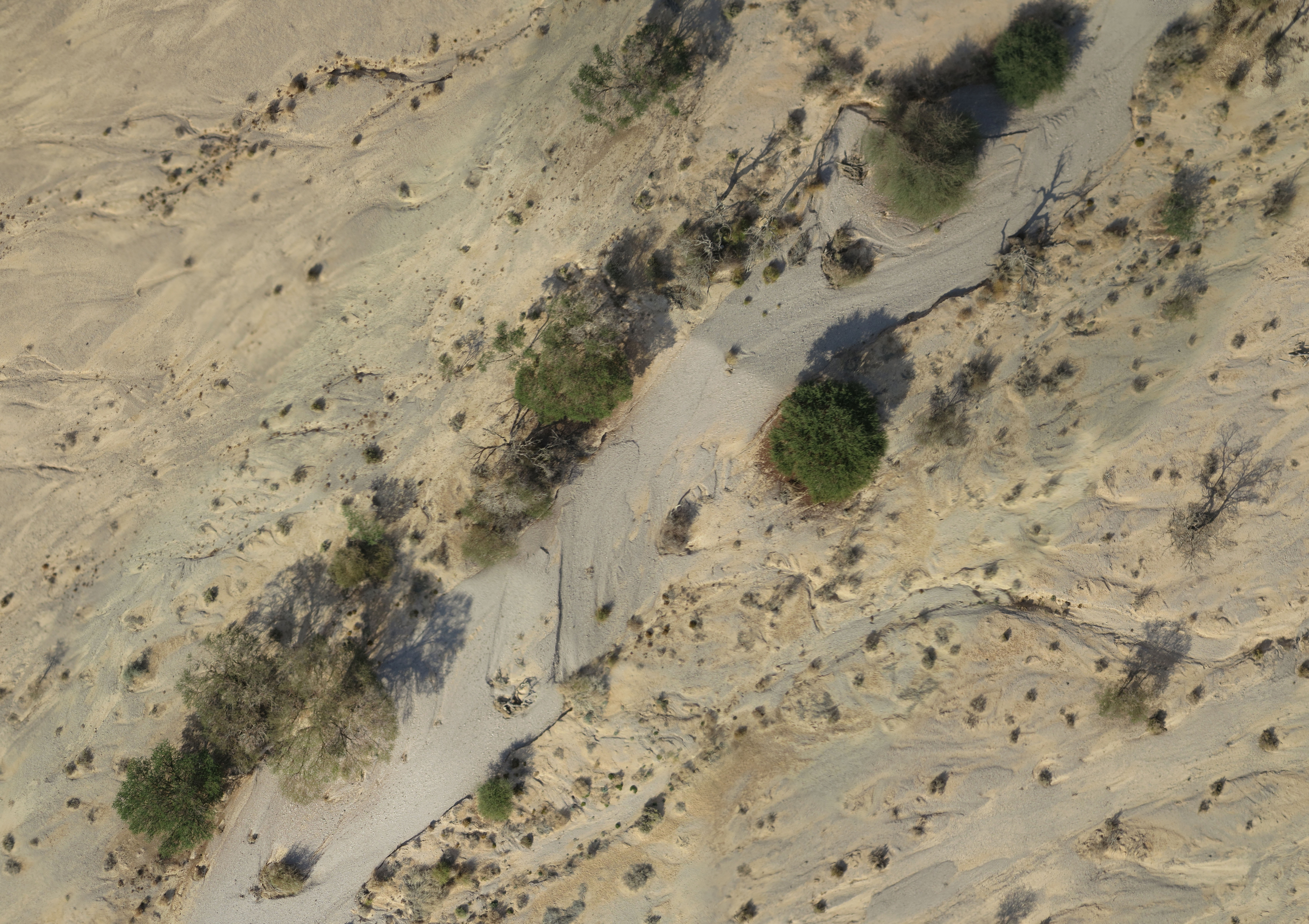
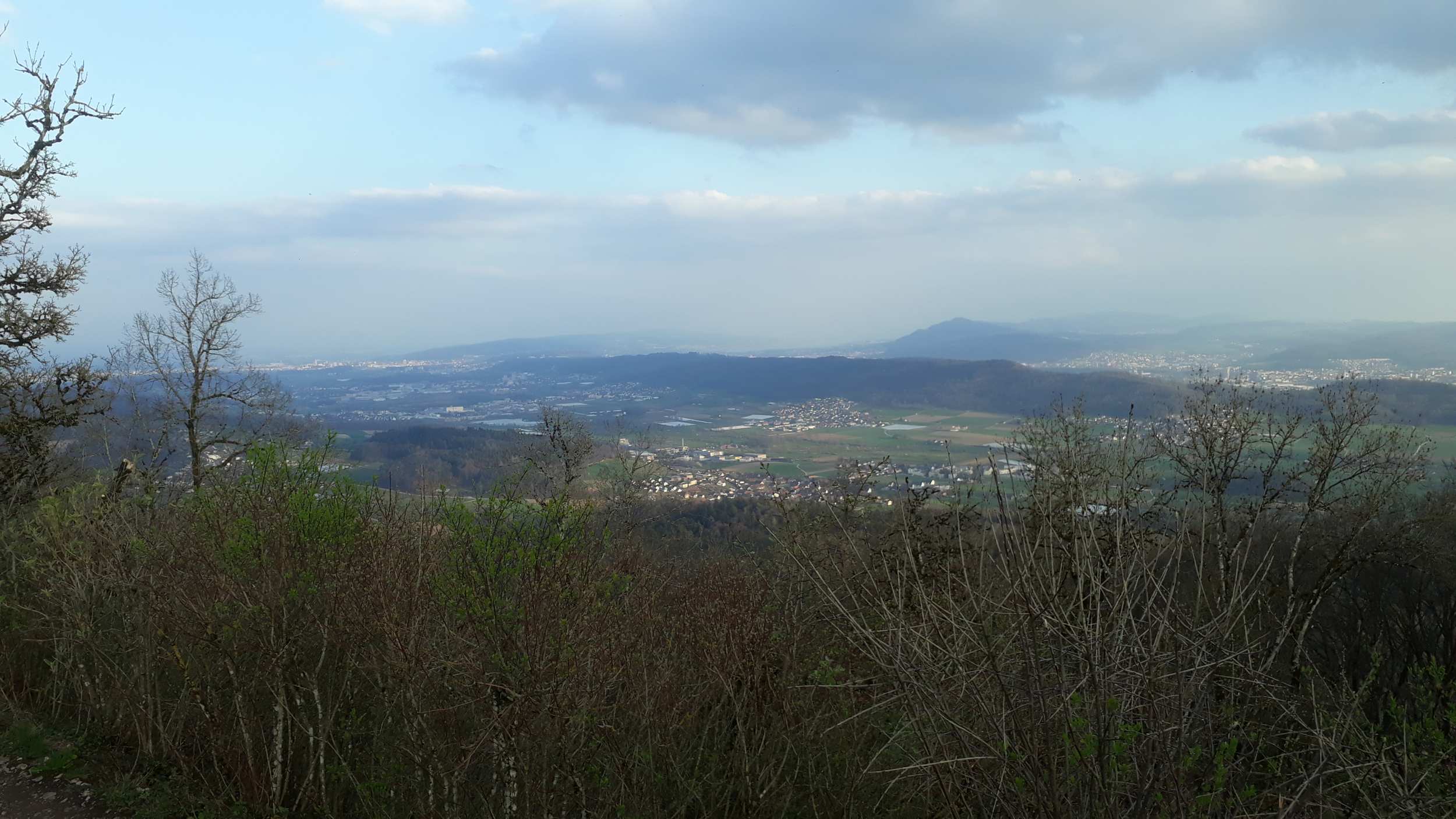
A small watershed that collects floods and run-off. The lowest place is home to a (relativity) dense Acacia savana. The slopes are completely bare. The wadi is covered with alluvium resting on a 6 m layer of red surface of late Pleistocene, which includes silt, clay and fine sand. Rainfall is 30 mm
-
Síkfőkút LTER Europe site is a temperate deciduous forest site, unmanaged since the late 1960ies. It is situated in the Szőllőcske forest reserve area on the southern foothills of Bükk Mountains, NE Hungary. The site is covered by a mature coppice oak forest (105 years old) with Q. petraea and Q. cerris in the upper canopy layer and other woody species occurring in the secondary canopy layer and shrub layers (Acer sp., Cornus sp, Euonymus sp., Crataegus sp.) The site was seriously impacted by oak decline during 1980ies. The soil has been classified as a brown forest soil type according to the Hungarian Soil Classification System which corresponds to Luvisol according to FAO WRB. Long-term data are available on climate, soil variables and forest structural and functional characteristics (for period 1973-2016).
-
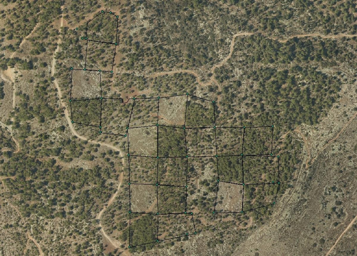
The Kedoshim-forest Long Term Ecological Research (LTER) is an experimental set up established in 2008 in a mature Pinus halepensis forest. This long-term research was designed to address silvicultural issues related to the management of mature, first generation, man-made, pine forest ecosystems in Israel and the design of their next generations as sustainable multiple-use forests. The Kedoshim LTER site is part of the Israeli LTER network - MAARAG. The Kedoshim LTER site provides a comprehensive well designed experimental infrastructure to study long-term effects of silvicultural manipulation (specifically overstory thinning) on vegetation dynamics, forest structure and ecosystem function. Four overstory thinning treatments were applied within 70×70 research plots: 1) clear cut, 2) heavy thinning – 100 tree ha-1 (65% reduction in stem basal area), 3) moderate thinning – 300 tree ha-1 (35% reduction in stem basal area) and, 4) control with no thinning – ca. 500 tree ha-1. Additionally, adjacent non-forested area was assigned as a reference. Climate and microclimate and various aspects of vegetation dynamics, forest function and biodiversity are monitored continuously since the application of thinning treatments.
-

The Hölstein site is located in in the eastern part of the Swiss Jura mountains (47°26’16.4’’, 7°46’31.1’’; 540 m a.s.l.), in a mixed, temperate forest with an exceptionally high biodiversity and a vigorous tree regeneration. The research plot has a size of 1.6 ha and comprises 540 mature trees. The main tree species are Fagus sylvatica and Picea abies with an admixture of Abies alba, Quercus petraea, Pinus sylvestris, Acer pseudoplatanus, Carpinus betulus, Fraxinus excelsior and Sorbus torminalis. A canopy crane is installed in the center of the research area to access the tree canopies for in situ measurements and for sampling of leaf material. Rainout shelters will be installed in 2019 for conducting a long-term throughfall exclusion experiment.
-
The forest site "Jussy" has been installed in 1995 as part of the Swiss Long-term Forest Ecosystem Research Programme LWF. The programme investigates anthropogenic and natural forces on the long-term health of the forests and the potential risks to humans. For this, a profound understanding of the relationship between processes, causes and effects in the ecosystem are necessary. The objectives of the LWF research programme include (i) early detection and a representative assessment of changes in forest condition, (ii) determination of external influences, both from anthropogenic and natural sources such as element inputs and climate and their effect on the forest ecosystem, (iii) development of indicators to assess the condition of the forest, (iv) integrated risk assessment based on different stress scenarios, and (v) extended platform for internal and external research projects. The LWF research programme provides, on the one hand, long-term data series from the last 20 years, together with a scientific interpretation to national and international policy makers. On the other hand, the available data and latest LWF infrastructure provide an attractive scientific platform for collaboration with both national and international partners. The site is located close to Jussy in the canton of Geneva, within a natural, mixed forest stand which mainly consists of 90 year-old sessile oak (Quercus petrea), 60 year-old aspen (Populus tremula), and 60 year-old European hornbeam (Carpinus betulus) trees. Among others, the site is equipped with two meteorological measurement stations; one is located within the forest stand, the second is co-located in the nearby open-field, allowing to measure the forest stand effect on micro-climate. The following parameters are being measured (starting-end year): Atmospheric deposition (throughfall and bulk deposition) (1997-today), Circular vegetation plots (1995-today), Crown Condition Assessment (1995-today), Deadwood survey (1995, 2005-today), Diameter and Height measurements (2000-today), Foliar analyses (1997-today), Leaf area index (LAI) (1996-today), Lichens (2003-today), Litterfall (1997-1998), Manual circumference band measurement (2001-today), Matric potential (manual suction cups) (1996-today), Meteorological measurements (1997-today), O3 Injuries (2002-today), Ozone visible injury assessment (2002-today), Passive sampling of NH3 (1999-2000), Passive sampling of NO2 (1999-2000), Passive sampling of O3 (2000-today), Permanent vegetation quadrats (1995-today), Phenological observations (1997-today), Soil matrix chemistry (1995-today), Soil morphology (1995-today), Tree core sampling (1916-1998), Tree crown measurements (1995-today), Deadwood sampling (2009-today).