
dissolved organic carbon in soil
Type of resources
Available actions
Topics
Keywords
Contact for the resource
Provided by
Years
Formats
Representation types
-
This is a Sphagnum dominated peatland located in the Pyrennées mountain.
-

Hydrometeorological and biogeochemical observations within 5 embedded catchments (from 0.2 to 14.5 km2). Alpine Mediterranean climate with heavy rainfall and flash floods in automn. The geology is mainly granite. The land use is mainly grassland and forest. More information at http://www.ohmcv.fr
-
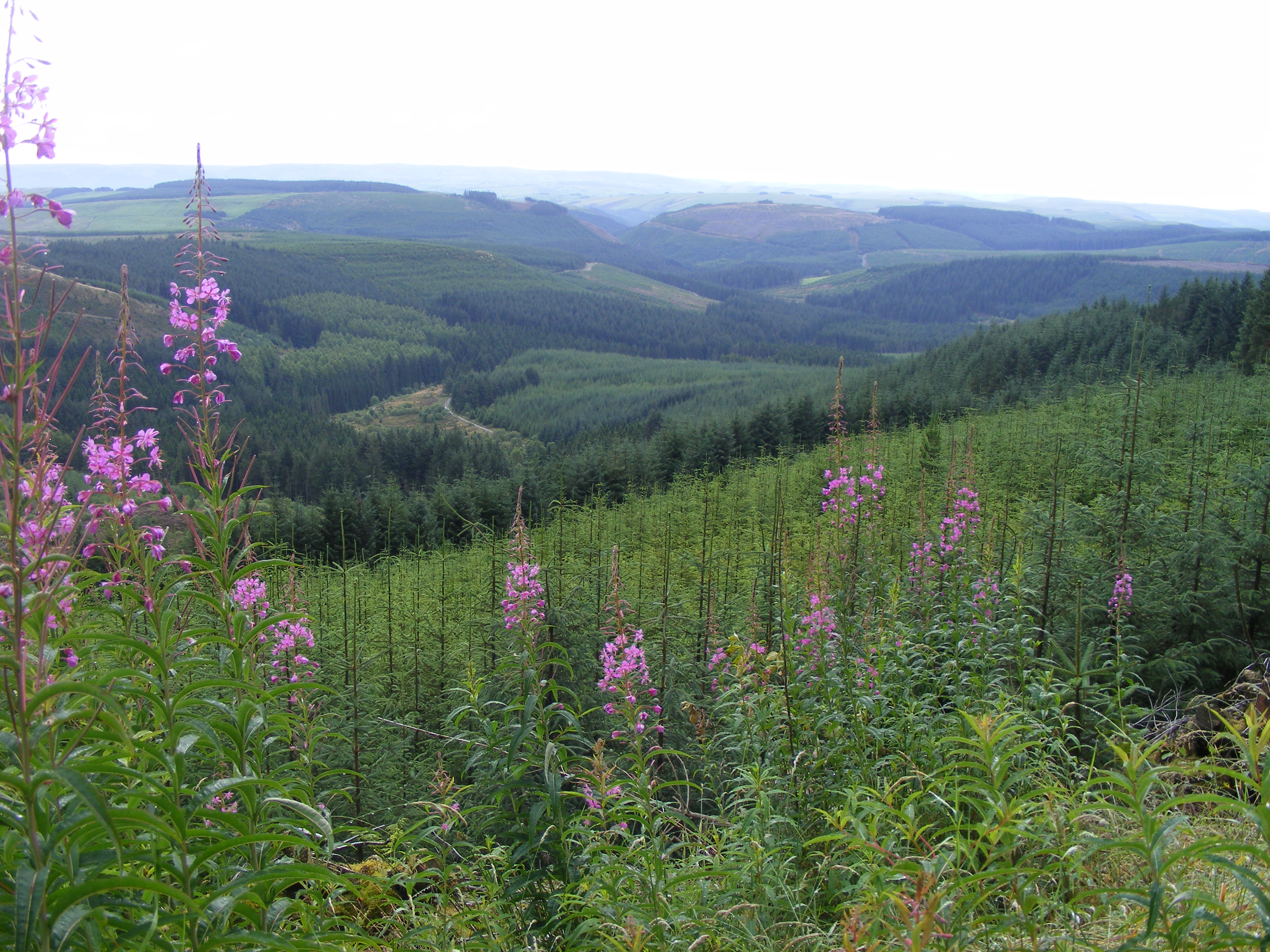
Plynlimon is at the headwaters of the Rivers Severn and Wye. The infrastructure at Plynlimon consists of 10 instrumented research catchments representing different land use options on the same geological parent material. It is the UK’s Critical Zone Observatory, part of the EU and global network of CZOs and is an ExpeER site. The infrastructure records high temporal resolution river flow and meteorological data (40 year data record) and stream water and precipitation chemistry for cations, anions, trace metals, nutrients, pH and alkalinity (30 year data record) and some data for suspended sediment. The site has an extensive spatial data library including topography, digital terrain model (DTM), soils, geology and vegetation/land-use available, open access, through the Environmental Information Data Centre (https://catalogue.ceh.ac.uk/documents/91961a0f-3158-4d00-984d-91eb1e03e8bd). Sub sites in the catchments represent a range of upland management types: mature/clear cut/replanted conifer forest; acid grassland; eroding peatland; improved grassland.Samples analysed for a wide range of major, minor and trace components. Bulk precipitation and cloudwater chemistry is also measured at one location.
-
Skogaryd is designed and state of the art equipped for interdisciplinary landscape and atmospheric studies that encompasses the complete catchment from a pristine bog via streams, riparian zones and forests to lakes, as well as the subsequent exchange between the atmosphere and surface waters The station also elucidating Greenhouse Gas (GHG) emissions from drained organic forest soils and are used for testing ecosystem models. The terrestrial sites at Skogaryd measure GHG emissions with eddy covariance (EC), CO2, H2O and N2O/CH4 (site dependent) and abiotic/biotic variables. They also have automatic stream station (flow, DIC/DOC etc.) and will be equipped with cameras/spectrometers for phenological studies and satellite ground truth validation. The forest sites are equipped for below ground studies; suction/gas probes, fine root production, Mycorrhiza, sap flow, above litter fall, tree production etc. At the lake CO2, H2O and CH4 are measured with EC. Abiotic and weather data are monitored. The sites have electric power, internet connection, boardwalks, bridges or boats. They have capacity for chamber/profile studies and process studies.
-
Waroneu is a 83 ha forested catchment located in the east of Belgium (« Hertogenwald »: Duke's forest) within the municipality of Baelen. In 2011, it was covered with 38% conifers (mainly Picea abies), 45% deciduous trees (Fagus sylvatica, Quercus robur, Betula pendula), and 17% open space. Biogeochemistry (nutrient and organic carbon in throughfall, rainfall, soil solution and outlet) has been studied since 1991. The catchment was limed in 1992 with 3T/ha dolomite and 200 kg/ha potassium sulfate. Since 2013, biogeochemistry and soil microbial parameters (microbial biomass, N mineralization, basal respiration) are studied in 6 intensive plots, reflecting major combinations of vegetation and upper soil caracteristics within the catchment.
-
Soil data of LTER Zöbelboden, Austria. Soil inventory is carried out since 1992 on regular positions (approx 65) in the catchment measuring soil chemistry. Soil water chemistry is measured in forest plots (2-3) using lysimeter sampling and analyses on a bi-weekly to monthly basis. Soil hydraulic characterizations exist for the major soil types in the catchment. Soil CO2 and N2O respiration data is available for some years
-
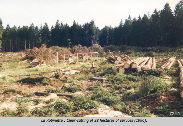
La Robinette is a 81 ha catchment located in the east of Belgium (« Hertogenwald »: Duke's forest) within the municipality of Baelen. Biogeochemistry (nutrient and organic carbon in throughfall, rainfall, soil solution and outlet) has been studied since 1991 as a reference catchment within the frame of a liming experiment (Waroneu catchment) and critical loads calculations. The catchment, initially covered by Picea abies, was subjected to windthrow, reducing coverage to 46% (1990s) and experimental clearcut of 22 ha (1996), followed by afforestation with deciduous species in 1998. Four 2-ha plots were planted with deciduous species in alternate rows. Alder, rowan, birch and oak were also planted within the catchment. In 2012, the catchment was covered by 8% mature and 41% young conifers (Picea abies), 7% deciduous trees (Fagus sylvatica, Quercus robur, Betula pendula, Alnus glutinosa, Sorbus aucuparia, Salix caprea ), 44% open space. Biogeochemical measurements have been complemented with experiments on litterfall, litter decomposition, soil respiration, N cycle processes. Flux and meteorological data have been collected from 2007 to 2011 (CarboEurope) and from end 2016 (ICOS). In addition, since 2013, biogeochemistry and soil microbial parameters (microbial biomass, N mineralization, basal respiration) are studied in 6 intensive plots, reflecting major combinations of vegetation and upper soil characteristics within the catchment.
-
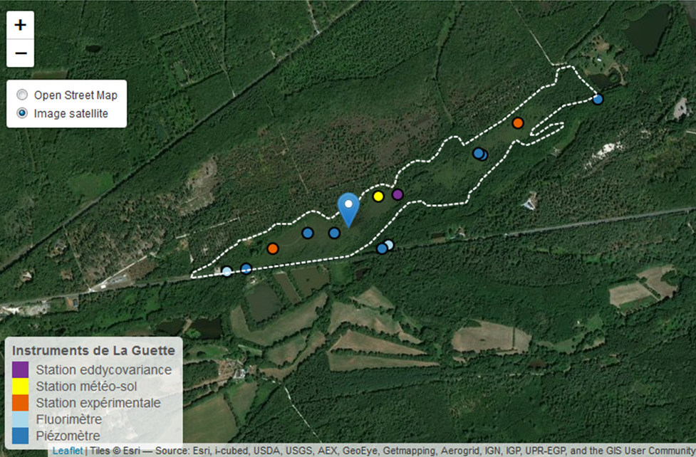
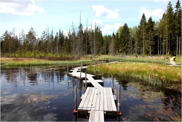
This is a peatland located in Sologne, 80 km south of Orléans. La Guette peatland is one of the four sites of the SNO Tourbières (CNRS). All the sites of the SNO Tourbières are part of OZCAR (French Observatory on the critical zone). The site was hydrologicaly disturbed. Restoration works took place in 2014. A labeling procedure has began to become associated site of ICOS.
-

The study plot was established by the Institute of Forest Ecology (Mendel University in Brno) in 1968, namely in connection with the UNESCO International Biological Programme (IBP) and the UNESCO programme "Man and the Biosphere" (MAB). The study plot is carried out in the natural forest region 30 – Drahanská Vrchovina upland (Drahanský bioregion, 1.52) about 1 km west of the village of Němčice in the Czech Republic on the modal oligotrophic Cambisol (KAmd´) of a fir-beech forest vegetation zone (4 FVZ) with forest type 5S1 – Abieto-Fagetum mesotrophicum with Oxalis acetosella (4AB3 – Fageta quercino abietina, union Luzulo-Fagion, association Luzulo-Fagetum) at an a altitude of 600–660 m at sites of autochthonous mixed forests. Research is aimed at ecological aspects of the transformation of spruce monocultures and optimation of management procedures at the application of sustainable management in forests. Recently, research is aimed at possibilities of the adaptation of forest stands on effects of an expected climate change. The main oriented research in present is: (i) study of mesoclimate and microclimate, (ii) evaluation of water balance, (iii) phenology of tree species, (iv) study of biogeochemical cycle (carbon, nitrogen, sulphur), (v) study of decomposition and soil processes, and (vi) evaluation of biodiversity.
-
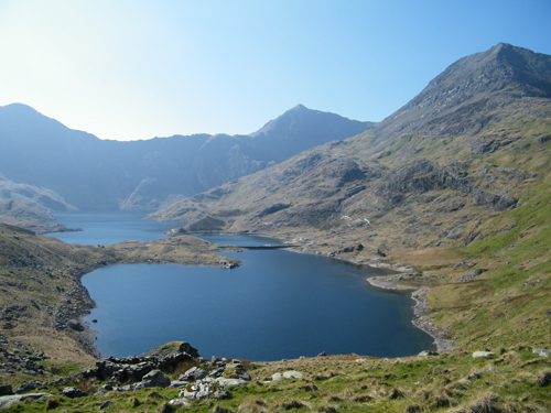
Yr Wyddfa/Snowdon is an upland ECN site incorporating the summit of Yr Wyddfa or Snowdon, the highest mountain in England and Wales, 19km south-east of Bangor in North Wales. It is co-located with the Nant Teyrn freshwater site. The altitude ranges from 298-1085m and includes three additional summits over 800m. The bedrock is a mixture of Ordovician acidic and basic volcanic rocks, with localised igneous intrusions. Evidence of glaciation is widespread, with prominent corrie moraines. There are 5 lakes within the site, three of which form a 'staircase'. The soils are varied and include brown podzolic soil, gleys, organic peat soils and humic rankers. The dominant vegetation is acidic grassland with Festuca ovina (sheep's fescue) and Agrostis sp (bent grass) in the drier areas and Nardus stricta (mat grass) in the wetter areas. The site is part of the Yr Wyddfa/Snowdon National Nature Reserve, managed by the Natural Resources Wales under agreement with the owner. The land is unenclosed and grazed by sheep and a small herd of feral goats.