
plant diversity
Type of resources
Available actions
Topics
Keywords
Contact for the resource
Provided by
Years
Formats
Representation types
-
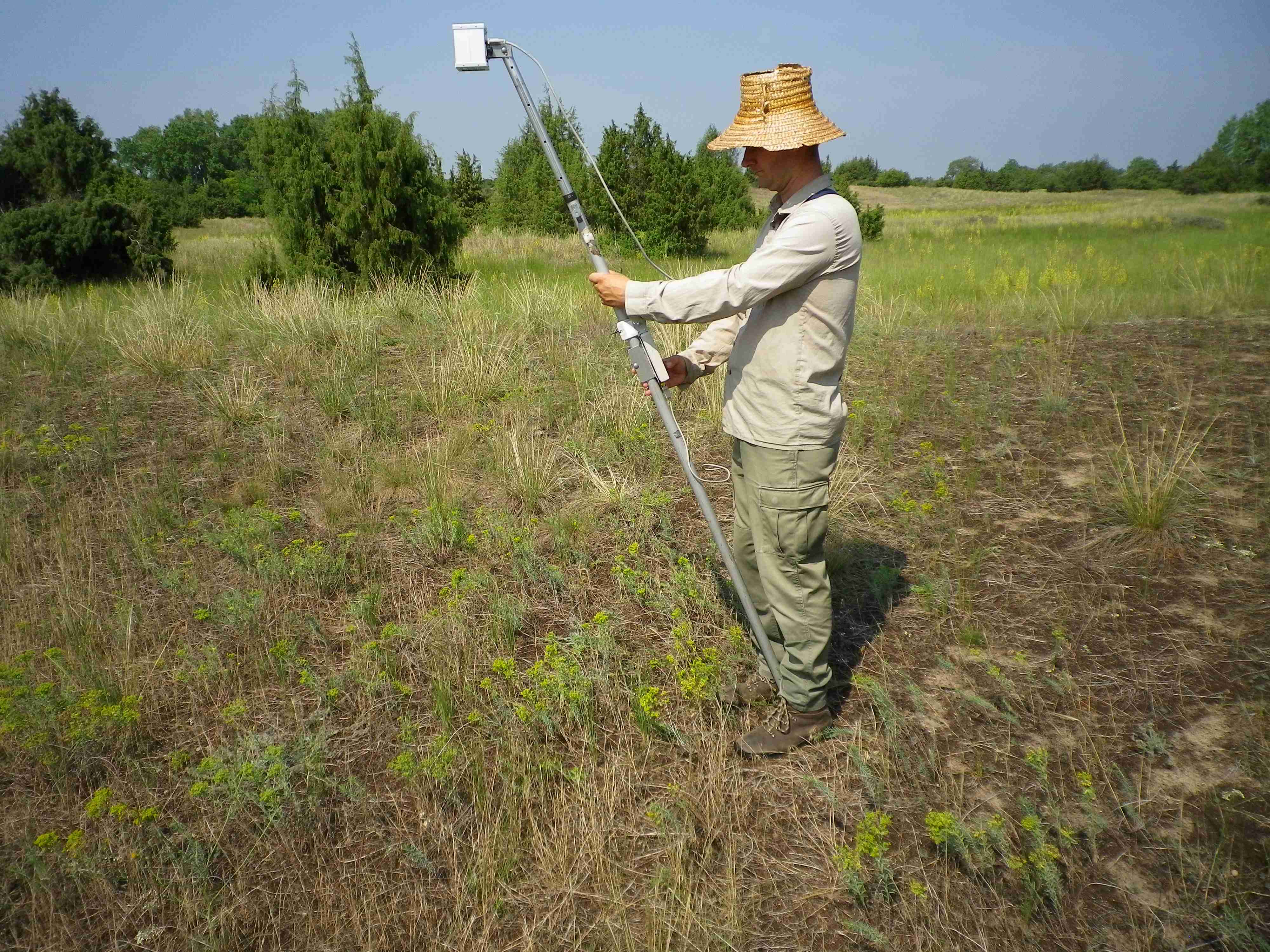
Orgovany-Agasegyhaza site for studying production-diversity relations and weather effect of productivity.
-
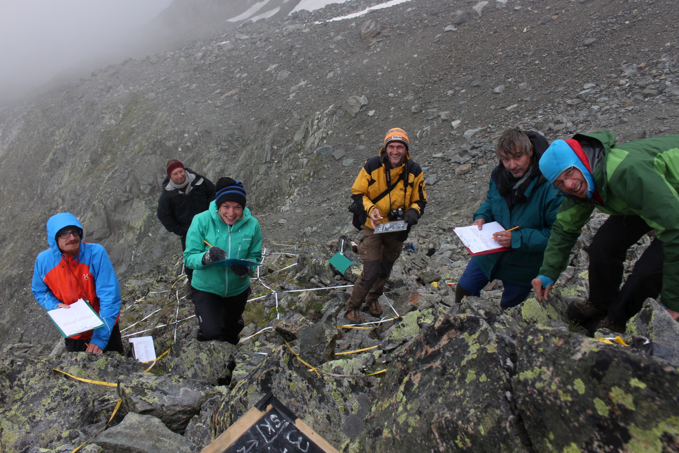
GLORIA Master Site.The 3497m-peak Mount Schrankogel belongs to the highest mountains of the Austrian Alps. Its northern and eastern side is surrounded by glaciers and glacier forelands. Its southern to western faces, however, are not interrupted by glacier Established in 1994 as the first comprehensive alpine to nival long-term monitoring site for high-altitude vegetation in the Alps, with ca. 1000 permanent plots of 1x1m arranged in transects of 30x3m or smaller ranging from 2900m to 3450m. Main purpose is ecological climate impact research. In 2001 it became a master site of the GLORIA network: e.g. method development and testing for species recording in 1x1m plots for GLORIA was partly conducted on Schrankogel. The first major resurvey of plots was made in 2004, the second resurvey was conducted in 2014. Besides long-term monitoring, several other research approaches were/are carried out at the Schrankogel site, such as species and vegetation modeling, vegetation mapping, phenological studies of alpine and nival plants, exclosure studies for grazing impacts at the lower altitudes of the site, soil studies, snow pattern studies (two permanent snow cameras), surface and soil-temperature measurements. In 2014, the the scope was extended to other organism groups such as soil microbiota, soil mesofauna (Oribatida and Collembola in particular), and surface-dwelling arthropods. Site setup, resurveys, or other activities were/are supported by: the Austrian Academy of Sciences through a national grant of the International Geosphere–Biosphere and the UNESCO MaB Programmes, by the Austrian and through the Institute of Mountain Research (IGF) of the Academy; by the Austrian Federal Ministry of Science and Research; the Austrian Federal Ministry of Agriculture, Forestry, Environment and Water Management; the Swiss MAVA Foundation; the Government of Tyrol; the project ALARM (Assessing Large-Scale Risks for Biodiversity with Tested Methods; No. GOCE-CT-2003-506675) in the FP-6 of the EU; the Austrian Climate Research Programme (ACRP: GZ B368633 ACRP6 - SCHRANKOGEL_20YEARS - KR13AC6K11076). For further details on Schrankogel_GLORIA see: http://www.gloria.ac.at/?a=42&b=56
-
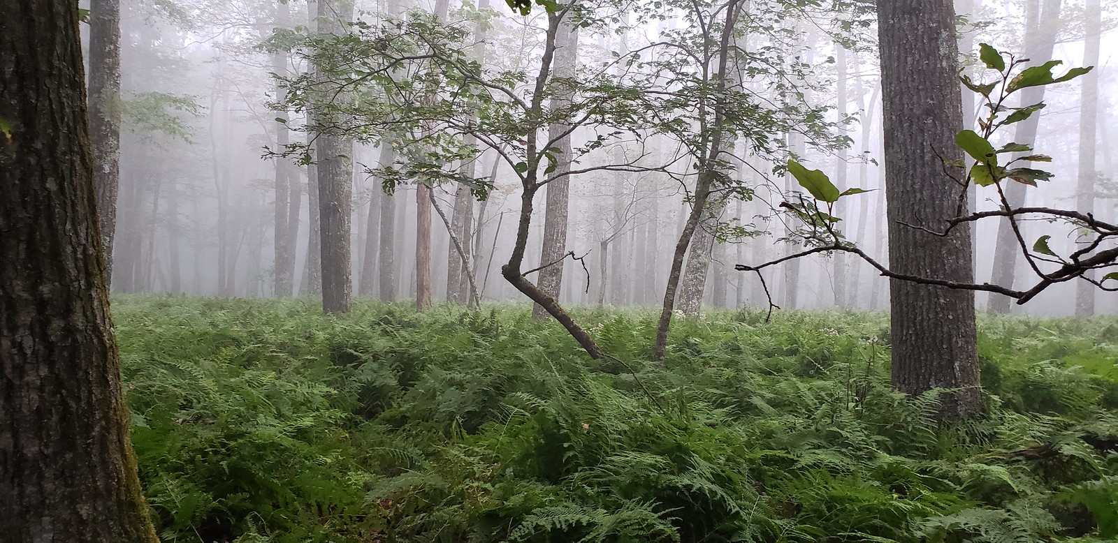
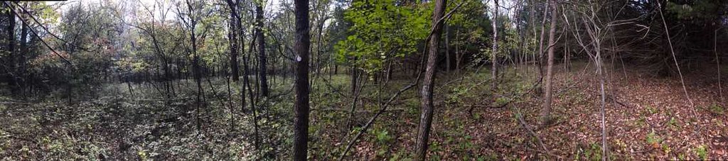
Mountain Lake Biological Station is located in a remote, but accessible southern portion of the Appalachian Mountain Chain in southwestern Virginia, approximately 20 km northwest of Blacksburg, VA. The Jefferson National Forest is contiguous to the station, with 42.5 km2 of woodland is designated as NFS Wilderness. The relocatable terrestrial NEON site is comprised of three parcels of land, with the northern two segments owned by the US Forest Service and the southern portion hosted by the University of Virginia. The 11.14 km2 site is situated on the elevated divide between the Atlantic and Mississippi drainage basins and is characterized by abrupt changes in environmental gradients and fine-scale variances in ecological niches. It is the only NEON Appalachians & Cumberland Plateau Domain site located in Virginia, as the other four domain 07 sites are found in Tennessee. Remote sensing surveys of this field site collect lidar, spectrometer and high-resolution RGB camera data. The flux/meteorological tower at this site is 94 with 6 measurement levels. The tower top extends above the vegetation canopy to allow sensors mounted at the top and along the tower to capture the full profile of atmospheric conditions from the top of the vegetation canopy to the ground. The tower collects physical and chemical properties of atmosphere-related processes, such as humidity, wind, and net ecosystem gas exchange. Precipitation data are collected by a tipping bucket at the top of the tower and a series of throughfalls located in the soil array. This site has five soil plots placed in an array within the airshed of the flux tower. Field ecologists collect the following types of observational data at this site: Terrestrial organisms (birds, ground beetles, mosquitoes, plants, small mammals, soil microbes, ticks), Biogeochemical data, and soil data. Total data products planned for this site: 115
-
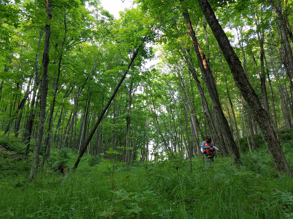
University of Notre Dame Environmental Research Center (UNDERC) is a core terrestrial site in NEON's Great Lakes Domain 5. Straddling the border between Northern Wisconsin and Michigan's Upper Peninsula, the UNDERC property comprises approximately 7500 acres and is maintained as an environmental education and research facility. UNDERC also has 30 lakes comprising 1350 acres, including Crampton Lake, a NEON aquatics site. The flux/meteorological tower at this site is 127ft with 6 measurement levels. The tower top extends above the vegetation canopy to allow sensors mounted at the top and along the tower to capture the full profile of atmospheric conditions from the top of the vegetation canopy to the ground. The tower collects physical and chemical properties of atmosphere-related processes, such as humidity, wind, and net ecosystem gas exchange. Precipitation data are collected by a tipping bucket at the top of the tower, a Double Fence Intercomparison Reference (DFIR) near the tower, and a series of throughfalls located in the soil array. UNDERC site includes airborne remote sensing surveys, automated instrument measurements and observational field sampling.There are also multiple plots for soil sensors and sampling and organismal sampling including birds,mammals, ticks and mosquitoes.
-
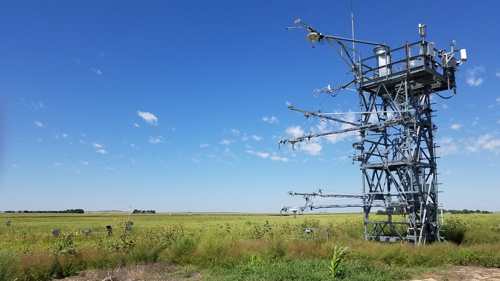
North Sterling (STER) is a relocatable terrestrial site is part of NEON's Central Plains Domain 10. STER is 100 miles to the east of CPER, is hosted by a private landowner with a strong interest in soil science and sustainable agriculture. The family farm has been in operation for nearly 100 years. Currently, the farm supports a mix of cattle grazing and field crops, primarily wheat, millet and hay. Remote sensing surveys of this field site collect lidar, spectrometer and high-resolution RGB camera data. The flux/meteorological tower at this site is 26ft with 4 measurement levels. The tower top extends above the vegetation canopy to allow sensors mounted at the top and along the tower to capture the full profile of atmospheric conditions from the top of the vegetation canopy to the ground. The tower collects physical and chemical properties of atmosphere-related processes, such as humidity, wind, and net ecosystem gas exchange. Precipitation data are collected by a tipping bucket at the top of the tower and a series of throughfalls located in the soil array. This site has five soil plots placed in an array within the airshed of the flux tower. Field ecologists collect the following types of observational data at this site: Terrestrial organisms (birds, ground beetles, mosquitoes, plants, small mammals, soil microbes, ticks), Biogeochemical data, and soil data. Total data products planned for this site: 113
-
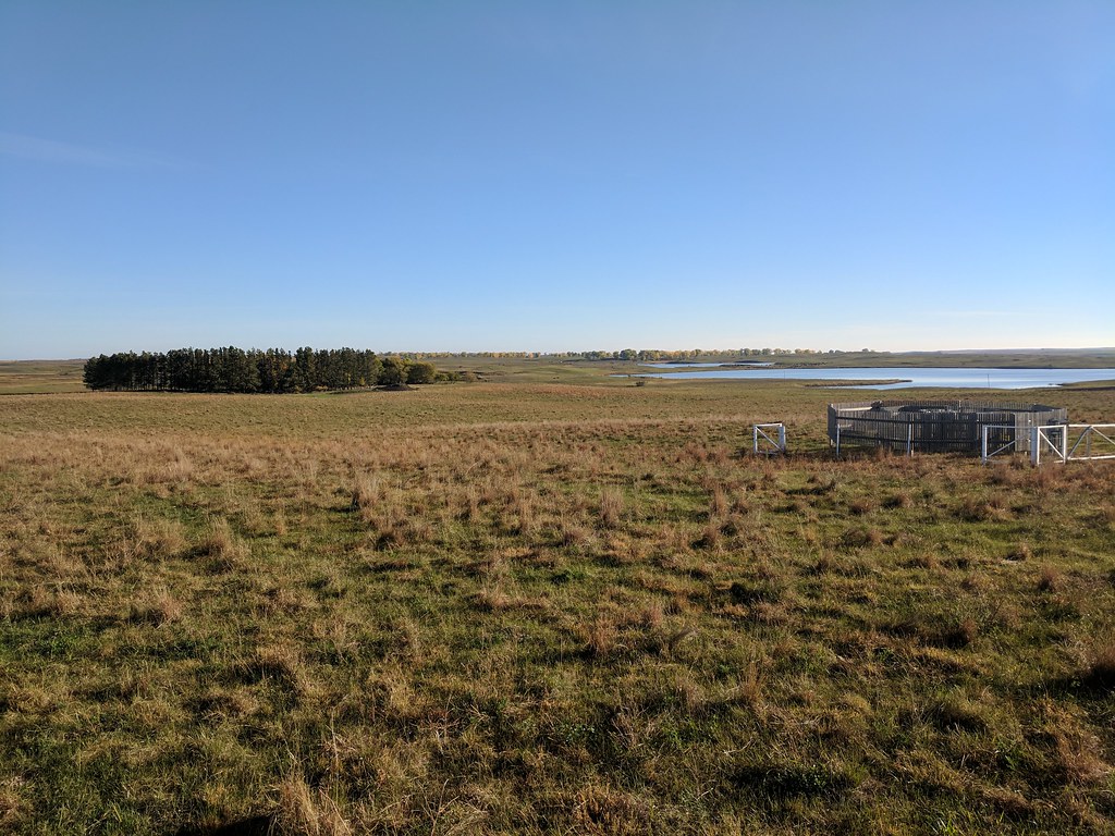
The Woodworth (WOOD) core terrestrial field site is located approximately 100 miles northeast of Bismarck, North Dakota in Stuntsman County. It is encompassed in the Northern Plains Domain, which includes a patchwork of grasslands, agricultural, and wetland/aquatic communities embedded in a matrix of small agrarian communities. This site is a restored praire located in an undulating matrix of small lakes, ponds, and ephemeral praire potholes formed by glaciers 10,000 years ago. It is managed by the U.S. Geological Survey and the U.S. Fish and Wildlife Service, and is part of the larger Chase Lake National Wildlife Refuge (NWR). Remote sensing surveys of this field site collect lidar, spectrometer and high-resolution RGB camera data. The flux/meteorological tower at this site is 26 with 4 measurement levels. The tower top extends above the vegetation canopy to allow sensors mounted at the top and along the tower to capture the full profile of atmospheric conditions from the top of the vegetation canopy to the ground. The tower collects physical and chemical properties of atmosphere-related processes, such as humidity, wind, and net ecosystem gas exchange. Precipitation data are collected by a tipping bucket at the top of the tower and a series of throughfalls located in the soil array. This site has five soil plots placed in an array within the airshed of the flux tower. Field ecologists collect the following types of observational data at this site: Terrestrial organisms (birds, ground beetles, mosquitoes, plants, small mammals, soil microbes, ticks), Biogeochemical data, and soil data.The WOOD terrestrial site produces 110 data products.
-
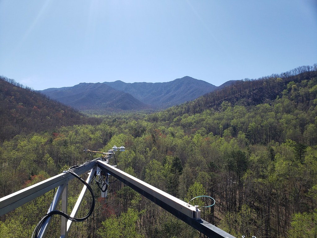
This relocatable terrestrial NEON site, comprised of 13 square miles within the 814 square miles of the Great Smoky Mountains National Park, is characterized by abundant rainfall, variable elevations, and an exceptional richness of biota hosted by closed-canopy deciduous old growth forests. It exists within the NEON Appalachians & Cumberland Plateau Domain, specifically located in the southwest area of Tennessee bordering North Carolina. As one of the largest protected areas in the eastern U.S., it is the most biodiverse park in the National Park system and the most visited. GRSM's terrestrial and aquatic plots are all contained in or near the Gatlinburg Ranger District. These plot locations were chosen because of their subjection to ecological phenomena, logistical convenience, and comparability to D07's core site (which is approximately 70 miles away). Remote sensing surveys of this field site collect lidar, spectrometer and high-resolution RGB camera data. The flux/meteorological tower at this site is 149 with 6 measurement levels. The tower top extends above the vegetation canopy to allow sensors mounted at the top and along the tower to capture the full profile of atmospheric conditions from the top of the vegetation canopy to the ground. The tower collects physical and chemical properties of atmosphere-related processes, such as humidity, wind, and net ecosystem gas exchange. Precipitation data are collected by a tipping bucket at the top of the tower and a series of throughfalls located in the soil array. This site has five soil plots placed in an array within the airshed of the flux tower. Field ecologists collect the following types of observational data at this site: Terrestrial organisms (birds, ground beetles, mosquitoes, plants, small mammals, soil microbes, ticks), Biogeochemical data, and soil data.
-
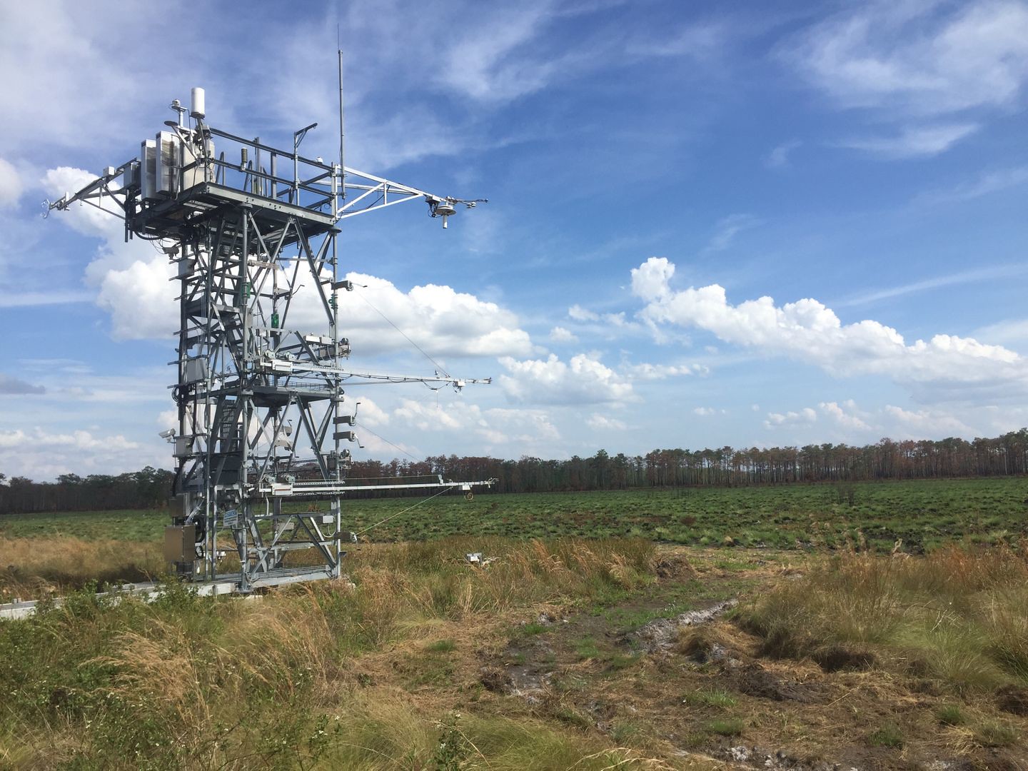
The 12,000-acre Disney Wilderness Preserve straddles the headwaters of the Everglades ecosystem in south-central Florida. This site is seasonally wet and flooded. Remote sensing surveys of this field site collect lidar, spectrometer and high-resolution RGB camera data. The flux/meteorological tower at this site is 26' with 4 measurement levels. This site has five soil plots placed in an array within the airshed of the flux tower.
-
The NEON site at the University of Kansas Field Station (UKFS) is a terrestrial field site located approximately 9 km north of Lawrence, KS, along an eastern deciduous forest and tallgrass prairie transition zone. The UKFS site is one of the two relocatable sites that are encompassed in the NEON Prairie Peninsula Domain, which includes the largest remaining areas of unplowed tallgrass prairie in North America. The Prairie Peninsula domain consists of grasslands, forests, and agricultural cover types. The Domain hosts four other NEON field sites, two aquatic and two terrestrial, all of which are located in Kansas. Remote sensing surveys of this field site collect lidar, spectrometer and high-resolution RGB camera data. The flux/meteorological tower at this site is 126 with 6 measurement levels. The tower top extends above the vegetation canopy to allow sensors mounted at the top and along the tower to capture the full profile of atmospheric conditions from the top of the vegetation canopy to the ground. The tower collects physical and chemical properties of atmosphere-related processes, such as humidity, wind, and net ecosystem gas exchange. Precipitation data are collected by a tipping bucket at the top of the tower and a series of throughfalls located in the soil array. This site has five soil plots placed in an array within the airshed of the flux tower. Field ecologists collect the following types of observational data at this site: Terrestrial organisms (birds, ground beetles, mosquitoes, plants, small mammals, soil microbes, ticks), Biogeochemical data, and soil data.
-
The TALL terrestrial field site covers 5300 hectares within the larger Oakmulgee District of the Talladega National Forest (475,000 hectares) in west-central Alabama. TALL is located within the Gulf Coastal Plain which is the dominant physiographic province (52%) of NEON's Domain 8: Ozarks Complex. It is also where the upper coastal plain gives rise to the Appalachian foothills. The lands of this region are rich a mosaic of forest types and habitats. Steep ridges to rolling hills fading to hardwood bottoms make up the diversity of forest conditions found in Oakmulgee. While known for its longleaf forests, over 40% of Oakmulgee is covered with a mixture of hardwoods and wetlands. Remote sensing surveys of this field site collect lidar, spectrometer and high-resolution RGB camera data. The flux/meteorological tower at this site is 115 with 5 measurement levels. The tower top extends above the vegetation canopy to allow sensors mounted at the top and along the tower to capture the full profile of atmospheric conditions from the top of the vegetation canopy to the ground. The tower collects physical and chemical properties of atmosphere-related processes, such as humidity, wind, and net ecosystem gas exchange. Precipitation data are collected by a tipping bucket at the top of the tower and a series of throughfalls located in the soil array. This site has five soil plots placed in an array within the airshed of the flux tower. Field ecologists collect the following types of observational data at this site: Terrestrial organisms (birds, ground beetles, mosquitoes, plants, small mammals, soil microbes, ticks), Biogeochemical data, and soil data.