
oxygen saturation
Type of resources
Available actions
Topics
Keywords
Contact for the resource
Provided by
Years
Formats
Representation types
-
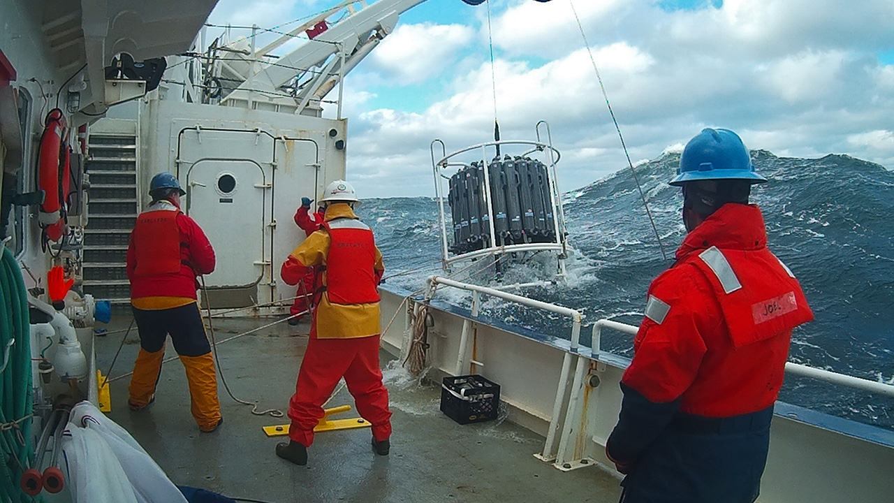
The Northeast US Shelf (NES) ecosystem spans the Middle Atlantic Bight and Gulf of Maine, is a large portion of the NW Atlantic Shelves Province, and is in a coastal biome. The waters over the NES provide an array of ecosystem services including fishing, energy development, shipping, waste disposal, recreation, and conservation. The NES ecosystem, like other productive temperate shelf ecosystems, is characterized by strong seasonality along with high levels of variability in physical forcing at timescales from days to decades, including climate impacts.
-
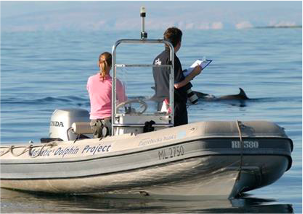
Large marine site located in the Kvarnerić area, around the sheltered coast and waters of the eastern part of the Lošinj and Cres archipelago. It is one of the most important feeding and breeding areas for bottlenose dolphins (Tursiops truncatus) in the Eastern Adriatic. Lithostratigraphic units represented on the coast are dolomites and post sedimentary diagenetic breccia (upper albian, lower cenomanian - K16, K12), rudist limestones (cenomanianmaastricht - K21-6). Soils on the coast are rockyground, anthropogenic soil on karst. The area was created after the transgression of the sea after the last glaciation; marine shelf; highly indented coastline. In July 2006 of preventive protection of a part of the Kvarnerić region for 3 years as a Special Marine Reserve (Cres-Lošinj Special Marine Reserve – CLSMR has been declared.
-
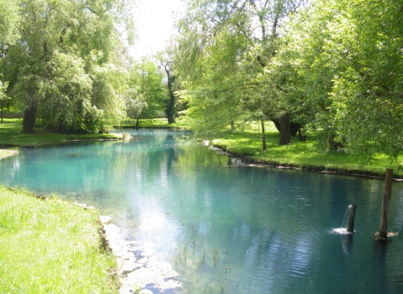
Aquitain's karsts observatory (Aquitaine, France) regroups different karst sites located on the edge of the Aquitain sedimentary basin. These karst watersheds range from 0.01 km² (Lascaux cave) and 1 km² (Cussac cave) up to 100 km² (Toulon springs) and the land use consists of forests and agriculture under modified oceanic climate. This observatory consists of various observation and experimentation sites like patrimonial caves and large karstic hydrosystem outlets.
-
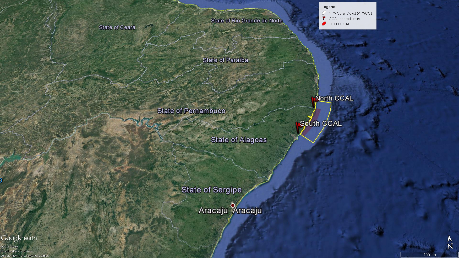
The Site comprises the Coastal Alagoas State portion of the Marine Protected Area Coral Coast (APACC), starting at the mouth of the Meirin River (Maceió, geographical coordinates: 9 ° 32'51 "S and 35 ° 36'59" W), following the preamar meanline, in the general northeasterly direction, bypassing and including the mangroves in all their extension to the left margin of the Persinunga River, on the border between Alagoas and Pernambuco States, geographical coordinates: 8 ° 54'49.04 "S and 35 ° 9'10.13" W, and advancing towards the direction of the Atlantic Ocean to the limit of the 10m isobath, according to the bathymetric chart of the Brazilian Navy. In this section, we can find significant samples of the main ecosystemic features present in APACC: estuaries, beach formations, marine angiosperm meadows, coralline reefs, and beach rocks.
-
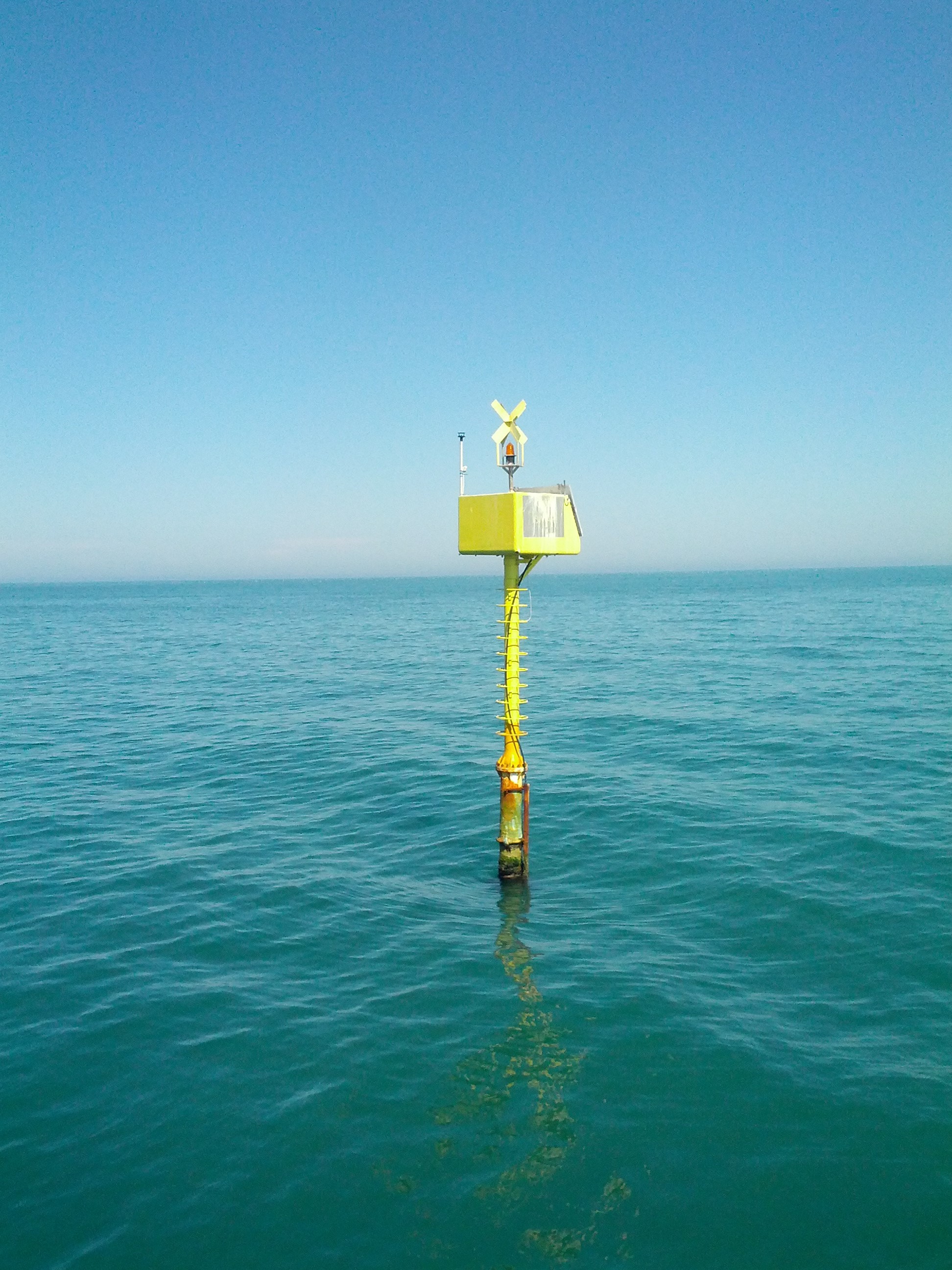
The Transetto Senigallia-Susak is a transect of sampling stations located in the Northern Adriatic Sea. The IRBIM-CNR in Ancona and the Politechnical University of Marche collects from the end of years 80s physical, chemical and biological data. This is an excellent observing site to analyze the characteristics of water masses entering and leaving the North Adriatic Sea and their possible modification. In the site is also located the TeleSenigallia pylon.
-
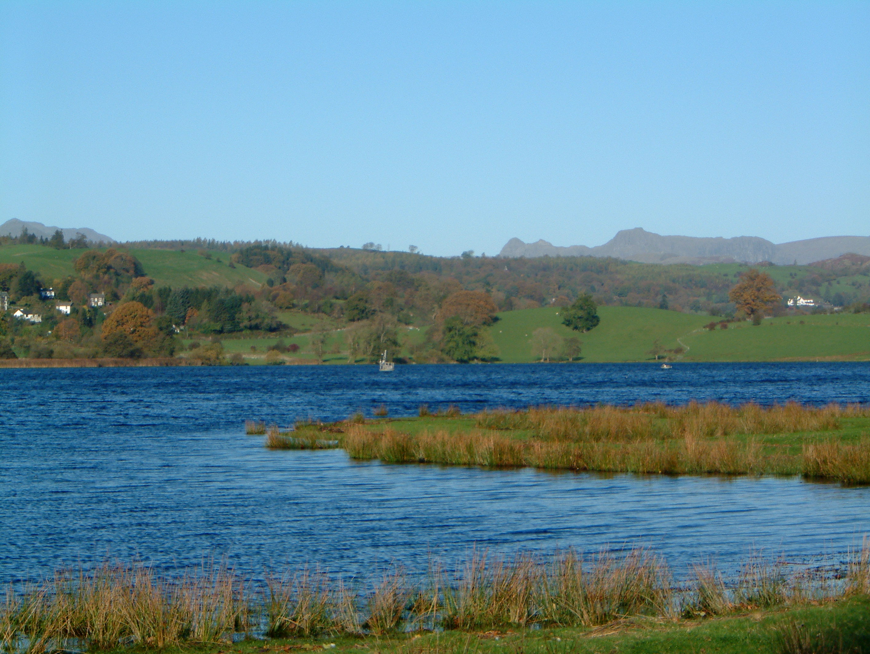
UK ECN Site. Esthwaite Water is a natural lake situated in a glacial valley and is generally agreed to be the most productive or eutrophic lake in the English Lake District. It lies approximately 65 m above sea level and has an area of 1 km2 and a maximum depth of 15.5 m. The average retention time is 90 days. The catchment area is 17.1 km 2 and the hills are composed geologically of Bannisdale slates and grits. The surrounding land is used chiefly for agricultural purposes and forestry. The lake is a grade 1 Site of Special Scientific Interest and has been a designated "Ramsar" site since November 1991. The diverse aquatic invertebrate fauna includes a number of species with restricted distributions in Britain, one of which is the flatworm, Bdellocephala punctata. The slender naiad, Najas flexilis, which is listed as Nationally Scarce, has been found in Esthwaite Tarn. Artificial enrichment of the lake occurs by input from the Hawkshead Sewage Treatment Works (which has operated a continuous programme of phosphate stripping since 1989) and originally from effluents from the fish farm which used to be situated towards the south of the lake. The lake undergoes summer stratification with oxygen depletion regularly below 7 m and sometimes as shallow as 5 m. The phytoplankton tends to be dominated by diatoms in spring and by cyanobacteria for much of the summer.
-
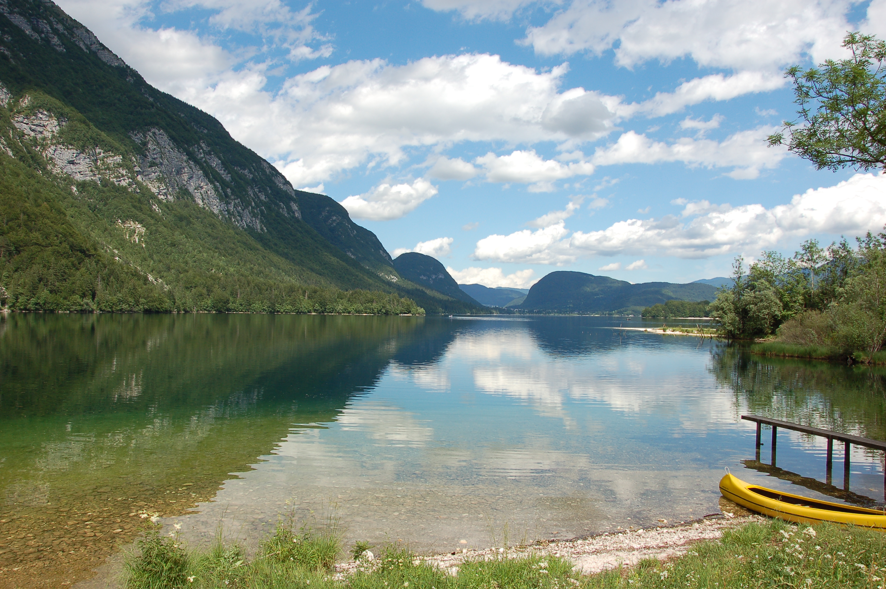
Lake Bohinj is of tectonic-glacial origin and was transformed by the Bohinj glacier. Its surface area is 3.28 km 2 , its volumeWeather conditions and chlorophyll concentrations determine long-term macrophyte community dynamics of Lake...92.5 × 10 6 m 3 and its maximum depth 45 m. It is located at an altitude of 525 m a.s.l. and issurrounded by mountains that are up to 2000 m high. Lake Bohinj is conditioned by the main inflow from River Savica and by several karst springs from the base of Mount Komarča and has a single outflow, River Sava Bohinjka. The residence time of the water in Lake Bohinj is about 4 months, which means that the total volume of the water in Lake Bohinj changes three times a year. The surrounding watershed comprises around 94.3 km2 and is mostly uninhabited, with a large portion extending above the tree line; therefore, the input of nutrients into Lake Bohinj is moderate. This watershed receives about 3300 mm of rainfall a year. Long-term temper-atures show a tendency to a rise. In winter, usually in January, the surface water cools and the lake can be frozen over. From 1961 to 1990, Lake Bohinj was frozen over for a mean of > 50 days/year, while in the decade from 1991 to 2000, the mean number of days with ice cover was reduced to 31 days/year. Since 1990, the lake did not freeze completely in individual years. The majority of the lake catchment area consists of carbon-ate rock, and therefore, the main lake sediment fraction is carbonate, while quartz and feldspar represent a minor part.
-
Bidighinzu Lake is a warm monomitic and hypereutrophic reservoir located in northwestern Sardinia at 334 m a.s.l. Built in 1956, it is mainly used for drinking water for a population of about 160,000 users. Bidighinzu Lake covers a surface area of 1.7 × 10⁶ m² and has a maximum volume of 12.2×10⁶ m³ and a mean depth of 7.3 m. According to ECOSTAT, it belongs to the LM7 category (altitudes <800 m a.s.l., mean depths >15 m, conductivity <2.5 mS cm−1). Its watershed has a surface area of 52 km² with a geological substrate consisting of basalt, limestone, and shale. The supplies of water from the catchment to the lake are insufficient to make up for the losses and human demands. Consequently, the lake receives additional water from Temo Lake and Rio Mannu-Su Tulis river lock, localized in different watersheds. Problems of potabilization have arisen since the early years of the reservoir’s use, particularly in summer-autumn, because of hypolimnic deoxygenation and the excessive presence of algae in the epilimnion. To face this situation, different restoration actions were carried out in Bidighinzu Lake. Among the most important: the installation in 1966 of an aeration system in the area around the water intake tower and in 1987 the reduction of nutrient loads from the watershed by the diversion of civil and industrial wastewater downstream of the dam. A comparison among data collected from just before to about 10 years after this last action the site did not show any improvement in the trophic status. Since 2006, the lake is managed by the Sardinia Water Authority (ENAS) and is part of LTER-Italy. The site has real-time remote monitoring station equipped with a multiparameter probe housed on floating platform. The main scientific purposes at present concern the relationships between trophic status, abundance of cyanobacteria and the presence of toxins; the assessment of climate change and local factors on the phytoplankton dynamics; the development of territorial indicators related to the trophic conditions based on the land cover and use of catchment areas. Recently in Lake Bidighinzu it was conducted an experimental activity, with an aeration system with micro-bubbles. The aim was to maintain sufficient oxygen in the hypolimnetic waters, especially in the summer months, in order to improve the purification process, prevent phosphorus release from sediments and mitigate eutrophication. Available data sets include information on phytoplankton and limnological variables since the last 70.
-
The basis for the Spiekeroog Coastal Observatory (SCO) was established in 2002 as the Time Series Station Spiekeroog. The Coastal Observatory seized preceding research initiatives and grew continuously to the recent observational infrastructure including a multitude of elements and parameters. Today, the SCO and the conducted research around, improve our understanding of environmental change and anthropogenic impacts on coastal areas along the land-sea interface. The unique characteristic of the SCO can be found within this interdisciplinarity of the element sites operated in the largest tidal flat region worldwide.
-
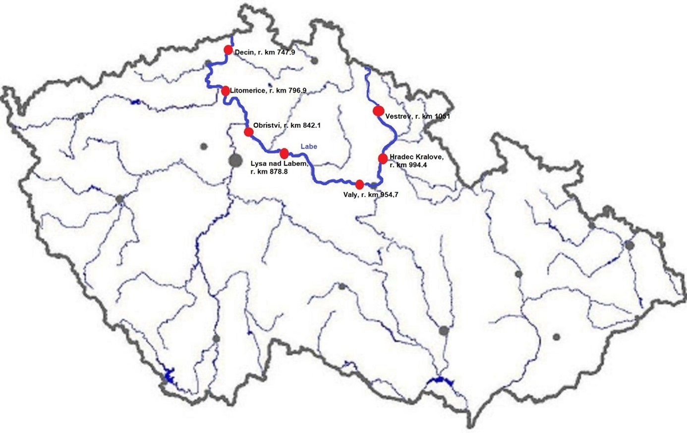
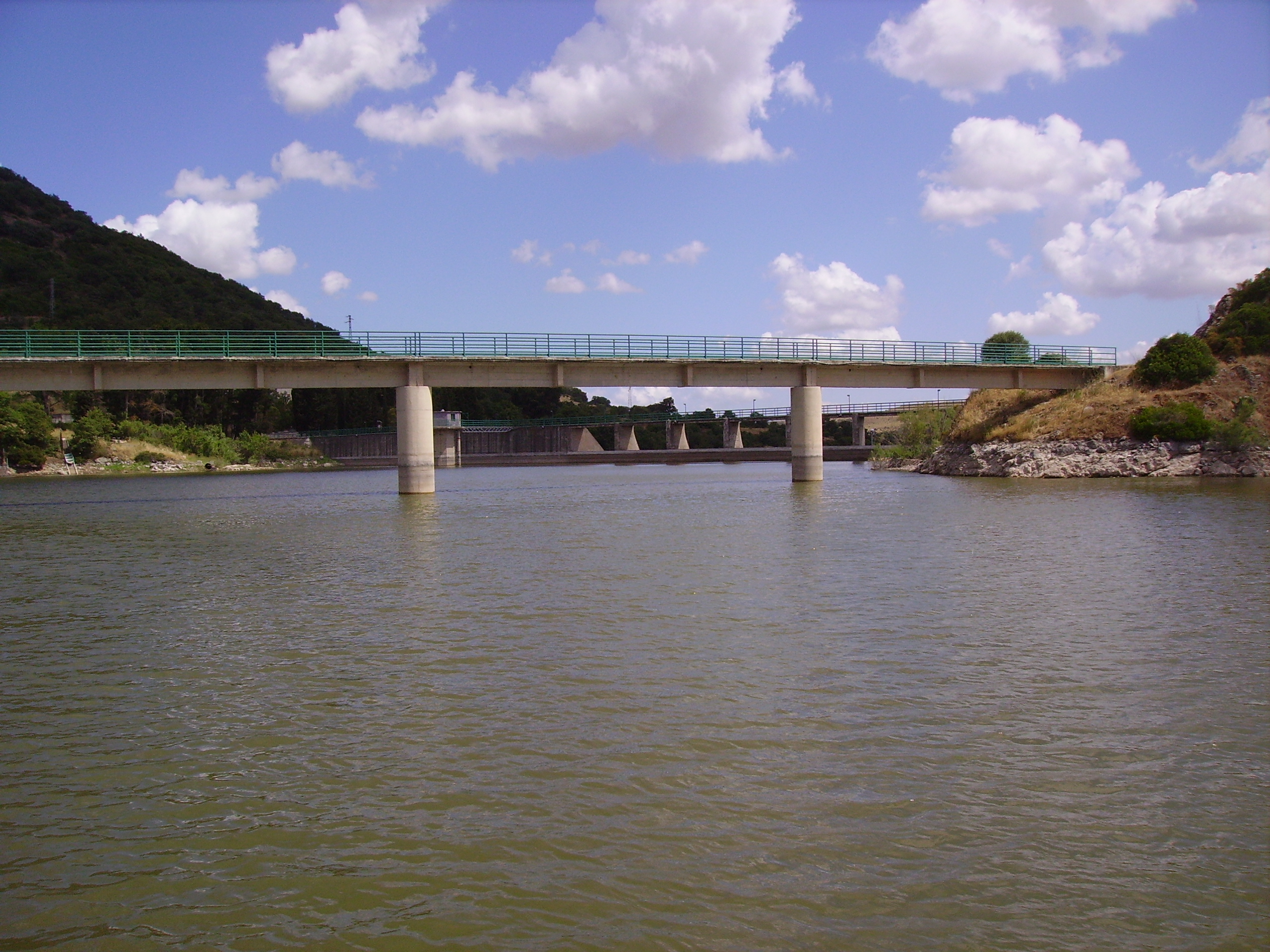
The Elbe River is one of the major rivers in Central Europe. It springs at an altitude of about 1,400 meters in the Giant Mountains in the north of the Czech Republic. It flows through eastern, middle, and northern Bohemia, and its catchment area includes most of Bohemia. The Elbe traverses the northeastern part of Germany and flows into the North Sea. The total river length is 1,094 km. In the Czech Republic, the monitored river length is 371 km and the catchment area includes 49,933 km2. The average flow at the Czech-German borders is 311 m3 s-1. Many weirs dam the watercourse of Elbe River in the Czech Republic. This artificial intervention is crucial for the characteristics of the riverbed, its width, depth, and bottom substrate. The width of the riverbed in the monitored area ranges from approx. 10 m on the upper course to approx. 150 m on the lower course and river sections above the weirs. The depth of the river varies from 0.5 m in the upper parts and below the weirs to more than 5 m in the lower course and above the weirs. The bottom substrate varies from the stony, gravelly, and sandy fractions in shallow and fast-running sections to muddy/silty fractions in slow-running sections above the weirs. The main tributaries of the Elbe in Bohemia are Metuje, Orlice, Jizera, Ploučnice, Vltava, Ohře and Bílina rivers. The catchment area is densely populated. The river is exposed to various sources of pollution (organic, agricultural, and industrial) and hydromorphological pressures (straightening, shortening, regulation of meanders, and fragmentation of river continuity). There are seven permanent monitoring sites on the Elbe River in the Czech Republic: Děčín (river kilometer 747.9), Litoměřice (796.9), Obříství (842.1), Lysá nad Labem (878.8), Valy (954.7), Hradec Králové (994.4) and Vestřev (1051). The Elbe basin long term environmental research has been organised by the Ministry of Environment of the Czech Republic and cooperation institutions since 1993. More than 600 physicochemical parameters, including sensory properties of water, are regularly monitored in at least nine different types of matrices (water, sediment, periphyton, floats, sedimentable floats, benthos, fish tissues, fish fry, and Dreissena polymorpha tissue) and using passive samplers. Among the main monitored characteristics belong balances of macroelements (carbon, nitrogen, oxygen, phosphorus), concentrations of inorganic salts, heavy metals and various organic pollutants such as pesticides, personal care products (including drugs) and other anthropogenic substances in the environment. Characteristics such as abundance and species composition are regularly monitored in fish, macrophytes, macrozoobenthos, phytobenthos and plankton.